16 July 2017
With Richard
We had found a pretty neat place to camp for our weekend camping trip in the Ya Ha Tinda area. The spot in the vicinity of Scotch Camp warden cabin was great: a small grassy patch in between some trees that gave us shelter, and easy access to the Red Deer River was nearby. We had fallen asleep super fast after yesterday’s adventure on Mount Tyrrell and the night had been quiet… except for some strange noises that I kept hearing in the early hours of the morning. Something shrieking, like an upset turkey.
When we finally got up around 6:30 am, I couldn’t believe what I saw outside. Something or someone had eaten up parts of Richard’s pole straps, nibbled on my water filter hose, and completely eaten or stolen some of our socks and t-shirts we had left outside our tent overnight. Now it was us who was upset! I can only suspect a hungry porcupine as the culprit; these omnivorous creatures are known to randomly gnaw on radiator hoses and other rubbery things in some parts of the Rockies. Or maybe some pack rats? I don’t know. Lucky for us we had brought an extra pair of socks. And the filter, though damaged, was still usable.
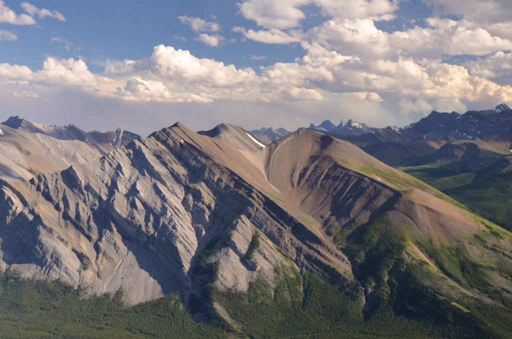
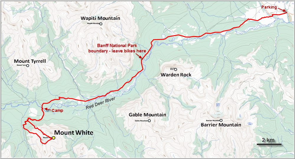
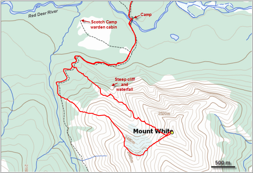
After an interesting military-style breakfast containing about 5000 calories – an MRE (meal ready to eat) courtesy of Wen – we embarked on another long day hike. We crossed the Red Deer River over the bridge and followed the horse trail slightly uphill as it swung around to the west, then curved back south, slightly overgrown in places but overall in decent shape. Near a clearing on Mount White’s west side we left the trail and headed up open slopes towards the sub-peak at GR152721. It was essentially just an easy hike on firm talus, quite enjoyable all in all.
To our surprise we found a small cairn at the summit of the sub-peak (elevation 2700 m), but then again one shouldn’t be surprised about finding signs of human existence anywhere near a trail, especially in such easy hiking terrain. It was windy and quite a bit colder than yesterday on Mount Tyrrell, so we kept our breaks short and carried on. More gentle terrain followed between the sub-peak and Mount White itself, the rounded hills covered in solid rubble, isolated patches of grass, and some larger angular chunks of rock near the summit. A repeater station sits atop Mount White, but we couldn’t find a summit cairn. The little hut looked quite new and I doubt that it existed when Rick Collier & party came up here in 1991.
Our views from the summit were somewhat obscured by a cloudy sky and some noticeable smoke in the air from the distant forest fires near Banff. To the north we could clearly see our ascent route up Mount Tyrrell from yesterday, with a potentially easier route further to the SE. East of us was the large Gable-Barrier massif, our original target for this weekend [we went on to climb these two later in October that year]. And looking southeast, a sprawling ridge complex with Melanin Peak at its centre appeared even more distant and remote…
The weather had taken a turn for the worse and it started to snow just as we were about to descend. The small valley that sits to the north of the col between White and its westerly sub-peak looked inviting enough and there was lots of scree, so we decided to give it a go. After stumbling down the unpleasant choss back down to the col, we quickly lost elevation on reasonably soft scree down into the valley. By now, the temporary squalls had disappeared and it cleared up again. We now had to do a little bit of sidesloping across grassy slopes on the other side of the valley to get around what looked like dense forest below. We also wanted to make sure to avoid a huge vertical cliff with an impressive waterfall at the bottom of this valley that we had spotted from below earlier in the day. The sidesloping brought us onto a northwesterly spur, which we easily followed back down to the trail. A bit of bushwhacking fun was necessary, but it was pretty short and painless.
When we got back to our camp, we were pleased to see that no further parts of our equipment or tent had been eaten! Whatever had been chewing on our stuff must’ve been a nocturnal eater. Next time we come to this area we will definitely make sure to keep all our gear inside the tent or at least the vestibules!
The long hike back to our bikes provided ample opportunity to talk and reflect upon our weekend adventure. Mount White had been a pleasant outing, much more relaxed and easier than Mount Tyrrell the day before. The route finding on the steep, exposed slabs of Tyrrell’s south ridge had been quite challenging, while Mount White was almost all easy hiking. As we tramped along towards the park boundary, dark clouds were once again chasing us from the west, and the sky looked increasingly hazy, with an orange hue imparted by the smoke. Although we knew that the fires were far away, we could literally smell and taste the smoke in the air. The bike ride was a welcome change and when we finally reached our car by 8 pm we were exhausted but happy to conclude a successful and very rewarding weekend adventure. And relieved to see nothing had chewed up our car tires!
DISCLAIMER: Use at your own risk for general guidance only! Do not follow this GPX track blindly but use your own judgement in assessing terrain and choosing the safest route.
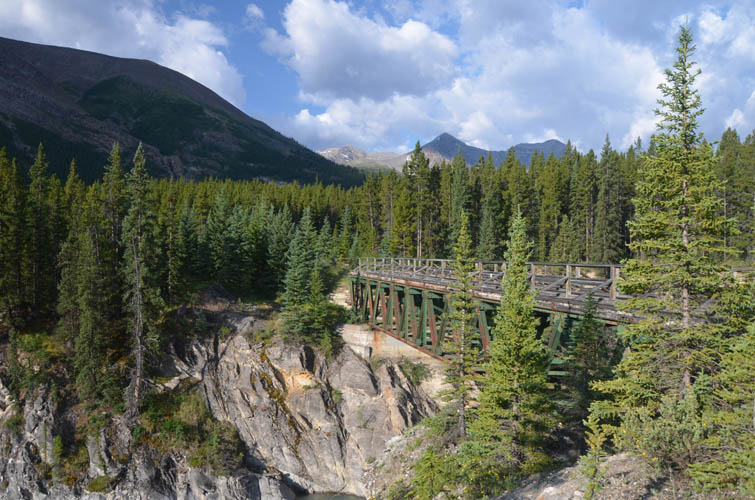
The bridge over the Red Deer River by our camp.
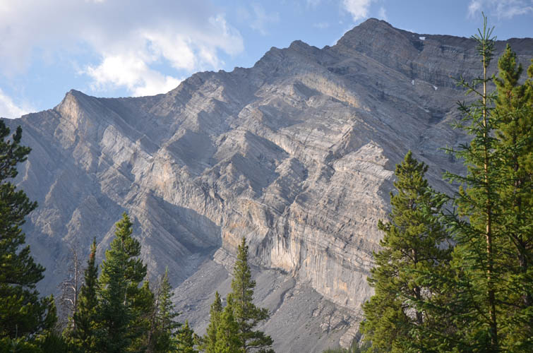
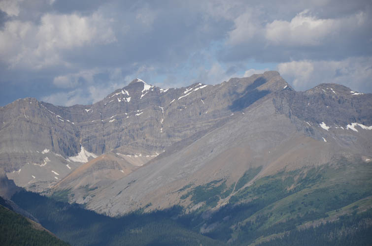
The north face of Mount White is steep and craggy. Probably some good scrambling/climbing in here.
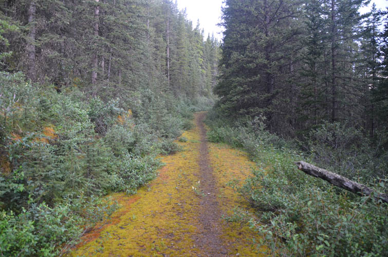
We follow the horse trail in the direction of Snow Pass.
Slogging up easy slopes on the west side of Mount White. In the background is Prow Mountain.
Close-up of Prow Mountain.
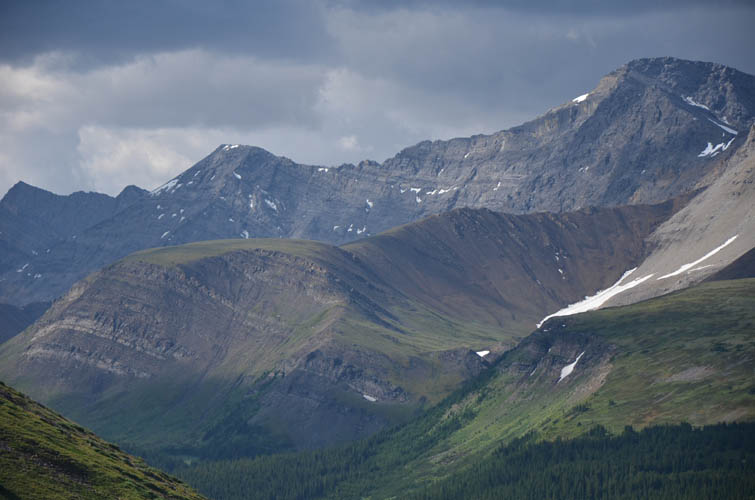
Dark clouds moving over jagged ridges make for a dramatic light show.
Wild beauty! I wish I could stay for a whole week to explore more…
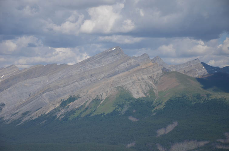
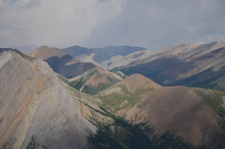
Looking back at the south slopes of Mount Tyrrell, which we climbed the day before. The line we took for ascent, right in the middle on or near the light grey spine, was full of steep and exposed friction slabs.
Hazy skies to the NW. This is Boar Station Peak.
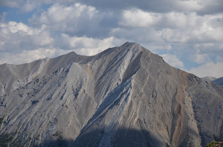
Mount McConnell
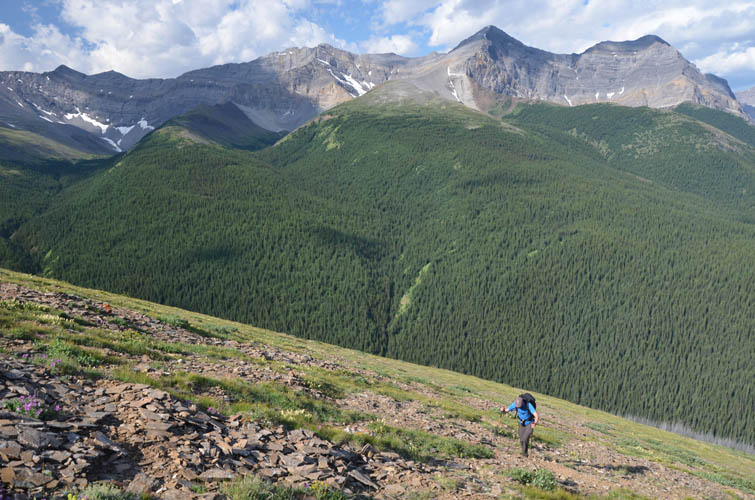
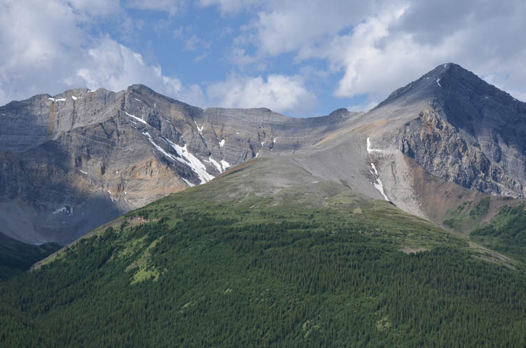
Gentle slopes of grass and rubble lead up to a sub-peak on the right, then down into a saddle and back up to the main summit of Mount White on the left.
Wide open slopes with sweeping views over a beautiful area, with Mount Tyrrell in the centre.
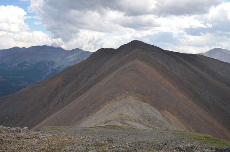
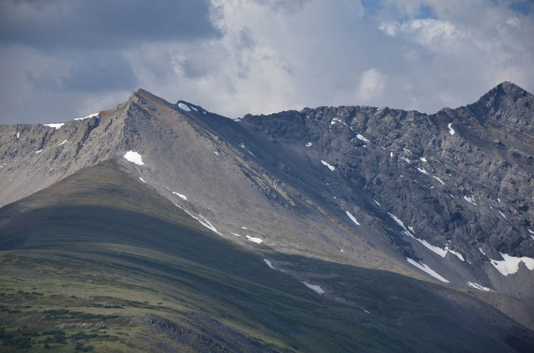
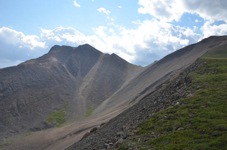
View from the sub-peak to the main summit of Mount White.
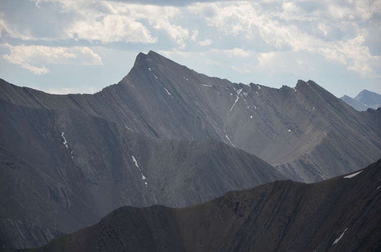
Steeply dipping strata create a jagged ridge on Melanin Peak to the south.
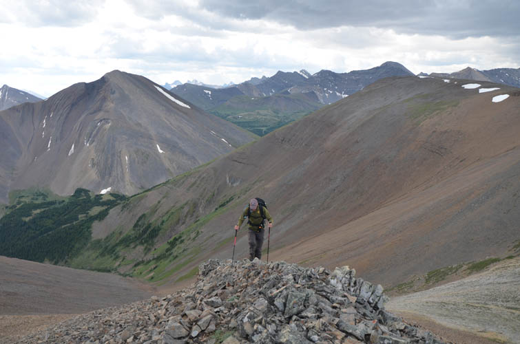
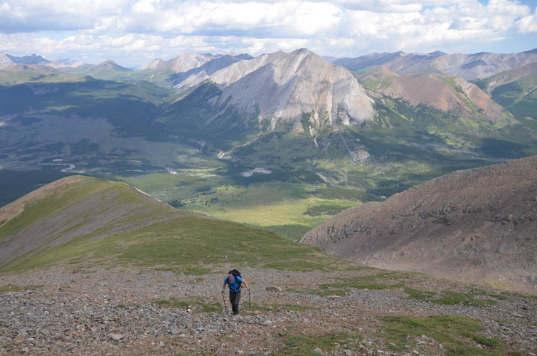
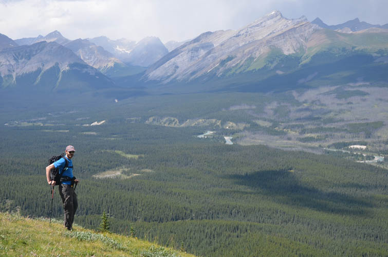
Richard approaching the summit.
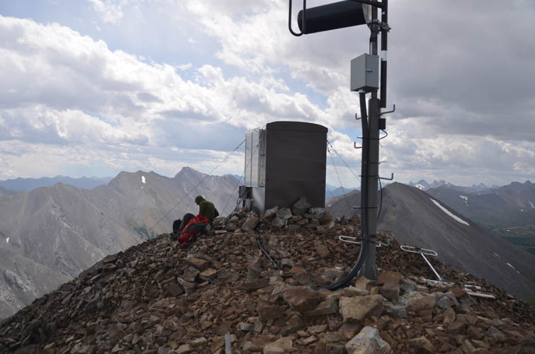
A small repeater station and antenna crown the summit of Mount White. In the distance, right above Richard’s head, is Melanin Peak.

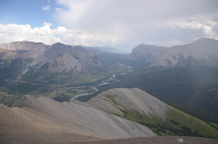
Our approximate route as seen from Mount Tyrrell to the north. We ascended open slopes on the right via the small bump and saddle, then descended through the valley in the middle, avoiding steep cliffs by a waterfall (W), back to the bridge (B) over the Red Deer River.
Looking back at Mount Tyrrell (far left) and the small peaks and valleys to the north. The skies are getting hazier as smoke from distant forest fires are moving in.
It’s incredible how fast conditions can change in the mountains. A temporary blast of cold air delivers hail and snow on the summit. Luckily, we avoid the worst of it as most of the dark clouds move east towards Gable Mountain (far right).

Lots of rubble on our descent – some of the fine scree variety, but mostly stop-and-go.
The sky is still blue to the east.
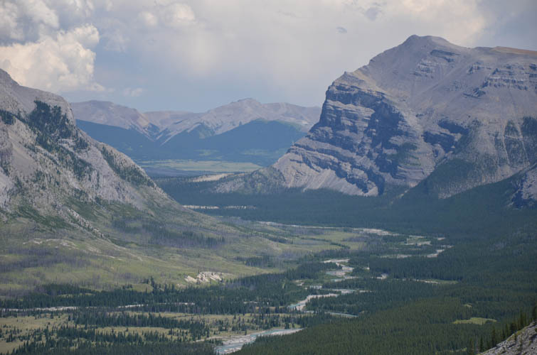
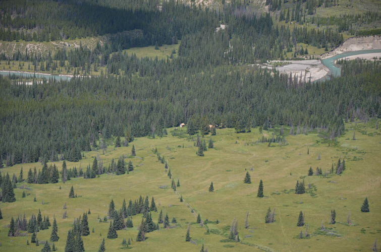
Red Deer River and Warden Rock.
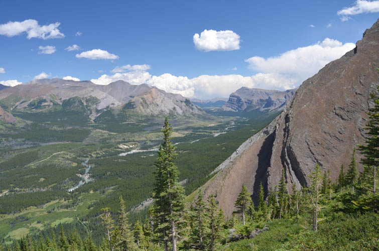
Another look at the lovely valley between White and Tyrrell.
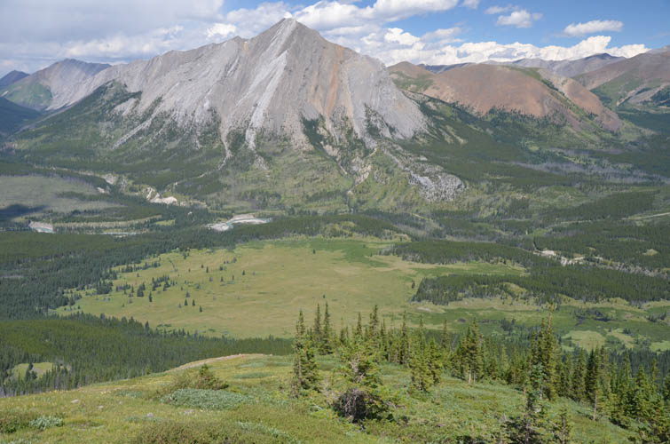
Scotch Camp patrol cabin sits at the edge of a large meadow south of the Red Deer River.
Vast and pristine wilderness.
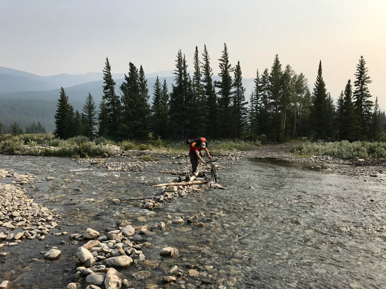
Last hurdle of the day: pushing our bikes through the ankle-deep waters of Scalp Creek near the Bighorn Campground. [Photo by Richard]