Central Highlands, Angola
16 January 2018
Solo
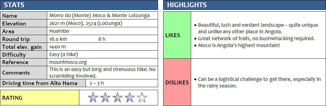
Famous for its rich, varied birdlife – that’s pretty much all I knew about Mount Moco, or Morro do Moco as Angola’s highest mountain is called. At an official elevation of 2620 m, it sits right in the middle of the Central Highlands northwest of Angola’s second largest city Huambo. I also knew that hiking was possible here, but I had no idea what to expect. It wasn’t easy getting there by public transport, but the effort was more than worth it. I can certainly say I was positively surprised!
There is a wealth of information available on mountmoco.org, a site put together by a group of experts that have specialized in documenting and studying flora and fauna around Moco. Their ultimate goal is to promote conservation and works towards environmental protection of this area, particularly the quickly receding Afromontane forest which is known to be an important habitat for many rare types of birds and other forest-dependent species. There’s also some info for visitors on how to get there and where to hike in these mountains, which I found very useful when I was researching the area.
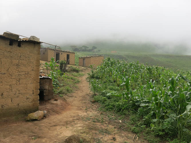
Having your own 4WD vehicle seemed to be one of the requirements for visiting Moco. I was backpacking through Angola and I didn’t want to rent a car, which can be hard to find and very expensive in this country, especially out here in the province. So I tried it by public transport – after all, where there’s a will there’s a way! From Alto Hama, a small local town where I was based, I caught a public bus first thing in the morning. The “Transflamingo Express” was still empty when it left town at 6 am, but unfortunately there was nothing “express” about the journey. It took us a full hour to get to Ussoque, located along the main highway about 70 km west of Alto Hama and the closest “town” to Mount Moco (there’s no hotel and only one basic shop here), as the bus was stopping frequently in villages on the way. In Ussoque I found a motorcycle driver to take me south along a narrow dirt track to Kanjonde, a small community and the “gateway” for hikes in the area where several trails start. It was only about 12 km, but the ride took more than an hour as sections of the track were very muddy and I had to get off several times to allow my driver to wrangle his way through large puddles. The clouds were hanging low and it was uncomfortably cold, making me wear all I had including sweater and scarf. About half way in we ran into another motorcycle. It was carrying the Soba, or village chief, of Kanjonde. I knew that I had to contact him first before venturing off on a hike in this area, so I was glad I bumped into him here, saving me some time to look for him. After the usual introductions and polite banter, I asked for permission to hike his land, which he promptly granted in exchange for a fee of 5000 kwanzas (11 euros). A bit steep considering the local average salary here, but fair and hopefully put to good use if it supports the concept of low-impact tourism amongst the locals and the idea that preserving the beauty of their natural backyard attracts paying visitors.
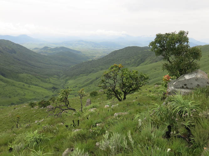
In Kanjonde I was greeted by a dozen young kids who were dancing around me, laughing and grimacing, and happily posing for picture after picture. This is a small and quiet village, a collection of simple mud huts with tin roofs, surrounded by farmer’s fields and nestled scenically at the base of the verdant peaks and ridges of the Serra de Moco mountain range. I was quite impressed by how friendly and polite the locals were, not what I had expected in a place where people are perhaps a bit more used to foreigners. I took some time to sit down and chat with a group of men, who were all very welcoming and eager to talk. An optional guide was offered, but they were happy to let me go off on my own and showed me the start of the trail.
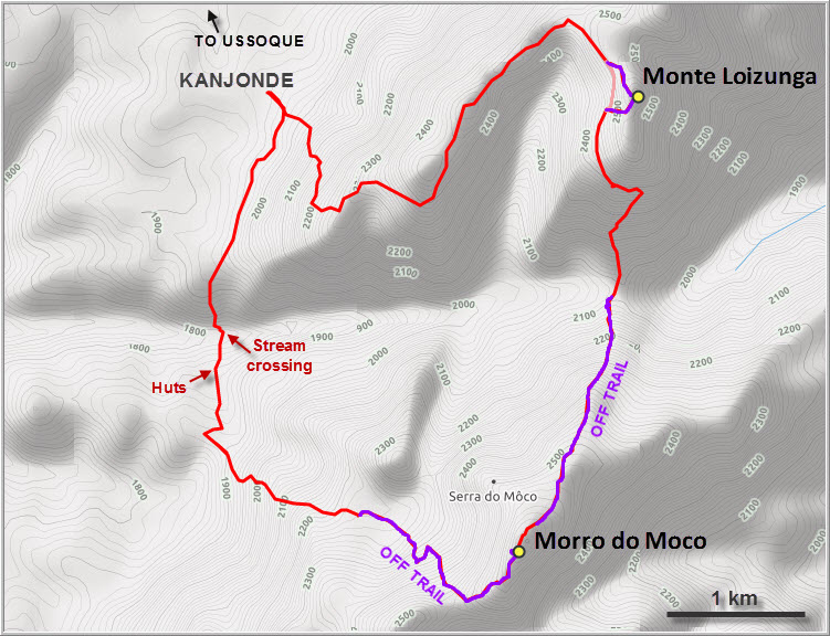
My plan was to follow the horseshoe ridge that lies east of Kanjonde to its highpoint, then descend south to a saddle, and hike back up to the summit of Mount Moco. From there I was hoping to follow another trail that heads southwest and then north back to the village. I had a couple of GPX tracks from mountmoco.org plus my own route drawn on satellite images where I could recognize trails in the landscape. Dark clouds were moving in at the start of my hike and the weather worsened later in the morning, but apart from several hours of rain, the plan worked out without a hitch, thank goodness.
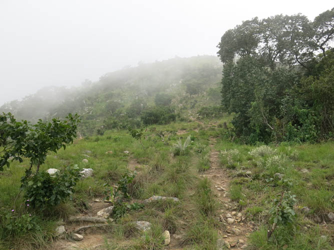
The main trail I took leaves Kanjonde on the eastern side and steeply rises in several switchbacks to the top of the ridge. It was impossible to get lost here, despite poor visibility in the thickening cloud cover. Once on the ridge, the trail more or less follows the broad ridge top with a few minor ups and downs. I had it all to myself today, no surprise on a day like this with no views and a constant drizzle. Not that I had expected any other tourists, of course, but I thought I might run into a few shepherds perhaps. Where the ridge made a turn east and then south I saw a herd of cows in the distance, but no people. It was raining hard now and I had to pull out my new bright orange poncho-tarp, which initially kept me dry but also made me sweat a lot more (at least my pack wasn’t sweating!). Loud roars of thunder coming in from the east made me wonder if I could complete my hike today or if I’d have to turn around… Thankfully, there was no lightning and the thunder disappeared after an hour.
On the eastern leg of the horseshoe, the trail hugs the side of the ridge as it heads south. To reach the highpoint of the ridge, which locals later told me is apparently called Loizunga, I had to tramp up a steep slope full of deep, wet grass. A small cairn sitting on a rocky outcrop was waiting at the summit, but I couldn’t wait to get back down. It was still raining and I was drenched from all the sweat trapped under my poncho.
After awkwardly stumbling back down the grassy slope to the trail, I followed it for a while until it fizzled out in small patch of dense ferns and leafy shrubs. I had already noticed that the trail was getting fainter, probably because I was much farther away from the village by now. Looking at my mapping app, I realized that I should’ve stuck more to the right to head down the slope to the saddle between Loizunga and Moco. But it didn’t matter, the terrain is quite open and gentle for the most part, without any cliffs or overly steep sections, so I simply headed down a grassy slope until I found the trail again. Down by the saddle where there was no wind and the humidity was stifling I was swarmed by hundreds of huge flies that were perhaps attracted by the smell of my sweat (that’s how bad I smelled!). Annoyingly, they seemed to like my face and my neck the most, and swatting them away inevitably resulted in a lot of casualties left behind on my skin. Well, at least it made me speed up so I could get away from these nasty little critters. I was rushing up the slope on the other side of the saddle as fast as possible – the higher I got, the breezier, which helped keep them at bay.
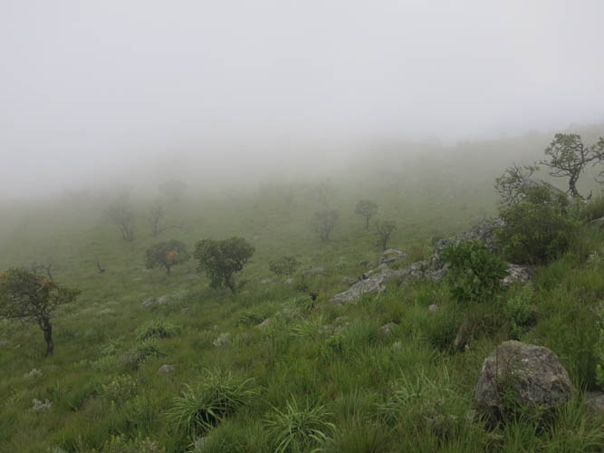
The broad north ridge of Moco is a lengthy affair, it just keeps on going and going. It didn’t help that I couldn’t see very far due to dense mist developing again, giving the whole place a spooky atmosphere. All I could see now were wafts of clouds hanging low above the grass, sluggishly moving between a few scattered trees, as I was tramping up the thick, wet grass cover. How glad I was to have my GPS to navigate here! The “ridge” is really more of a broad shoulder that seems to extend in all directions; it was impossible to see where I was heading.
After what felt like a long time, but probably only was an hour or two, I encountered a faint trail coming in from the right (north) and a few minutes later, suddenly I was standing on the summit of Mount Moco. The summit itself is pretty unspectacular: there’s a large cairn between a few small trees and bushes on an elevated rise, with an old rusty plaque (illegible) next to it. Several fire rings with bits of garbage in the grass are proof that the place regularly sees visitors, some of whom end up camping here. It was unsurprising that on a rainy day like this I’d have the whole place to myself. Fortunately, the weather was starting to improve slowly, affording me the occasional glance through the clouds.
One of the GPX tracks I had downloaded was supposed to be a “trail” heading southwest from the summit and then northwest down into the valley, but this trail does not seem to exist or perhaps I just couldn’t find it. Perhaps in the dry season, when the grass isn’t as high, the trail is easier to see but I looked hard and ended up simply plodding through the grass. Again, the topography is gentle and thus easy to explore on foot, but all the wet, slippery grass bumps can make for cumbersome hiking. The landscape up here really reminded me of some remote Alpine meadows in Switzerland – mellow, lush and green – very unlike the images conjured up when you think of an African country like Angola. I’m not a birder, in fact I know precious little about birds, so I couldn’t identify any of the birds I saw, but there were quite a few to be seen along my route. Going by the twitter alone, I’m sure there must’ve been many more hiding in the landscape that escaped my untrained eye.
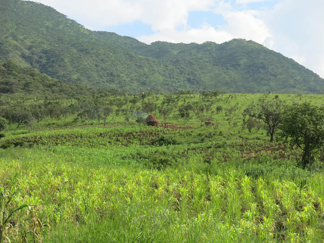
Roughly following the directions of my track, I eventually came to a beautiful little basin covered on all sides by grassy slopes, with several creeks running through it. To my delight, I spotted a proper trail near the end of the basin on the other side of a creek. By now the sun had come out and I was in high spirits, leaving behind the gloomy could forests of the summit ridge… It was pretty smooth sailing from here on. All I had to do is follow this trail, through meadows and forests, down into the valley. Near the bottom I reached a small hut with a group of women standing in a nearby field. They seemed surprised to see me and asked where I had come from. Using lots of gesturing, we somehow managed to communicate and had a good laugh together. There were several trails through the fields now and they kindly showed me the way get back to Kanjonde.
The trail kept on descending and was very steep and slippery in a muddy section of bush before reaching a small stream in the valley. It was only ankle-deep but too wide for rock hopping, so I had to take off my boots and wade it – a refreshing break in the afternoon heat now that the sun was shining again. About an hour later I arrived back in Kanjonde. My motorcycle driver had been patiently waiting for eight hours in the village and certainly deserved the fee we had arranged plus a good tip for taking me there and back safely from Ussoque.
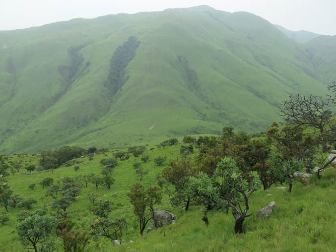
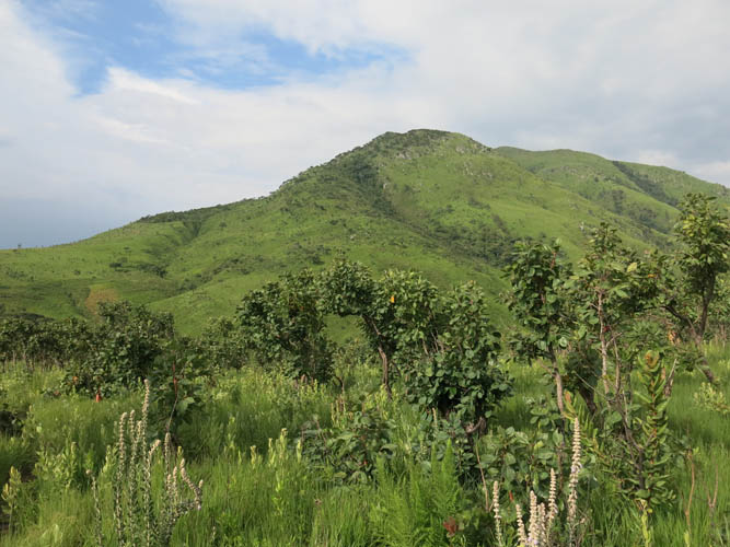
This loop was a beautiful hike, very different from all the others I’ve done in Angola. While there were no technical difficulties, it’s a long trip that took quite some energy out of me. The climate is cooler and the land lusher up here, and walking along the gentle ridges and valleys of the Serra de Moco is definitely a unique experience.
Notes on costs, logistics and security:
- Check mountmoco.org for up-to-date information before going.
- There is no risk of landmines in this area, but always double-check before going off the beaten track in Angola.
- Cost of a bus ride from Alto Hama to Ussoque: ca. 500-1000 kwanzas (1-2 euros).
- Cost of a motorcycle ride from Ussoque to Kanjonde and back, incl. wait time: ca. 5000 kwanzas (11 euros).
- Permission to hike the mountain needs to be obtained from the local Soba (Chief) of Kanjonde. Fee: 5000 kwanzas (11 euros).
- Cost of a guide to hike Morro do Moco: ca. 7000 kwanzas (15 euros).
- Alto Hama, Hotel Pensão Hama: 5000 kwanzas (11 euros).
- Daily buses go from Luanda to Alto Hama: ca. 10-16 hours, 6300 kwanzas (13 euros). Huambo to Alto Hama takes 1 hour and costs 1000 kwanzas (2 euros).
DISCLAIMER: Use at your own risk for general guidance only! Do not follow this GPX track blindly but use your own judgement in assessing terrain and choosing the safest route.
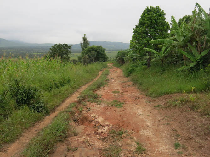
A rough track leads from Ussoque to Kanjonde at the foot of Mount Moco.
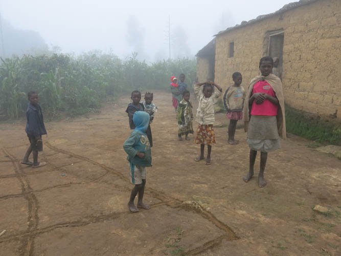
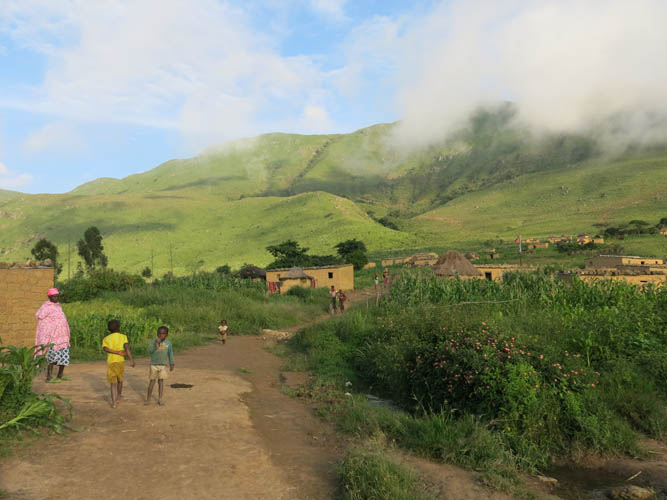
Friendly welcome in misty Kanjonde.
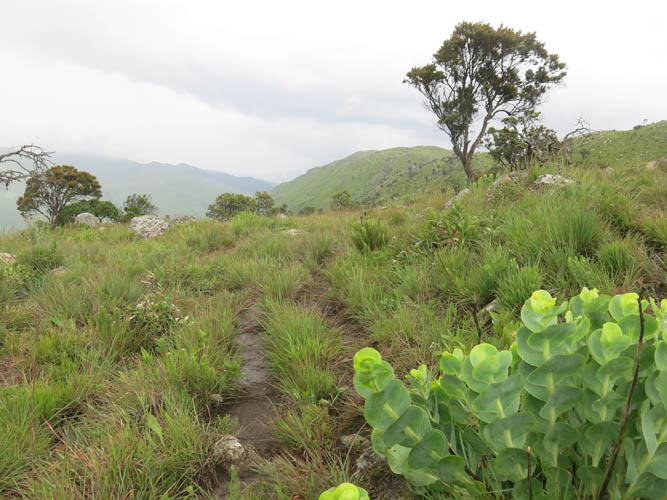
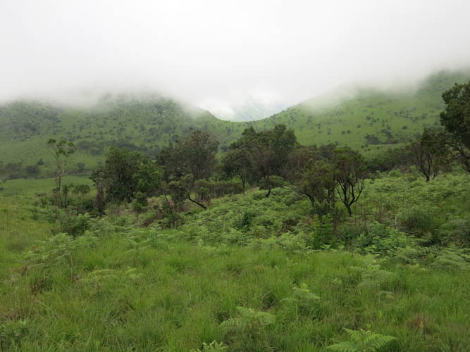
The start of the trail.
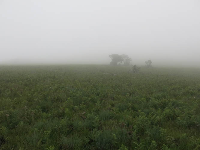
Into the clouds…
On top of the ridge, with clouds all around me.
A glance at the eastern side of the horseshoe ridge that leads up Monte Loizunga.
It’s a lovely ridge walk – very green and moist here.
At the turn of the horseshoe ridge, I leave the trail and head up the grassy slopes to Monte Loizunga’s summit.
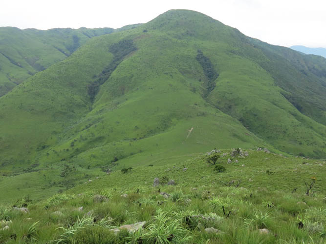
At the top of Monte Loizunga, with Morro do Moco behind.
I believe this is Monte Soque to the NW.
Heading down to the saddle between Loizunga and Moco. The summit of the latter can be seen on the horizon.
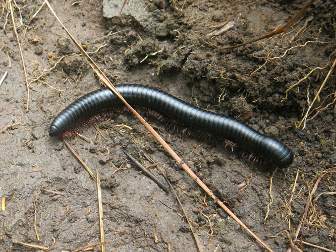
Lots of millipedes on the trail.
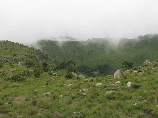
Looking back at Loizunga and the saddle I just passed through, where hundreds of flies descended upon me!
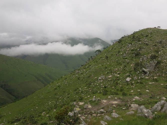
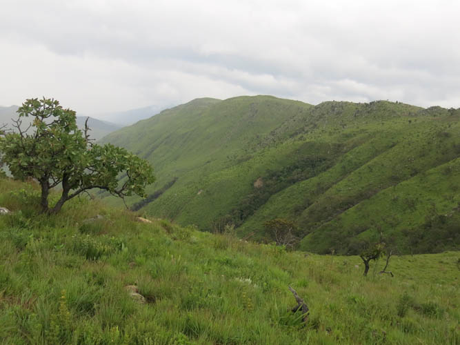
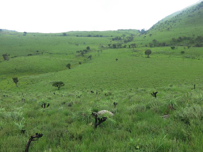
A remote valley to the east, with dense forest cover in the lower part.

Off-trail up the north ridge of Moco. This is what much of the route looks like.
It’s eerily quiet as I stomp through the wet grass in the clouds, with nothing but a few scattered trees to give me company.
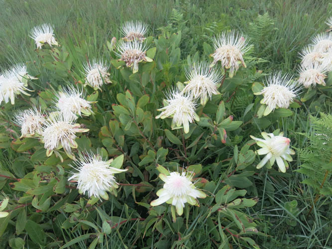
There are very few flowers up here. Not sure what this is.
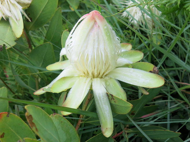
Some of the buds are still opening up.
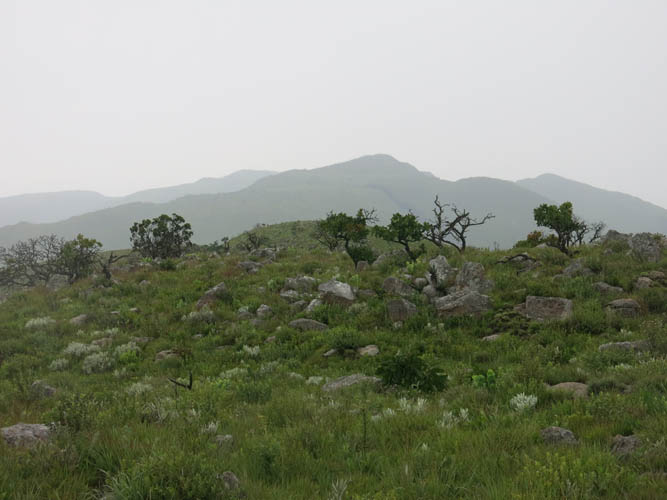
Near the summit the ridge widens. Very hard to navigate here in the mist!
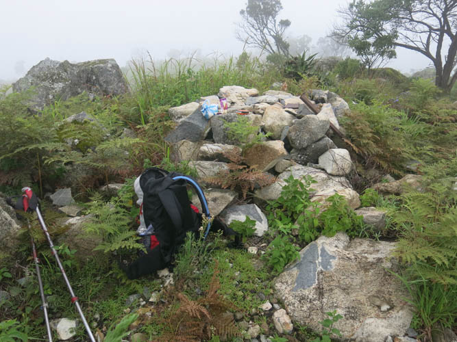
At the summit of Morro do Moco, the highest point in Angola (2620 m).
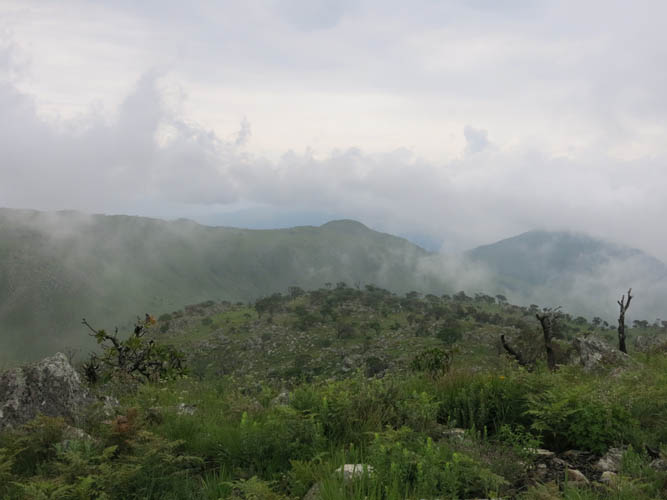
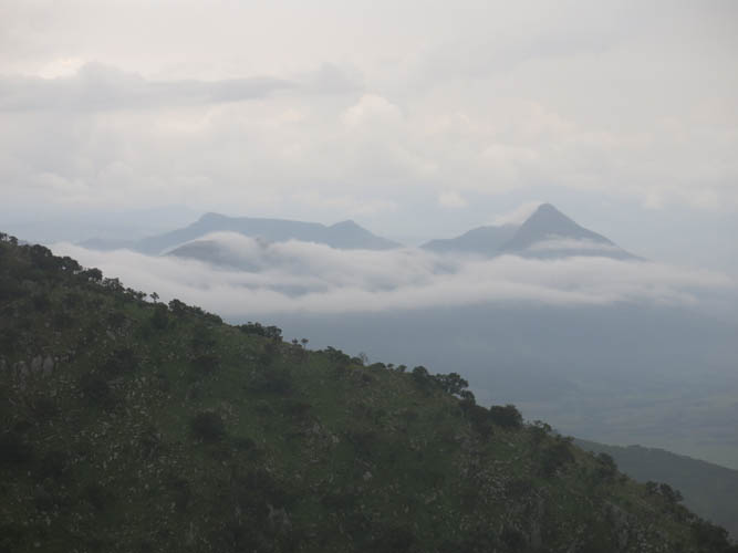
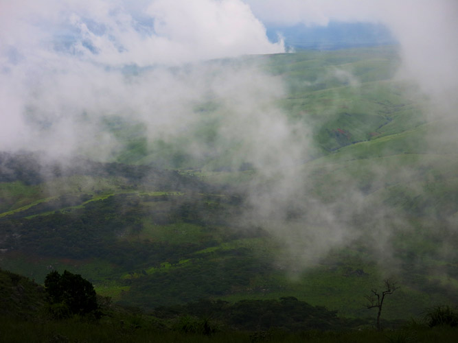
The sky is trying to open up. This view is to the NE.
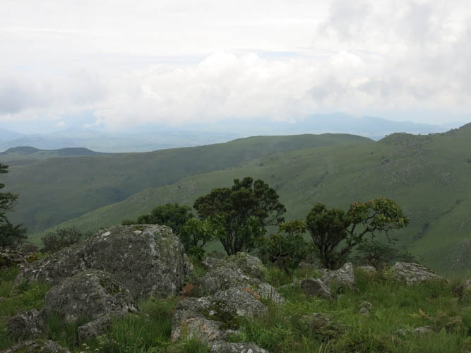
Looking NW, part of the long horseshoe ridge that I ascended in the morning becomes visible.
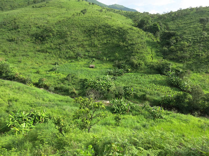
Descent down another lush valley.
A beautiful small basin on the way down, somewhat reminiscent of an Alpine meadow in Switzerland.
The clouds are finally starting to disappear. The first time the sun is winning today!
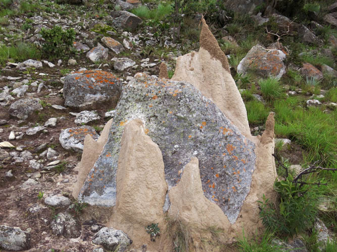
Termite mounds clustered around a boulder. These guys are about a metre high.
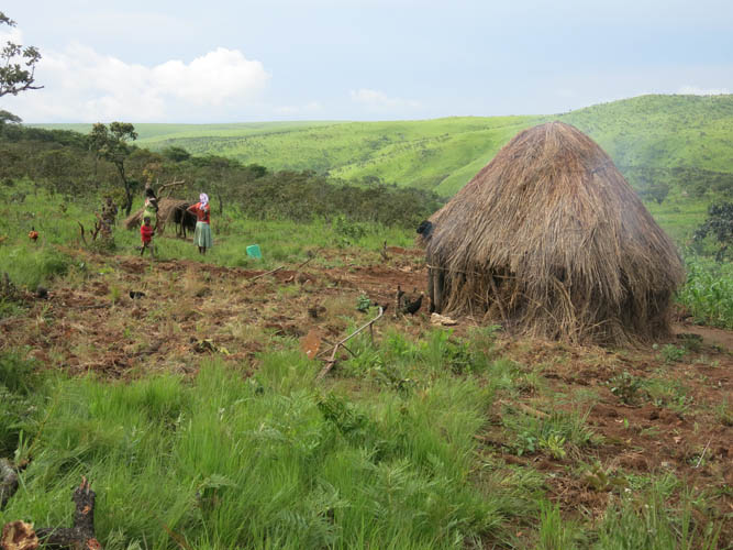
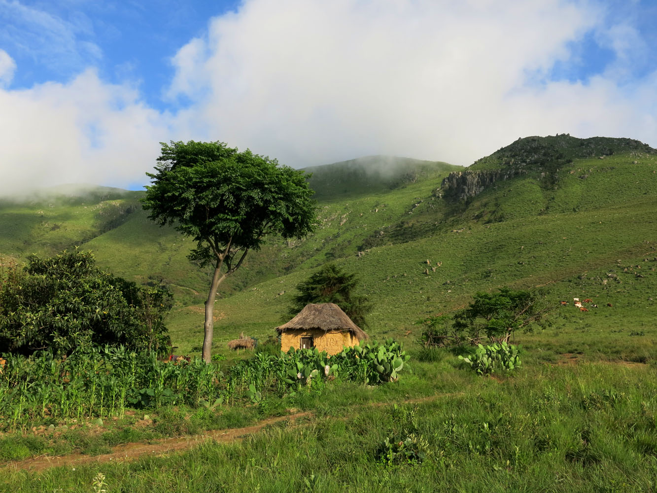
A lonely hut surrounded by fields… the first sign of civilization on my way back.
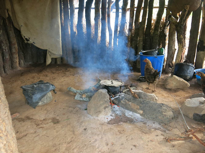
The hut inside: kitchen, living room, sleeping quarters, and chicken den.
Some colourful views finally.
While I was wearing a jacket earlier on, it quickly gets hot and stuffy now that the sun is out in the afternoon.
At the bottom of the valley, I have to cross a small stream to continue on the other side.
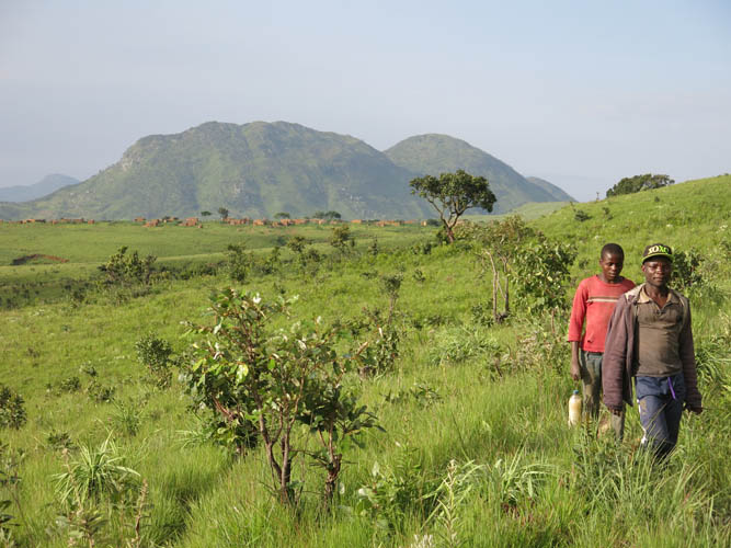
Almost back in Kanjonde, with Monte Mbeu rising behind. These two boys are only the second group of people I’ve met on the trail all day.
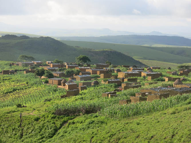
Kanjonde
Saying good-bye to the roof of Angola – what a beautiful place!