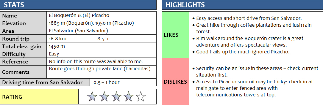
9 November 2017
Solo
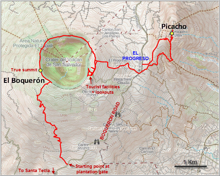
The broad San Salvador volcano forms a natural barrier on the western flanks of El Salvador’s capital and is a popular destination for locals and tourists seeking a breath of fresh air from the hustle and bustle of this busy city. The mountain really consists of two main peaks: El Boquerón (meaning “wide mouth”), the main crater that has been developed as a tourist attraction, and Picacho, a subsidiary peak to the northeast that’s actually higher in elevation but that nobody ever seems to visit. I decided to combine the two for a nice day hike from my base in San Salvador.
El Boquerón is a fairly developed site with a road leading up to almost the edge of the crater, parking facilities, restaurants, small tourist shops and even a small visitor centre complete with volcano exhibit. Instead of driving all the way up (how boring is that!), my plan was to hike up the SW side of the mountain along small tracks and trails, then circle around the crater, hike down to the col between El Boquerón and Picacho, and finally ascend Picacho. Satellite images was all I had, but the route I had plotted on Google Earth worked out pretty well in the end.
The first hurdle of the day was to get through the morning rush hour from San Salvador to the neighboring town of Santa Tecla. The public bus took forever and as a tall guy it’s not exactly easy to squeeze yourself onto a row of school bus seats with 7 or 8 other people. Although the bus ride only cost me US$0.20, it took a whole 2 hours! In Santa Tecla I found a nice breakfast place and then hopped on a small pick-up truck carrying day workers up the El Boquerón road. I got off at the start of my planned route at an unmarked gate, elevation 1265 m.
The gate was shut, but there was a big gap on the side and I couldn’t see any trespassing signs, so I went ahead. The whole area on the volcano’s slopes here is occupied by coffee plantations. I hiked up the wide dirt track past row upon row of beautiful coffee trees, not seeing a soul for the first hour or so. Then I ran into a plantation worker on the road, a lone woman whose job it was to trim the trees and clear the undergrowth. I cautiously asked if it was ok for me to be hiking through here and she didn’t think it was a problem at all. She also assured me that the area was safe, which was later confirmed by several other people I ran into.
As would be expected in a plantation, there are numerous paths that crisscross the fields, and having a route to follow on my navigation app was essential in not getting lost. At some point higher up I had to go through another gate that marked the start of a different plantation – “Hacienda San Antonio”. The place was even more deserted, I seemed to be the only person around. Thankfully, near the upper end of the main dirt road I followed, a plantation worker came out of nowhere with his two dogs and directed me to the start of a narrow trail that went straight up through the bushes towards the crater. Leaving the coffee fields behind me, I hiked through beautiful rain forest along a faint path that was intermittently marked with three orange dots on tree trunks all the way up to the crater rim.
I was quite taken aback by the sheer size of the huge El Boquerón crater when I first looked down from its edge – it’s 1.5 km in diameter! The crater used to be filled with water, which disappeared in 1917 when a huge eruption sent ash clouds into the sky and obliterated the lagoon. Now all that’s left is a small mini-crater, a cinder cone called Boqueroncito that sits at the bottom of the bigger crater, right in the centre. A path leads down for those interested in a side excursion, but I didn’t bother as I still wanted to go up Picacho. Instead, I turned left (west) and followed the crater rim trail a few hundred metres to the summit. A small concrete marker sits at the top, but there were no people around. On the rim trail I only met a few farmers carrying heavy loads of leaves, wood, and vegetables. They came from small patches of land on the steep inner slopes of the main crater that have been developed into agricultural fields. It is incredible how hard these people have to work to be able to farm their fields in these conditions – there are no horses, mules or mechanical equipment that helps them move their produce up the steep slopes and back down the other side.
I continued further NW along the rim, where the trail slowly deteriorated and finally turned into a rough jungle path hugging the outer side of the volcano, just off the crest. Once in a while I came across some terrific viewpoints overlooking the crater, then it was back into the forest. Not a lot of people seem to do this hike and I saw no one else for several hours until I got to the main tourist site on the eastern side of the crater – the “El Boquerón National Park”. For US$3 admission, you get to walk on some sort of interpretive trail for a few hundred metres, complete with handrails, picnic benches, and miradores (lookouts). Several Salvadorian families were strolling about, enjoying a lazy afternoon and the gorgeous views of the crater. Having seen the crater from all angles now, I didn’t spent too much time here and headed back to the trail I had mapped that would lead me down to the saddle between El Boquerón and Picacho.
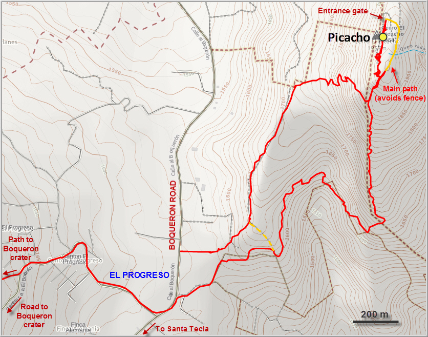
My route took me through the forest of El Boquerón’s upper slopes past some farmers’ fields with great views of Picacho across the valley. The few farmers I met were really friendly and always open for a quick chat, most were visibly surprised by the appearance of a colourful gringo hiker in their backyard. One friendly chap directed me to a shortcut that probably saved me quite a bit of time in getting down to the village of El Progreso, which sits along the main road in the saddle between El Boquerón and Picacho.
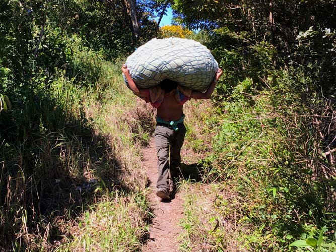
Heading through the village, I found the path I was aiming for right away and followed it through dense, lush forest. I was surprised by the excellent quality of this trail, as it wasn’t marked on any maps and I didn’t see anyone else around. Finally, after an hour of hiking, a guy carrying a huge bundle of beautiful white flowers on his back came towards me. Many of the farmers here apparently grow these magnificent flowers that seem to flourish particularly well on the rich volcanic soil, while others still follow the age-old tradition of burning wood to make charcoal and selling it on the local markets.
The trail I was on contoured around several gullies, but didn’t gain much elevation until it eventually reached the SE ridge of Picacho. Climbing steeply up through light forest, I slowed down significantly here… the afternoon heat and the efforts of the day were getting to me. I was really tired by now and sat down for a long break to enjoy nice views of San Salvador to the east. There were only a few hundred metres of elevation left – easy, I thought, not knowing that the main crux was yet to come!
Just as I reached the first of several communications towers that occupy the top of Picacho, the trail abruptly swerved right, away from the summit. A much smaller trail kept on going up, so I followed it, only to be faced with a barbed wire fence in the now thick forest… What to do now? I didn’t want to go back to the main trail, not knowing where that would lead, so I climbed the fence, which clearly quite a few others had done before me. It was only 2 metres high, but quite tricky with the barbs on top.
A few minutes later I was standing underneath a tall communications tower at the summit of Picacho, waving at a maintenance worker who evidently didn’t mind my presence here. There weren’t really any views from here, and the cluster of field houses and towers didn’t exactly make for a scenic spot up here.
The real problem came when I wanted to leave. The entire complex is surrounded by the fence I had climbed, but usually the main gate for the access road is open. Unfortunately, the gate was locked now and the only guy with a key to the gate had already left for the day… leaving the rest of the maintenance workers (who have their homes up here) and me trapped inside the complex. They had suggested I exit through the gate and then link up with the main path again, but now I had no choice but to climb over that barbed wire fence again. This proved to be much more difficult than on the way up because of the awkward angle of the terrain at the fence, but with the generous help of my new friends I managed to get over it without ripping my pants: they happily brought me not one but two ladders (!) to help me over and see me off! Thus is Salvadorian hospitality J.
Descending back down to the village of El Progreso was even quicker and easier as I found an excellent trail that branched off my ascent trail and took me straight down to the main road. I spent the last 2 hours on public buses in busy traffic getting back to my hotel in San Salvador, which to be honest was drudgery after such a gorgeous day out in nature (a taxi would’ve been a better idea, although you can’t beat the cost of my return journey – a total of 60 cents!). However, it had been a great day full of exploring and hiking through plantations and rain forest and I was thoroughly content with my adventure.
DISCLAIMER: Use at your own risk for general guidance only! Do not follow this GPX track blindly but use your own judgement in assessing terrain and choosing the safest route.
Note: Unfortunately, my camera broke on the first day of my trip so I had to take all photos with my iPhone.
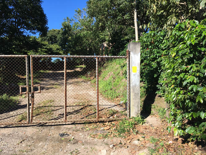
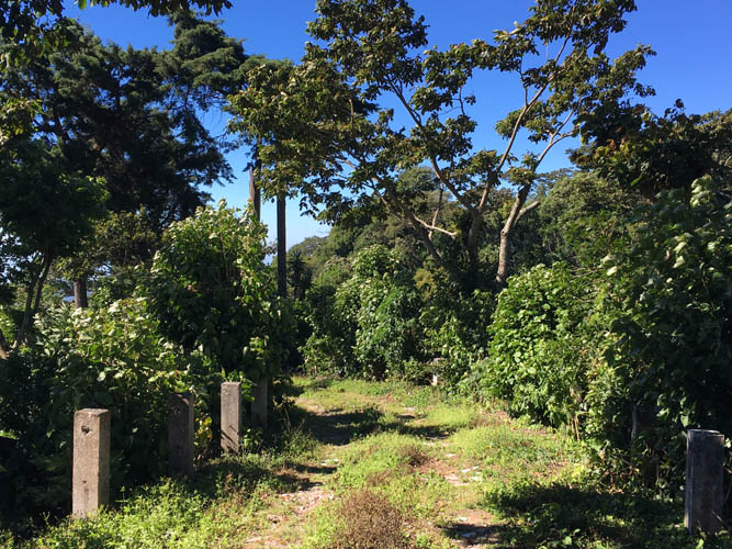
The gate into the coffee plantation at the start of my hike.
A wide track lined with coffee trees leads uphill through the hacienda.
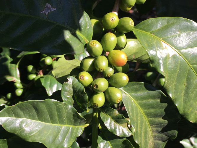
These coffee cherries (the fruits that contain the beans) are still green and not ready to be harvested yet.
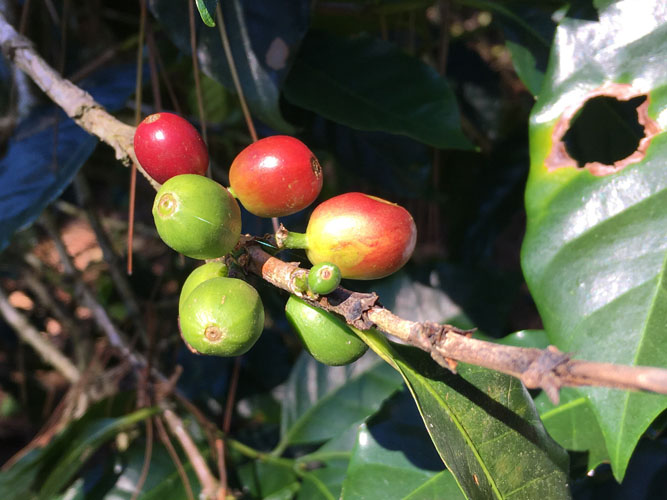
Coffee cherries in various stages of maturity on the same branch. The ripe fruits, characterized by a deep red colour, are carefully picked by hand.
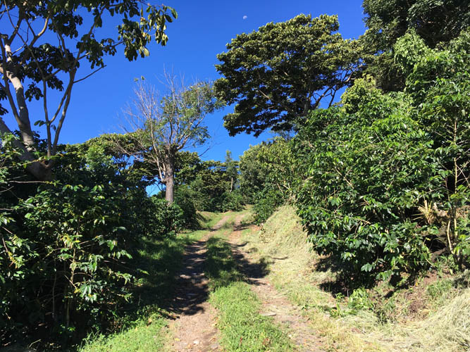
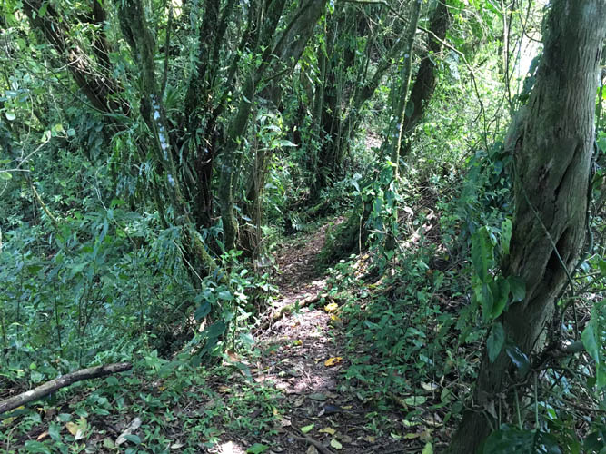
Easy hiking on a good track. There’s hardly anyone to be seen.
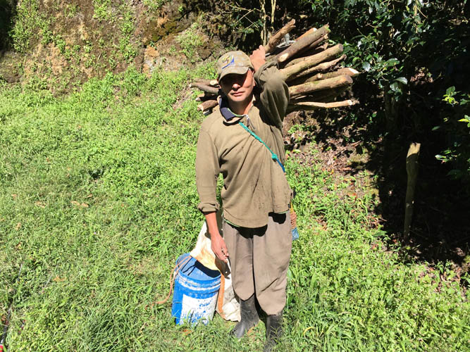
I ran into this friendly plantation worker near the end of the track.
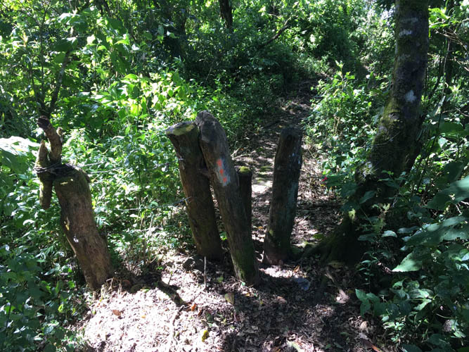
Past the old road, there is a faint track through the bush occasionally marked by three orange dots.
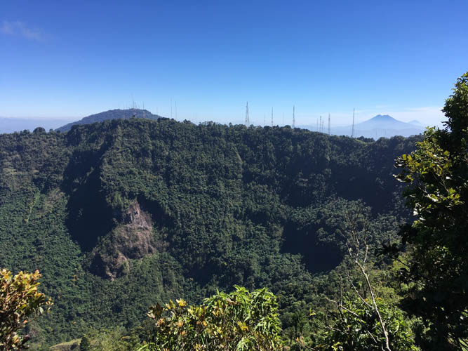
Finally at the edge of the huge crater! It’s too wide to be captured with one regular shot. Across from me are the telecommunications towers near the parking lot and tourist centre.
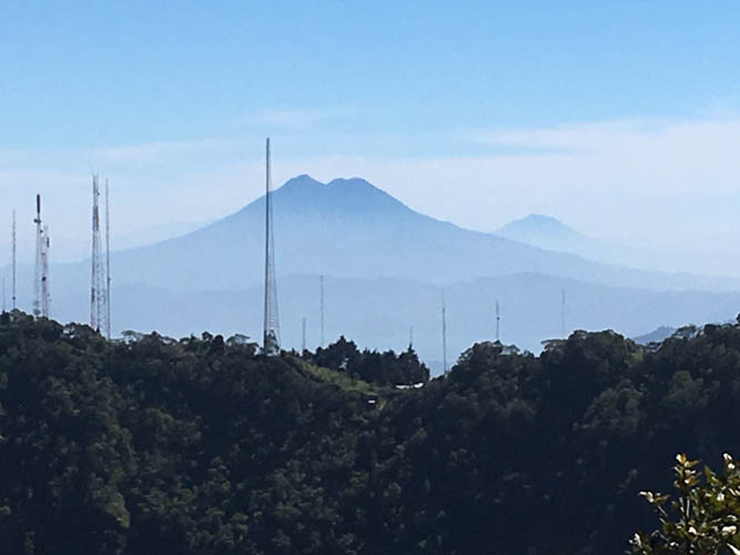
Close-up of Volcan San Vicente in the distance. This peak is about 40 km east of here.
There are very few people on the trail that hugs the crater rim, all of them farmers that have fields on the inner or outer slopes of the crater.
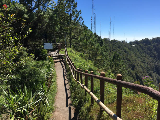
View from the summit towards the NW along the crater rim.
The famous volcanoes of Santa Ana and Izalco can be seen in the distance to the NW.
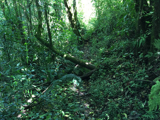
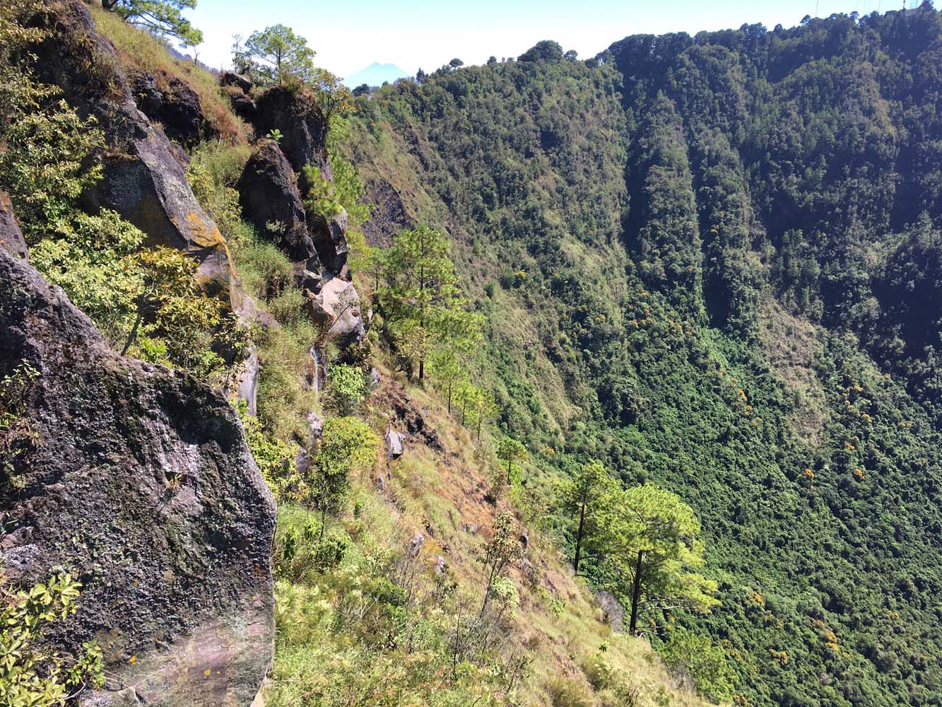
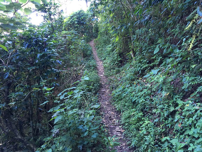
I follow the rim trail in a clockwise direction. It now leads through an extended section of lush rain forest and doesn’t appear to see much traffic here.
A pleasant jungle walk that I have all to myself today.
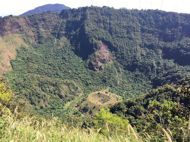
Occasionally, views of the crater open up. A smaller cinder cone called Boqueroncito sits at the bottom of the larger Boqueron crater.
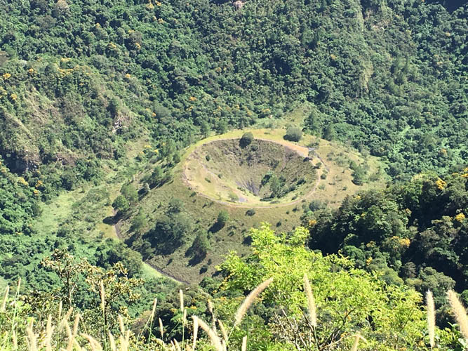
There’s a trail that leads down to the smaller cone, but I don’t have the time to visit today.
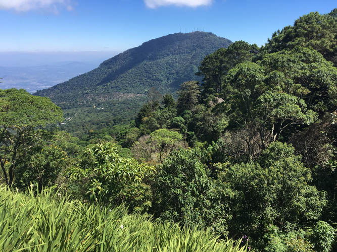
The higher Picacho peak shows up as well.
At the visitor centre on the other side of the Boqueron crater, there’s a small area with interpretive trails and lookouts.
Admission to the “park” is $3. Of course, completing the full circle around the crater offers more and better views, but takes about 2-3 hours.

From from the main lookout down the crater.
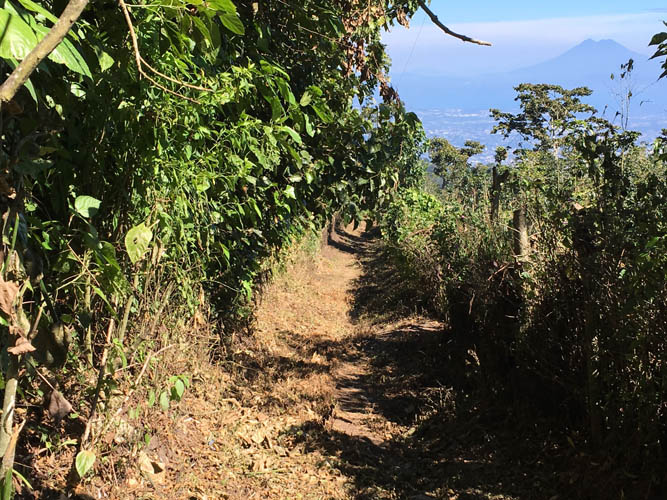
Small dirt paths lead down the eastern slopes of El Boqueron towards the village of El Progreso.
I follow a good trail up the south side of Picacho.
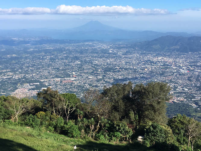
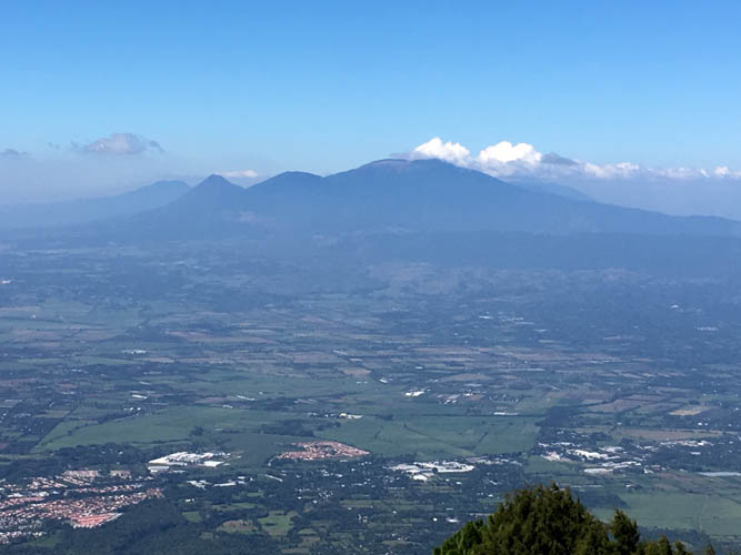
Views of San Salvador from half way up Picacho, with the impressive San Vicente volcano in the background.

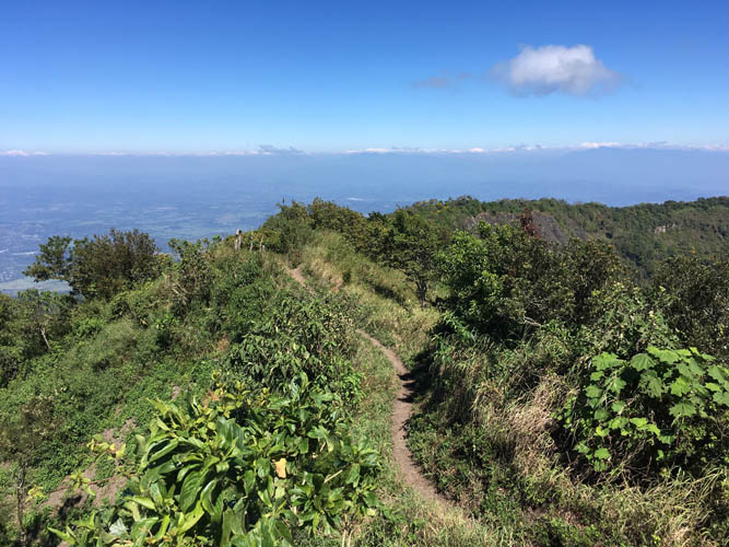
The rest of the way is along a forested ridge on a good trail.
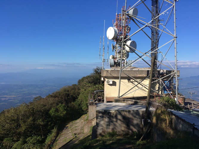
A rather unimpressive cement block marks the summit of Picacho right underneath one of the telecom towers.
Looking north from Picacho’s summit.