 Davos, Switzerland
9 September 2014
Solo
A quick and easy trip at the doorstep of Davos
On my second day in Davos, my parents, my uncle and I decided to combine a visit to the nearby Schatzalp with an easy hike that did not involve too much elevation gain for them and would allow me to climb a little peak en route at the same time.
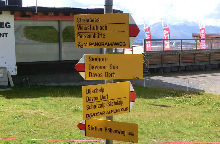
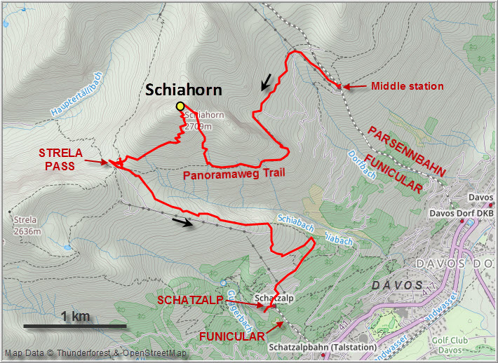
There are several different ways to get to the Schiahorn from the town of Davos. A number of trails go all the way from the town centre up the north side of the valley, for example via the Schatzalp hotel (our descent route) or a bit further west via the Latschenfurgga pass (same approach for the Chüpfenflue, another small peak nearby). Alternatively, if you want to cut down on the initial elevation gain like we did today, there’s the option of taking a funicular half-way up. The Parsennbahn funicular starts right in the town centre and goes all the way to the Weissfluhjoch near the Weissfluh summit, with a stop mid-way.
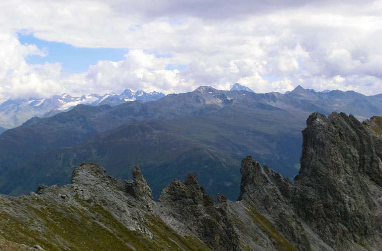
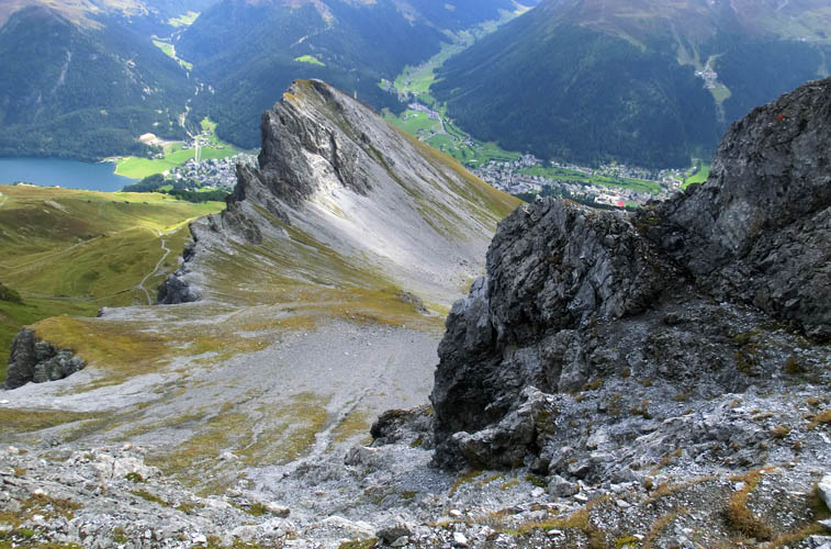
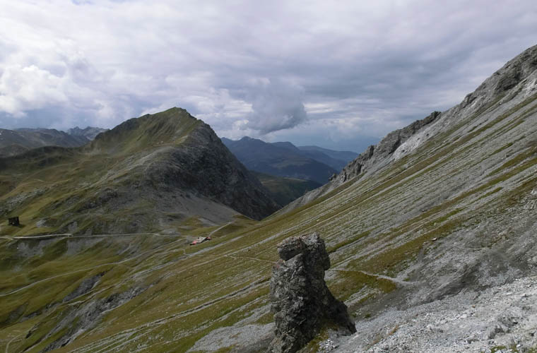
The weather forecast of 80% chance of rain was in stark contrast to the sunny skies that greeted us in the morning when we entered the gondola. We got off a the middle station and hiked the Panoramaweg that contours around the mountain at more or less the same elevation to the Strelapass. Beautiful views of Davos, the Dischma and Sertig valleys, and the surrounding mountains on the other side of the Davos valley accompanied us all along this route.
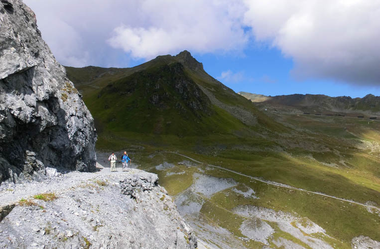
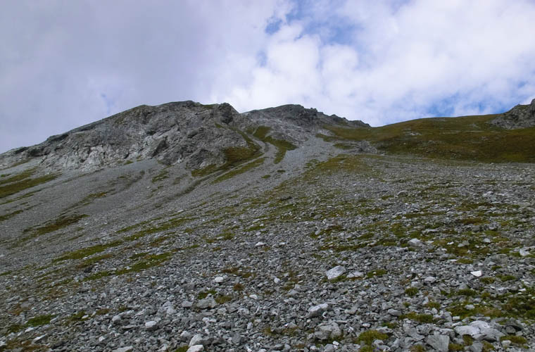
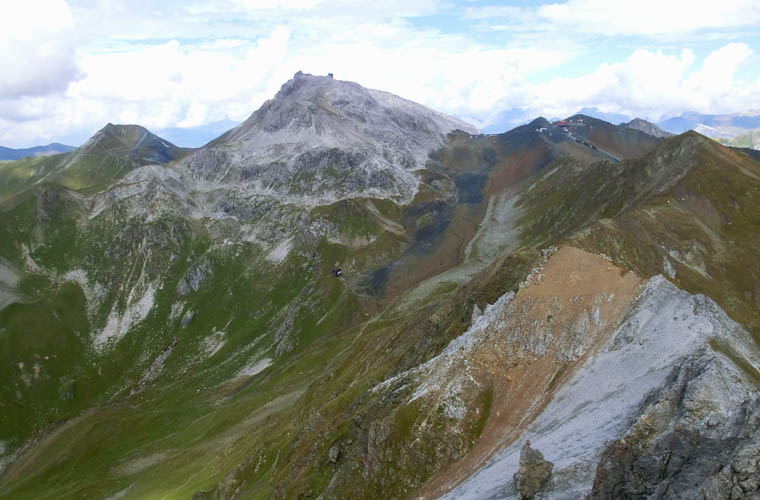
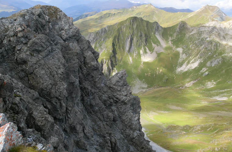
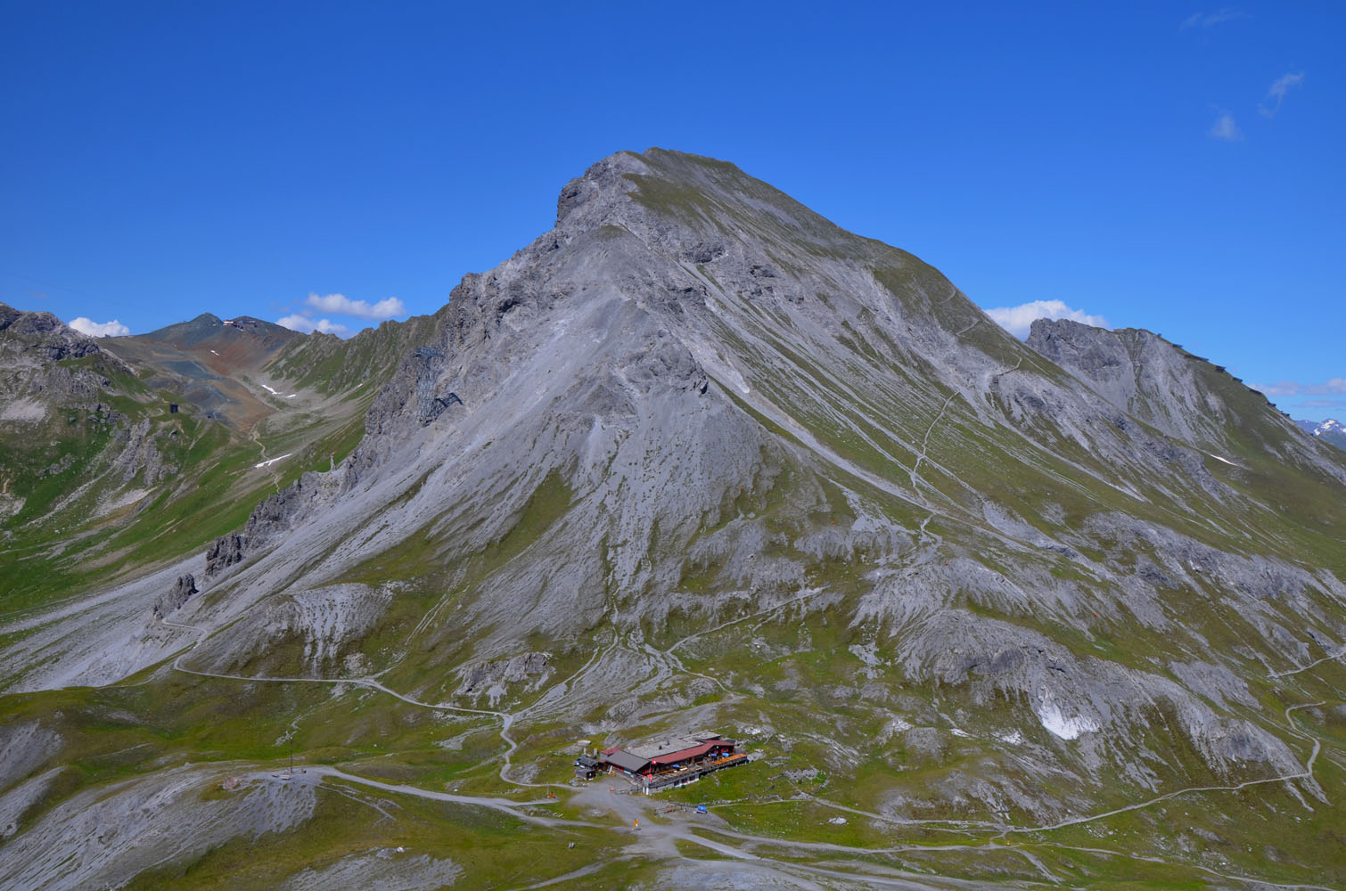
Shortly before reaching the Strelapass (ca. 2 hours from the middle station at a very leisurely pace), I left the well maintained trail and hiked up steep, grassy slopes that led to a small bowl between the Schiahorn to the left and another smaller peak with a very jagged ridge-like top to the right. What I found baffling was the absence of a trail or any signs of human activity so close to a popular hiking trail, funicular, and restaurant. Higher up the bowl I veered slightly to climber’s left into a gully, aiming directly at the highest point – the summit of the Schiahorn. The slope got steeper and only the last 20-30 metres or so were rocky and required easy to moderate hands-on scrambling to get to the top.
A surprised fellow hiker was waiting for me at the summit – nobody seems to come up this SE gully route as there is a very good path that zig zags up the more gentle south slope. We shared some stories and both signed the summit register, which is full of entries with numerous people visiting every year due to the short and easy approach.
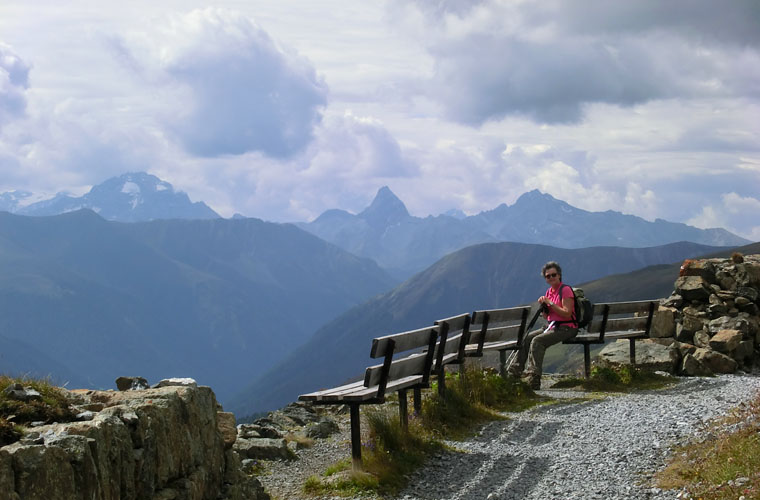
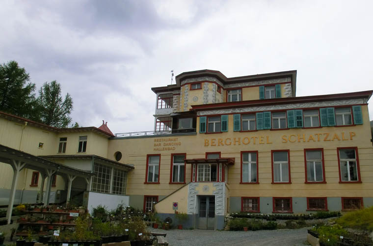
The hike down the main path to the pass took me a mere 15-20 minutes, probably bolstered by the prospect of getting a hearty warm lunch in the Strelapass restaurant. Apart from beer, snacks and the usual alpine fare, the place also serves excellent home-made soups, including the Bündner Gerstensuppe (a type of barley soup) that is typical for the area. From the pass it is about another 1.5 to 2 hours down to Davos town via the Schatzalp Hotel and the Thomas-Mann-Weg, an excellent trail that features thought-inspiring quotes from the famous author’s novel “Der Zauberberg” (The Magic Mountain). The Schatzalpbahn funicular provides another opportunity to cut the descent short if you’ve had enough by the time you reach the Schatzalp Hotel.
|
Elevation: |
2709 m (official), 2698 m (my GPS) |
|
Elevation gain: |
600 m |
|
Time: |
4.5 h |
|
Distance: |
9.0 km |
|
Difficulty level: |
Regular route up trail on south side: Easy hike (Kane), T2 (SAC) |
|
|
Ascent via SE gully: Easy to moderate scramble, T3/T4 |
|
Reference: |
Local maps & own routefinding |
|
Personal rating: |
3 (out of 5) |
NOTE: This GPX track is for personal use only. Commercial use/re-use or publication of this track on printed or digital media including but not limited to platforms, apps and websites such as AllTrails, Gaia, and OSM, requires written permission.
DISCLAIMER: Use at your own risk for general guidance only! Do not follow this GPX track blindly but use your own judgement in assessing terrain and choosing the safest route. Please read the full disclaimer here.