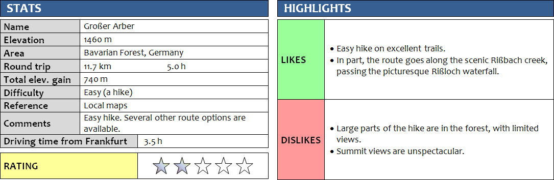
Bavarian Forest, Germany
27 April 2018
With Wen
Nice quick hike to the tallest peak in the Bayerischer Wald, the Bavarian Forest. Plenty of route options exist to reach the summit, of course, but this one is one of the fastest. The parking lot just north of the touristy town of Bodenmais is an ideal starting point for this hike.
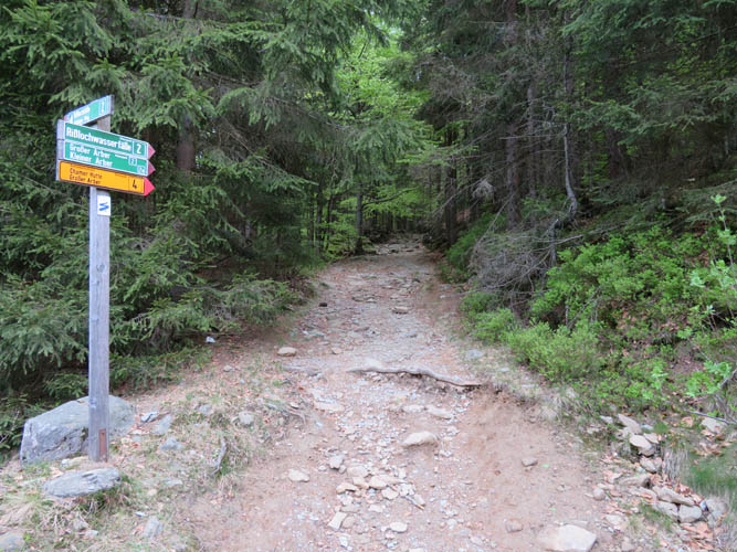
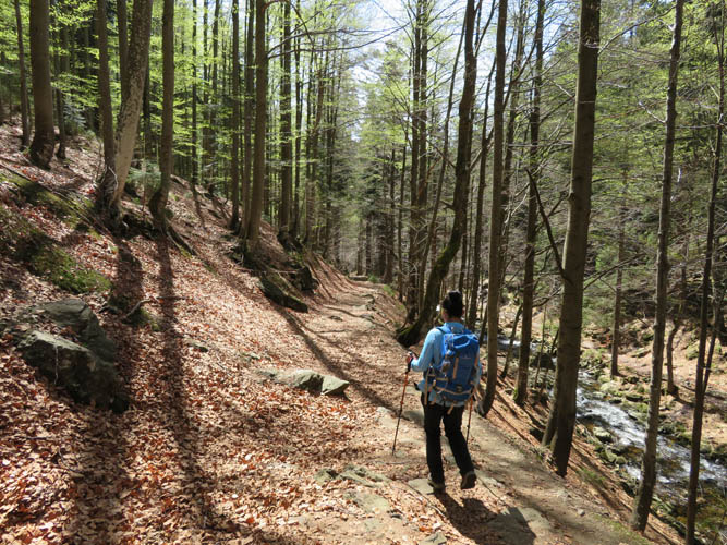
There’s no denying it, the ascent to the Großer Arber is fairly boring and in part even unpleasant. The trail is pretty rough for most of the way up in the forest, with lots of chunky rocks and boulders on the track. For part of the way it is actually easier to follow a faint trail that has developed right next to the main track.
The two massive telecom “golf balls” near the summit of the Großer Arber are a bit of an eye sore. Consequently, the views from the highest Bavarian Forest peak are rather uninspiring on this broad summit mass that is almost completely built-up with a paved road leading up to a large parking lot, restaurant and weather station.
There are quite a few options to return back in a loop, but we were a bit pressed for time so we decided to just go back the same way. Near the bottom, we opted to hike back a slightly different route along the Rißbach Creek, which was probably the highlight of the day with its many pretty cascading waterfalls.
A nice, easy hike and good workout but not the most memorable trip.
DISCLAIMER: Use at your own risk for general guidance only! Do not follow this GPX track blindly but use your own judgement in assessing terrain and choosing the safest route.
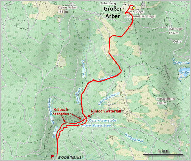
There are several ways to reach the Grosser Arber from the town of Bodenmais. Shortly after leaving the parking lot on the northern end of Bodenmais, there is an option (turn left here) to hike along the cascading Rißbach creek, which is more pleasant but slightly longer than going straight through the forest.
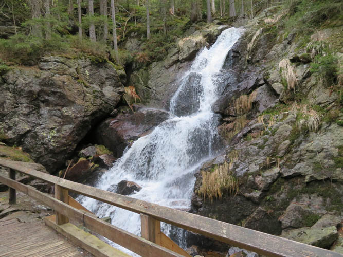
The Rißloch waterfalls.
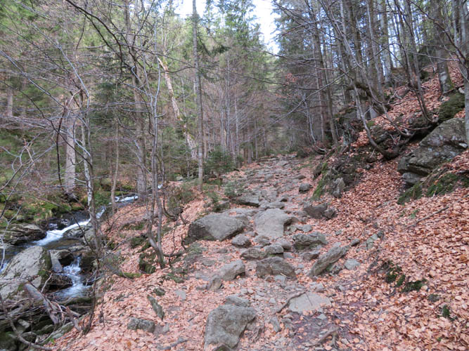
Much of the ascent is on a coarse track with lots of rocks and boulders.
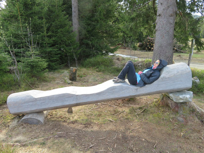
Taking a break on a very comfortable “trunk lounger” built by local handymen.
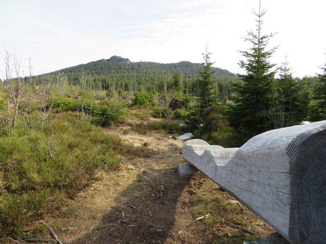
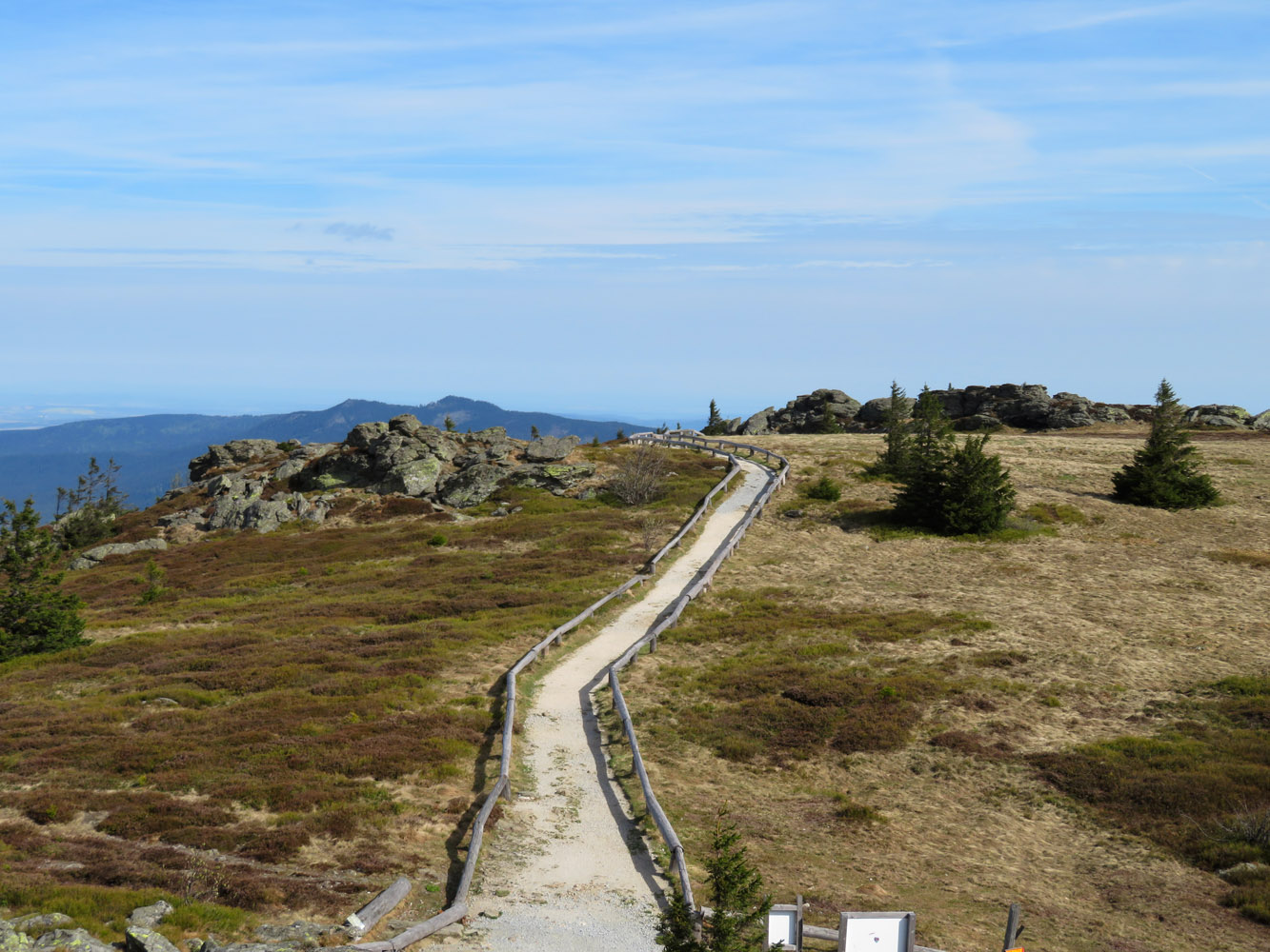
Views of the gentle summit.
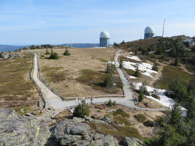
The dome-shaped summit of the Grosser Arber is criss-crossed by wide walking paths so even those driving up by car can go for a hike here!
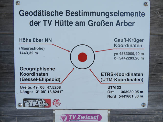
Exact coordinates and altitude are posted on a sign outside a telecoms station near the summit. A good place to calibrate the altimeter of my GPS device!
Sweeping views of a sea of trees from the top – that’s the Bavarian Forest!
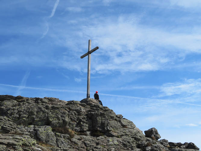
Summit cross.
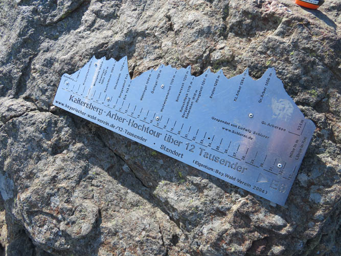
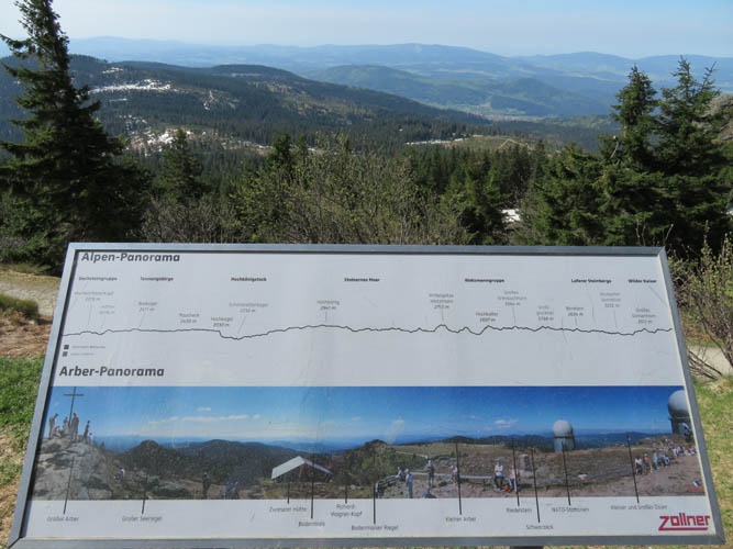
Every peak and bump above 1000 m deserves special attention in an area barely rising above 1400 m. This sign showcases a hike that traverses a dozen of them.
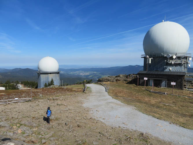
Giant “golf balls” dominate the summit. This is looking north towards the Czech Republic.
Finally some sunshine on the hike back.
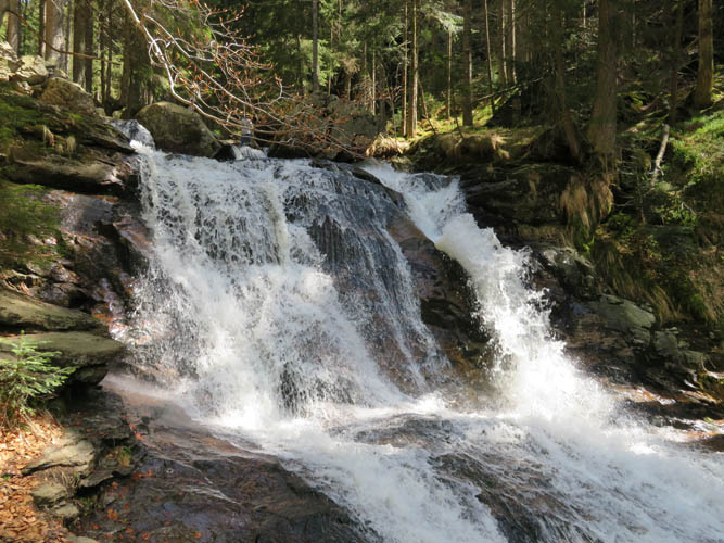
The Rißbach creek.
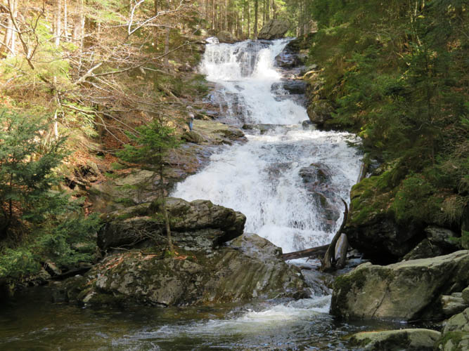
Cascading waterfalls of the Rißbach.