Banff National Park, AB, Canada
19 July 2021
Solo
Bushwhacking and enjoyable ridge scrambling with brilliant views
Also see: Ship’s Prow Mountain (Kananaskis); The Prow (Ghost)
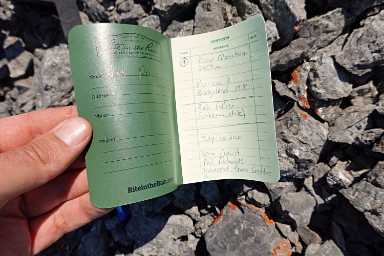
This is the mountain I was supposed to climb with Vern and Phil a week earlier, when I had to bail at the very last minute. They were probably only the third group making it to this remote summit after the original Topographic Survey in 1918 (Morrison & Bridgeland) and the famous Rick Collier, who took two attempts, the first being in winter and the second in the fall of 1993. In 2020 Ephraim Roberts also climbed the first false summit, which is actually 65 m higher than the true summit further northwest.
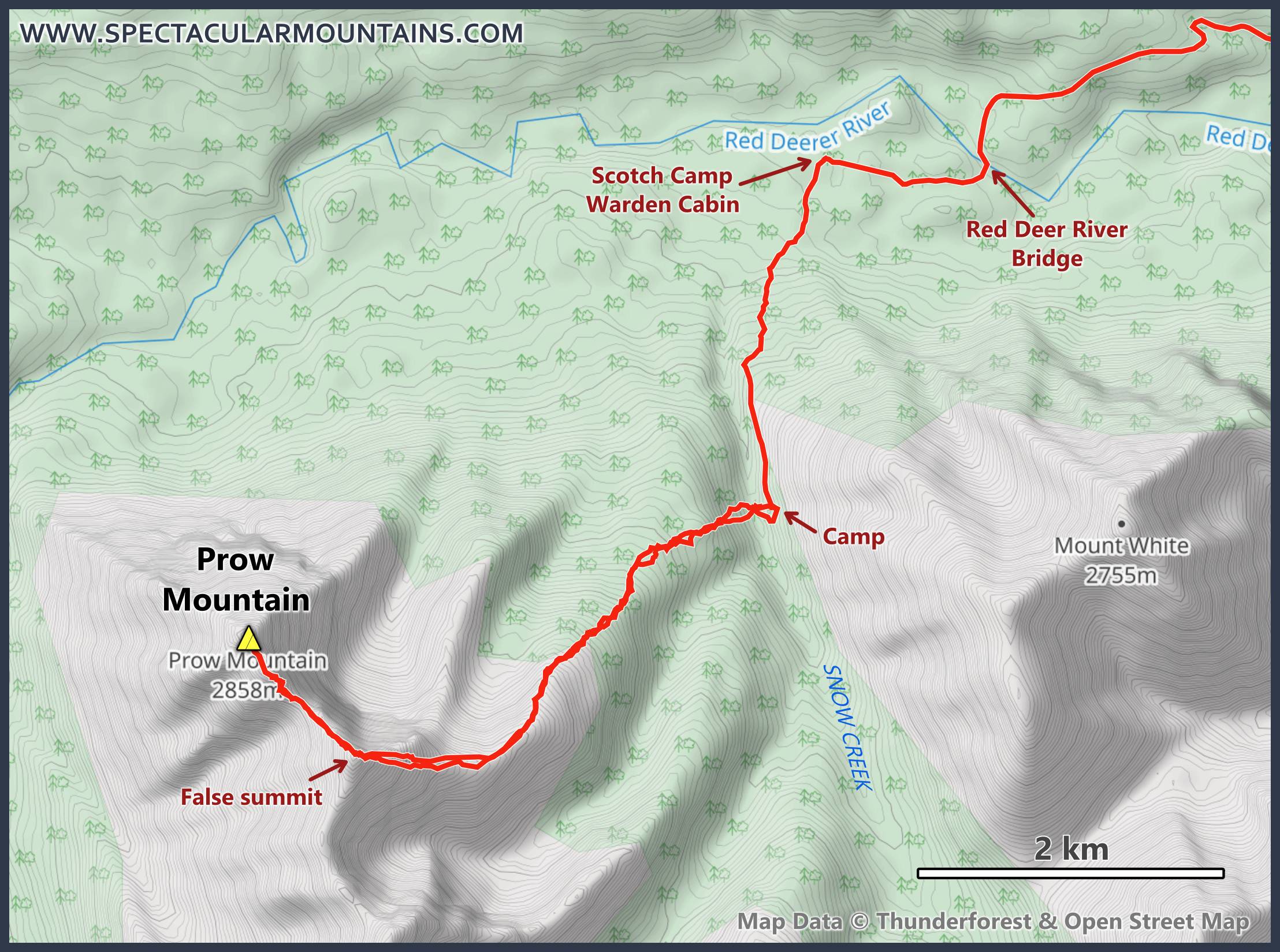
Thus, there was sufficient beta available for me to make this a much more “predictable” event today, which I really didn’t mind after all the exploring and uncertainties of the previous day. There is a significant swath of forest that lies between the Cascade Fire Road and the upper treeless slopes of Prow Mountain, so bushwhacking is one of the unavoidable items on the menu for this trip.
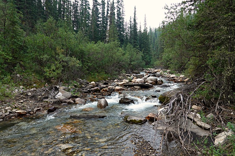
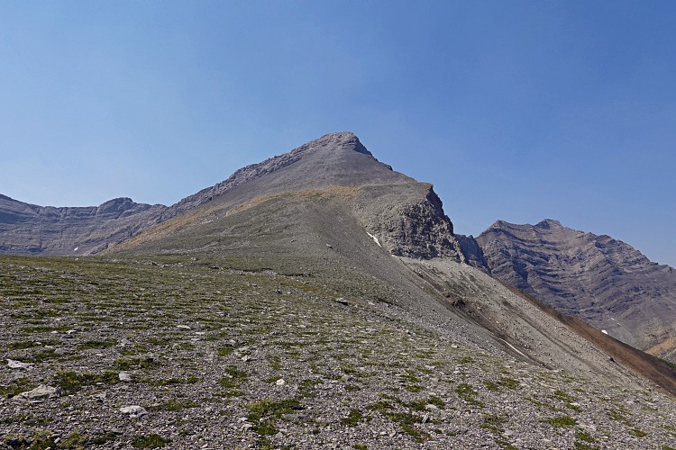
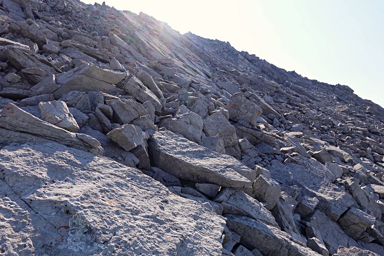
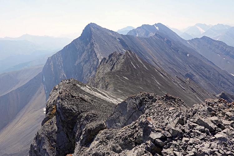
The rib extending east and northeast from the false summit (which also informally goes by “Greater Prow” or the rather anonymous name of “Forward”) is probably the best approach route. First, I dropped down some 60 metres from the road and waded a very lively Snow Creek. On the other side it’s light to moderate bushwhacking for the next hour and a half. A GPS is very helpful because the rib is broad and has a few dips, so it’s easy to lose orientation when mocking about in the middle of the trees.
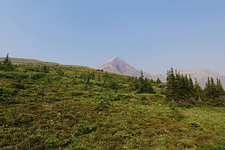
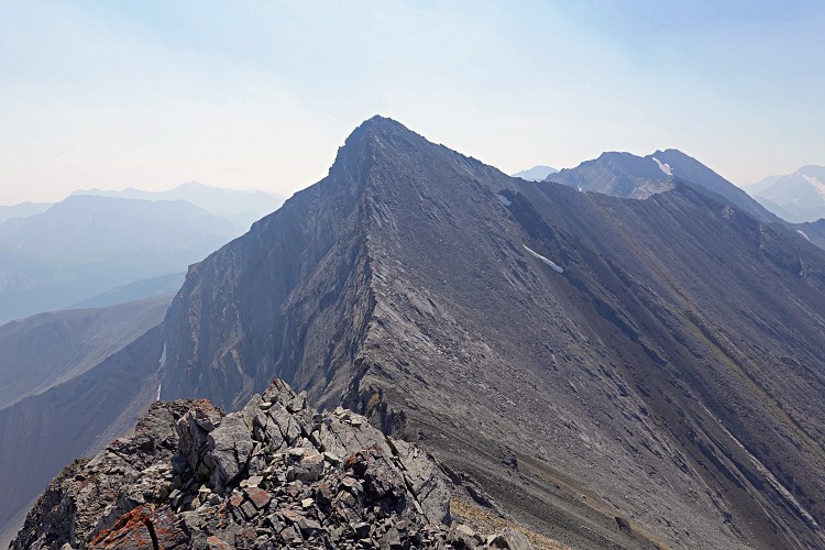
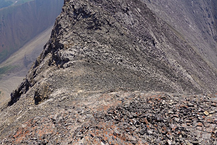
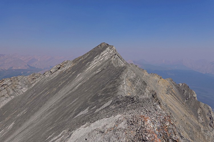
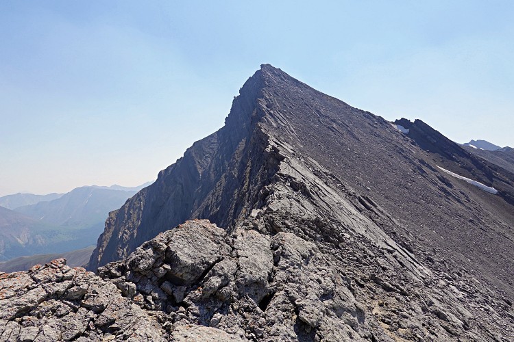
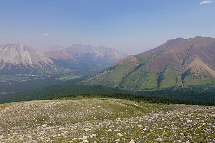
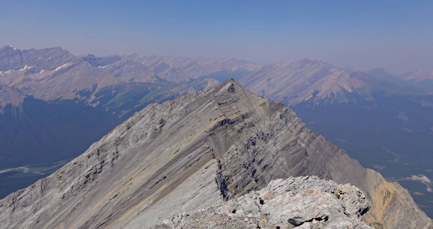
Above tree line the trip changes from annoying bushwhacking to highly enjoyable ridge walking, with fantastic views of the entire range of peaks ahead of you. I really liked this section. It feels very isolated up here, yet also freeing as you can effortlessly move about. Towards the main ridge the rib then steepens, eventually changing into small rock bands and talus that requires a bit of moderate scrambling to get to the top featuring a large cairn.
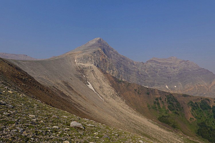
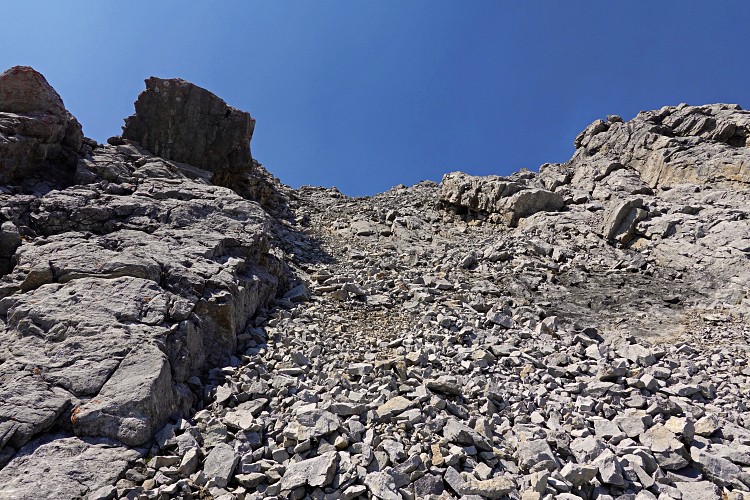
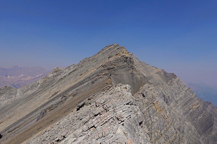
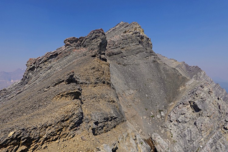
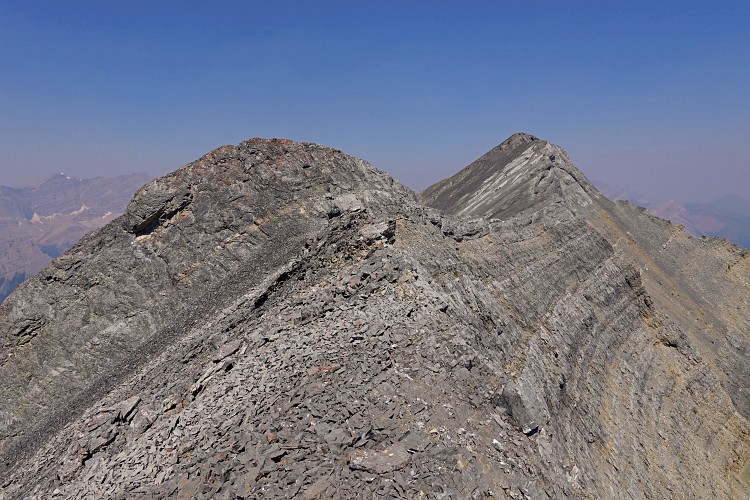
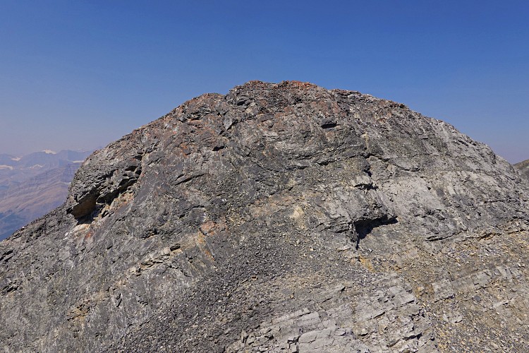
It was another hot and windless day – my favourite conditions, but I do have a habit of drinking a lot, so I was concerned to see my water reservoir almost depleted already. The stretch from the false summit to Prow Mountain true summit took me exactly an hour and a half. It’s mostly easy to moderate scrambling, some of it on large wobbly slabs of rock, with one short 5 m rock band, the crux. Holds are small and few, but at least the rock is solid and the exposure isn’t too bad. It’s difficult scrambling (approach shoes would help here), and certainly more difficult getting down than up!
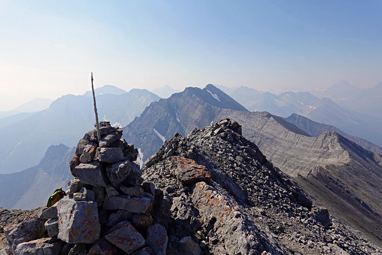
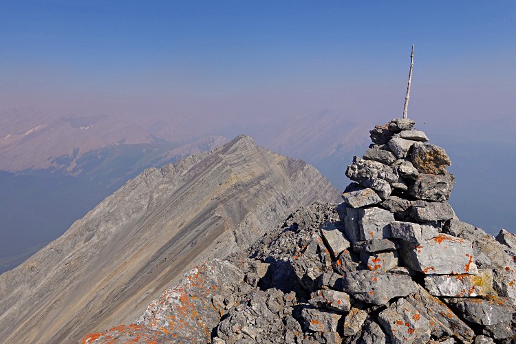
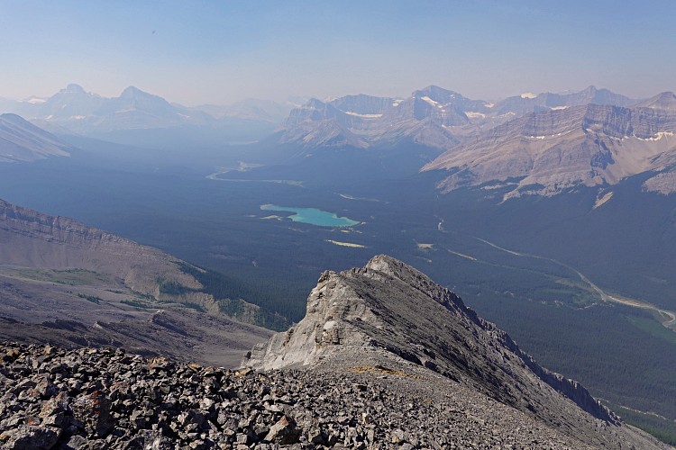
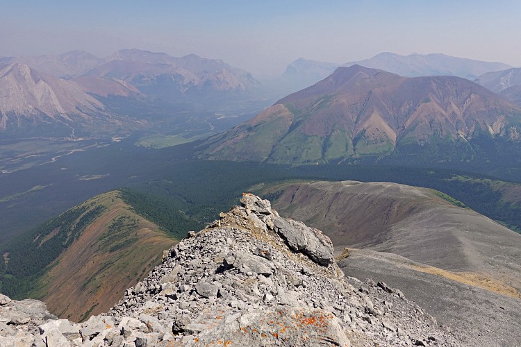
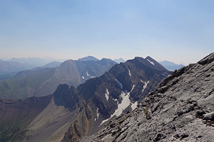
Beyond the crux the ridge eases again and quickly leads to the summit, where Vern and Phil had kindly placed a new register the week earlier. Remarkable from up here are the good views of Skeleton Lake, Mount McConnell and Mount Drummond, as well as Cataract Peak and other bigger guys further west.
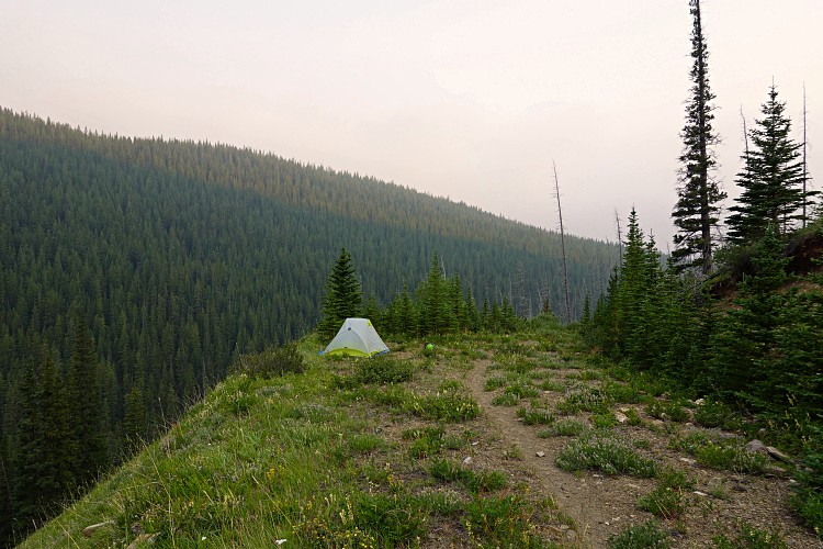
Now completely out of water, I took the exact same route back, via the false summit, and down the long NE-trending rib and into the bush down to Snow Creek where I eagerly filled up again. When I got back to my camp site I first couldn’t believe my eyes… my tent was gone! Fearing the worst, perhaps that a bear had torn through it, I searched the area around the bend… And there it was, down the slope hanging in the bushes, complete with sleeping bag and backpack inside. I can only presume that a strong gust of wind must’ve blown it away. Strange, because it was a pretty calm day, but I also hadn’t used all my pegs, so no wonder… You never stop learning new lessons out in the wild!
Climbing Prow Mountain was fun and also strenuous. Of course now I still had the long hike and bike back to my car at Bighorn Campground ahead of me. Luckily, the weather stayed warm and sunny for the rest of the day and I thoroughly enjoyed the lovely hike back past the Scotch Camp warden cabin. I even ran into the two researchers again, who had just completed one week of field work and were equally happy to return home for some well-deserved pizza and beer.
|
Elevation: |
2840 m |
|
Elevation gain: |
1650 m (1340 m) |
|
Time: |
13.5 h (7.5 h) |
|
Distance: |
37.8 km (10.0 km) |
|
Difficulty level: |
Difficult (Kane), T6 (SAC) |
|
Activity: |
Hiking & Scrambling |
|
Reference: |
Rick Collier; Vern |
|
Comments: |
Stats in brackets from/to camp at Cascade Fire Road |
|
Personal rating: |
3 (out of 5) |
NOTE: This GPX track is for personal use only. Commercial use/re-use or publication of this track on printed or digital media including but not limited to platforms, apps and websites such as AllTrails, Gaia, and OSM, requires written permission.
DISCLAIMER: Use at your own risk for general guidance only! Do not follow this GPX track blindly but use your own judgement in assessing terrain and choosing the safest route. Please read the full disclaimer here.