Kananaskis, AB, Canada
24 October 2019
Solo
A challenging winter trip with a long and tiring descent
It was almost three weeks ago when Richard and I made plans to go up Shunga-la-she, but then turned around at the bridge over the Sheep River due to too much snow on the mountain’s north side. Back then we opted for an attempt up the East Peak of Mount Burns instead, which turned out to be a great alternative and a terrific ridge scramble.
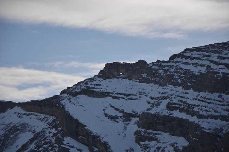
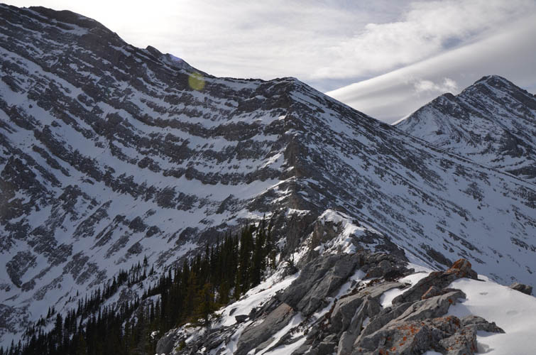
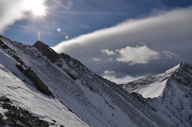
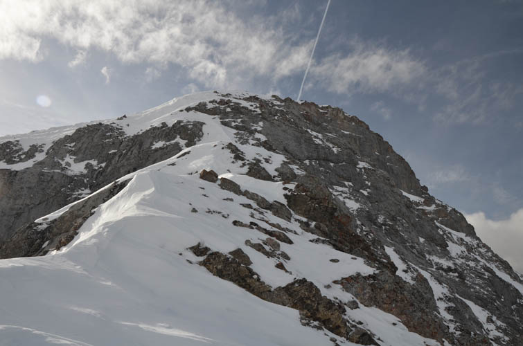
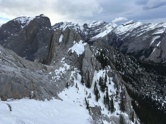
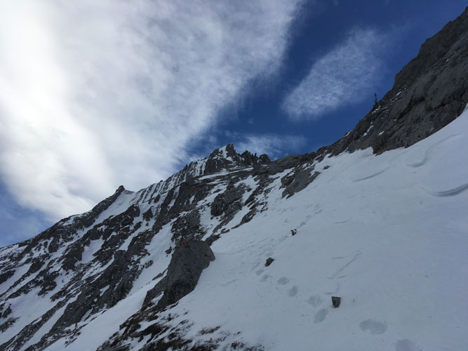
There had been very little fresh snow coming down in the past weeks, so with a sunny and relatively warm weather forecast I wanted to give Shunga-la-she another try. Thankfully my prediction turned out to be correct – there was no snow at all on the bridge this time around and only a thin cover in the forest. I made good progress up the treed north ridge, occasionally following pink and blue flagging. Once I hit treeline things got considerably harder due to strong winds and hard snow patches on the exposed ridge crest. It was fun scrambling, though, with a number of steep cliffs in the way that either had to be tackled head-on or bypassed on climber’s right. I can see how the presence of snow definitely makes this much more challenging than in dry conditions.
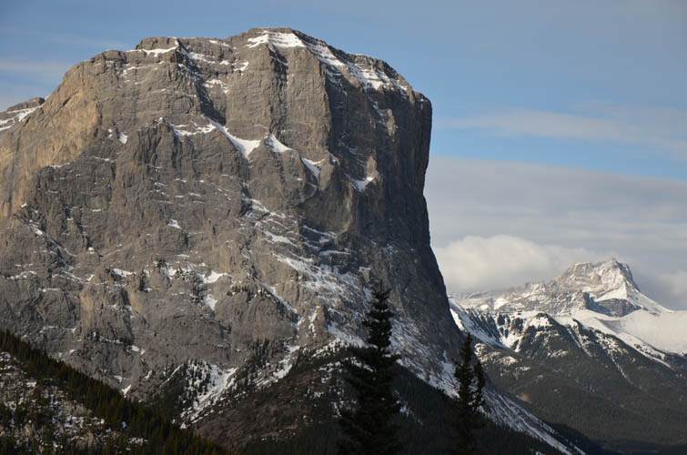
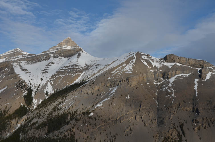
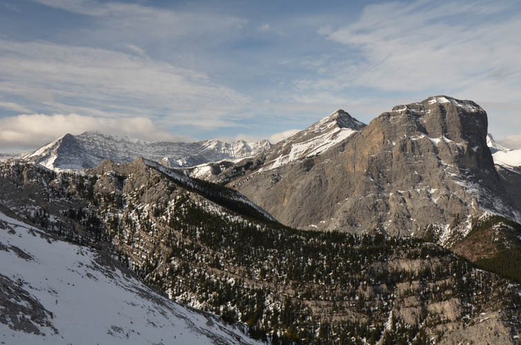
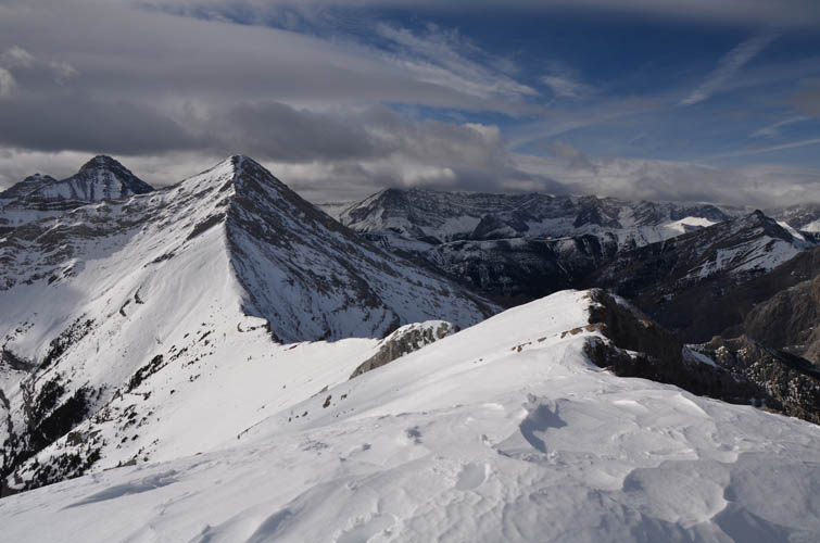
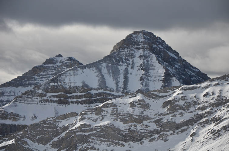
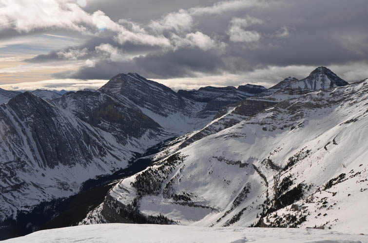
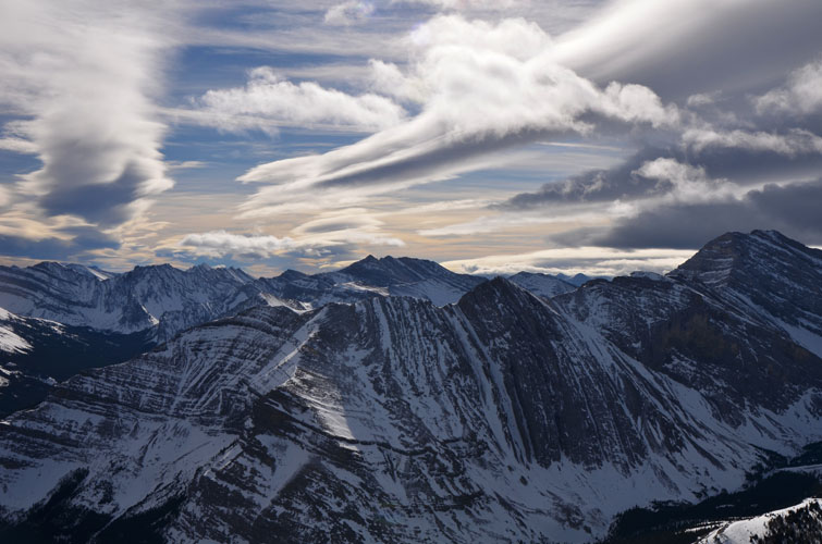
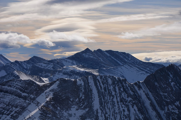
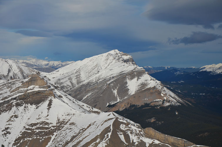
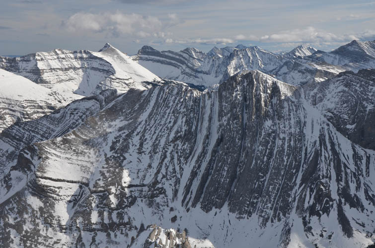
Beautiful views of neighboring Jägermeister Peak, Gibraltar Mountain and Mount Burns kept me distracted as the wind was whipping me around on the upper ridge to the cairned top. The summit panorama was fantastic due to the fascinating interplay of varying cloud cover and sunlight today: darker clouds far to the west, some Chinook formations along the Front Ranges, and clear blue skies down in the plains to the north and east.
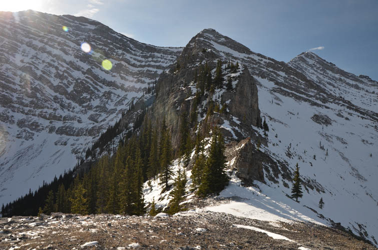
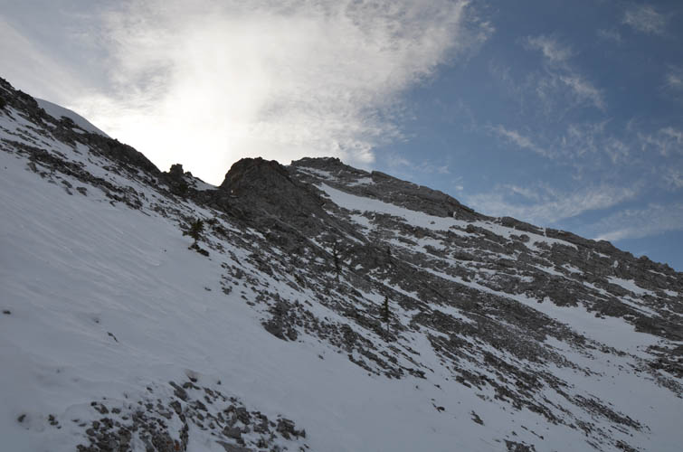
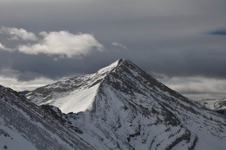
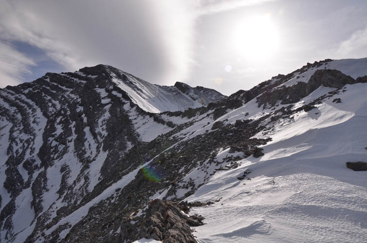
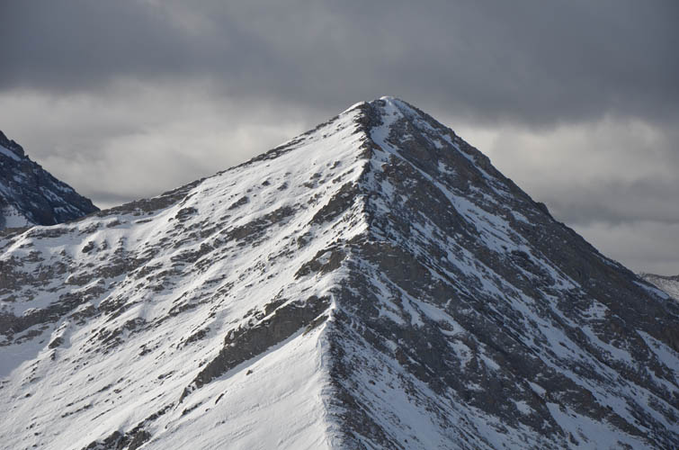
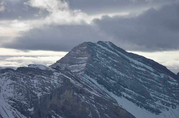
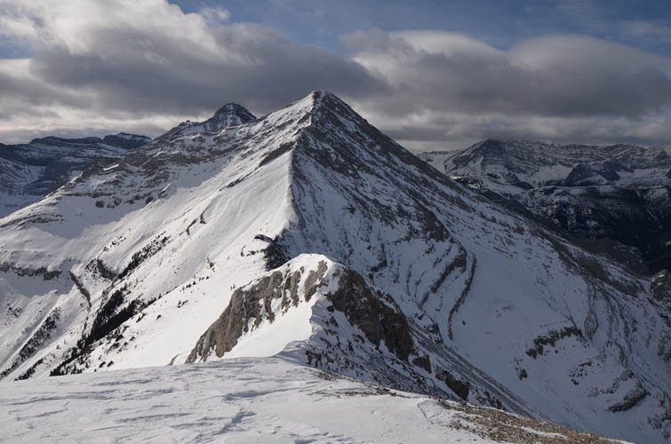
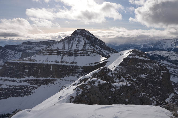
It was only 1 pm now, about three and a half hours into my day. Why not add on the next high point along the ridge, informally referred to as “Jägermeister Peak” in Nugara’s More Scrambles book, I thought to myself? It looked a bit daunting from Shunga’s summit, and it certainly was! The wind only kept getting stronger now that it was afternoon and the terrain was more serious than before. I bypassed the first intervening crag along the ridge on the right (north), using my ice axe to get down a steep slope of hard snow. The second crag near the col didn’t offer any detours around it, so I had to climb it along its crest which wasn’t easy with all the snow around. Numerous smaller steps and rock bands required careful negotiating as I slowly made my way past the saddle and up Jägermeister’s NE ridge. The crux was a steep section of exposed rock with small holds – quite awkward to climb with all the snow and ice around and no doubt more straightforward in the summer. I was feeling pretty tired by the time I was on the uppermost section scrambling up a steep, snow-covered chute on the north side of the exposed ridge crest. I finally reached the summit around 4 pm… it had taken me two and a half hours to get here from Shunga-la-she! That’s a lot more time and energy than I had expected.
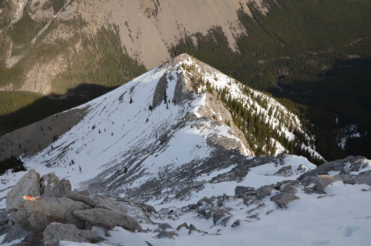
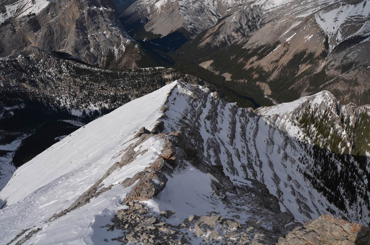
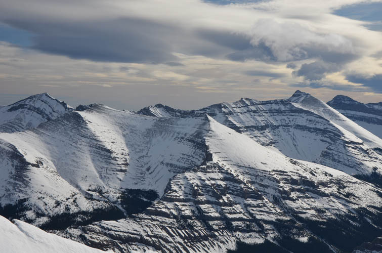
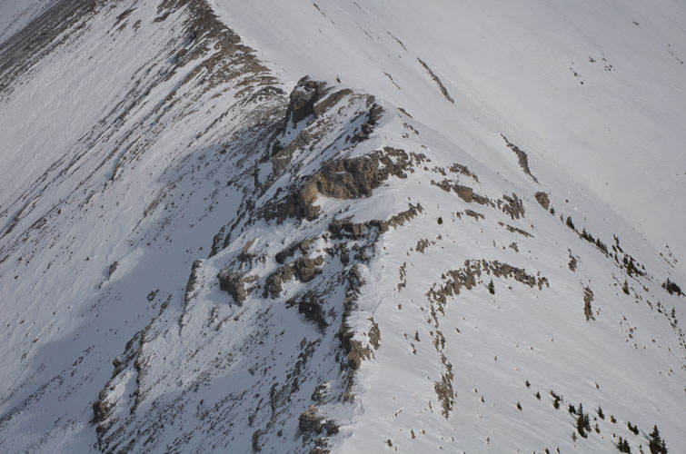
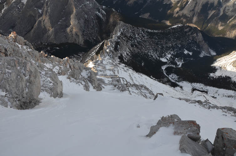
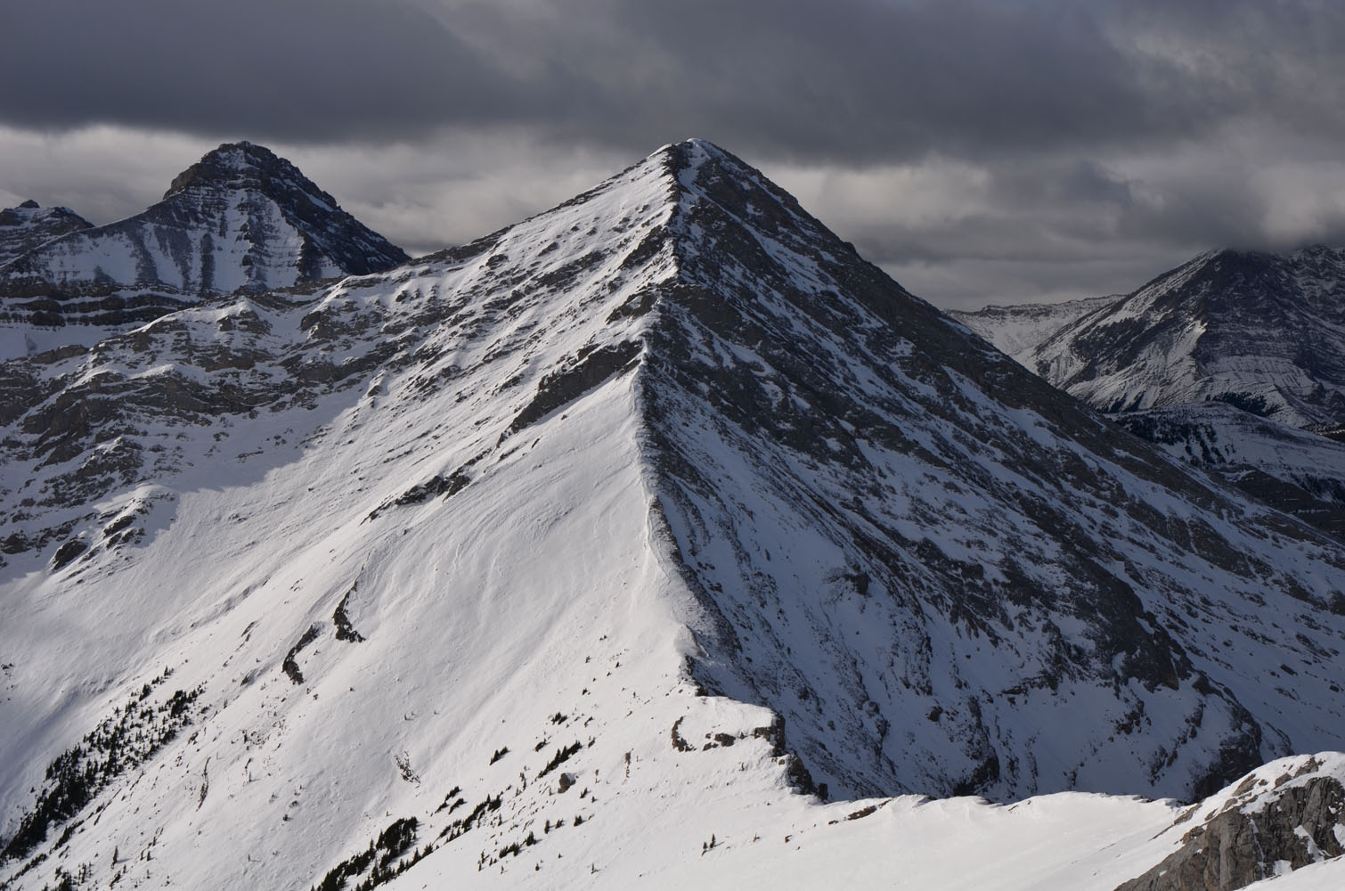
After taking a short break on the south side of the summit sheltering from the wind, I looked at the descent option I had thought about as a possible way to get off this mountain quickly. The northwest ridge of Jägermeister Peak may look simple and straightforward when looked at from the valley below, but from this vantage point it was a whole different beast! Vertically tilted strata form a jagged line of ribs, with steep drops on either side. Not scrambler-friendly at all! I poked around a bit and discovered a ramp-like feature between some of these ribs just a few metres on the eastern side of the ridge crest. Perhaps this would go? It did, but only just. The upper part of the ramp had a thick layer of steeply dipping, hardened snow that was tricky to descend. Strong winds were whipping up the snow, sandblasting my face as I tried to slowly slide down this slope using my ice axe to glissade. The wind got so strong I had to stop half-way down and put on my thick winter jacket and face mask. A strong gust blew off my sunglasses and I almost lost my helmet when I pulled the mask over my head.
Thankfully the super steep, super windy section was short and the terrain eased off in the lower part of the ridge where I was on a mixture of rock and snow again. The ramp narrows, then peters out at a v-shaped notch in the ridge where a snow-filled gully on skier’s right offers a way down into the valley to the NE. Continuing along the ridge crest would’ve been impossible in these conditions; even in the summer this knife-edge ridge looks like it would probably be more than scrambling.
I thought I was home free now that I was off the ridge… Far from it! Although I was now in the trees ploughing through knee-deep snow, several cliffbands unseen from above were waiting for me in the forest below and resulted in some rather tricky manoeuvring including lowering myself off a tree, sliding down an ice-covered rock band, and jumping off a cliff into a thick patch of snow below because I saw no other way to circumvent these cliffs. There may well be a better route that zig-zags through these cliffs, but they’re hidden in the forest so I had no way of telling where to go. My energy was waning at this point as I was struggling through time-consuming microterrain, but of course I had no choice and had to press on. Clearly, going back along the ridge to Shunga-la-she and then following my ascent route back down would’ve been a better choice.
After lots of messing around in the forest I eventually made it down to the creek, filled with boulders and a thick blanket of snow. I ended up sidesloping through the forest on the other side of the valley in order to avoid getting my feet trapped between boulders. Staying above the creek bed also allowed me to detour around several waterfalls below. On the flipside, I had to contend with almost an hour and a half of bushwhacking in snow-covered forest, much of it with my headlamp on now that it was dark. Lower down the forest finally thinned out and when I found my boot prints from the morning I breathed a huge sigh of relief. All that was left now was another hour of retracing my route back to Sheep River road and then an easy hike to my car.
I think this was more of a mountaineering trip in the conditions I experienced today. Snow, ice and strong winds exponentially increase difficulties that would otherwise be more straightforward to tackle. The power of the elements also makes you much more vulnerable if something goes wrong. Overall, I cannot recommend my descent route off Jägermeister Peak due to the steep snow slope below the summit and the many unseen cliffs in the forest below. In the summer it might be a different story: it would be interesting to explore this route during ascent on a nice warm day to see if there’s an easier way around the cliffs. With all the snow around, it was A LOT of work to get through, so it won’t be me returning here anytime soon!
|
Elevation: |
Shunga-la-she: 2615 m (my GPS) |
|
|
Jägermeister Peak: 2751 m (my GPS) |
|
Elevation gain: |
1730 m |
|
Time: |
11 h |
|
Distance: |
15.8 km |
|
Difficulty level: |
Difficult climber’s scramble (Kane), T6 (SAC) / a mountaineering trip in winter conditions |
|
Reference: |
Andrew Nugara & Vern Dewit for ascent up Shunga-la-she. Own routefinding for Jägermeister Peak. |
|
Personal rating: |
4 (out of 5), but this excludes my descent off Jägermeister Peak which is not recommended |
NOTE: This GPX track is for personal use only. Commercial use/re-use or publication of this track on printed or digital media including but not limited to platforms, apps and websites such as AllTrails, Gaia, and OSM, requires written permission.
DISCLAIMER: Use at your own risk for general guidance only! Do not follow this GPX track blindly but use your own judgement in assessing terrain and choosing the safest route. Please read the full disclaimer here.