Tyrol, Austria
9 August 2018
Solo
The wrong way round: how to make a difficult scramble even more difficult
What an adventure! This mountain taught me another important lesson: do your research beforehand to know what’s in store, no matter how easy the terrain may look on a map. Pretty obvious you’d think, but even after years of hiking and scrambling, I still had to learn this lesson (once again) the hard way.
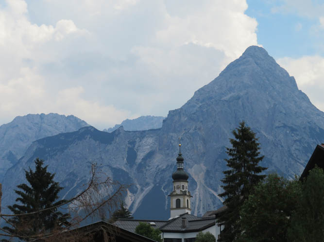
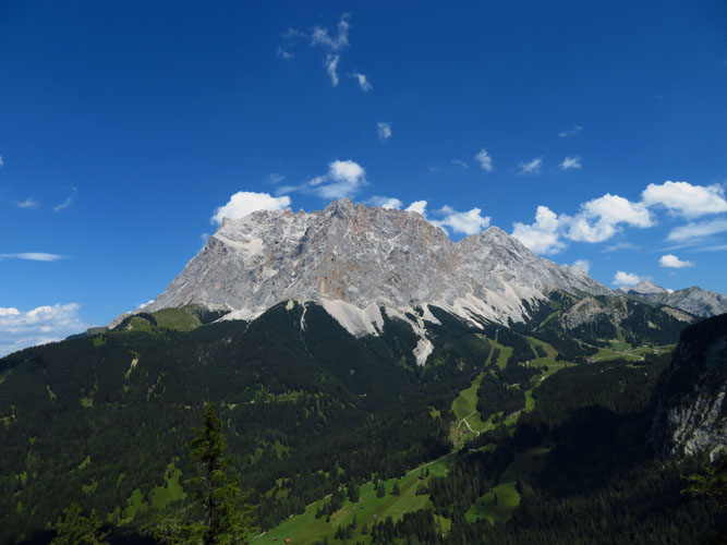
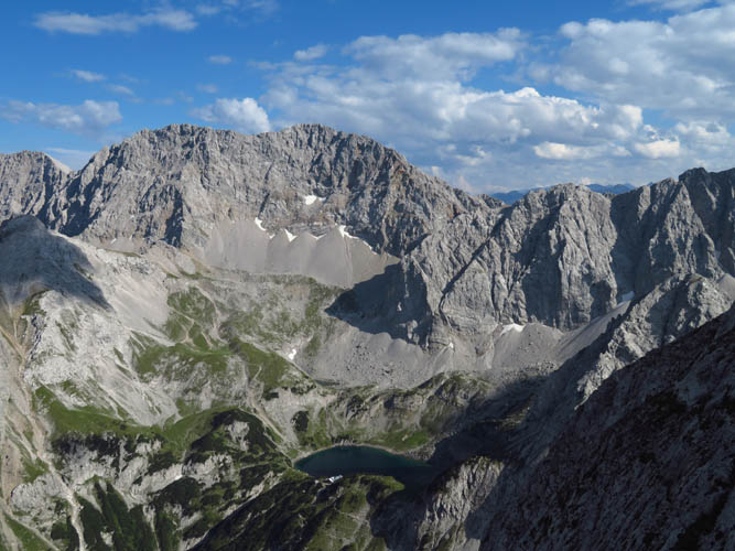
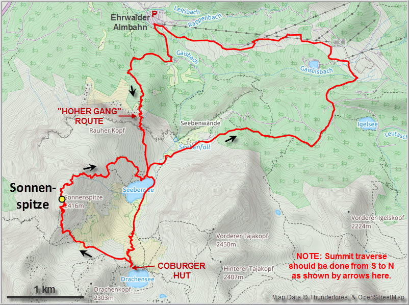
The Ehrwalder Sonnenspitze, or simply Sonnenspitze (German for “sun peak”), is a prominent mountain in the shape of a slender pyramid when viewed from nearby town of Ehrwald. Locals affectionately refer to it as the “Matterhorn of Ehrwald” because of its steep, craggy summit tower. The peak first caught my attention when during our descent hike from the Zugspitze back down into Austria. It really is a magnificent looking peak, flanked on the northern side by a huge cliff called the Seebenwand. And despite its rather unimpressive summit elevation barely over 2400 m, this little peak definitely packs a punch. All I knew about it, however, was that there was a route shown in my navigation app, plus the somewhat cryptic advice a local hiker had given me that the ascent is “definitely doable but for experienced parties only”.
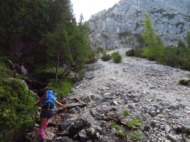
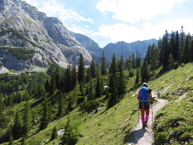
Wen joined me on the first part of this trip to the Seebensee lake, which in itself is totally worth the effort. From the parking lot at the Ehrwalder Almbahn gondola station we took the Hoher Gang route, a steep trail that elegantly cuts through the huge cliff by way of a narrow grassy ramp on the right side. The path quickly gains elevation through the forest, followed by a short section of scrambling on a good trail with fixed steel ropes here and there. We had brought our helmets for this section, but didn’t need them.
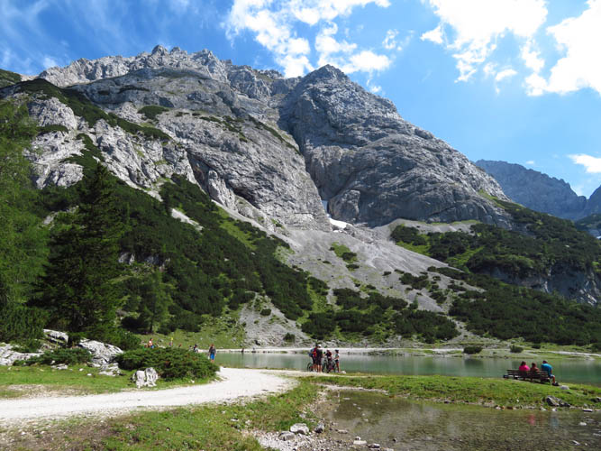
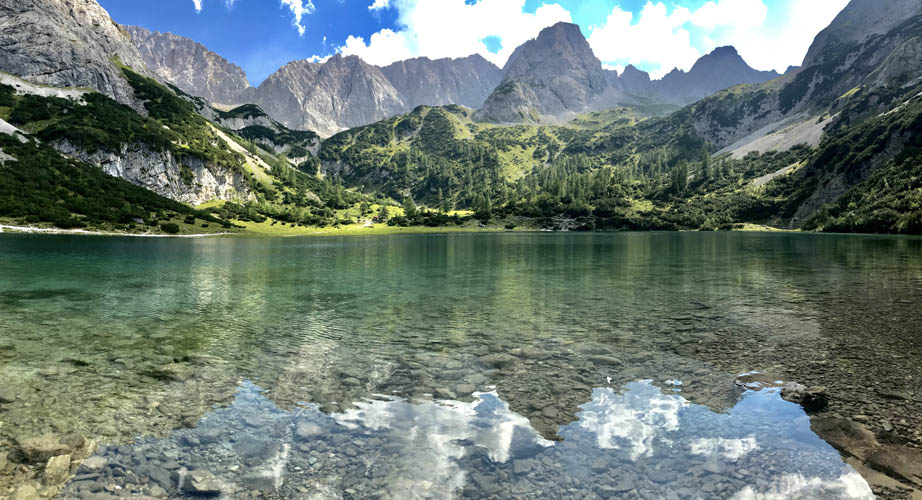
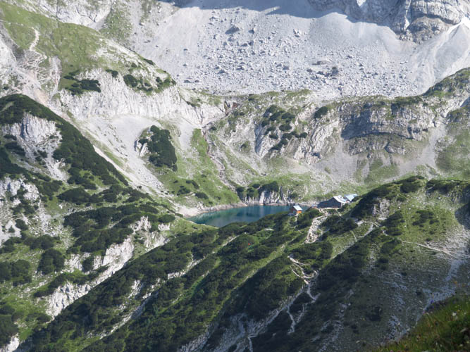
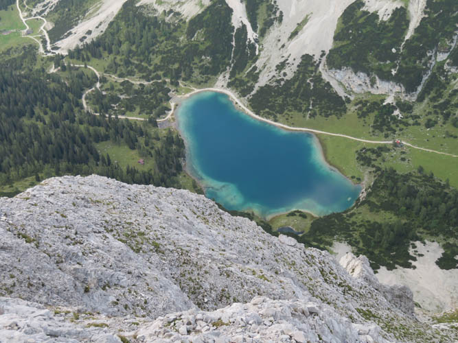
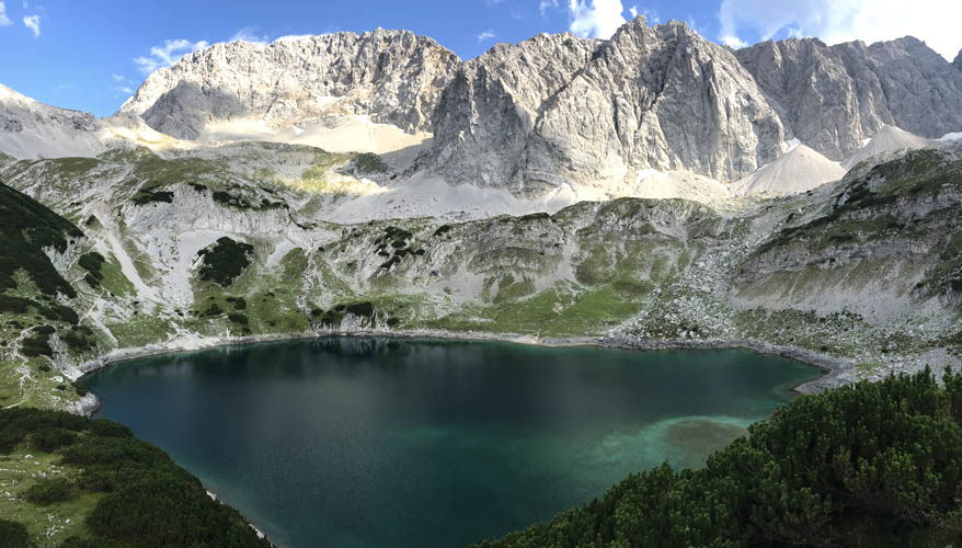
Above the cliff, a beautiful high valley opens up with a pretty little lake – the Seebensee – in the middle. The crystal clear water was quite chilly but that didn’t stop Wen from going for a refreshing swim. While she was chilling by the lake, I set off on the trail leading up the north side of the Sonnenspitze starting right by the lake. It was another 700 m elevation gain from here, which I figured would take me about an hour up and 45 minutes down, plus 15 minutes summit break. It turns out my calculation was way too optimistic, if not to say quite overconfident, I must admit!
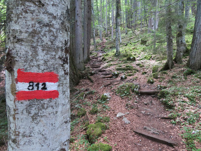
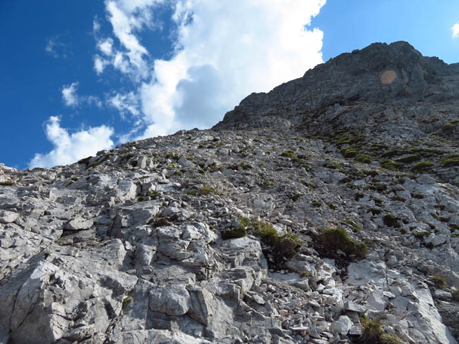
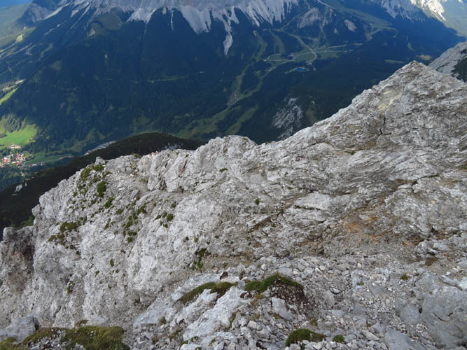
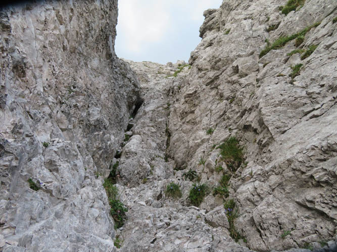
What I thought was an easy hike or scramble turned out to be a challenging, difficult undertaking. Initially, the path is easy to follow as it winds its way steeply upward. Just over half way up, the hiking turns into moderate scrambling on rubbly rock, with the odd cairn showing the way. The cairns weren’t always easy to find, especially since I was hiking against the sun in the morning. Most people, it seems use the north side as their descent route!
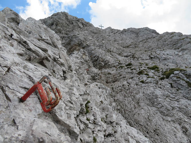
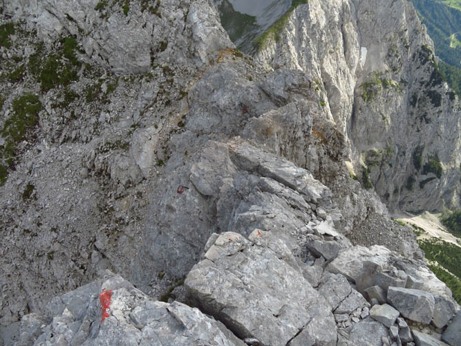
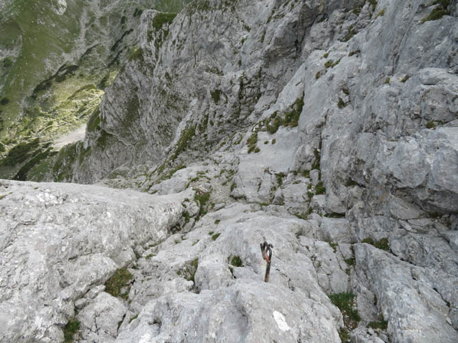
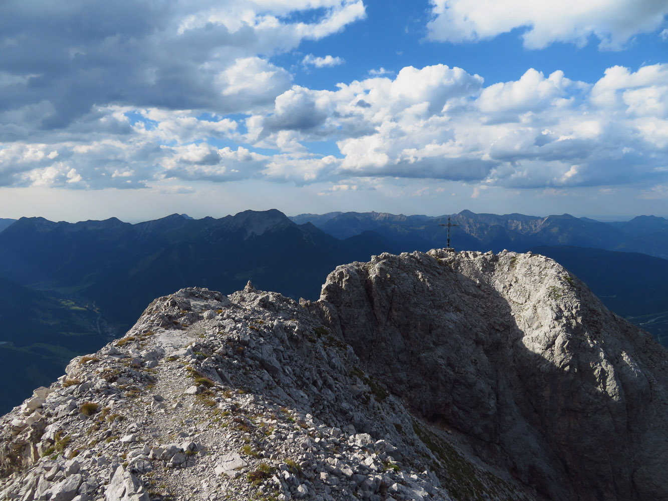
Near the top the route gets quite exposed and pitons are in place for those using ropes (I assume some folks also climb the peak in the winter when snow or ice makes this a serious mountaineering trip). With the summit cross in sight, the last hurdle was to climb up a steep, exposed rock slab – nothing overly difficult as the rock is pretty solid, but full concentration and surefootedness are certainly required.
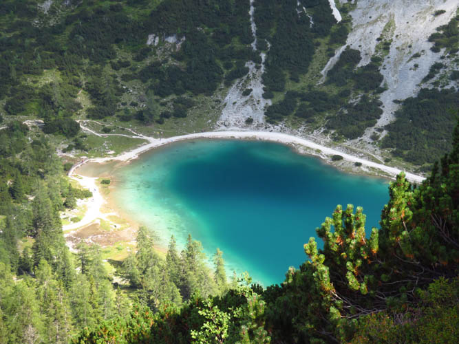
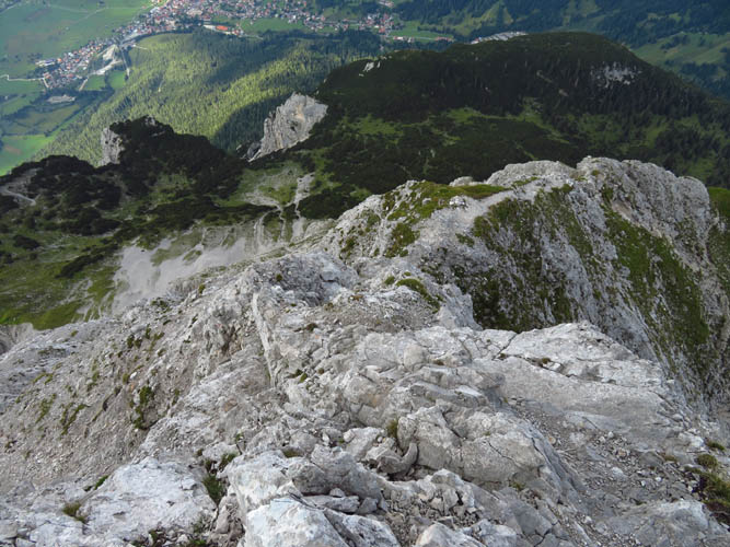
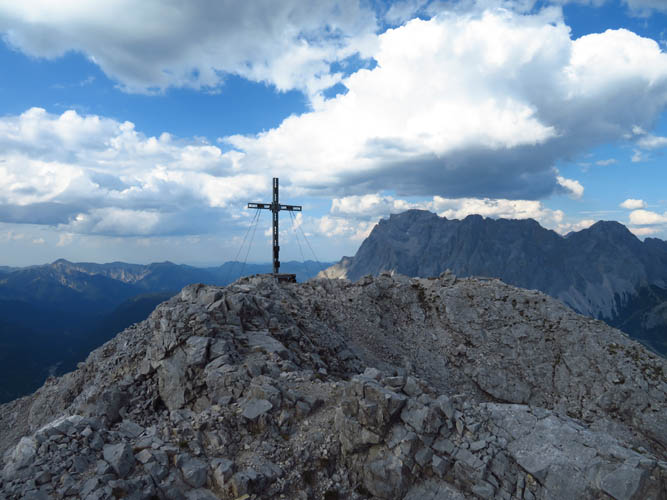
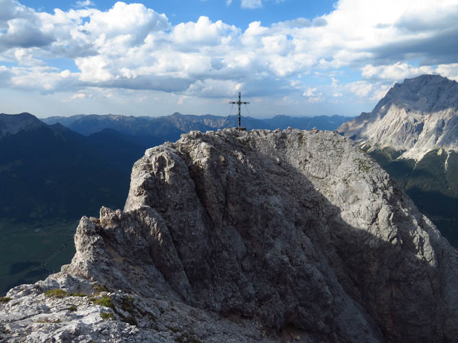
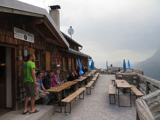
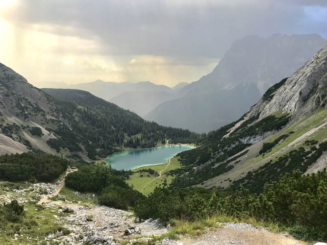
The summit offers terrific views of both the Seebensee and the Drachensee, another smaller lake that sits higher up in the valley. The Coburger Hütte, a fully catered Alpine chalet, strategically sits on a small rise right in between the two lakes – the location couldn’t be better. I was stunned by a jam-packed summit register. The first entry was from 2016 and it was already full! Clearly, this is a very popular climb and there must be an easier route up, so I thought. Wrong! The route on the south side, also shown in my navigation app, turned out to be even more challenging.
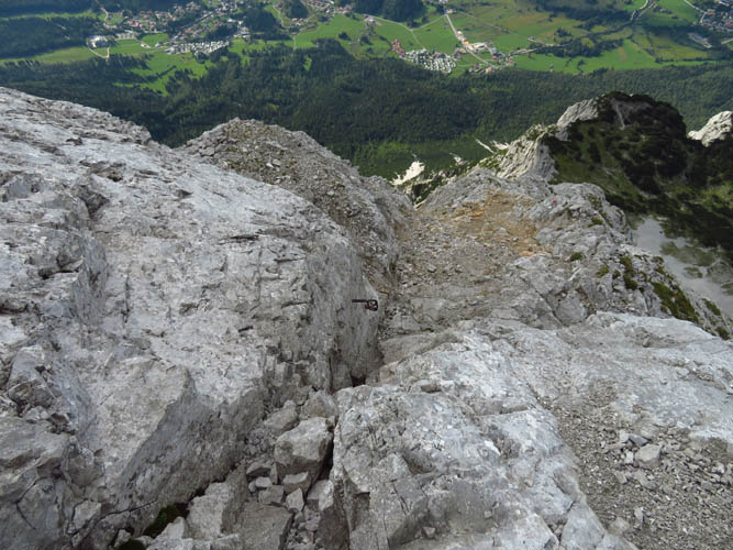
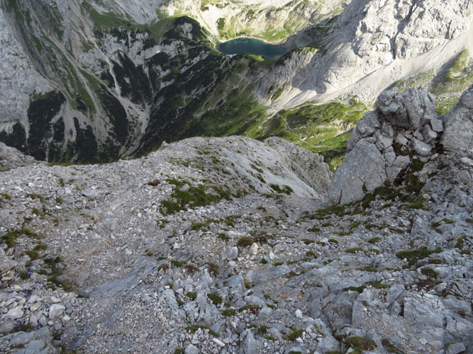
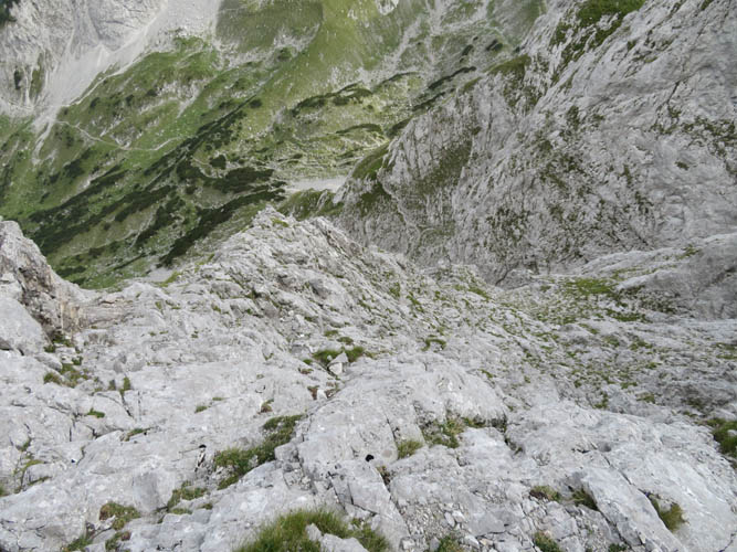
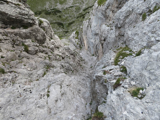
A narrow, exposed ridge scramble leads from the summit cross to the true summit some 50 m further south. Here, the real fun starts! The descent route is very steep, very exposed, and chock full of hands-on challenges that range from moderate and difficult scrambling to brief sections of free-soloing. There were lots of spots that looked impossible at first, but upon closer inspection were doable if broken down into small steps. Numerous pitons and even one fixed steel rope attest to the route’s popularity, and the fact that roping up is not out of place here. I found the descent challenging, interesting and exhilarating at the same time. The biggest challenge was mental, those nagging thoughts of what’s to come, that lingering uncertainty when you’re descending into unknown terrain. I didn’t know the route and constantly wondered if at some point I’d get to a spot where a rope was required – a vertical wall or an overhang perhaps. Going up the south side would’ve been easier, of course, and it was only until after my trip that I learned that the traverse of the mountain is commonly done from south to north, not the other way round!
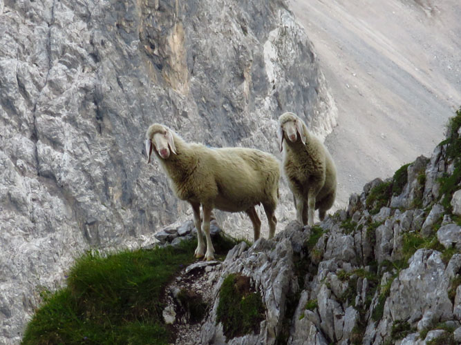
Finally, after an exposed ledge with a fixed cable and a steep, narrow gully (easier for tall people as lots of stemming necessary!), I ended up on a trail next to a grassy patch where two sheep were munching away… If sheep can make it here, then that must be the end of the tough part, I figured. Wrong again! Shortly after the sheep scuttled away into nowhere, I had to re-don my helmet and stash away my poles again. A few more steep downclimbs, then I eventually hit a short scree run that brought me down to the main trail leading to the Coburger Hütte. Just in time as a light rain shower started. I definitely wouldn’t want to be up on Sonnenspitze’s steep cliffy terrain when it’s wet, or worse, in a thunderstorm.
Exhausted but relieved to have made it down in one piece I was ecstatic to see Wen waiting for me at the chalet – 1.5 hours later than planned, but better late and safe than never.
For our return to Ehrwald we chose the longer but more relaxing option of following the main trail towards the upper gondola station, which is how most people hike in and out. While the Coburger hut was packed with people drinking beer and feasting on Austrian specialties, we had the trail all to ourselves now that it was already quite late in the evening. In hindsight, it probably would’ve been faster to simply return down the steep Hoher Gang route, but our tired legs and weary minds preferred the more gentle grade of the main trail.
Obviously there are several lessons to be learnt from this episode. Here are two that stand out to me:
- No matter how trivial or straightforward a peak might look like on a map or satellite pictures, always read up on route details and other people’s experiences. Had I done my homework, I’m pretty sure I would’ve still taken on the challenge of climbing the Sonnenspitze, but I would’ve done it the other way round – from south to north, which is the recommended direction with most of the tricky spots to be upclimbed, not downclimbed.
- On a difficult climb, always leave some extra time in case things don’t work out as planned. Again, had I done my homework, I would’ve known that this is a more serious undertaking considered an “alpine route”, so I would never have set off as late as I did at 1 pm! An early start is also important to avoid potential thunderstorms or rain showers that typically occur in the mid- to late afternoon.
Overall a hugely enjoyable difficult scramble and a peak I really had to work for. Helmet essential, rope/harness recommended for those not used to/comfortable with steep, exposed terrain.
| Elevation: | 2417 m (official), 2405 m (my GPS) |
| Elevation gain: | 1500 m |
| Time: | 8.5 h |
| Distance: | 16.0 km |
| Difficulty level: | Difficult climber’s scramble (Kane), T6 (SAC) |
| Reference: | Local maps |
| Comments: | Traverse recommended from south to north as indicated on map above |
| Personal rating: | 5 (out of 5) |
DISCLAIMER: Use at your own risk for general guidance only! Do not follow this GPX track blindly but use your own judgement in assessing terrain and choosing the safest route.