Rhön Mountains, Germany
15 April 2018
With Wen
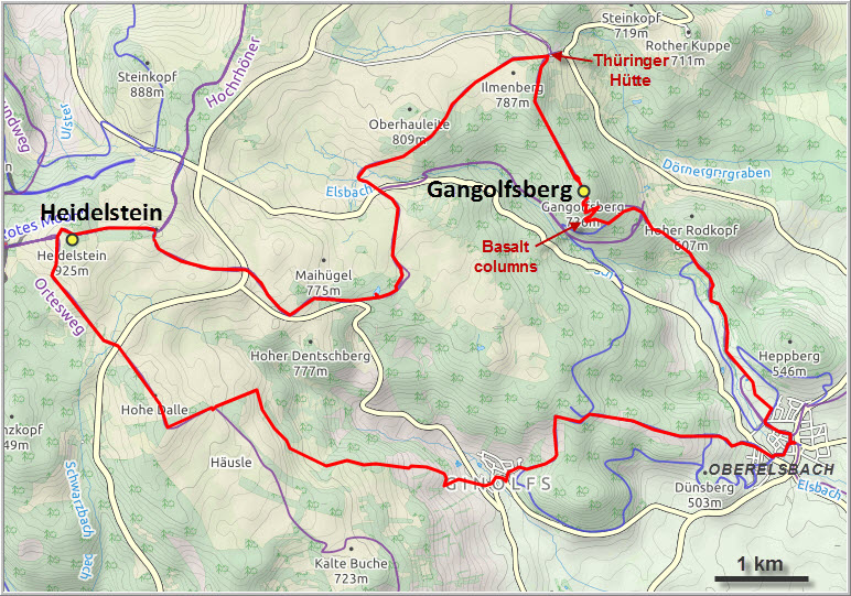
Finally another hike after a long break! I mapped out a route with a decent amount of elevation and distance to give us a nice day of exercise in the lovely Rhön Mountains combining the Gangolfsberg with the Heidelstein summits. “Mountains” is a misnomer, of course, for this area is more hilly than mountainous after all. But with a total distance of more than 26 km and 850 m of elevation gain, the trip certainly served its purpose and made us feel our muscles again.
There is a nice quiet trail leading towards the Gangolfsberg from the village of Oberelsbach along a brook called Els, from which the name of the settlement is derived. Much of the trail is in the forest, including the unspectacular summit, so views are limited. The highlight and main draw of the Gangolfsberg hike are the outcrops of well-preserved basalt columns that can be observed close-up in various orientations. The most famous site is the “Prismenwand”, a wall of basalt “prisms” sticking out sideways and giving a cross-sectional view of these four- to six-sided columns. Other outcrops show vertical columns of basalt some 5 to 10 m high. There’s even a staircase with steps made of basalt boulders! The basalt is part of a former volcanic intrusion that formed the Rhön Mountains during the Tertiary, between about 30 to 10 million years ago. Many of these outcrops were mined in recent history as basalt is prized as a particularly resistant type of rock useful in highway construction for example.
The summit of the Gangolfsberg is very easy to miss since it’s along a gentle forested ridge and only evident by a small granite marker (Wen missed it entirely!). A few hundred metres further on we took a nice lunch break at the old St. Gangolf chapel. All that’s left here are a bunch of old crumbling walls – made of basalt, of course – but the ruins are so crude it’s hard to picture that this used to be a chapel once.
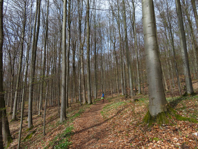
We continued our hike through beech forest past the Thüringer Hütte (a popular rest stop for hikers and day trippers) towards the Heidelstein, our second objective. It’s typical Rhön landscape here: gently rolling hills with a mix of forests, open meadows and natural grassland with the odd stand of wind-blasted trees and shrubs. Overall quite pleasant for hiking, but after a couple of hours it does get a bit monotonous and we wished for something more exiting.
The Heidelstein summit is everything but exciting. There is a 218 m tall TV and radio tower at its summit, which is unfortunately fenced in and not accessible to the public. The trail leads up to the main gate; it’s about 12 m lower than the true summit and completely in the forest. A few hundred metres to the west there are some nice views to be had of surrounding landscape, including the nearby Wasserkuppe and the Kreuzberg.
Instead of returning the same way, I had mapped out a loop route to add some variety – so I thought. Unfortunately, the way back turned out to be a rather boring walk, mostly through empty grassy hills and forest. While there had been dozens of hikers on the trail before, we were now all alone here. But it didn’t matter – after all we were here to get some exercise and fresh air, and we had perfect hiking weather on top of that!
Overall not the most exciting hike, but a good outing nonetheless. The basalt columns at the Gangolfsberg were definitely the highlight of the day.

DISCLAIMER: Use at your own risk for general guidance only! Do not follow this GPX track blindly but use your own judgement in assessing terrain and choosing the safest route.
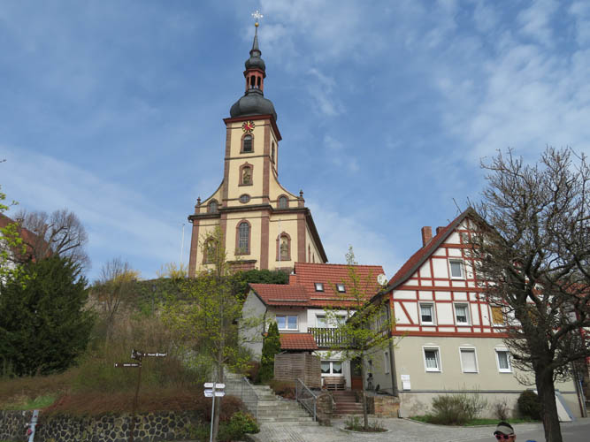
The picturesque village of Oberelsbach.
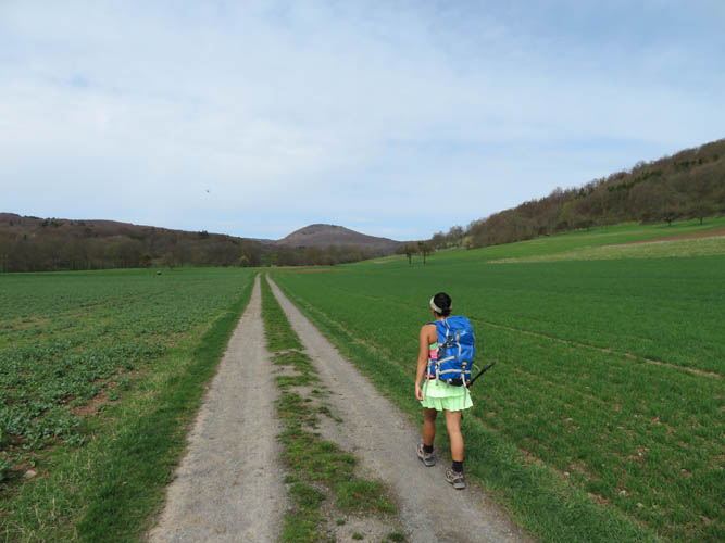
Starting out on a wide path through the fields.
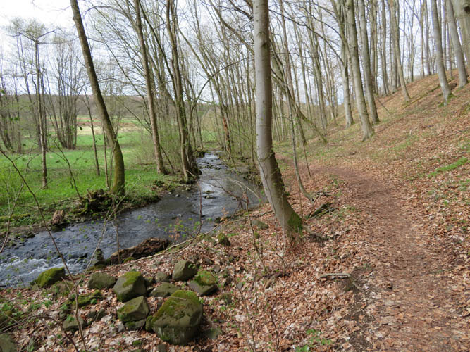
For a short section, the trail runs parallel to a small brook called the Els.
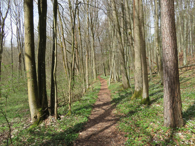
It’s a beautiful forest walk!
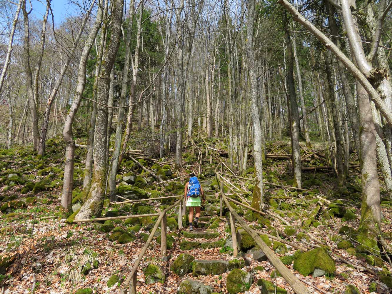
Finally gaining some elevation.
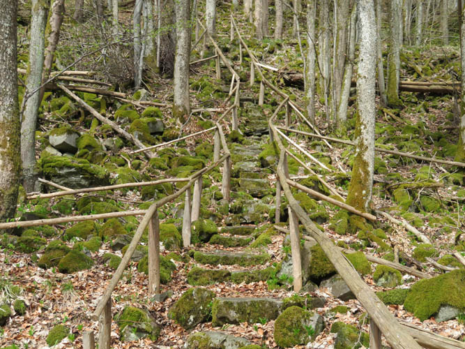
A staircase made of basalt chunks.
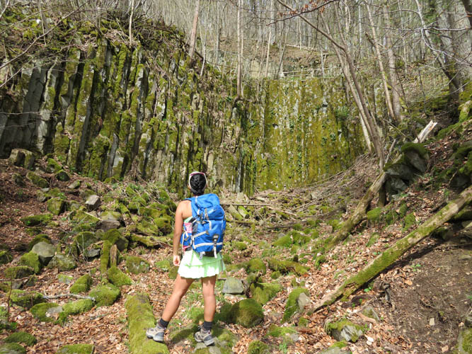
An old quarry with vertical basalt columns covered in moss.
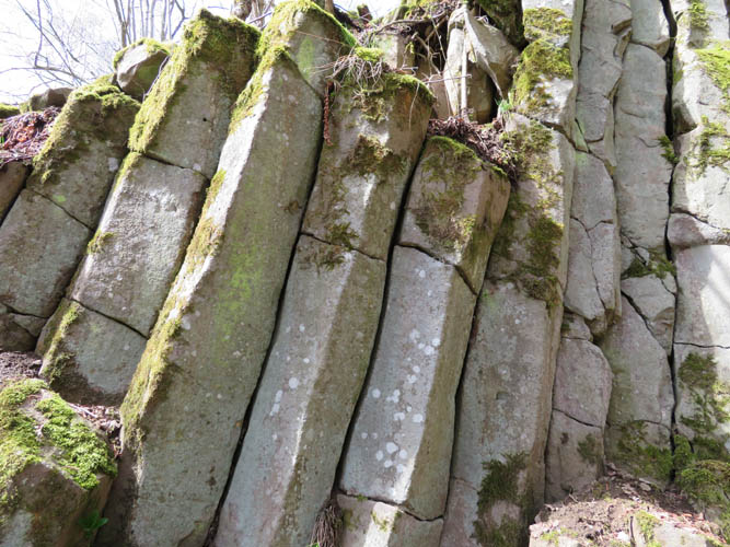
Most of the columns are 5- or 6-sided and about 30-40 cm in diameter.
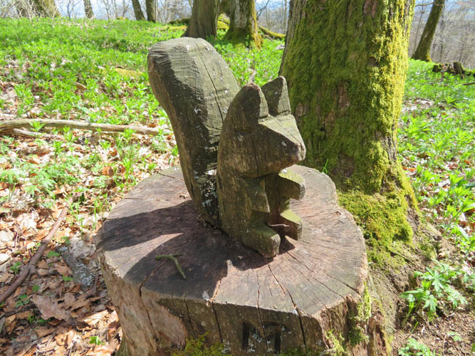
A squirrel carved in wood on the Gangolfsberg.
The unspectacular summit of the Gangolfsberg is marked by a diminutive granite stone.
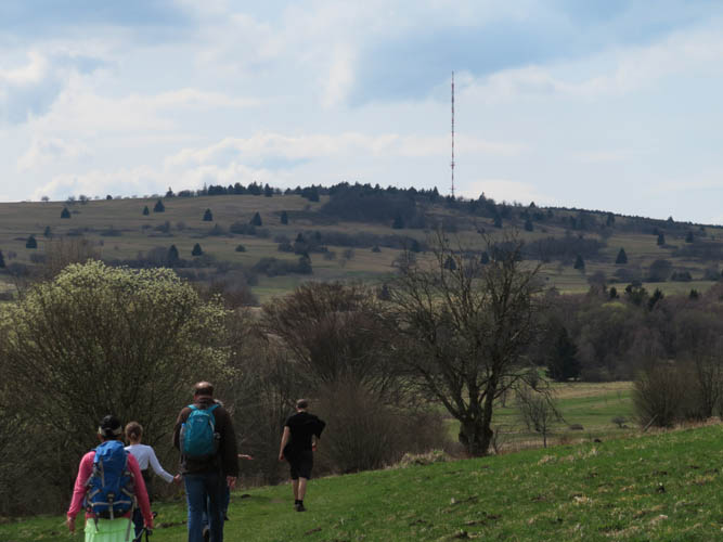
We encountered quite a few other hikers on the popular trail between the Thüringer Hütte and the Heidelstein with its large telecom tower at the summit.
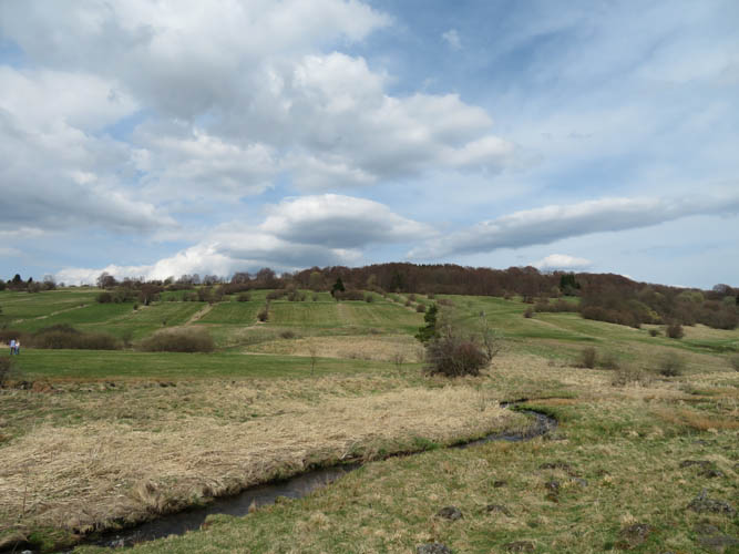
Typical Rhön scenery.
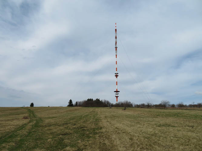
Heidelstein summit. The tower including antenna measures 218 m in height.
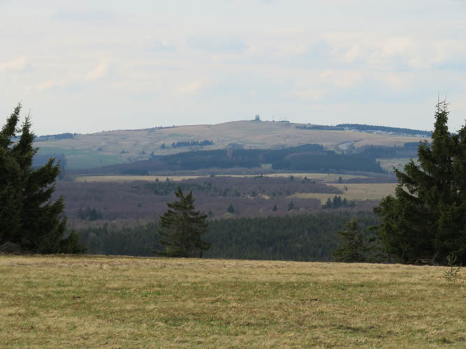
The Wasserkuppe (950 m) as seen from the Heidelstein. The big “golf ball” at the summit is part of a former military installation that now houses a local gliders club.
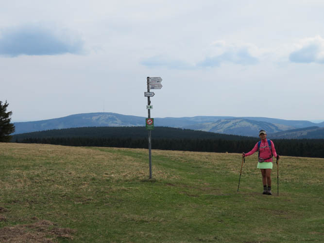
Wide open grassland covers the south side of the broad Heidelstein summit. In the distance to the left of the sign is the Kreuzberg (928 m).
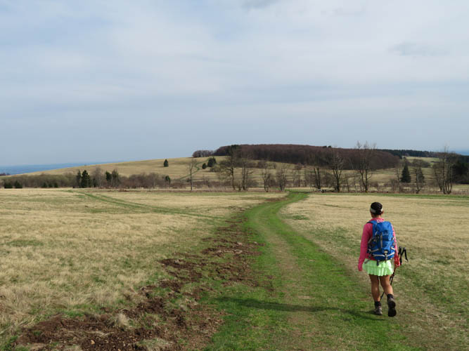
We have the trail to ourselves on our way back.
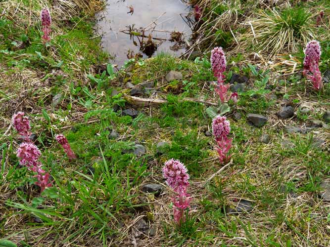
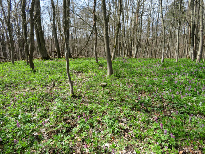
Spring is here! This flower is called “Rote Pestwurz” (red butterbur).