Ghost, AB, Canada
5 January 2020
With Trevor
Heavy-duty workout with wonderful views at the end
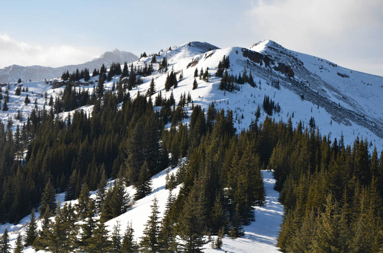
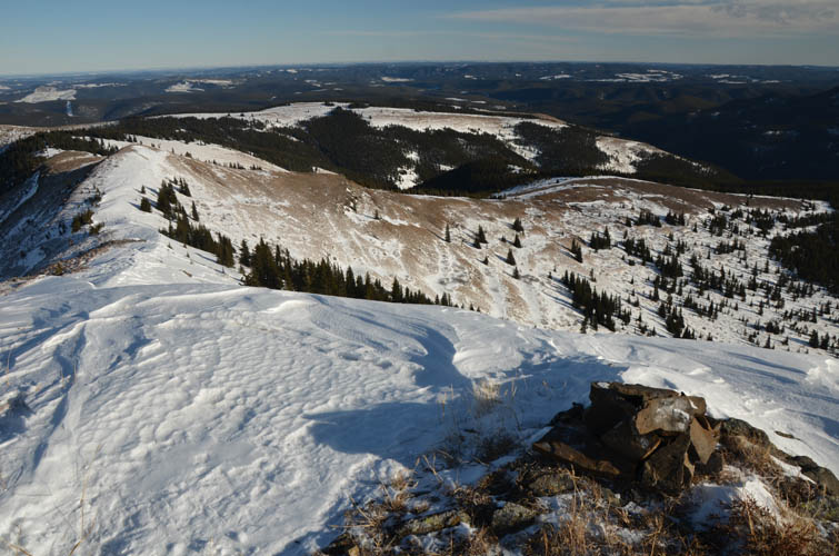
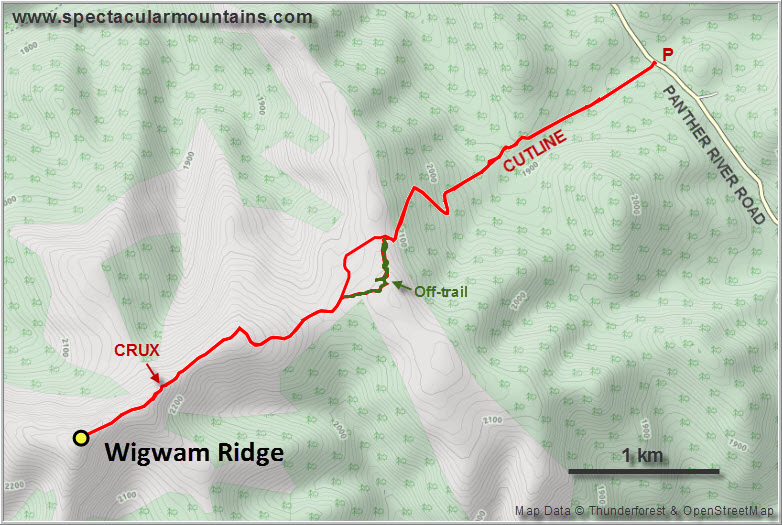
This is a rarely visited local ridge in a remote part of the northern Ghost just east of Zombie Peak. Despite being dwarfed by bigger and more impressive mountains of the Front Ranges to the west, the ridge’s high point reaches almost 2400 m and involves about 1000 cumulative elevation meters to get there. Three obvious routes exist: one from the OHV track along Sheep Creek to the north followed by a narrow cutline through the forest, another one from a south-trending ridge that can be accessed from the old Shell wellsite road at North Burnt Timber Creek, and a third option that goes in a straight E-W line from the Panther gravel road.
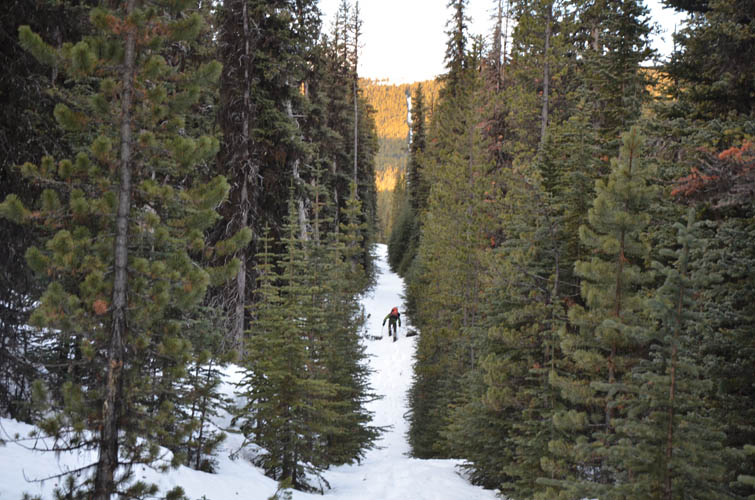
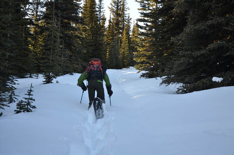
Trevor and I chose the third and probably shortest option for our outing today. We knew we’d be spending about three quarters of the approach (and deproach) on a cutline in the forest, but with so much snow around we wanted to keep the distance to a minimum and not play around with loops. It’s a good thing we did, and also that there were two of us, for the snow was so deep and unsupportive in places that neither one of us would’ve made it alone today.
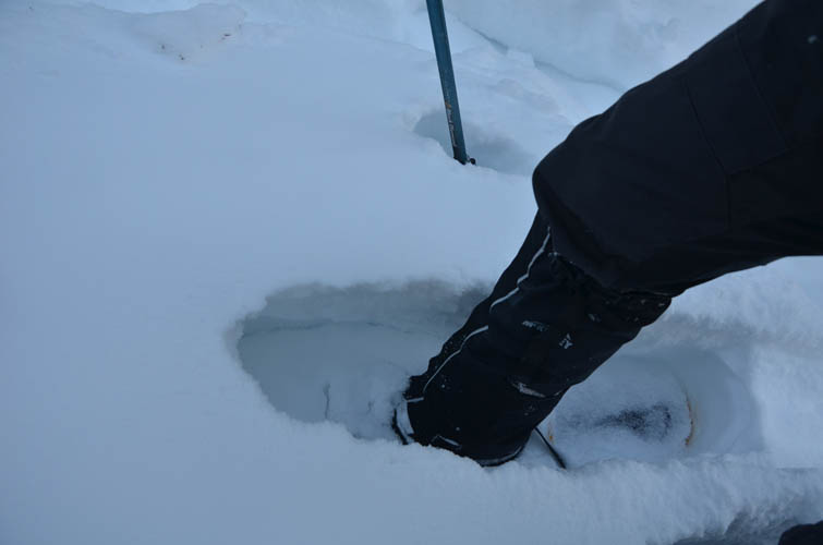
We kept our snowshoes on pretty much the whole day all the way to the summit and back. Following the cutline (probably an old seismic line) was straightforward. Curiously, the snow got thicker the higher we went and at one point we were postholing more than half a metre – with our snowshoes on! It was pretty exhausting and at times our progress was excruciatingly slow. The snow was just too soft and heavy and there was too much of it.
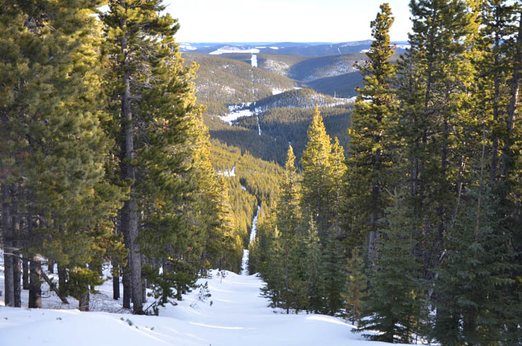
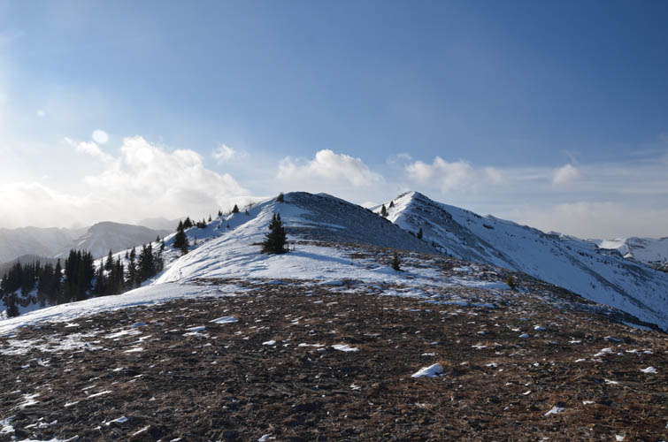
Where the cutline steepens significantly we took a bypass that switchbacks up at a more manageable grade. Soon after we left the forest behind us and reached the first ridge top, a broad barren rise with our first views of the day. The wind was so strong up here we immediately sought shelter behind some trees. Believing the ridge to be free of snow from now on, we dumped our snowshoes and continued on foot… a mistake as it turned out. We had to go back and retrieve them only half an hour later after getting stuck in deep snow again.
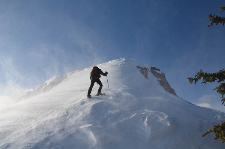
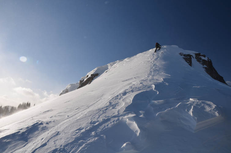
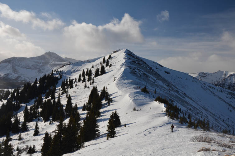
Contrary to what we expected (and what the shading on topo maps would have you believe) much of the ridge top is actually covered in trees. Without snowshoes there is no way we would’ve made it very far. We ploughed through more of the same terrible soft snow and eventually left the last of the trees behind us just before a small cliffband. In summer this is perhaps just an easy scramble, but in winter there’s a steep snow slope that can make things interesting. Trevor led the way and gingerly climbed up the hardened snow, using the front points of his snowshoes for traction and kickstepping his way up the last bit over a steep lip. It probably would’ve been easier to snowshoe around the left (south) side, but concerns about possible avalanche hazard made us decide against that option.
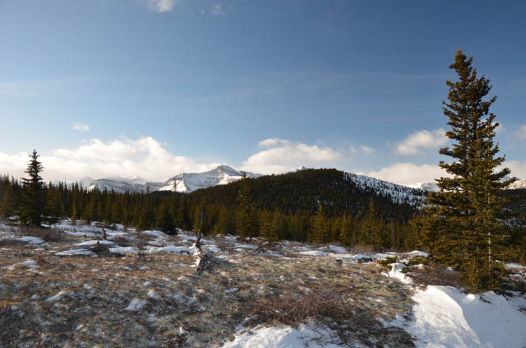
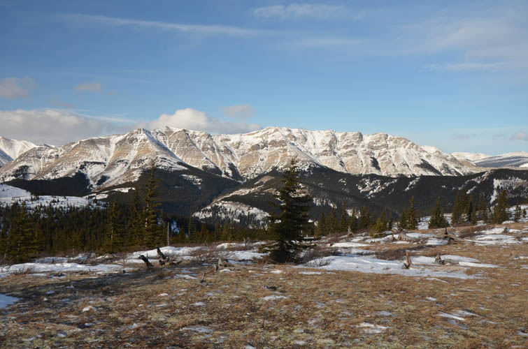
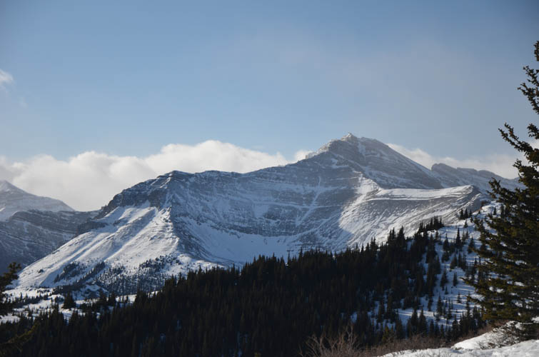
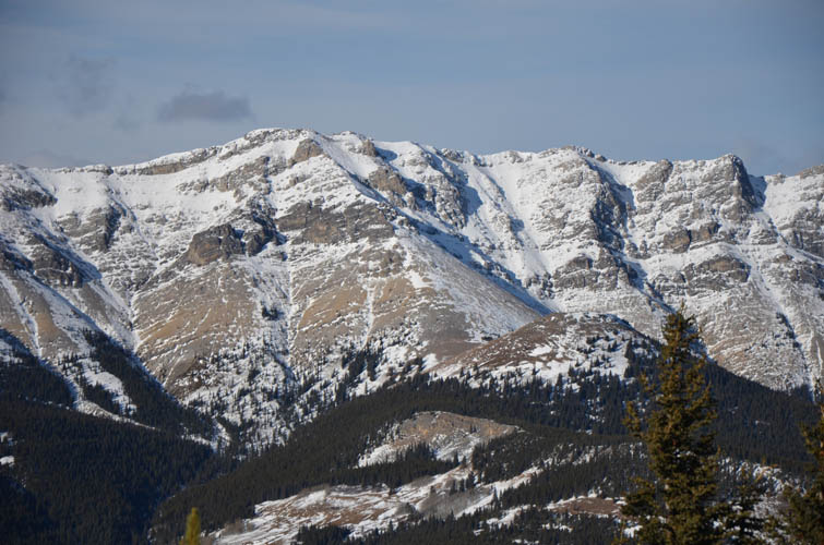
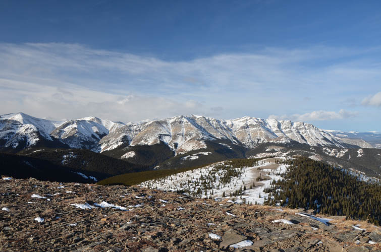
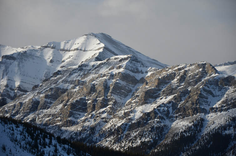
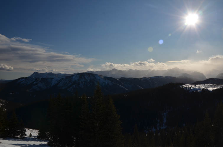
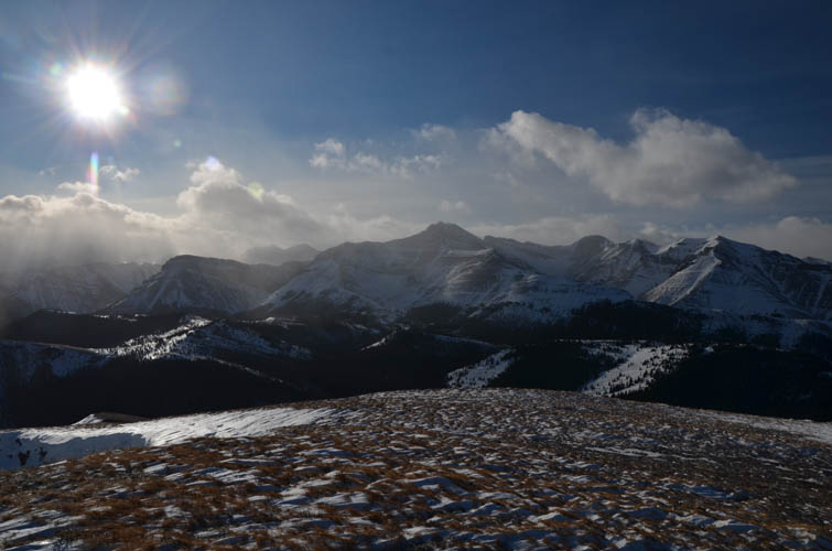
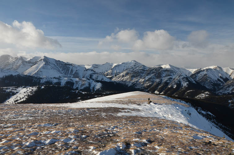
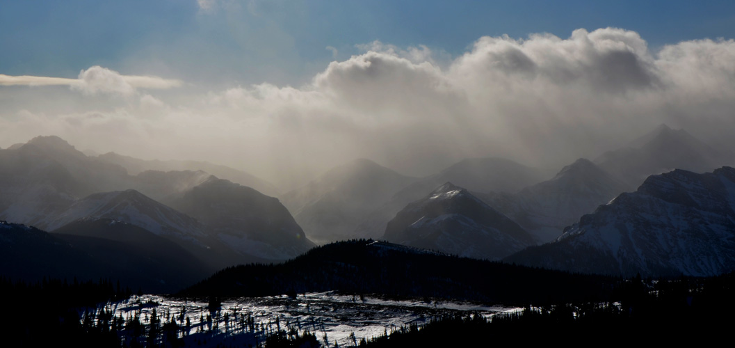
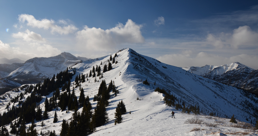
We now had about a kilometre to go, all on the open ridge with fantastic views of the Front Ranges around us. Two more sections of steep, hardened snow followed, then we arrived at the summit at 2363 m. Interestingly, there’s a massive cairn just a few metres downslope whereas the cairn on the high point is rather small. This is truly an underexplored and perhaps underappreciated part of the Rockies. I love the view of so many unknown and unnamed peaks and ridges in the distance. Only a few landmark peaks stand out, like Otuskwan and Zombie. Further south is the unmistakable shape of Ghost Peak, while Mount Davidson and Mount Oliver were mostly shrouded in clouds.
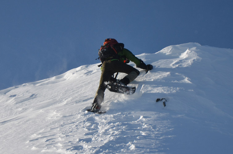
The bitterly cold wind didn’t allow us to stand around for too long and after a short break we headed back the same way. Getting down the steep snow lip at the cliffband proved to be the crux of the day (it’s really just two or three difficult steps). After that all we had to do was to blindly follow the “ditch” we had painstakingly hammered into the snow earlier that day. Half-way down the cutline we started to notice how tired we were. It always amazes me how exhausting snowshoeing can be because you use so much more of your body to move along. By the time we got back to the car we felt like we had just completed a 10 hour trip up a major mountain. No doubt this would be a much easier and shorter trip in the summer. But the winter landscape was just magical today and despite the major effort required we were both happy with a very enjoyable trip.
Note: The total ascent recorded with my phone on Gaia was only about 530 m. However, this underestimates the true cumulative gain as there are many small ups and downs along the route. “Oversmoothing” of minor elevation changes in some apps can be the cause for this discrepancy. The actual gain is closer to somewhere around 900 m when the absolute data is plotted (with trackpoint distance and elevation threshholds applied).
|
Elevation: |
2363 m (my GPS) |
|
Elevation gain: |
Approx. 900 m |
|
Time: |
7.0 h |
|
Distance: |
11.5 km |
|
Difficulty level: |
Easy (Kane), T3 (SAC) |
|
Comments: |
Snow can significantly increase the difficulty level in winter. Possible avalanche risk along south aspects of summit ridge. |
|
Reference: |
Own routefinding |
|
Personal rating: |
4 (out of 5) |
NOTE: This GPX track is for personal use only. Commercial use/re-use or publication of this track on printed or digital media including but not limited to platforms, apps and websites such as AllTrails, Gaia, and OSM, requires written permission.
DISCLAIMER: Use at your own risk for general guidance only! Do not follow this GPX track blindly but use your own judgement in assessing terrain and choosing the safest route. Please read the full disclaimer here.