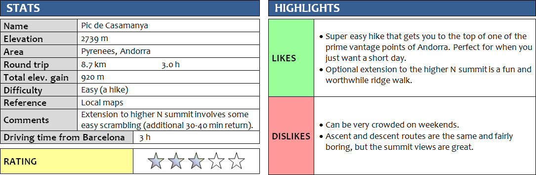
Pyrenees, Andorra
11 June 2018
With Wen
Great short hike to one of the easiest-to-reach mountain tops in Andorra! Casamanya is perhaps the most popular mountain hike in this little Pyrenean country, and for good reason. It’s easy to get from anywhere in Andorra (well, almost all peaks here are!), there’s a good trail along the entire route, and it only takes about 1.5 hours to the top where fabulous views await. This route is obviously very popular with trail runners and those going for a quick jog as well.
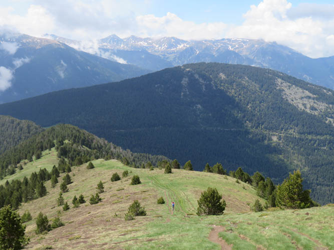
The trail goes through forest first before following the broad, open ridge for the rest of the way straight to the top of Casamanya’s south peak, which has an iron marker and a huge summit cairn. While we didn’t find this hike overly inspiring, it was still nice to get to the top of a mountain without having to think about the route or worry about conditions. Summit vistas were terrific: a country entirely unknown to us but chock-full with potential mountain adventures!
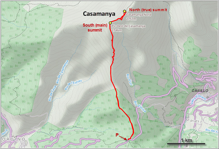
More interesting was the extension to the higher north peak of Casamanya. At 2737 m, it exceeds the “main peak” by only about 10 m according to my GPS. The side trip took me down a dip and over an intermediate bump (which even has a name: Casamanya Mig) before topping out on the north summit. There was no scrambling, but there were a few snow patches to cross. I could imagine that if there was more snow or even ice, some of the steeper sections could be dicey without the right equipment.
While we had the whole mountain to ourselves for the first couple of hours – it was a weekday in early June after all – we ran into a handful of people on the way down. A fun short hike and a great introduction to the mountains of Andorra.
DISCLAIMER: Use at your own risk for general guidance only! Do not follow this GPX track blindly but use your own judgement in assessing terrain and choosing the safest route.
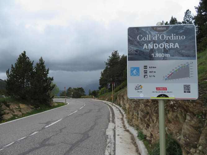
A good road leads up to the Ordino pass at almost 2000 m where the trailhead is located.
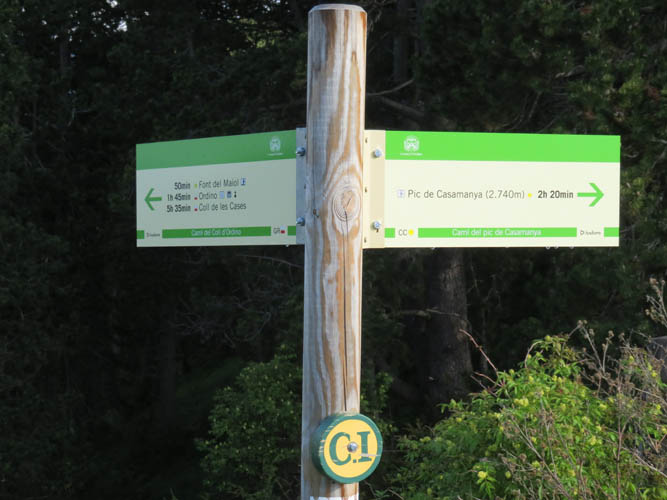
Trail sign at the start. It’s supposed to take 2h20min to the top, but for fit hikers 1.5h or less is not unreasonable.
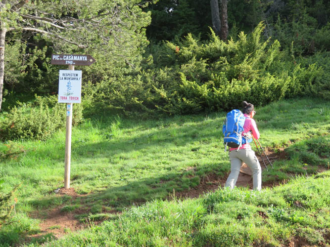
The first section of trail is through the forest.
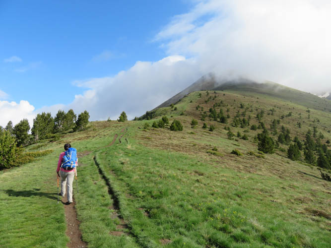
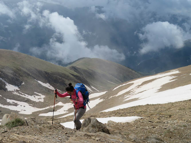
Then a wide ridge opens up.
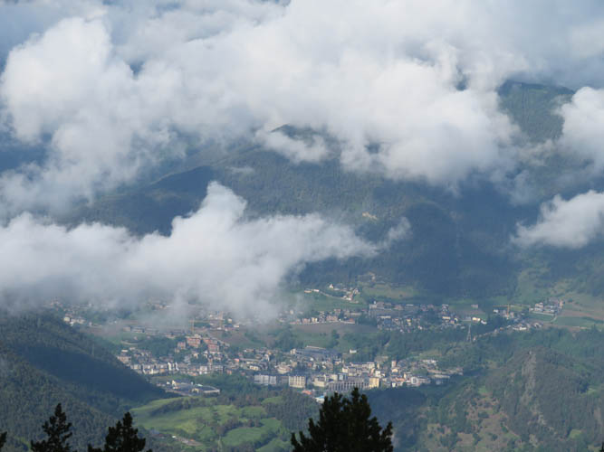
The small town of Ordino appears through the clouds in the valley below.
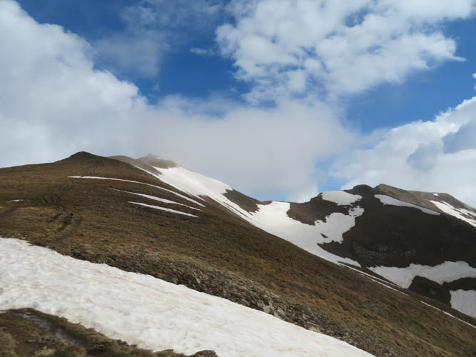
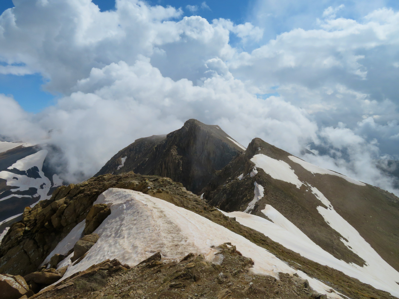
South summit (L) and north summit (R) of Casamanya.
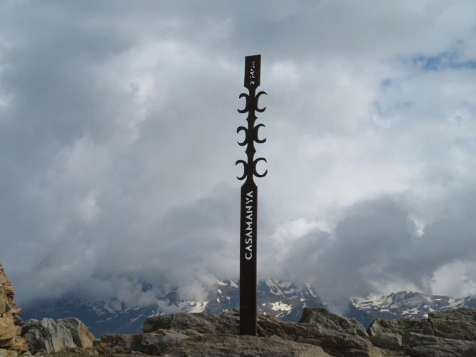
Most people stop at the south summit with its imposing iron marker and huge summit cairn.
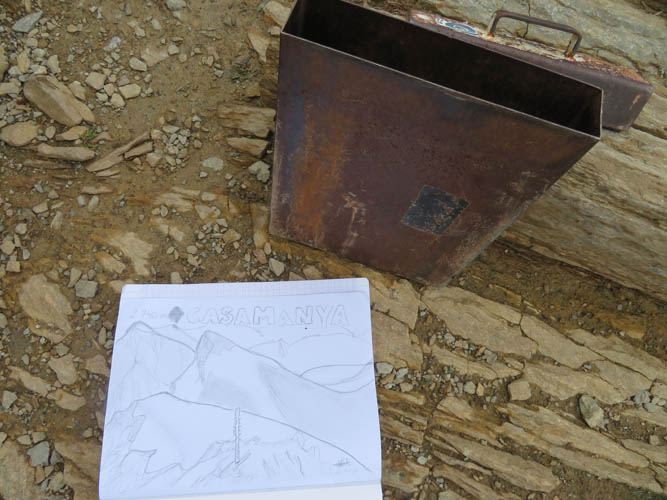
And there’s even a brand-new register to sign!
Blue sky, clouds and snow-covered rock make for the perfect contrast when taking pictures. I should take my good camera next time (or maybe I should just learn how to take better photos!).
The last few metres to the south summit.
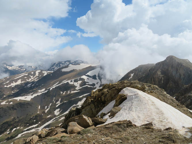
View from the south summit to the north peak (far right). In the distance just left of centre is La Serrera Peak.
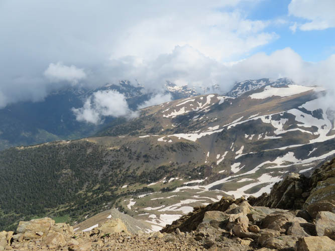
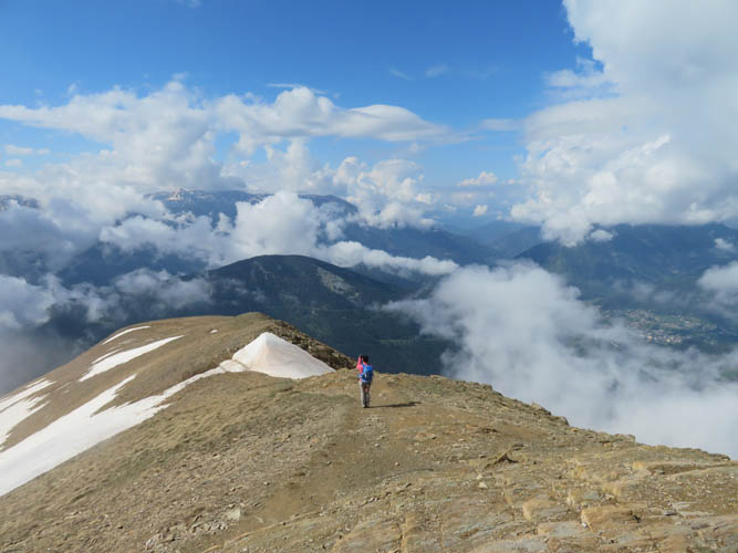
The clouds are constantly moving in and out today.
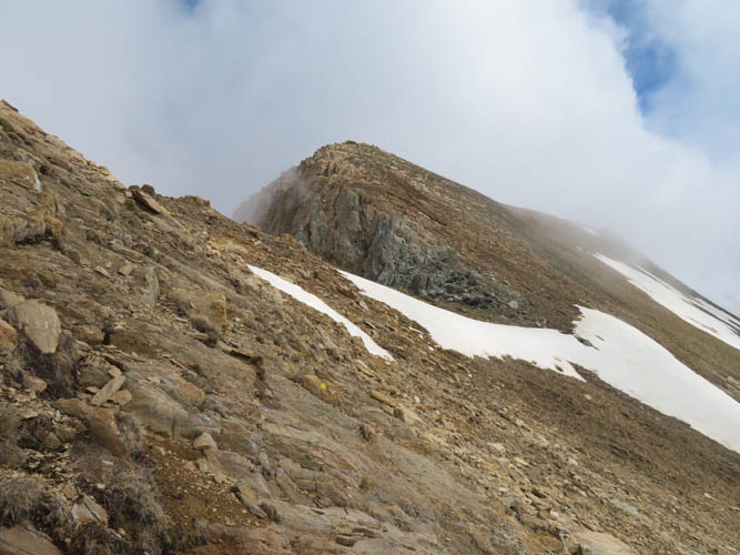
Along the ridge towards the north peak. The snow is fairly soft and doesn’t pose a problem today.
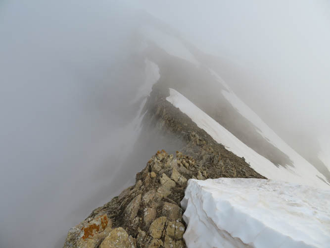
Just stay away from those overhanging cornices!

I was denied any views on the north peak which was completely hazed in cloud and mist. Now, back on the south peak, things are starting to clear up again.
The relaxing hike back down the main ridge.
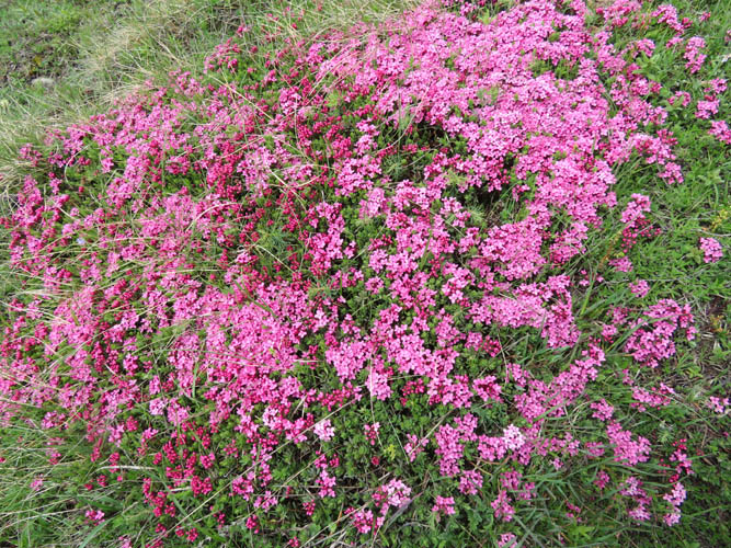
Nice to see some colour!
Casamanya is the perfect introductory hike to the principality of Andorra!