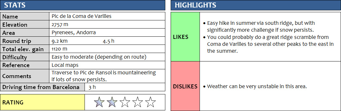
Pyrenees, Andorra
12 June 2018
Solo
This was a strange trip. The weather forecast had called for sunny, warm weather, yet it turned out to be a nasty day. I had planned to do a traverse along the frontier ridge that separates Andorra from France north of the Ransol valley, but I didn’t get far.
For most of the day the sun was nowhere to be seen, thus almost all of my photos are grey and drab. I parked at the end of the asphalt road that goes up the Ransol valley, where a number of good hiking trails start. The first trail took me across several tricky creek crossings that were all overflowing due to the recent heavy rain and late snow melt this year, and on to the Cóms de Jan hut, a mountain refuge for thru-hikers and those needing shelter from bad weather. Unsurprisingly, there was no one around. In fact, I didn’t see anyone else all day.
From the hut I followed an official trail east towards the south ridge of Coma de Varilles. Several large snow patches covered the path, and it seemed I was the first in a long time to tramp across as I couldn’t see any other boot prints. Because of the snow, the trail was difficult to find in places despite the red and white markers that are painted on rocks in regular intervals.
As I plodded up the easy south ridge to the summit, the clouds became denser and the wind stronger. I put on all my layers, toque and gloves, but was still cold, so I had no choice but to keep moving to keep myself warm. Then the rain started, followed by hail and then snow, pelting me at high speed from the side. My poncho turned out to be of very limited use in these conditions – it was flopping all over the place, frequently lifting itself up and flying straight into my face. A winter jacket and face mask would’ve been way better here. I had not expected this type of weather in June!
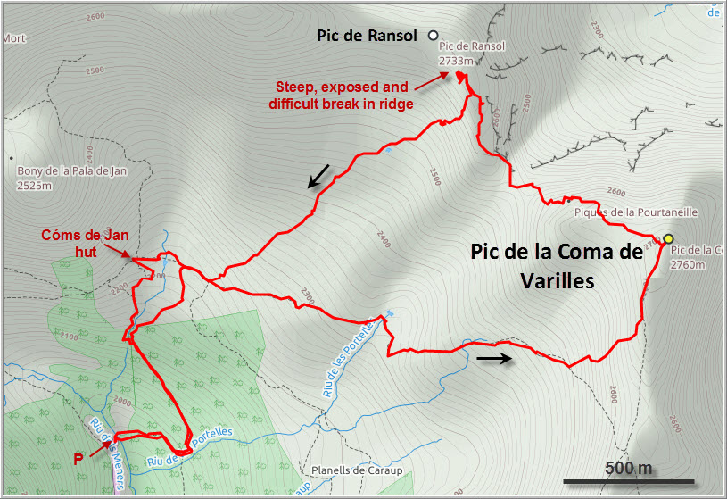
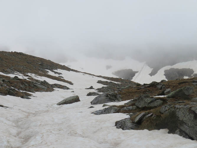
I was still hopeful that somehow the weather might turn around when I scrambled down the west ridge of Coma de Varilles towards Pic de Ransol. The latter wasn’t very far on the map, so I thought by the time I’d get up to that summit I might actually have some views again. But it only got worse. My field of view was now limited to about 50 m ahead and all I could see was wet rock and dense white fog. When I came to a steep snow patch just before a significant dip along the ridge, I decided to call it quits and get the hell out of there. Even though I was very close to Ransol’s summit (150 m distance, 50 m elevation), it was no fun anymore and the steep, snowy dip in the ridge didn’t look safe to cross in these conditions. Time to head home!
On the way up earlier in the morning I had made a mental note of possible bailout routes off the ridge. It looked as if you could basically come down the snow-covered slopes almost anywhere. I didn’t want to backtrack all the way along the ridge in this weather, so I slowly made my way down the southern slopes of Ransol, first on rock and grass as far as I could, then on the long snow slopes that extended far down into the upper valley. It was a bit unnerving at first because I couldn’t see very far, but the snow was soft enough to allow me to safely plunge-step downhill. Steep at first, the angle of the slope gradually decreased, and soon I was thoroughly enjoying my descent jumping down the mountain in the soft snow. The upper valley was completely filled with snow and seemed eerily devoid of life, with the only sounds being my heavy breathing and the soft wafting of the mist.
Shortly before reaching the main trail the snow vanished and I had grass and rock under my feet once more. And I finally had a good view of my surroundings again, the clouds hanging around the ridge above me. A big sigh of relief! I was so glad to be off the mountain…
This had been a very strange trip, completely different from what I had expected, and one that had certainly pushed my comfort zone – all because of the adverse weather conditions. That ridge is definitely not a place I want to visit again in dense clouds, steep snow, and howling winds. Maybe one day I’ll be back to sort out that unfinished business with Pic de Ransol, but then it will be on a warm, calm and sunny summer day!
DISCLAIMER: Use at your own risk for general guidance only! Do not follow this GPX track blindly but use your own judgement in assessing terrain and choosing the safest route.
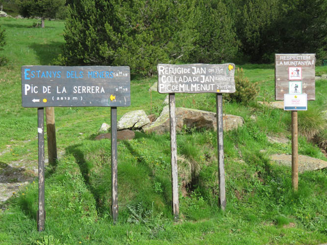
Several peaks can be reached on good trails from the small parking lot at the end of the Ransol Valley road. La Serrera is probably the most popular one of them.
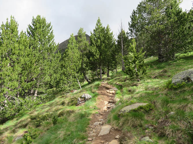
The trail to the Cóms de Jan hut. Still in the sun for now!
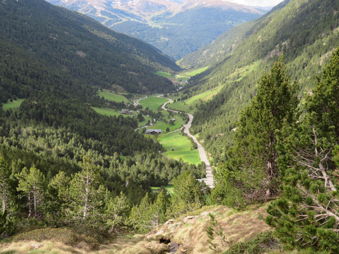
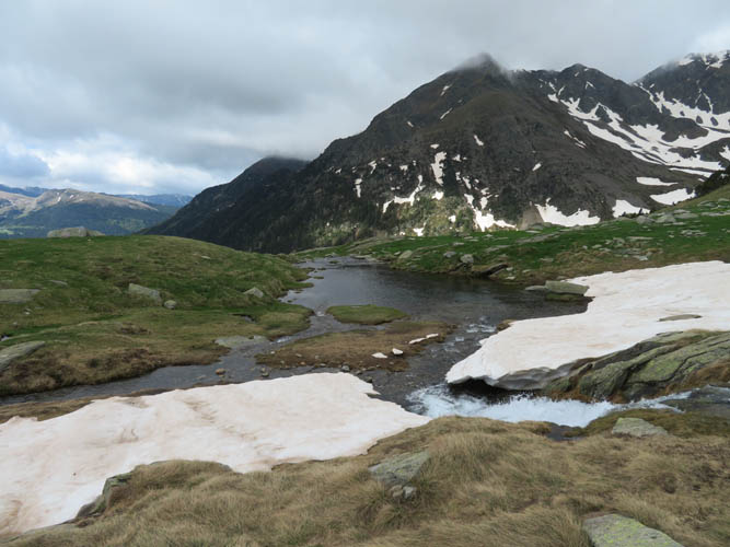
The Ransol Valley.
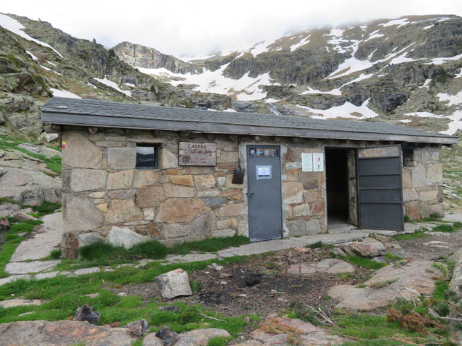
Cóms de Jan hut.
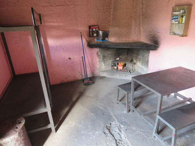
I was surprised to see how neat and clean it is inside. There’s even a medical emergency kit on the shelf!
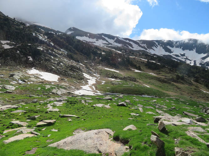
Heading east along an often boggy trail. The summit of Pic de la Coma de Varilles can be seen left of centre.
The ground is wet and the creeks are overflowing in many places – too much rain over the last few months!
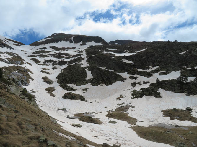
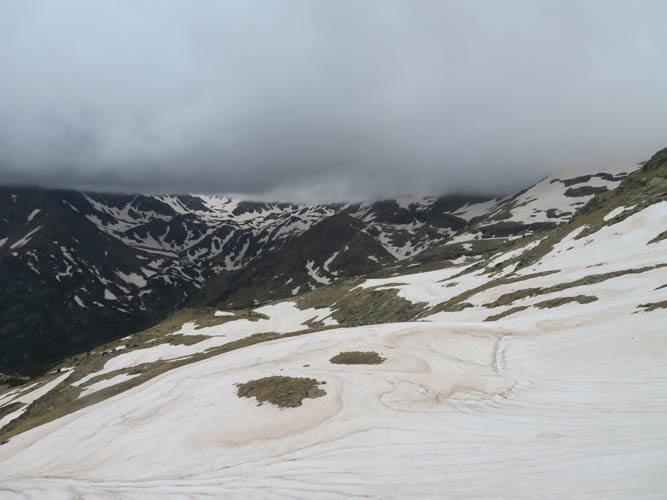
Pic de la Coma de Varilles. Snow covers much of the mountain’s SW slopes. The south ridge (right side) is mostly snow-free.
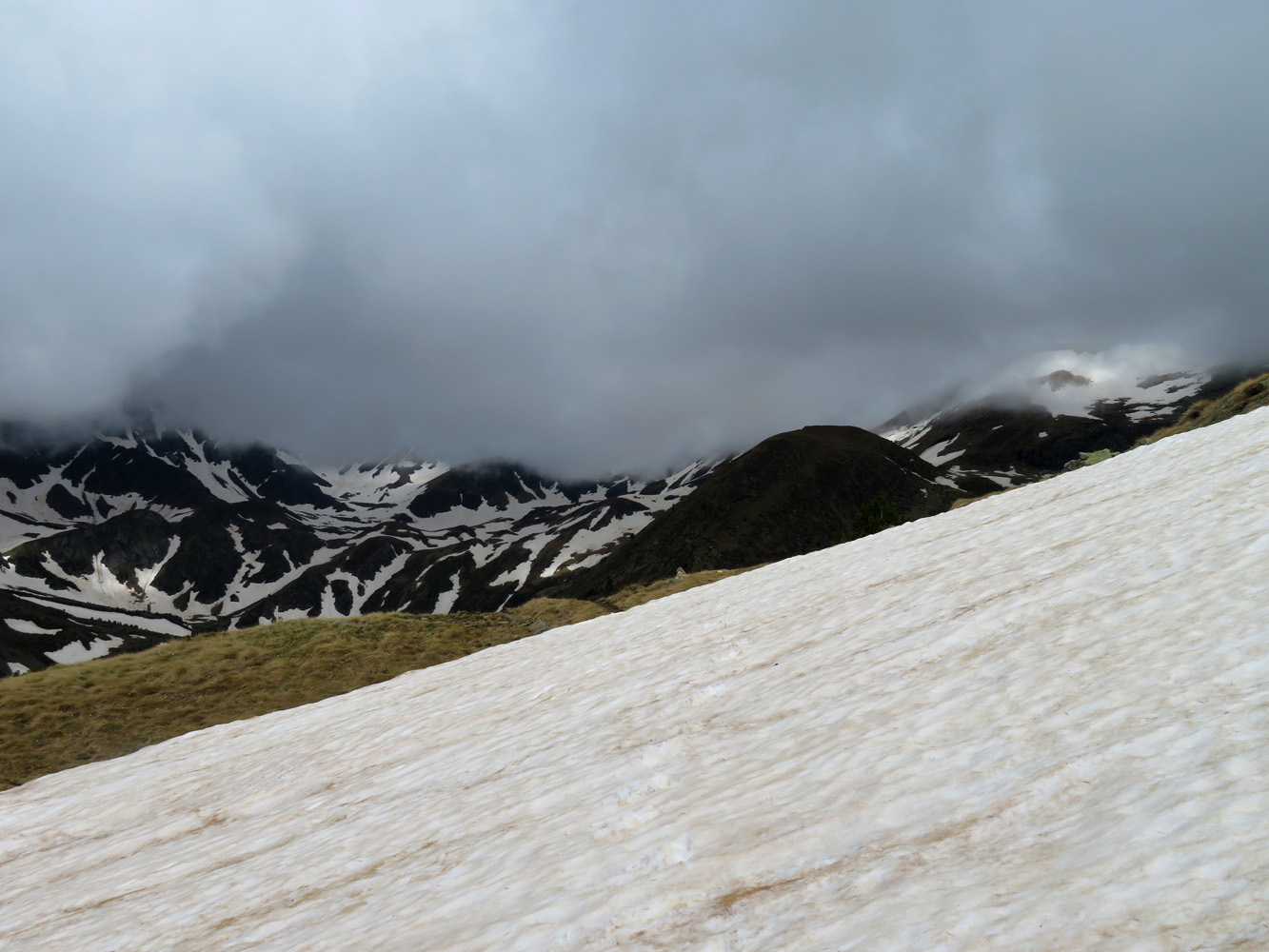
The trail is buried under large snow patches in some sections.
An ominous blanket of dark-grey clouds approaches from the SW.
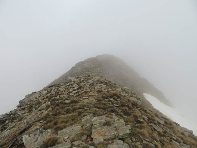
On the south ridge, the weather is getting worse…
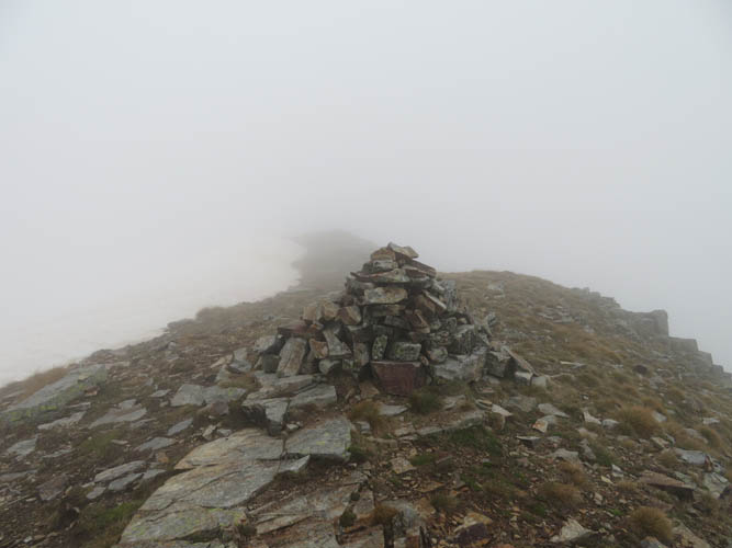
Now summit views whatsoever!
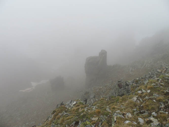
Interesting rock gendarmes on the way down the west ridge of Coma de Varilles.
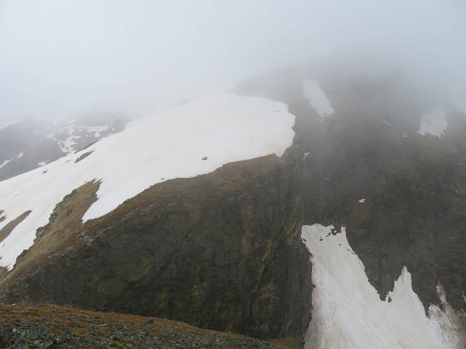
There are several sharp breaks in the ridge between Coma de Varilles and Pic de Ransol.
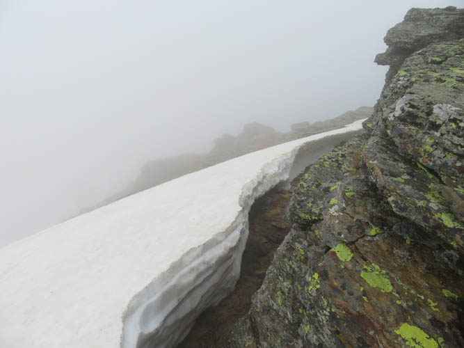
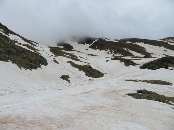
Still more than a metre of snow up here!
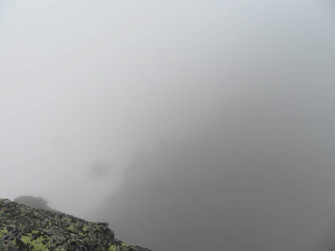
White-out just before Pic de Ransol.
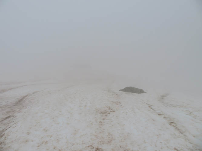
Time to head down on the shortest route possible. The descent is strenuous and slow though since I can’t really see where I’m going…
Almost back down at the main trail, I take a last glance back at the inhospitable ridge.