Livingstone Range, Canada
8 July 2016
Solo
Difficult access and exciting scrambling in the Livingstone Range
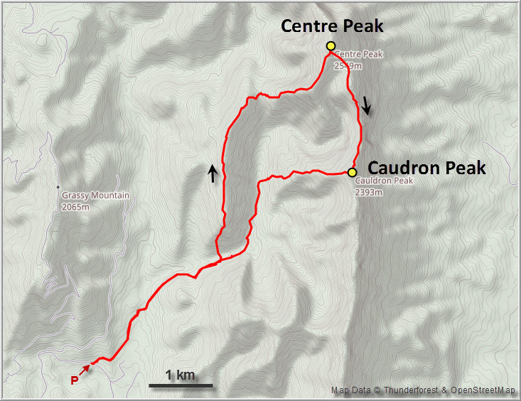
Centre Peak, the highest point of the long, knife-straight ridge that forms the southern part of the Livingstone Range, can be seen quite clearly from Highway 22 and I had wondered many times whether there were any good scrambles on this seemingly endless ridge. After doing some research, the little I found suggested that both Centre Peak and Caudron Peak would be climbable as scrambles. The famous Rick Collier had done so on an impressive 4-day traverse of the entire Livingstone Range from north to south, tagging both Centre and Caudron along the way but bypassing the connecting ridge on the lower slopes to the west.
Edit January 2019: There are now several other accounts out there on trips that were done both before and after mine. These include Bill Kerr’s ascent up the east side of Centre Peak in summer 2014, Brandon Boulier’s two separate winter ascents of Centre and Caudron in 2014/2015, and Vern & Phil’s ascent of the two peaks in a single trip in November 2016. As always, these are the only recorded and discoverable online reports – obviously there must’ve been many more ascents that we are simply unaware of.
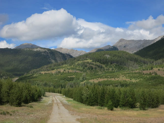
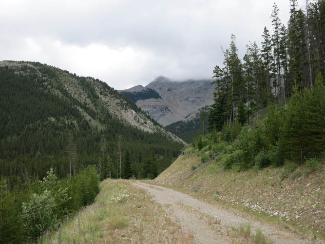
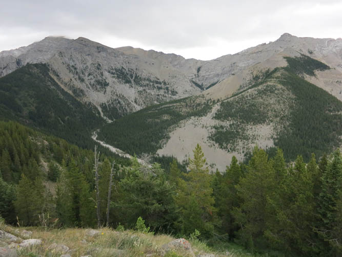
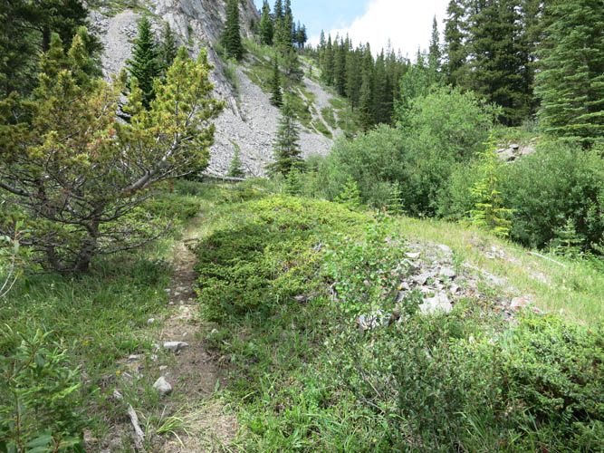
After some initial issues with access along the Grassy Mountain Road north of Blairmore – see note below – I was able to start my hike a few km southwest of my objectives. At first, the going was easy on a good gravel road that leads to a wellsite at Caudron Creek. A few hundred metres before the wellsite I left the road (cairn), turning north down into a dip to cross the creek, then headed up the steep hillside of the small ridge that parallels and sits just west of the main mountain range. The creek crossing was a mere hop and I was thankful I didn’t have to get my feet wet. Light forest on the initial steep ascent was then followed by a pleasant walk on the ridge, facilitated here and there by smatterings of a trail, but it is clear that not many people visit this area.
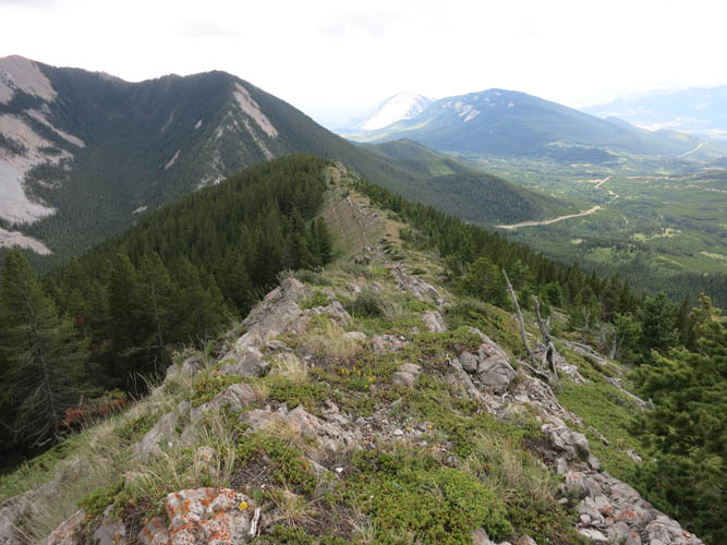
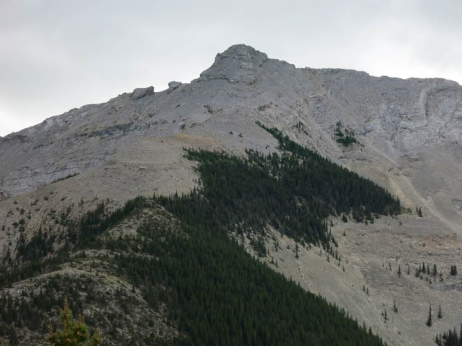
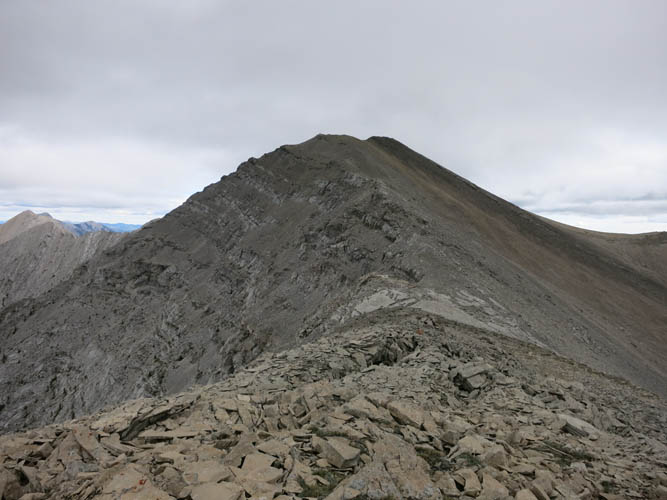
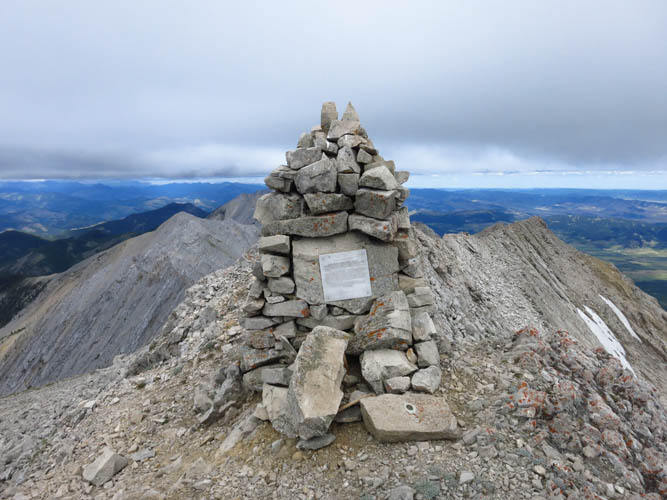
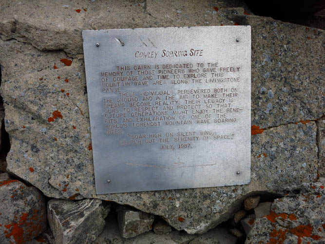
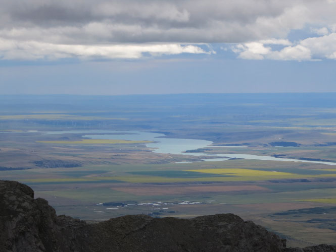
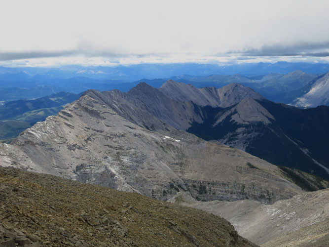
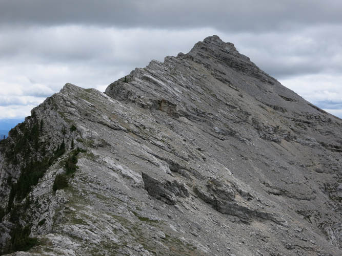
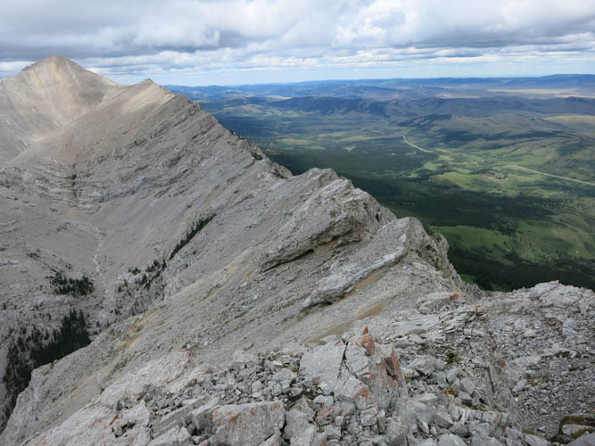
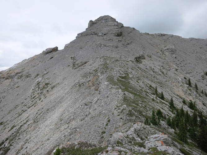
Where this lowly ridge turns right (E), annoyingly, I had to lose some 200 m of hard-won elevation, only to gain it again on the other side of the dip. After that it was an enjoyable scramble up fractured slabs and rocky slopes all the way to the top of Centre Peak. The summit sports an impressively large cairn with a dedication from 1987 to the pioneers of a local soaring club from the nearby town of Cowley. There’s also a (now broken) stone plaque that honours two brothers, previous owners of the fertile farmland below Centre Peak, who ascended the peak several times in the 1930s. A half-broken wooden box with a tiny Tupperware container inside serves as a register. Not surprisingly, there were only about a handful of entries since the register was placed in 2010. Some people even attempt to hike along the entire length of the ridge from Thunder Mountain in the north all the way to Blairmore in the south, something that was accomplished in 2006 by the late Rick Collier, one of Alberta’s most celebrated mountaineers.
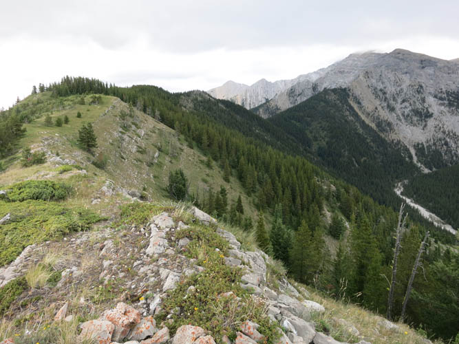
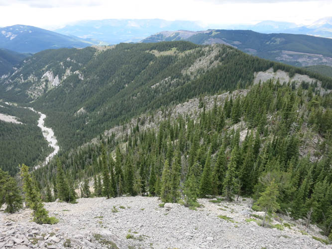
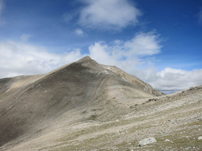
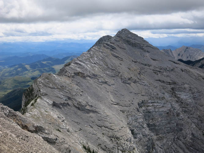
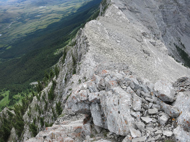
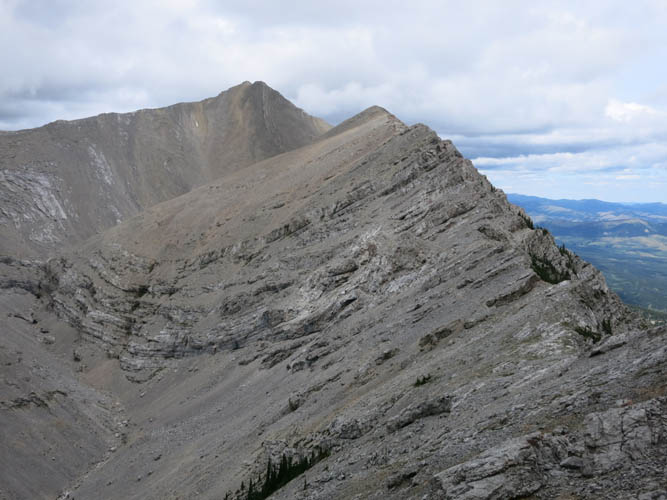
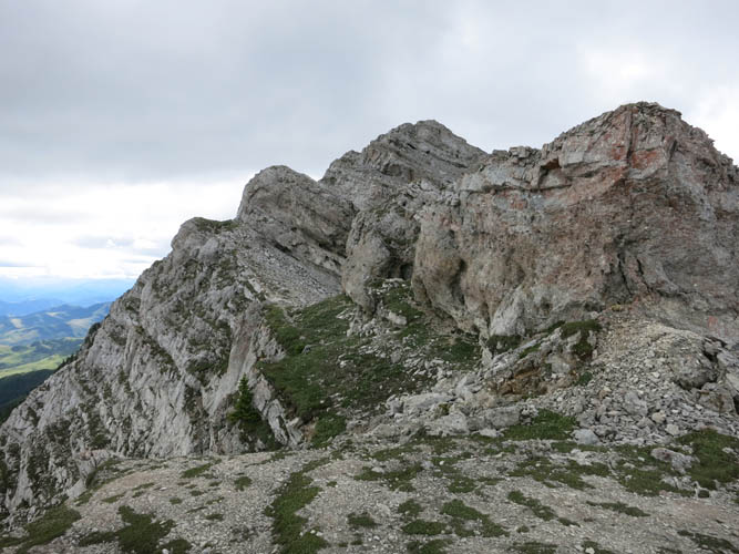
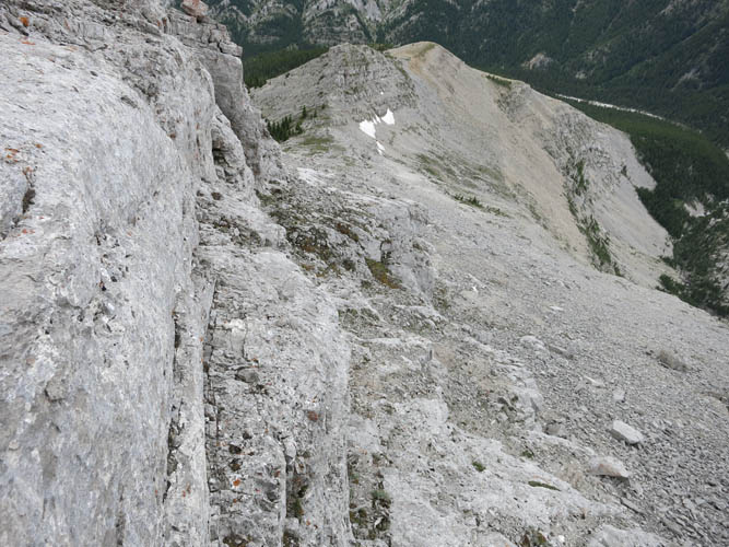
It was really windy up on top here, so I huddled on the sheltered east side below the summit to devour my lunch and contemplate the upcoming traverse to Caudron Peak. From a distance, this ridge looked like it could hold plenty of nasty surprises: I had seen several jagged cliffs and vertical rock steps from a distance earlier in the morning. But my fears were unfounded. The first third of the 3 km traverse was an easy hike off the summit mass of Centre Peak on initially steep rubbly slopes. The next third was the trickiest section: the ridge narrowed and several steep drop-offs prevented further progress along the spine of the ridge. The key to overcoming these obstacles was to follow a faint game trail that elegantly wound its way along the path of least resistance, switching between the right and the left side of the ridge crest wherever the easiest route was. Now “easy” for goats doesn’t mean easy for humans, of course, and at one point I was faced with a serious 10 m downclimb on the east side of the ridge that would probably classify as a difficult climber’s scramble, although the exposure was manageable. After this crux I continued along narrow grassy ledges on the east face that allowed for easy travel until the game trails turned back up onto the ridge. Most of the remainder of the traverse after reaching the col was easy scrambling right on the ridge top.
I found this traverse exciting and enjoyable, but careful routefinding was certainly necessary. Looking back at the traverse from the summit of Caudron Peak, it appeared as if perhaps a slightly easier route may be possible by circumventing any cliffs and drop-offs on the right (W) side if coming from Centre, but this seemed to involve quite a few elevation losses and re-gains. There was a small cairn but no register on Cauldron, so I left a small jar with booklet that I had brought.
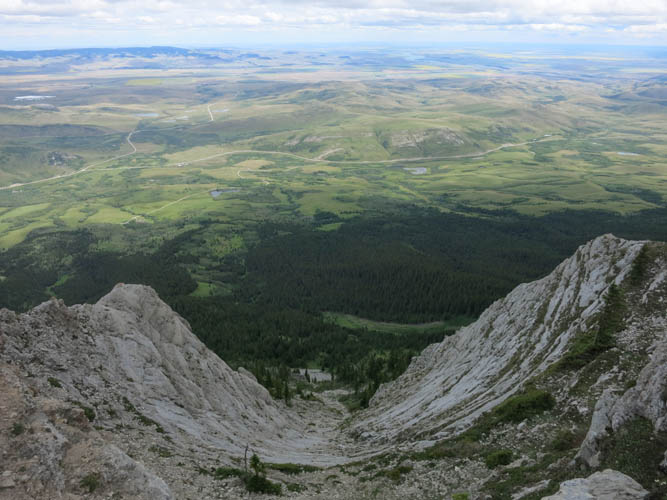
My descent plan from Caudron Peak was to head down the west ridge back down to Caudron Creek and then follow the valley back to the wellsite road to complete the loop. Getting off the summit mass in the top 50-100 m initially involved a few moderate to difficult moves; however, there was also quite a bit of scree on my right that I believe might offer an easier alternative. The remainder was a pleasant hike along a broad and bare ridge, which lower down turned into scree-covered and partially treed slopes that easily led down to Caudron Creek. I hiked down this lovely little valley through patches of trees, flowering meadows and lush creekside vegetation back to the gravel road to link up with where I had started in the morning.
After just over 8 hours I was back at my car. If it wasn’t for the difficulties in accessing this area, I think this would make for a really enjoyable trip overall. Obtaining permission from the respective landowner(s) is a real pain but obviously should be respected. If I had to do this trip again, I would probably chose the east route to Centre Peak instead (see Bill Kerr’s trip) as it seems to be more straightforward to access.
Note: Access to Caudron Creek is restricted and requires permission by various landowners. Mining operations north of Blairmore and privately owned farmland east of Centre and Caudron Peaks severely limit access options. Make sure you contact the relevant stakeholders and ask for permission to cross their land before heading out.
|
Elevation: |
Centre Peak: 2549 m (official), 2548 m (my GPS) |
|
|
Caudron Peak: 2393 m (official), 2412 m (my GPS) |
|
Elevation gain: |
1560 m |
|
Time: |
8 h |
|
Distance: |
18.3 km |
|
Difficulty level: |
Centre Peak via SW ridge: Easy (Kane), T3 (SAC) |
|
|
Traverse to Caudron Peak: Difficult climber’s scramble; T6 |
|
Reference: |
No info on this route was available to me prior to trip |
|
Personal rating: |
4 (out of 5) |
NOTE: This GPX track is for personal use only. Commercial use/re-use or publication of this track on printed or digital media including but not limited to platforms, apps and websites such as AllTrails, Gaia, and OSM, requires written permission.
DISCLAIMER: Use at your own risk for general guidance only! Do not follow this GPX track blindly but use your own judgement in assessing terrain and choosing the safest route. Please read the full disclaimer here.