High Rock Range, AB, Canada
25 September 2019
With Wen & Sean
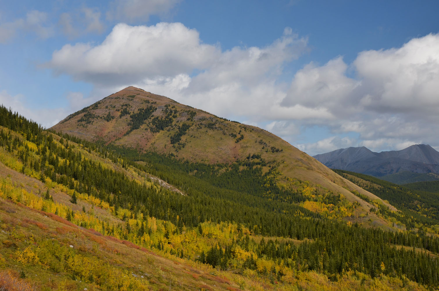
Don’t let this deceivingly gentle hill fool you!
It may look gentle and benign from a distance, but this “little” hill is actually quite a workout and took more time and energy than we expected. As an “optional” detour on our way back from our camp at Weary Creek Gap after having climbed Mount Muir earlier in the day, we thought it would be just a short hike up a pleasant grassy slope. We must’ve been quite tired from the previous two climbs, but it certainly felt like more than just a little grassy hill!
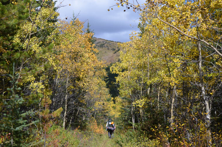
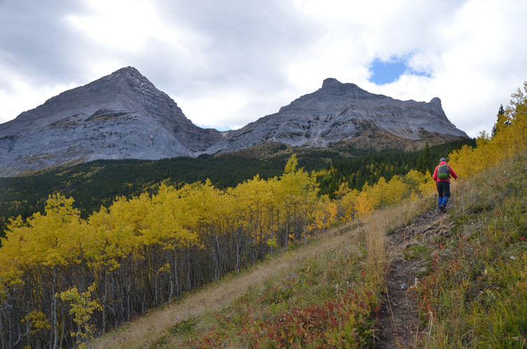
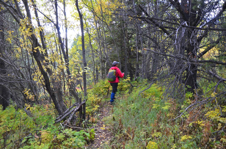
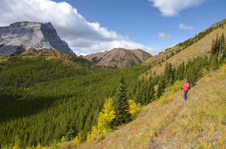
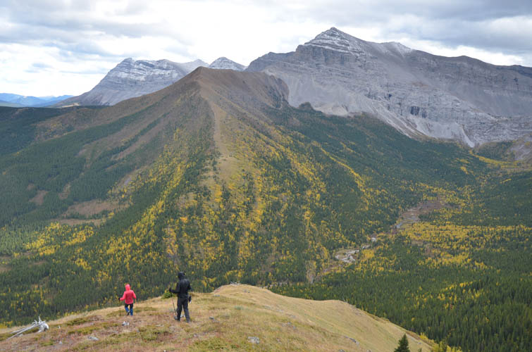
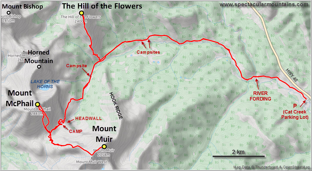
After packing up camp and heading down the faint path at the headwall between Mount Muir and Mount McPhail, we followed the McPhail Creek trail back for a few km before reaching the southern end of the long humpback ridge that forms the Hill of the Flowers. An excellent horse trail leads up some switchbacks through the lower treed slopes before making a sharp left turn onto the hill’s west side and continuing to the col between the Hill of the Flowers and Horned Mountain (this is the “Horned Mountain Trail” described in Daffern’s guidebook). We got suckered into following this trail at first while admiring the colourful landscape around us lit up by the warm afternoon sun. However, we quickly realized our mistake and then changed direction to head straight up the grassy slopes back to the ridge crest.
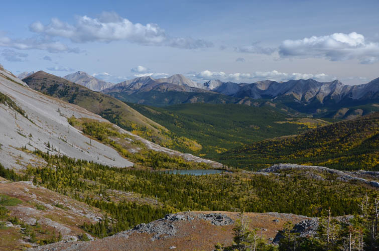
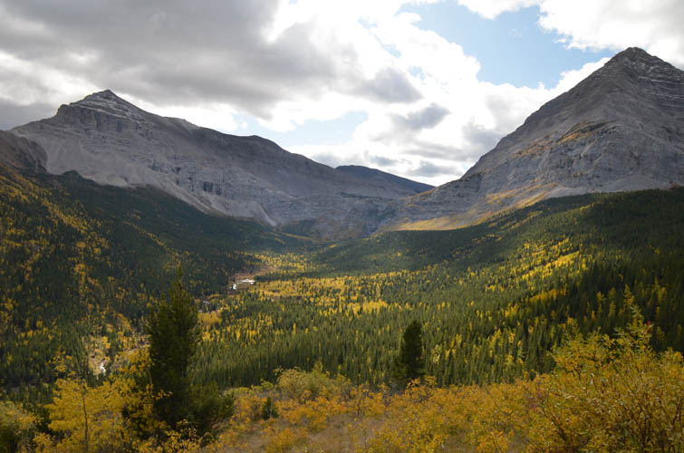
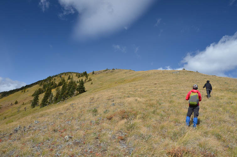
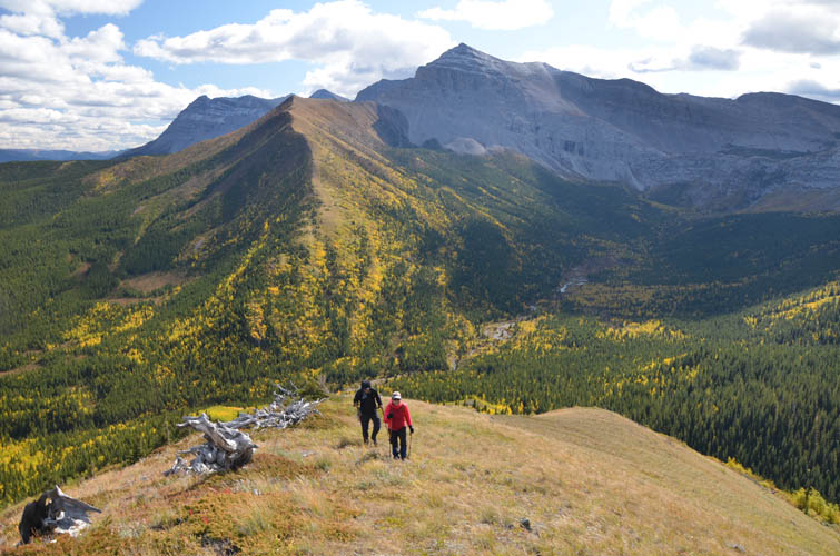
The remainder was a steady plod along the trailless ridge top, a bit boring at times but overall fairly pleasant. The flowers that this hill is famous for were mostly gone by this time of the year. Trees line the ridge crest in some sections and provided a welcome shelter from the increasing winds blasting us from the west. Yes, the cold weather front was coming in fast, as forecasted. We were enjoying the last nice day of fall it seemed, as the next few days would see more than 40 cm of snow fall in this area!
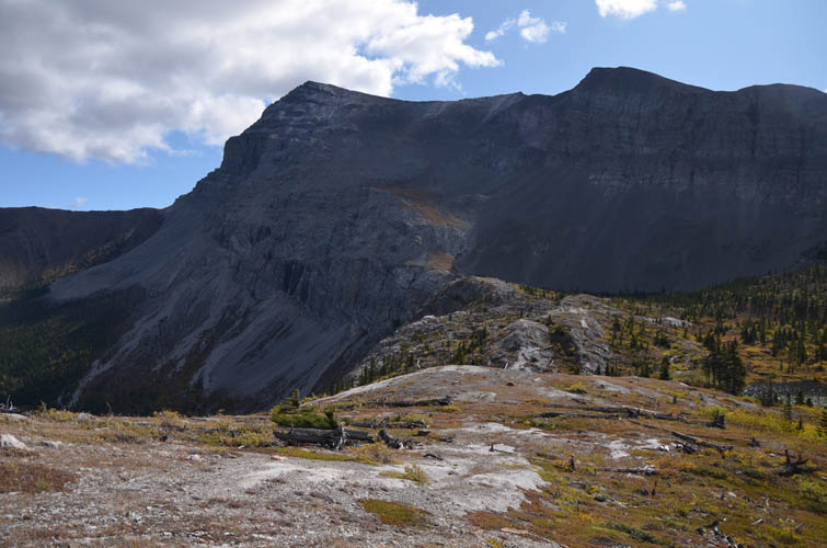
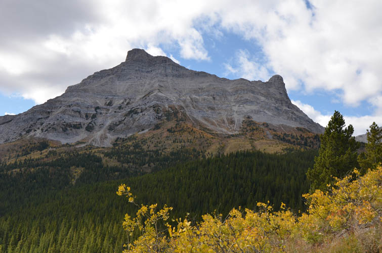
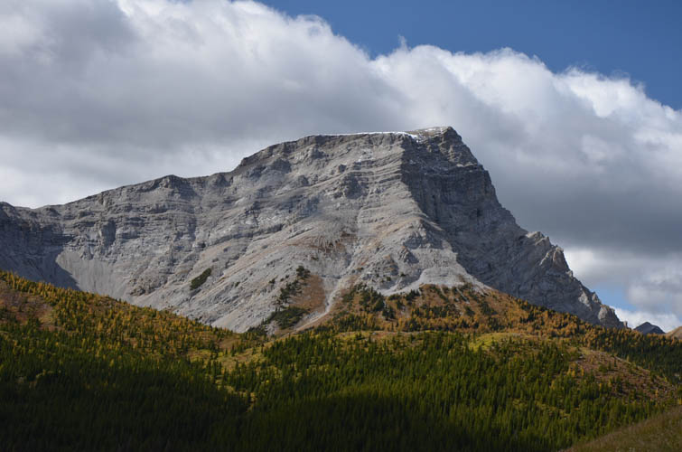
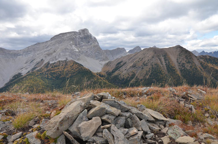
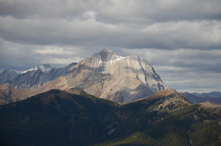
It was cloudy and cold by the time we reached the cairned summit (no register), so after taking a few snapshots of nearby Mount Bishop and Horned Mountain we returned the same way we came.
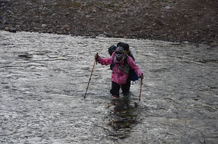
Back at the trail intersection we still had almost 2.5 h ahead of us to get back to Cat Creek parking lot. But the trail is flat and in good shape and we had plenty to talk about so time just flew by. At the Highwood River crossing we met a couple of girls with their horses who appeared from a nearby camp run by Anchor D Outfitting out of Turner Valley. Guided horse rides and hunting trips are apparently quite popular in this area. After spending two full days hiking and climbing here, we could totally understand why. It is indeed a very beautiful part of Kananaskis, a bit more raw and untouched than other parts but still accessible and full of opportunities to explore. Definitely an area to visit again!
|
Elevation: |
2390 m (my GPS) |
|
Elevation gain: |
590 m (from McPhail Creek trail) |
|
Time: |
2.5 h (from/to McPhail Creek trail) |
|
Distance: |
4.7 km (from/to McPhail Creek trail) |
|
Comments: |
From Cat Creek parking lot to trail intersection it’s an additional 360 m elevation gain and 9.5 km one-way (approx. 2-3 h of hiking). |
|
Difficulty level: |
Easy (Kane), T2 (SAC) |
|
Reference: |
Daffern’s K-Country Trail Guide Vol. 5 |
|
Personal rating: |
3 (out of 5) |
NOTE: This GPX track is for personal use only. Commercial use/re-use or publication of this track on printed or digital media including but not limited to platforms, apps and websites such as AllTrails, Gaia, and OSM, requires written permission.
DISCLAIMER: Use at your own risk for general guidance only! Do not follow this GPX track blindly but use your own judgement in assessing terrain and choosing the safest route. Please read the full disclaimer here.