Najran, Saudi Arabia
30 March 2019
Solo
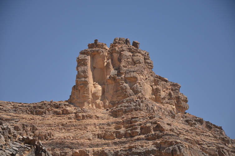
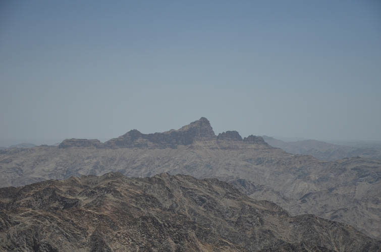
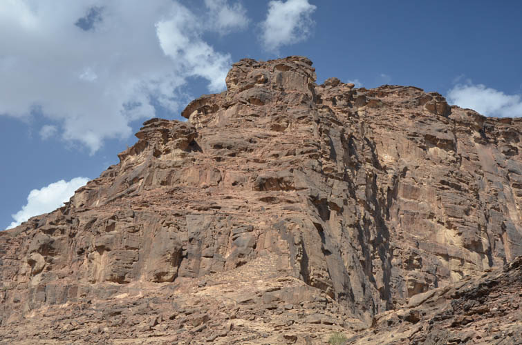
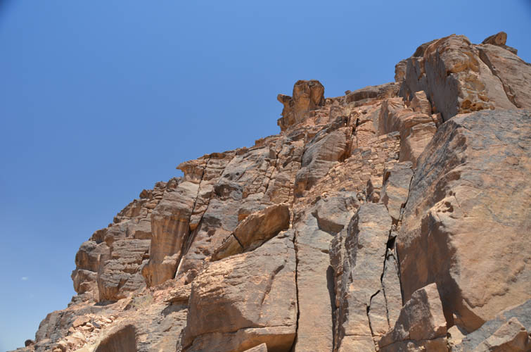
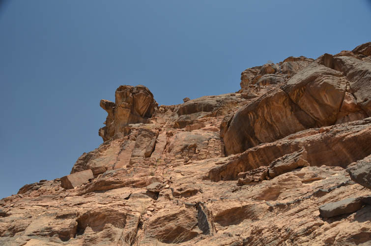
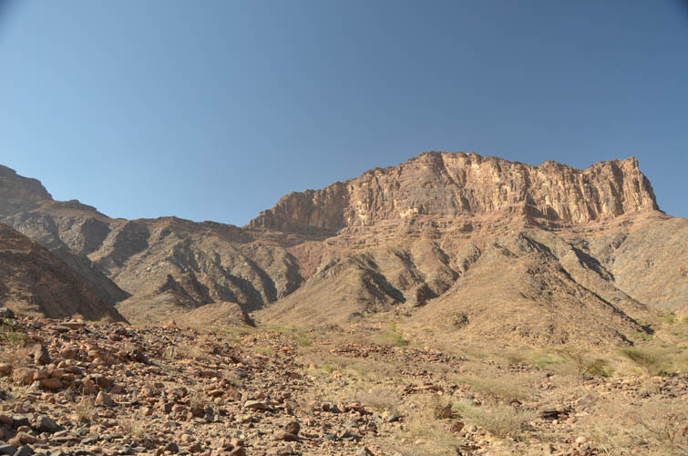
Towering fortress guarded by vertical cliffs
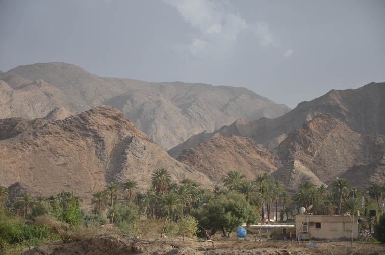
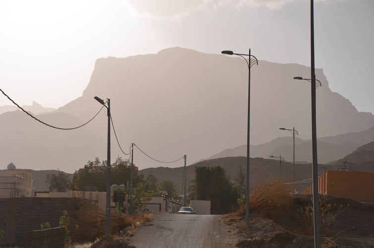
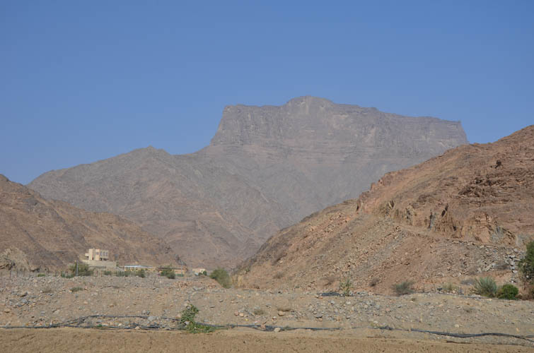
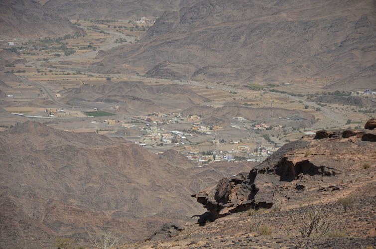
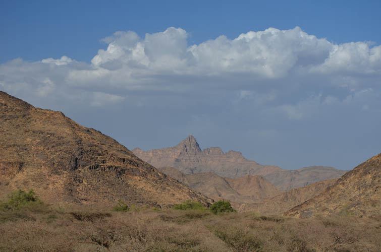
Jabal Kufar (variant spelling: Kfar, Kafar) is a highly conspicuous peak in the Sarawat Mountains northwest of the Saudi city of Najran. When viewed from the main road to the east it resembles a giant fortress guarded by impenetrable walls all around. Its impressive shape is perhaps best admired from the small town of Al Harshaf, which is the starting point for a summit bid up this big blocky mountain.
The only reason I knew of this mountain was because Mohamed, who had hosted me for dinner in Habuna two nights earlier, had mentioned it as one of the most difficult mountains to climb in the area. He hadn’t climbed it himself, but knew of people who had. My curiosity was piqued… I had no idea where exactly the mountain was, it didn’t show up on my map and it was hidden from our view when Mohamed and I discussed it. So at the end of my Jabal Anthari climb the day prior, I decided to drive into the next town and ask some people there about Jabal Kufar. I didn’t have to drive very far…
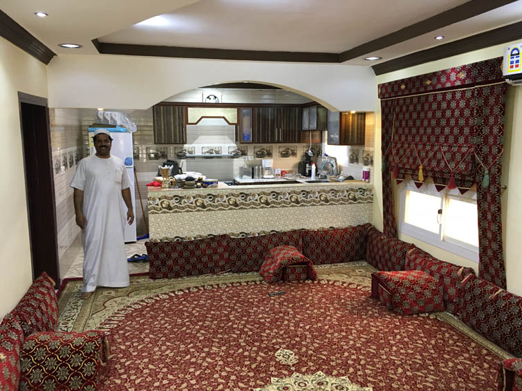
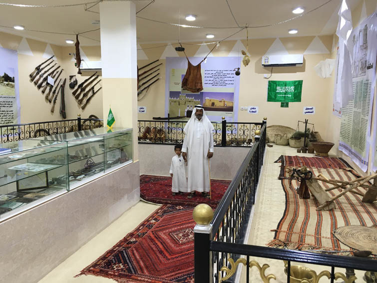
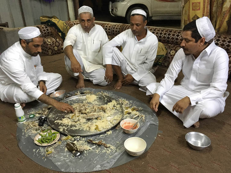
A few hundred metres after driving off, a big black Ford F150 truck passed me and a man excitedly motioned me to stop. “Hello, how are you Sir, why don’t you come to my house and stay there? We will have dinner and I can show you around!”… I was baffled. Once again here’s a complete stranger whom I’d never met before, basically picking me up on the road asking if he can host me. Unbelievable! His name was Mana, a lovely and kind man in his 40s, very friendly and extremely excited to have me as a guest. I gladly accepted and we continued to his “summer house”, a small gated property at the edge of Al Harshaf where he comes with his family and friends to relax and find some quiet time. The house is situated in the corner of a large fenced yard and had all the amenities I could dream of: a carpeted patio, comfy air-conditioned living room, fully-equipped kitchen, plus bedroom and bathroom with laundry machine. But before settling for the night it was time to meet his friends. First stop was to see a group of friends including Ali, who maintains his own personal museum in this house, displaying historical and archeological artifacts he found in the area. They showed me around and offered me tea, dates and Saudi coffee on the patio outside – absolutely lovely people. Next up was Mr. Saleh plus a whole group of friends who all joined us for another massive feast: once again a young goat was slaughtered in honour of my visit and prepared with rice, tomato-chili sauce, salad, and melon for desert. His friends included teachers and engineers, some of whom spoke a little bit of English, which greatly helped with the conversations (my very limited Arabic is barely enough to make a formal greeting and say good-bye). Of course everyone wanted to know why on Earth I was interested in going up the mountains in their backyard. It was just inconceivable to them that someone would want to go up into the barren rocky landscape all alone, just for fun. The concept of recreational hiking simply does not exist here, which is in part due to the relative isolation this region has endured (or enjoyed!) having been closed to international tourism for pretty much its entire existence. None of the people I met would ever go hiking or climbing for pleasure and nobody had visited any of the summits around them. Hence it was very difficult getting my hands on any detailed information on these mountains. As the evening progressed, they remembered one guy from the town who had climbed Kufar before and called him up to ask if he’d come with me. He didn’t have time, but advised me to bring a rope just in case. Hmm… perhaps I was underestimating this mysterious mountain after all. We chatted and laughed deep into the night before my friendly host Mana dropped me off at the summer house where I got a few hours of sleep.
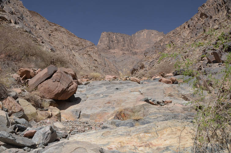
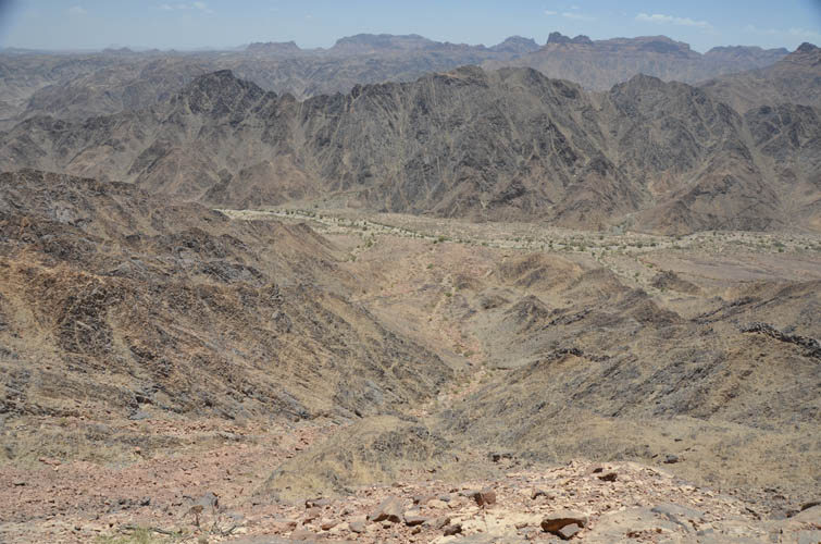
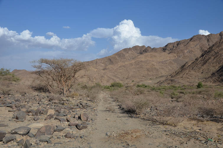
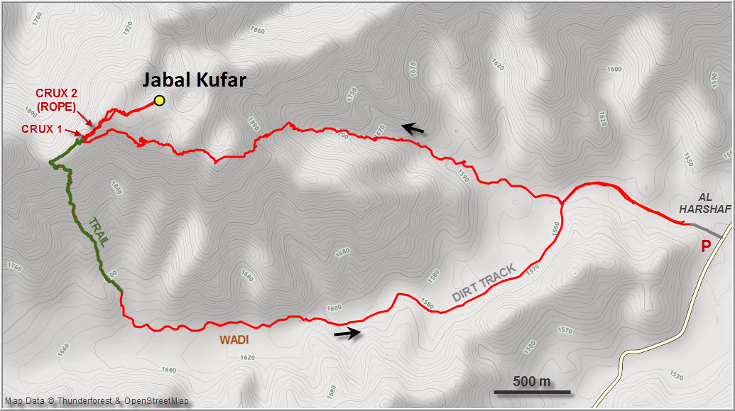
The next morning I drove to the entrance of a small wadi only a few km from Mana’s house where I was told the easiest route would start. There is in fact a dirt track in the wadi that can be used to shorten the approach, but only with a high-clearance 4WD vehicle. My little Hyundai Accent rental would’ve never made it past the first few hundred metres.
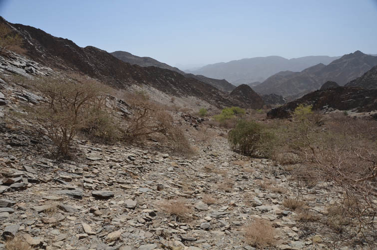
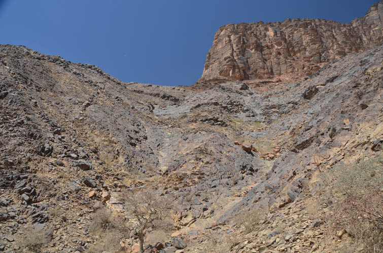
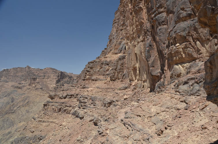
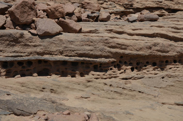
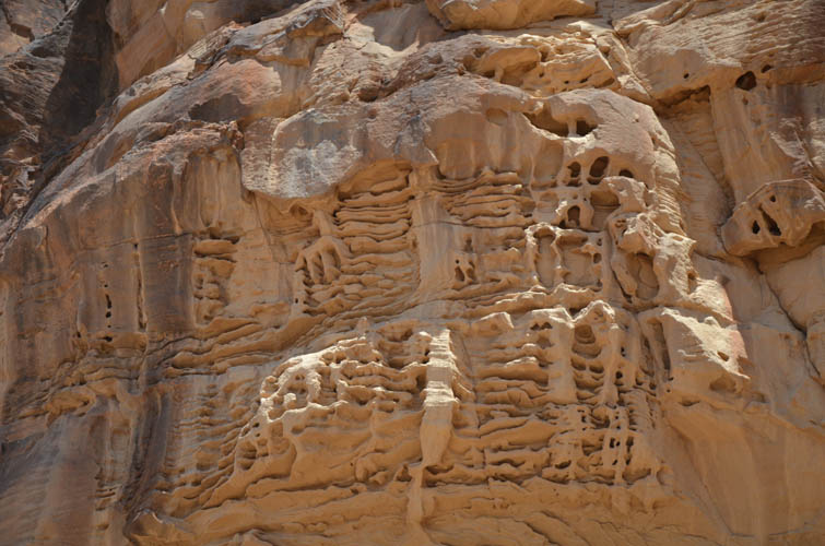
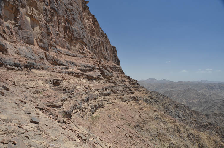
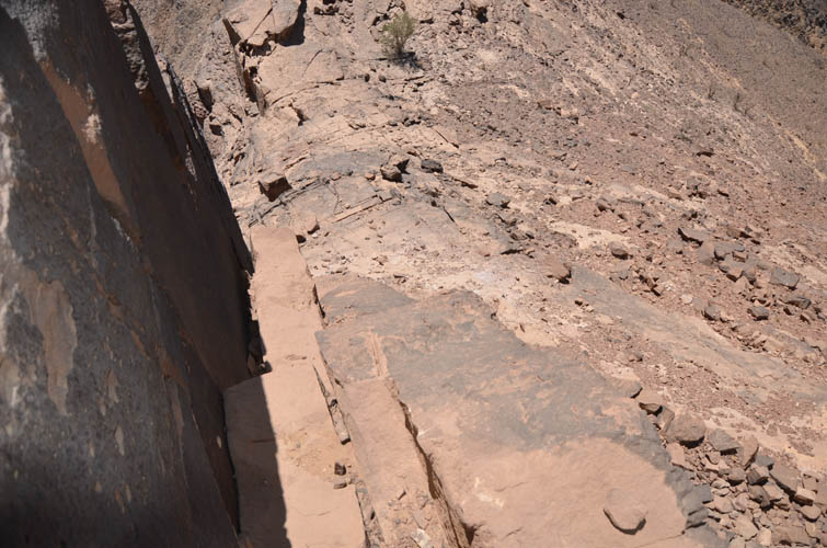
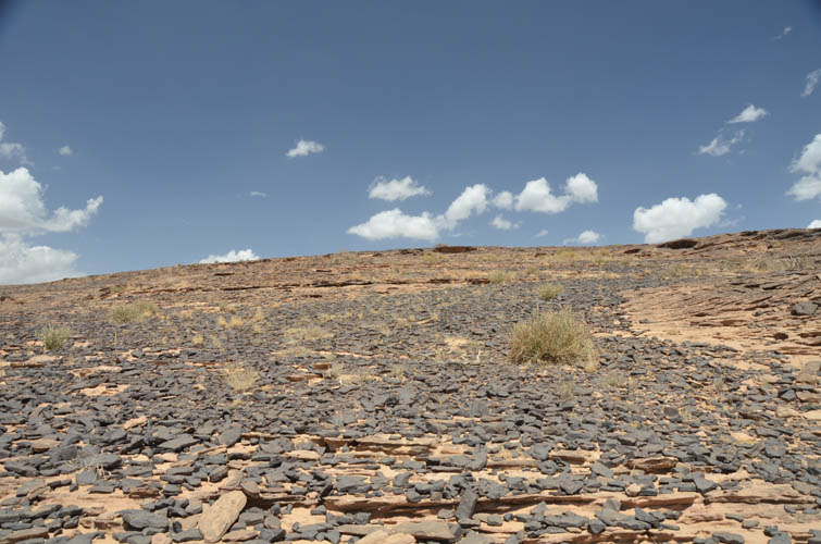
All I knew about the approach was basically to follow the valley to some trees, then go up a side valley to the right to loop around the backside of the mountain where it’s possible to scramble up. Lacking any detailed description, I of course got off route right away and turned right far too soon. I tramped up a small, bushy drainage, roughly aiming for the left edge of the huge vertical wall that forms the east face of the upper part of the mountain. It was actually quite a pleasant hike, mixed with a bit of scrambling to get over boulders and some steep shaly rock. However, when I reached the edge of the cliff and poked around the corner to the left, I knew I was completely in the wrong place. The vertical cliff continues on the south side for quite a distance, so I was left with no choice but to contour around the mountain on ledges and rock steps just below the huge wall to my right. It was slow going and several times I got stuck on ledges that dead-ended, but with time and patience eventually I reached the west side of the mountain.
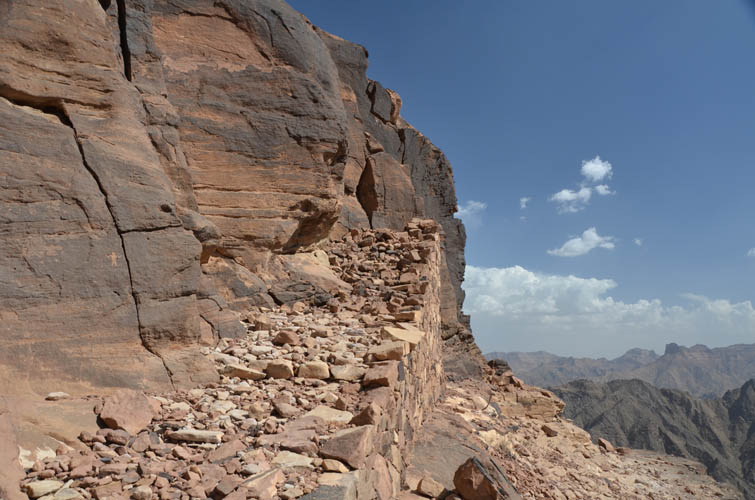
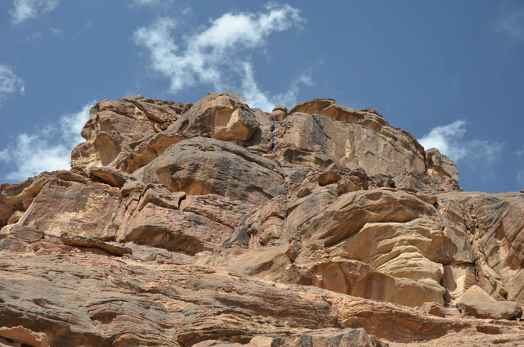
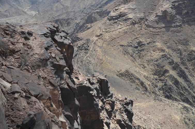
And then… completely out of the blue… a TRAIL appeared in front of me! Unbelievable, I had not expected this… I was jumping for joy! It came up from the valley below me to the south, turning east towards the big wall of cliffs and this is right where I stumbled upon it. Unfortunately, my enthusiasm over the newly found trail was short-lived: looking around the corner, you could follow the trail straight up to some kind of man-made staircase that abruptly ended in the cliff. Someone had neatly piled up hundreds of stones in an effort to build a ramp up the cliff, but it only went half way! At the top of the ramp I found an old rope, which confounded me a bit because there was no way to properly secure it anywhere. An airy step was required to make it up to a ledge in the cliff, which I was then able to scramble up onto easier terrain. The crux with the rope that the guy mentioned, I thought to myself… good, I just passed it and should be able to make it back down no problem.
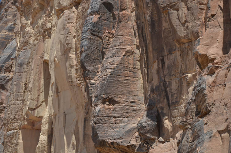
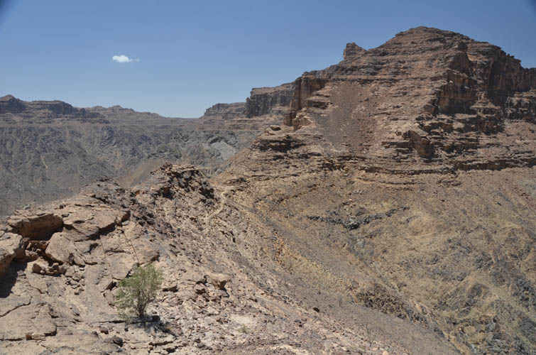
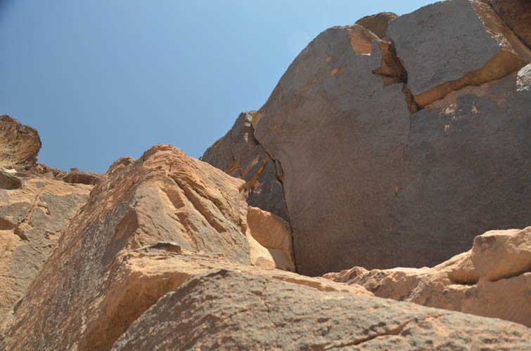
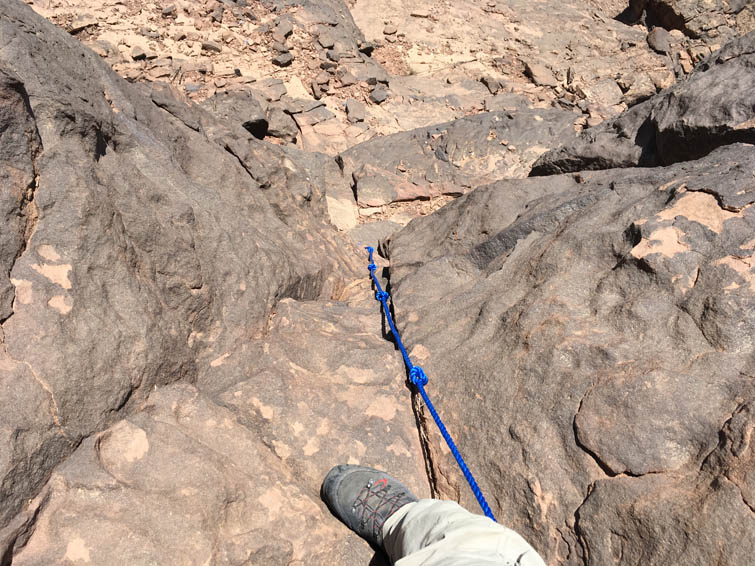
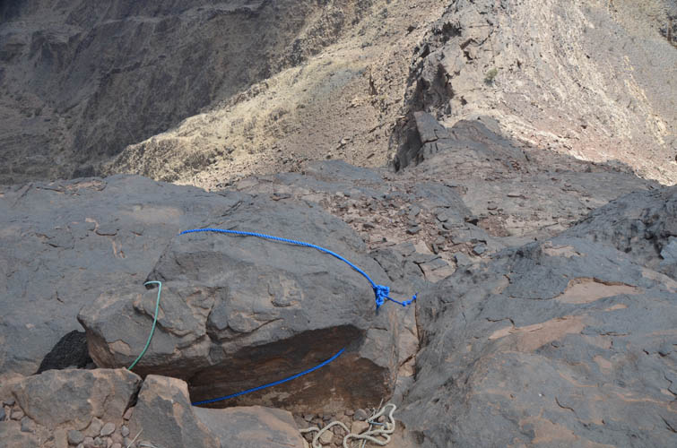
But then I looked up and saw another cliff, this time with a bright blue rope dangling down a 5 m vertical section. Ok, this is the real crux! To be honest it looked quite scary from a distance and I was almost sure that I wasn’t going up there alone and without protection. A bit disappointed about the prospect of having to turn around, I thought I could at least scramble up to it and check it out up close. And as is sometimes the case in the mountains, initially daunting situations can turn out more manageable once you put your nose into it. I stood by the rope and tested it, it looked brand-new and fully carried my weight. Even the climb itself didn’t look so hard anymore – there were some good holds and the vertical section was only a few metres. I decided to go for it, climbing each step up and back down on the rock to make sure I could descend the section again, using the rope only as an emergency line. At the top the rope was tied around a big boulder. Normally I would stay away from using random ropes whose origin or age I can’t confirm. Here the holds in the rock gave me sufficient confidence to proceed – but I doubt many would still classify this as a scramble. It was probably closer to a short section of free soloing, which of course many difficult scrambles include anyway. Another example of how the line between scrambling, rock climbing and mountaineering is a very blurry one.
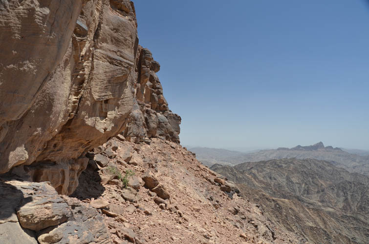
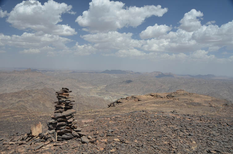
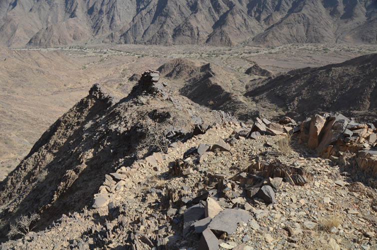
Once past the blue rope crux the rest was almost a walk in the park. Surprisingly, there were no cairns and no more trail, but the route to the summit was obvious. A few sections of moderate scrambling and a steep hike brought me to the broad, flat summit plateau crowned by a big cairn in the middle. Being one of the tallest peaks in the area, Jabal Kufar offers sweeping views of the surrounding mountains and Al Harshaf below. I felt really elated to have conquered this seemingly impenetrable fortress and sat down for a well-deserved lunch break in the hot afternoon sun. Soon, however, my thoughts were turning to that downclimb at the blue rope crux again. Adding to my worries, I was also starting to run low on water. The day had been extremely hot so far and the 3.5 litres I had brought were clearly not enough for a full day of climbing and routefinding.
Getting down the crux was much easier than expected. I almost thought it was harder going up than down, perhaps because I took it so seriously and tested everything when I first stood in front of it. The second crux with the airy step was awkward again, but once that was behind me I knew I was home free. All I had to do now is follow the trail down into the wadi, then hike back out along the dirt track.
I was ecstatic to see my friend Mana in Al Harshaf again and we celebrated the successful climb with plenty of soft drinks, tea and water – I had been hiking with an empty camel bag for the last two hours and was craving all the liquid refreshments I could get. Jabal Kufar had turned out to be a challenging and very enjoyable climb, despite getting off-track on my ascent. Taking the wadi route and trail in and out all the way will definitely save a lot of time and energy on this trip.
|
Elevation: |
2278 m (my GPS) |
|
Elevation gain: |
900 m |
|
Time: |
8.5 h |
|
Distance: |
12.9 km |
|
Difficulty level: |
Difficult climber’s scramble (Kane), T6 (SAC) |
|
Reference: |
No info was available to me prior to trip |
|
Personal rating: |
4 (out of 5) |
NOTE: This GPX track is for personal use only. Commercial use/re-use or publication of this track on printed or digital media including but not limited to platforms, apps and websites such as AllTrails, Gaia, and OSM, requires written permission.
DISCLAIMER: Use at your own risk for general guidance only! Do not follow this GPX track blindly but use your own judgement in assessing terrain and choosing the safest route. Please read the full disclaimer here.