
Davos, Switzerland
11 July 2018
With Wen
Our first outing in Switzerland this year and Wen’s first time ever hiking in the Alps! As with most mountains surrounding the resort town of Davos, the Pischahorn’s trails and slopes are pretty much uncrowded in the summer. Perhaps it’s the town’s reputation as a winter playground that keeps hikers away, or maybe it’s the fact that Davos – as the host to the World Economic Forum every year, plus numerous other conferences – isn’t exactly a cheap place for come for a holiday even by Swiss standards. Whatever the reason, it is exactly this lack of crowds on the hills that makes the landscape here so much more attractive and keeps me coming back.
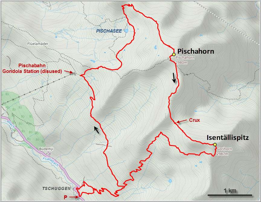
The Pischabahn gondola that once used to carry skiers half-way up the mountain isn’t operational anymore. A good starting point for a nice day hike is Tschuggen, basically just a couple of farm houses, an inn, and a small church high up in the Flüela Valley. It’s a very picturesque place and the inviting outdoor patio of the restaurant is a great reward to look forward to when you go off on your hike in the morning.
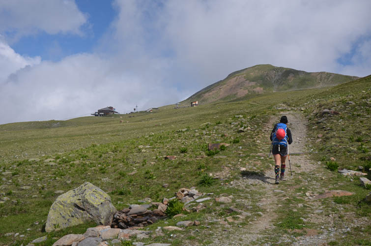
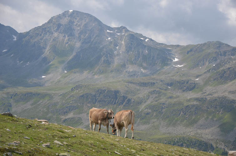
The initial trail that traverses the grassy slopes of the eastern side of the valley towards the Pischa gondola station is in great condition and the grade is pleasantly gentle – an ideal combination for getting our rusty joints and neglected leg muscles back into hiking mode again. At the gondola station we took a relaxing lunch break and watched a herd of cows playing around in what remains of the station, scratching their necks on wooden masts and noisily stomping around some metal sheets.
From the station we could’ve gone straight up the ridge to the top, but opted for the longer but more scenic route via the small hidden valley on the west side of the summit where the pretty Pischa Lake is located. It looks like a perfect heart, upside down! The colours of the water glimmering in the sun were such an amazing sight from the trail above, this is definitely a place to hang around and take extended breaks if the weather is good. The trail skirts the lake, then rises to Pischahorn’s north ridge from where it’s an easy hike to the spacious summit.
After enjoying fantastic views from the top we descended a short distance on the trail down the SW ridge and then tackled the long, pathless ridge connecting Pischahorn with Isentällispitz. This is a very enjoyable undertaking, mostly hiking with short stints of hands-on scrambling (some moderate, most easy) on a serrated ridge crest. Before reaching the Isenfürggli, a small named col between the two peaks, we veered left (east) to contour around the last rise along the ridge and make use of soft snow patches instead.
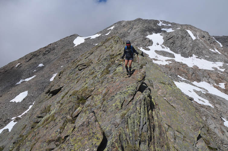
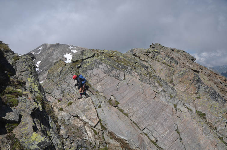
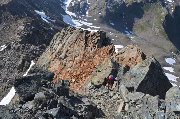
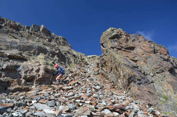
The crux of the day arrived quite unexpectedly. I don’t have the area’s climbing guide by the Swiss Alpine Club where this ridge traverse is mentioned, so I had no idea that there was a short section of very difficult scrambling (rated ZS – “ziemlich schwierig” or “fairly difficult” on the Swiss climbing scale) right at this point. It was a short, near-vertical cliff in the ridge that offered no easy way around but simply had to by upclimbed, with significant exposure below. I looked at it and hesitated – it was certainly not beyond our abilities and there were small, solid holds. Perhaps it might’ve been possible to backtrack and bypass this whole section below the ridge, but this was no sure bet and would’ve certainly entailed some significant elevation loss and re-gain. I asked Wen to look at the crux up-close and, to my amazement, she didn’t wait long but simply climbed up the cliff with impressive confidence. As with many other difficult cruxes, it really is a matter of breaking it down into small steps, carefully checking the quality of each hold, and making sure that what you upclimb you can also downclimb if you get yourself stuck or into a deadend. Self-confidence and a clear, focussed mind are probably even more important than physical abilities in these situations.
After the crux the terrain was much easier, although still no walk in the park. The ridge just kept going and going, and the summit of the Isentällispitz wasn’t getting much closer. After taking another long break in a sunny spot with beautiful views, we were energized again to take on the remainder of the ridge to the summit tower, which looks daunting from a distance but can be easily scrambled up along a scree chute on the NW side of the ridge. What a fabulous view back along the looong ridge we had just traversed from the Pischahorn!
A pretty straightforward descent from the Isentällispitz is to scramble down the south ridge towards a minor bump called Gorihorn on the official Swiss maps (although I suspect the label was somehow misplaced and “Gorihorn” refers to either the Isentällispitz itself or what looks like another, higher point along the ridge further south). From the Gorihorn we took the easy way out and simply hiked through snow patches, boulder fields and grassy slopes back to an old cow trail that zig-zags from the Isenfürggli back down into the valley and hooks up with the main hiking trail near Tschuggen.
A fantastic outing with a mix of everything from easy trail hiking to difficult ridge scrambling in super scenic surroundings. Definitely something I would repeat, even if this 11 hour trip turned out to be much longer than planned.
| Elevation: | Pischahorn 2981 m (official), 2977 m (my GPS) |
| Isentällispitz 2985 m (official), 2985 m (my GPS) | |
| Elevation gain: | 1530 m |
| Elevation loss: | 1530 m |
| Time: | 11.5 h |
| Distance: | 19.0 km |
| Difficulty level: | Difficult (Kane), T6 / II (European) |
| Reference: | Local maps |
| Personal rating: | 4 (out of 5) |
DISCLAIMER: Use at your own risk for general guidance only! Do not follow this GPX track blindly but use your own judgement in assessing terrain and choosing the safest route.
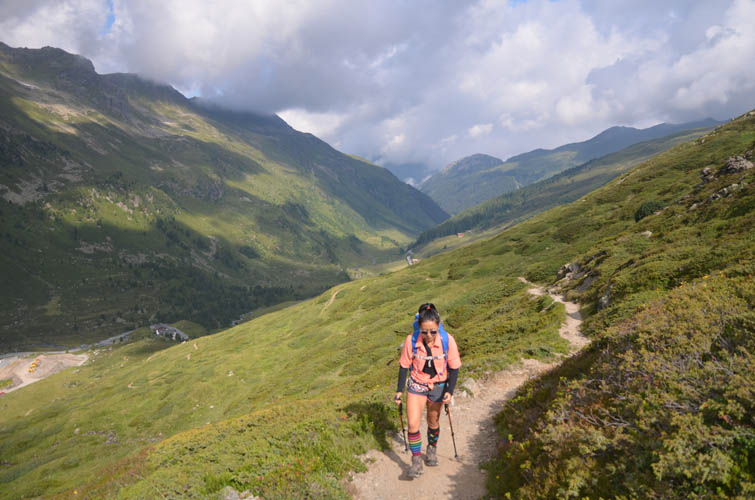
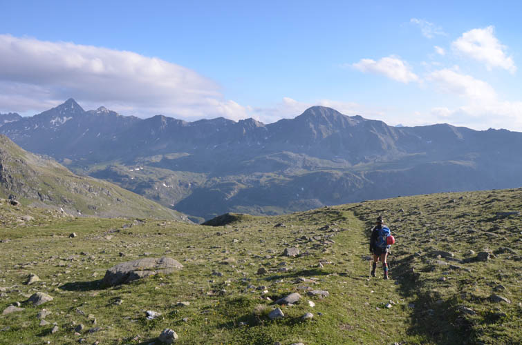
Easy start on a good trail in the Flüela Valley from Tschuggen.
Heading towards the disused Pischabahn gondola station (left).
Happy Swiss cows! Chlein Schwarzhorn in the back.
On Pischahorn’s NW ridge, looking north.
Turn-off from the ridge into the “hidden” valley to the north, where a secondary trail contours around the slopes.
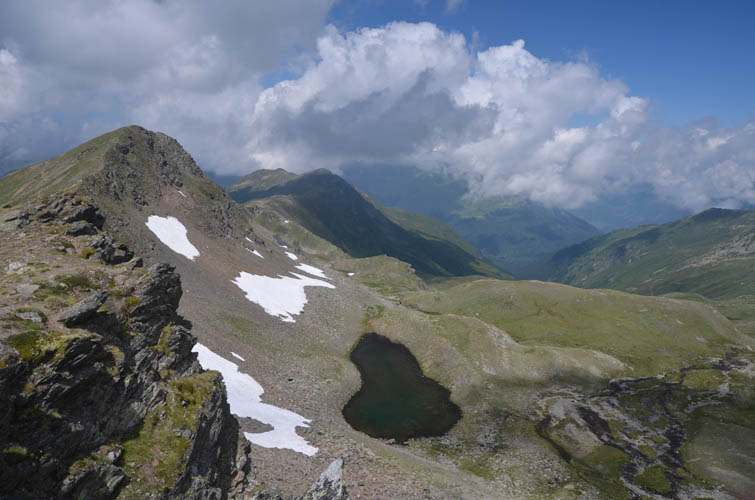
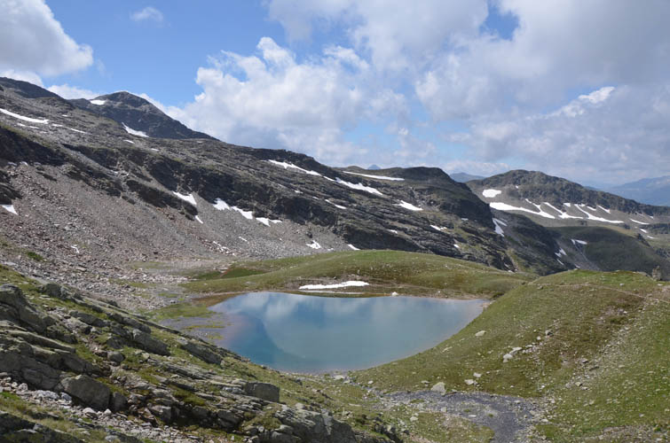
First glance of the pretty Pischasee (Pischa Lake).
It’s a heart, upside down!
Can’t get enough of this little lake! It’s so pretty to look at from all angles.
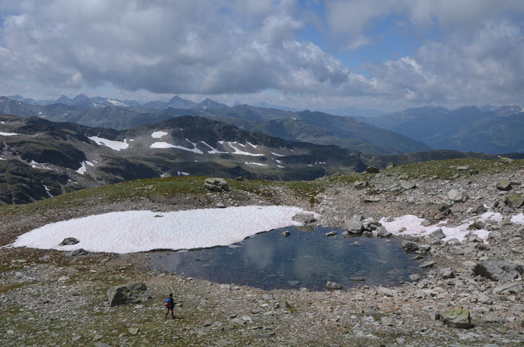
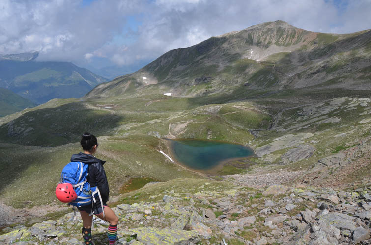
Wen admiring another small lake nearby.

We look and feel so small in this grandiose landscape!
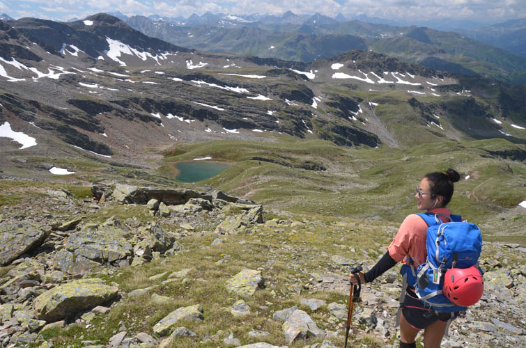
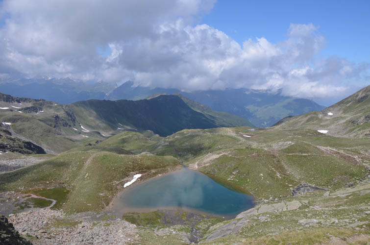
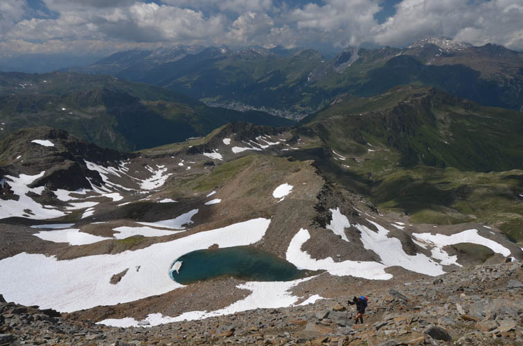
Looking down at the Pischa Lake from the N ridge.
From here it’s an easy ridge walk to the summit of the Pischahorn.
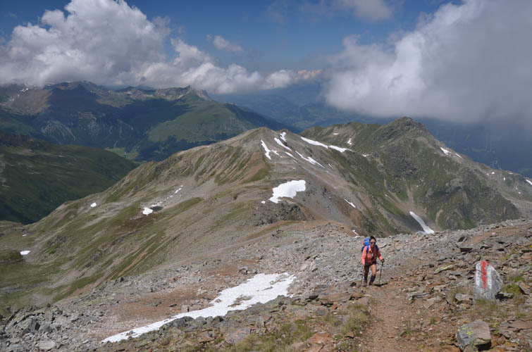
All on a well-marked trail!
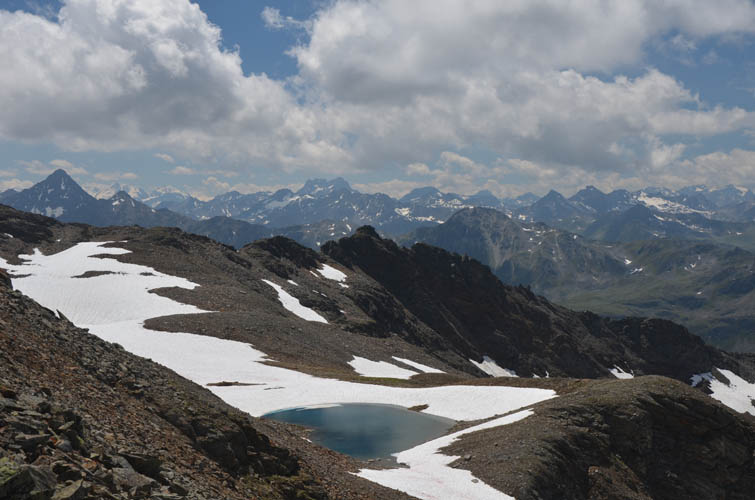
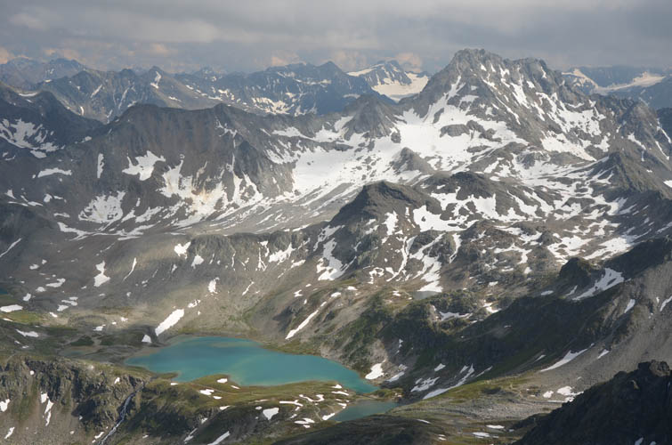
We counted 5 or 6 different lakes and tarns on the north side of the mountain. They make this area particularly picturesque!
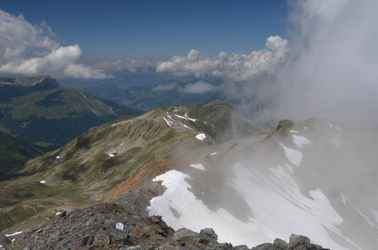
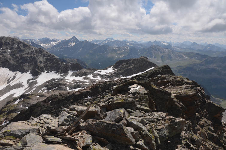
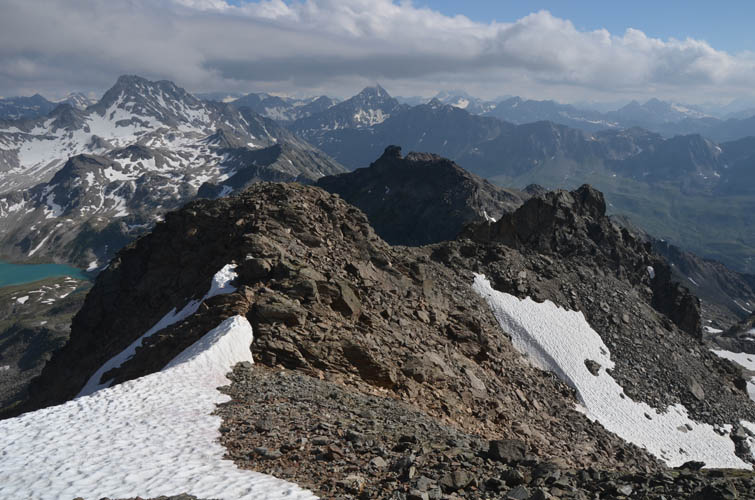
What a view from the top! Clouds are wafting up from the east towards the N ridge.
A perfect day for this long outing – not too hot, not too cold, and no rain.
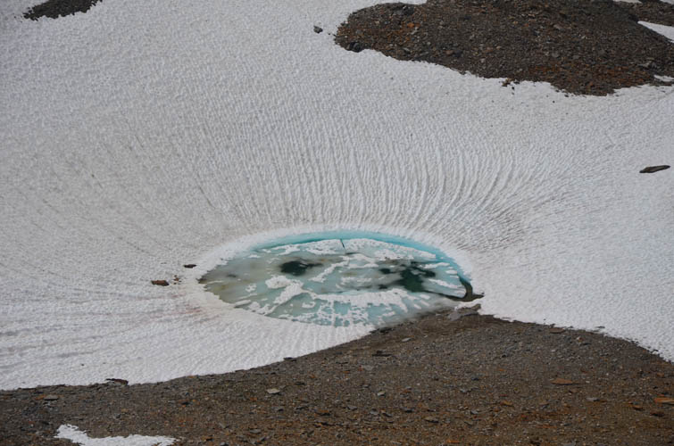
Some of the smaller tarns in more sheltered locations high up are still frozen up.
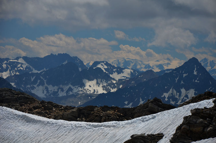
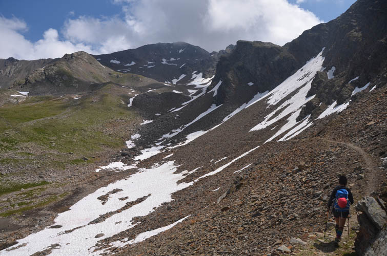
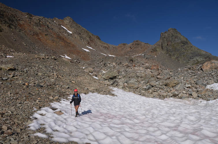
There is still quite a bit of snow left on north facing aspects.
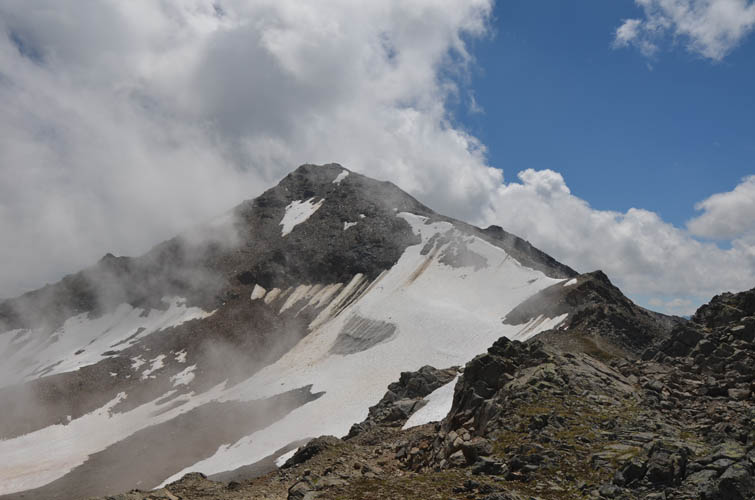
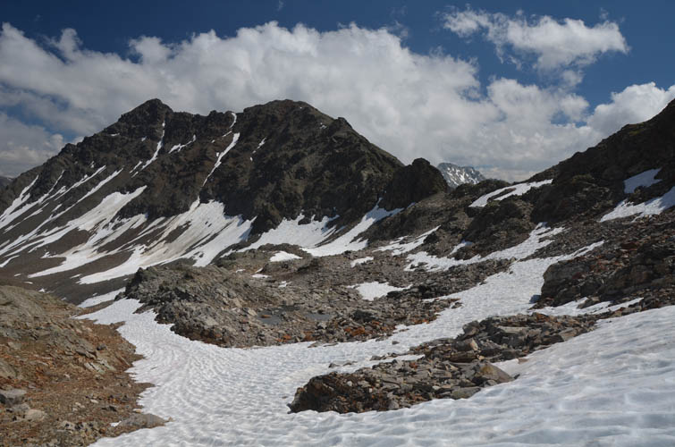
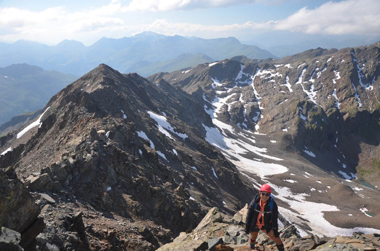
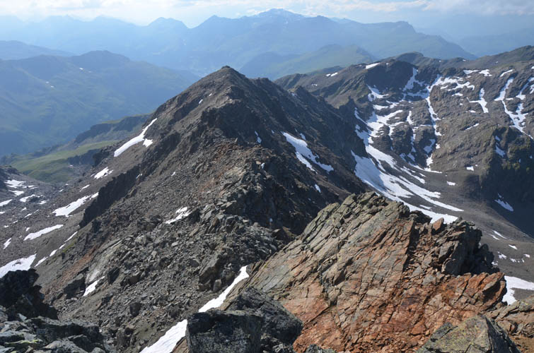
Now for the scramble part: the ridge connecting the Pischahorn with the Isentällispitz (high point on the left).
There’s some moderate exposure on a section of the ridge right at the beginning.
Some of the intervening bumps are cairned.
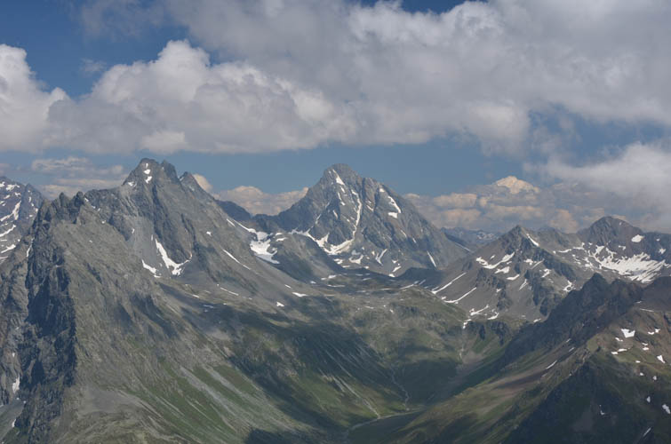
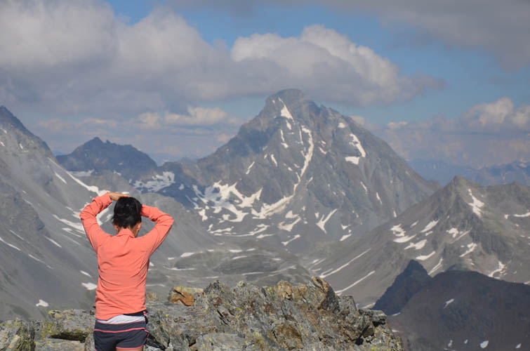
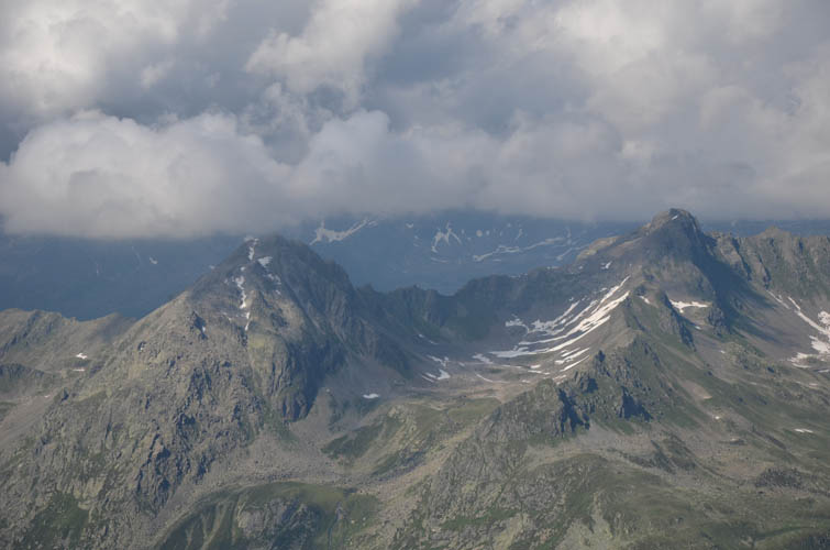
Hazy view of Piz Linard (middle) to the southeast.
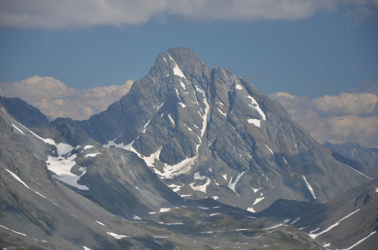
Close-up of Piz Linard (3410 m), located in the Upper Engadine.
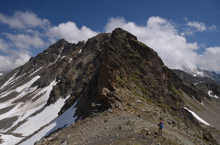
Slab scrambling along the ridge.
Here, we use snow patches to avoid one of the bumps along the ridge, heading straight to the small saddle on the right. Our goal, the summit of Isentällispitz, is on far left and still quite a ways to go!
Wen heading towards the crux at the Isenfürggli saddle.
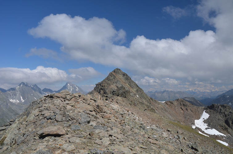
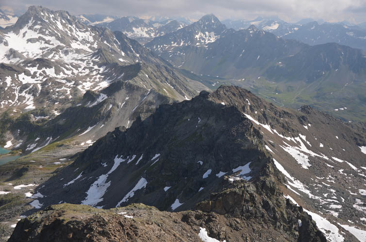
Back on top of the ridge, the rest of the way to the summit in the distance looks much tamer.
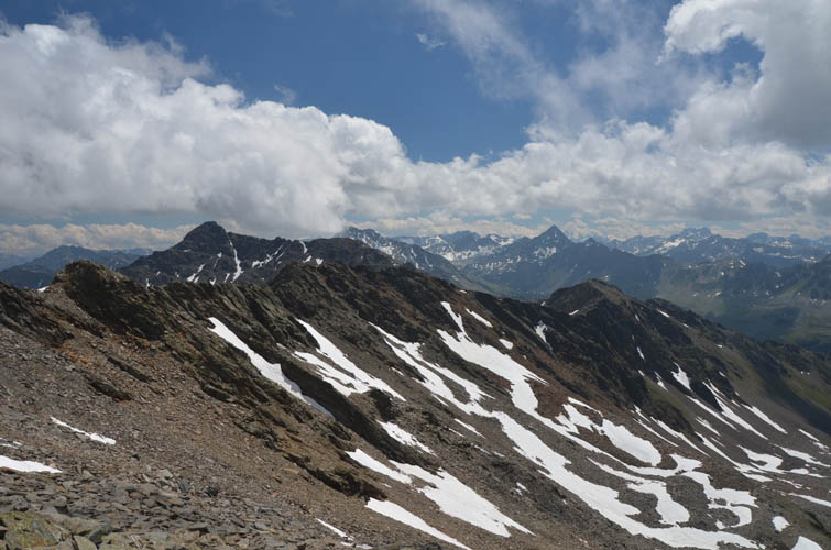
Great views of the Gorigrat to our right – the ridge connecting Isentällispitz with Jörihorn.
Lots of minor ups and downs along our ridge – it’s slow going!
Near the summit, there’s some fun, moderate scrambling across crumbly blocks of rock and a short scree chute to the top.
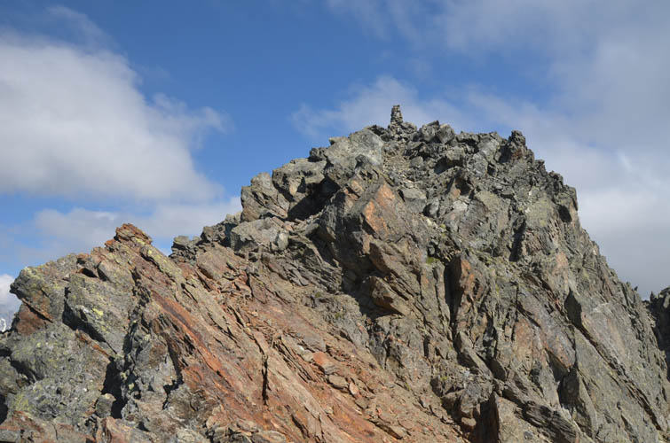
Summit of Isentällispitz.
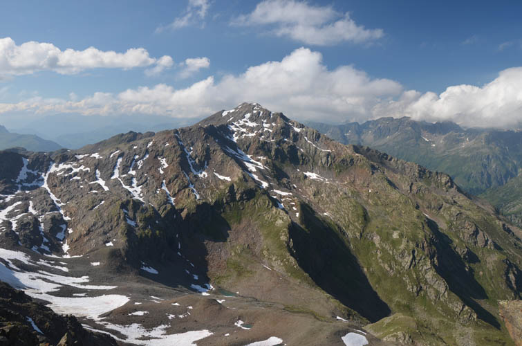
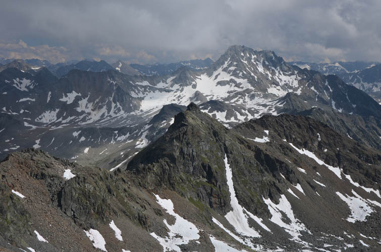
Looking back at Pischahorn.
The long ridge we traversed.
Piz Linard never fails to impress!
To the SE are the Jöri Lakes, another fantastic hike with lots of peaks that can be easily climbed, e.g. the Flüela Wisshorn (the larger mountain on the right).
A look down the Gorigrat, the ridge connecting Isentällispitz with Jörihorn.
Ominous looking clouds to the east… thankfully they stayed there!
Descent off the Isentällispitz on the south side.
The Gorihorn is a mere bump seen here on the left above the snow – hard to imagine it has an official name.
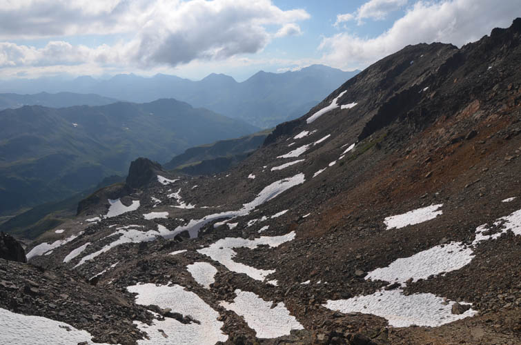
Our trail-less descent takes us down this small side valley through chossy terrain partially covered by snow patches, just east of the ridge we traversed.
A look back at the Isentällispitz (left).
Easy hiking back down the old cow track.
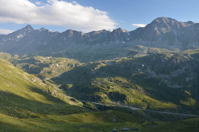
Last panorama of the day looking west down the Flüela Valley: Schwarzhorn on far left, Sentisch Horn on the right.