High Rock Range, AB, Canada
24 September 2019
With Wen & Sean
A gorgeous mountain featuring great views and tedious talus
After a three-week vacation in Canada our friend Sean was about to leave for his far-away home in Australia again. I thought long and hard about what we could do for a farewell outing and eventually settled on a two-day overnighter in the beautiful High Rock Range of Kananaskis, an area I haven’t explored nearly as much as I’d like to. Wen also joined us on this trip and the combo McPhail and Muir from Nugara’s More Scrambles book seemed to be a good choice for introducing them both to a true wilderness camping and hiking experience far away from the crowds of Banff and Canmore.
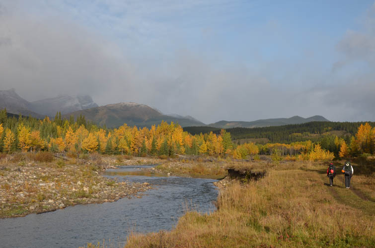
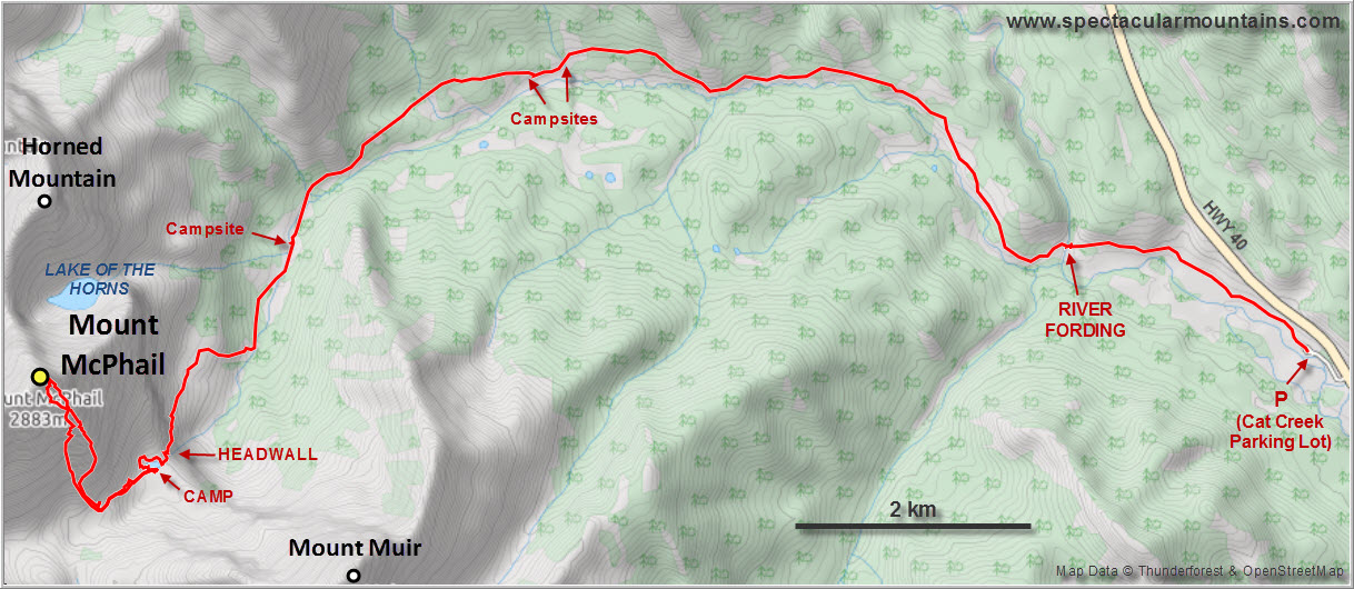
The hike in from Cat Creek parking lot was long but enjoyable and a great way to warm up for what was to come. Annoyingly, as has happened many times this season, the weather forecast was once again completely wrong: instead of sun and blue skies, we started out hiking in a drizzle with grey, fast-moving clouds obscuring the mountains to the west. This also made the approach trail along McPhail Creek a lot muddier than it should’ve been. I was worried about crossing the Highwood River at first but thankfully it was only about knee-deep and the current not too strong.
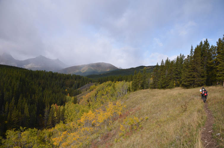
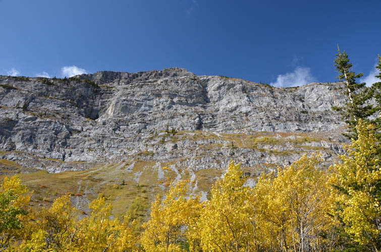
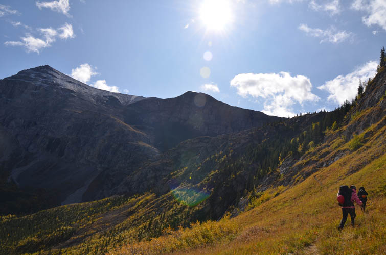
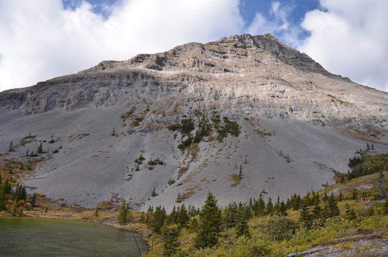
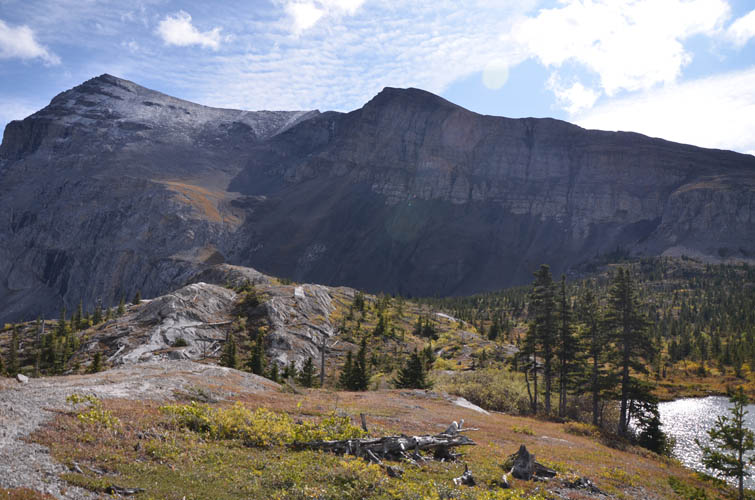
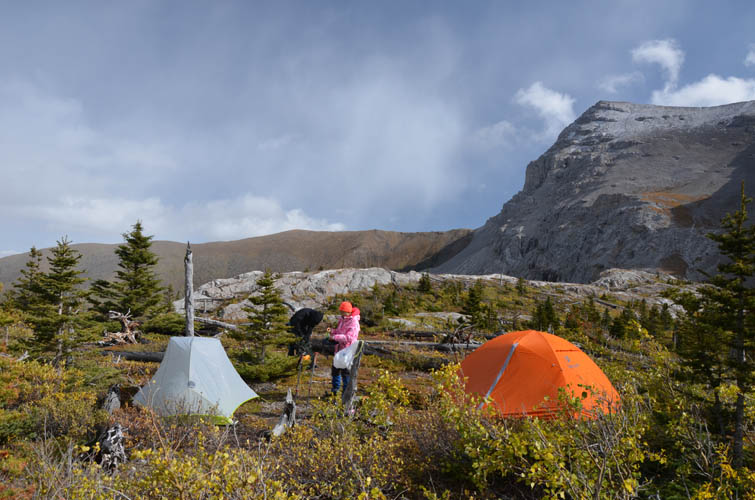
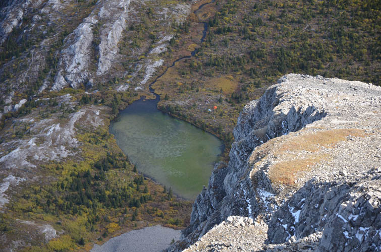
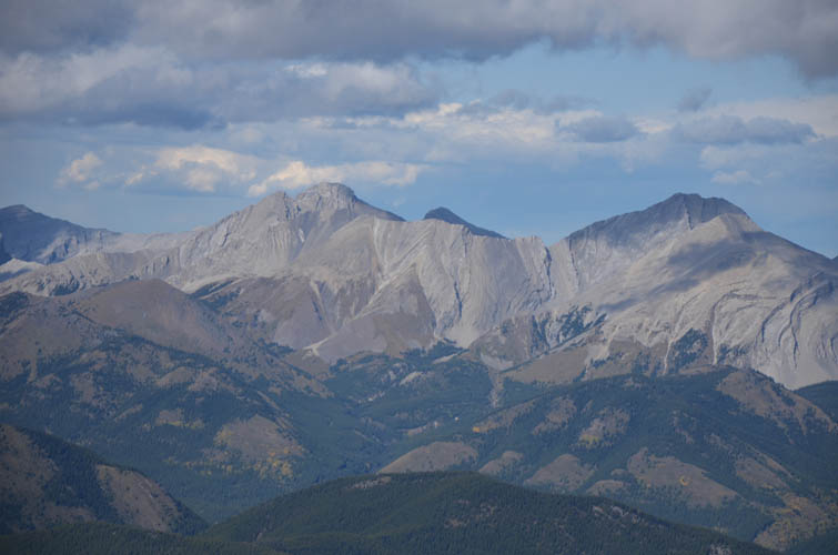
A bike would really be a time-saver on this approach as the trails are generally pretty good and the terrain fairly flat. After a few hours of steady hiking we reached the turn-off (cairned) to the headwall towards Weary Creek Gap. The skies finally started clearing and a gorgeous landscape revealed itself while we hiked above the forested valley and past stands of glowing larches and poplars to the waterfall at the headwall. The trail was in pretty good shape yet doesn’t seem to see much traffic. Right above the headwall is a pretty tarn with several potential bivy sites around it. It was cold and windy when we got there and it took us a while to find a decent spot to pitch our tents. We actually ended up almost walking around the entire lake before settling on a site on the southern side. It was still exposed to the wind, but existing fire circles and log “benches” made it a pretty convenient place to set up camp.
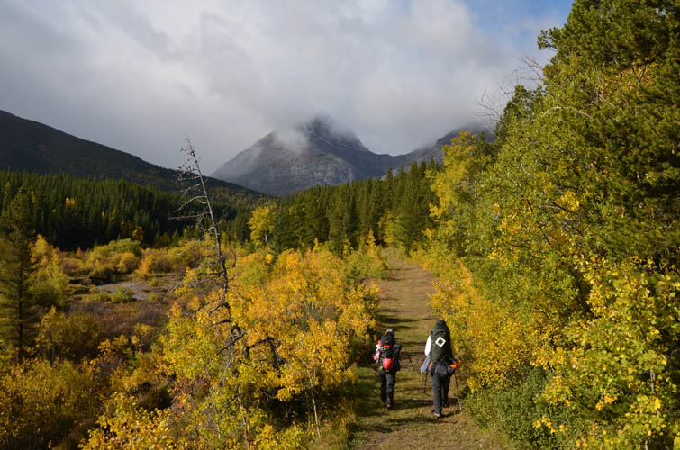
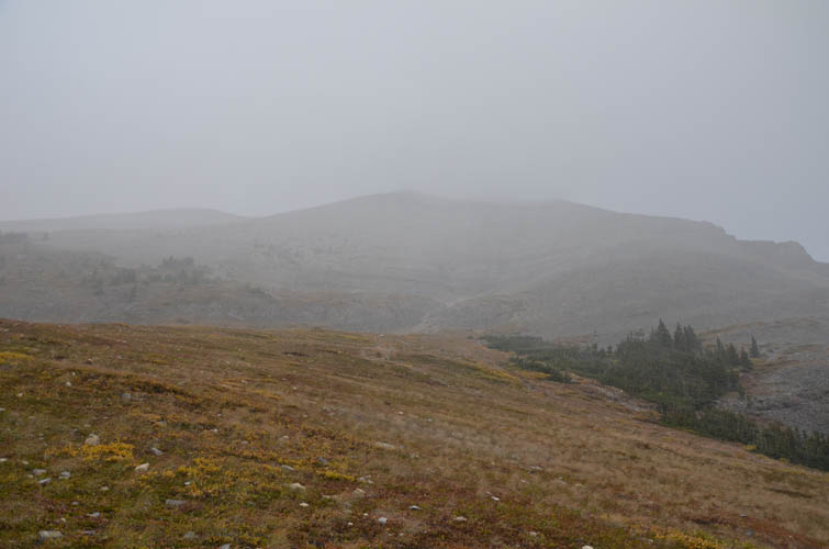
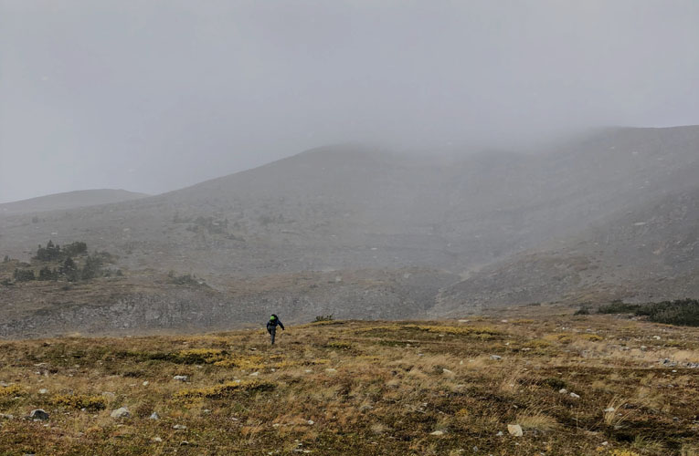
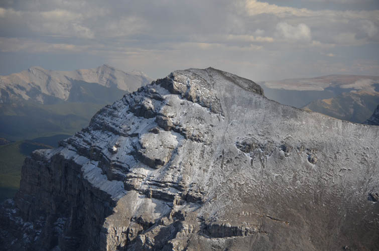
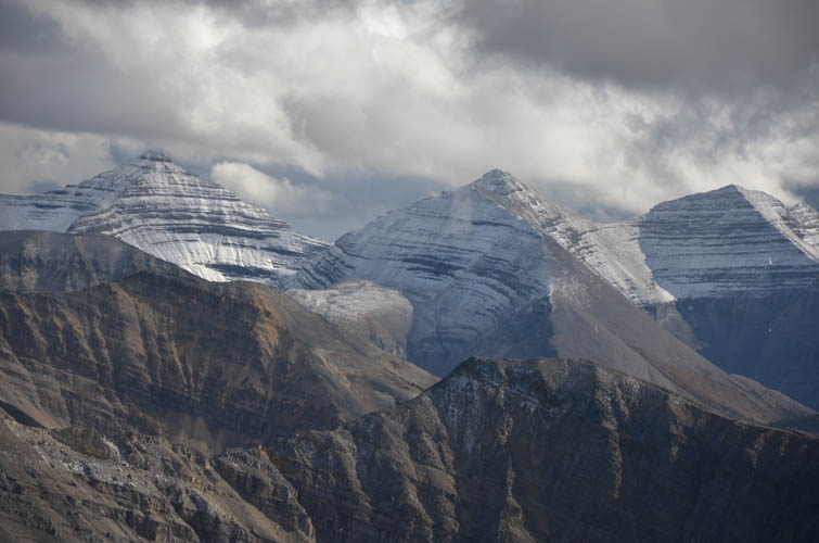
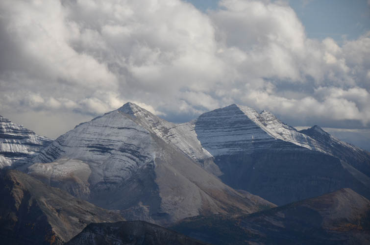
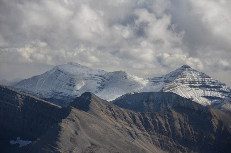
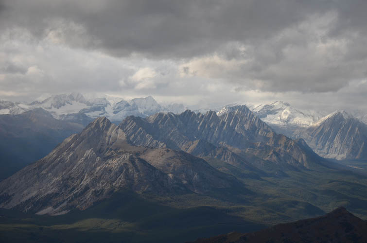
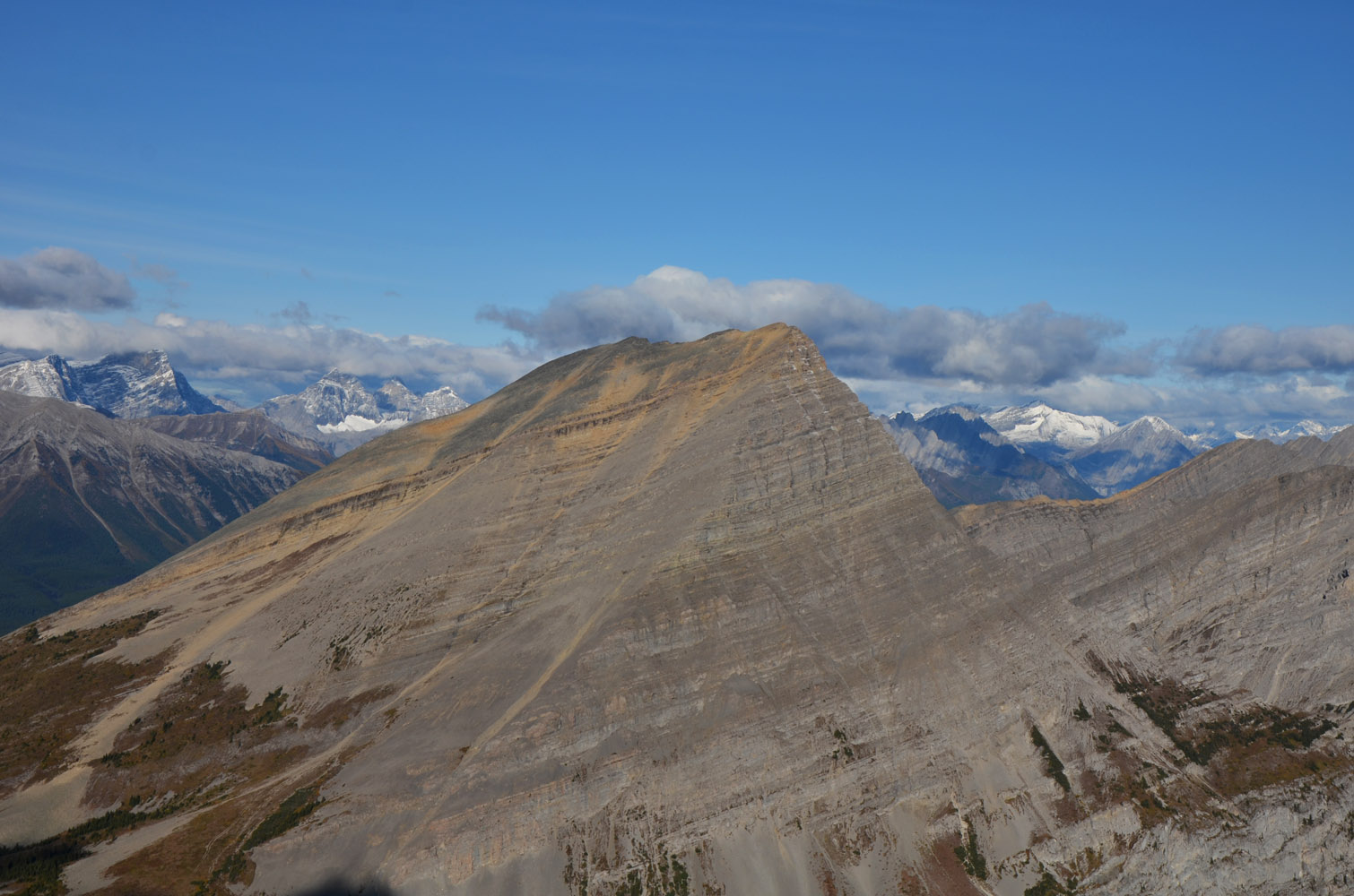
The beautiful southern and eastern cliff faces of Mount McPhail looked stunning from our bivy site while the sun was out, but that didn’t last long. After a relaxing lunchbreak, as we plodded up a faint trail east towards Weary Creek Gap, the skies darkened once again and a light snowfall made us zip up our jackets. By the time we headed north towards McPhail’s central ascent gully we felt like we were in a full-out winter storm with winds gusts pushing us sideways. Wen had enough at this point and decided to go back to camp. Ten minutes later Sean followed suit and turned around as well. I don’t blame them… The mountain looked scary in these conditions. Visibility was so poor, I couldn’t even see a proper ascent line.
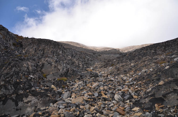
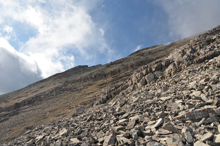
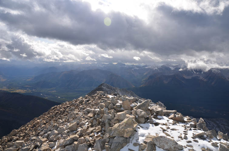
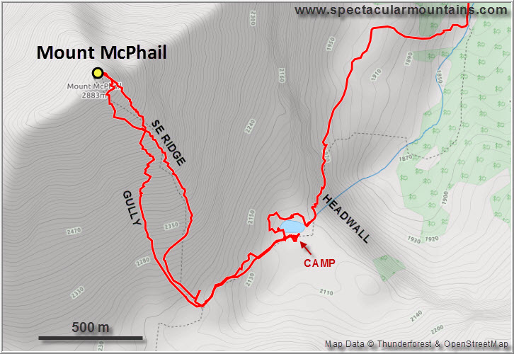
But I trudged on, hoping the skies would eventually clear up… and they did! I chose the central gully for the ascent, which was actually quite enjoyable and kept me busy as I was trying to scramble up the various cliff bands and rock steps, so busy I didn’t even notice that the storm had subsided about half-way up. This is also where I was forced all the way right onto the SE ridge by one particularly tall cliff that I didn’t feel like climbing. Once on the ridge all I had to deal with was a steep slope of loose angular rock chunks, not the most pleasant terrain and certainly quite annoying in places, but also not the worst I’ve seen. While the gully was more in the moderate scrambling realm, the ridge was mostly steep hiking mixed with easy scrambling.
During the slog up I felt completely out of shape and quite weak for some reason. Perhaps it was the three beers the night before, or the lengthy approach, or the psychological strain of “having” to tramp up a mountain in poor conditions while my team mates were relaxing at camp. It was probably a combination of all of these factors. Seeing the summit appear on the ridge not far before me, with mostly blue skies above, was nothing short of revitalizing. I literally felt the adrenaline rush through my system, giving me a huge burst of energy to complete the climb.
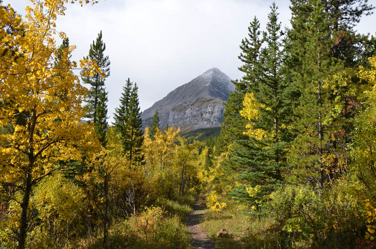
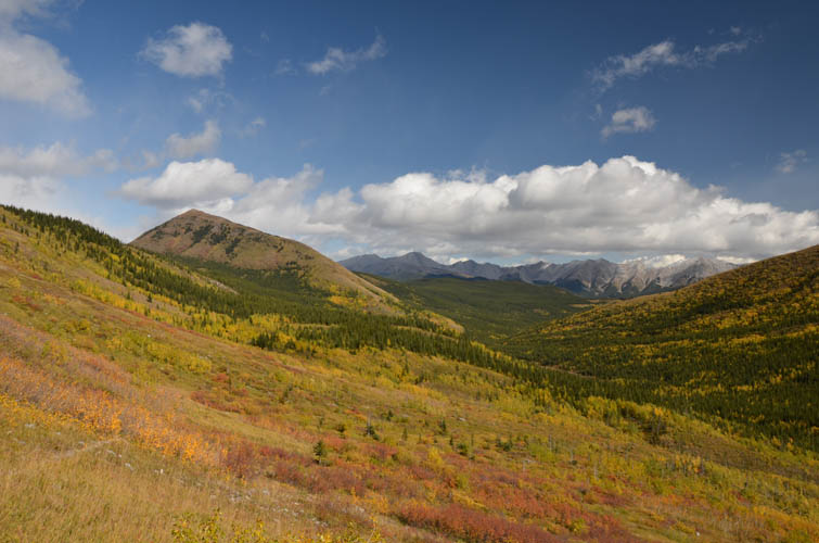
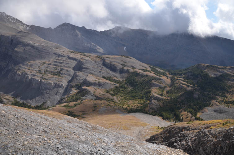
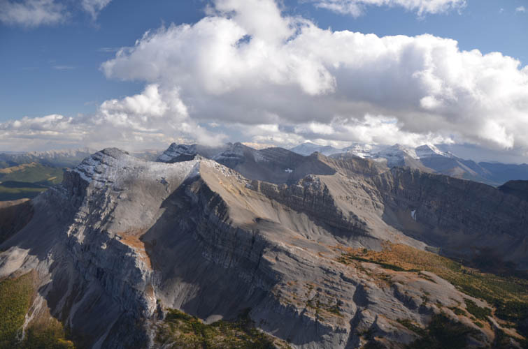
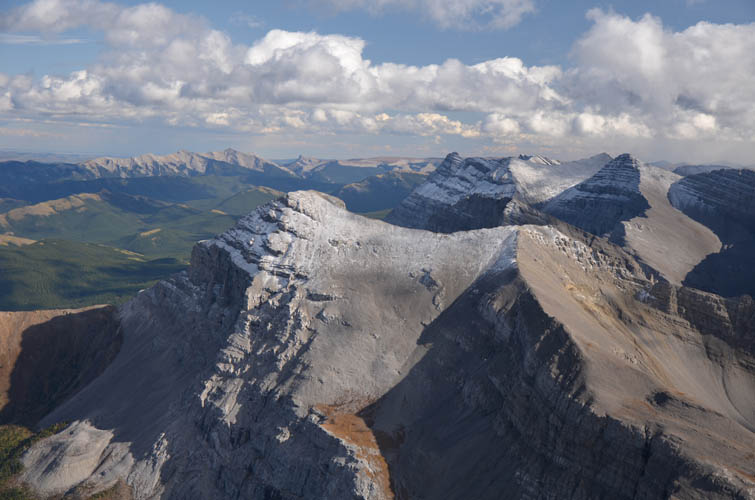
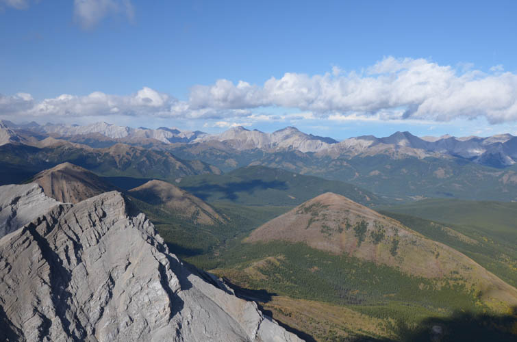
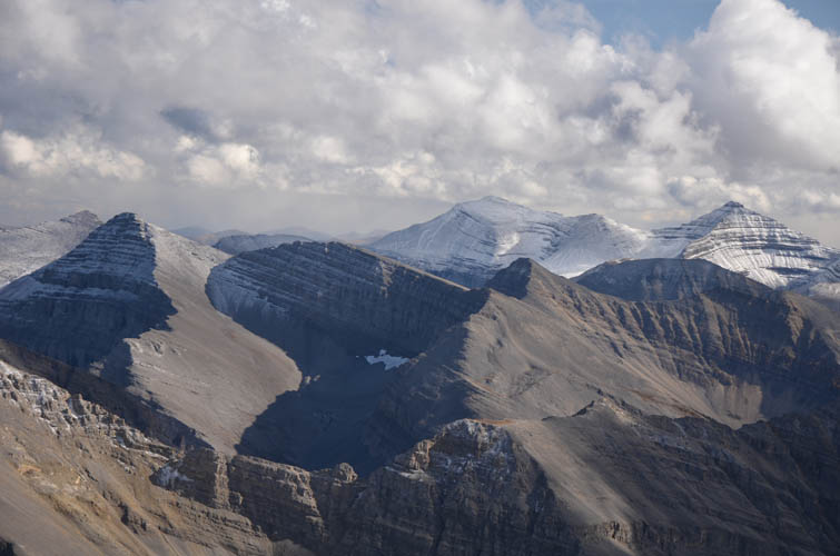
There was a bone-chilling wind at the summit, but I made sure I took a good look around me from this fantastic vantage point. Mount Bishop and Horned Mountain to the north, a plethora of snow-clad peaks in BC far to the west, and gorgeous Mount Muir – our next day’s objective – immediately to the south along the Continental Divide. I felt so lucky I had hit the right time window and was blessed with such gorgeous views. An hour earlier or later and all I would’ve seen at the summit would’ve been a soup of grey clouds!
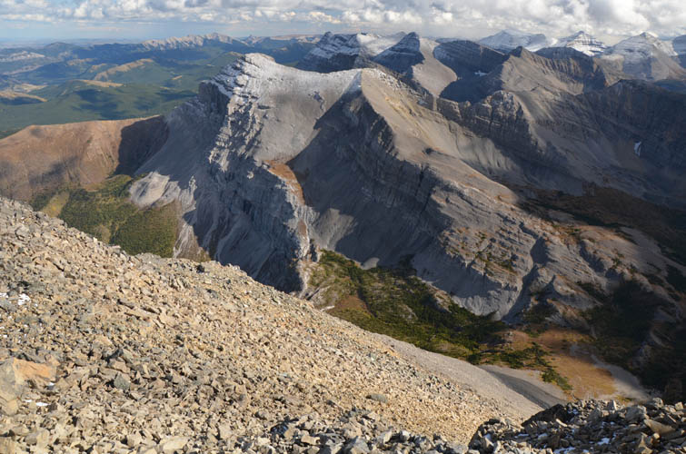
On descent I initially tried some promising-looking scree in the upper gully, but soon veered left (east) towards the SE ridge to avoid the numerous cliffs that are hard to judge from above. Overall the descent was tedious, but not all that bad. Soon I was back on the grassy ascent slopes, heading down the trail back to camp shortly after. Wen and Sean already had an awesome campfire going when I arrived. We spent the rest of the evening playing frisbee, sitting around the fire, and chatting about bears, Chinese food, and world politics. The warmth of the fire was comforting, but it soon got so chilly that we were better off wrapping ourselves in our down sleeping bags and calling it a night.
|
Elevation: |
2886 m (official), 2887 m (my GPS) |
|
Elevation gain: |
1540 m (790 m from camp) |
|
Elevation loss: |
1000 m |
|
Time: |
8.5 h (3 h camp to camp) |
|
Distance: |
18.2 km (4.5 km camp to camp) |
|
Difficulty level: |
Easy to moderate depending on route (Kane), T3/T4 (SAC) |
|
Reference: |
Nugara |
|
Personal rating: |
3 (out of 5) |
NOTE: This GPX track is for personal use only. Commercial use/re-use or publication of this track on printed or digital media including but not limited to platforms, apps and websites such as AllTrails, Gaia, and OSM, requires written permission.
DISCLAIMER: Use at your own risk for general guidance only! Do not follow this GPX track blindly but use your own judgement in assessing terrain and choosing the safest route. Please read the full disclaimer here.