Radomire, Albania
7 September 2018
Solo
At the top of Albania (and Macedonia)
Mount Korab, also known as Maja e Korabi in Albanian, is the highest peak in both Albania and Macedonia. It’s a popular destination with lots of hikers coming up from the Macedonian side, but only few people seem to climb it from Albania and I had a hard time finding any information on this route. The little I found suggested that it was apparently quite a lengthy trip with lots of elevation gain… We were driving through northern Albania en route to Kosovo, so of course Mount Korab was too enticing to pass up!
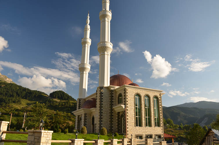
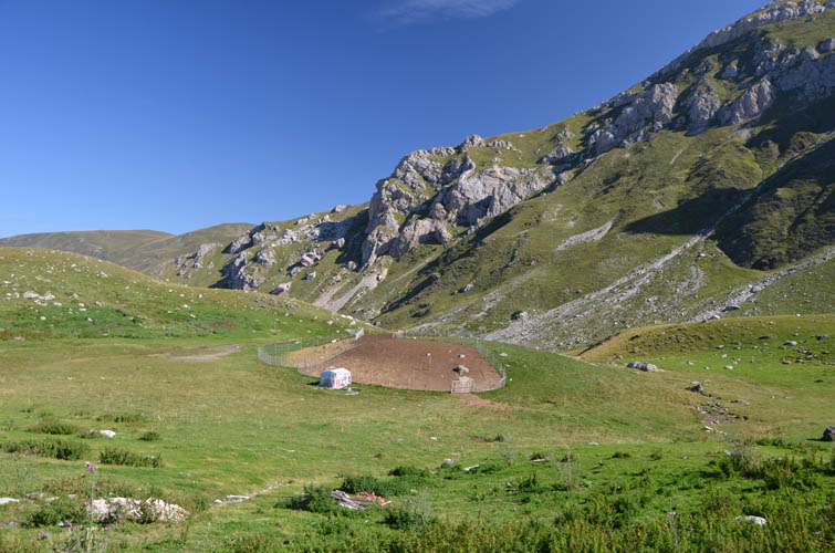
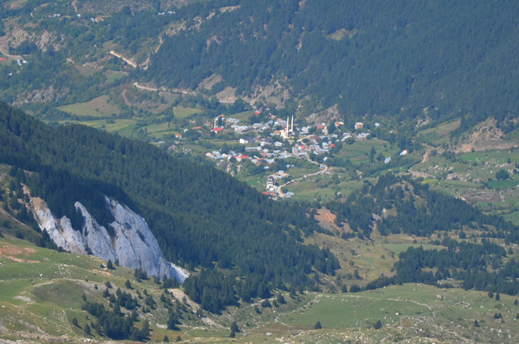
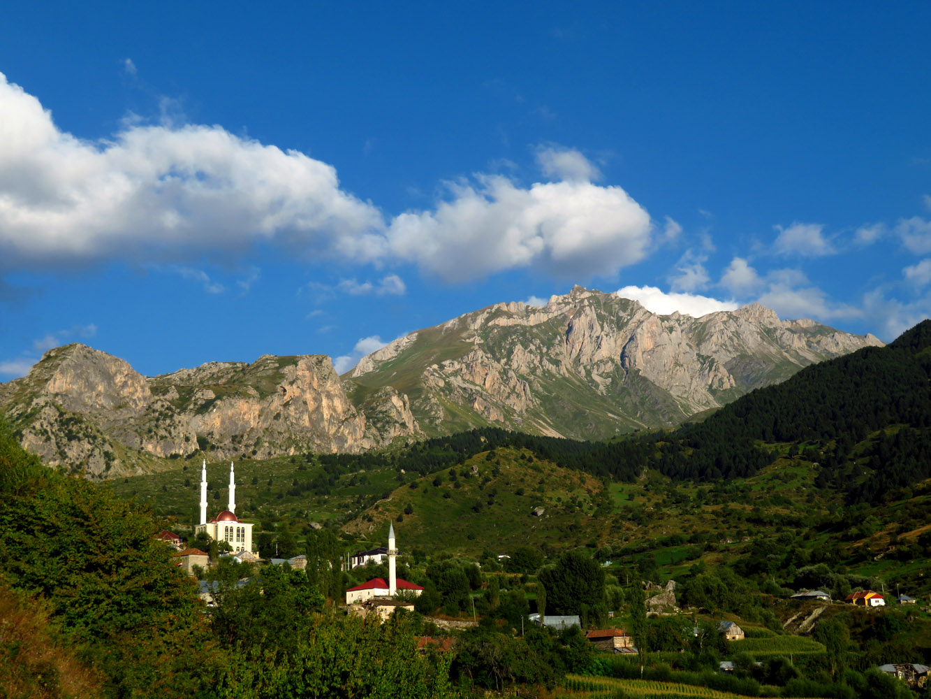
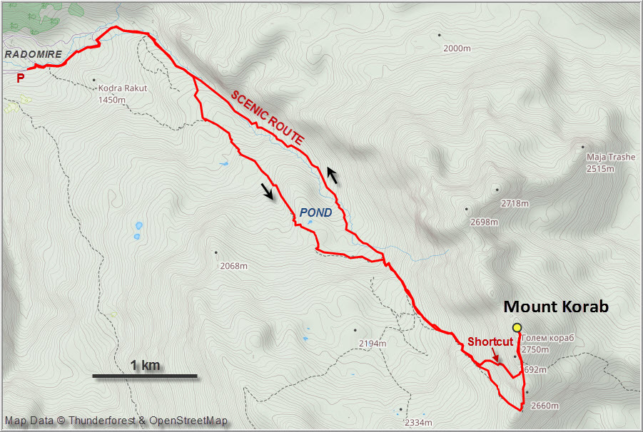
The drive to the village of Radomire from the northern town of Kukes is in itself quite a beautiful journey along a winding mountain road through this remote part of Albania. The last few kilometres to Radomire are super slow going on a bumpy gravel road. The sight of Radomire’s shining new mosque when you enter the village really takes your breath away. The bronze-coloured minarets stand out brilliantly in the majestic green mountain scenery.
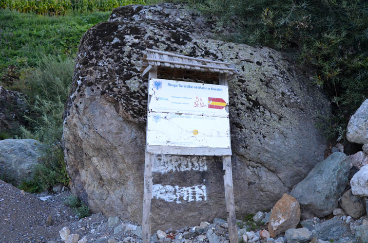
We found a great camping spot for our van just on the other side of the village and only a hundred metres from the trailhead. The next morning, I set off around 7:30 am while Wen wanted to spend the day resting and reading.
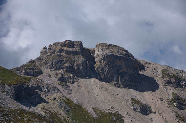
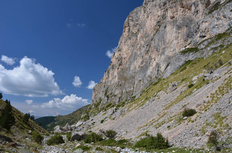
Initially, the trail is well-marked as you follow a small brook upstream and to a small collection of farmhouses underneath an impressive vertical cliff. The trail then veers up a rise slightly to the right. Here, I lost the red-white-red paint markers and decided to head straight across a gently undulating grassy plain – always uphill of course and in the middle of the broad valley. It worked out quite well as I soon found another trail that led to a farmhouse and animal enclosure near a small pond. There was nobody around, it was almost eerily quiet…
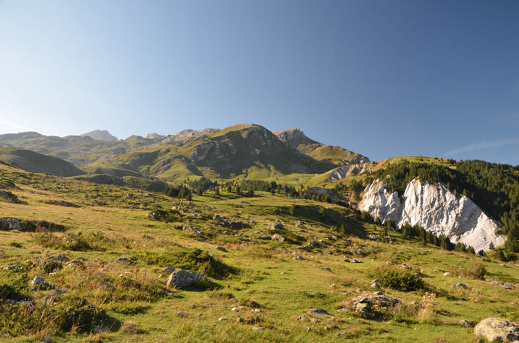
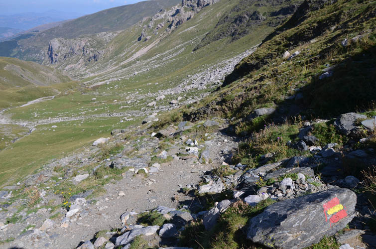
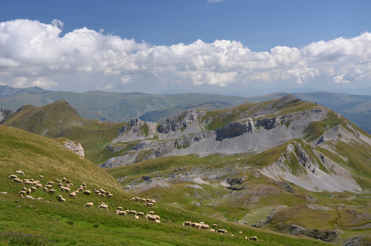
Just after the pond, the trail I was on rejoined the main trail with the paint markers. This was just before several rocky switchbacks going up a steep slope to the upper part of the valley, where the path disappeared. The paint markers (not all strategically well-placed) guided me through this lovely green valley, but you could simply walk across the grass and take the line of least resistance. The terrain is really easy and gentle here, so you can’t really go wrong. It’s a very quiet and peaceful place up here, the only sounds coming from a distant herd of sheep grazing on the side of the mountain. A lone shepherd walking across the grass barefoot with just a small plastic bag in his hand was the first person I saw all day.
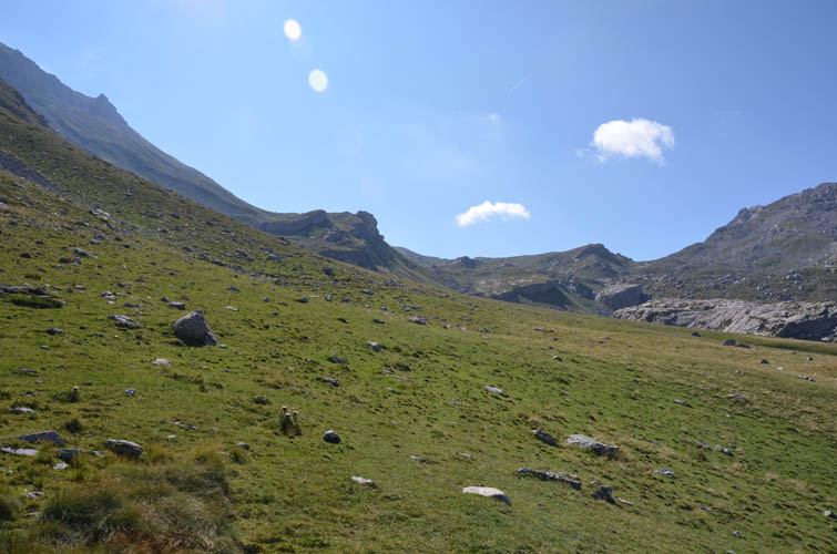
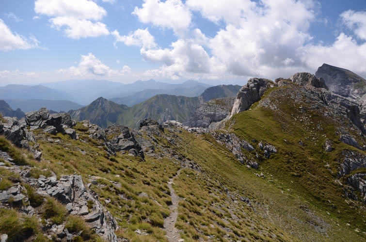
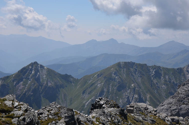
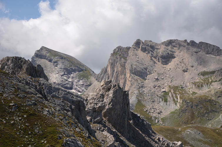
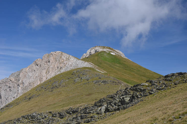
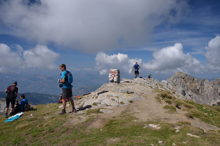
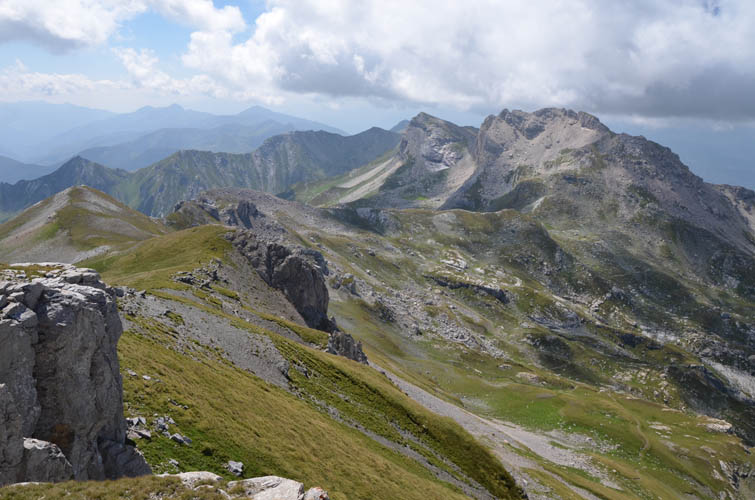
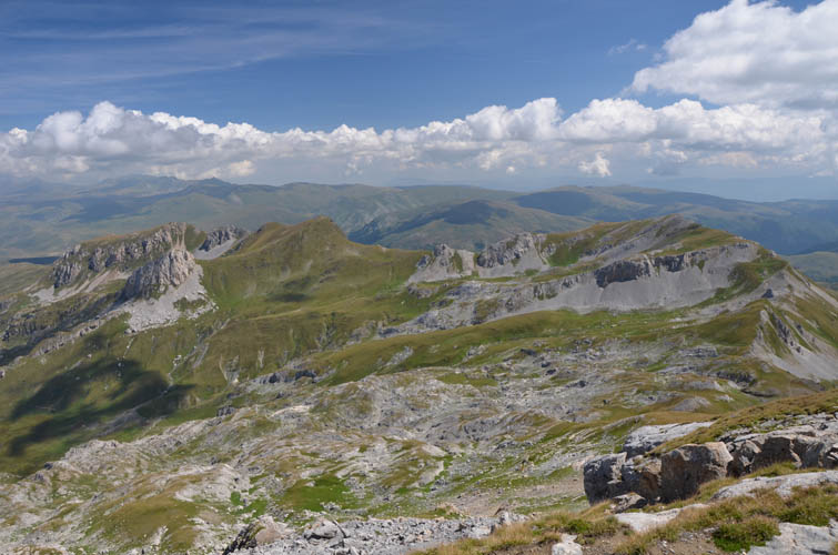
The route basically leads all the way to the end of the valley, where the paint markers disappear completely, and to a small saddle on the ridge which marks the border with Macedonia. Once on the saddle at the ridge top, beautiful views of dozens of other Albanian and Macedonian peaks open up. Turning left (north) at the saddle, It’s a straightforward ridge walk on a beaten trail from here to Korab’s summit.
There were about a dozen other hikers that had come up on the Macedonian side and, looking down to the east, I could see more people slowly making their way up. This is no doubt a popular hike! We were all sitting around the broad summit enjoying fabulous 360 degree views on a perfect sunny day. I wish I had more time to explore the mountains in this area!
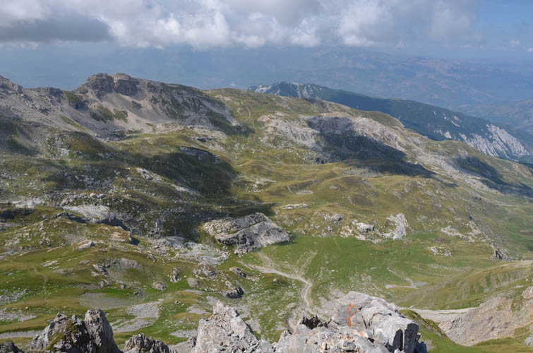
My original plan was to simply follow the same route back down, but I found a shortcut by making a sharp right turn about 400 m south of the summit and hiking down steep grassy slopes instead of going all the way back to the saddle. Back in the valley I passed one other group of hikers that were heading to Radomire, but had no chance to talk to them. Near the small pond below the switchbacks, I looked hard for the paint markers to try to stick to the “official” route. This route effectively hugs the right (eastern) side of the valley when descending and goes through some really interesting terrain full of large boulders and steep cliffs on the right. It’s definitely the more scenic route, but my ascent route was probably faster and more efficient.
Back at our van I found Wen surrounded by several locals, curious about what she was doing here. She had been dealing with passersby all day, making here very uncomfortable at times as a lone woman. Albania is a male-dominated society after all, and seeing a foreign girl alone can cause a lot of interest, if not suspicion, especially in the more remote rural areas. While I was happy to be back, Wen was even more relieved to see me!
Mount Korab was a really pleasant and easy outing through a very mellow and picturesque landscape. While the Macedonian route is definitely the more popular one, the Albanian side is the more tranquil and adventurous option.
| Elevation: | 2750 m (official), 2751 m (my GPS) |
| Elevation gain: | 1550 m |
| Time: | 7.5 h |
| Distance: | 16.2 km |
| Difficulty level: | Easy (Kane), T3 (SAC) |
| Reference: | None |
| Personal rating: | 4 (out of 5) |
DISCLAIMER: Use at your own risk for general guidance only! Do not follow this GPX track blindly but use your own judgement in assessing terrain and choosing the safest route.