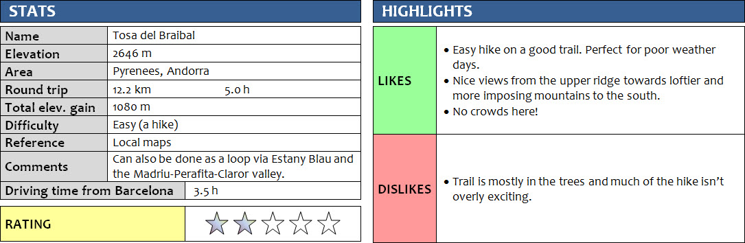
Pyrenees, Andorra
13 June 2018
With Wen
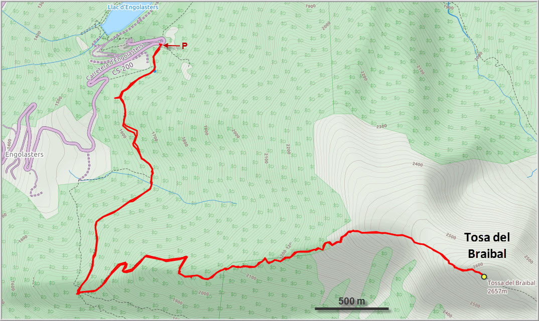
Once again the weather was not looking good today. We were staring at dark clouds moving overhead as we were sitting in our van at the end of the Ransol valley, contemplating our options for today. Duty-free shopping in Andorra’s malls? Definitely not! Two friendly Spanish hikers who came by suggested we try the area southeast of Andorra La Vella, which often sees clear skies when the rest of the principality is socked in. We checked our maps and decided on a short ridge walk to a high point called Tosa del Braibal.
Sure enough, when we arrived at the parking lot near the Engolasters lake, the sun had come out and we were in high spirits again. The hike up to Tosa del Braibal is pretty quick and straightforward. Lots of people, including a school group, were out and about on the wide main trail at the beginning. Once past the turn-off for the Tosa del Braibal trail we were completely alone and didn’t see anyone else for the rest of the trip.
The path is excellent but mostly in the trees for the first 75%, so there’s really not much to see. Before leaving the forest the trail goes through an area of large boulders on the ridge top. The last part is on a wide, open, grassy ridge, which is probably the best part as you can enjoy beautiful views of the impressive mountain chain to the south from here. Grey clouds now started to move in and out, and we could see neighboring valleys and ridges getting rained in but thankfully we never even got a drizzle.
From the summit it is possible to continue along the ridge towards Estany Blau, descend into the Madriu-Perafita-Claror valley and then return from here. We didn’t want to push our luck with the weather and were just as happy to turn around at the summit.
Overall not the most exciting trip, but a good workout hike with nice views.
DISCLAIMER: Use at your own risk for general guidance only! Do not follow this GPX track blindly but use your own judgement in assessing terrain and choosing the safest route.
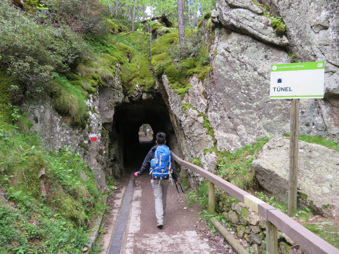
A neat tunnel built for a short section of the trail at the beginning.
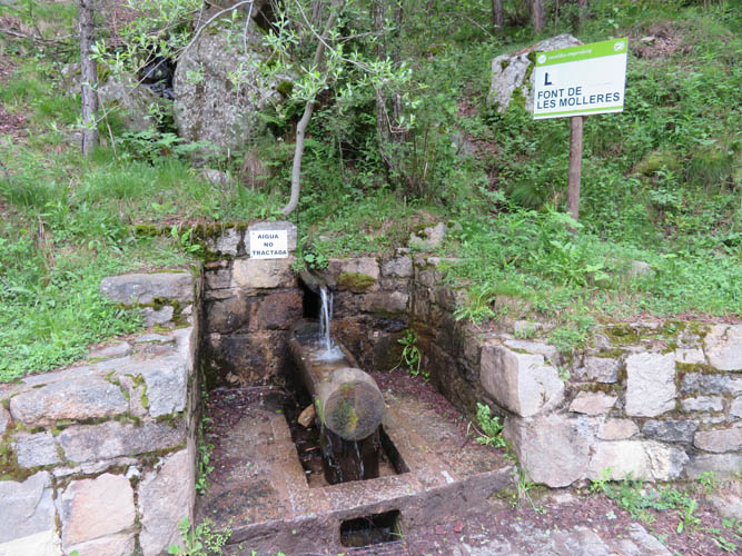
There are several “fonts” (springs) along the lower trail.
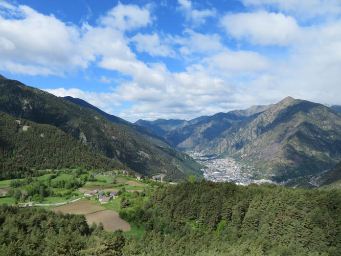
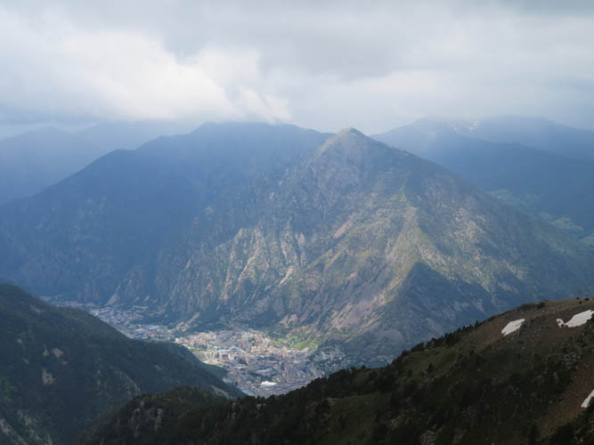
Sunny view to the south: Andorra la Vella, the principality’s capital.
Yep, it’s a workout!
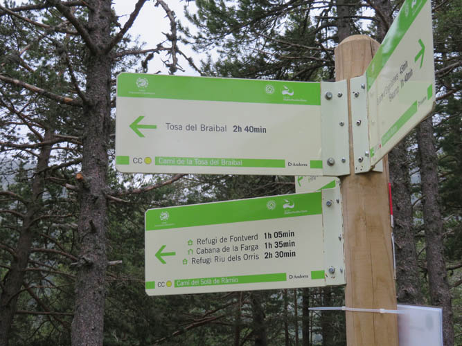
At the trail intersection – 2h 40 min to the top of Tosa del Braibal according to this sign. The times seem to be pretty good estimates, at least by our standards.
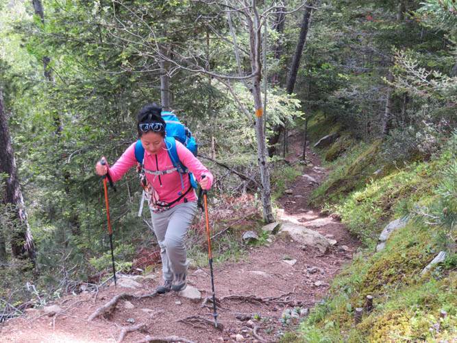
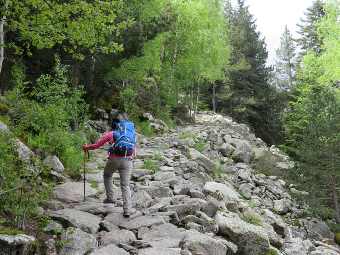
Plodding up the Tosa del Braibal trail.
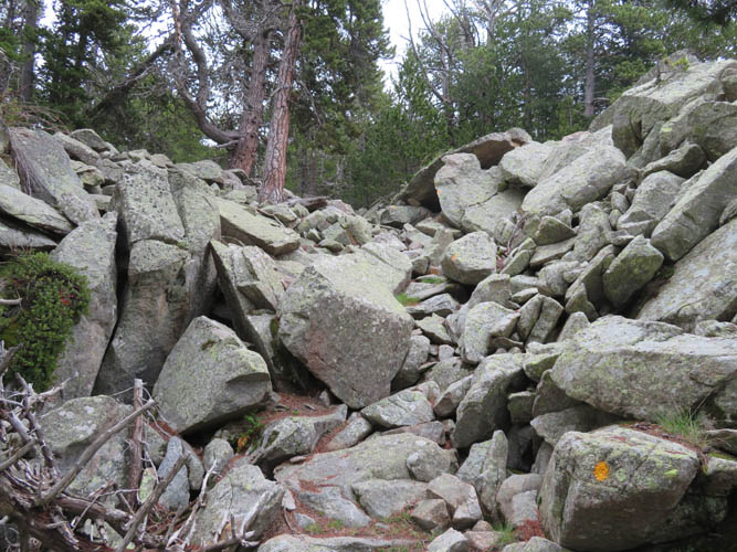
The boulder field, well marked with yellow paint.
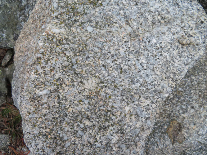
The boulders are made of granite.
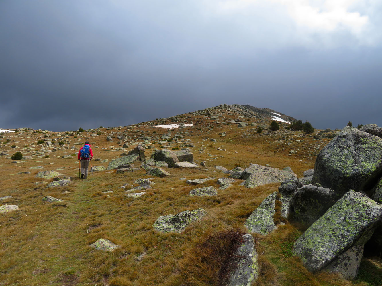
Towards the summit, dark clouds looming above.
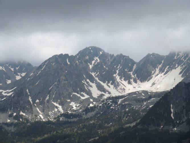
To the south, these craggy mountains really remind me of the front ranges in the Canadian Rockies.
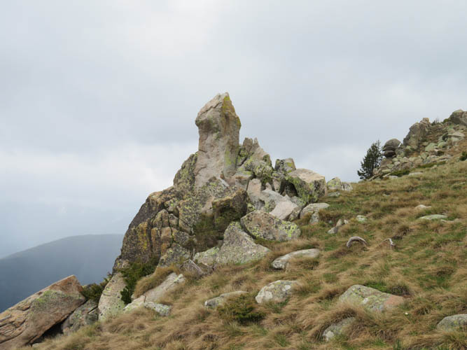
Interesting outcrops along the ridge – looks like an arrow, spearhead, or maybe something else…
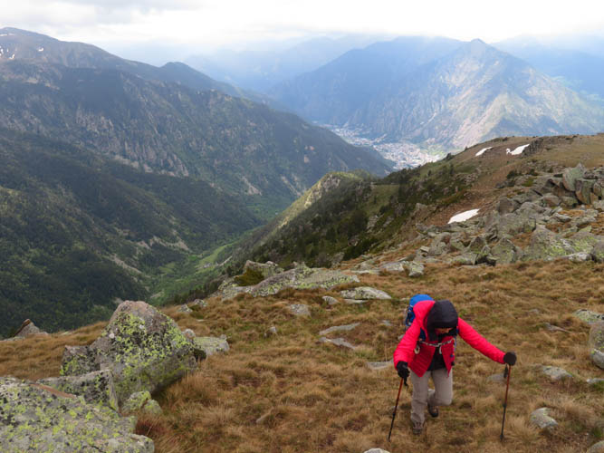
Wen coming up the upper part of the ridge.
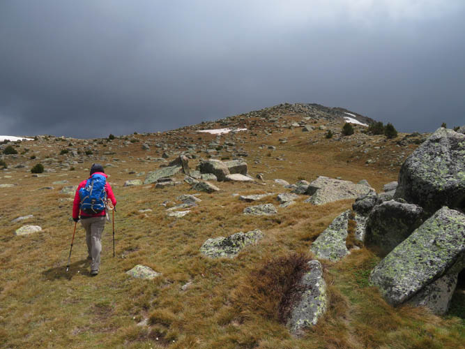
Yes, the weather has definitely turned. We are still lucky our ridge, completely avoiding the rain!
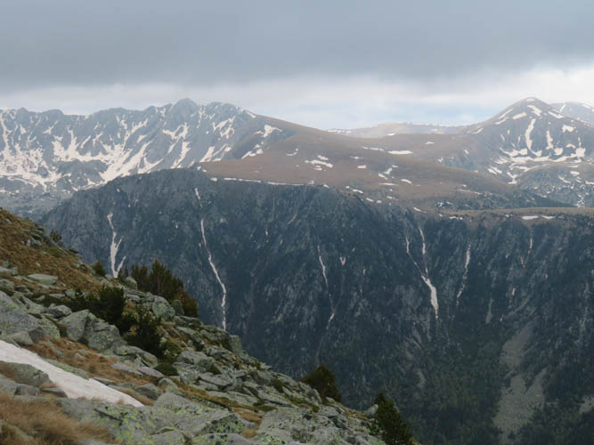
Fantastic hiking and scrambling possibilities on the other side of the Madriu-Perafita-Claror Valley.
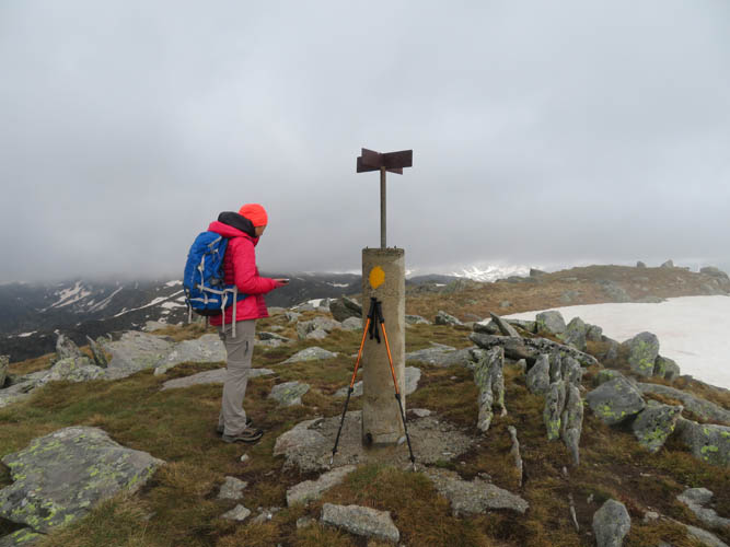
At the summit of Tosa del Braibal, looking east. Time to head down!