Harz Mountains, Germany
29 December 2019
With Tilo
A hike along the inner-German border
The Brocken is the highest point in the Harz Mountains, a relatively small and low-lying range that straddles the border between Lower Saxony in West Germany and Saxony Anhalt in the east. Although more of a big rounded hill than a proper peak, the Brocken stands out as the last significant promontory before the flat expanse of Germany’s northern plains. It’s a popular destination for tourists and hikers on any given day, but when the sun is out it’s simply teeming with people as Tilo and I were about to find out today.
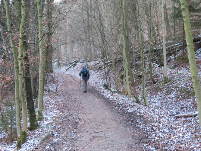
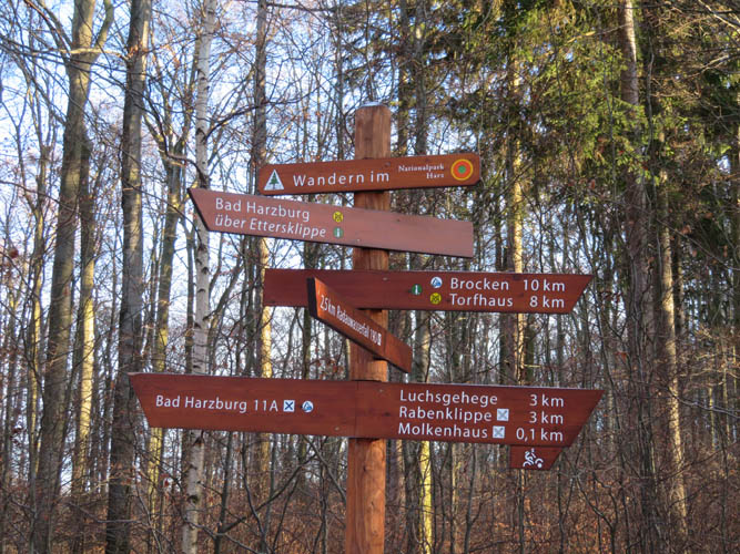
Tilo had done this trip a couple of times before and I was glad to have him guide me up the mountain and simply follow in his footsteps. There are numerous ways to the top from various levels of elevation all around the mountain, but the route he picked is one of the best ways to get a good mix of popular scenic pathways and narrow trails far away from the crowds.
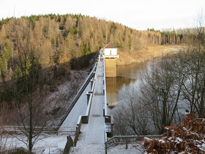
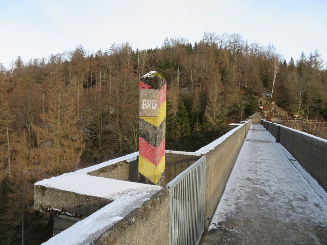
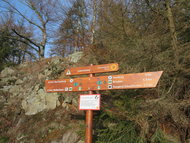
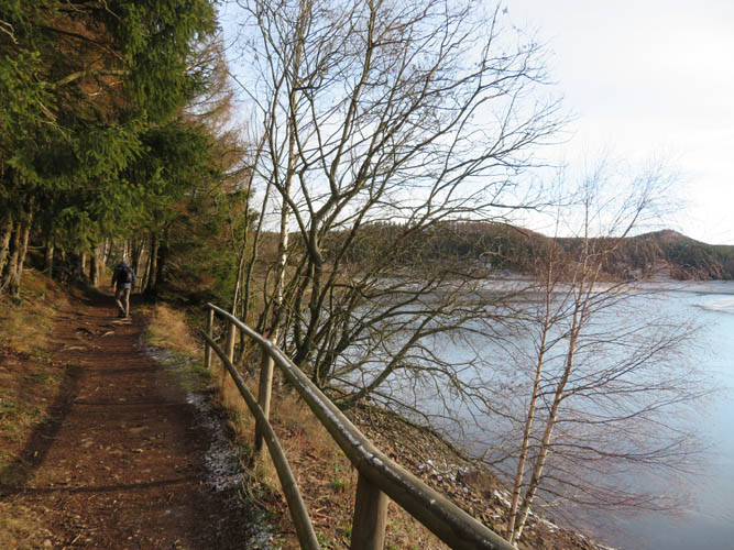
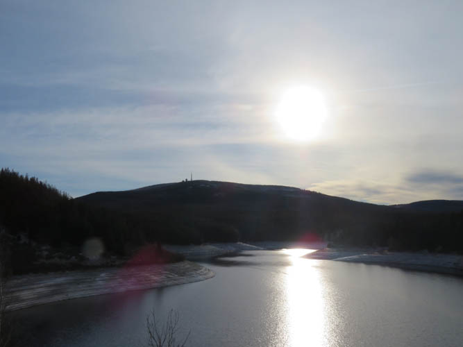
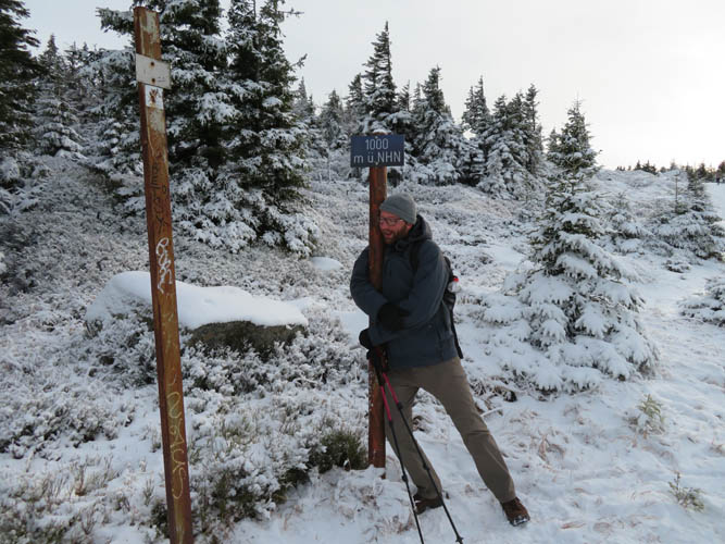
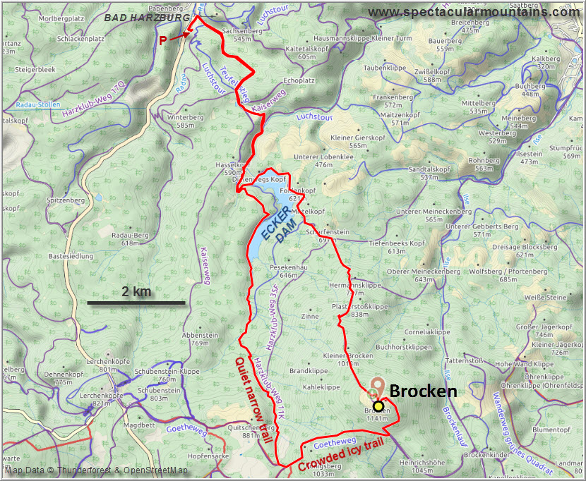
We started in the small town of Bad Harzburg on the northwestern side. The “ascent” really is a nice extended stroll on a network of excellent paths, passing by a number of scenic spots such as the Ecker dam (Eckertalsperre). This large artificial lake demarcates the former border between West Germany and communist East Germany and access was heavily restricted at the time. A concrete post marking the border at the halfway point on the dam wall is the only reminder left of this era of separation.
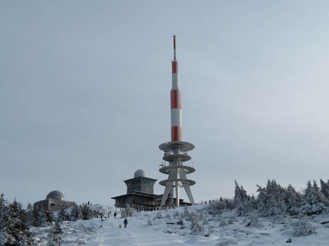
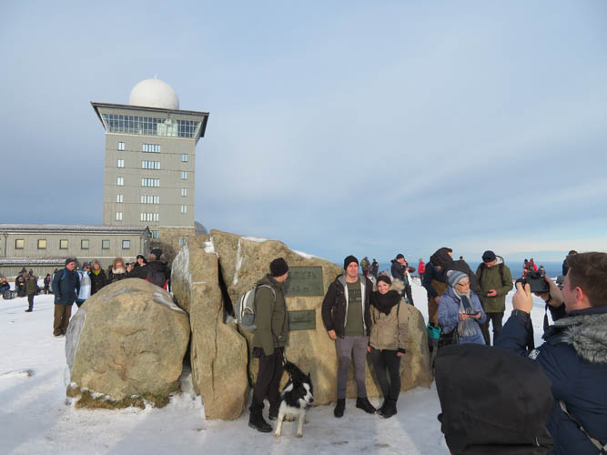
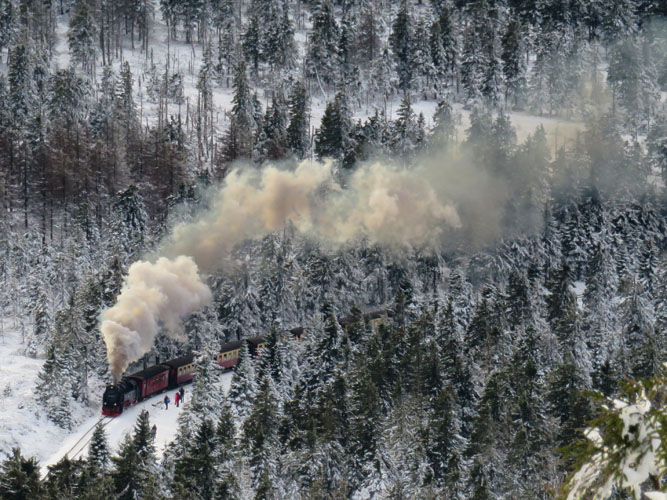
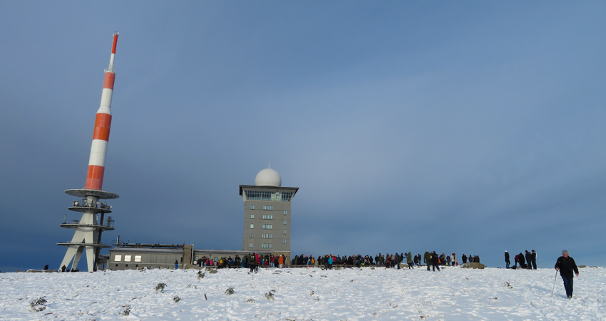
Time flew by as we chatted to catch up and before we knew it we had reached the broad open summit area with its massive rocket-like radio tower on top. There is also a big restaurant, a museum, a hotel, and a train station. Yes, a train station! This is the only mountain I’ve ever hiked that has a train line going to the top, albeit a tourist-type train pulled by an old noisy steam engine.
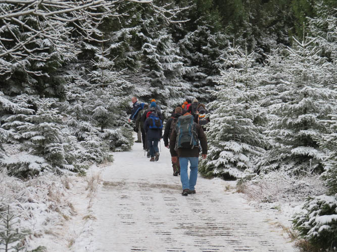
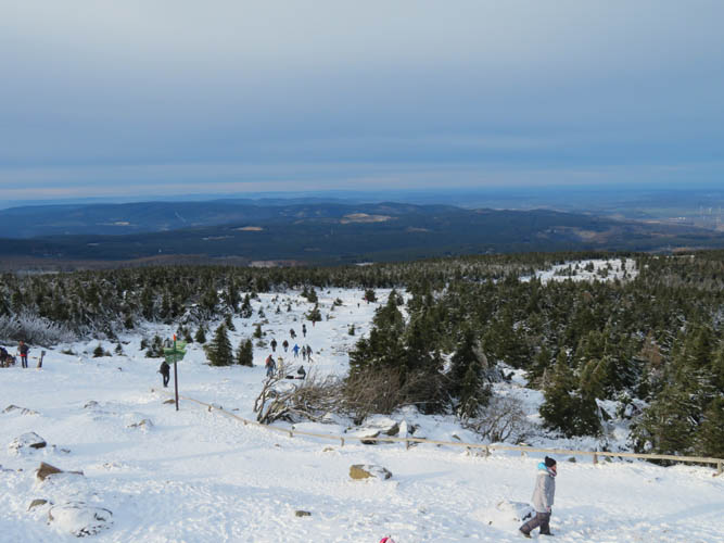
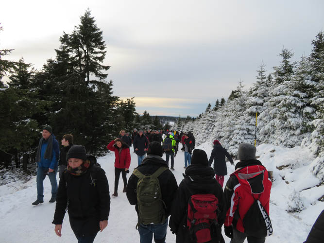
There must’ve been hundreds of people crowding the summit area today. Understandable – it was a beautiful sunny day offering great views of the surrounding hills and the vast flat plateau of the North German Basin. Most people come up via a much shorter route from the south and many also take the train.
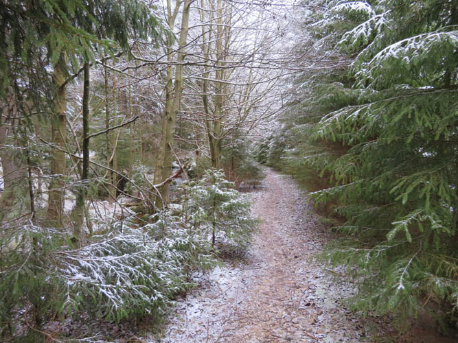
After a short lunch break all we wanted was to leave the crowds behind us, but we were still rubbing shoulders with a seemingly never-ending stream of visitors on the first stretch down where we followed part of the popular route. The pathway here was wide, but the hordes had trampled down the snow so much that the surface was iced up and super slippery in places. Microspikes would’ve done wonders here, but of course nobody including us had them. We spent a long time making our way down the icy sections until we finally hit the turn-off to a much smaller trail that basically had no traffic at all, and no ice. A lovely narrow trail through the forest along a small gurgling creek, very scenic and peaceful. This was probably my favourite part of the day!
We still had a long way to go and half-way down the narrow trail we realized that we had to up our pace if we wanted to make it back in time for Tilo’s train ride home to Berlin. The scenic trail joined up with several others and took us back to the western side of the dam. Once we had passed the dam, we rejoined our original route and spent the last couple of hours hiking down in the dark. We arrived at the train station with a mere 10 minutes to spare, happy about the fortunate timing and a great day spent exploring the many trails of the Harz Mountains. Thanks Tilo for showing me around!
|
Elevation: |
1142 m (official), 1143 m (my GPS) |
|
Elevation gain: |
1200 m |
|
Time: |
6.5 h |
|
Distance: |
27.3 km |
|
Difficulty level: |
Easy (Kane), T1 (SAC) |
|
Reference: |
Local maps |
|
Personal rating: |
3 (out of 5) |
NOTE: This GPX track is for personal use only. Commercial use/re-use or publication of this track on printed or digital media including but not limited to platforms, apps and websites such as AllTrails, Gaia, and OSM, requires written permission.
DISCLAIMER: Use at your own risk for general guidance only! Do not follow this GPX track blindly but use your own judgement in assessing terrain and choosing the safest route. Please read the full disclaimer here.