Sulaymaniyah, Iraq
2 November 2018
With Kawan
A small peak that turned out more tricky than expected
Time and time again I’ve made the experience that, in a foreign land, the best trips are the ones undertaken with local friends. It was thus with much excitement that Wen and I accepted an invitation by Kawan, my good friend Kam’s brother, to join him and his family on a day trip to Jasana Cave in the mountains between Sulaymaniyah and Dukan in eastern Iraqi Kurdistan..
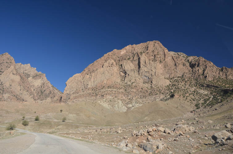
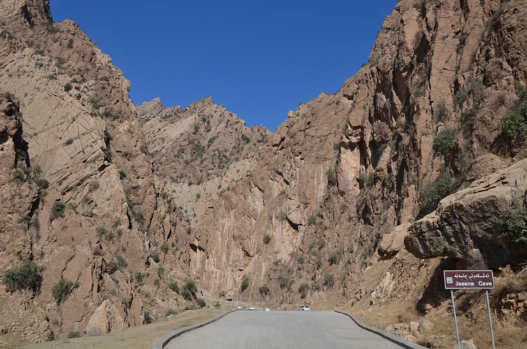
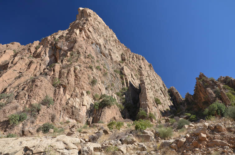
Located in a narrow canyon at the foot of a craggy mountain, Jasana Cave is a popular picnic spot and weekend-getaway for locals and visitors alike. The mountain that hosts the cave, on the other hand, is not exactly known as a hiking or climbing destination. As with most peaks in Iraq, route information is non-existent and hiking trails – official or unofficial – do not exist here.
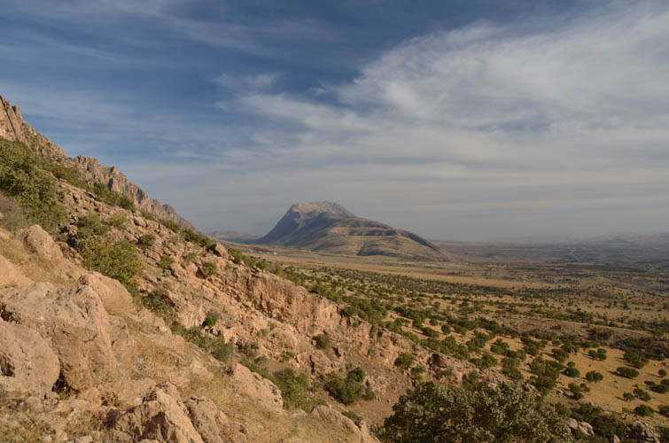
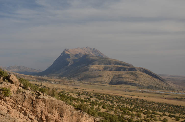
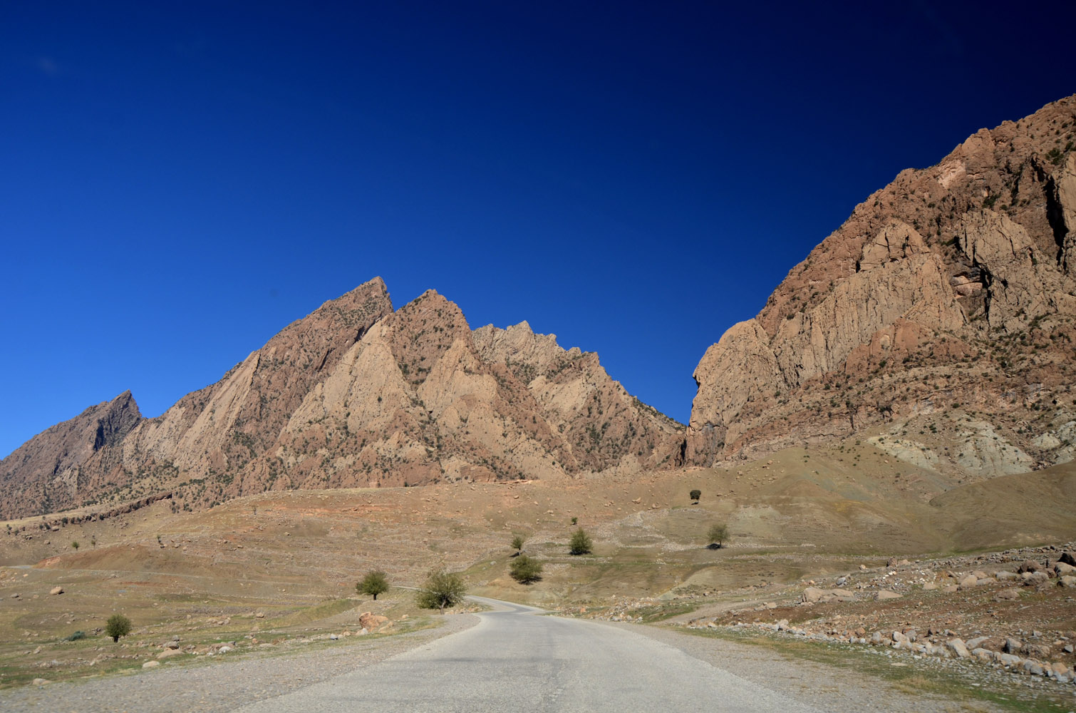
The drive from Sulaymaniyah takes about an hour and a half and is well worth the journey, with scenic views of the Piramagrun massif and the jagged ridges surrounding Sarah Mountain. A small road goes off the main Dukan-Suly highway and ends right at the entrance to a small canyon near the cave. There were only about a handful of other people around when we arrived, so we had our choice of picnic spots.
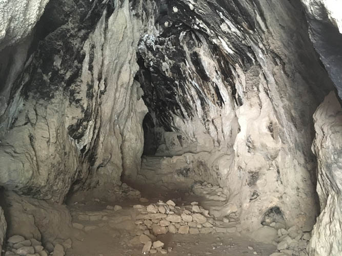
A visit inside the cave is a pretty short affair. It’s a large dome-shaped cavern within the near-vertically tilted beds of rock that shape the western slopes of the mountain ranges here. With a large entrance and flat floor it’s easy to access, but not very deep. No doubt this is a popular place for picnics and BBQ’s, especially when reprieve from the sweltering heat of the summer is needed.
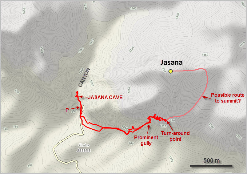
After visiting the cave, Kawan and I decided to do some exploring and find a way up the peak itself. With an estimated maximum elevation of perhaps 1670-1700 m, it’s not really a big mountain and shouldn’t be a big endeavour… Unless, of course, your route is barred by countless cliffs and vertical slabs of rock!
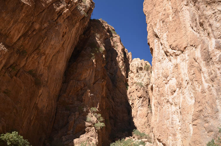
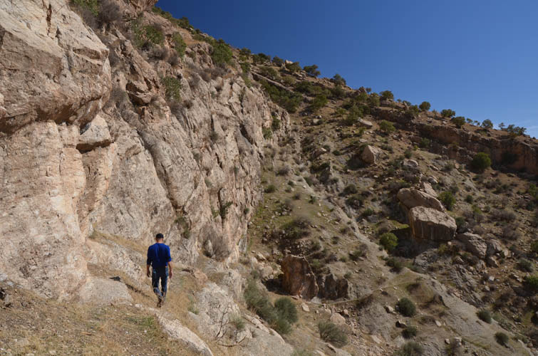
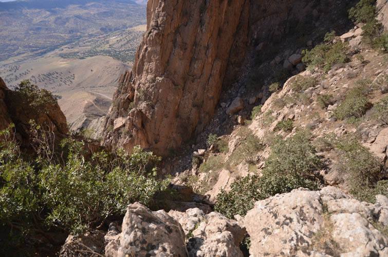
We first tried our luck by following the canyon northward but got turned around after only 50 m past the cave. It was only one difficult step up a big rock boulder wedged between some slabs, but without climbing equipment or at least some basic protection it wouldn’t be smart to scramble up here. The rock is exposed and a fall would probably end quite badly.
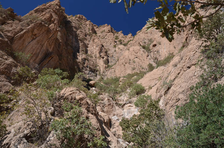
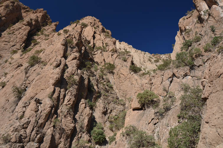
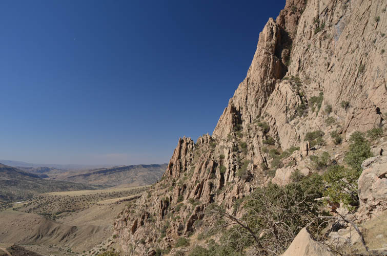
No choice but to turn around and try the southern side of the peak. The south face consists of an impressive arrangement of huge, vertically tilted layers of rock that end in sharp, jagged sawtooth ribs at the top. In a few places – at least this is what it seems from below – these massive walls of rock are interrupted by narrow gullies that might offer a way through.
After contouring around the base of the slabs for a while, we eventually found a promising gully. The scrambling here was really interesting, mainly because the terrain is so complicated. Potential routes are hard to spot as you can’t see far ahead and game trails are very faint, if at all present. The terrain can be quite confusing and therefore involves plenty of routefinding, but we had a lot of fun going up and down various gullies and rock ribs. While most of the scrambling was easy, there were a few tricky spots as well.
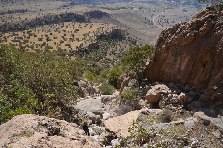
Progress was slow in these cliffs and eventually we ran out of time, just as we got to a point where there appeared to be an easy route up to a saddle east of the summit. It was pretty obvious that we still had quite some elevation gain left to make it to the top, so we decided to turn around instead and follow the same route back.
This was a great little exploratory trip in a beautiful area with tons of potential for some good scrambling. I’ll have to come back one day to join Kawan and Kam to complete this ascent, inshallah… Thank you Kawan, for a very enjoyable day out!
|
Elevation: |
1316 m (my GPS) |
|
|
Highest point reached. |
|
Elevation gain: |
700 m |
|
Time: |
4.0 h |
|
Distance: |
4.9 km |
|
Difficulty level: |
Moderate (Kane), T4 (SAC) |
|
Comments: |
– No water source encountered on this route |
|
|
– Stats here refer to attempt only. |
|
Reference: |
No route info was available to us prior to trip |
|
Personal rating: |
3 (out of 5) |
DISCLAIMER: Use at your own risk for general guidance only! Do not follow this GPX track blindly but use your own judgement in assessing terrain and choosing the safest route.