Banff, AB, Canada
2 + 3 September 2019
With Vern & Mike
Remote peaks in one of the most beautiful corners of Banff National Park
Day 1 & 2: Approach. Deluc Peak & Dip Slope Mountain
For a long time, the whole summer really, I had been looking forward to doing a multi-day, multi-peak backpacking trip somewhere in a remote part of the Rockies. Endless ideas crossed my mind and eventually were narrowed down to a few realistic options that interested me the most. Then I scrapped all my plans when Vern Dewit (explor8ion.com) suggested we venture into the Three Brothers area to climb Deluc Peak, Dip Slope Mountain, and a bunch of other obscure and rarely ascended mountains, a trip that had been on his mind for many, many years. It was, of course, a no-brainer and I jumped on the opportunity, as did Mike Mitchell (giantsgate.com) who also joined us for this 4-day adventure. Mike proposed combining Deluc and Dip Slope with ascents of nearby Mount Harris and Clearwater Mountain, which only made sense since the four peaks nicely tie together along a long loop route that would see us tramp up several seldom visited valleys with some of the most stunning landscapes that Banff National Park has to offer.
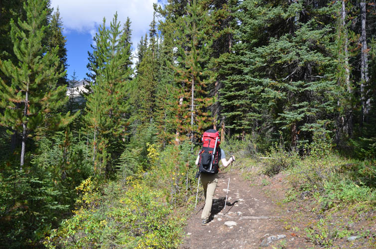
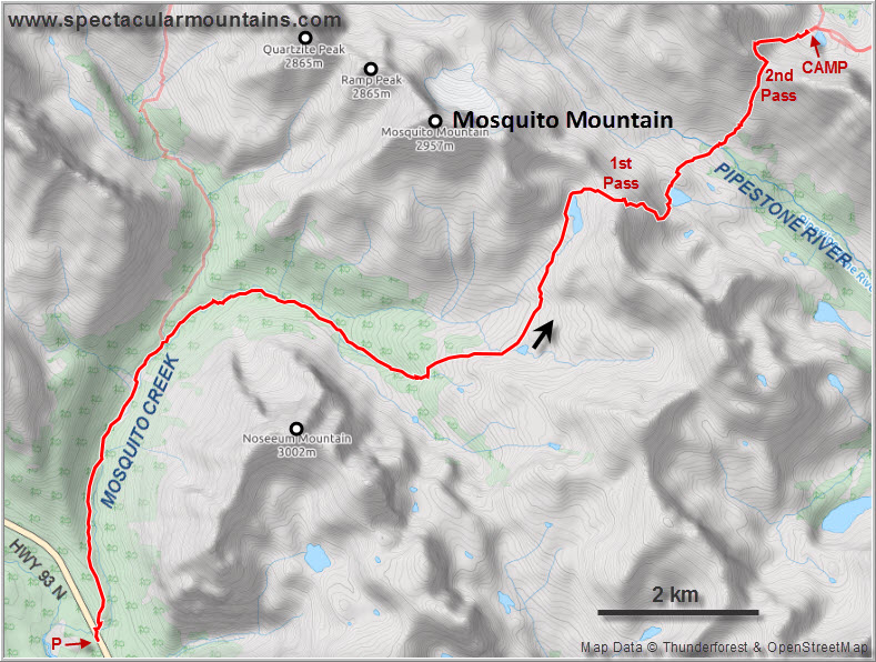
One thing that cannot be underestimated for a planned ascent of these peaks is the long approach. It took us almost 6 hours (at solid pace) and a solid 1350 m elevation gain on the first day just to get to the base of Deluc Peak, without even having climbed any mountain yet. We were very fortunate in that Phil Richards had done all the scouting for us already, having found a route up Deluc on a solo-trip only a few weeks earlier this year. His GPX track and trip beta were invaluable to us and made our approach smooth and trouble-free.
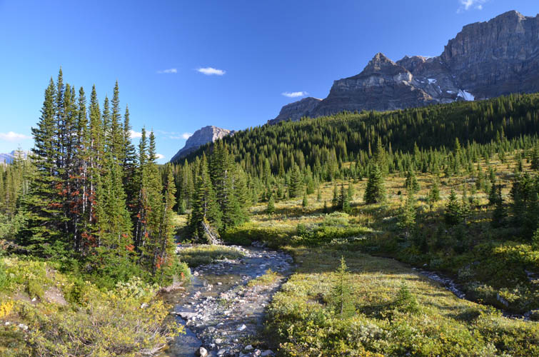
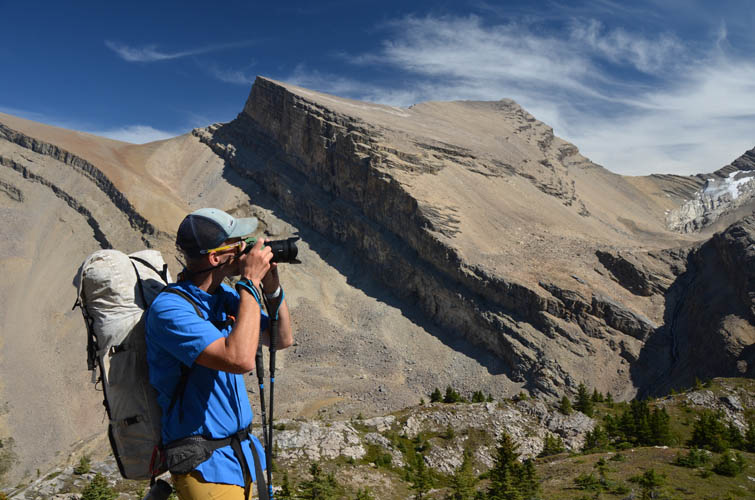
The starting point for our trip was the Mosquito Creek parking lot right by the campground and hostel. The excellent approach trail through the forest along Mosquito Creek is used for many other objectives like Mount Willingdon, Quartzite Peak, Ramp Peak, Mosquito Mountain etc. It was my first time in the area and it was a delight to have Vern and Mike point out the various scrambling and mountaineering opportunities around us… endless possibilities it seems. I knew right on day one that this wouldn’t be my last time in the area!
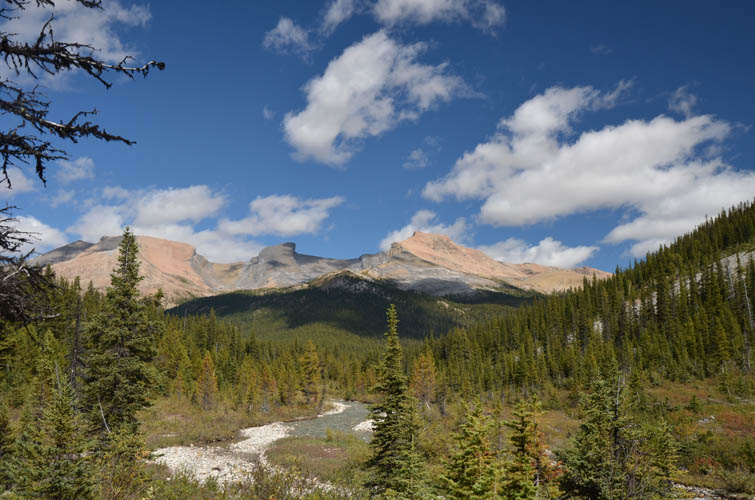
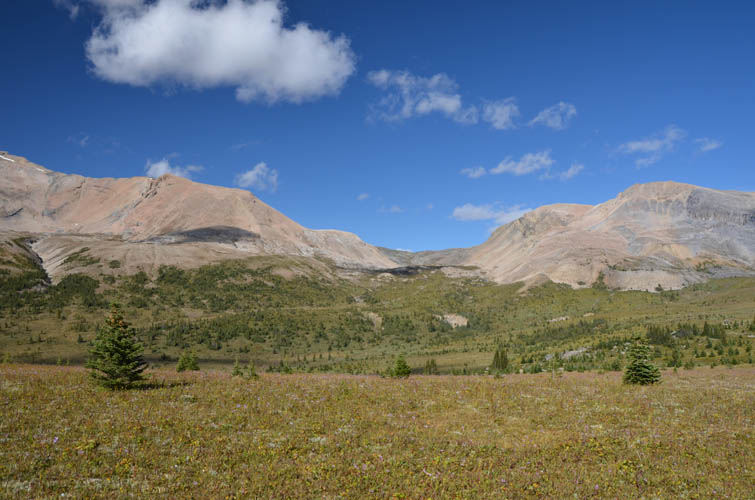
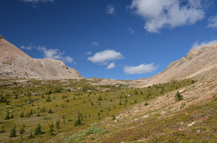
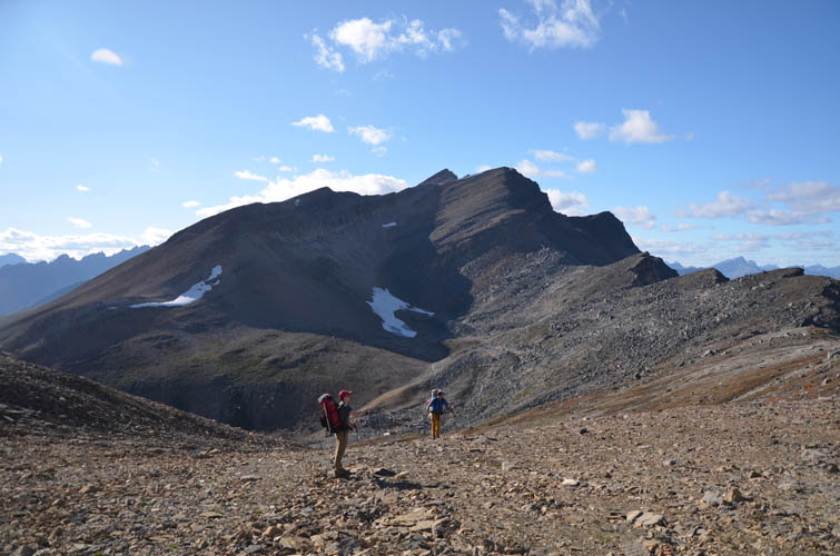
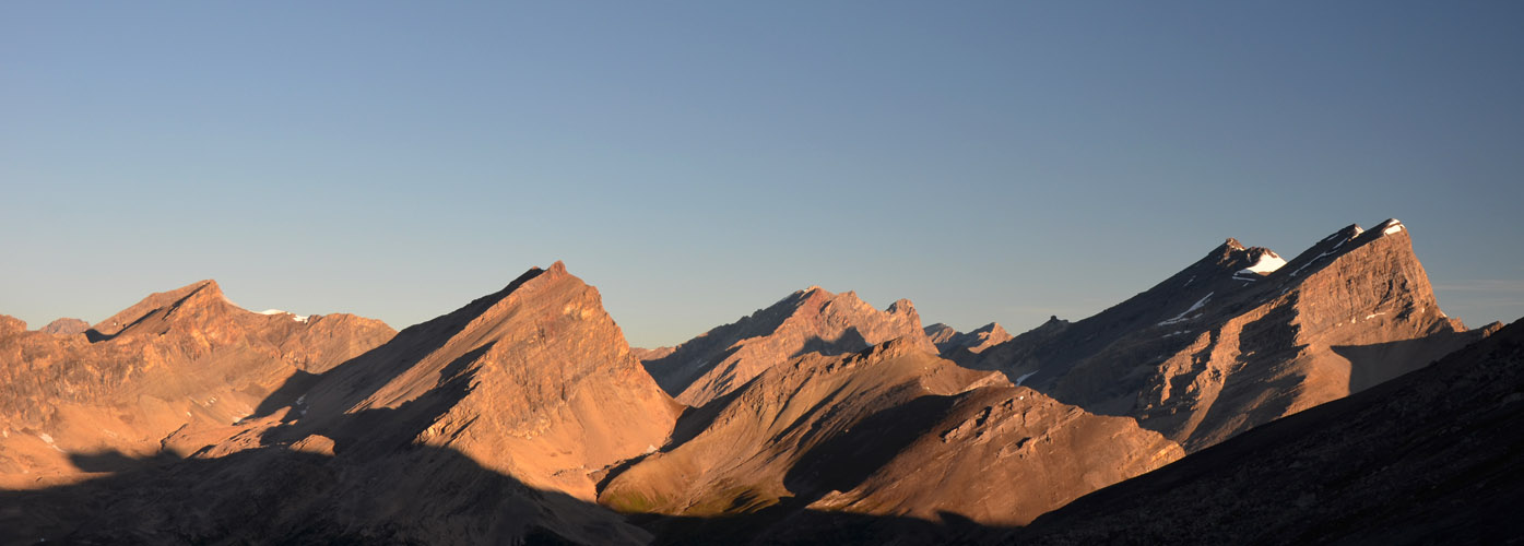
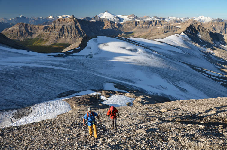
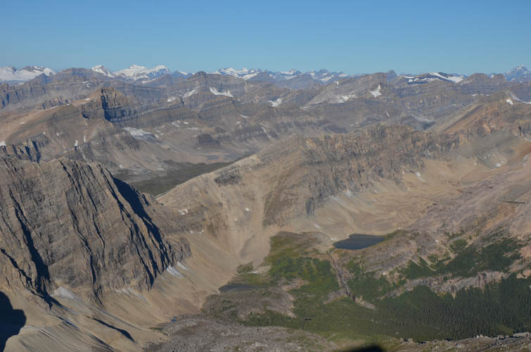
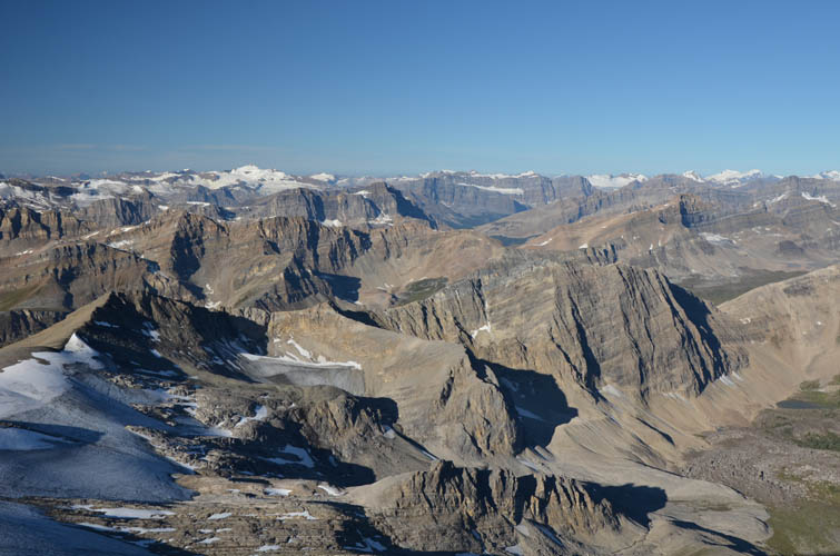
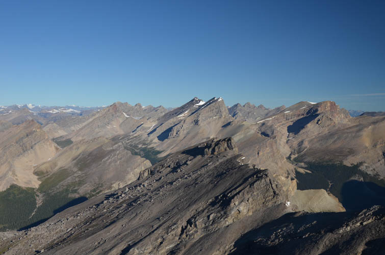
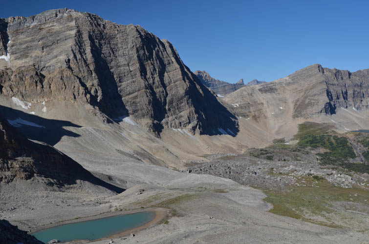
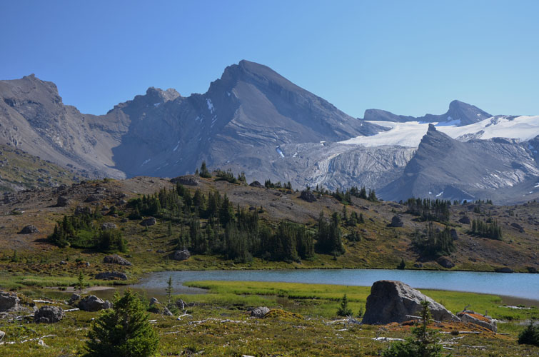
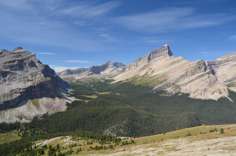
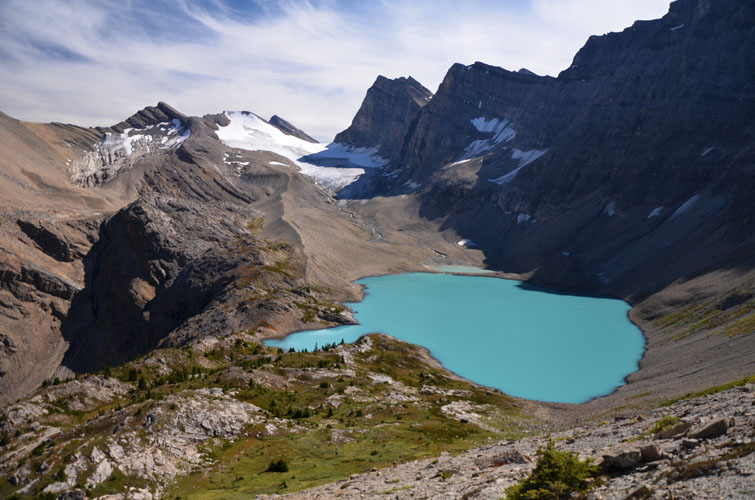
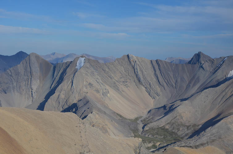
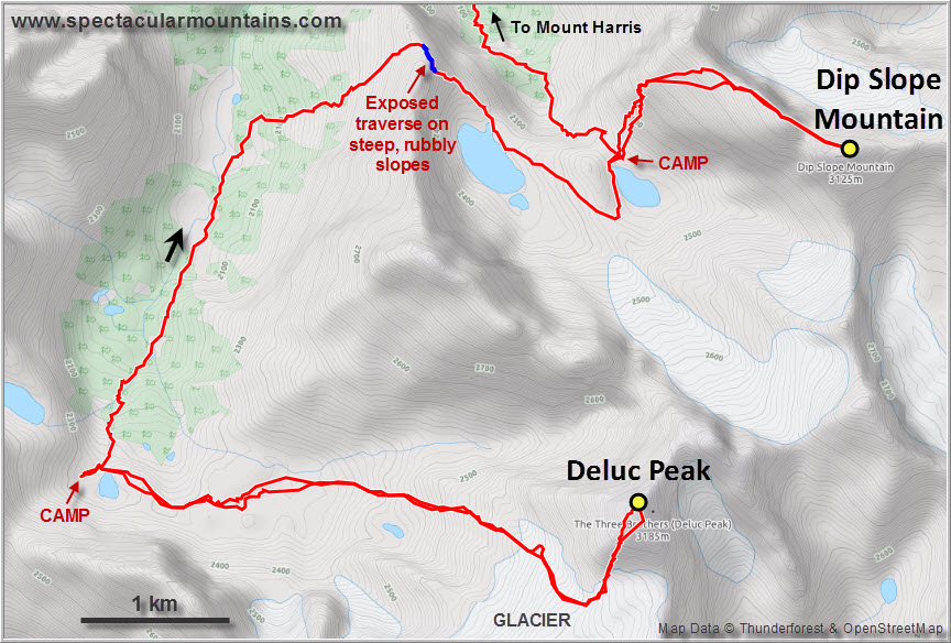
After hiking up the valley for about 9.2 km, we left the trail and headed north across gentle meadows and past a picturesque lake to a small pass, descending on rubble and mud slopes on the other side towards another small, unnamed lake. Phil’s route then took us around the left (west) side of the lake, over hilly meadows across the valley and then northeast to a second pass where we got our first glimpse of Deluc Peak. We were warned by Phil not to simply head straight down the other side of the pass here, which features a number of steep, rubbly cliffs, but to contour around the left side where easier scree slopes can be found. The valley below the pass is as charming and scenic as it gets. Two little lakes surrounded by stands of pine trees, meadows, and waterfalls; an open area of small, grass-covered bumps and dips, half of it sprinkled with massive, angular boulders that fell off the cliffs above to form an enchanting rock garden; and a beautiful glacier curving down from Deluc Peak into a field of moraines. By the time we reached the valley it was almost 8 PM, leaving us with an hour of daylight to set up camp by the lower lake.
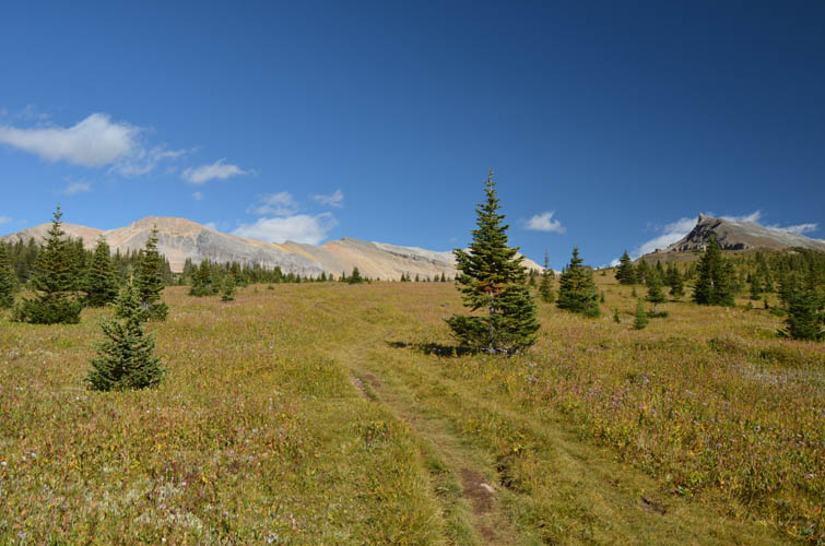
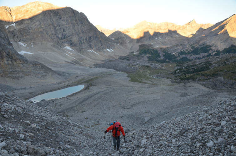
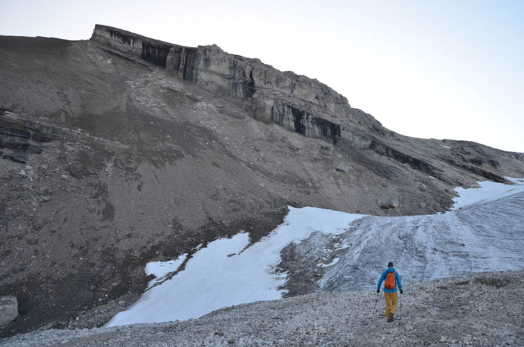
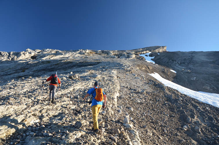
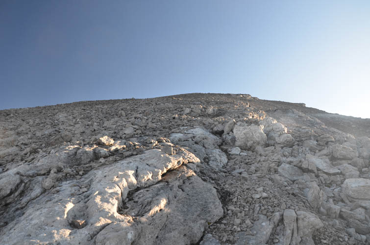
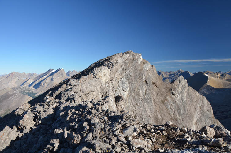
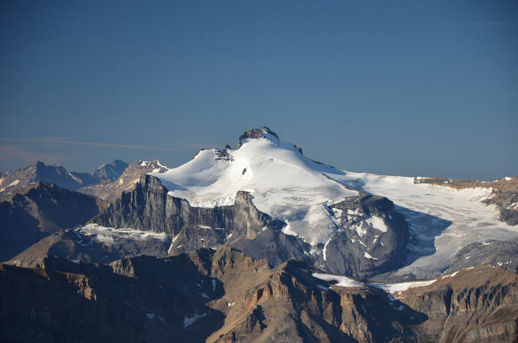
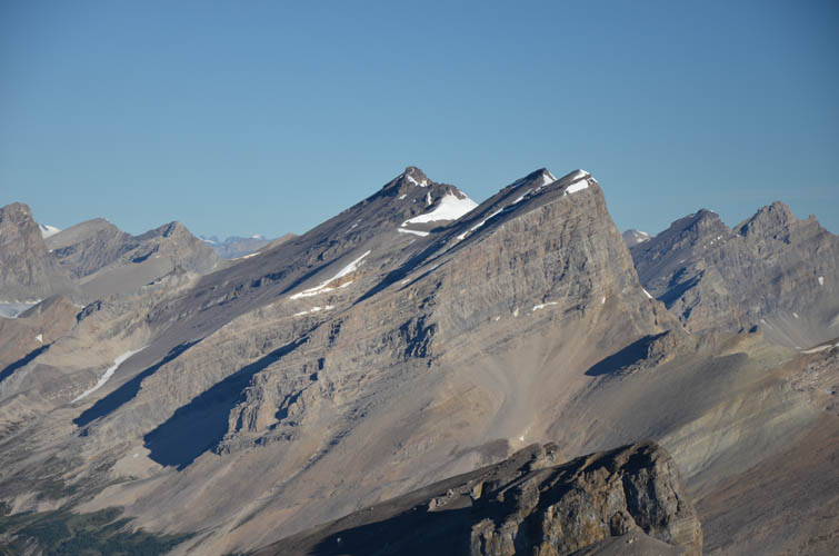
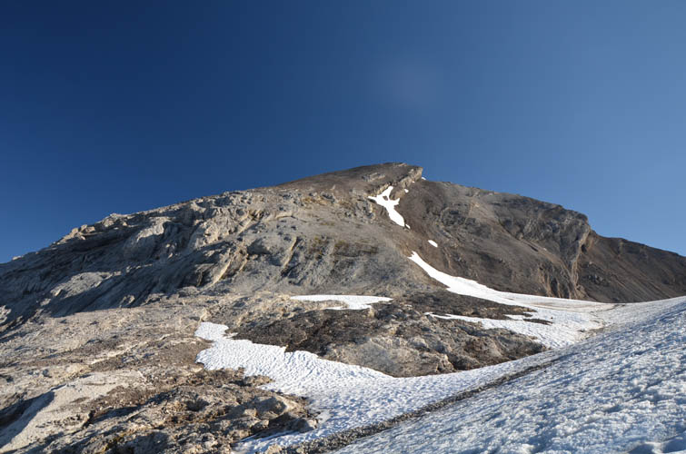
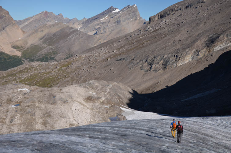
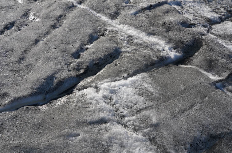
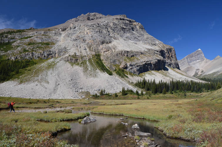
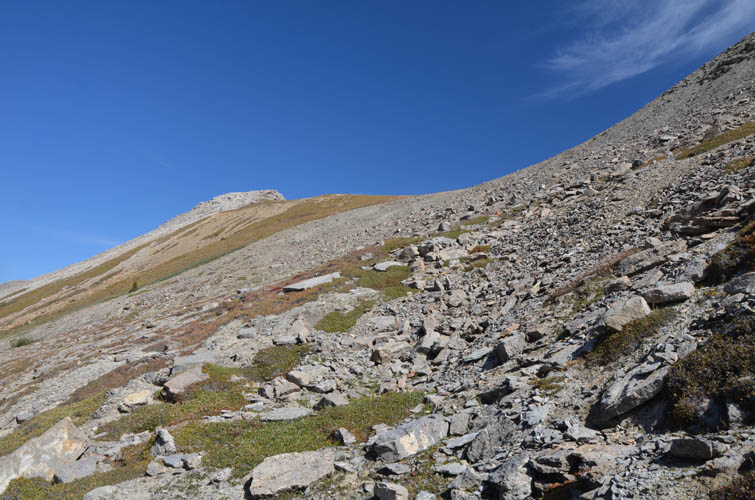
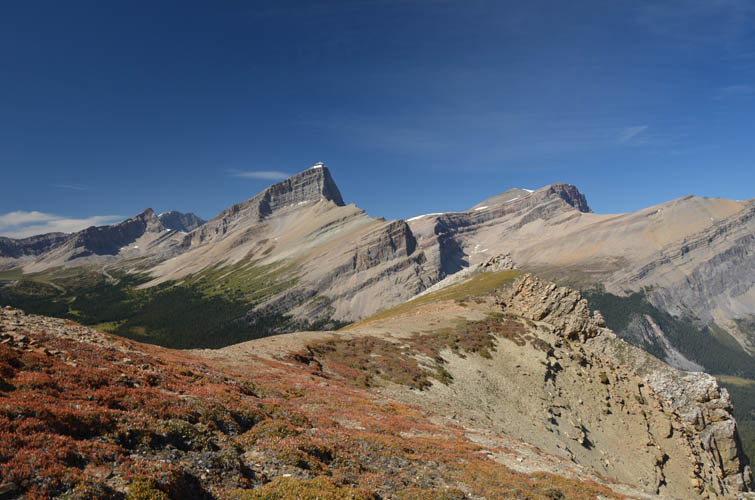
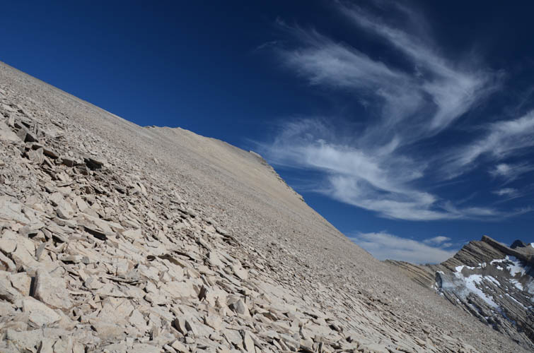
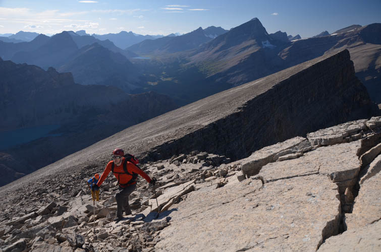
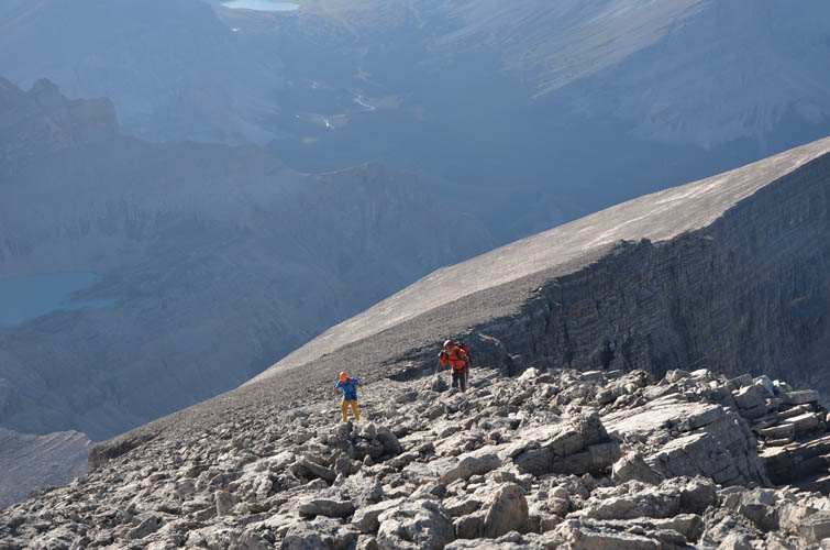
The next day we arose early, ready to tackle both Deluc and Dip Slope Mountain in a single day. From camp we started hiking up through this magical valley, across the scree of the moraines and onto the glacier. Almost all of the snow on the glacier had melted and there were no crevasses to be seen, so we were able to plod up directly on the ice quite safely and without having to use the crampons we brought (the glacier can also be avoided entirely by hiking up scree and rocks on climber’s left). Higher up we left the ice where the glacier intersects with Deluc’s broad south ridge. From here it was an easy scramble directly to the summit. Our helmets definitely came in handy as much of the talus on these slopes is loose.
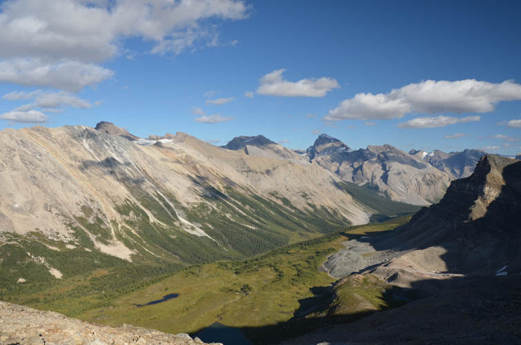
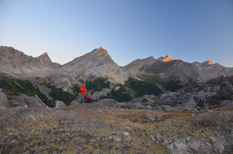
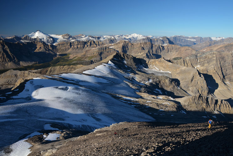
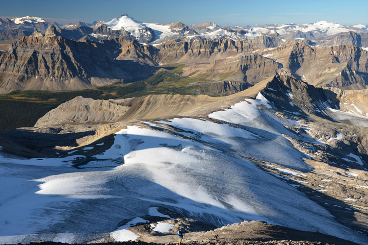
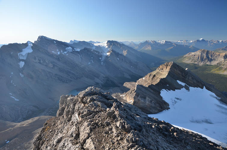
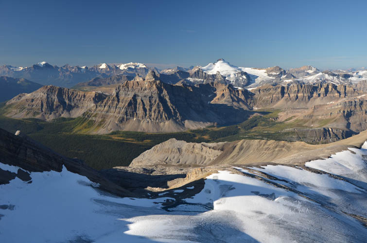
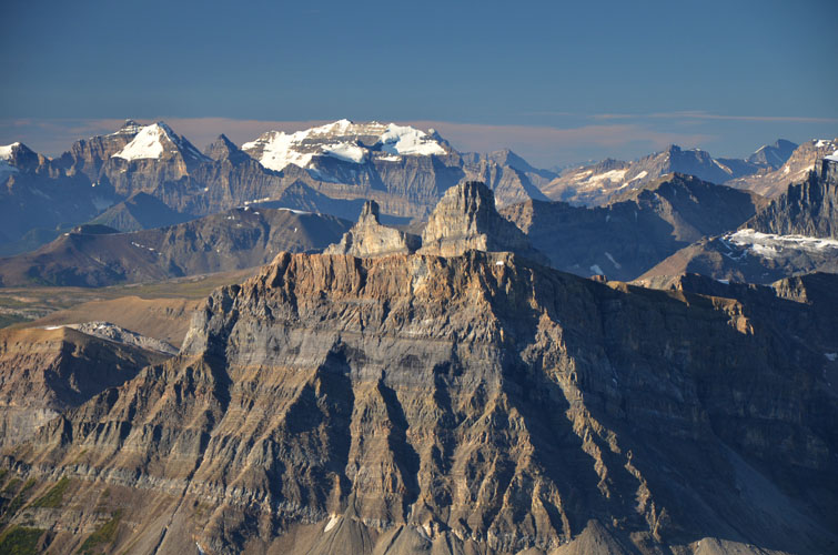
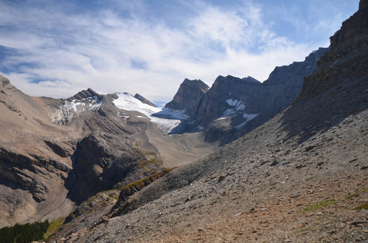
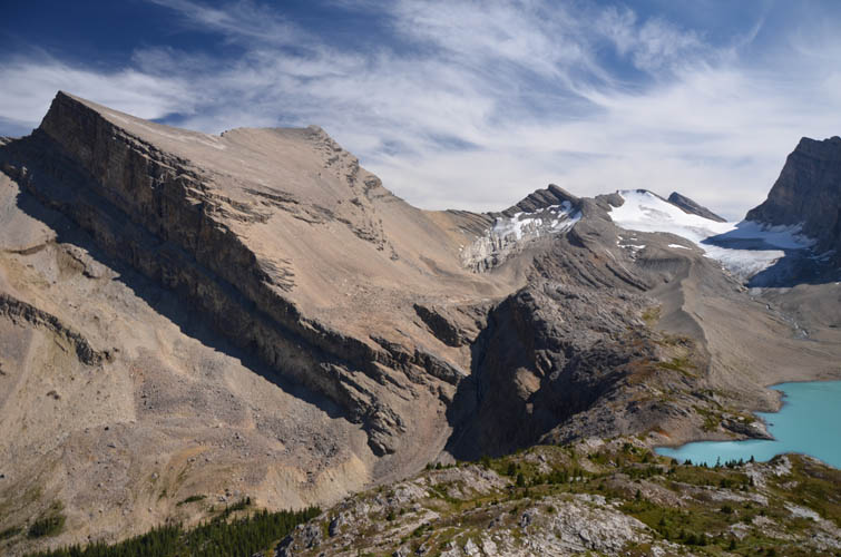
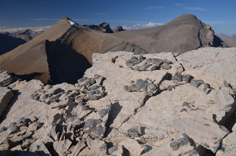
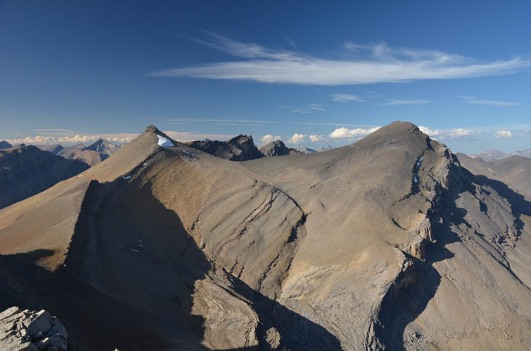
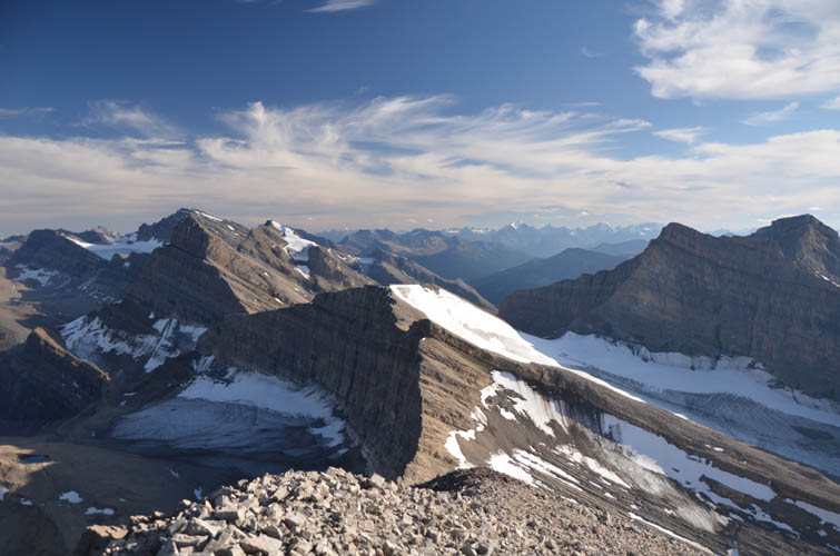
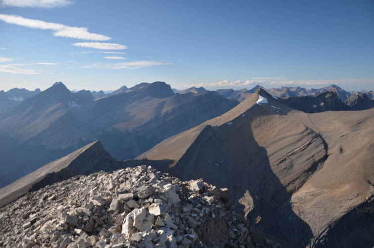
Cataract Peak, Watermelon Peak, Mount Willingdon and Dip Slope Mountain (our next objective) are just a few of the landmark peaks that can be admired from Deluc’s fantastic summit panorama. The day was just perfect – sunny, blue skies, and clear views all around us. The toils of lugging up our heavy packs into this area were all but forgotten now.
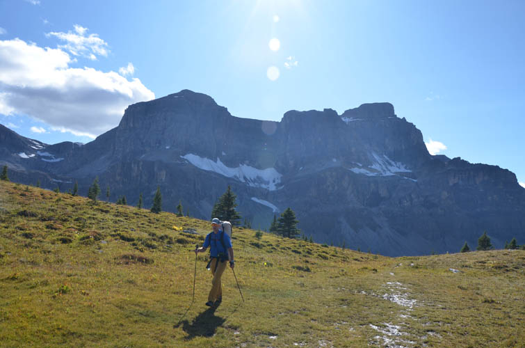
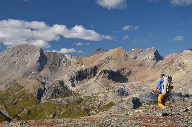
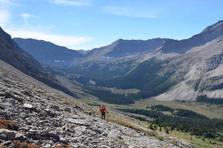
The descent off Deluc was quick and quite pleasant and we were back at camp wrapping up our stuff in no time. Now came the unpleasant part: schlepping our heavy packs down into the wooded valley to the north and then back up a ridge to the northeast. Vern expertly led us through the forest in the valley, making the bushwhacking and stomping through boggy areas short and painless.
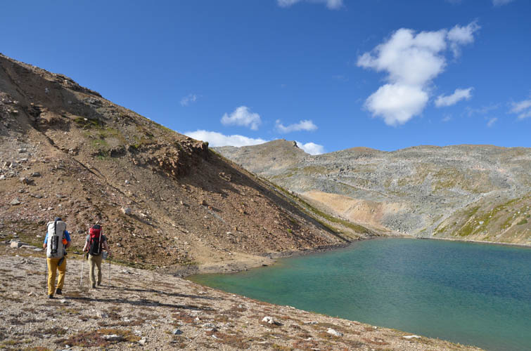
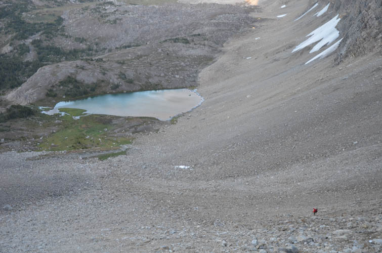
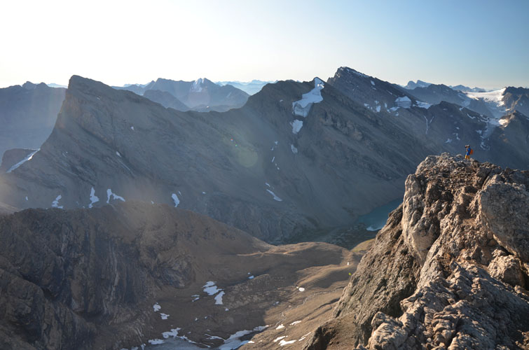
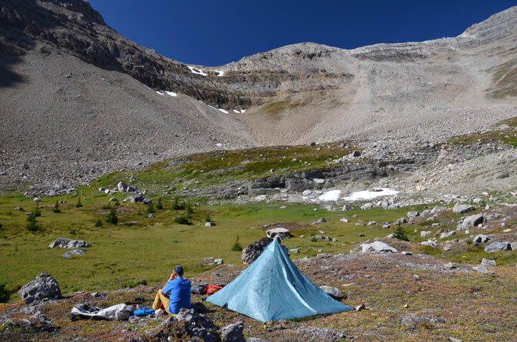
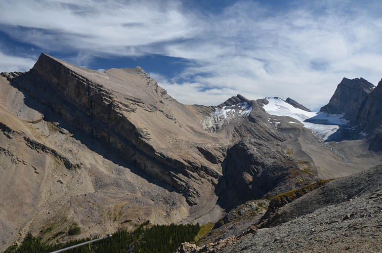
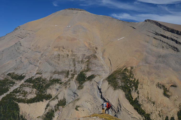
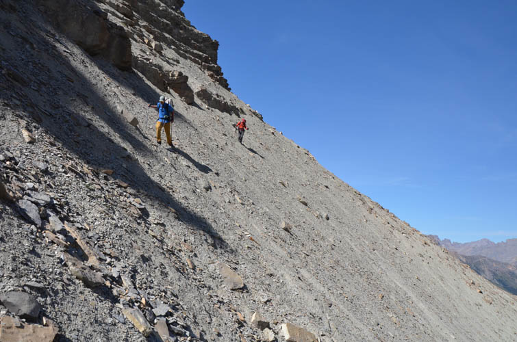
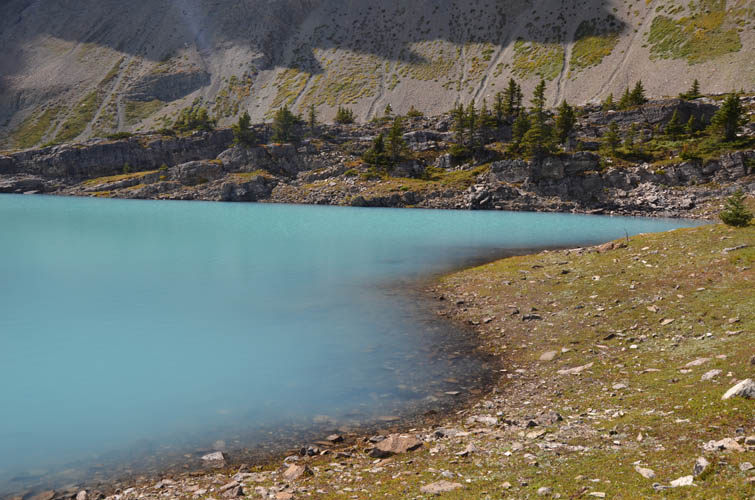
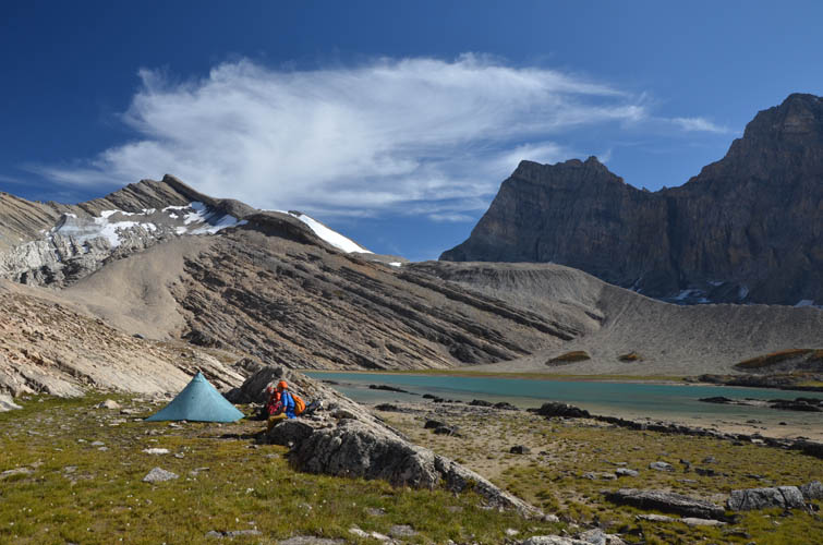
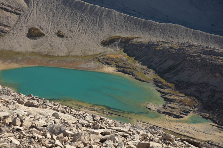
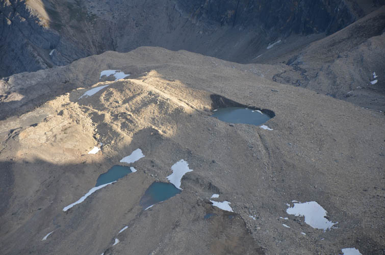
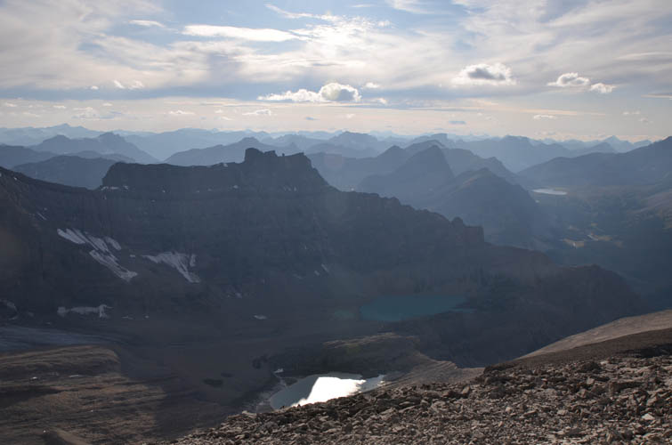
To get to the next valley to the northeast from where we could access Dip Slope Mountain, we scoped out a route via the ridge that extends north of Deluc’s NW2 outlier. Satellite pictures appeared to indicate that there might be a way across, but we weren’t sure. All three of us were up for some exploring and decided to slog up to the ridge to check it out: yes, it was a go, barely though! The traverse from the ridge to the valley involved some careful sidesloping on a rather steep, rubbly slope, with a vertical drop-off going down hundreds of metres below us. Thankfully, this section was short and once behind us all we had to do is amble down to a beautiful turquoise lake and over to another smaller lake below Dip Slope Mountain. We found an ideal place to set up our tents along a stretch of flat grass between two rock ribs and only a few metres from the lake’s outlet. I just wish we’d had more time to enjoy this little piece of paradise!
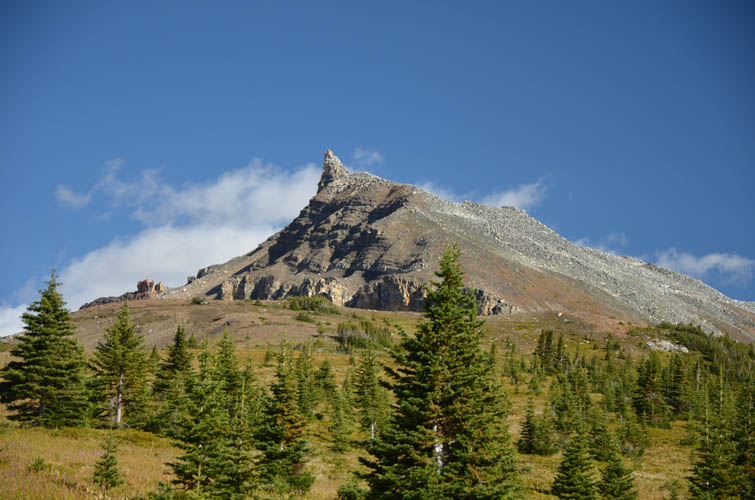
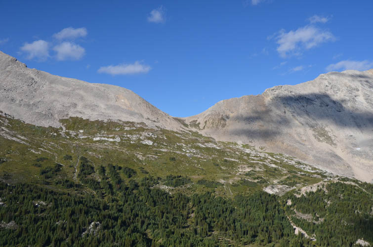
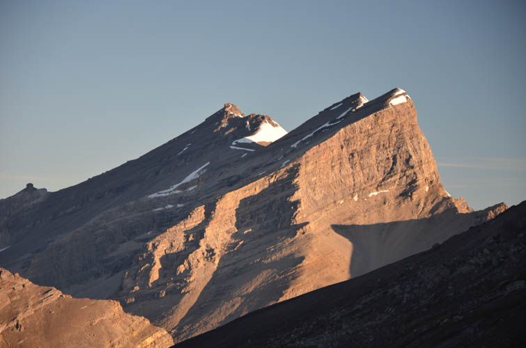
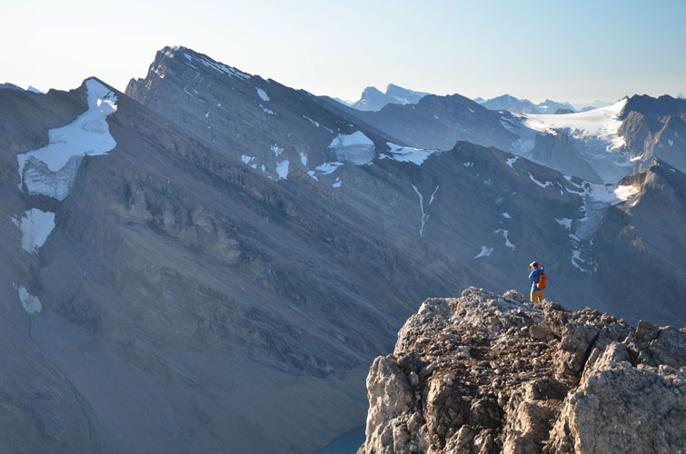
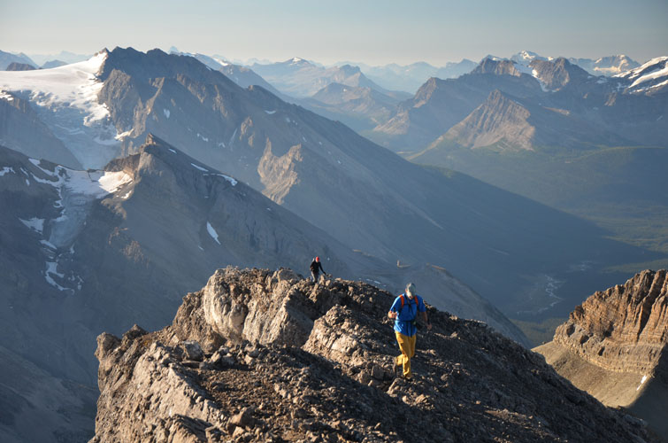
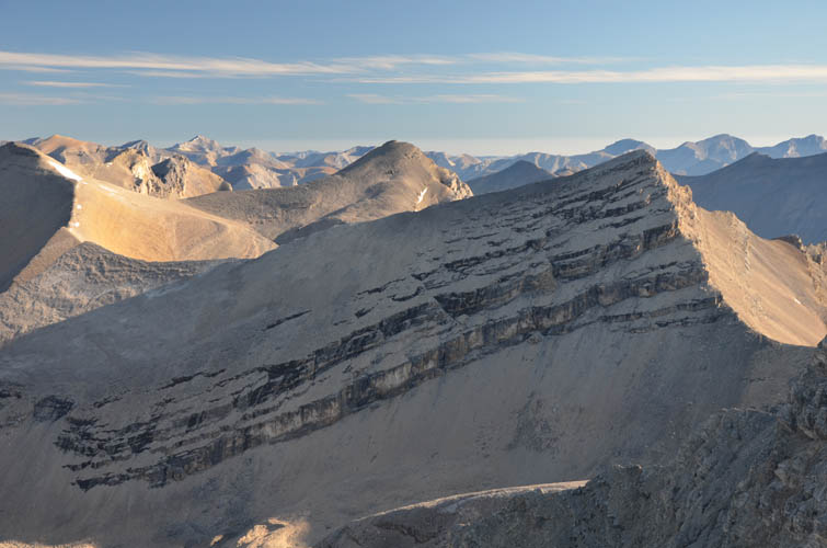
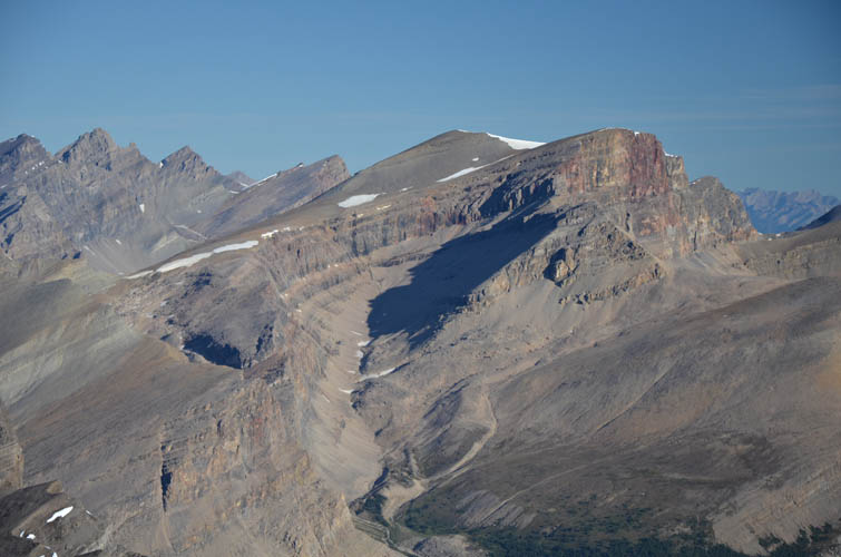
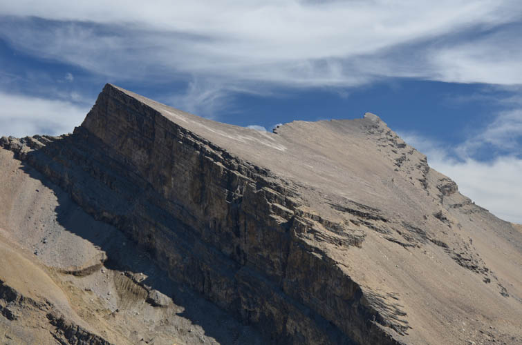
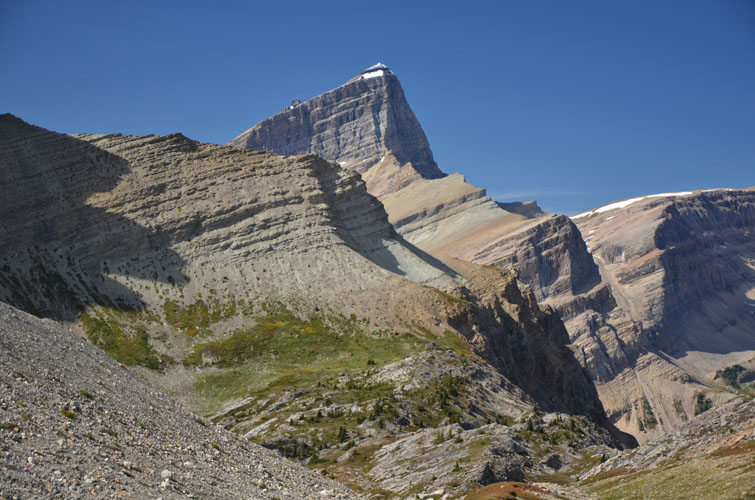
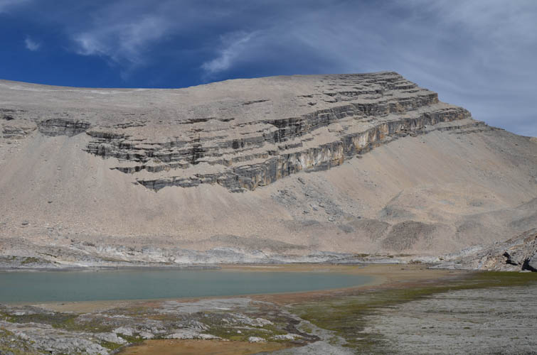
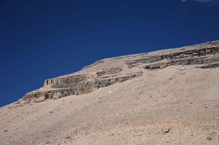
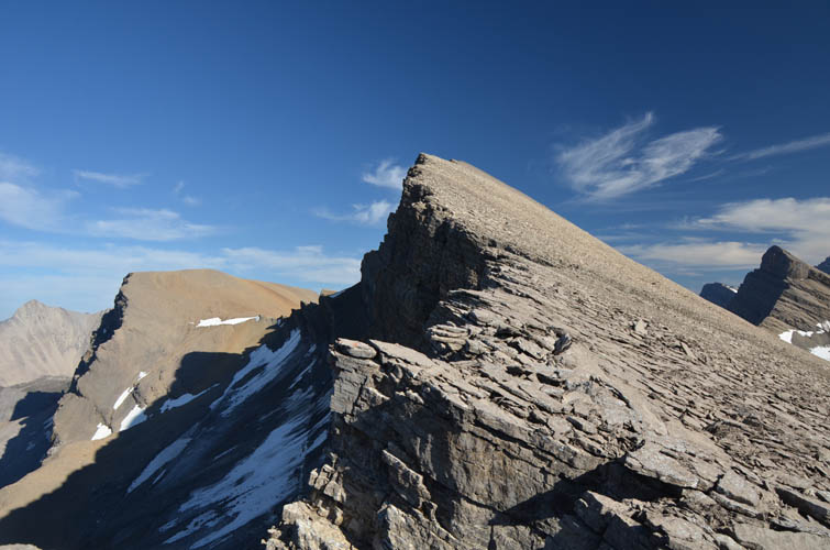
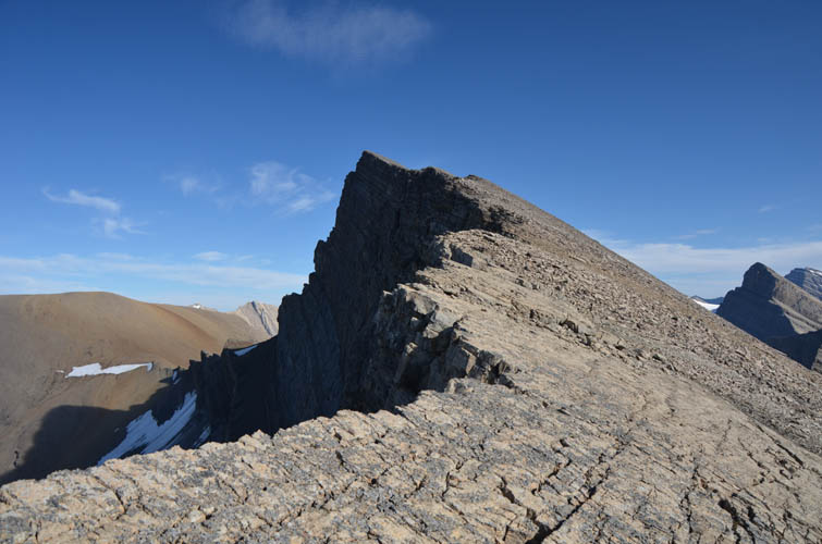
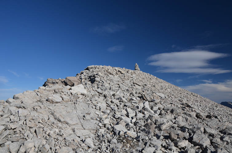
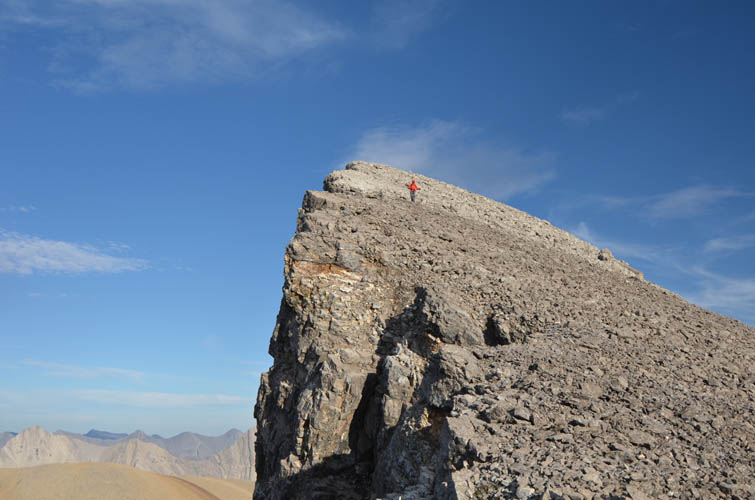
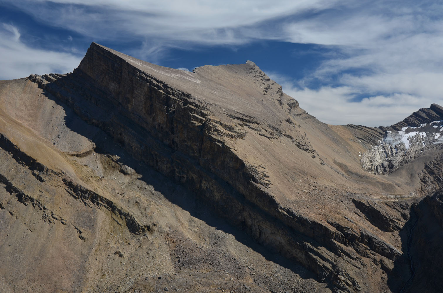
After taking a well-deserved break, we now focused our attention on the last objective of the day: Dip Slope Mountain. The name makes perfect sense when you look at this mountain from the valley below: it’s one giant slope of talus, with a series of step-like cliffbands on its eastern side all dipping down parallel to bedding towards the south. The north side, on the other hand, is a single vertical wall that drops straight down, making for a very enjoyable ridge walk once you’ve made it through the piles of choss from the lake below. The ridge rises in waves towards the slender, almost aesthetic looking summit tower with a pointy cairn on top.
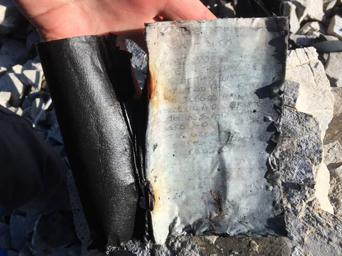
It was almost 30 years ago, in 1990, when Graeme and Marnie Pole recorded the first ascent on Dip Slope. Many years passed until the second (Rick Collier and Martin Krippl, 1998) and third party (Liam Harrap and Stacey Lockre, 2016) visited, at least as far as records in the summit register and online tell us. Our visit was likely the fourth only – no surprise given the peak’s remote locale.
While Dip Slope Mountain’s abundance of rubble and talus made it less pleasant to climb than Deluc, the place we called home for tonight in the valley below was just as magical as yesterday’s campsite. We relaxed by the lake, ate our dinners, and even played a bit of frisbee before heading to bed. It rained for a good part of the night while we got some much needed rest after a hugely enjoyable and successful day. The next day, with Mount Harris on the agenda, wasn’t going to be quite as triumphant…
|
Elevation: |
Deluc Peak: 3182 m (official), 3169 m (my GPS) |
|
|
Dip Slope Mountain: 3125 m (official), 3119 m (my GPS) |
|
Elevation gain: |
1350 m from parking to camp (1st day) |
|
|
2370 m for Deluc and Dip Slope (2nd day) |
|
Time: |
6 h (1st day), 13.5 h (2nd day) |
|
Distance: |
16.4 km (1st day), 22.0 km (2nd day) |
|
Difficulty level: |
Moderate (Kane), T4/T5 (SAC) for both peaks |
|
Reference: |
Phil Richards (Deluc), Graeme Pole (Dip Slope) |
|
Personal rating: |
5 (out of 5) for Deluc, 3 (out of 5) for Dip Slope |
DOWNLOAD APPROACH ROUTE (GPX FILE)
NOTE: This GPX track is for personal use only. Commercial use/re-use or publication of this track on printed or digital media including but not limited to platforms, apps and websites such as AllTrails, Gaia, and OSM, requires written permission.
DISCLAIMER: Use at your own risk for general guidance only! Do not follow this GPX track blindly but use your own judgement in assessing terrain and choosing the safest route. Please read the full disclaimer here.