Nordegg, AB, Canada
12 June 2021
Solo
A lengthy ridgewalk to a remote peak
This was a big trip – much bigger than I had expected. Largehorn Peak is one of those forgotten Front Range summits that are too remote for a casual scramble and too far from any major urban centre. Moreover, there’s basically no information available on this mountain, a surprising fact given its proximity to Nordegg and a major highway (Hwy 11).
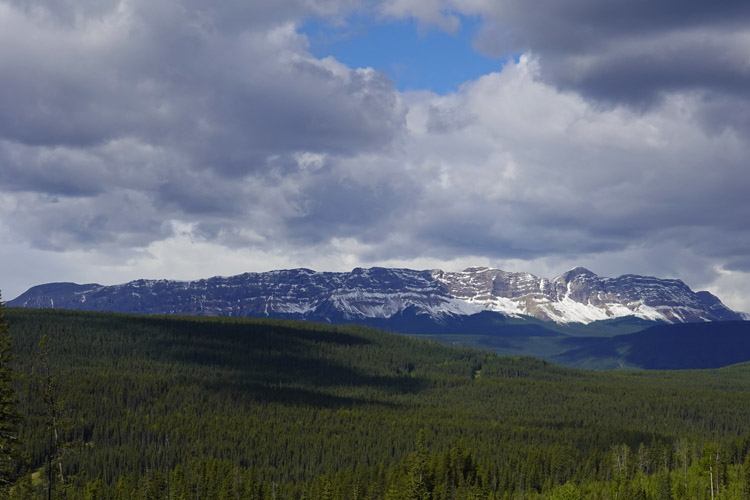
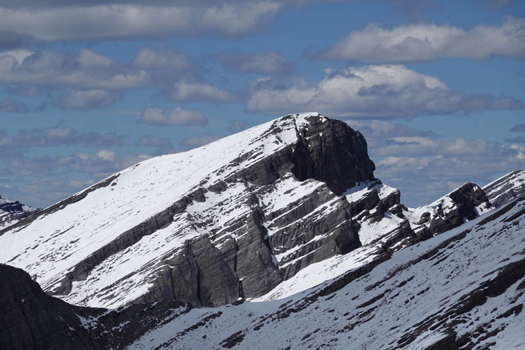
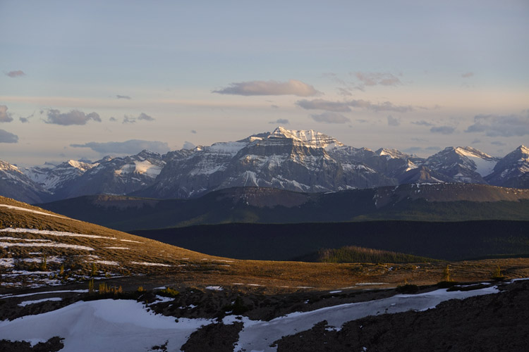
I’m not sure where the name comes from, but it’s not the most fitting name if the whole mountain is considered. It’s large, yes, but more of a really long ridge than a distinctive horn. Nonetheless, if one takes a closer look at the true summit of this massif, the highest point is somewhat horn-shaped when viewed from the east. Interestingly, almost all maps I consulted show the summit somewhere on a lower bump around the middle of the ridge instead of its highest point on the north side (Google maps even places it in the forest to the east!).
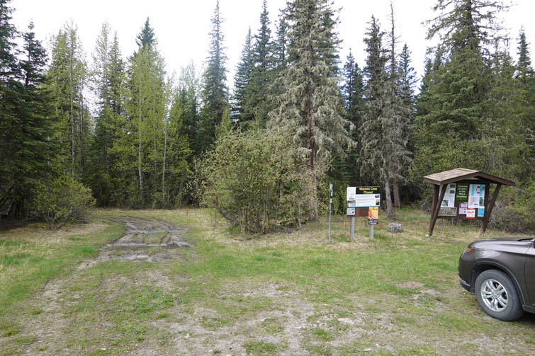
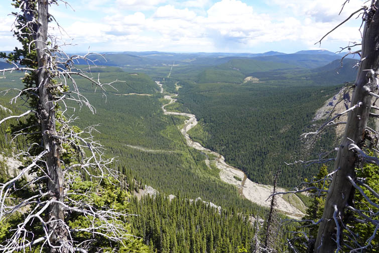
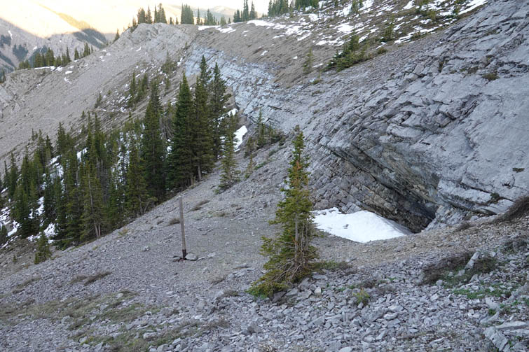
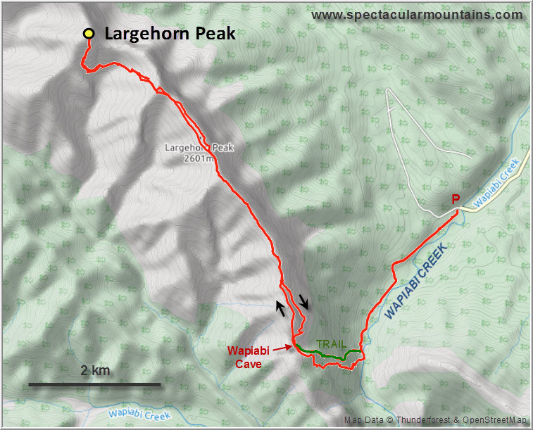
After driving out from Calgary in the morning I started out at the lazy hour of 10:30 AM. There are two excellent gravel roads – the Chungo Road and a wellsite road – that go west from the Forestry Trunk Rd (Hwy 40/734) to the signed trail head for the Wapiabi Cave, which officially closed to visitors in 2010 to protect its bat population. This is indeed an uncrowded area – I was the only one here, although a short while later a truck with a horse trailer pulled up; three locals who were out for a ride to the Wapiabi Gap.
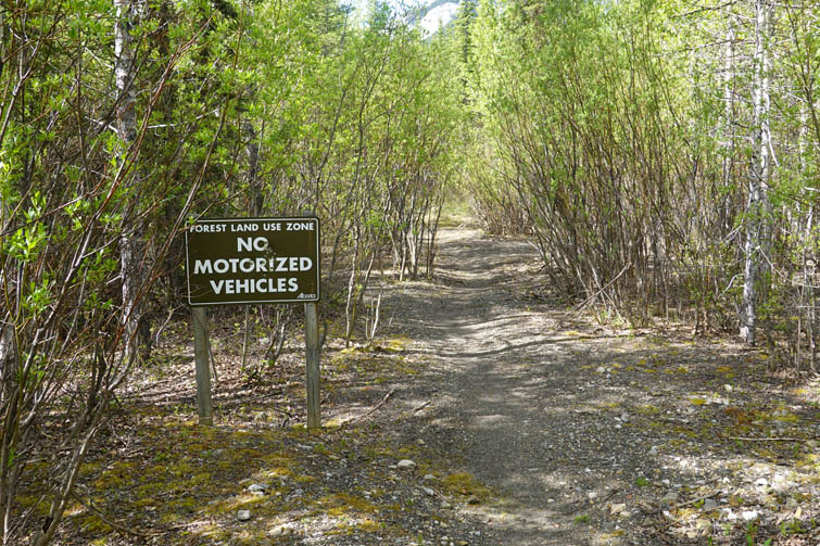
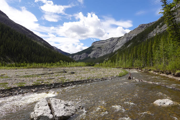
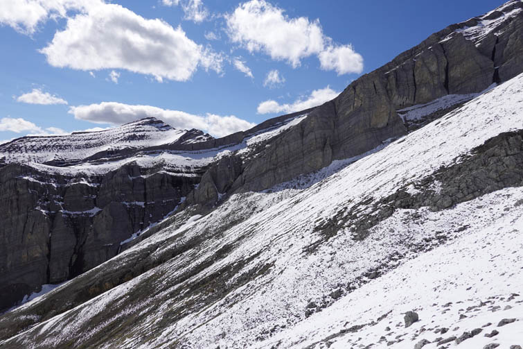
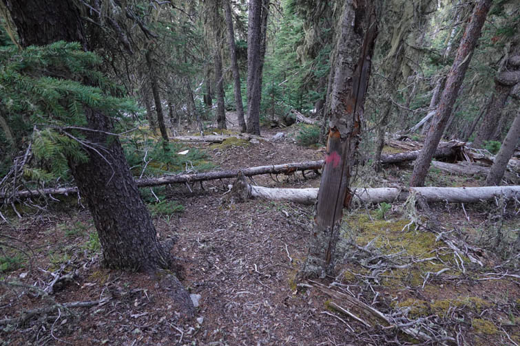
My initial approach was the same: follow a good horse trail along cutlines and forest to where it crosses the Wapiabi River. Here, a narrow and partially overgrown trail continues on the north bank for a few hundred metres before petering out. This is where I headed up the lower east slopes of Largehorn Peak’s SW ridge. Heading up here was actually not as easy as it first appeared. There is a massive grey cliff band that stretches across these slopes almost along the entire length of the mountain. I spotted a steep stretch of trees that seemed to hold a way through the cliffband and it worked, evidenced also by a faint game trail. The forest above offered relatively easy travel but stints of annoying bushwhacking slowed me down. I eventually ended up in a rocky drainage that emerged near the ridge top.
And what was the first thing that caught my eyes up here? A trail, just a mere 100 metres away! Really, a man-made trail? I wasn’t sure. It looked pretty good and beaten, but then again game trails can often look like that (as for example the exceptional trail on the western slopes of Mythic and Epic Towers in the Fairholme Range).
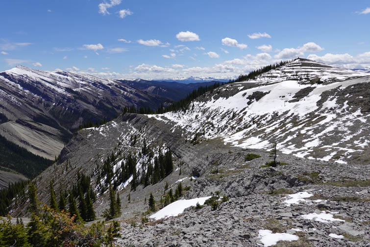
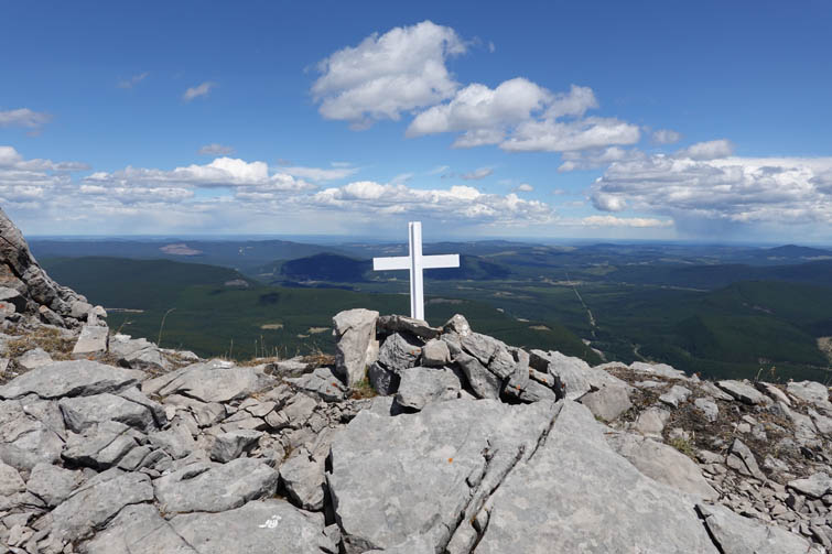
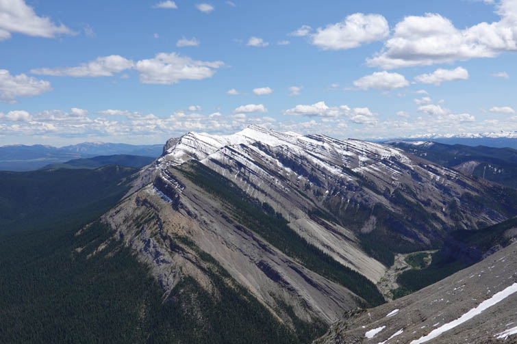
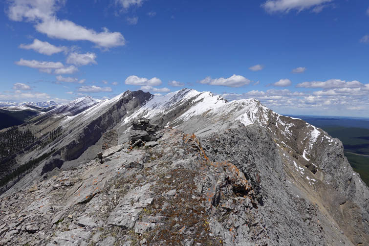
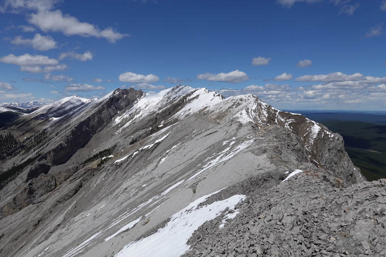
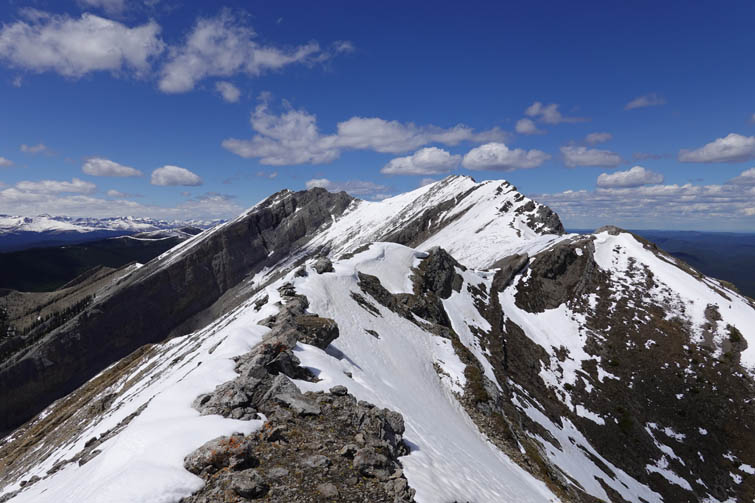
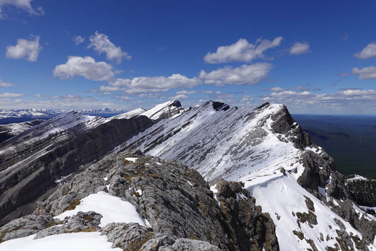
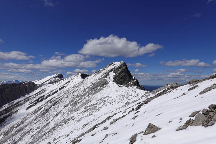
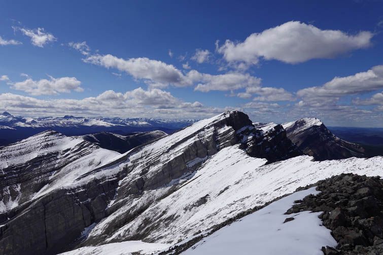
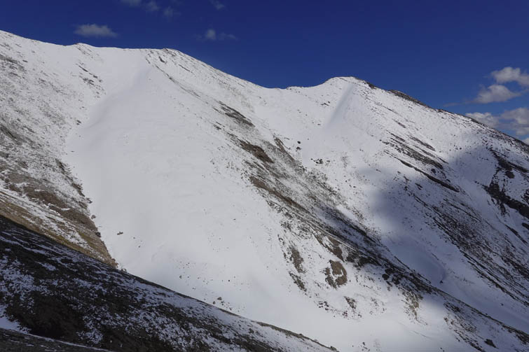
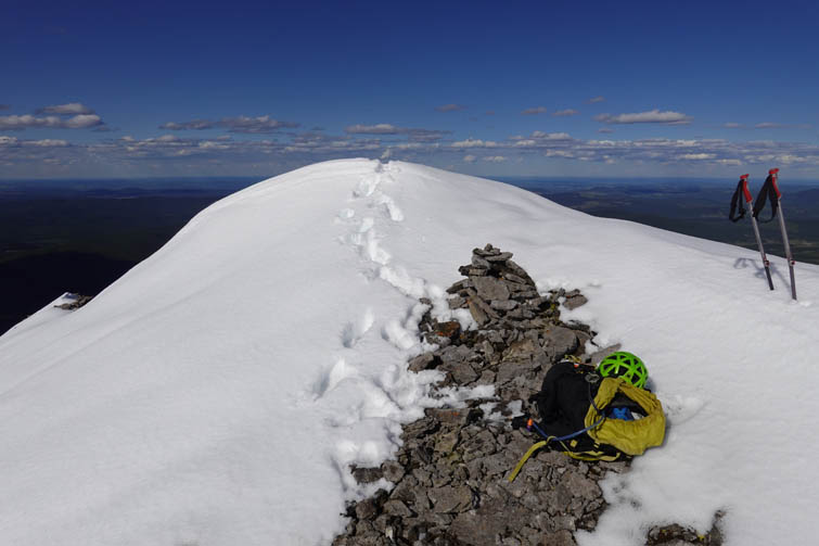
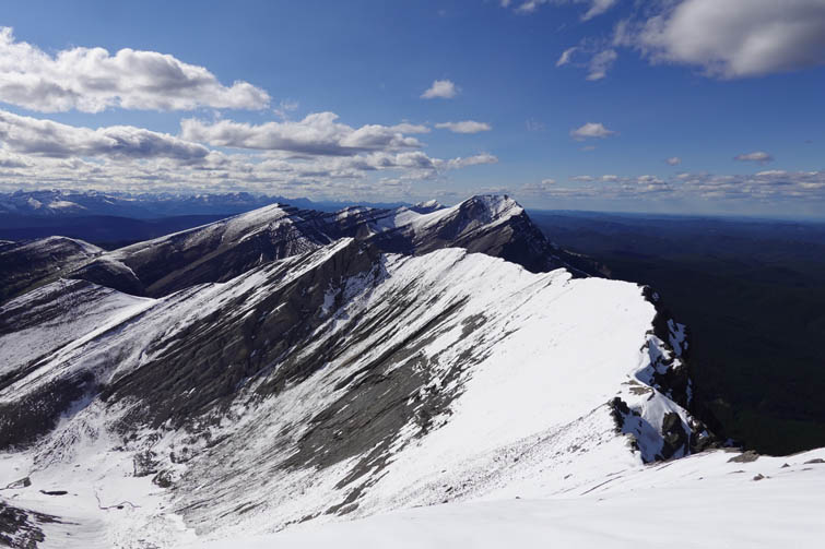
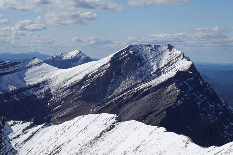
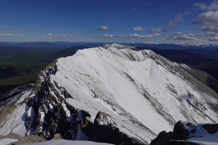
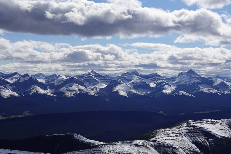
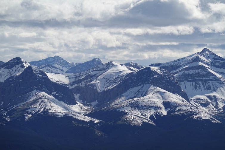
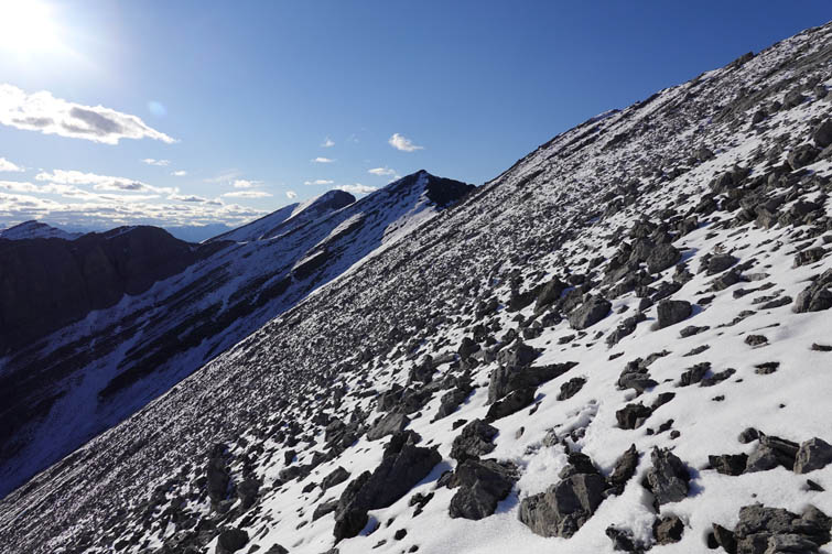
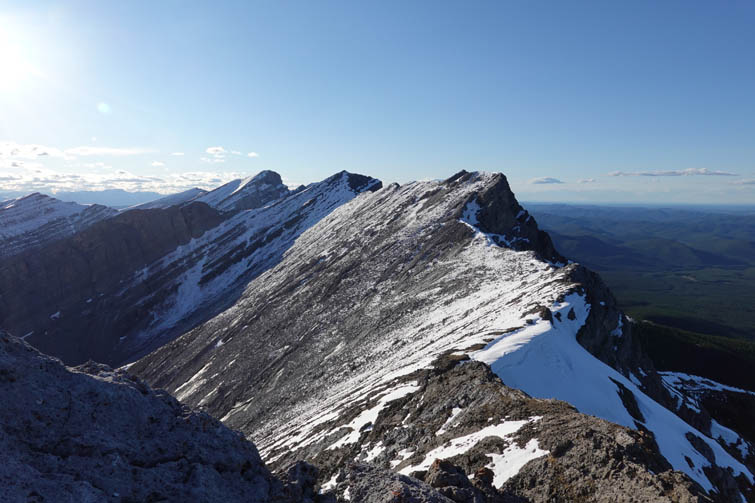
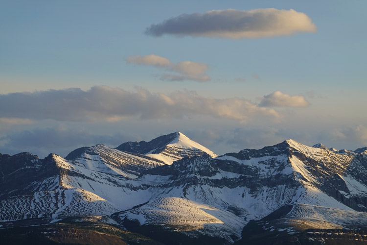
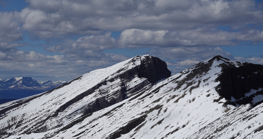
The wind was picking up so I didn’t give any further thought to the origins of this trail, but continued on along the ridge crest to the first high point where a small, unmarked white cross can be found near a sizable summit cairn. This, of course, is not the true summit of Largehorn Peak, and neither are the next five or six high points that follow! What I thought would be an easygoing ridge walk turned out to be a really long and exhausting outing. Yes, the ridge is absolutely lovely and a joy to traverse. All the little cliffs and barriers I encountered brilliantly resolved themselves as I got closer, with nothing more than moderate scrambling to overcome them. The vistas were spectacular, and I was blessed with warm temperatures and a light breeze on a beautiful sunny day. The snow on the other hand made it a challenge. About 20-40 cm of fresh snow had fallen in the past week, covering large parts of the west slopes and ridge top. With baseball to football-sized chunks of sharp rock underneath, it was impossible not to trip and twist my feet as I stumbled along especially when sidesloping. This was definitely the awful and frustrating part of the trip and I suspect that even without snow the terrain wouldn’t be that pleasant.
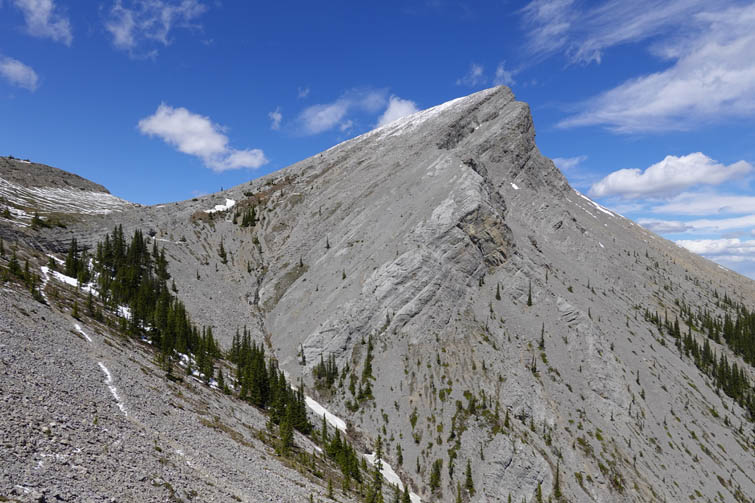
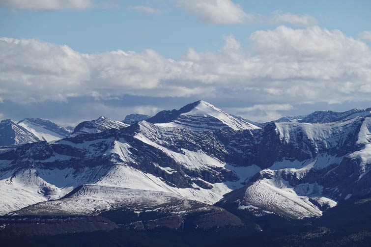
My progress was slower than expected and by the time I reached the point that’s marked as the “summit” on various maps, it was already close to 4 PM. Although there was a small old cairn, this of course was far from the highest point. I could see two slightly higher points immediately to the north, and then a much higher one about 3 km farther away. Well, I was here now, so might as well go for it!
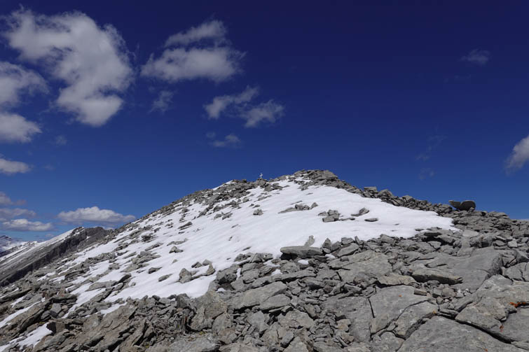
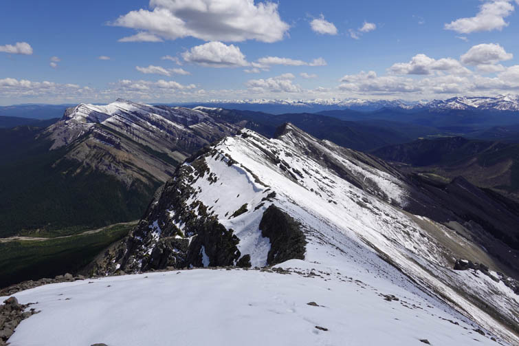
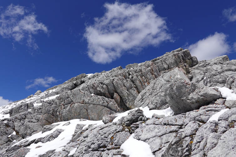
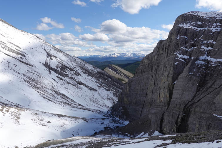
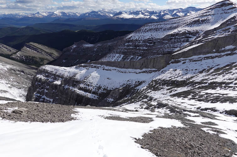
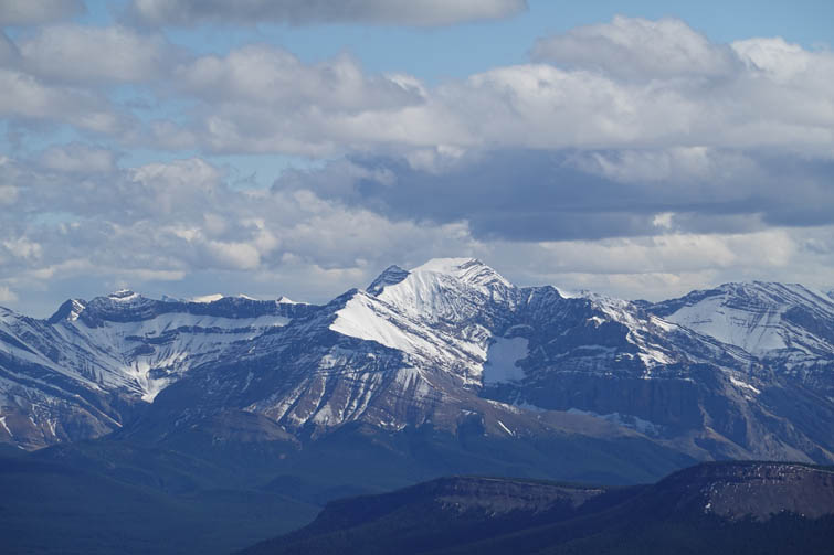
A few bumps further along the ridge the views of the true summit opened up and my heart almost stopped… The summit mass is guarded by a series of nasty vertical cliffs that would be impossible to scramble. The only way through appeared to be a narrow ramp breaking the cliff above a large waterfall, but that would necessitate an elevation loss and re-gain of several hundred metres, plus a long trudge across snow-covered slopes. I clenched my fists and just went for it. Thankfully, the route worked out very well and after a long slog I finally stood on the true summit of Largehorn Peak at just under 2610 m. Not very high by Rockies standards, but it felt like a greater achievement than many higher peaks I’ve climbed before!
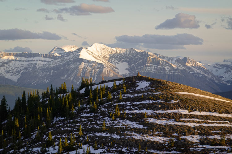
It was 6 PM already, so I had no time to waste and after a short break headed back the same way. The many ups and downs along the ridge and especially the sidesloping were certainly exhausting, but at least the route was straightforward and all I had to do is put one foot in front of the other. Plus, the weather was holding up beautifully. The last high point (with the white cross) I opted to bypass on a scree slope to the east that has intermittent game trails, which brought me directly to the good trail I had spotted earlier in the morning on my way up.
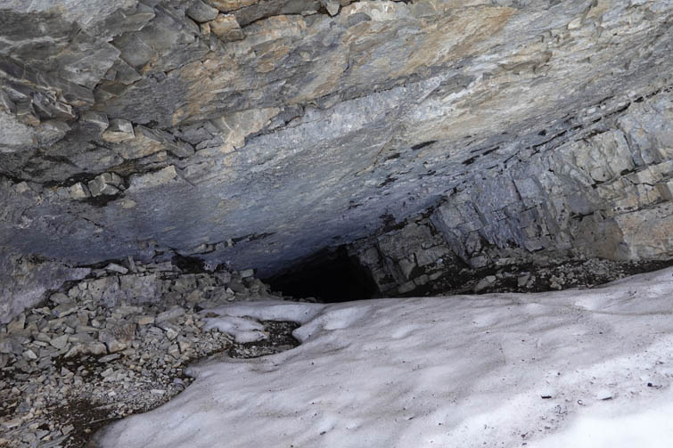
And then came the surprise of the day: Wapiabi Cave! I had no idea where it was before, but this was clearly the entrance to a deep cave with an old signpost in front of it. I took a quick peek, and then followed the good trail downhill, overjoyed that I had found both the cave and a man-made trail that got me down into the valley in no time. It’s pretty clear that the trail isn’t used anymore since the cave was closed in 2010, and there certainly is no more trail maintenance. While the upper part was a breeze, the lower third in the forest was quite overgrown with a fair bit of deadfall strewn across the path.
Hiking out in the fading light I got back to my car just past 11 PM, relieved and happy about a long and successful trip. I still had to drive about 3.5 hours back to Calgary, which made this into one of the longest day trips I’ve ever done. Needless to say that if I did this trip again I’d definitely camp out at the trailhead the night before and then get an early start, which makes much more sense. But I have a feeling I probably won’t repeat this trip any time soon ☺.
|
Elevation: |
2607 m (true summit) |
|
Elevation gain: |
2180 m |
|
Time: |
12.5 h |
|
Distance: |
22,8 km |
|
Difficulty level: |
Moderate (Kane), T4 (SAC) |
|
Reference: |
Own routefinding |
|
Personal rating: |
3 (out of 5) |
NOTE: This GPX track is for personal use only. Commercial use/re-use or publication of this track on printed or digital media including but not limited to platforms, apps and websites such as AllTrails, Gaia, and OSM, requires written permission.
DISCLAIMER: Use at your own risk for general guidance only! Do not follow this GPX track blindly but use your own judgement in assessing terrain and choosing the safest route. Please read the full disclaimer here.