Anatolia, Turkey
20 October 2018
Solo
An enjoyable loop overlooking the world’s second largest caldera lake
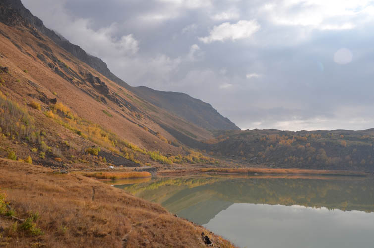
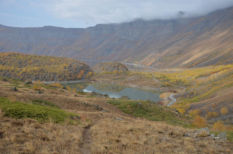
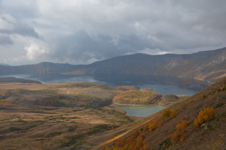
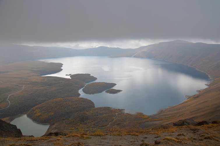
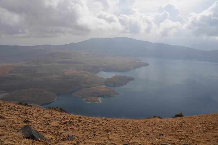
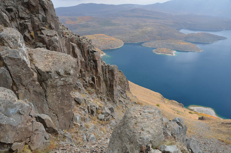
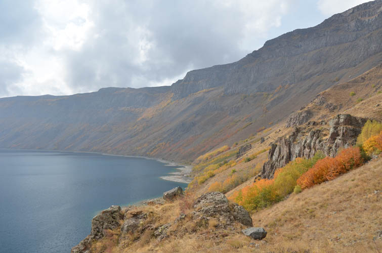
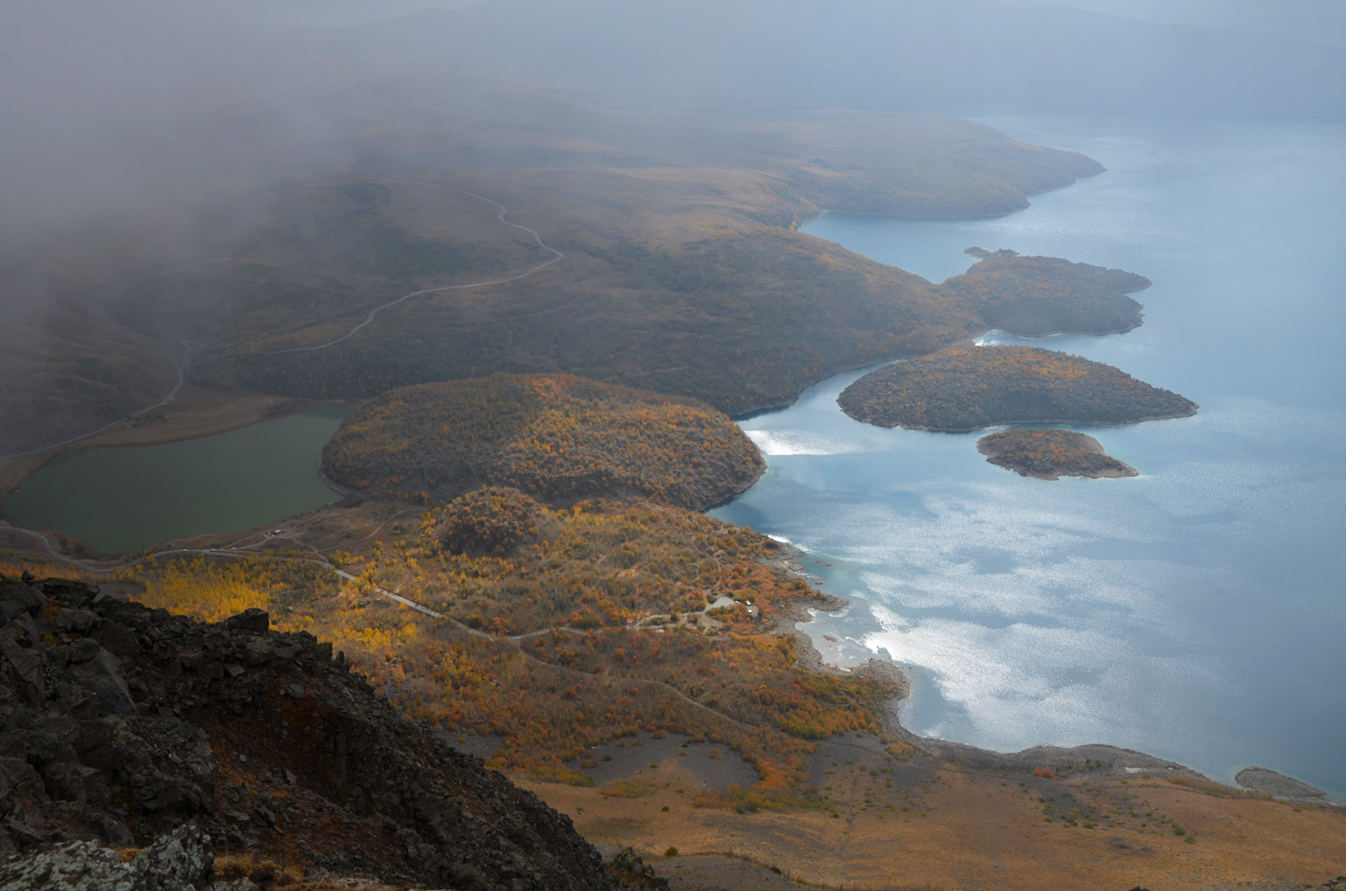
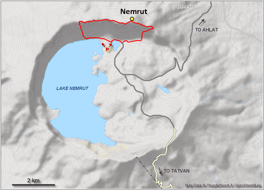
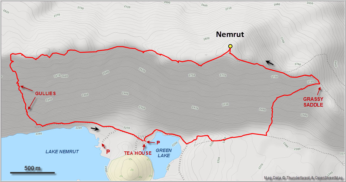
Nemrut is a dormant volcano that sits along the tectonic boundary between the Eurasian and Arabian plates in Turkey’s Anatolia region near Lake Van. The concentric crater measuring about 15 km in diameter is filled on its western side by three lakes, which makes it look like a giant half-moon when viewed on satellite pictures. Lake Nemrut, the biggest of the lakes, is also the world’s second largest caldera lake after Lake Toba in Indonesia. It’s an impressive sight to visit, which can easily be done in a regular car on a dirt road and a cobbled stone road leading in from Ahlat and Tatvan, respectively.
Despite all this, most outsiders don’t even know about Nemrut (there is also another, more famous Mount Nemrut near Adıyaman in SE Turkey), and those visiting the area often pass it up in favour of the more popular Lake Van and other sights in the area. In the three days we spent there, we saw lots of Turkish tourists but no foreigners – with the exception of Ziina and Daniel, a lovely German couple who had driven here in their converted VW Caddy. It was fun hanging out with some super interesting fellow travellers again and we whiled away our time drinking tea and exchanging travel stories at Faysi’s little tea house by the small green lake.
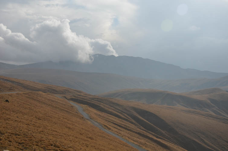
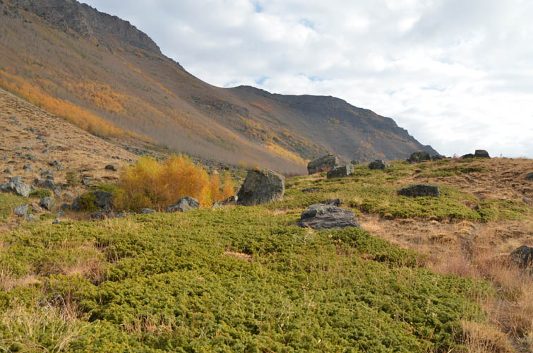
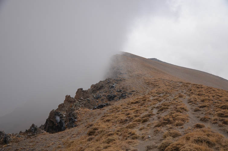
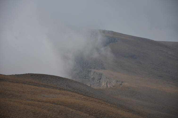
Although the weather could’ve been better, I was glad I picked the second day for a short hike to the summit of the crater rim. It was cloudy and a bit chilly up on the ridge, but at least I was spared the rain we experienced the day before and after (there were even some remaining snow patches on the eastern slopes left from a previous squall).
Several established but unmarked trails lead to the summit. The easiest route is from the east where the Ahlat road goes over the rim at about 2450 m elevation, leaving only about 500 m to go. Since we were camping down by the lake, my obvious route choice was to follow a faint trail east of the small lake, then head north on the steep inner slopes of the crater to a grassy saddle. The path is marked on some maps but can be a bit tricky to find, so a GPS or navigation app is certainly useful.
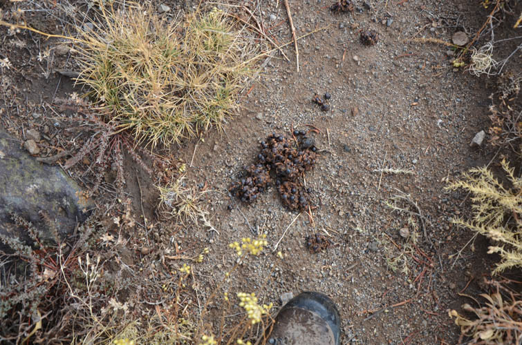
Bear scat full of half-digested juniper berries lining the trail made me hopeful I might actually get to spot one of the mighty creatures that apparently roam this area quite frequently. Fayzi, our charming host at the tea house, claims to have befriended some of them to the point where they show up at the lake for leftover dinner quite regularly. In the end I didn’t see any bears during the hike, but we did hear a strange howling noise at night and eventually spotted a small bear toppling over a garbage bin near the tea house. Sadly, the bears have gotten so used to humans here that I suspect it’s just a matter of time before an accident happens. Local hunters who are mostly after birds pose an additional threat.
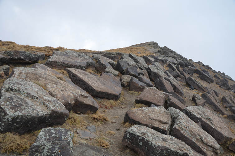
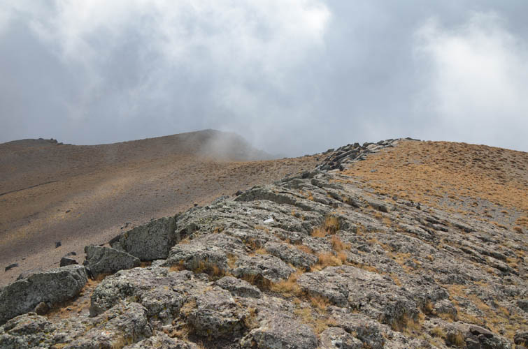
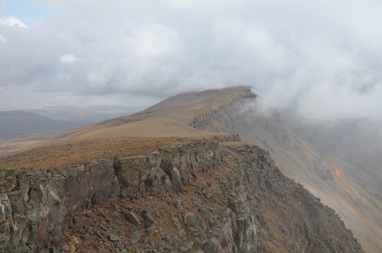
Grey clouds moved in from the north when I arrived at the ridge top, leaving me with limited views for the rest of the way up to the summit. There’s a rudimentary trail on the crater rim here and it was all easy hiking. Some people later told me there’s supposed to be a red box with a register at the top, but I didn’t see one.
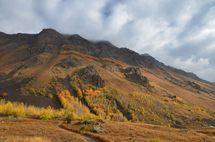
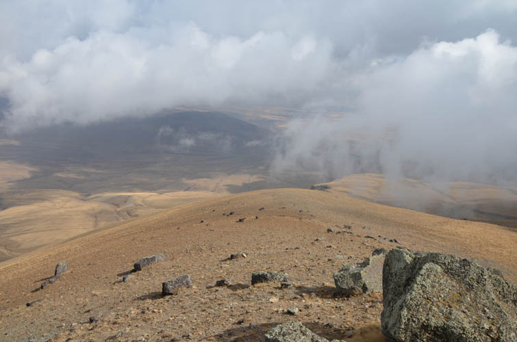
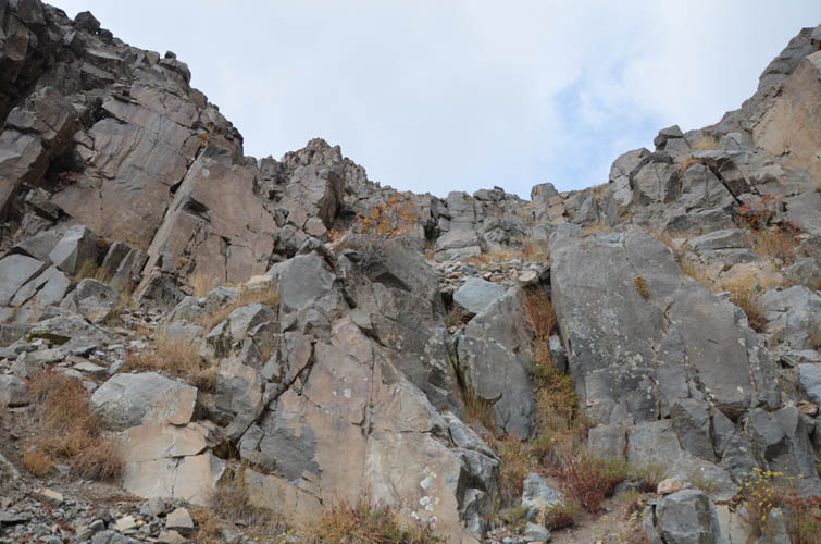
After a short summit stay the weather cleared up a bit and I thought to myself why not continue to explore a little further along the ridge? Moreover, one of the high points to the west appeared slightly higher than the official summit I was standing on and I was curious to check it out. My extension took me across more of the same terrain – slabs of volcanic rock and sparsely vegetated mud on a barren open ridge. The sun fought through the clouds and I was finally able to take a glance at the lakes in the crater below me. It was such a magnificent sight from up here!
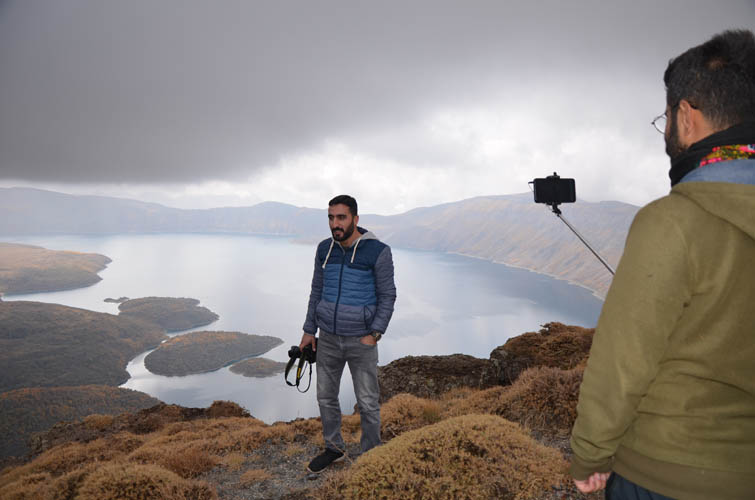
The seemingly higher point along the ridge in fact turned out to be 20 metres lower than the summit. Mountain tops can be so deceiving when you’re in the middle of them, or maybe I’m just really bad at guessing elevations. I hadn’t seen a single person on my hike, but then I suddenly ran into a group of Turkish hikers who had come up from the village of Serinbayır northeast of the crater to take pictures of the lakes below. We shared some cookies and took pictures together before I continued further west along the ridge.
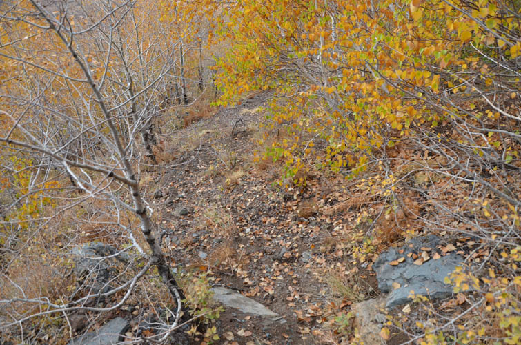
Faysi from the tea house had told me about a direct route down from the summit back to the green lake. However, standing up on the edge of the crater, it was extremely difficult to tell where the route was through the steep cliffs that flank the top of the ridge. Now that I was about 3 km west of the summit, an obvious route down to the crater presented itself at a broad saddle. I had hoped for a good scree run on fine volcanic sand, but instead had to put up with rather unpleasant chunks of rock stuck on a steep, grassy slope. Half-way down a couple of minor cliff bands appeared that required some moderate scrambling via gullies, but nothing overly difficult. My descent straight down the inner crater slopes spat me out at the end of an abandoned path that nicely leads back to the cobbled road and Faysi’s tea house.
| Elevation: | 2948 m (official), 2931 m (my GPS) |
| Elevation gain: | 810 m |
| Time: | 4.5 h |
| Distance: | 10.0 km |
| Difficulty level: | Moderate (Kane), T4 (SAC) |
| Reference: | Local maps and own routefinding |
| Personal rating: | 4 (out of 5) |
DISCLAIMER: Use at your own risk for general guidance only! Do not follow this GPX track blindly but use your own judgement in assessing terrain and choosing the safest route.