Muhayil, Saudi Arabia
4 April 2019
Solo
A hot, dusty and sweaty hike up an unknown mountain
Having the unique opportunity to drive through the kingdom with a rental car all on my own, without a guide or booked tour, truly felt like a privilege. I was away from the tourist masses, surrounded only by locals wherever I went, and had complete control over where I could drive and what I wanted to climb if I so desired. Ultimate freedom.
But nothing is free, of course, not even freedom. The price to pay was extensive research, scouting, and information gathering at various stages of my trip to ensure what I was doing was 1. safe, 2. practically doable, and 3. actually enjoyable. Often times, it was a lengthy if not cumbersome exercise to do all this homework first. And then when it came to the actual trip, there were hiccups, dead ends, and failed attempts… the pay-off wasn’t always there. There were climbs I had to abandon for practical or safety reasons, and there were certainly trips I ended up not enjoying very much as well. But such is the nature of exploring and enjoying your freedom – the outcome is often uncertain, because you cannot and do not want to control the very freedom you’re seeking. A bit of a paradox really.
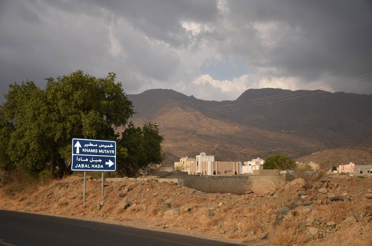
The selection of mountains I was planning to visit was based on a variety of factors. One criterion was to try to visit different geographical areas along my approximate itinerary in order to get a feel for the range of landscapes Saudi Arabia has to offer. I was now coming through the town of Muyahil northwest of Abha and decided to base myself here for a few days to explore the city and surrounding area. Several peaks popped out on my topo map as well-defined mountains that should be easily accessible from a nearby road and could potentially make for nice day trips. As usual, almost none of these peaks were named on my map. Road signs and locals later confirmed “Jabal Hada” and “Jabal Durum” as the two biggest in the area, located about 15 km northeast of Muhayil along highway 2460.
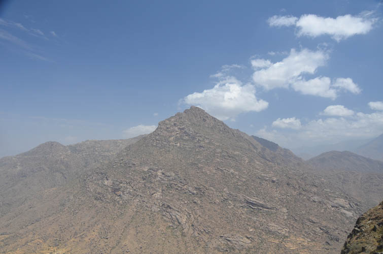
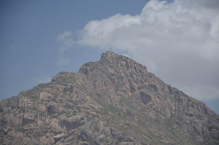
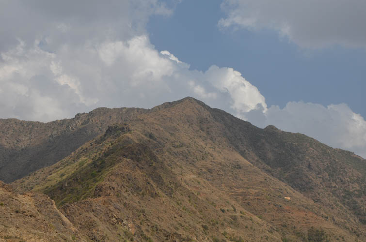
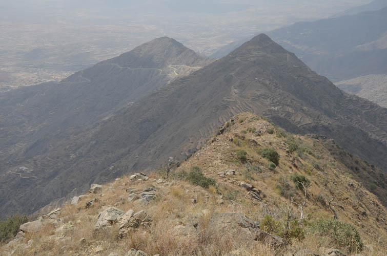
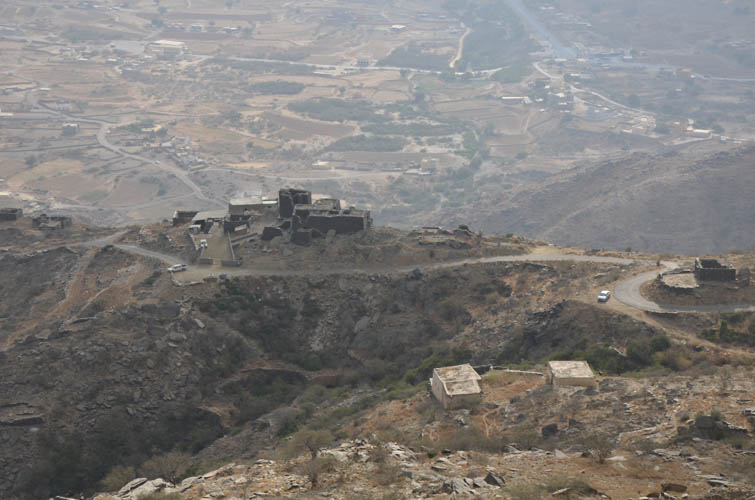
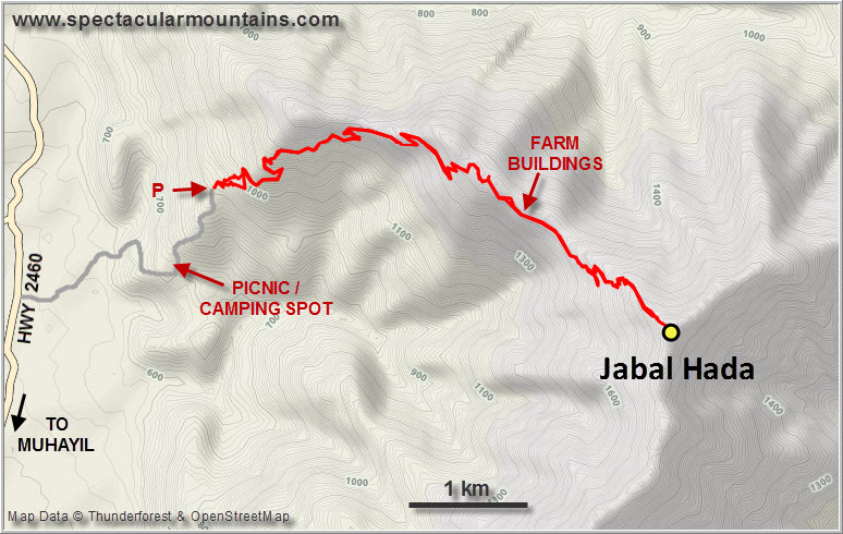
Jabal Hada is a fairly sizeable massif with three main ridges, each several kilometres in length. Small villages occupy the lower slopes and there are scattered buildings even on some of the ridges. The best way to get to the summit, according to the maps I had, was to approach it by way of the northwest ridge where a dirt track leads up part-way.
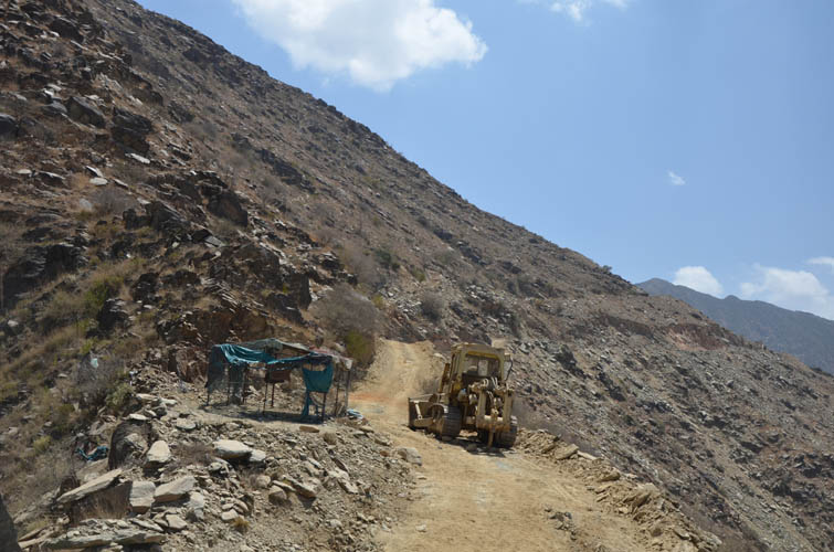
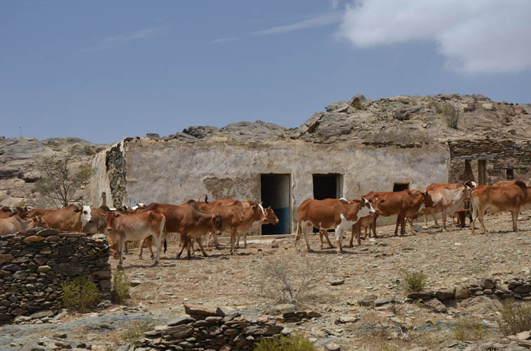
I drove up on a narrow asphalt road to the very end of it at an elevation of about 900 m and parked by a small farm building. A young Ethiopian fellow guarding the house was the only person around. He was watching with much amusement as I put on my boots, donned my broad-brimmed sun hat, and extended my hiking poles.
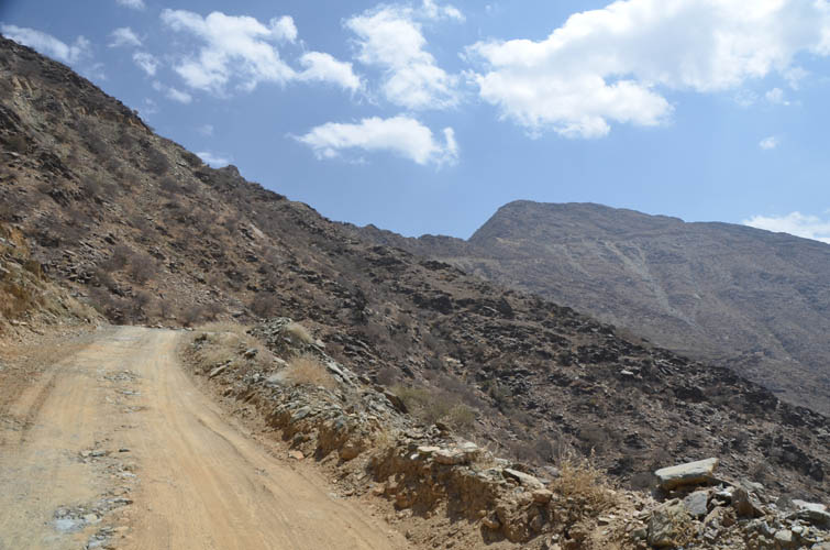
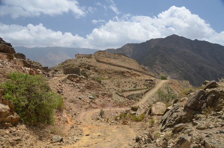
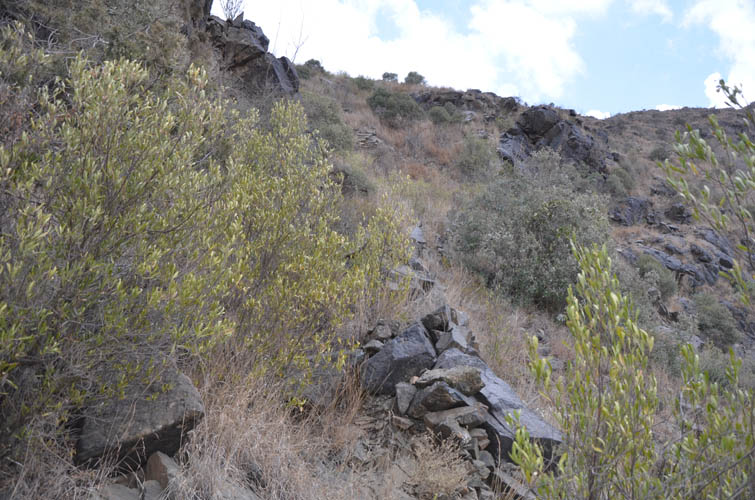
To get to the dirt track I had to cut across some rough terrain with thorny shrubs for a few hundred metres. Once on the narrow track, it was smooth sailing for the next couple of hours. This was essentially an access road for farmers to reach their animals and farm building up on the ridge, but today there was nobody here. It was hot and I was sweating intensely as the morning sun heated up the light-coloured dust below me. The track made numerous switchbacks before reaching the crest of the ridge and coming to its end by a cluster of farm houses. It was a rather tedious trudge up to this point to be honest, not the most pleasant approach.
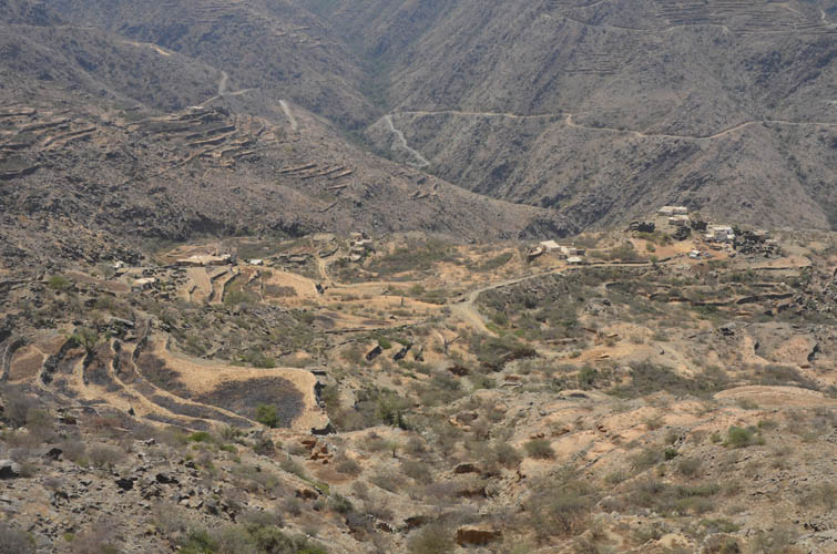
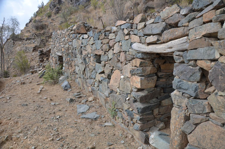
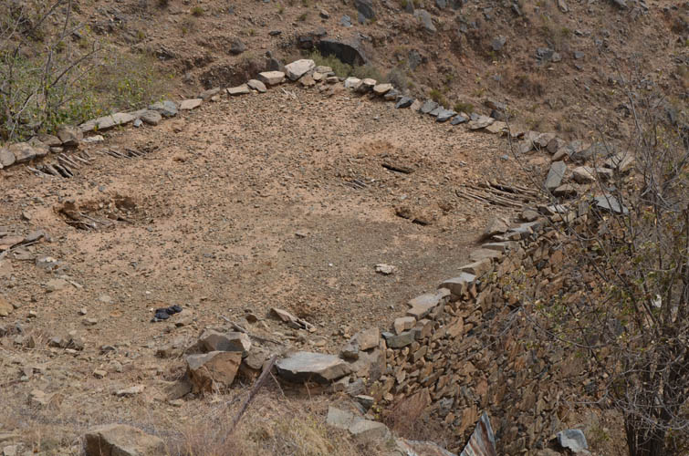
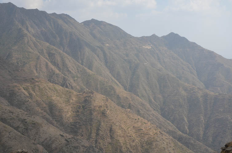
Behind the farm buildings I followed a foot path that rises a little higher on the south side of the ridge to some old fields. A lot of these are step fields that have been established on flattened plots of land carved out of the hillside and fortified with stone walls. Many of the fields and stone houses appeared derelict and no longer in use, a sign of the changing times as farmers give up their trade and villagers move to the cities.
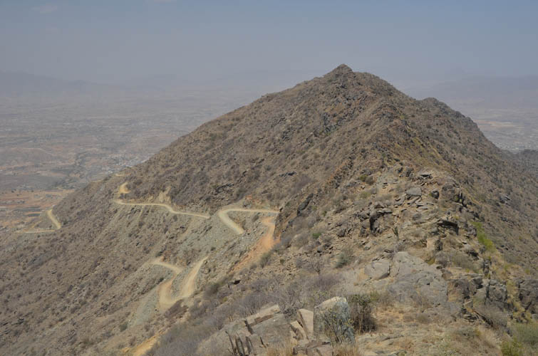
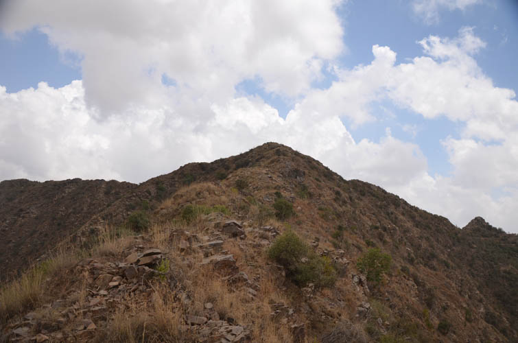
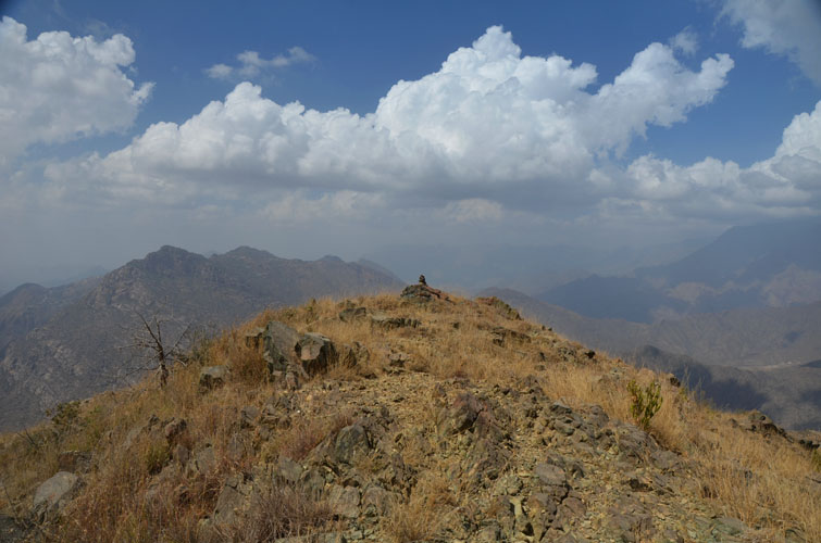
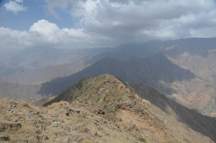
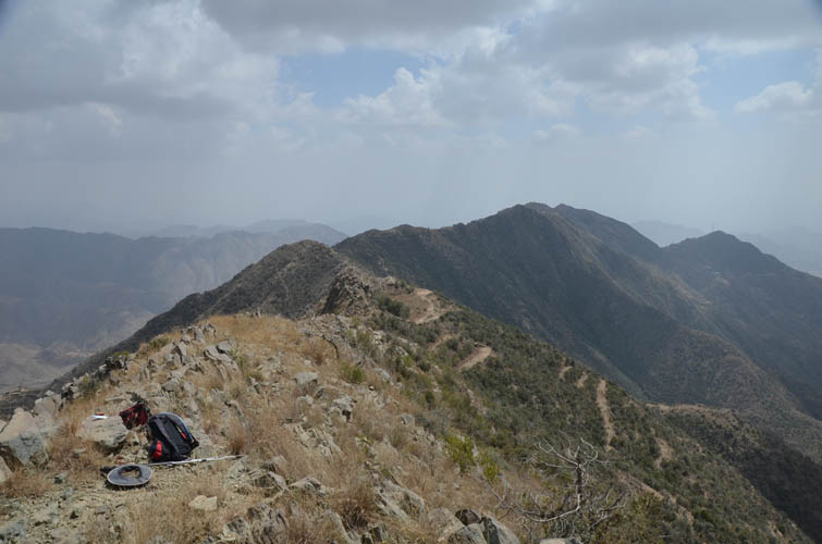
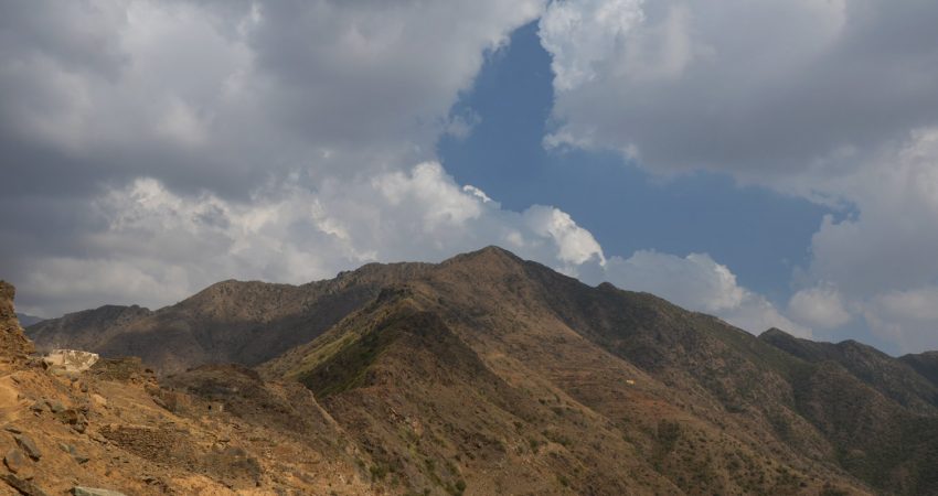
After one more short off-trail section to get back onto the ridge top, the rest was an easy hike on the open ridge to the summit. I was surprised to find neither a trail along the ridge, nor a cairn at the summit. Up here at 1900 m elevation there was a light refreshing breeze and I felt perfectly comfortable, worlds apart from the hot and stuffy conditions down by the dust track. I took a long break and pondered whether all the effort had been worth it to come up here. Yes, the views were quite nice (very hazy, though) and the last bit of hiking was fun, but I certainly wasn’t blown away. This is one of those mountains that make you enjoy others even more, I thought to myself. Yes, you need to have these kinds of trips too, you can’t just expect super amazing experiences every time. It’s the reality of venturing into the unknown – sometimes you win, sometimes you don’t – but if you don’ try at all, you would never know, would you?
At least my mind was at ease while I was enjoying my summit lunch, knowing true well that the descent would be easy. All I had to do is follow the same way back down, no routefinding required. I was so relaxed that all I could think about was the tasty shawarma I was planning to have for dinner in Muhayil. A shawarma with hummus, pita bread, a salad and an ice-cold Pepsi – what a fine reward for a long, hot and sweaty day!
|
Elevation: |
1929 m (my GPS) |
|
Elevation gain: |
1050 m |
|
Time: |
6.0 h |
|
Distance: |
13.9 km |
|
Difficulty level: |
Easy (Kane), T3 (SAC) |
|
Reference: |
No info was available to me prior to trip |
|
Personal rating: |
2 (out of 5) |
NOTE: This GPX track is for personal use only. Commercial use/re-use or publication of this track on printed or digital media including but not limited to platforms, apps and websites such as AllTrails, Gaia, and OSM, requires written permission.
DISCLAIMER: Use at your own risk for general guidance only! Do not follow this GPX track blindly but use your own judgement in assessing terrain and choosing the safest route. Please read the full disclaimer here.