1 April 2017
With Phil
This is probably one of the least “efficient” trips I’ve done in a long time – the ratio of effort to achievement was just too skewed on this one! If it wasn’t for Phil, who joined me on this unexpectedly strenuous outing, it would’ve been way worse and I likely would’ve never been able to make it to the summit on this day. There was simply too much soft, deep snow to plough through!
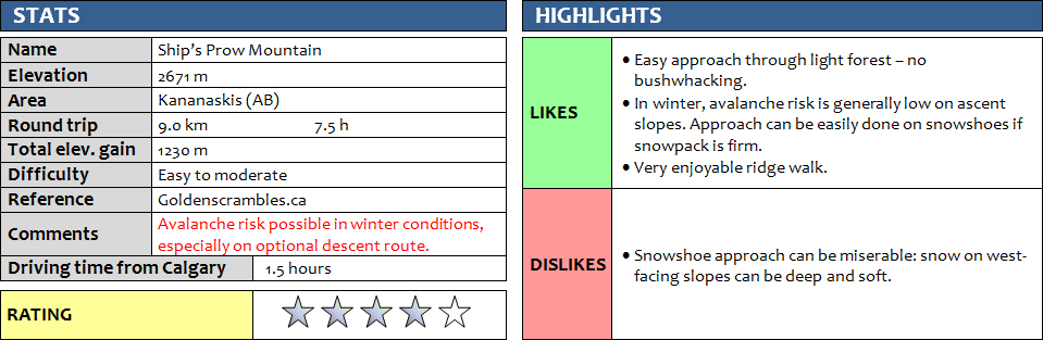
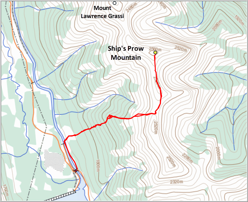
Following the suggested ascent route by Josée & Fabrice of Goldenscrambles.ca, we followed the maintenance road on the east side of the canal (north of Goat Pond) for about 600 m before turning right and heading up the west slopes of the long range of peaks that include Ha Ling, Mount Lawrence Grassi, Big Sister and Rimwall.
As soon as we left the road, I immediately started punching through the thick snow cover, while Phil somehow managed to stay on the surface. We quickly switched to snowshoes and started the long plod uphill through open forest. Thankfully, there was no deadfall or bushwhacking to speak of, so travel was generally easy – at least at the beginning! The snow got thicker and the angle of the slope steepened as we gained elevation, making for an extremely energy-draining combination… We constantly sunk through the unsupportive snowpack and often had to wade or simply plough our way through as best as we could. Needless to say, it was very slow going in places and more than once we wondered what the hell we were doing here; this was NOT what we had expected! The weather wasn’t helping either: it was cloudy, snowy at times, and there was no sun and no views.
It is amazing what mutual encouragement and motivation can do in these situations. We kept our spirits high and just soldiered on. Eventually we reached treeline and the much-awaited open wind-swept slopes. It felt like such a relief to dump our snowshoes and simply do some normal hiking on firm ground!
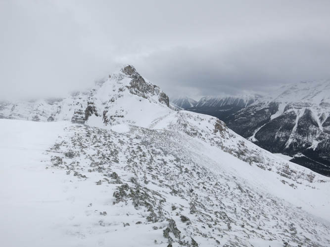
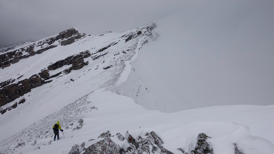
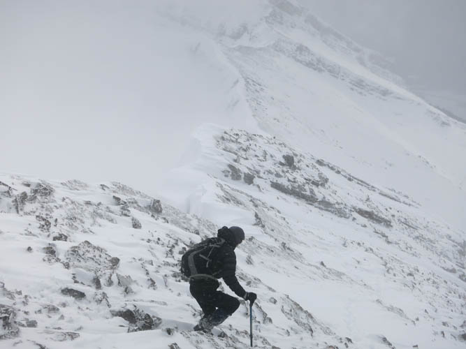
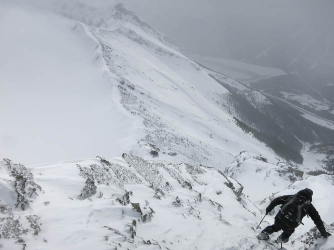
I was surprised how quickly we reached the summit ridge after leaving the trees. It was quite windy and cold up here, but we were eager to continue as the summit was now within sight after the clouds had started to thin out a bit for the first time. There was still just under a kilometer to go to the summit, and this was the most enjoyable part of the day. A large, continuous cornice flanking the ridge crest made us stick to firm ground just below, which involved scrambling up and down a few minor steps here and there. Most of the traverse was on solid rock, but patches of ice and snow-filled holes between the rock required some caution. An intervening bump along the ridge has an impressive cairn sitting on it and I wonder if this high point carries a separate name.
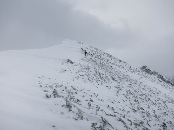
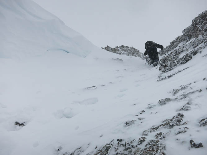
The final approach up to the summit block was an easy hike on frozen scree and broken up rock chunks. Just below the summit, a cliff band presented the only real scrambling challenge of the day. It can be easily circumvented on the left (west) side, but with snow filling the leeside, we opted to tackle it head on. Firm snow allowed for good traction on the steep rubbly slabs, offering a direct route through the cliff band without any serious difficulties.
By the time we stepped up to the summit cairn, the clouds had moved in again and our views were limited to white sky and fuzzy grey rock in the distance. It didn’t matter, though. We were just happy to have reached our objective knowing that the suffer fest earlier had not been in vain. It was windy and our faces were blasted with tiny pellets of hail and snow, so we didn’t hang around very long and quickly made our way back down.
As is usually the case, the crux required more caution going down than up. Our steps had loosened up some of the rubble and you really had to be careful not to knock down rocks on each other. Even though this section was short, we decided to take turns here and I didn’t start climbing down until Phil had cleared the area.
Although we had initially contemplated an alternate descent down the west-facing gully just south of the summit, which others have taken before, we decided against it due to the potential avalanche danger. It’s fairly steep and filled with lots of snow, not the kind of terrain we wanted to venture into. Moreover, it was much easier to simply retrace our “ploughed” trail through the deep snow in the forest!
This was an arduous but enormously rewarding trip that required a lot of work to complete. I have to thank Phil for coming up with the idea, and more importantly for his amazing perseverance and drive that got us both to the summit and back. In the conditions we had – soft, deep snow – I wouldn’t recommend it to anyone, but if the snowpack is firm then the approach up the west slopes would make for a really pleasant snowshoeing trip. In summer this is bound to be a straightforward off-trail hike followed by an easy/moderate ridge scramble.
DISCLAIMER: Use at your own risk for general guidance only! Do not follow this GPX track blindly but use your own judgement in assessing terrain and choosing the safest route.
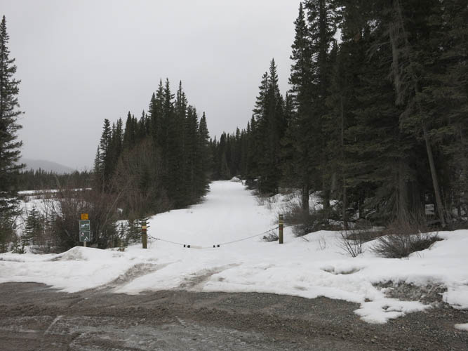
The start of the access road where we parked.
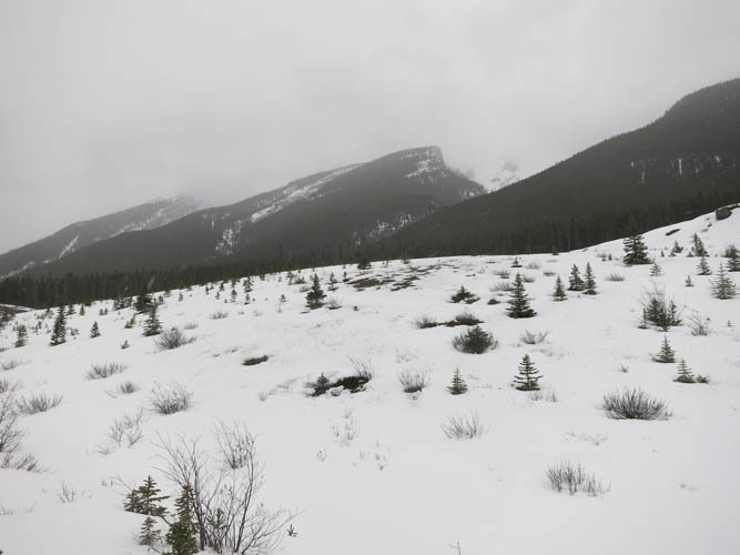
From where we left the road, the summit should be visible but today is shrouded in clouds.
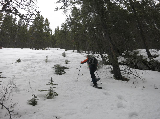
Slogging up through the snow-filled forest.
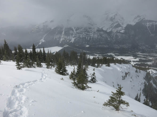
At treeline, we’re finally able to leave our snowshoes behind. The sun makes a brief appearance, but the views should really be better!
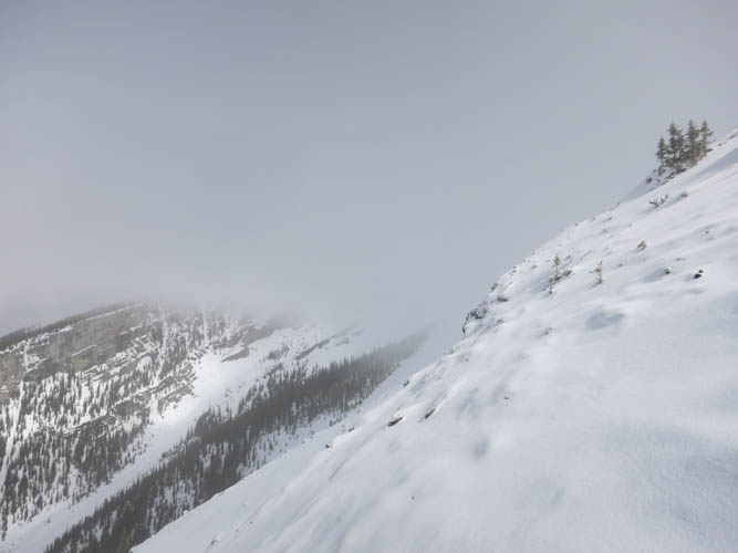
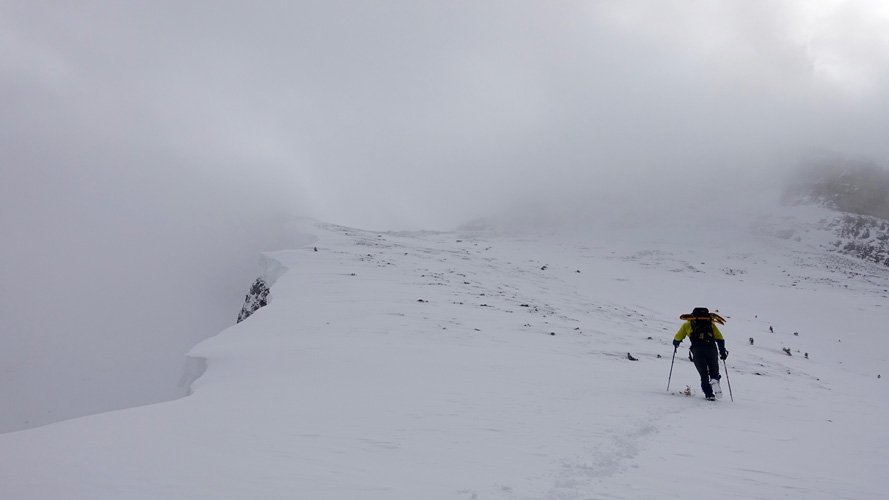
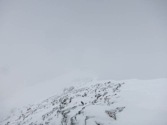
It’s mostly white and grey today!
Hiking up to the top of the main ridge. [Photo by Phil]
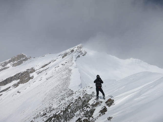
At the summit ridge, looking north towards the intervening high point. [Photo by Phil]
And looking back south: we gained the ridge just before the pointy crag.

Curious ice crystals that grow into the wind like horn corals.
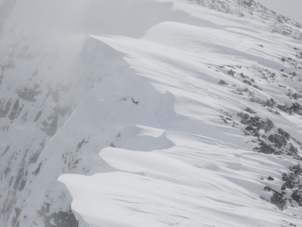
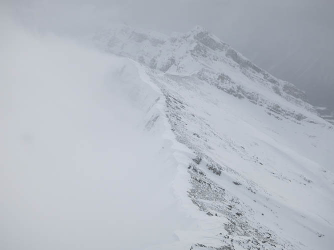
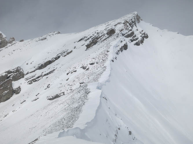
The cornice bounding the ridge crest is massive!
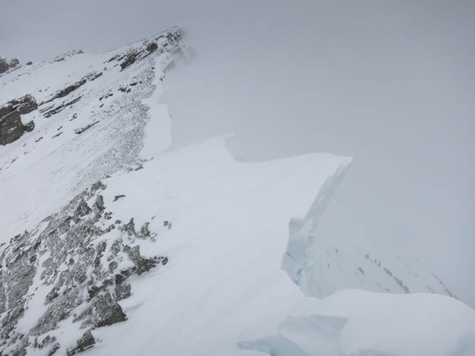
Close-up of the cornice.
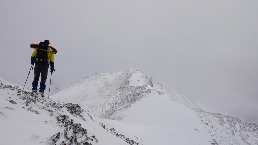
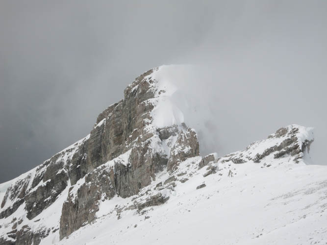
A first view of the summit in the distance. [Photo by Phil]

Some sidesloping on icy rock and snow is necessary to avoid the ridge crest and its wide cornice.
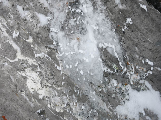
More bizarre ice and snow formations, which are the result of the incessant strong winds up here.
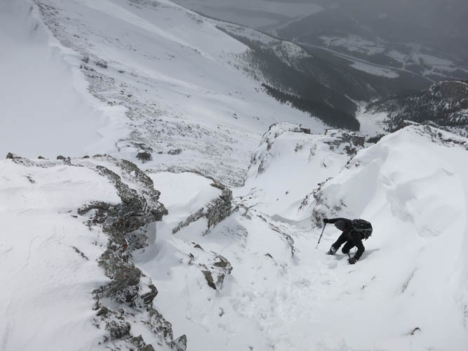
Climbing up a steep gully through cliffbands on the summit block.
Phil is leading the way, the summit a mere metres away.
Fantastic summit views! 🙂
Heading back down. Now the strong, abrasive wind is straight in our faces.
Phil climbing back down the crux.
It’s short, but steep and loose.
A view back at the steep cliff north of the summit that others (like Steven Song) had to downclimb on their way to Ship’s Prow Mountain along the northern route.
Snow and clouds
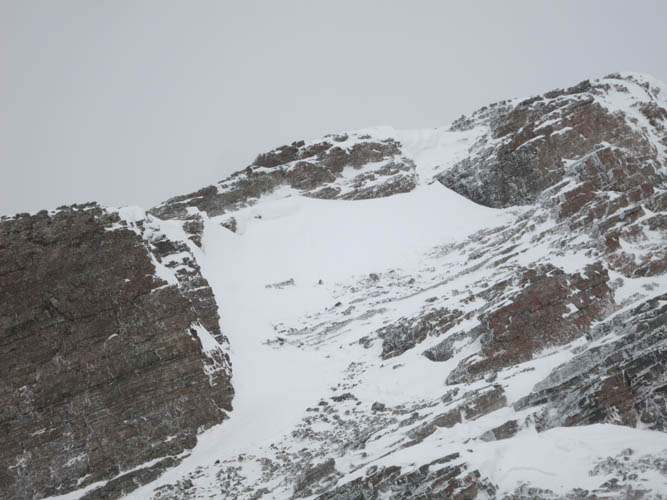
A close look back at the crux just below the summit (looking north). The cliff bands are fairly easy to overcome with all the snow in between.

How wonderful to see some sunlight on the ridge on our descent!
Reason enough to stop and take some pictures. Here, Phil captures the views on the ridge with the summit in the background.
Another look back at the summit.
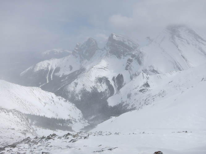
The Three Sisters briefly appear in the clouds.
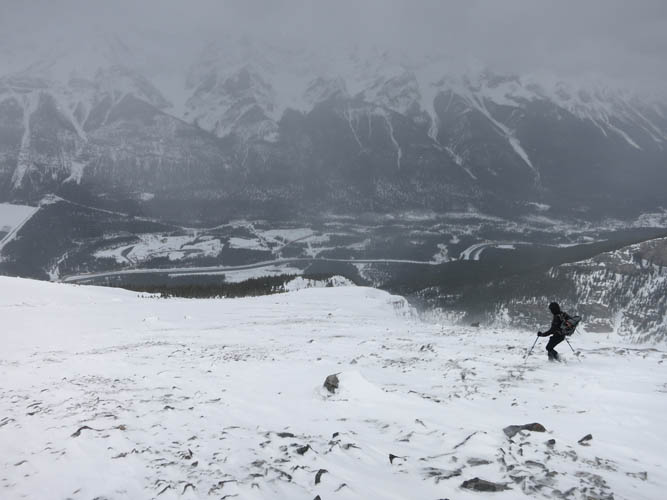
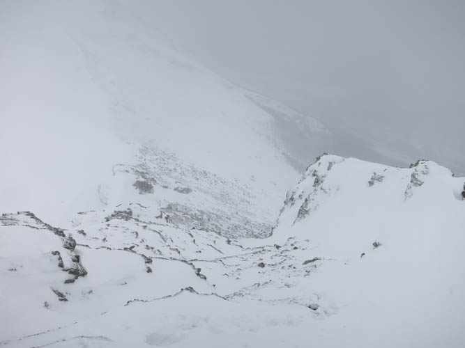
Descent back down into the valley.