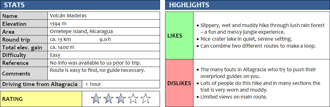
Ometepe Island, Nicaragua
4 June 2015
With Wen
Maderas is the smaller but more popular one of the twin volcanoes that together form Ometepe Island on Lake Nicaragua. We wanted to see how the two compare, so two days after hiking up Volcán Concepción on the north side, we donned our hiking gear again to ascend Maderas. We were joined by Silvio, the same guide we had for Concepción, who as before proved to be great company, was very knowledgeable about the local flora and fauna, and did an excellent job of leading us up and down safely. Although it was really nice to have Silvio with us, in retrospect a guide wouldn’t have been necessary as the route is easy to follow, at least the trail on the northern side of the mountain that most people use.
We left our hotel in Altagracia at the brutally early time of 4:30 am to catch the 5:00 am bus to Finca Magdalena. These early starts are uncomfortable when you’re on holidays of course, but trying to avoid the heat of the day as much as possible just makes sense. In my morning daze I forgot my GPS in the room, so annoyingly I couldn’t record a track for this trip (route on the map is approximate).
The trail that goes up the volcano from the northern side is the route of choice for most visitors. We saw perhaps three or four other groups on the well-trodden path that, similar to Concepción’s lower slopes, goes through beautiful rain forest with impressively tall trees at the beginning. Of special interest to me as a chocolate lover were the wild cacao trees by the side of the trail, with beautiful cacao pods in various stages of ripening hanging right off the trunk. Soon the grade steepened and the trail got narrower and very muddy and slippery. We had to make frequent use of tree branches and lianas to help pull us up, and the higher we got, the more we had to focus on not slipping on the many exposed roots and boulders that were often wet and slick. I was completely soaked, mostly from my own sweat, and my pants and boots covered in mud. As messy as it was, it was also fun and exciting to be here clambering our way through the jungle! I love being out in nature and this is pretty much as close as you can be to Nicaragua’s rain forest, feeling it with all your senses and all your limbs.
The flipside of being in the forest for so long is that the views on this hike are very limited to non-existent until you reach the crater rim. Even here, wafts of clouds were partially covering the rim and we weren’t too impressed with the views of the crater lake. It surely is a nice, quiet spot to take a lunch break, but the setting is nothing special in my opinion. Apart from the lake, there’s a forested ridge around you and a large patch of green tall grass, that’s about it. Perhaps we would’ve liked it a lot more if the skies had been blue and sunny, opening up better views around us. There was only one other group of hikers, but they left when we arrived, so we enjoyed a very peaceful hour in this tranquil spot before heading down.
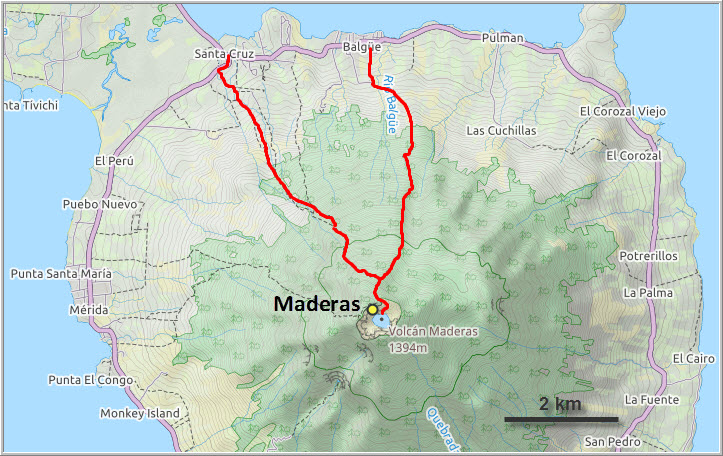
For the descent, Silvio suggested taking the northwestern route back down, to the small town of Santa Cruz. A different way down for a change is always a great idea! Indeed, it turned out to be the more enjoyable of the two routes. The landscape is a bit more varied on the northwestern route, with several stretches of hiking in open terrain, and there’s also an interesting historical site of ancient petroglyphs at El Porvenir near the end of the trail.
This hike was a great jungle hike with tons of slipping and sliding on muddy trails and bashing through dense bush that made us feel like Indiana Jones. On the whole, Concepción was more exciting, primarily because of the more varied terrain and the novelty of seeing an active volcano close up. Nevertheless, both mountains were terrific hikes that were totally worth getting our pants muddy for!
Notes on logistics:
- Several trails go up to the crater lake of Volcán Maderas. The main route starts from Balgüe/Finca Magdalena in the north.
- Guides cost around US$20 but aren’t really necessary on the main route if you’re an experienced hiker and can handle steep, muddy, slippery trails. For any of the other routes it’s best to have someone show you the way as the route is not marked/flagged.
No GPS track available for this route.
DISCLAIMER: Use at your own risk for general guidance only! Do not follow this map blindly but use your own judgement in assessing terrain and choosing the safest route.
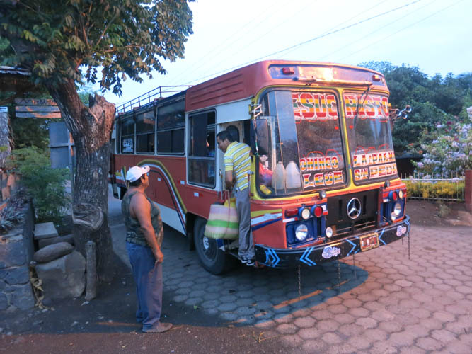
Typical Ometepe island bus.
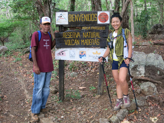
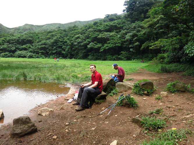
Our guide Silvio and Wen at the trail head for Maderas.
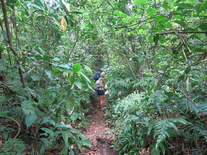
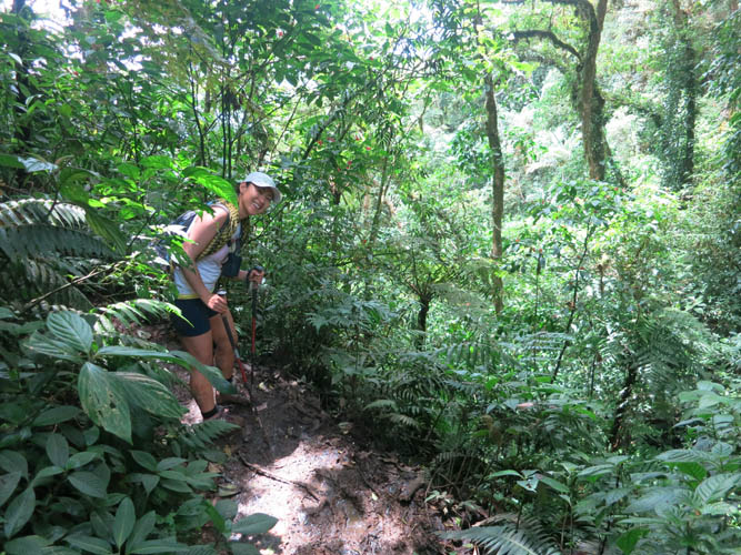
The vegetation is already sprawling but at least the trail is still dry in the lower part.
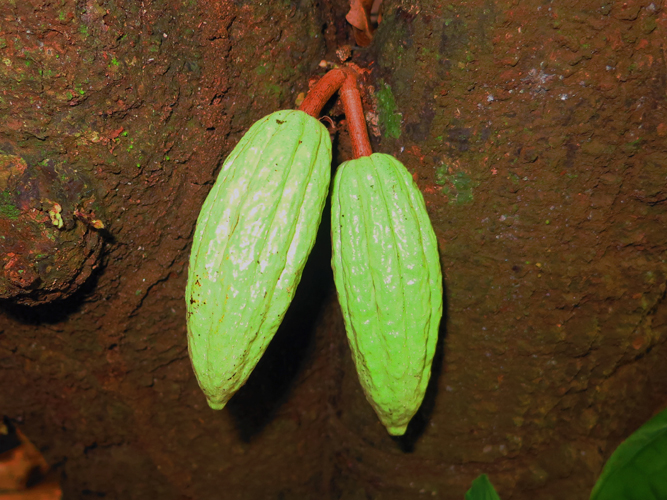
Cacao pods hanging off the trunk of a cacao tree.
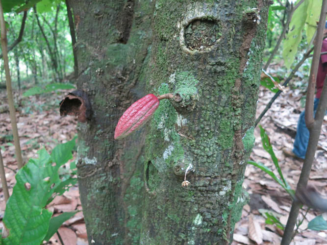
Another pod in red. The fruits of the cacao tree always grow directly on the trunk instead of the branches. Nicaragua isn’t really known for its cacao, but does produce some excellent beans that are made into high-quality chocolate (e.g. the 50% Labooko by Austrian company Zotter, one of the best milk chocolates in the world, although the cocoa in this chocolate is probably from a different part of Nicaragua).
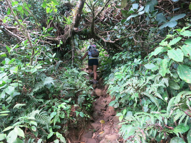
The trail quickly gets more demanding as we gain elevation.
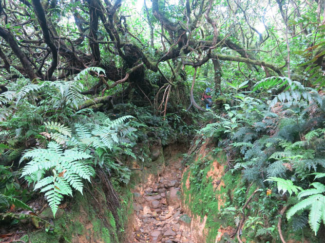
And more slippery and muddy!
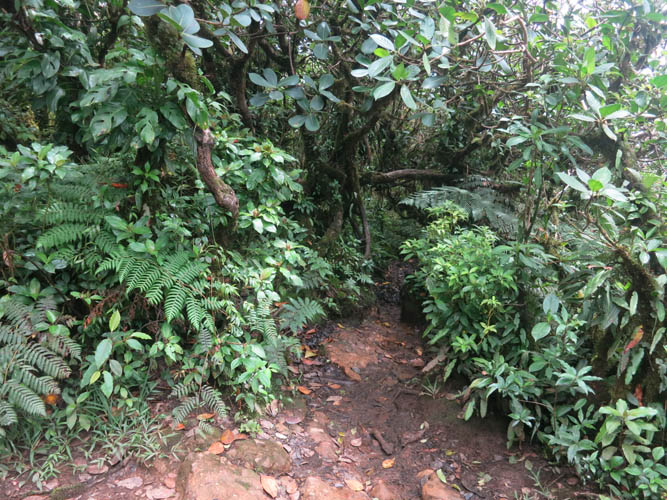
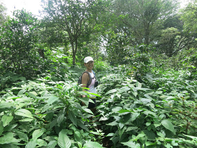
Thick, dense jungle.
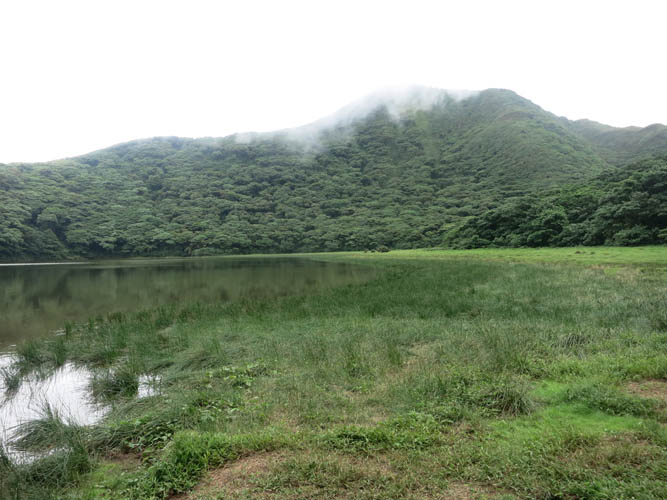
At the Maderas crater lake.
Enjoying a relaxing break at the lake.
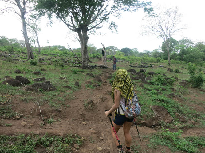
Back down the slippery path, this time on the northwestern route.
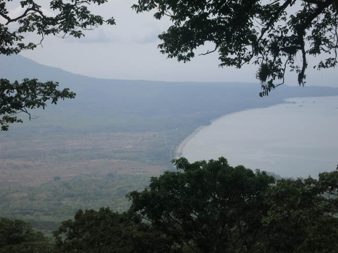
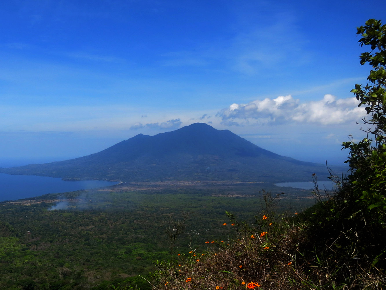
One of the rare views we had from the upper slopes: the northeastern coastline of Ometepe Island.
This route isn’t as popular – we didn’t see a single person on the northwestern trail that day.
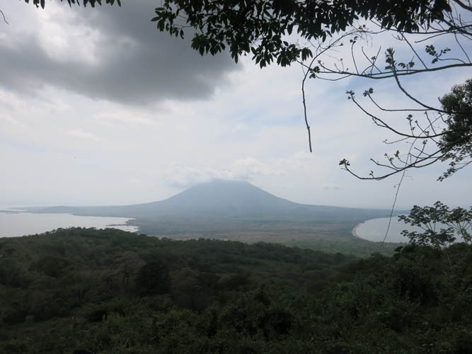
A cloudy view of Concepción, Madera’s sister volcano to the north.
Easy hiking through open fields in the lower section of the trail.
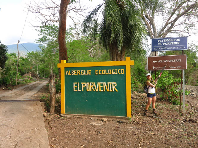
This is the trail head at El Porvenir. The last stretch of our hike was on an asphalt road to the town of Santa Cruz.
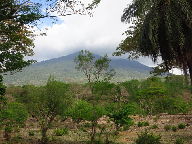
Looking back at the cloud-covered summit of Maderas.