Lower Engadine, Switzerland
14 July 2018
Solo
A big mountain that’s easy to underestimate
A fantastic outing to one of the area’s highest peaks and hands down one of the most enjoyable outings I’ve had in Switzerland!
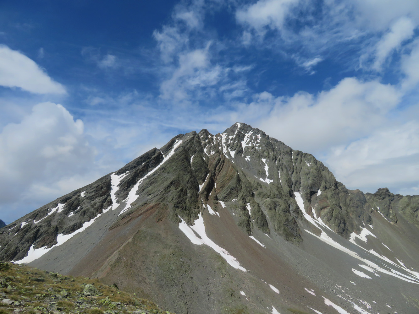
Piz Linard is the crown of the Lower Engadine. Its massive pyramid-shaped summit mass towers above almost everything else when viewed from the nearby Graubünden Alps southeast of Davos. Linard is one of those big mountains that many regard as a mountaineering objective because of the steep, often icy snow fields that linger well into the summer on its south flanks, the easiest and normal route. However, if conditions are right and enough people have beaten a trail into the snow before you, an ice axe will suffice to make the ascent. A word of warning: in addition to an ice axe and a mandatory helmet, most people use crampons for extra stability on the snow fields, so crampons are also highly recommended.
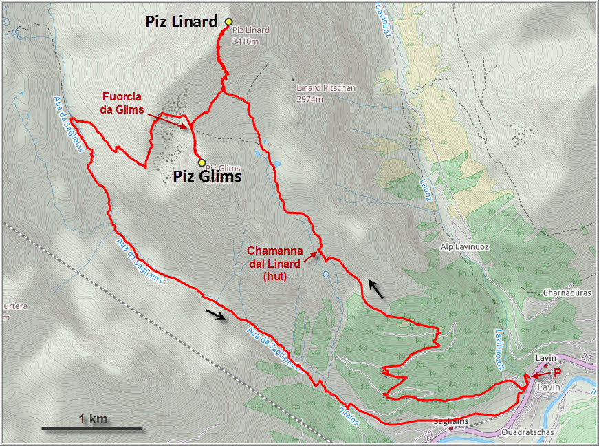
To get to the base of the mountain, you first have to overcome more than 1000 elevation metres on a good trail from the town of Lavin to the Chamanna dal Linard, a fine mountain hut used by many climbers to break the trip down into 2 days. The approach took me about an hour and a half at a good pace. The hut is famous for its Graubünden nut cake (Graubündner Nusstorte), plus it serves home-made meals, coffee, beer, and all the luxuries you didn’t know you needed or wanted on a mountain escape!
From the hut I hiked northwest past the Lai da Glims lakes and crossed a talus field to get to the base of the south face. Finding the correct ascent gully is key to making this a non-technical affair. This is also where the climb starts in earnest – I put on my helmet, donned my gardening gloves (very useful in scree and for my ice axe), and started up the narrow gully. The gully is full of loose, crumbly rock and presents a real hazard if people are above you. As I made my way up, a group of 15 was just descending and there were lots of small rocks tumbling past us. They had spent the night in the hut and set off in the morning, equipped with helmets, crampons and axes. Some of them were roped up, too.
Cairns mark the point where to exit the gully near the end of it to the right, where a short section of moderate scrambling leads to a scree field and the snow fields. I was surprised how steep the snow field was, my ice axe was definitely a must here! Step by step, I followed the boot holes created by the people before me using my axe as an anchor. I can see how crampons would make the ascent more reassuring and certainly more comfortable. Half way up the first snow field, I encountered one last person coming down: a guy without any equipment, not even a helmet, was bum-shuffling down a sharp, exposed rock rib to the right of the snow field. It looked like a painfully slow and strenuous exercise, but he wanted to avoid the steep snow at all costs since he had nothing to stop himself with in the event of a slip. He had really put himself into a dangerous predicament, but at least he openly admitted being woefully underprepared for such a big mountain. Thankfully, he made it off the mountain safely as I later found out.
There is a second, slightly easier snow patch to cross before the ridge top is reached. From here, it was a short and easy scramble to the big summit cairn complete with register. One look at the book shows how popular Piz Linard has become: lots of climbers make the ascent every summer and it is nothing unusual to have 20 or 30 entries on a single summer day.
The descent down the snow fields was actually easier than I had expected. It was noon and by now the sun had warmed up the snow sufficiently to allow for deeper step-kicking and better grip. No one was below me when I came down the gully, which also sped things up.
Once out of the gully, I made a beeline across scree and grass slopes to Fuorcla da Glims (2802 m), the col between Piz Linard and Piz Glims. The latter is easily attained via the easy north ridge and makes for a great vantage point to admire the sheer south face of Piz Linard.
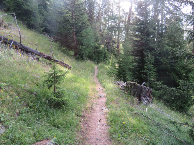
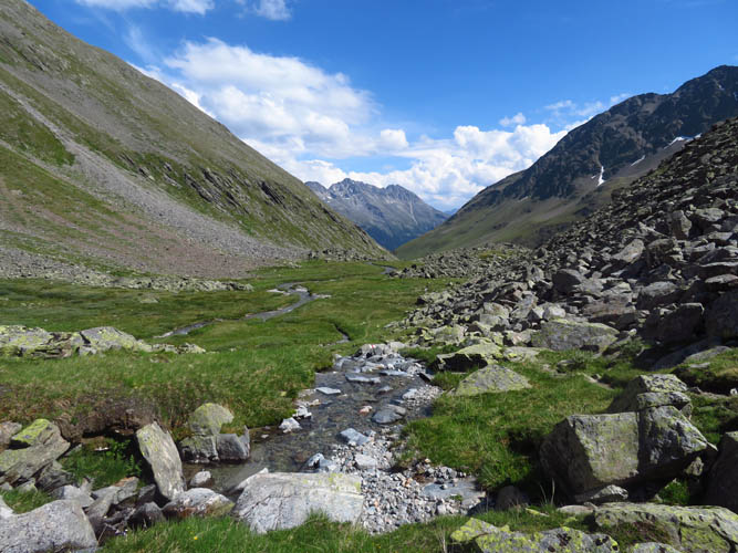
Instead of heading back down the same way via the Linard hut, I decided to do a slightly longer return route through the Sagliains valley to the southwest of Piz Linard. I’m glad I did, this is an absolutely beautiful valley, especially in the upper part, with a charming stream in the middle and some pretty big peaks flanking it on either side. The trail is in good shape but gets pretty overgrown in some places down the valley where lush ferns and grasses have taken over.
Overall this loop route worked out really well. It’s a long day with considerable elevation gain, but it was worth it every step of the way. And of course why not stay at the Chamanna dal Linard and spend some more time in this stunning part of the Swiss Alps!
| Elevation: | Piz Linard: 3410 m (official), 3404 m (my GPS) |
| Piz Glims: 2868 m (official), 2875 m (my GPS) | |
| Elevation gain: | 2080 m |
| Time: | 10.5 h |
| Distance: | 18.6 km |
| Difficulty level: | Piz Linard: Difficult climber’s scramble (Kane), T6 (SAC) |
| Piz Glims: Easy (Kane), T2 (SAC) | |
| Comments: | Ice ax and helmet essential. Crampons recommended if snow persists (most of the year). |
| Reference: | Local maps |
| Personal rating: | 5 (out of 5) |
DISCLAIMER: Use at your own risk for general guidance only! Do not follow this GPX track blindly but use your own judgement in assessing terrain and choosing the safest route.
An excellent approach trail allows an easy and fast start of the day.
Piz dal Ras (3028 m) across the valley to the west.
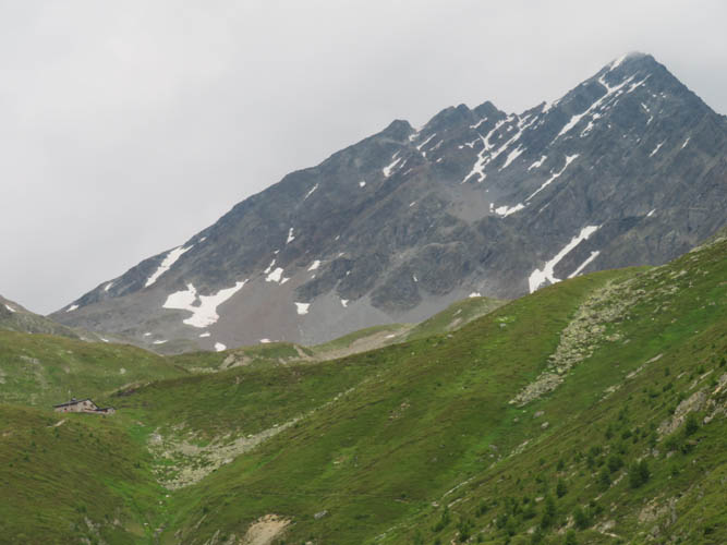
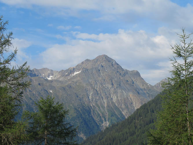
My first glimpse of Piz Linard. The Linard hut is tucked away in the valley below to the left, about half way up the mountain. Lots of people stay here overnight before making an early morning summit dash.
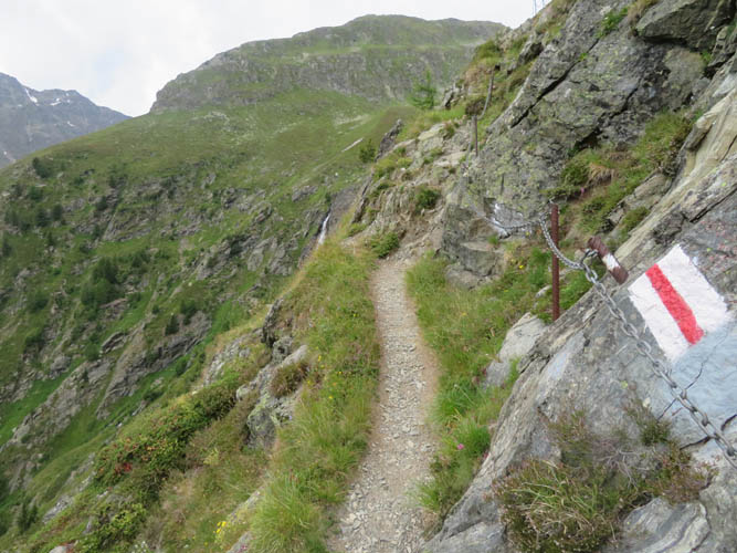
A fixed cable along a short stretch just before the hut – unnecessary for most, but it does make access to the hut family-friendly.

The Chamonna dal Linard hut.
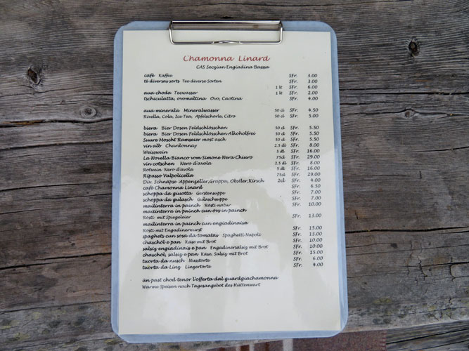
Lots of tasty treats on offer here, including the famous nut cake (Nusstorte). Prices are quite reasonable.
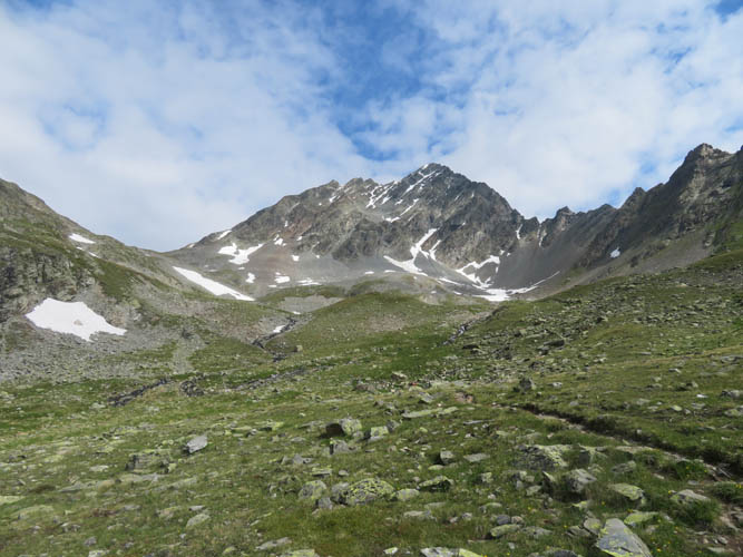
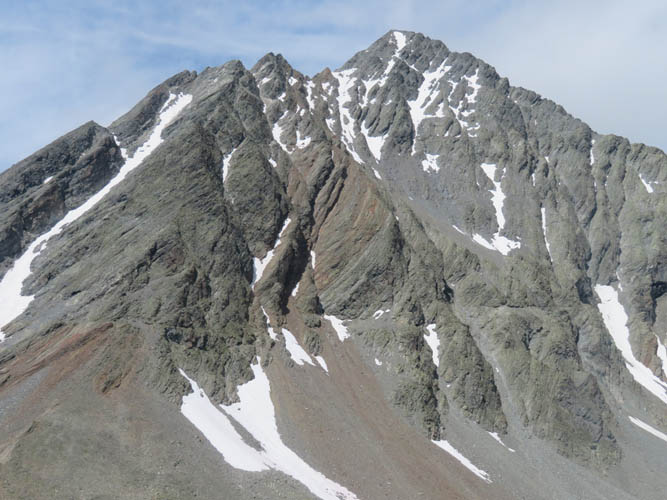
A view of Piz Linard from just above the hut.
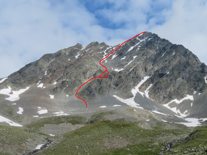
The approximate route in the upper part of the mountain as seen from the south. This is the “normal route” that goes up a prominent gully above the scree field, leaves the gully on the right across some rock steps (easy to moderate scrambling; several route options possible), heads up the scree slope in the middle, then veers diagonally right across several steep snow slopes and finally emerges on the SW ridge from where it’s an easy hike to the top.
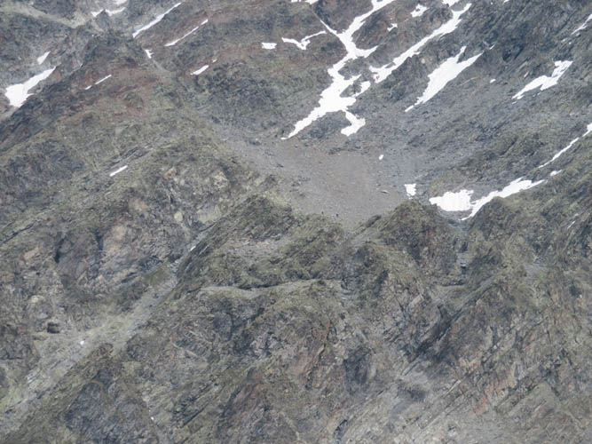
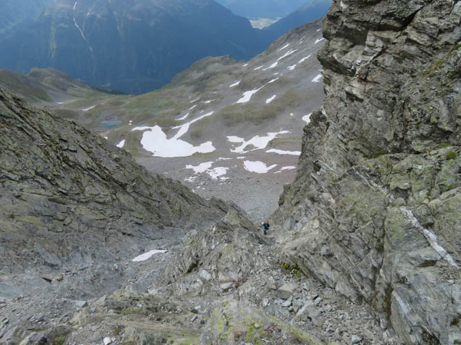
Close-up of the upper part of the gully (lower left) and the central scree slope. You can barely make out some small figues at the bottom of the scree field and the lower end of the snow chute – climbers who started early in the day from the hut and are already descending.
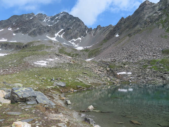
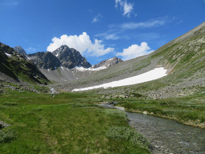
Looking up at mighty Linard from the small tarns below.
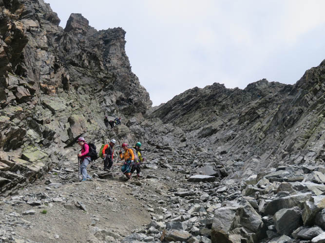
A party of four coming down the main gully.
Looking down the gully from about half-way up.
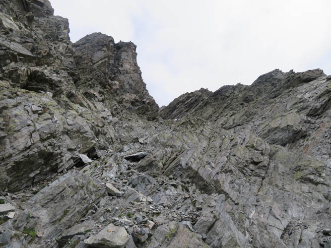
It’s steep and the rock is crumbly and loose. Helmets are absolutely essential here.
Another look down the gully. This is one of the most dangerous places on the mountain when other parties are around because of a high risk of rock fall.
Piz Glims appears in the sun to the SW.
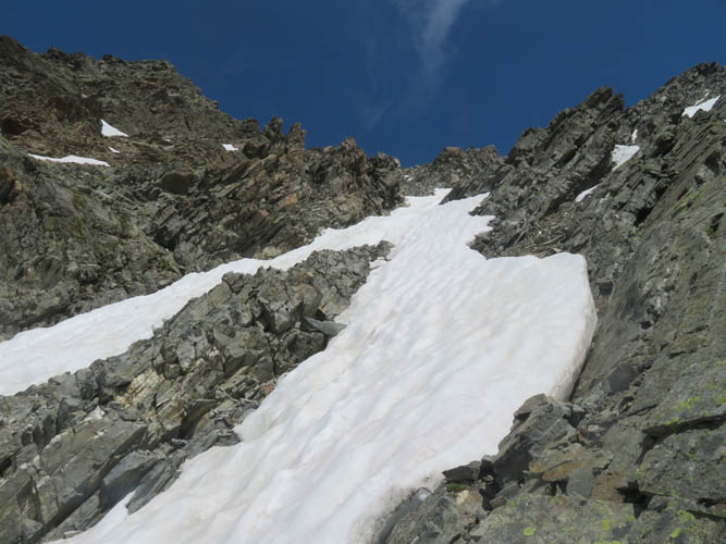
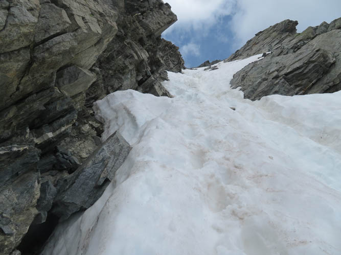
Heading up the steep snow chute.
Bare rock offers better footing in places where the snow has melted, but several steep sections of snow are unavoidable.
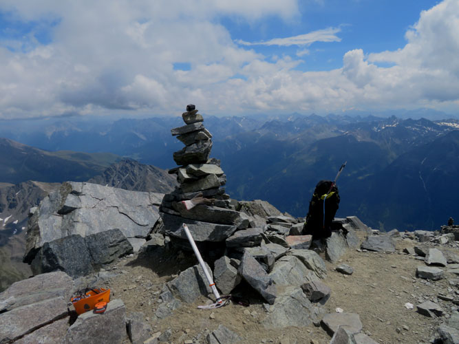
At the summit. I’m the last visitor of the day.
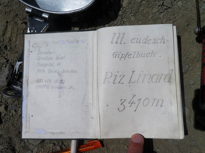
The thick register sees new entries almost every day during peak season.
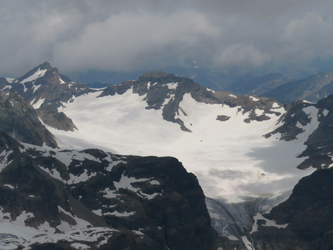
Silvrettahorn (L) and Signalhorn (centre) above the Silvretta and La Cudera Glaciers mark the border with Austria to the north.
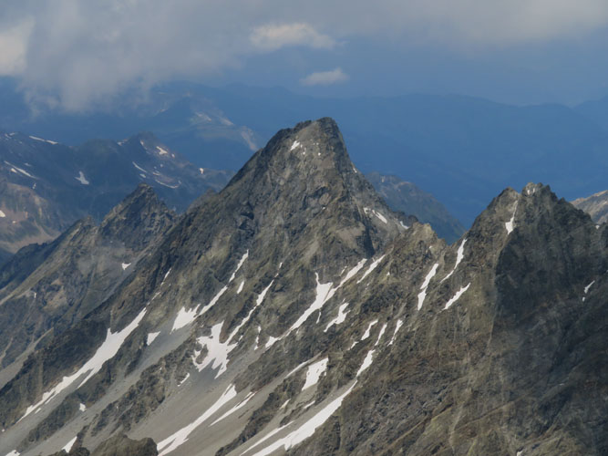
About 4 km directly north of Piz Linard is the Verstanclahorn (3301 m), which is probably much more than just a scramble.
Piz Murtera (3044 m) to the SW.
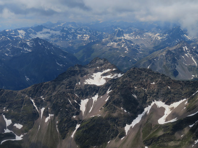
The Plattenhörner to the NW of Piz Linard comprise several summits, the highest reaching an elevation of 3220 m.
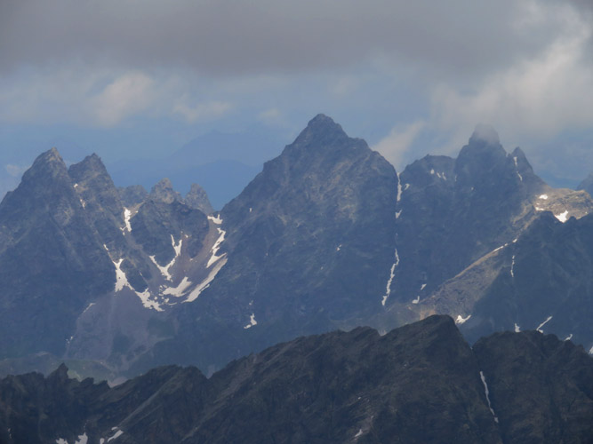
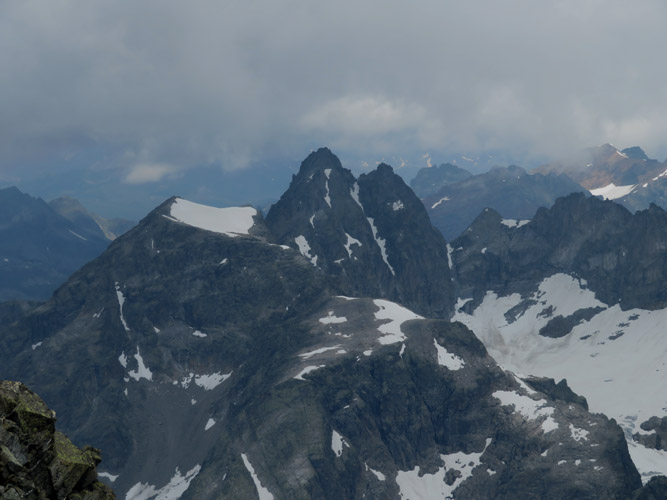
These jagged peaks also straddle the Swiss-Austrian border (L to R): Chlein Seehorn (3032 m), Großes Seehorn (3122 m), and Großlitzner (3109 m).
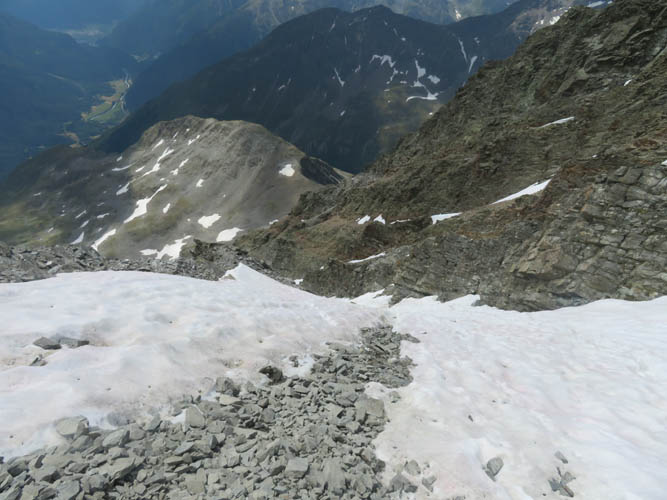
Descent down the snow chute. The snow is a lot softer now.
Even with soft snow, this chute is quite steep and precarious.
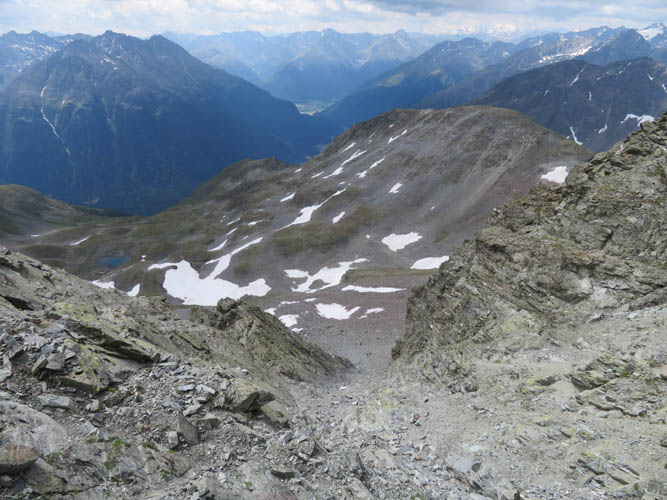
Sidesloping from the bottom of Linard’s gully to the saddle that leads up to Piz Glims (left).
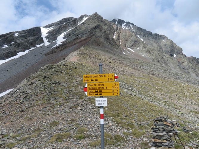
At the saddle – “Fuorcola da Glims” is the official name.
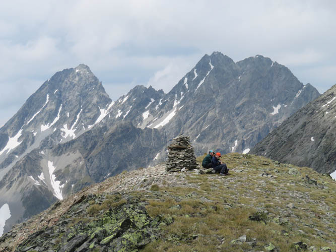
A group of hikers at the summit of Piz Glims.
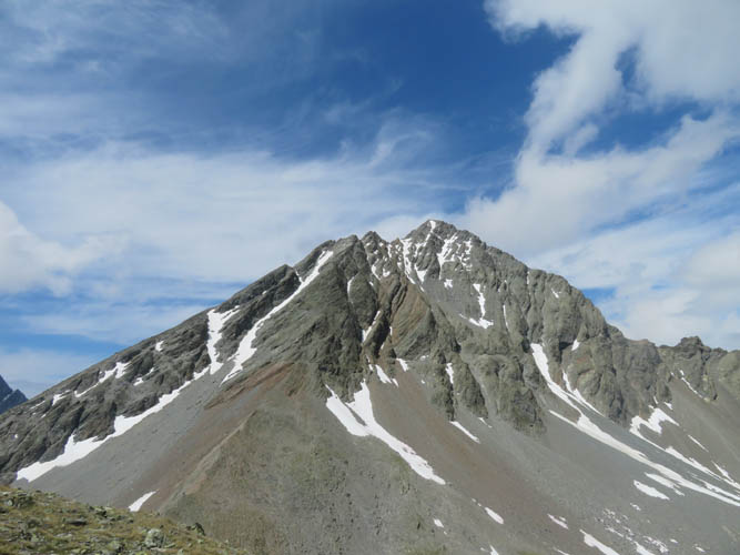
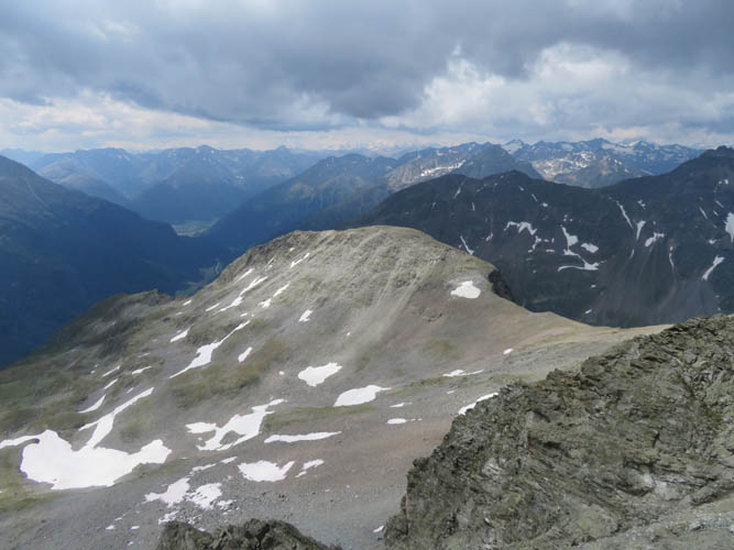
Looking back at Piz Linard.
From here, the ascent route looks steeper than it is.
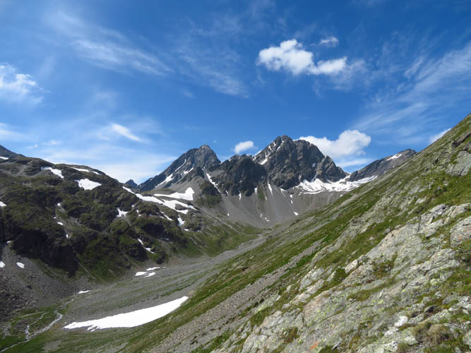
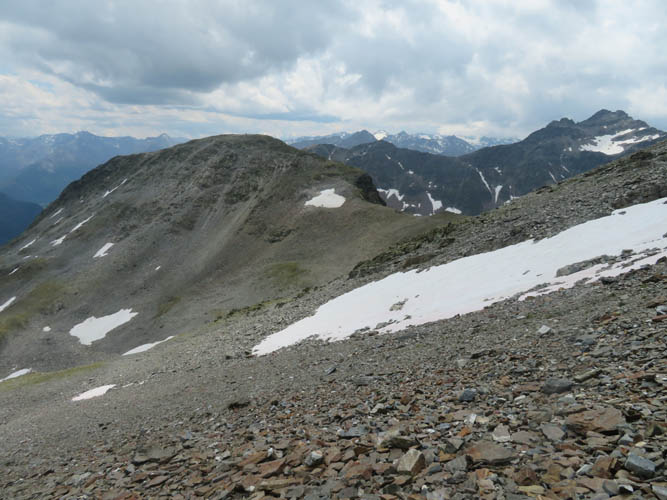
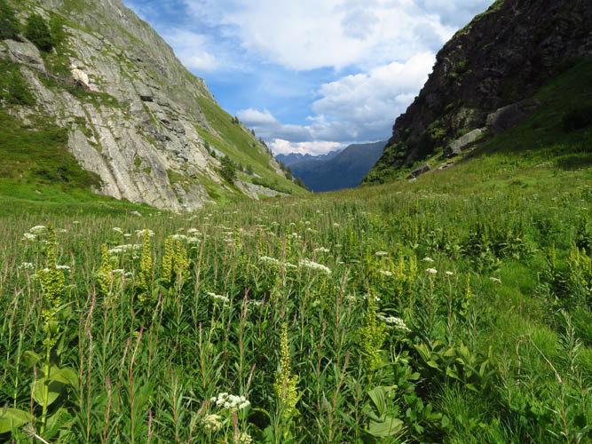
Upon descent from the Fuorcola da Glims pass, this beautiful view of the upper Sagliains Valley and the Plattenhörner opens up.
What a lovely and peaceful place!
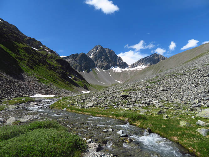
Looking down the Sagliains Valley.
And another look back up. The small brownish peak in the centre is Piz Zadrell (3103 m).
Lush vegetation covers the trail on the way down in the Sagliains Valley.