Davos, Switzerland
24 July 2018
With Wen
Built-up tourist summit vs deserted ridge scramble
The Weissfluh features prominently on the horizon above Davos. Its fitting name derives from the bright white limestone making up the summit mass, which stands in stark contrast to the dark grey, brown and red hues of the surrounding peaks and ridges.
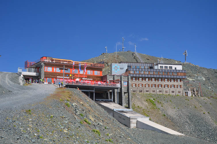
The easiest way of getting to the top is by funicular (the “Parsennbahn”) and gondola from the town of Davos almost directly to the summit. I’m not a big fan of hiking up mountains that are so easily accessible and that are built up with gondola stations, restaurants and cafes teeming with people. Hence, expectations were understandably low when we set out in the morning…
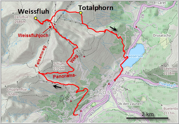
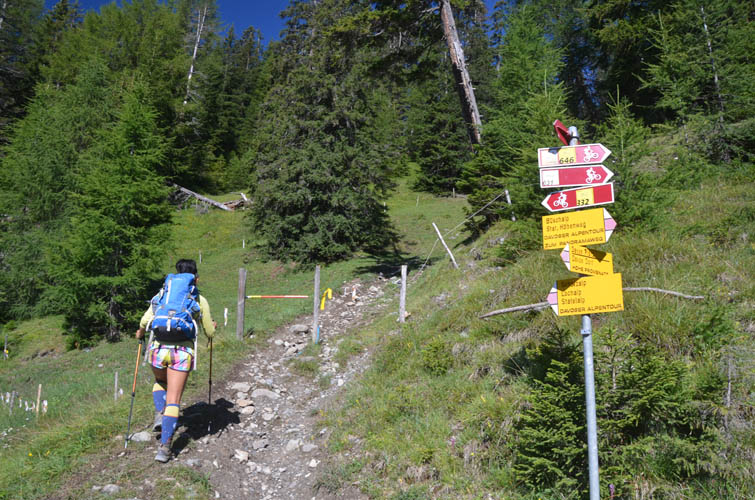
The most enjoyable part of the day was the hike from Davos town to the Strela Pass, followed by a walk along the more or less level Panoramaweg trail that contours around the south side of the Schiahorn mountain. Once you’re above treeline, there are really fabulous views to be had of the Davos Valley below and a sweeping panorama of ridges and mountains to the south. We had actually intended to take the Felsenweg trail, a shorter route that connects the Strela Pass with the Weissfluh directly, but it was closed due to construction. The Panoramaweg is longer, but well worth the detour.
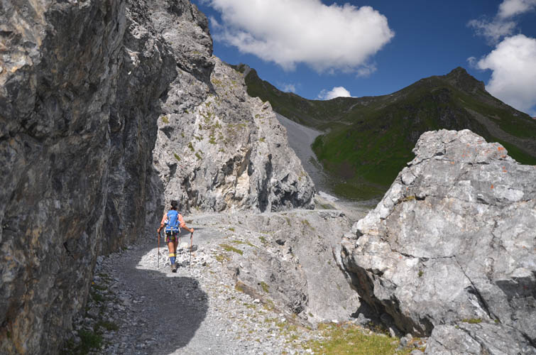
Near the Parsennbahn middle station we took the marked hiking trail that parallels the funicular line . It’s a bit of a boring hike and the terrain is made even less attractive by the ungainly sight of ski lifts and flattened ski slopes that need to be crossed. The last stretch beyond the Weissfluhjoch (a secondary bump where the Parsennbahn ends) is on an interesting trail that switchbacks across rock slabs and snow slopes to the summit. There were about a hundred other people around us, but I can’t fault them: the views are worth it.
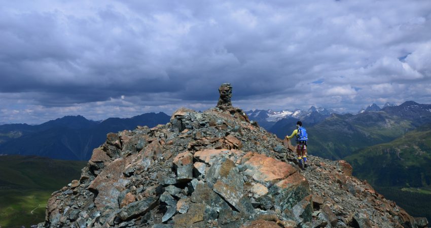
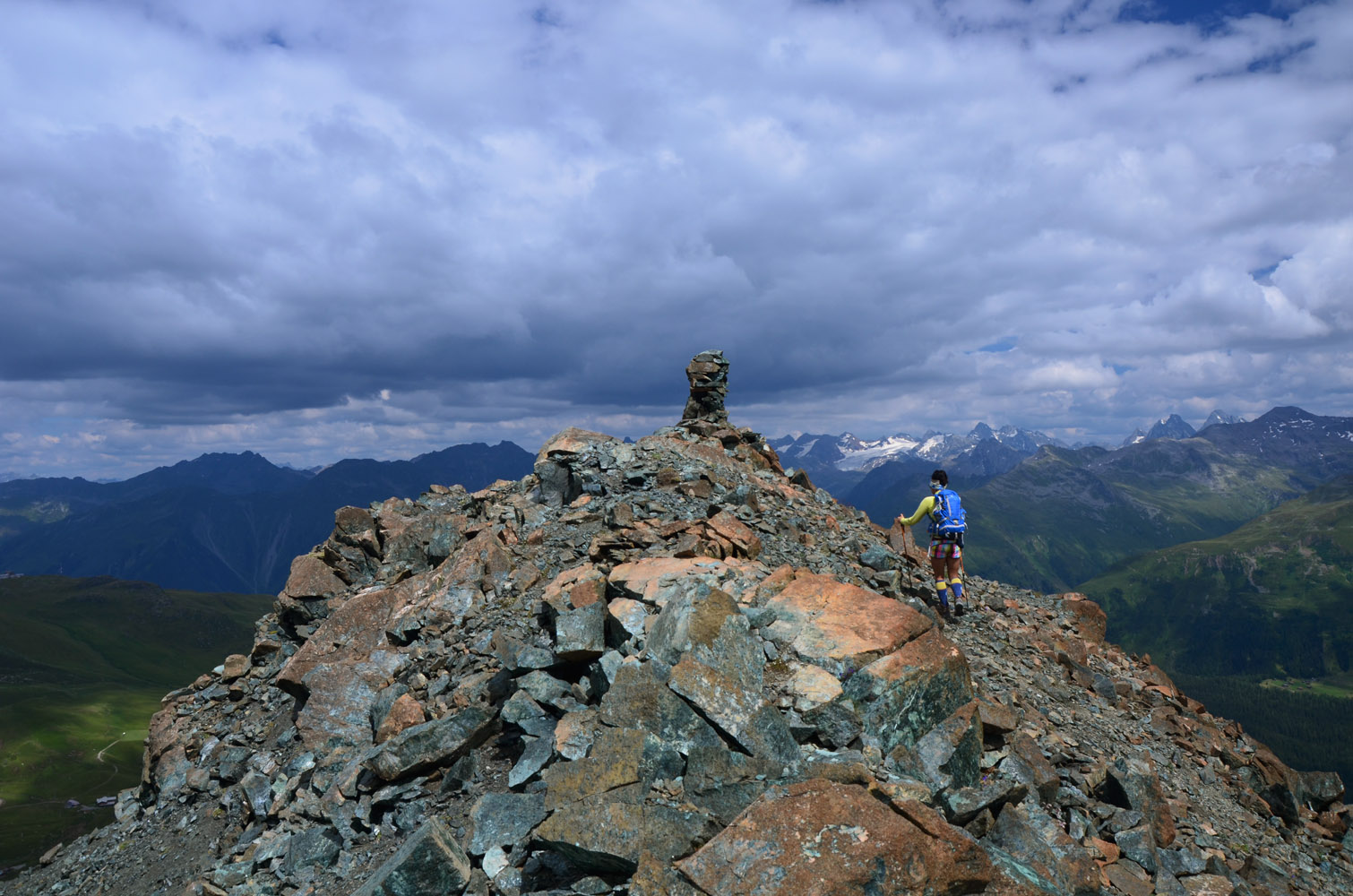
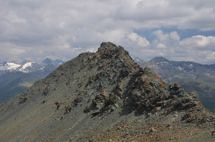
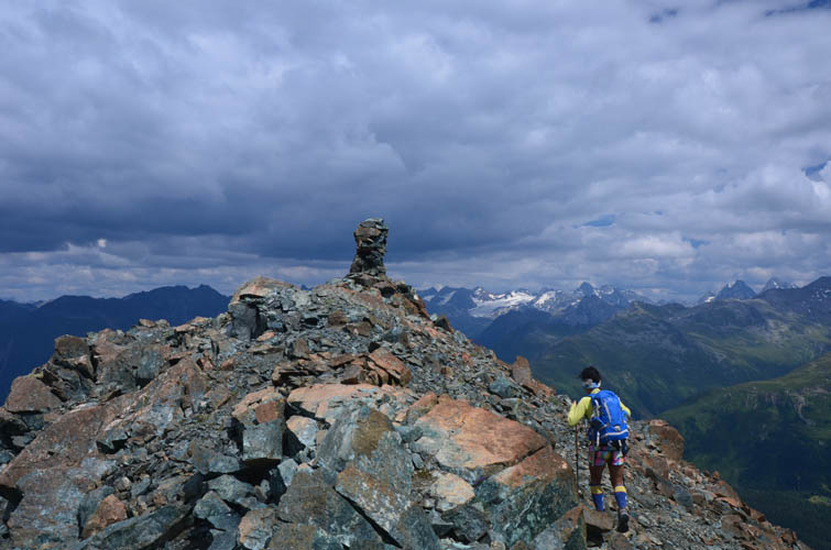
There are several options to extend this hike towards the east, for example by continuing along the ridge via the Schwarzhorn and Casanna. We simply wanted to return to Davos as it was our last day in the area, but fancied adding on a short scramble if possible. The Totalphorn, a minor peak along the end of a small craggy ridge that juts out towards Davos, served exactly that purpose. It looks quite incongruent in the otherwise mellow landscape of gentle slopes and meadows, and – as the name implies (“tot” means dead) – is completely devoid of any vegetation. The short moderate scramble along the busted up ridge took a little longer than expected, but was fun and added variety to the day.
Scree slopes below the summit allow a fairly rapid descent to a hiking trail below, which took us down to the eastern edge of Davos town in a couple of hours. Our low expectations on today’s hike had been met – there’s not much to hiking up the Weissfluh and the mountain by itself doesn’t make for an attractive destination. If it wasn’t for the lovely Panoramaweg and the short scramble on the Totalphorn I probably wouldn’t recommend this trip at all.
| Elevation: | Weissfluh: 2843 m (official), 2840 m (my GPS) |
| Totalphorn: 2468 m (official), 2531 m (my GPS) | |
| Elevation gain: | 1460 m |
| Time: | 8 h |
| Distance: | 20.0 km |
| Difficulty level: | Weissfluh: Easy hike (Kane), T2 (SAC) |
| Totalphorn: Moderate (Kane), T4 (SAC) | |
| Reference: | Local maps |
| Personal rating: | 1 (out of 5) for Weissfluh, 3 (out of 5) for Totalphorn |
DISCLAIMER: Use at your own risk for general guidance only! Do not follow this GPX track blindly but use your own judgement in assessing terrain and choosing the safest route.
On a good trail in the forests above Davos.
Above treeline on the way to the Strela Pass. The Schiahorn (right) is an easy to reach and pleasant hike.
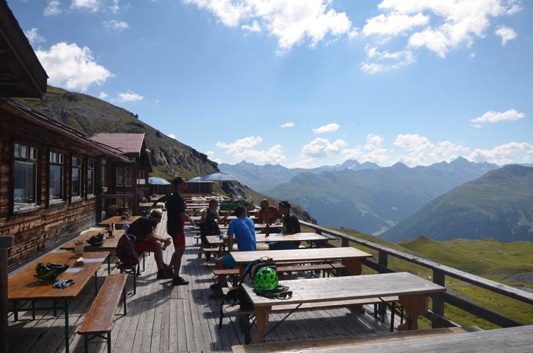
The restaurant at the Strela Pass has a big patio with terrific views!
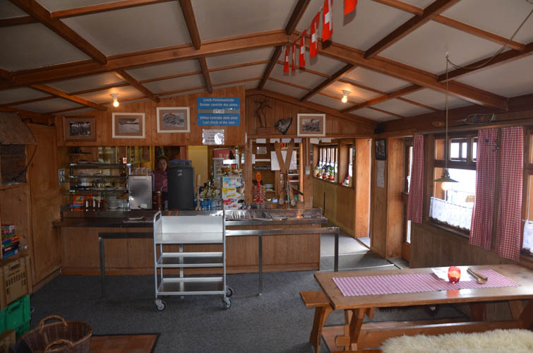
Inside the restaurant.

We follow the Panoramaweg (trail) that contours around the south side of the Schiahorn.
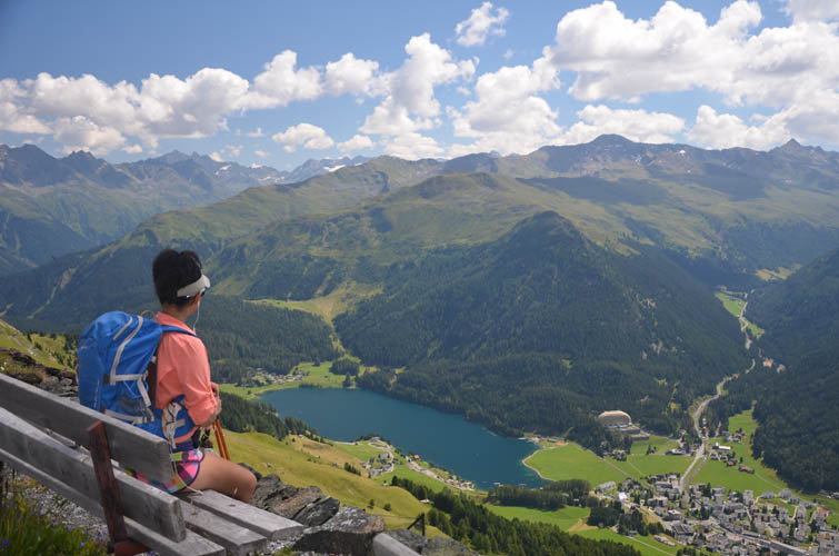
What a great location for a picnic bench overlooking Davos town and Davos Lake below.
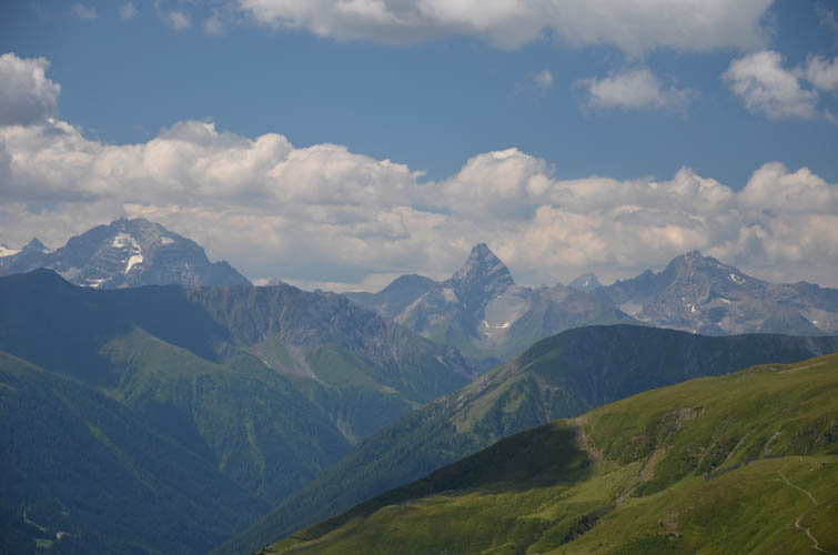
On the horizon to the SW, these three distinctive peaks of the Albula Alps really pop out (L to R): Piz Ela (3339 m), Corn da Tinizong (3173 m), and Piz Mitgel (3159 m).
Parts of the Panoramaweg are hewn into the cliffside.

Near the middle station of the Parsennbahn funicular.
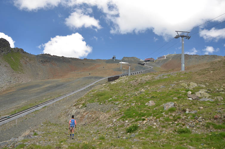
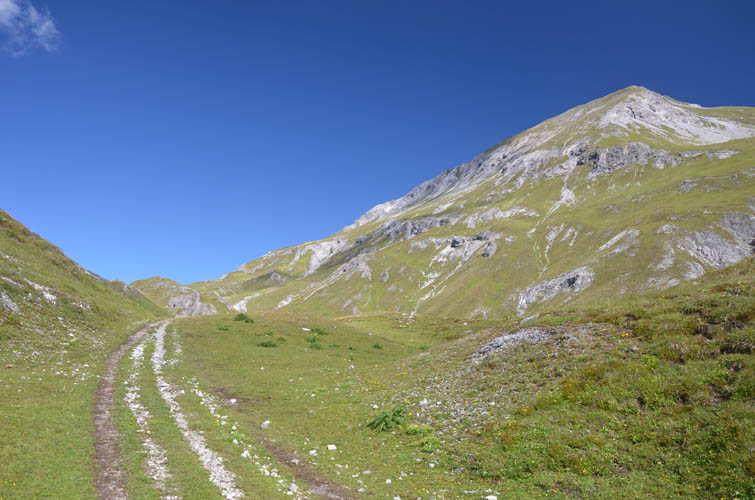
The boring stretch: from the Panoramaweg we head straight up through barren ski runs parallel to the funicular railway line.
At the Weissfluhjoch the funicular ends.
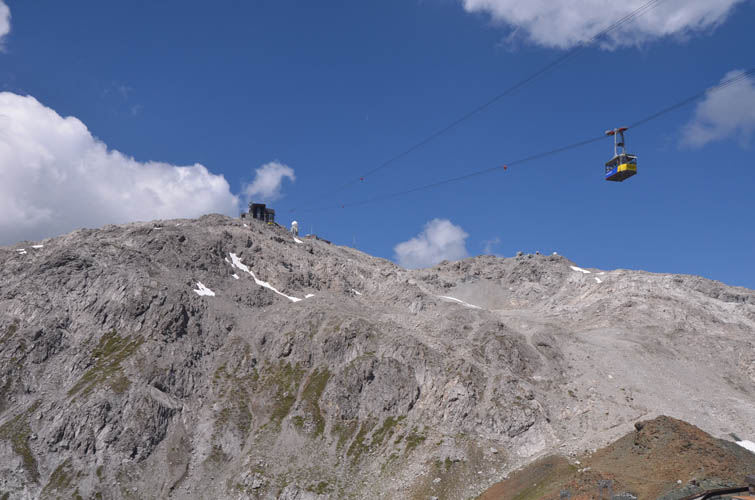
From here as small gondola line takes tourists to the very top of the Weissfluh.
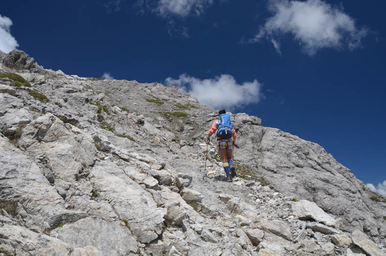
Or you can take the trail that entails fun hiking and some easy scrambling.
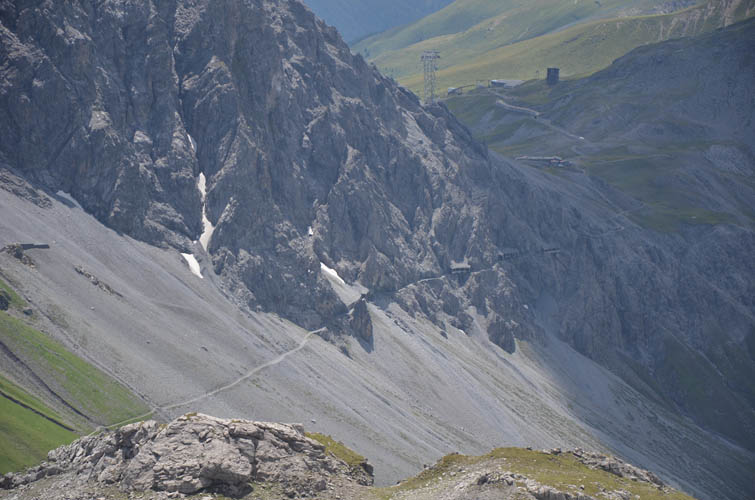
Looking down to the SW, we can spot the Felsenweg trail that runs from the Strela Pass around the north side of the Schiahorn.
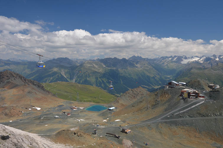
The gondola runs non-stop.
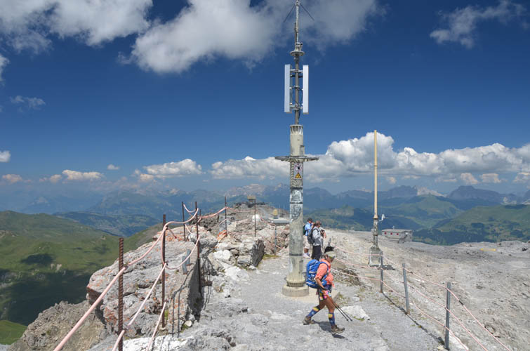
Not a cairn, but an antenna crowns the summit of the Weissfluh.
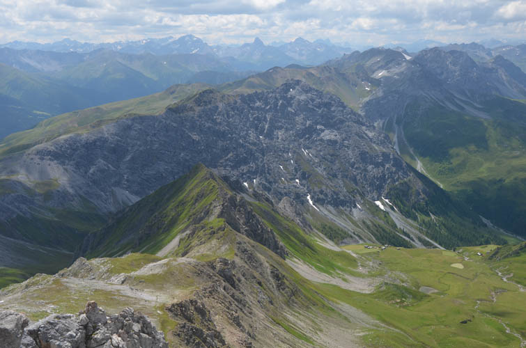
The Chüpfenflue (centre) lies west of here and has a steep drop-off on its north side.
Looking northwest towards Arosa.
To the east, a small peak called Casanna stands out.
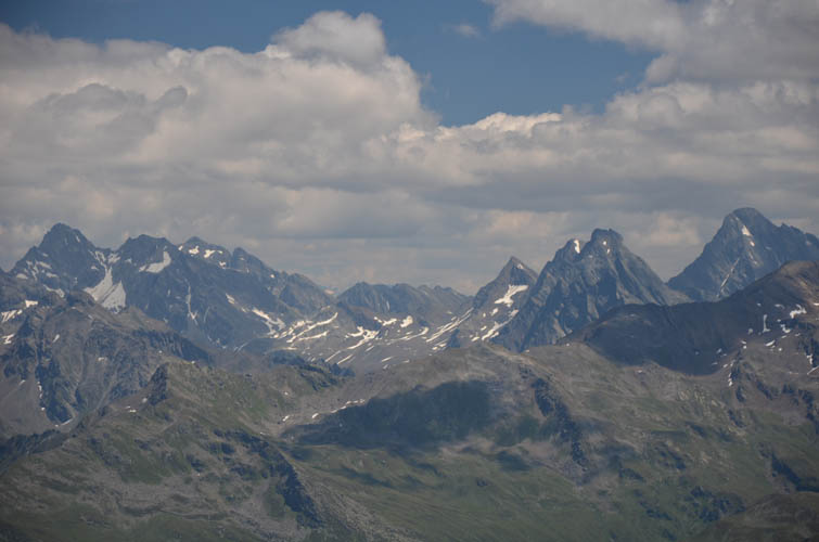
And farther away to the SE, some loftier and more challenging objectives of the Silvretta range appear. On the far left is Piz Buin (3312 m), located right on the Swiss-Austrian border. On the right are the Plattenhörner (3220 m) and Piz Linard (3410 m).
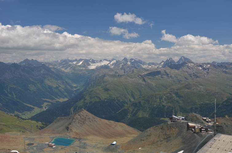
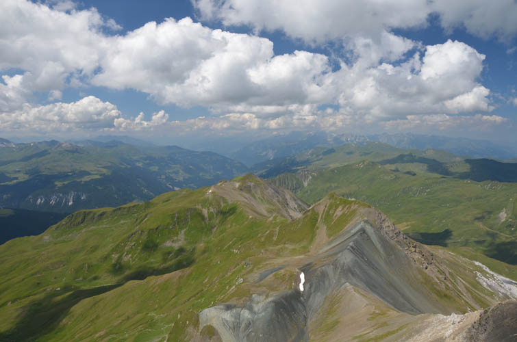
Next stop for us is the rather diminutive Totalphorn (2468 m), the small reddish peak right above the lake.
Approaching the crumbling north ridge of the Totalphorn.
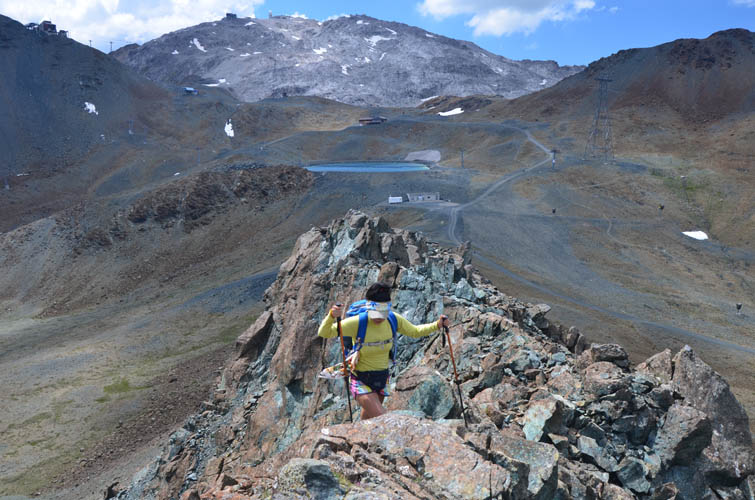
The only real scrambling of the day is along this ridge. Weissfluh in the background.
And finally a summit cairn!