Kananaskis, AB, Canada
20 September 2017
Solo
Nice off-the-beaten track hike
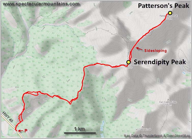
Patterson’s Peak and Serendipity Peak in the Highwood area of Kananaskis aren’t the most popular objectives for hikers and scramblers. It’s a bit of a slog to get there and the scrambling is minimal. However, what I did enjoy is that it’s pretty straightforward and makes for a nice solo outing far off the busy trails.
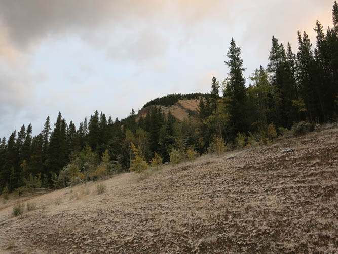
It was a Wednesday in late September when I pulled up the side of an empty highway 40 and parked my car by the trailhead. Obviously there’d be nobody else around on this route today, I thought to myself. As I hiked up the gentle ridge through light forest, I found a fairly decent mud trail veering off to the right at some point. I followed it, but it seemed to contour around the hillside rather than taking me uphill, so I stopped to check my bearings at a large clearing next to a small stand of fir trees.
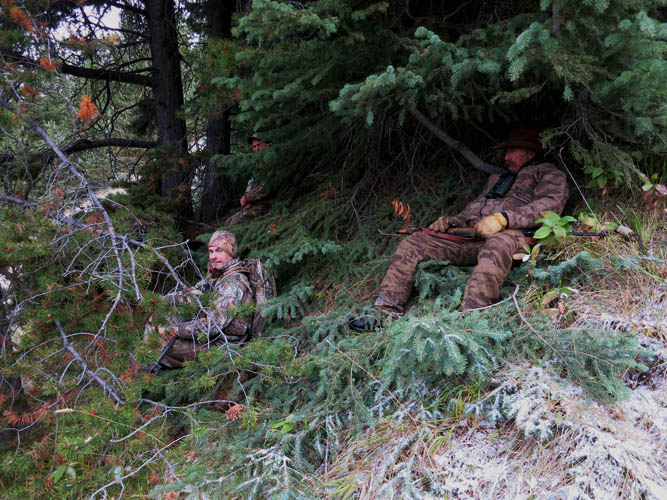
A muted but firm “Good morning” coming from the trees behind me made me wince and shudder… I turned around and saw three hunters in full camouflage gear hiding underneath the trees, only metres away from me. I couldn’t believe it – somewhere in the middle of nowhere on a weekday I had just run into the only other people in the forest it seemed. They clearly weren’t too happy to see a “BEAR!” yelling hiker in their hunting terrain, so I briefly explained where I was headed, apologized for scaring away their prey, and went on my way up the clearing back to the ridge top.
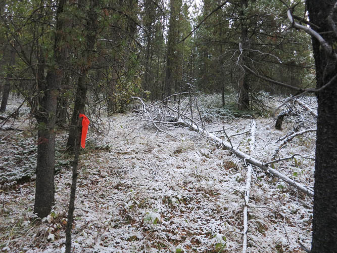
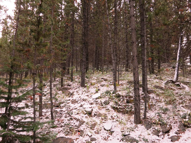
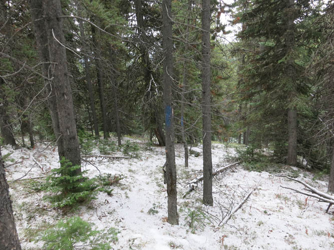
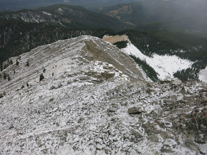
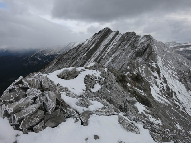
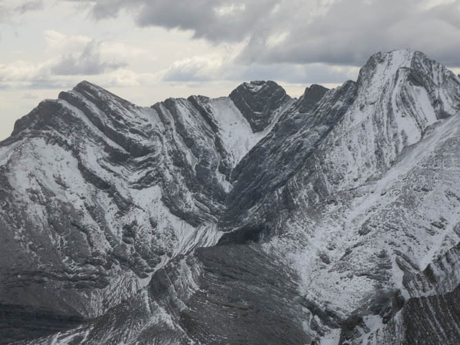
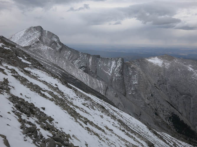
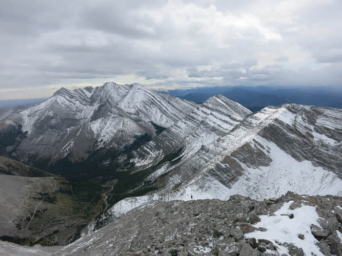
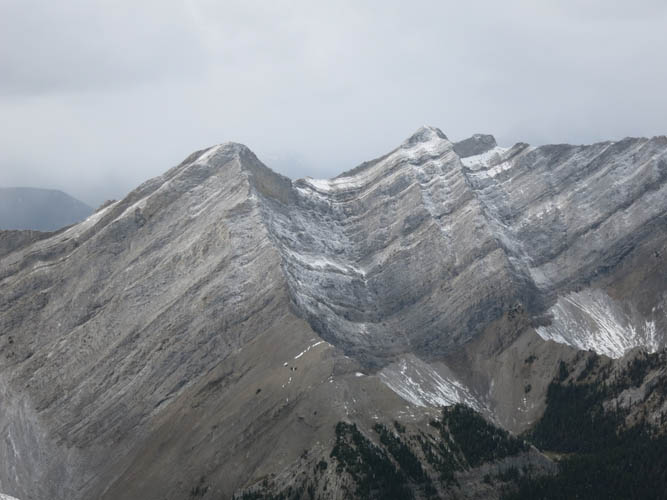
Finding the correct route up the forested ridge required a bit of searching, but eventually I came across a blazed trail (blue paint on trees) that led me in the right direction on the west ridge of Serendipity Peak. This peak, named so by Bob Spirko, is a great destination in its own right and almost exclusively a hike except perhaps for the last hundred elevation metres where the terrain gets steeper and quite rocky. A thin layer of snow made things a bit more challenging for me today, plus a chilly wind that really picked up once I reached the top of the narrow south ridge. From here, the summit cairn of Serendipity Peak was only a short hike away.
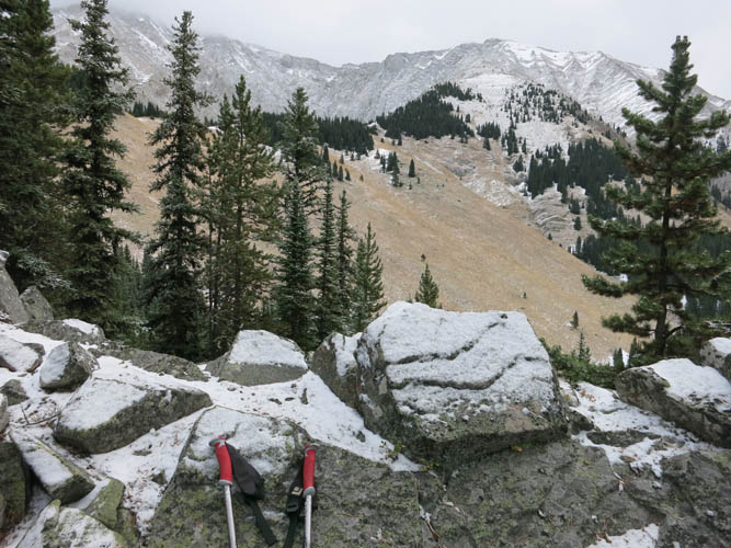
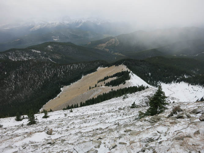
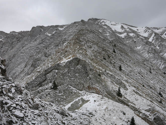
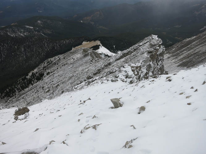
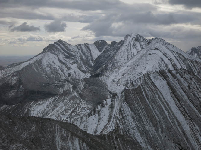
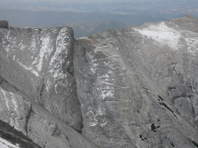
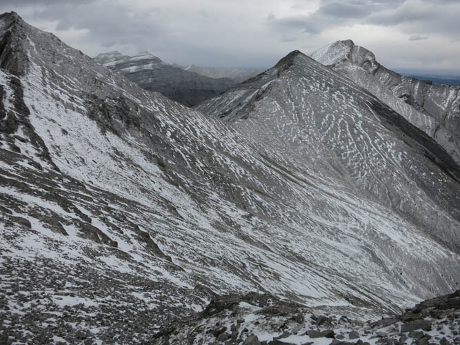
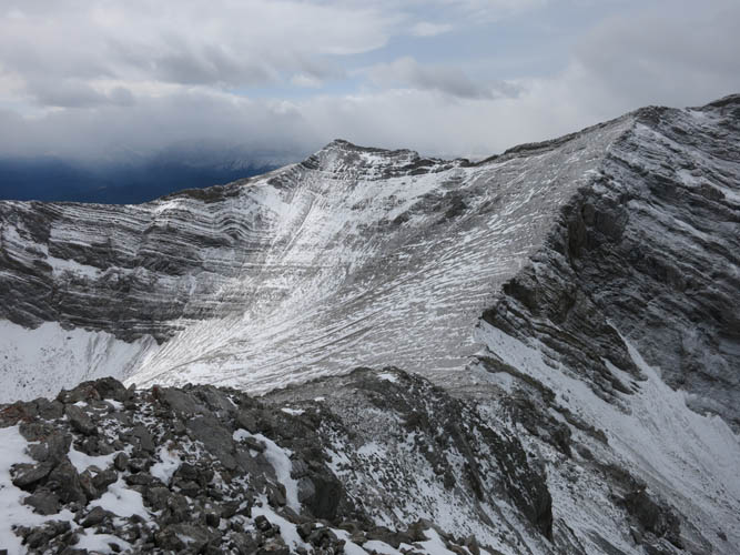
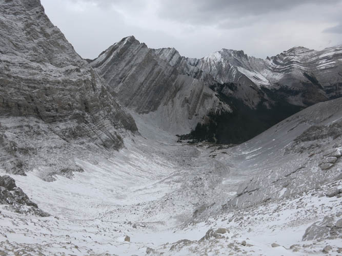
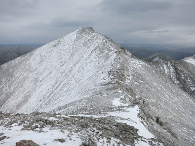
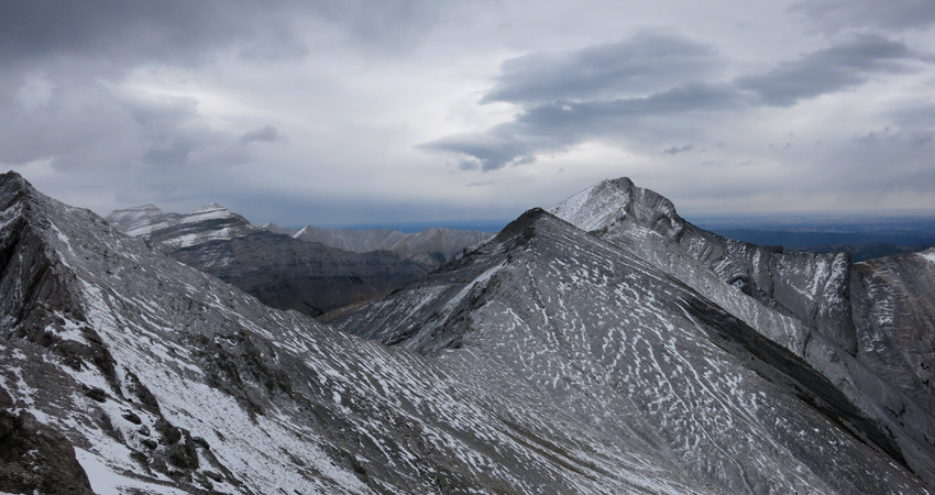
After a quick break I set my eyes on Patterson’s Peak, that lonely summit in the distance to the NE. Scrambling the connecting ridge to the north and then east may be possible but looked too sketchy in today’s poor weather conditions, so I opted to sideslope part way down into the bowl between the two peaks and reach the SW ridge of Patterson’s that way. One could also descend all the way down into the bottom of the bowl and then re-ascend on the other side, but I think that would probably require even more energy. And the terrain is all the same anyway: lots of annoying rubble that isn’t exactly a pleasure to traverse. It’s not very difficult, however, and with a bit of patience I was through this section in no time. The last bit to Patterson’s Peak summit was an enjoyable hike that feels like you’re walking right to the edge of the Rockies – which of course you are!
I took the same route back, carefully retracing my steps through the snow-covered upper part of Serendipity Peak. By the time I was back down at treeline dense clouds were covering the peaks above me and I was glad I had enjoyed at least some limited views up there. My hunter friends were long gone when I passed their hiding tree, and I really wonder if they ever caught anything that day or if I was to blame for scaring off all the game in the area!?
This tour is well off the beaten track and requires some routefinding and a bit of moderate scrambling between the two peaks. Overall not the most exciting of trips I’ve done with the long and somewhat boring approach and all the sidesloping on rubble, but of course the weather also wasn’t in my favour today.
|
Elevation: |
Serendipity Peak: 2658 m (my GPS) |
|
|
Patterson’s Peak: 2718 m (my GPS) |
|
Elevation gain: |
2040 m |
|
Time: |
10.0 h |
|
Distance: |
17.5 km |
|
Difficulty level: |
Moderate (Kane), T4 (SAC) |
|
Reference: |
Nugara |
|
Personal rating: |
2 (out of 5) |
NOTE: This GPX track is for personal use only. Commercial use/re-use or publication of this track on printed or digital media including but not limited to platforms, apps and websites such as AllTrails, Gaia, and OSM, requires written permission.
DISCLAIMER: Use at your own risk for general guidance only! Do not follow this GPX track blindly but use your own judgement in assessing terrain and choosing the safest route. Please read the full disclaimer here.