Castle, AB, Canada
26 July 2020
With Don
Day 2 of an adventurous backpacking trip into the South Castle
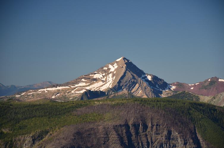
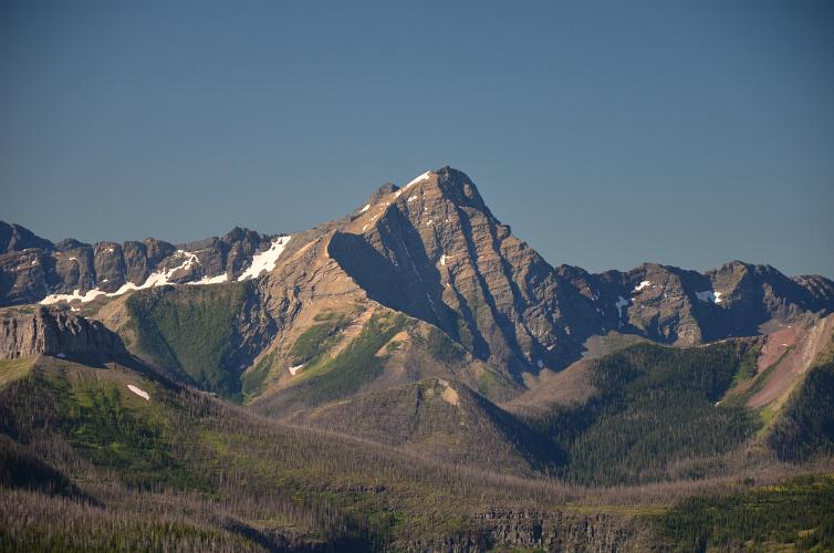
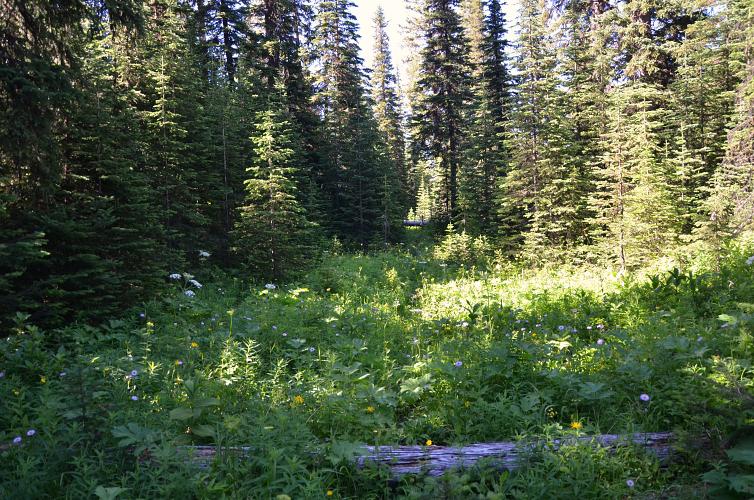
After a restful night at our camp high up on the Great Divide Trail (GDT) under the impressive cliffs of Mount Matkin, Don and I woke up refreshed and ready for another full day of adventure. Since this was only a 2-day backpacking trip our packs weren’t too heavy, but I was still glad to lose some weight every time I had a meal so I could rid myself of another pound. It was scrambled eggs with peppers and bacon for breakfast – the freeze-dried pouch meals taste terrible at home, but up here in the wild they’re divine when you’re hungry! Although our improvised campsite on a small patch of flat grass right next to the trail was perfect for its location, it had the major disadvantage of having no source of water nearby. We used up the rest of our precious water supply from the day before (the last source for us had been Scarpe Creek), hoping we’d come across a stream somewhere soon.
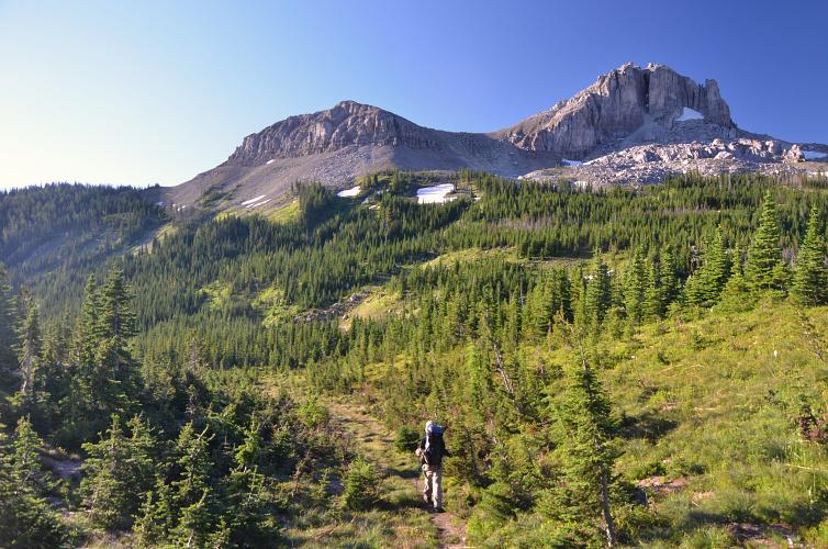
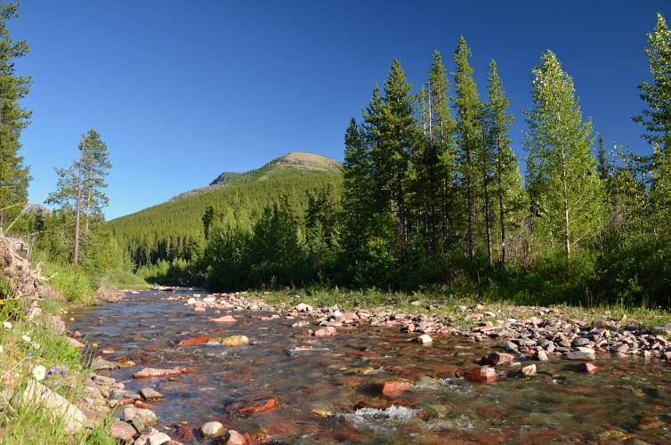
Lucky for us, after only 25 minutes of hiking east on the GDT we found a small gurgling creek and replenished our supplies with fresh cold water, pure goodness from the mountains. At this point Don made the decision to skip any further scrambling and save his energy for the descent instead. From where we were on the GDT the summit of Font Mountain was only about a kilometre away, while the GDT contours around it on the northern and eastern side.
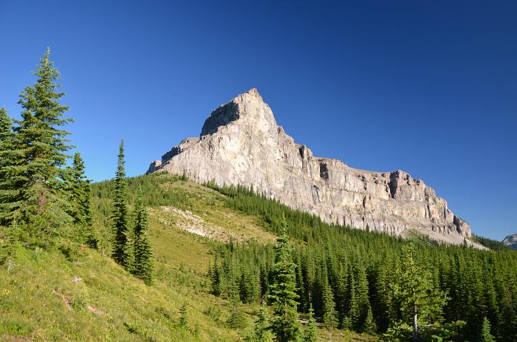
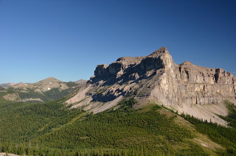
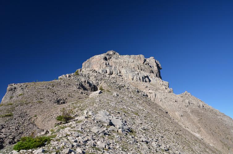
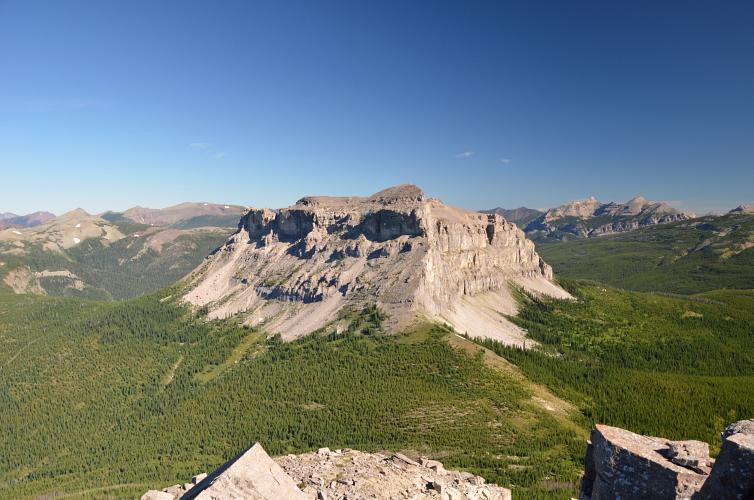
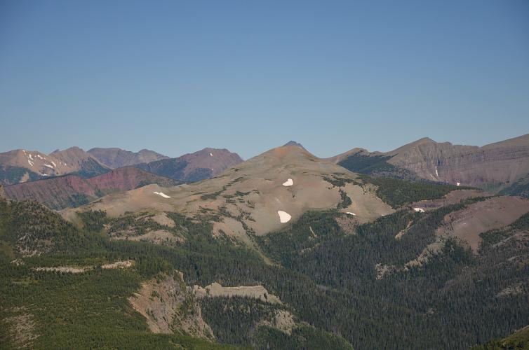
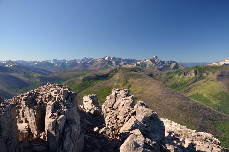
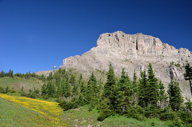
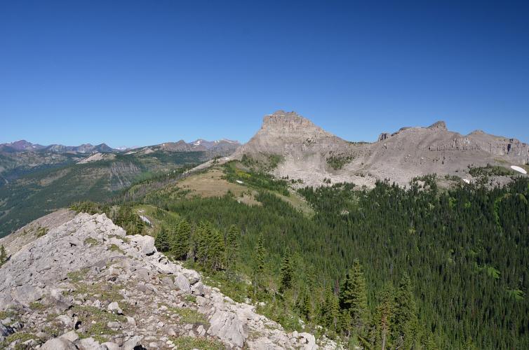
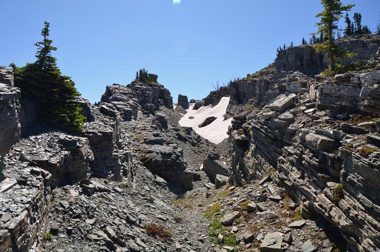
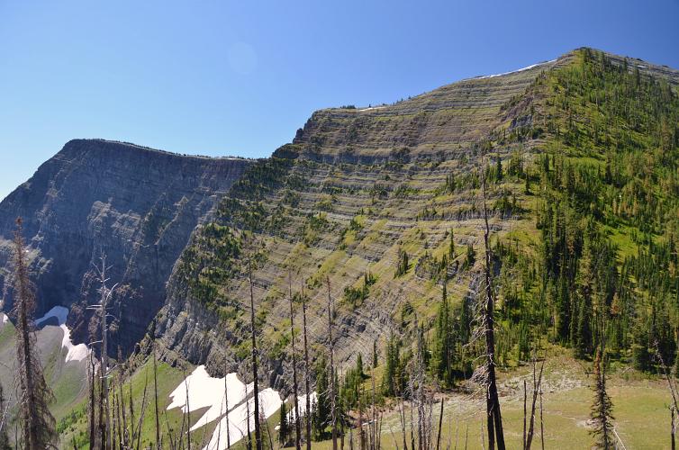
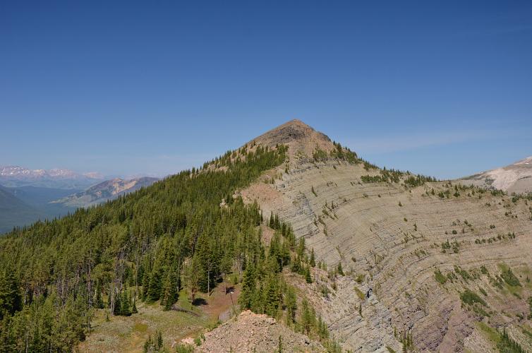
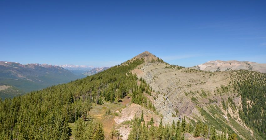
The broad alpine plateau between Matkin and Font is a relatively flat and lightly forested area and it’s easy to walk up to the base of Font pretty much anywhere. After Don continued on the GDT, I hiked up the open grassy slopes to a large talus apron which hangs off a saddle on the east ridge of the mountain. Once on the ridge, a short, easy scramble on fractured limestone steps leads to the small, fortress-like summit block. Out of the four – Jutland, Matkin, Font and Sage – Font Mountain is probably the most frequently visited and easy-to-access from the GDT.
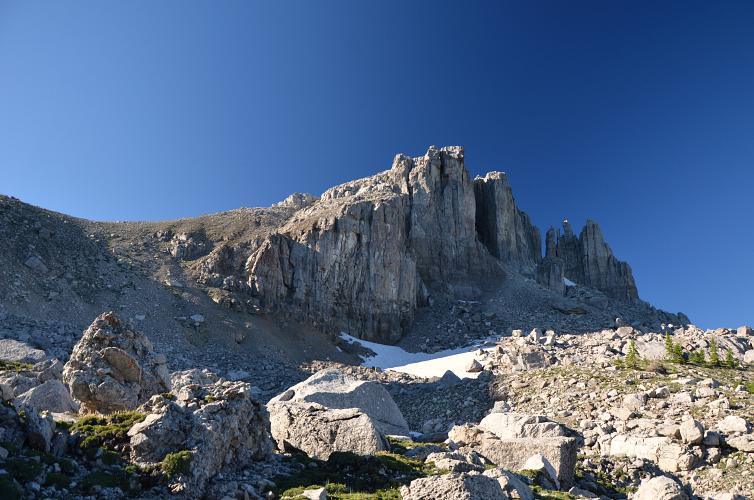
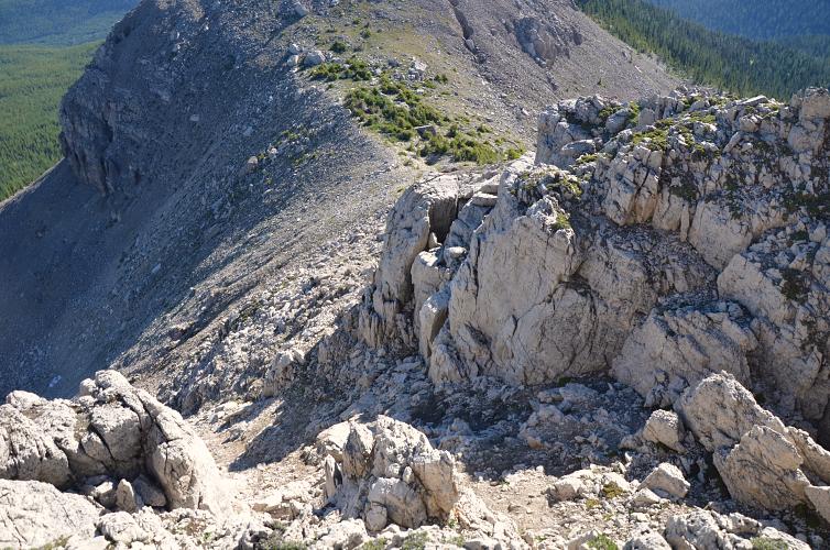
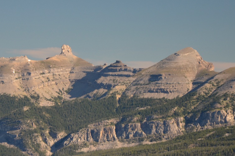
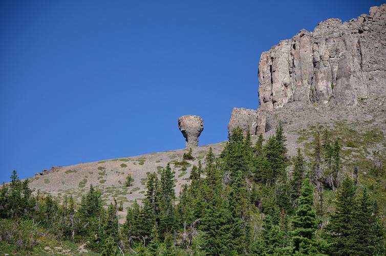
After enjoying a shot of Fireball from the register courtesy of Ephraim (thank you!), I checked out the south ridge of Font – a steep drop-off makes this a no-go. So I scrambled back to the saddle above the talus apron and then dropped down on the south side from there. The route along the connecting ridge to get back to the GDT is quite pleasant and offers views of a bizarre rock pillar that looks like a miniature water tower.
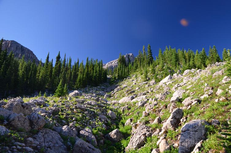
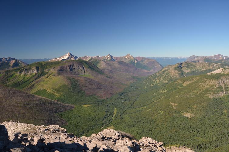
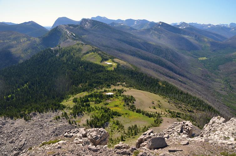
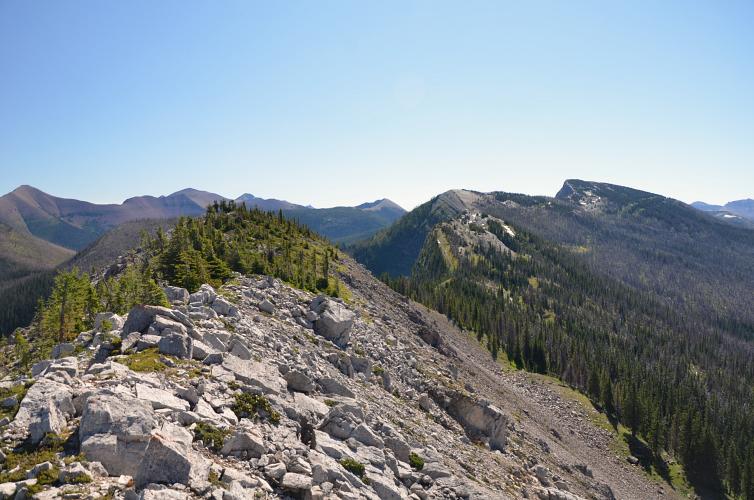
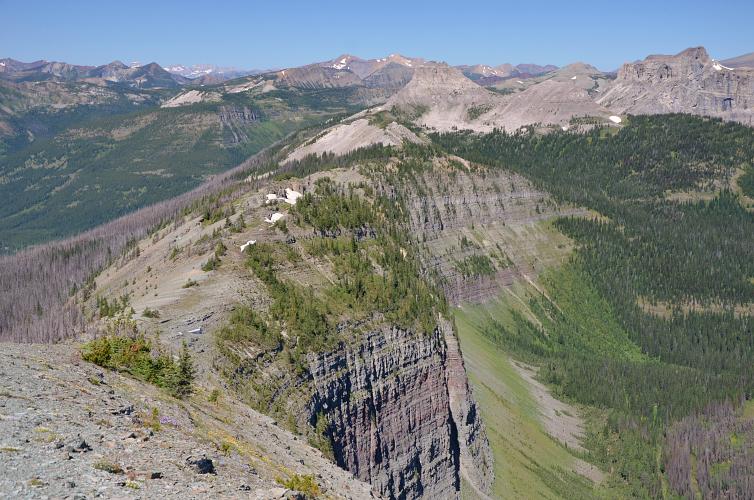
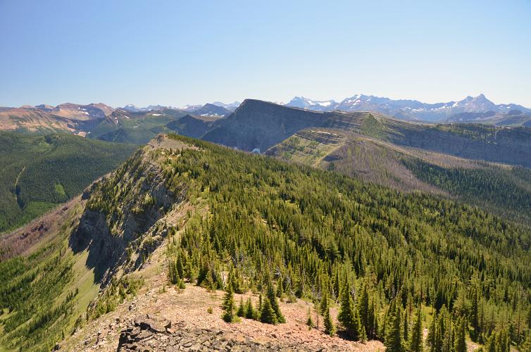
Bursting with excitement on this beautiful bluebird day, I picked up my pace once I was back on the GDT. I haven’t seen too much of the GDT up here before but this has got to be one of the most scenic sections. The open ridge offers breathtaking views on an excellent trail across varied terrain. Eventually, I got to a small high point where a side ridge extends north towards Sage Mountain.
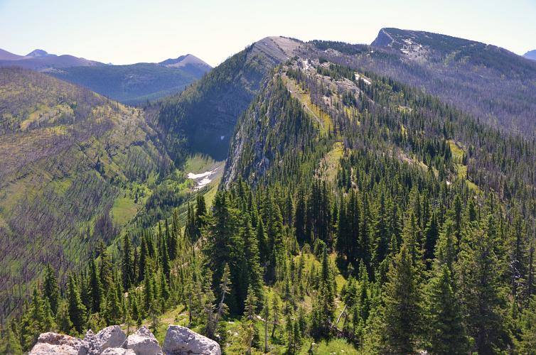
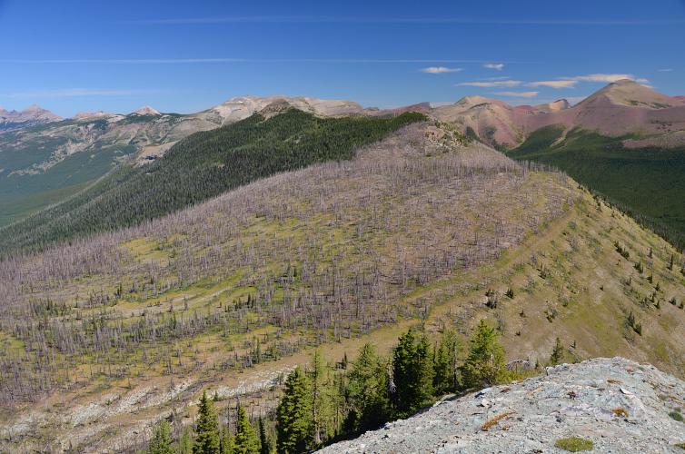
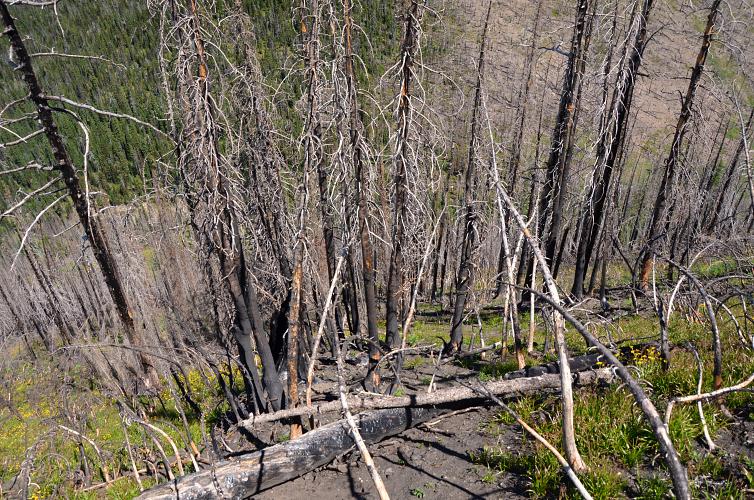
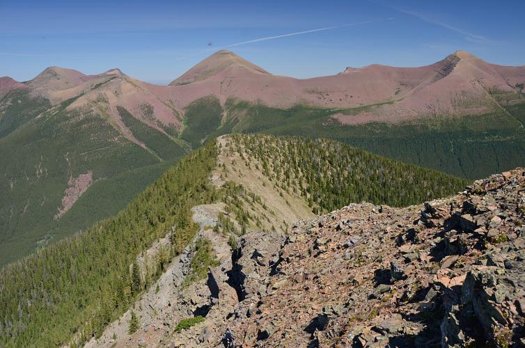
The long ridge connecting the GDT with Sage Mountain was a cumbersome affair. There were several significant ups and downs with annoyingly steep slopes on northern aspects where I almost lost my balance a few times with my heavy pack on my back. It’s technically not difficult, but just super steep with hard dirt, grass, rubble and fallen tree logs. Other parts of the ridge are full of burnt matchstick timber, then the terrain gradually gets friendlier closer to the summit. The whole ridge walk took me over two and a half hours and cost me a lot of energy. It was hot, sweaty and dusty, and my water supply had almost dried up. The summit of Sage Mountain has a nice old cairn sitting at the top. The summit views, however, are certainly sub-par to those of all previous three summits.
There are probably faster ways off Sage Mountain, but I wasn’t aware of any trails around the peak and the forest below looked dense everywhere. I remembered seeing an old trail in the second dip along the connecting ridge so I decided to backtrack along the ridge to find this old trail and explore where it went.
The old trail did indeed exist and was heading down the right direction: the valley to the west of Sage Mountain where Font Creek runs. To my dismay, it was almost completely overgrown and hard to follow in places. Still, it gave me a bit of comfort – at least I was following something. The “trail” runs from a saddle down the west side of the ridge towards Font Creek. In the lower part it got so dense with trees that I abandoned it and bushwhacked directly to the creek for the last few hundred metres. At least I had water now, and much to my relief there was even a faint and slightly less overgrown trail on the other side! (I think this is called Upper Font Creek Trail). I followed this faint trail down the valley until it joined a good ATV track that makes a sharp bend at this point. The track led directly back to the Castle River and the road on the other side.
With a fresh blast of energy and eager to see Don again I raced down the 5 km to the spot where we had left the bikes, then cycled the remaining 11 km until I finally reached the car again just before dusk. Three days would’ve probably been more appropriate for this jam-packed adventure and I think I could’ve done without Sage Mountain, which was by far the least enjoyable out of all four peaks. The ridgewalk along the GDT, fun scrambling on Font and Matkin, and beautiful sweeping vistas from Jutland were unforgettable. Thanks to Don for joining me on this awesome adventure!
|
Elevation: |
Font Mountain: 2340 m |
|
Sage Mountain: 2359 m |
|
|
Elevation gain: |
1480 m |
|
Elevation loss: |
2050 m |
|
Time: |
13.5 h |
|
Distance: |
35.8 km |
|
Difficulty level: |
Easy (Kane), T2/T3 (SAC) |
|
Reference: |
No info was available to us prior to trip |
|
Personal rating: |
5 (out of 5) for Font, 2 (out of 5) for Sage |
NOTE: This GPX track is for personal use only. Commercial use/re-use or publication of this track on printed or digital media including but not limited to platforms, apps and websites such as AllTrails, Gaia, and OSM, requires written permission.
DISCLAIMER: Use at your own risk for general guidance only! Do not follow this GPX track blindly but use your own judgement in assessing terrain and choosing the safest route. Please read the full disclaimer here.