Sulaymaniyah, Iraq
9 November 2018
Solo
Short and sweet – a fun scramble in the Piramagrun Massif
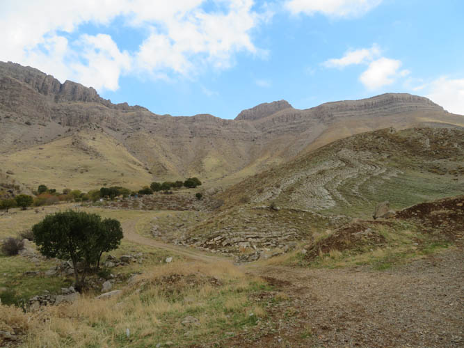
Our third day in the Piramagrun Massif, and by far the best so far in terms of weather. The sun finally came out today and it didn’t rain!! Initially we had planned to camp at Zewe rest area only for one night, but we liked the solitude and tranquility of this place so much that we ended up staying for three nights.
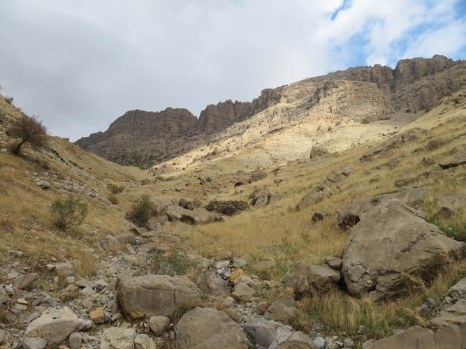
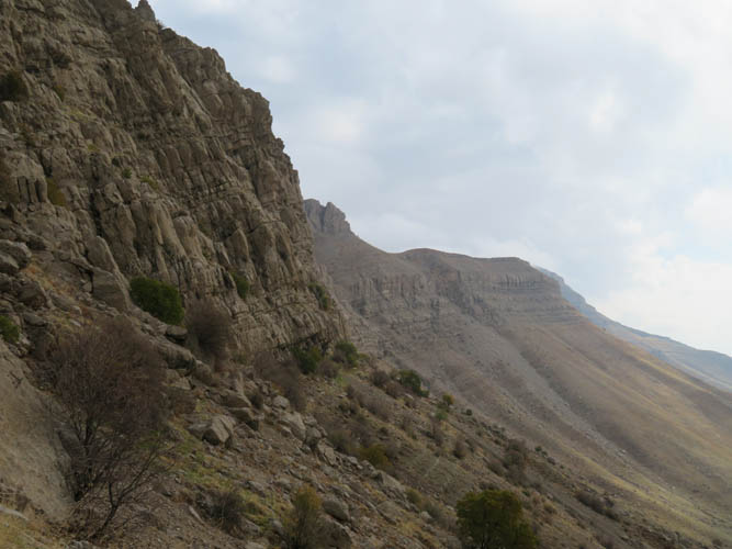
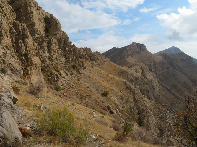
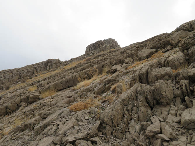
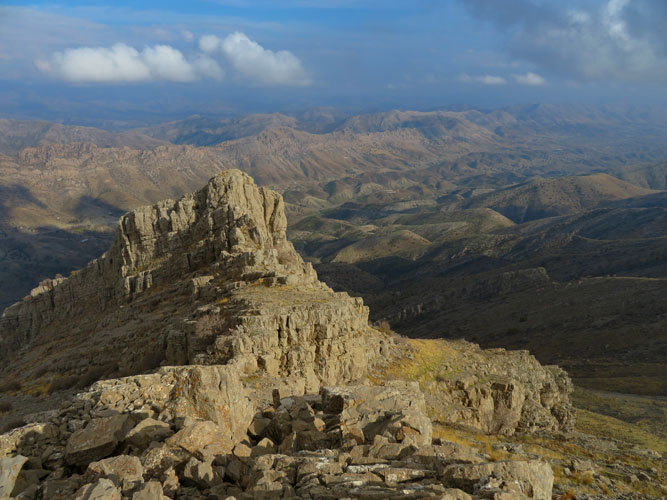
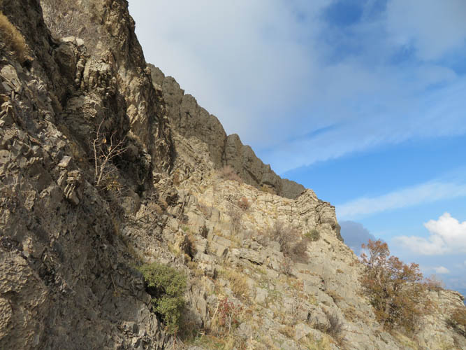
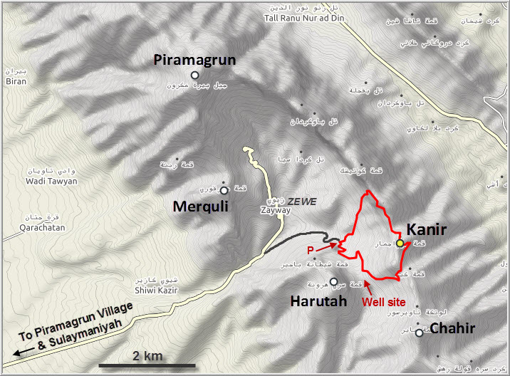
My objective today was a small peak referred to as Kanir by the locals. Some shepherds I met also called it “Pashkala Sowza” whereas my map label reads “Jawzajamar”, so who knows what the “official” name of this little peak is. It sits right along the long ridge connecting the massif’s highest mountain, Piramagrun, with another peak called Chahir to the southeast. After hiking up Chahir the day before, I wanted to see if there’s another way of accessing this ridge through the forbiddingly steep looking cliff on its west side. Several narrow gullies that break through the cliff can be seen from the village of Zewe below, but only one or two actually offer a feasible way up for the scrambler/hiker.
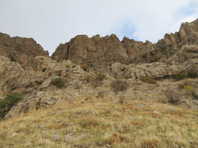
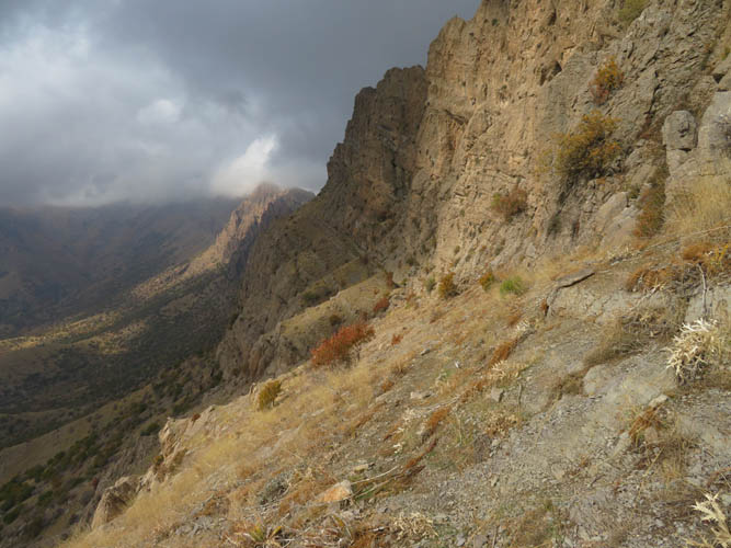
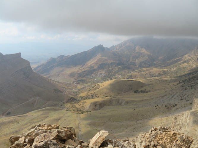
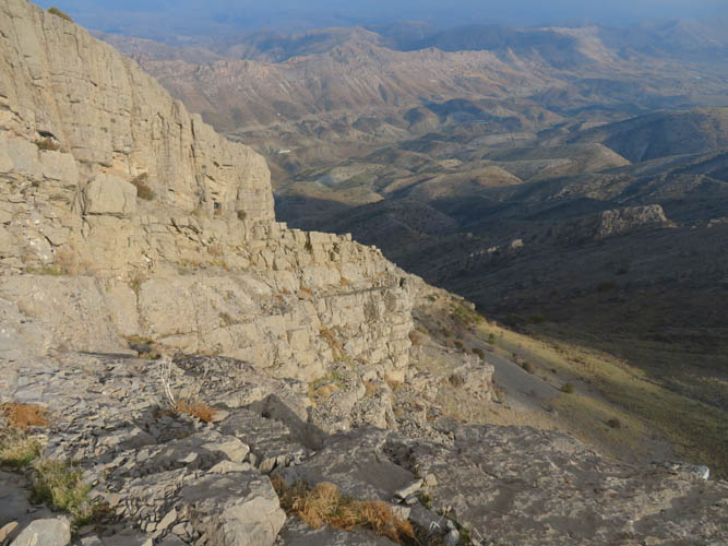
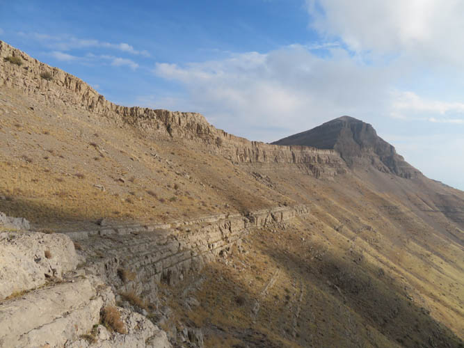
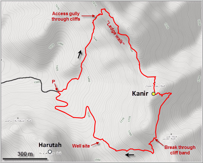
After leaving the car at the end of the driveable well site road (as for Harutah/Chahir), I hiked up a small drainage and grassy slopes to the base of a long scree tongue below the cliff. The meadows here are full of sheep trails and no bushwhacking is necessary, allowing a pretty convenient and efficient approach. Avoiding the scree on the left, I hiked up to the gully and was through it in no time – no scrambling necessary. Above the gully is a wide, slanted ledge that splits up the cliff into an upper and lower part. This ledge parallels the ridge top and runs all the way south to a saddle, where it merges with the ridge top. An elegant and very scenic route that even has a faint trail and cairns in places! For the entire time of this “ledge walk” I enjoyed terrific views of the Zewe valley below me.
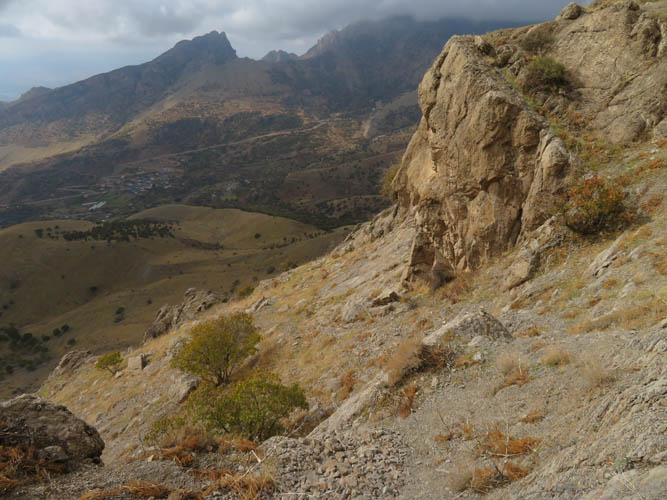
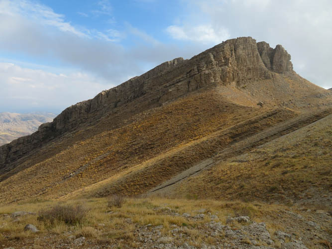
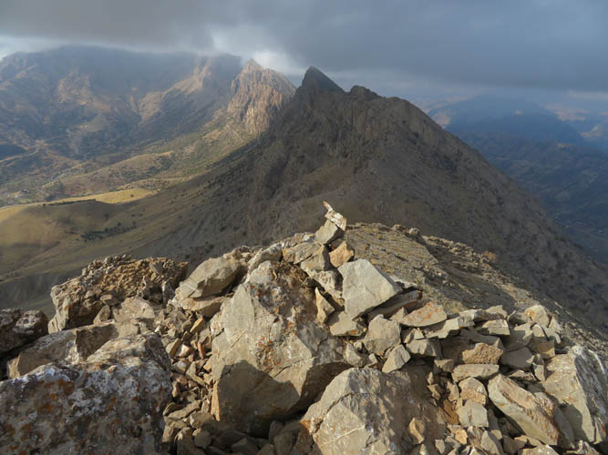
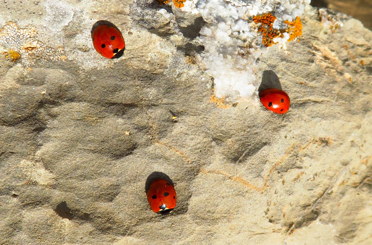
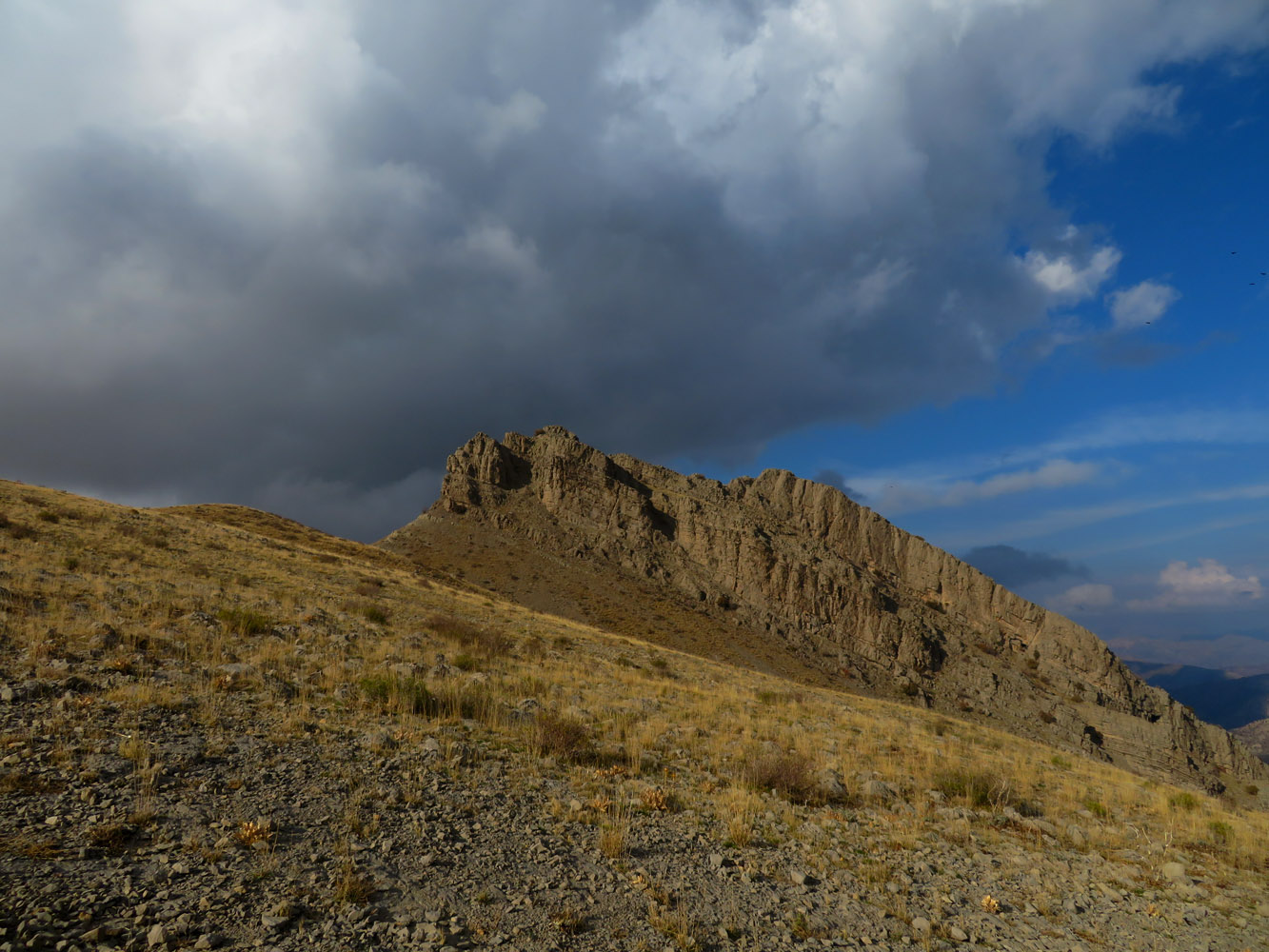
At the saddle I had a clear view of the Kanir summit mass before me, a rocky pyramid with a steep cliffs on the north and west sides and more gently dipping strata on the left (east). I contoured around to the left, losing a little bit of elevation in the process, to find a spot where the tilted rock layers could be scrambled up easily. A short and easy scramble weaving through successively higher layers followed and soon I was standing on the small craggy summit of Kanir. A small cairn marks the high point. There was very little evidence of regular human traffic up to this point; the only company I had up here were hundreds of lady bugs sunbathing on the sharp dolomite here. What a short day, I thought! It had only taken me 2 hours from the car to the summit.
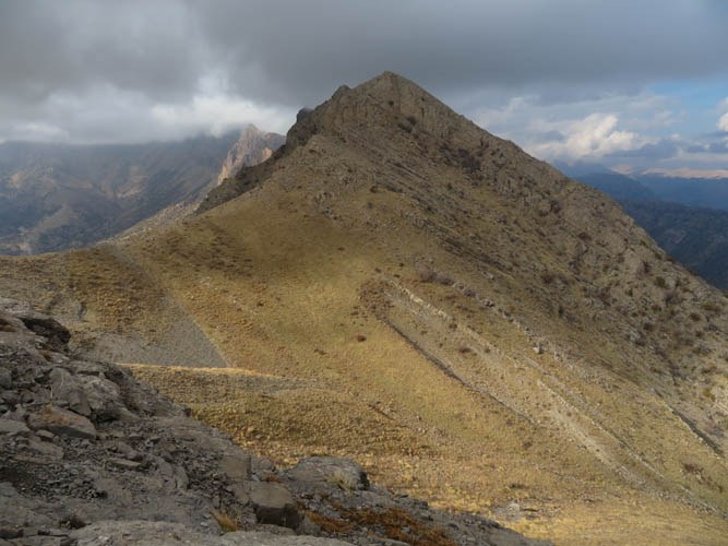
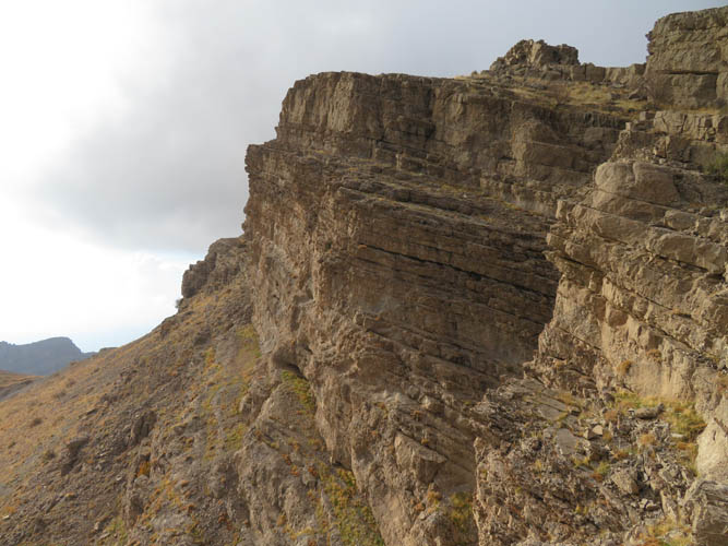
If the ascent was pretty short, the descent took me longer than expected. I love loop routes so I wanted to head further south along the ridge, then hopefully find another break in the cliff and head down to the wide saddle between Harutah and Kanir where an oil well is located. Getting off Kanir’s summit mass proved more difficult than I anticipated. The rock is quite unstable at the top, with many sharp and loose boulders. What’s more challenging though is that the south side of Kanir is once again guarded by huge vertical cliffs. From the summit I scrambled down one “step” to a lower rock layer on a wide bench dipping eastward. Following a faint animal track down the bench, I had to lose quite a bit of elevation before the cliff to my right became sufficiently broken up to allow me to get through and reach much easier terrain below.
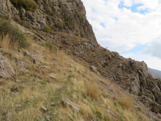
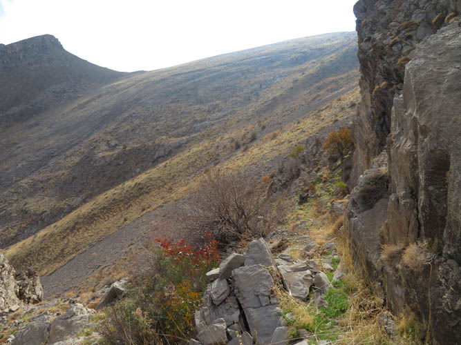
I hiked back up to another wide saddle along the main north-south ridge and found a nice spot marked by cairns where the cliff below can be easily descended. Compared to my ascent route up the steep gully and the “ledge walk”, this is definitely a much more straightforward way of gaining the main ridge. It looks like one could also continue further south to reach Chahir without any significant difficulties, but I can’t vouch for that as I haven’t done it.
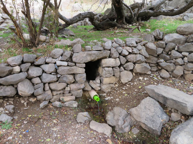
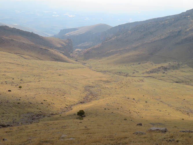
Once I was off the main ridge the rest was pretty smooth sailing: a short hike down grassy slopes to the well site, then a leisurely walk along the abandoned dirt road back to the car.
For experienced parties, this trip would probably rate as a hike with some easy bits of scrambling. However, because of the nature of the terrain and, more importantly, all the routefinding involved, I feel it’s more in the moderate scrambling realm. Though short, this is definitely a super enjoyable outing with very rewarding views all around.
| Elevation: | 2008 m (my GPS) |
| Elevation gain: | 720 m |
| Time: | 3.5 h |
| Distance: | 7.3 km |
| Difficulty level: | Moderate (Kane), T4 (SAC) |
| Reference: | No route information was available to me prior to trip |
| Personal rating: | 4 (out of 5) |
DISCLAIMER: Use at your own risk for general guidance only! Do not follow this GPX track blindly but use your own judgement in assessing terrain and choosing the safest route.