Kananaskis, AB, Canada
21 June 2020
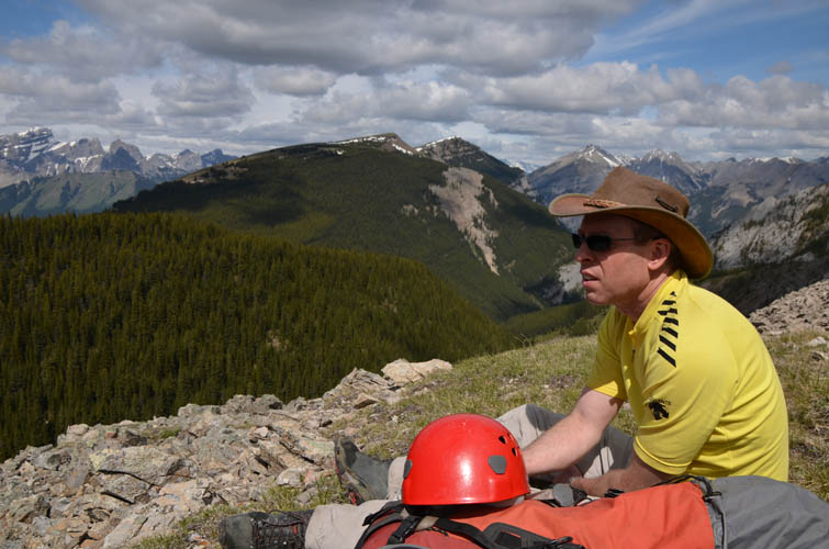
With Trevor
Excellent scrambling on a remote peak close to Canmore
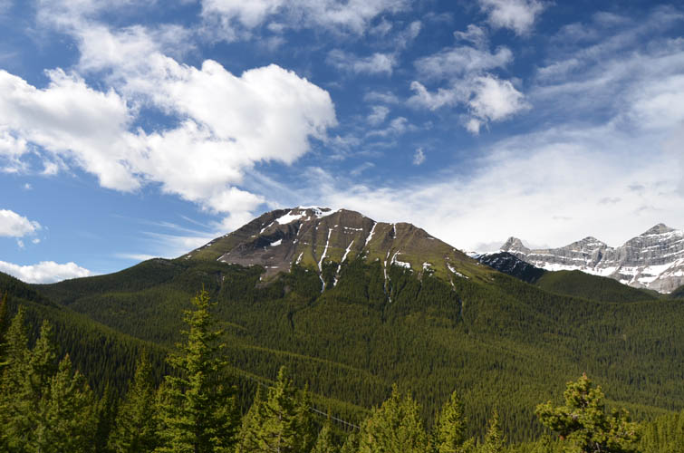
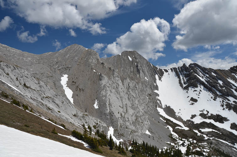
This was a fabulous exploratory trip with Trevor. The objective was the unnamed peak between Mount McGillivray and Skogan Peak. This peak has significant prominence (>200 m) and looks quite impressive, especially when viewed from its neighbors to the north and northwest. Instead of using an anonymous grid reference, we decided to informally refer to the mountain as Gilligan Peak – a contraction of McGillivray and Skogan.
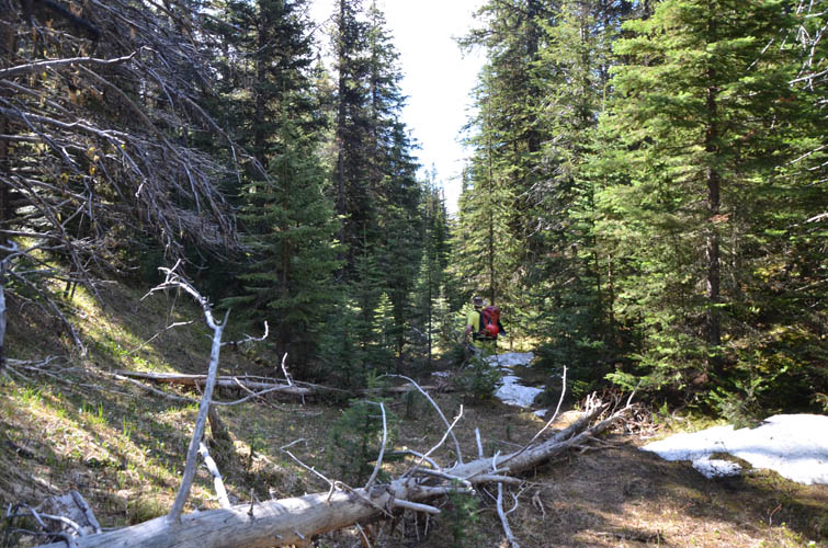
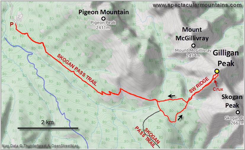
The initial approach, the same as for Pigeon Mountain, was fast and easy. Skogan Pass Trail is a wide track that rises at a gentle but steady incline, first along the not-so-esthetic powerline, then through forest around the southern flank of Pigeon. Where the trail makes a sharp bend back to the west we entered the forest and followed a game trail in a small valley heading east, making use of the occasional clearing. Eventually we left the small valley and turned NE, making our way uphill through light forest with a bit of easy bushwhacking. Our forest walk led us over a small rise that sits between Skogan Pass Trail and the valley west of our objective. Surprisingly, there were still some patches of thick snow lingering on the east side of this rise, but we largely managed to avoid them.
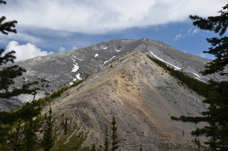
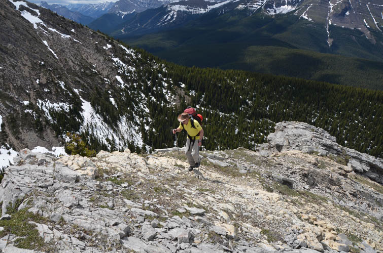
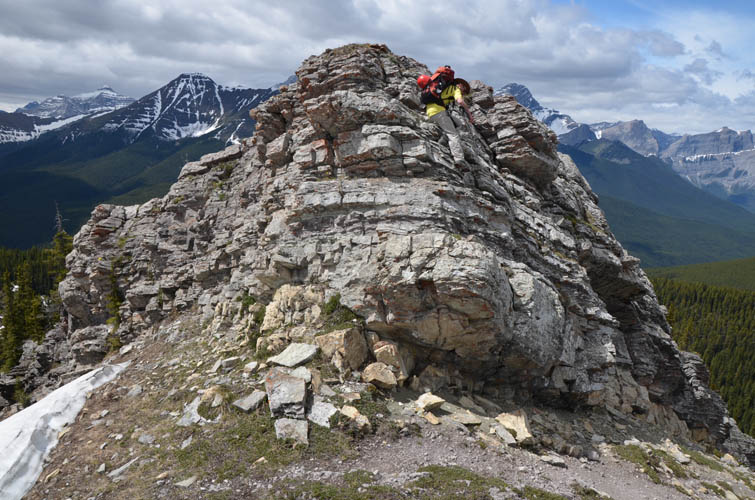
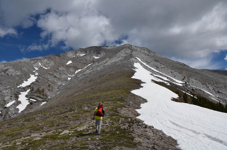
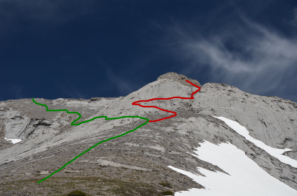
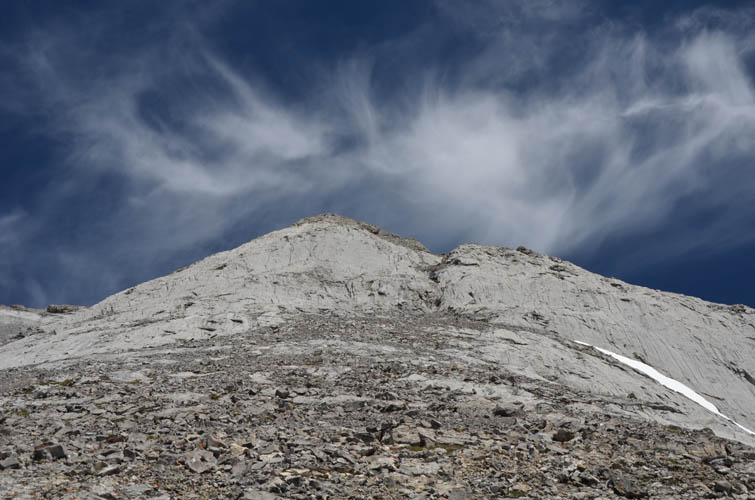
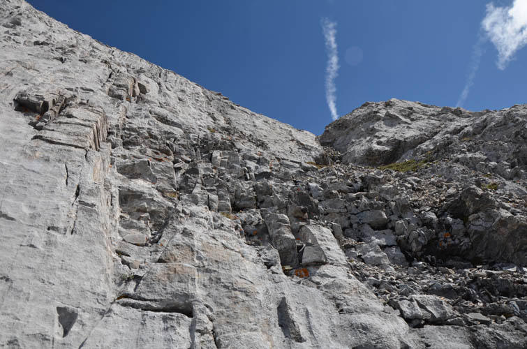
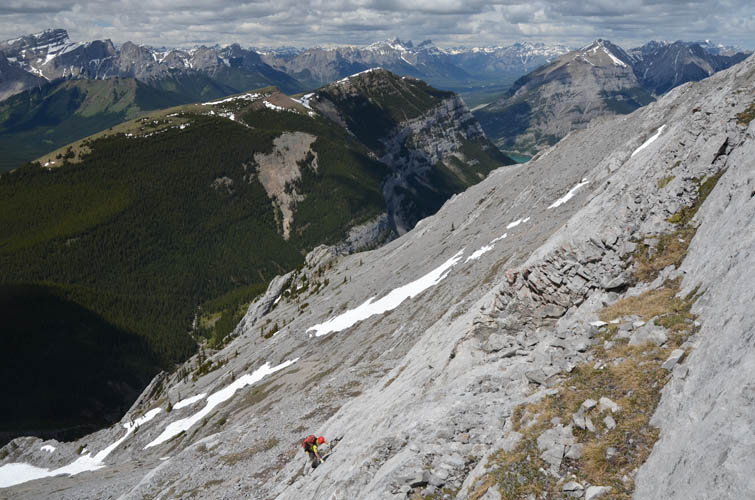
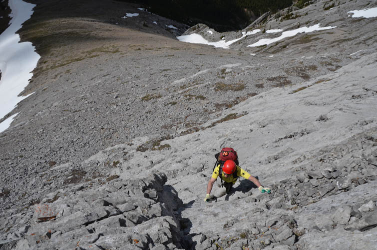
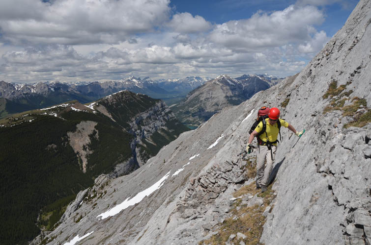
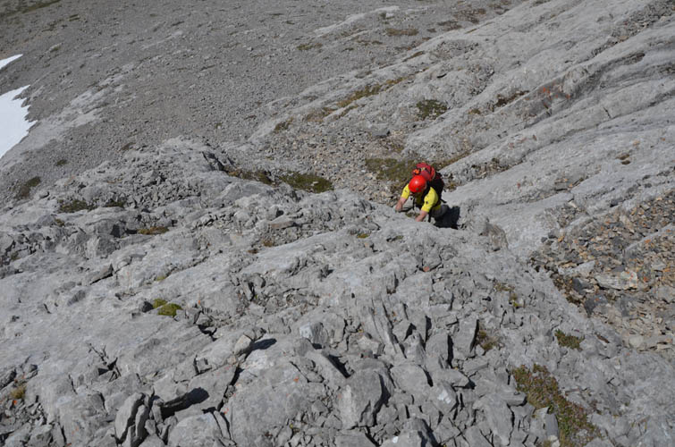
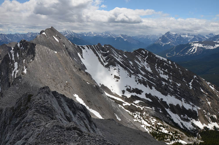
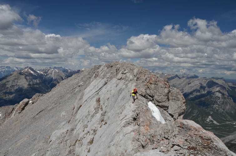
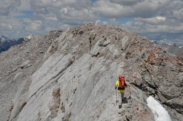
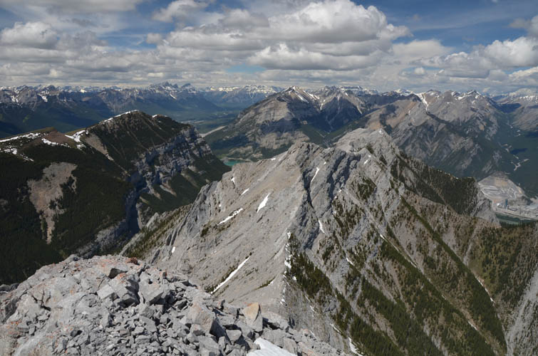
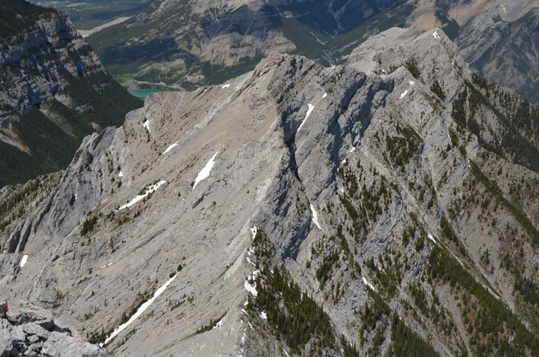
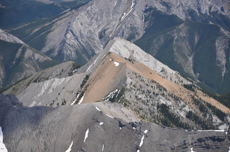
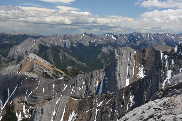
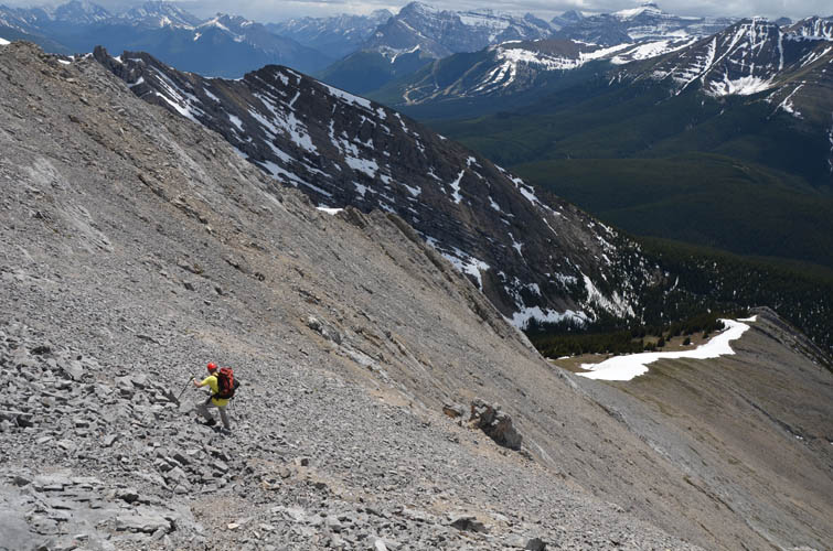
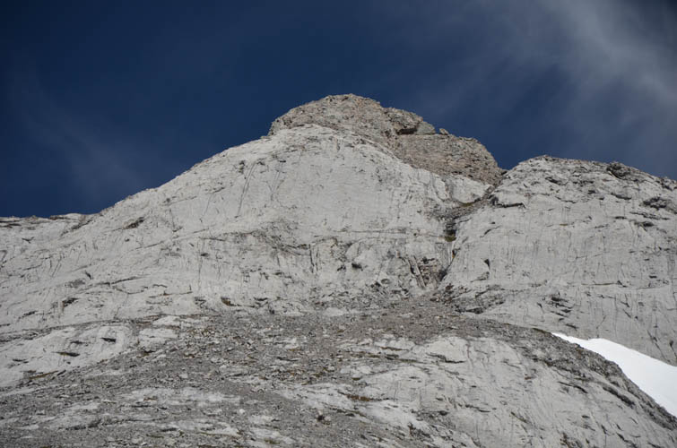
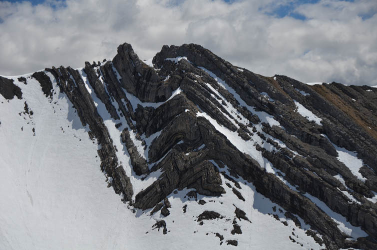
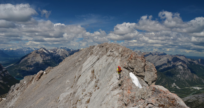
After losing about 80 m of elevation we arrived at a really pretty creek in the valley. This was great place to take a break, listen to the gurgling sound of the water, and fill up our bottles. Now we had the most enjoyable part in front of us: ascending the southwest ridge of Gilligan with >500 m of gain. Though steep, the ridge offers delightful and easy hiking on open grass and rock slopes with great views all around. About three quarters of the way up is the crux, a horizontal light grey rock band that looks too difficult to scramble from a distance but upon closer inspection can be tackled by way of a vertical crack. We had a lot of fun discussing various lines here and breaking it down step-by-step (moderate scrambling with a few difficult moves, some exposure). Once above the rock band we easily scrambled to the summit ridge, with the cairned top a short distance further north.
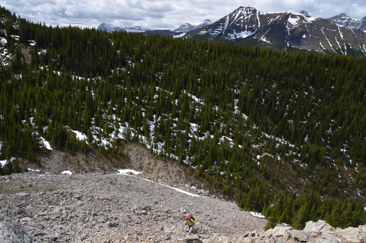
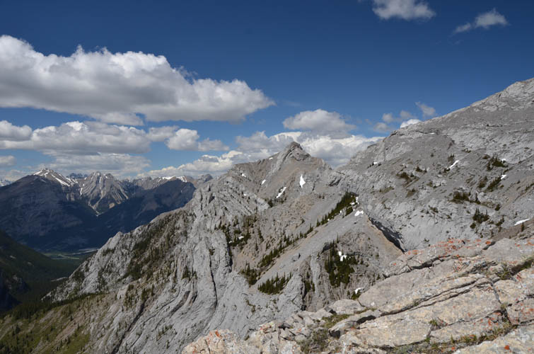
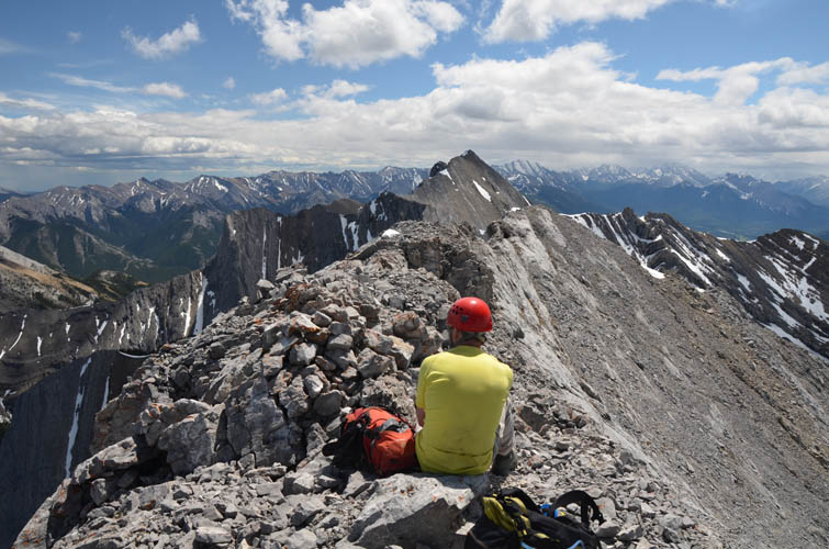
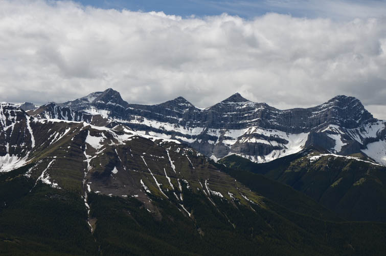
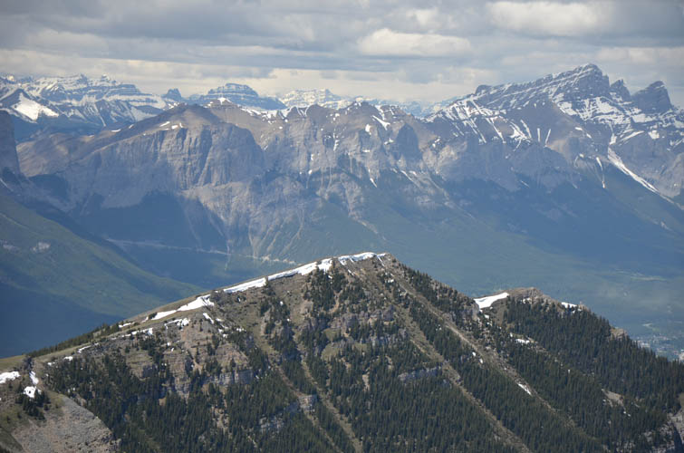
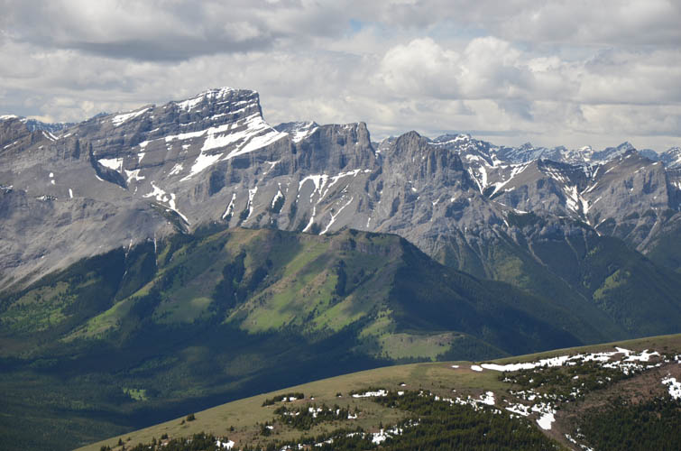
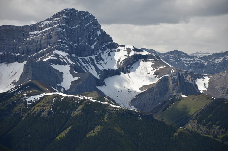
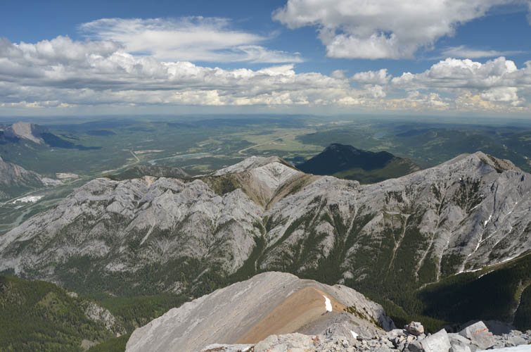
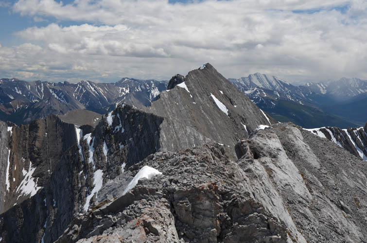
From the summit there are wonderful views of Mount McGillivray, which is about 100 m lower in elevation and looks really interesting from this vantage point. The sharp limestone blocks of its south ridge appear difficult and convoluted, but the traverse has been scrambled before. We spotted a ton of people on popular Heart Mountain to the east, while the gentle tree and grass-covered slopes of Pigeon Mountain to the NW had quite a few hikers on it, too.
We took a slightly different route down to see if we could avoid the crux section, and it worked: from the summit we descended directly west into the middle of a small scree bowl, losing enough elevation to drop below the rock band (which is just slabs and scree here), then immediately veering left to gain the west ridge again. This is a moderate route that, if taken on ascent, would bypass the crux on climber’s left.
The rest of our trip was straightforward and fast, the only other route change being the section between the small rise and Skogan Pass Trail where we simply made a beeline through the forest, which worked out great. A successful and highly enjoyable little adventure to a rarely ascended peak.
Note: Skogan Pass Trail is closed from December 1st to June 15th to help protect wildlife!
|
Elevation: |
2622 m |
|
Elevation gain: |
1440 m |
|
Time: |
9.0 h |
|
Distance: |
19.6 km |
|
Difficulty level: |
Moderate to difficult (Kane), T4/T5 (SAC) depending on route |
|
Comments: |
Helmet highly recommended! |
|
Reference: |
Own routefinding |
|
Personal rating: |
4 (out of 5) |
NOTE: This GPX track is for personal use only. Commercial use/re-use or publication of this track on printed or digital media including but not limited to platforms, apps and websites such as AllTrails, Gaia, and OSM, requires written permission.
DISCLAIMER: Use at your own risk for general guidance only! Do not follow this GPX track blindly but use your own judgement in assessing terrain and choosing the safest route. Please read the full disclaimer here.