Banff, AB, Canada
4 September 2019
With Vern & Mike
Trying to find a route up a remote and elusive peak
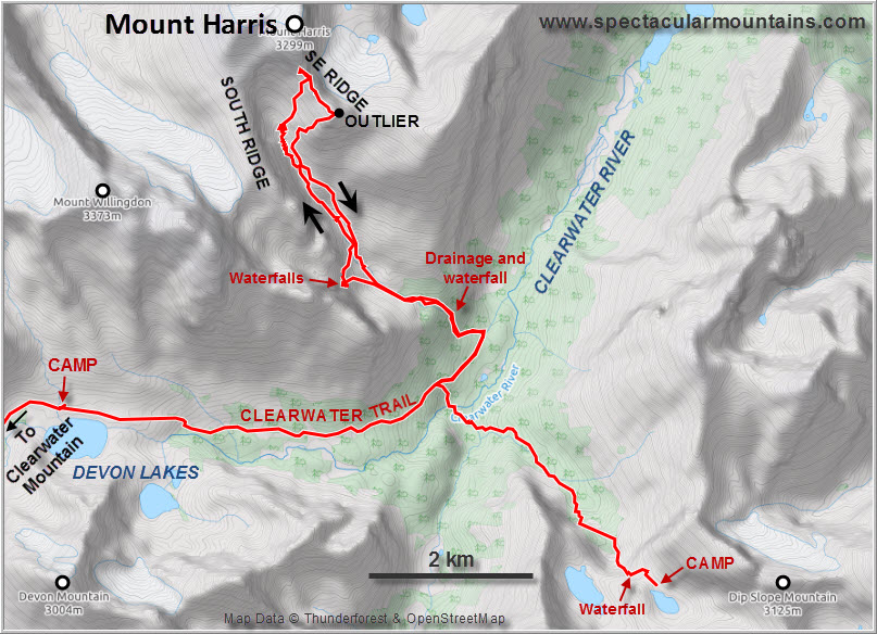
Day 1 & 2: Approach. Deluc Peak & Dip Slope Mountain
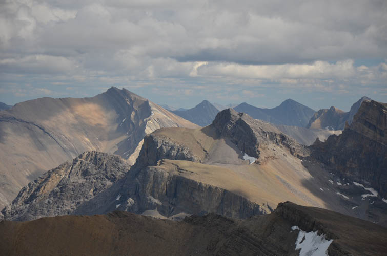
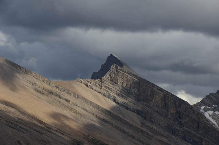
Day 3: Mount Harris
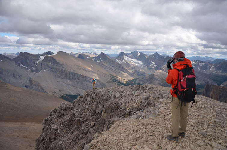
Waking up by the peaceful little lake below Dip Slope Mountain around 6 AM, the sky still dark and grey after it had rained half the night, was both a beautiful experience as well as a struggle. I really didn’t want to get up after having ascended two mountains and around 2400 m elevation metres yesterday, and I’m sure Mike and Vern felt the same way. But hey, we were here now, and we were here to explore and climb some peaks. The adrenaline kicked in as soon as we all stepped out of our wet tents and started discussing today’s route plans.
Mount Harris, located in a remote corner of Banff National Park, about half way between highway 93 and the Ya Ha Tinda area, was first ascended in 1919 by Rockies surveyor Ley Edward Harris. In total, the mountain probably hasn’t seen more than a handful of ascents in its existence, including one by Rick Collier in 1996 who approached the valley to the south and had to use ropes to overcome cliffs below the summit. Most recently, Paul Zizka ascended the mountain via the same valley and the south ridge, the “only difficulty” being a cliffband near the beginning of the valley. But “difficult” is a relative term, of course, and given the paucity of route information we had available to us, it was no surprise that the day turned out to be quite different than expected…
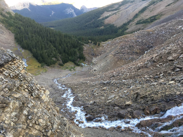
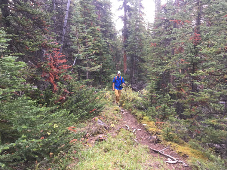
Getting to the base of Mount Harris is an adventure in itself. After packing up camp, we first had to hike down the valley that extends NW from Dip Slope Mountain’s south slopes. The biggest hurdle, albeit not a hard one, was getting down the headwall of the valley directly below our camp. A scree ramp diagonally leads to a small waterfall, which is crossed and then followed to the bottom on mud and scree on its left side (when descending). A long stretch of wet bushwhacking followed, most of it fairly light and easy, some of it a bit annoying due to boggy stretches. When we eventually reached the Clearwater River at the end of the valley, we were relieved to see that it hadn’t swelled as much as we had feared and it was actually no problem at all to wade it in a few steps. A few hundred metres of moderate bushwhacking – a rather nasty affair when done uphill with heavy packs through wet forest – followed on the other side to get to the Clearwater Trail that runs parallel to the river but higher up. We stashed our packs here and pulled out our light day packs for Mount Harris, knowing we’d be coming back here again on our way to camp at Devon Lakes.
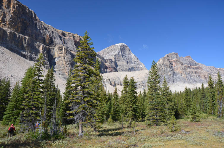
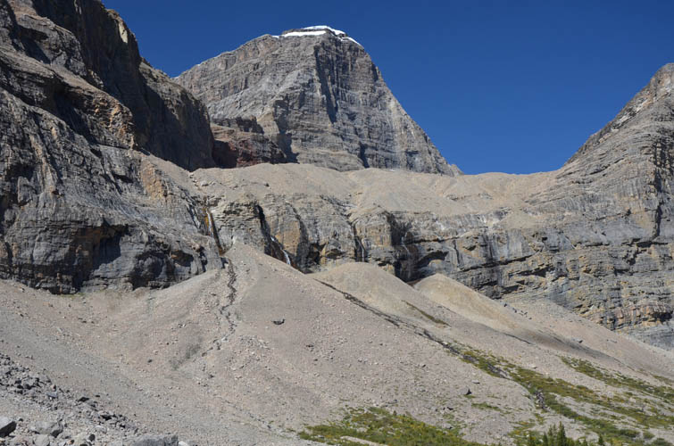
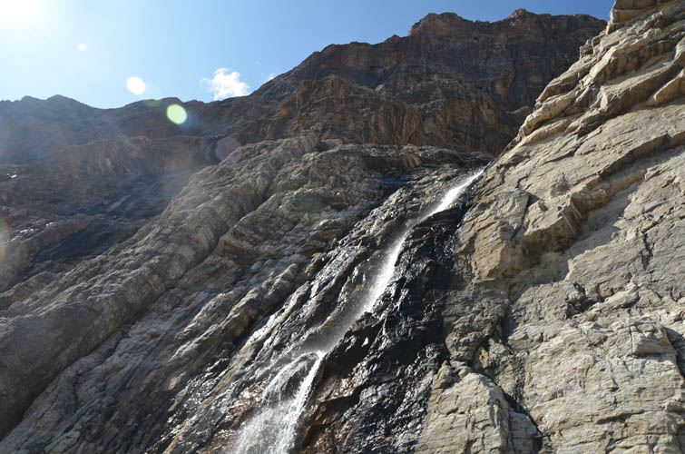
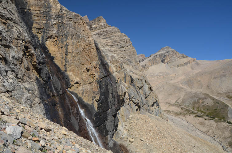
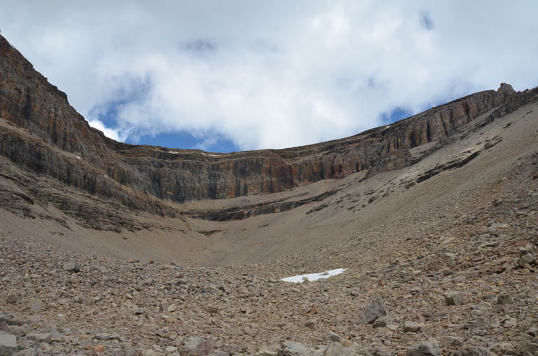
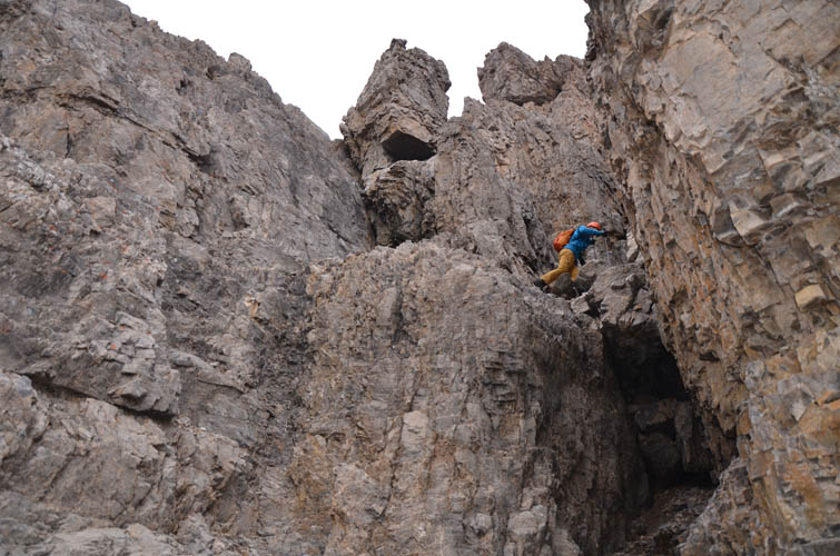
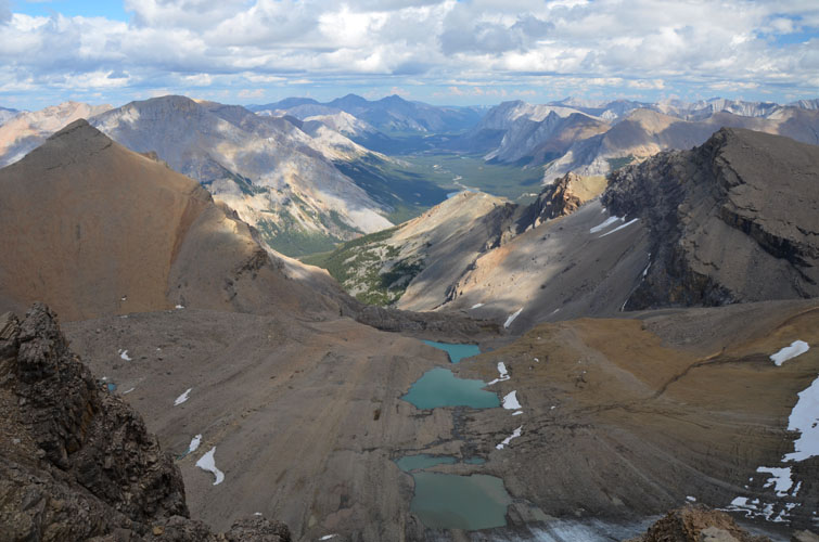
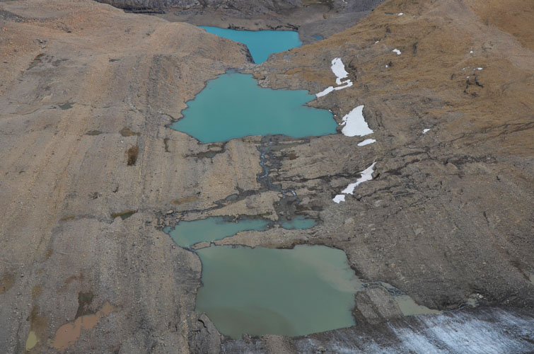
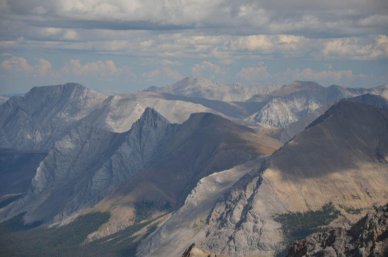
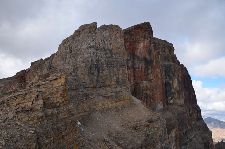
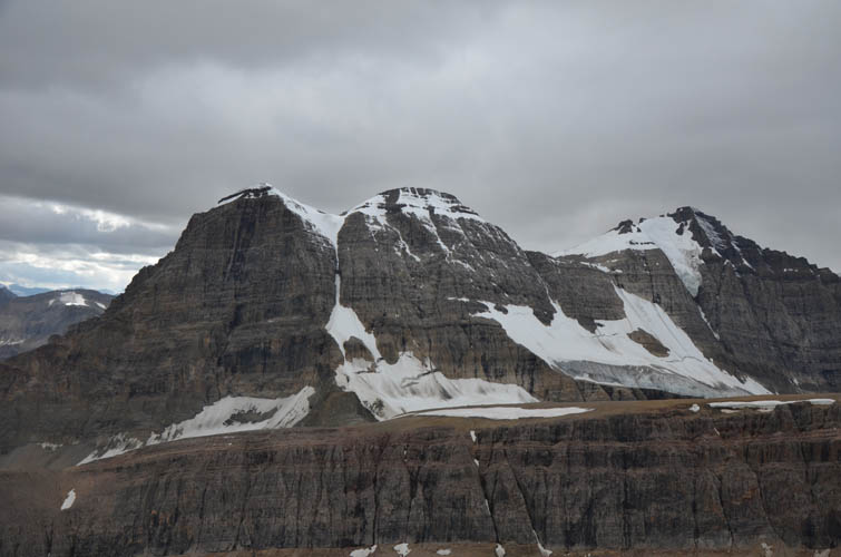
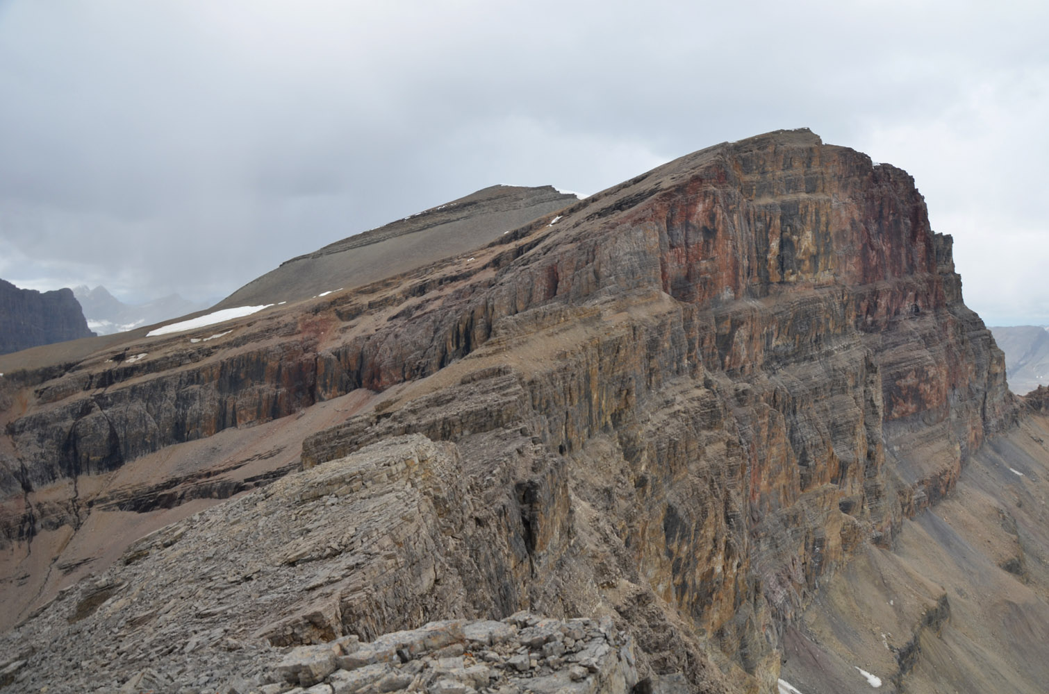
After hiking east along Clearwater Trail for about a km, we turned north on the right side of a major drainage and found a pretty easy way up into the open valley south of Mount Harris. This is a strange valley: it’s a very picturesque place, with lovely meadows and gurgling creeks in the lower part. It’s also a very long valley, bounded by a huge, vertical cliffband on the west and north sides, and a steep scree slope with more cliffs above on the east side. We almost felt as if we’d just trapped ourselves in a massive cul-de-sac. We looked around the lower part, a bit incredulous that there should be a scramble route up the cliffs on the left side according to the beta we had, because we simply couldn’t see a feasible route up. Ok, time to really get up-close and examine the cliff in detail: there were at least four small waterfalls coming down the cliff just above a big scree cone, which was the most obvious way to break through the rockband and gain the south ridge of the mountain. We went right up against the wall and spent a good half an hour discussing various lines, but it was clear this wasn’t scrambling terrain anymore. The cliff face was near-vertical, the holds small and possibly wet and even overhanging. The decision was unanimous: no way we were going up there without protection!
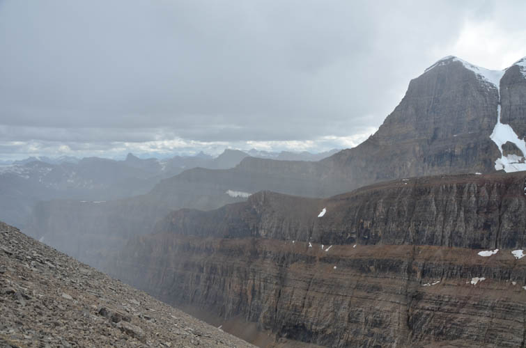
There was no choice now but to head north to the end of the valley and take a look at Rick Collier’s route. He had used ropes to break through the cliffs on his ascent in 1991, but in icy conditions, so we pinned our hopes on finding a scramble route somewhere now that conditions were perfectly snow- and ice-free along the entirety of this cliffband.
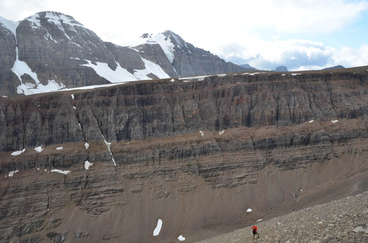
Once again we were out of luck. The closer we came to the cliffs at the end of the valley, the more obvious it became that this was a technical wall climb no matter what part of it you approached, and we looked everywhere. Mike found a steep couloir half-way up the cliff that looked like it might work, but upon further inspection we all agreed that the chances were more than slim. In a vain attempt at finding a route around the cliff on the mountains east side, we slogged up the side of the valley on terrible rubble to the top of a small ridge, only to discover that this was a no-go as well. We all felt pretty demotivated at this point, and just to make things worse the weather also started to turn on us at the same time with dark clouds moving in fast from the NW. We had trudged up almost 1400 m just to get blocked by a cliff, only 200 m below the summit of Mount Harris!
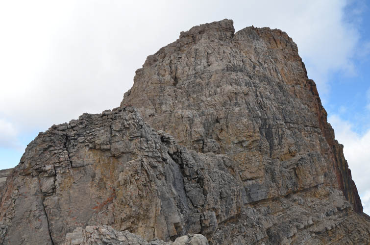
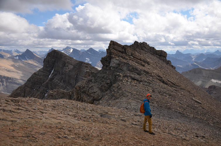
The consolation prize – gaining the possibly unclimbed summit of a minor outlier along the ridge SSE of Mount Harris – was hardly worth the effort it had taken us to get here. But this is how things in the mountains go sometimes, and it serves as a reminder that you can’t expect everything to work out, you can’t rely on success, you can’t be too disappointed, because this is exploration after all. And the fun of exploring, of poking around, discovering new terrain, is definitely worth all the hard work, even if the summit is not attained at the end of it.
We actually had quite a bit of fun scrambling along our ridge to the minor outlier, then headed back down the talus slopes as a light rain set in and the wind picked up. The weather cleared up shortly after and we also found a more pleasant route down the valley on sections of grassy shelves on the east side, so the return to Clearwater Trail and back to our packs was smooth and enjoyable.
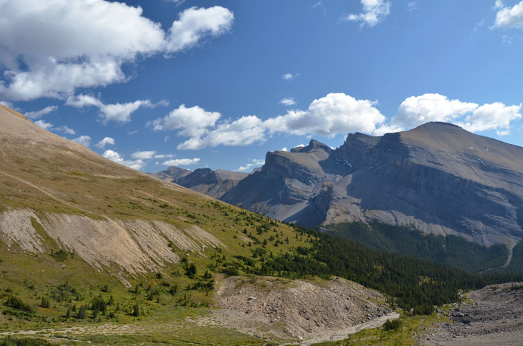
The last task of the day was to lug our heavy packs for 6 km up the Clearwater Trail to Devon Lakes where we arrived just after 8 PM, with just about enough light to set up camp and cook a quick dinner. I had the best sleep in a long time that night, dreaming about chocolate cake and pizza… None of these miracles were to appear the next day, but at the very least we pulled off a successful ascent again. Beautiful Clearwater Mountain was waiting!
|
Elevation: |
Mount Harris summit: 3299 m (official) |
|
|
Our highest elevation: 3095 m (my GPS) |
|
Elevation gain: |
1950 m |
|
Time: |
12.5 h |
|
Distance: |
23.4 km |
|
Difficulty level: |
Moderate (Kane), T4 (SAC) |
|
Reference: |
Rick Collier, Paul Zizka |
|
Personal rating: |
2 (out of 5) |
NOTE: This GPX track is for personal use only. Commercial use/re-use or publication of this track on printed or digital media including but not limited to platforms, apps and websites such as AllTrails, Gaia, and OSM, requires written permission.
DISCLAIMER: Use at your own risk for general guidance only! Do not follow this GPX track blindly but use your own judgement in assessing terrain and choosing the safest route. Please read the full disclaimer here.