Ghost, AB, Canada
18 October 2019
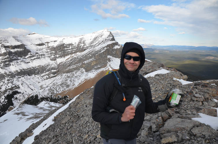
With Kevin
Beautiful, remote, uncrowded
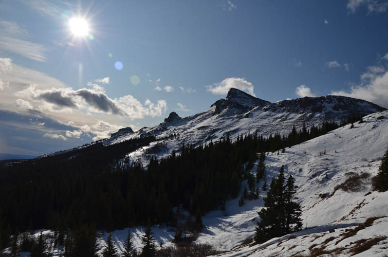
Ever since ascending Ghost Peak in a white-out with my late friend Priyesh in 2016 I’ve been wanting to come back to this beautiful and remote area. Vern and Phil climbed Ghost in November 2017 and then easily hiked up Sheep Meadow Mountain, which sits directly to the south. The latter, I thought, would make for a nice shoulder-season objective and a good reason to return to the area.
Sheep Meadow Mountain, which is made up of a north and a south peak, is mentioned in the Ghost section of Gillean Daffern’s K-Country guidebook (vol. 3) while bivouac.com uses the slightly odd name of “Fallen Peak” after the nearby Fallentimber Creek. A similar naming discrepancy exists for neighboring Ghost Peak: “Kink” was assigned to this summit by bivouac, whereas the summit register Priyesh and I found in 2016 actually refers to the mountain as Ghost Peak. Although of little relevance and unofficial anyway, I will stick with the more traditional names for consistency’s sake.
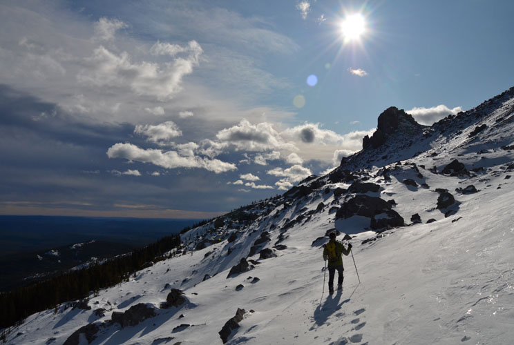
I was excited to have seasoned mountaineer and climber Kevin Barton join me on this fantastic scramble. Not that it was a mountaineering trip, but it was certainly more than we expected. We never imagined this trip would take us almost 12 hours to complete – after all we are dealing with relatively minor Front Range peaks here that would normally be largely free of snow due to Chinook winds prevalent in the area. Not today. There was still a surprising amount of snow both on the east and west sides of the mountain which really slowed down our pace, plus a fierce wind up on the ridge chilling us down to the bone. No wonder I felt so exhausted the next day :).
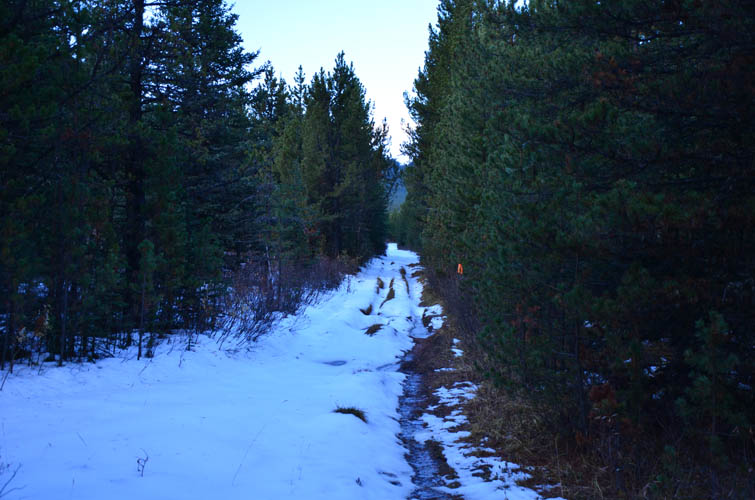
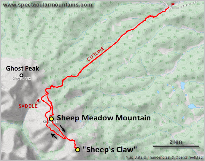
The approach is easy and straightforward (see my Ghost Peak trip report for details). This time we had no issues driving to the trailhead with my old Honda CR-V via Hunter’s Valley Road. Parts of the last stretch of dirt road were a bit messy due to current logging activities going on in the area, but the ground was mostly frozen and easy to navigate.
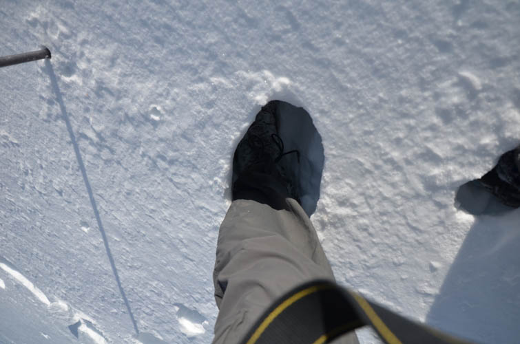
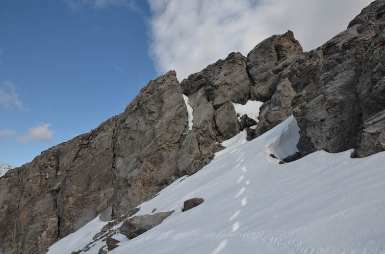
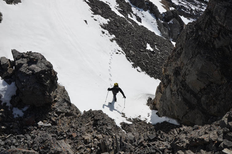
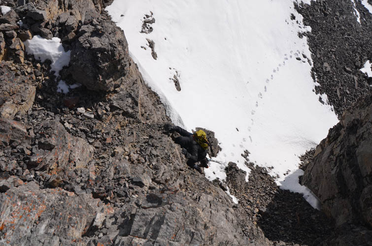
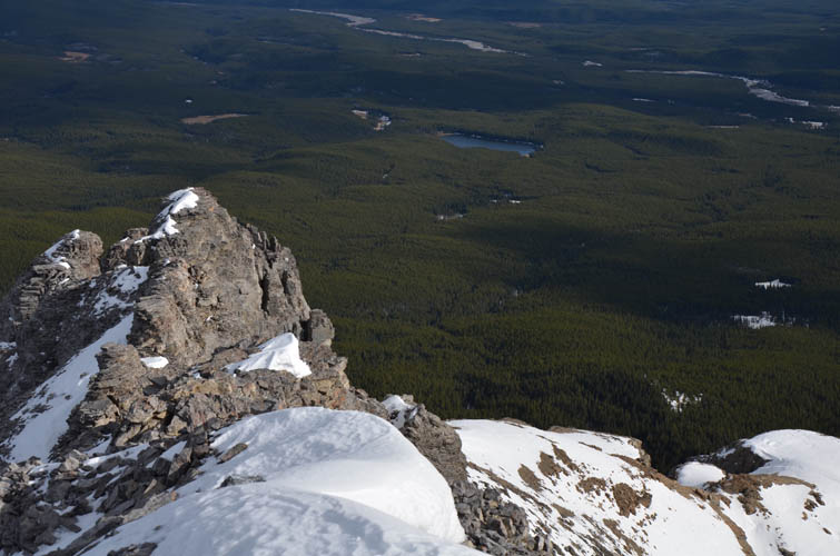
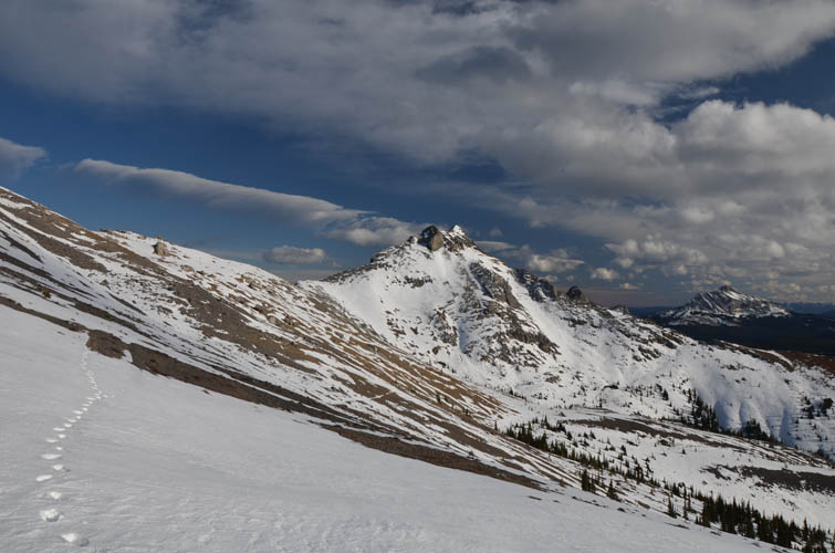
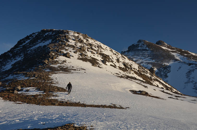
After the long hike west along the cutline and OHV track, we decided not to climb all the way to the saddle between Sheep Meadow and Ghost, but instead veer left (south) along the eastern slopes of Sheep Meadow. We figured it’d be easy to traverse these slopes but the snow cover was a lot thicker than expected, especially in localized dips where we were stuck up to our waist in places. On the positive side the snow was hard enough not to pose any avalanche risk and the east side was wind-sheltered. I’m really thankful to Kevin who did all the hard work ploughing through the snow here, while all I had to do was follow in his footsteps. We eventually gave up the traverse and climbed to the ridge top just before the main summit, where strong wind gusts almost blew us off. The wind was so cold, it forced me to put hand warmers in my winter gloves (and wish I had brought my mittens).
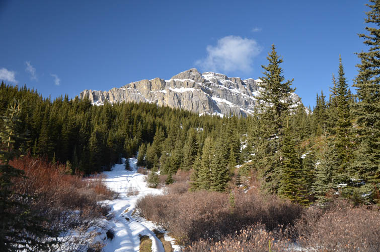
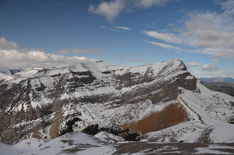
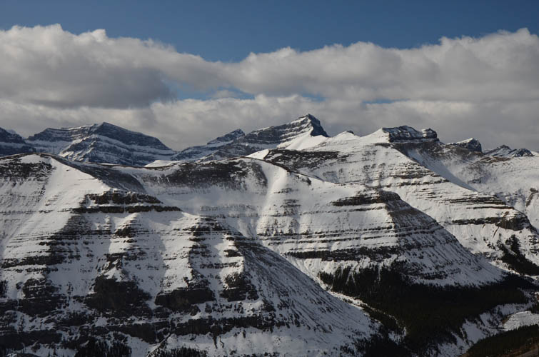
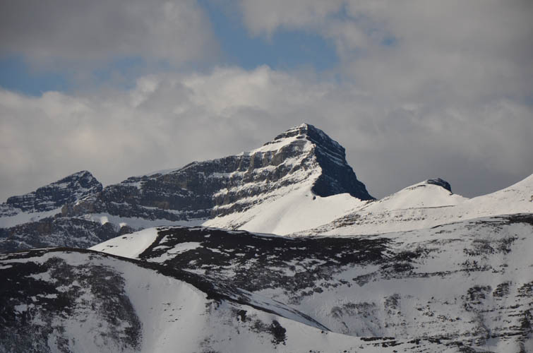
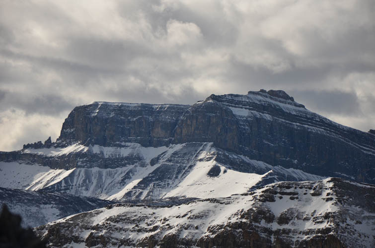
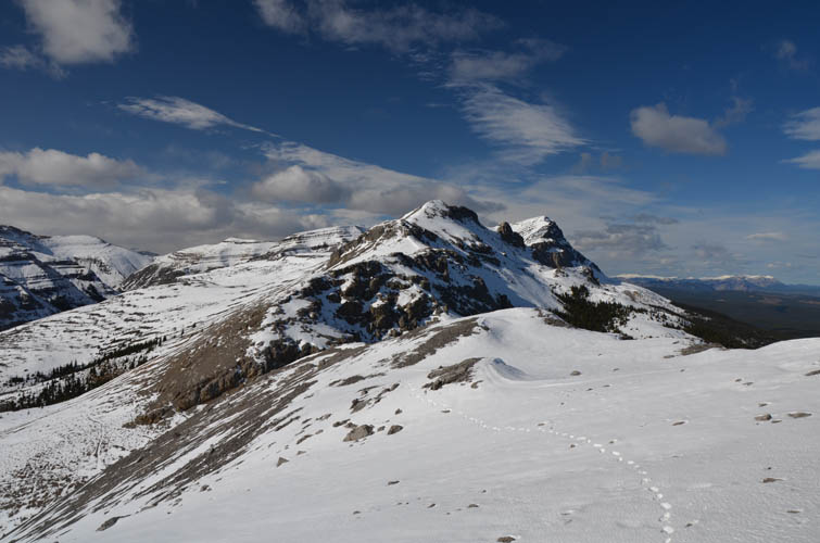
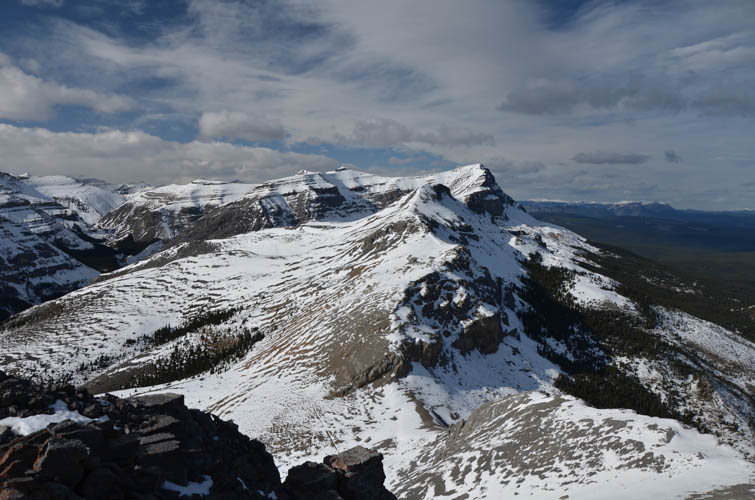
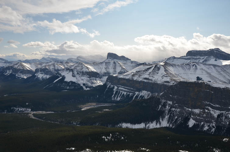
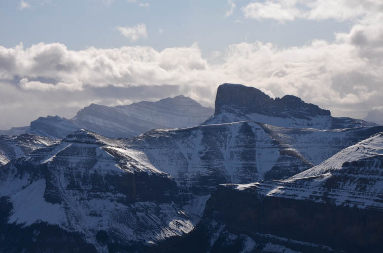
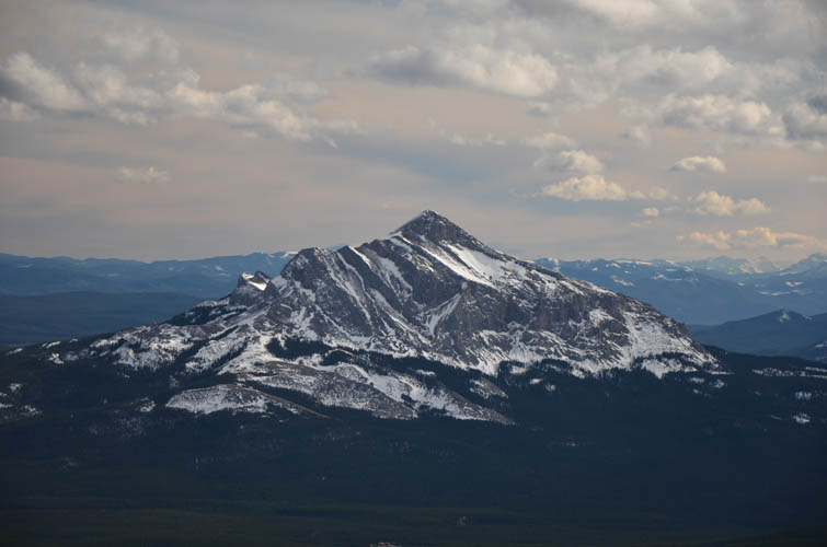
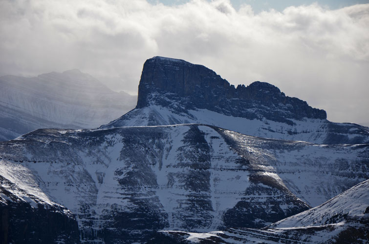
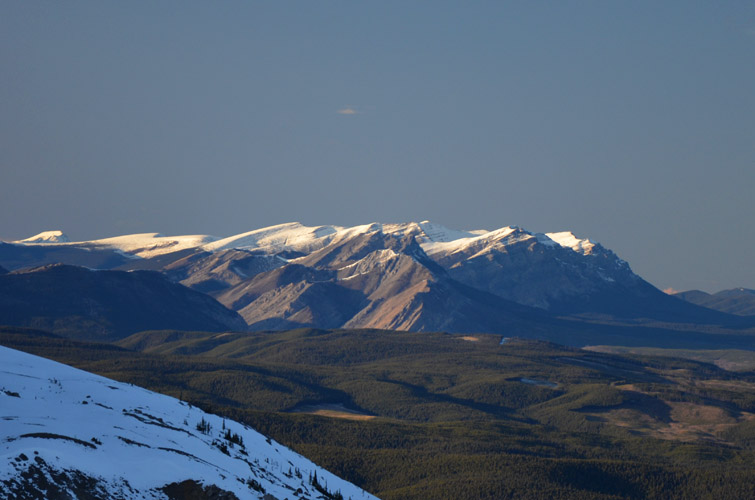
One thing I can never get enough about winter days like this are views of craggy snow-covered mountains with clear blue skies behind. Simply gorgeous! It was the complete opposite to the foggy day and lack of views Priyesh and I had to contend with on Ghost Peak three years earlier. Mount Davidson, Astral Peak, Castle Rock, Black Rock Mountain and of course the iconic Devil’s Head make for a marvellous backdrop to the west and southwest.
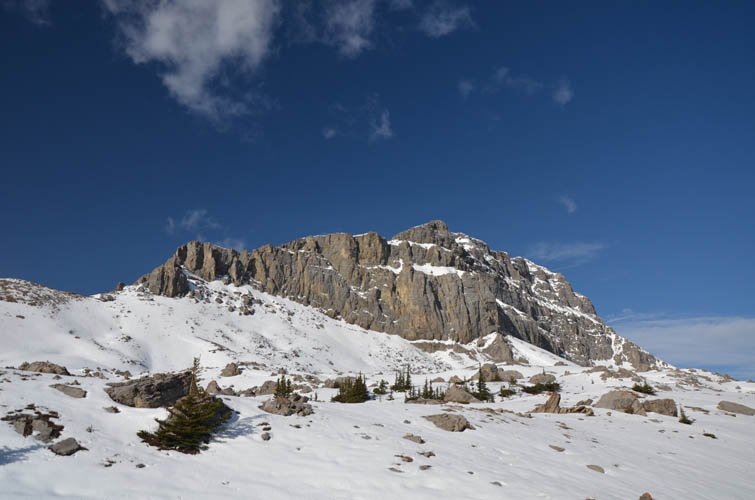
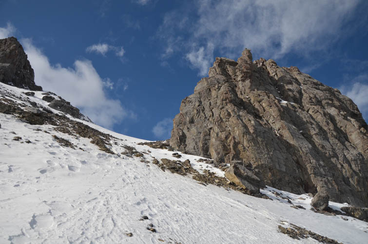
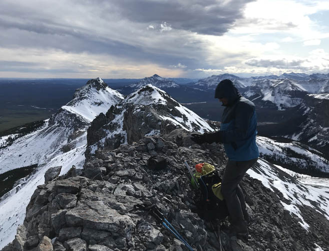
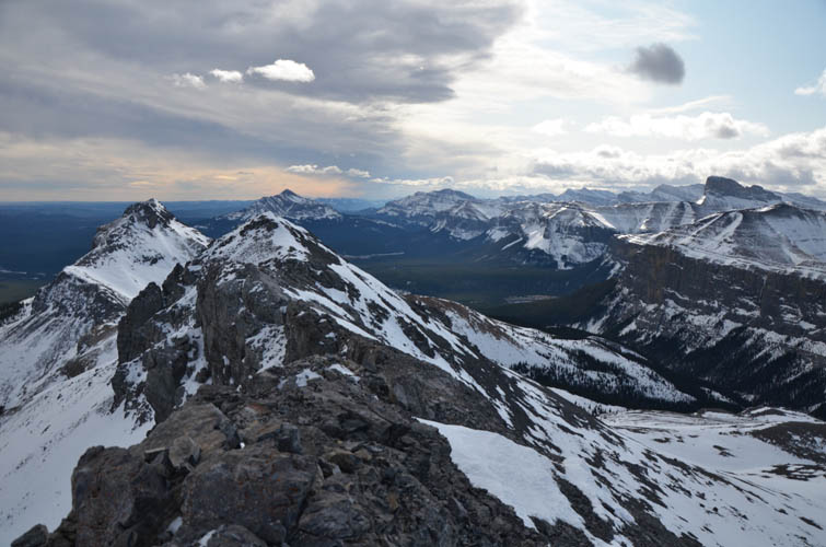
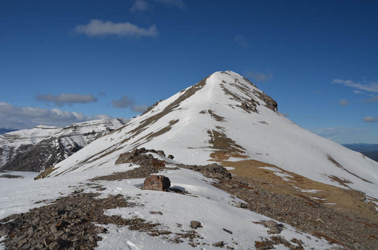
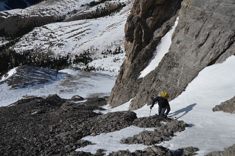
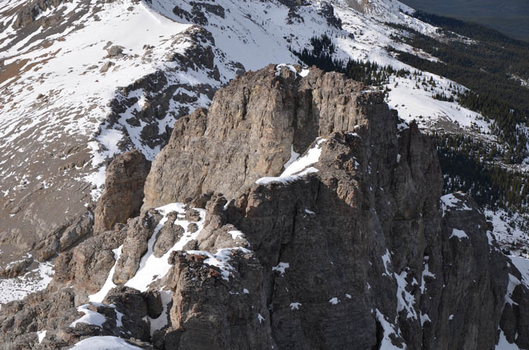
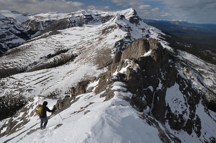
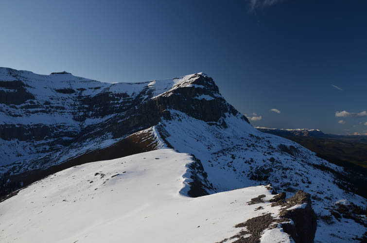
An easy scramble took us to the summit where we found a small cairn and had some fun rebuilding it. Our next destination was the second or south peak of Sheep Meadow Mountain, which is slightly lower in elevation. The south ridge narrows significantly in a few places and has several interesting scrambling sections, including one short chute that required a few difficult moves. All the moderate to difficult stuff is avoidable by simply traversing below the ridge crest on the west side.
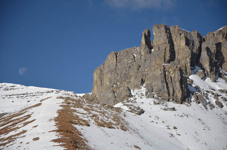
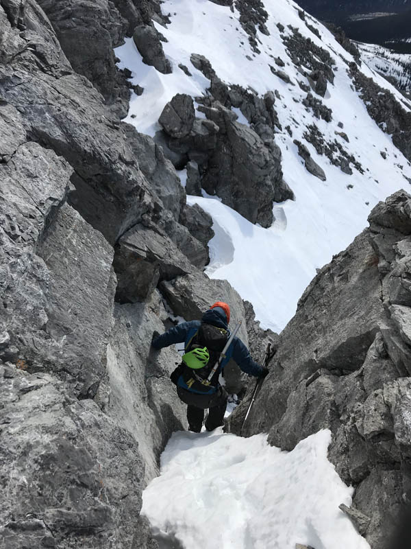
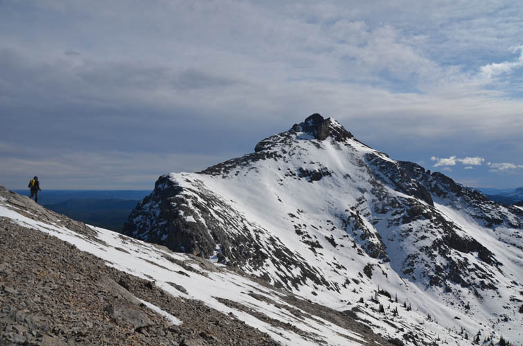
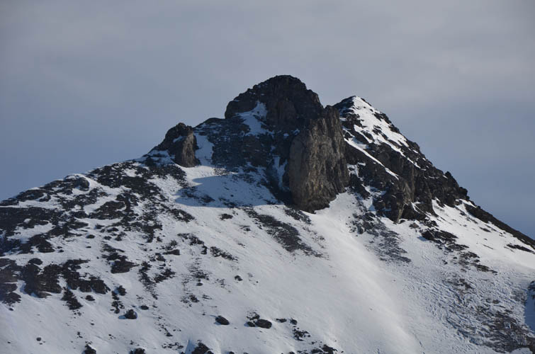
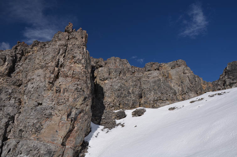
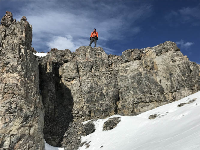
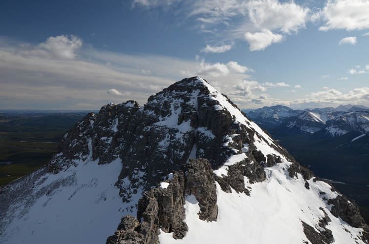
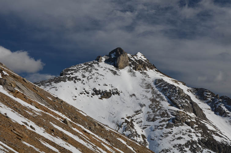
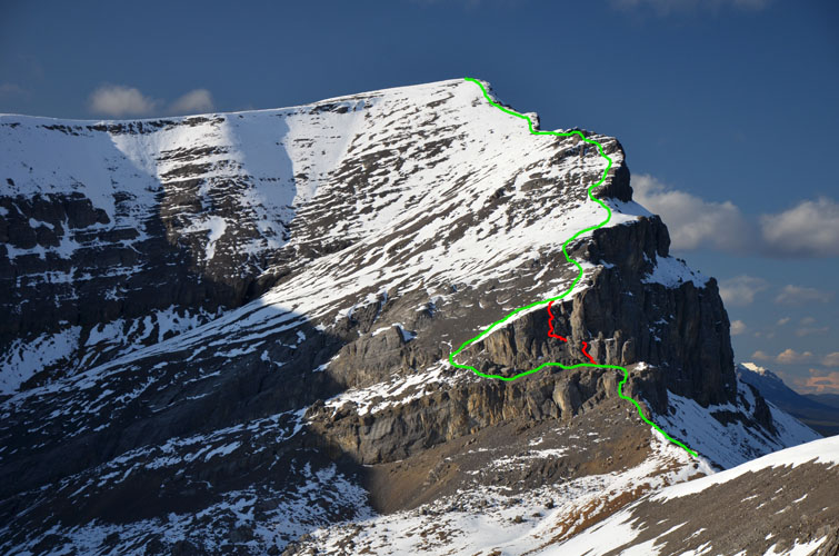
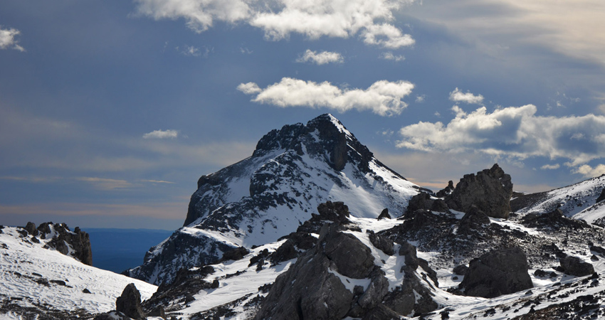
As we kept moving south along the ridge we started to realize how far we had to go still and how much elevation we had to lose to get to the south peak. In fact, the distance between this aesthetic little peak and Sheep Meadow main summit is almost 2 km and involves an elevation loss and re-gain of about 250 m. Though long, it was a very enjoyable hike on open, wind-swept slopes with some easy to moderate scrambling on the upper ridge to get to the south summit. We bypassed a black vertical rock buttress on this ridge on climber’s right, then climbed a short 5.1 section to a subsidiary summit by mistake (crumbly rock but fun!) before realizing that the highest point was actually a short distance further south. A diminutive cairn adorns the summit of the south peak.
Kevin and I both agreed that this looks like a wholly separate peak and certainly required a lot of energy to get to, so we felt it really deserves a separate name. The scrambling is also a bit more challenging here, at least in winter conditions, and when Kevin made the slightly facetious suggestion of calling it “Sheep’s Claw” we both instantly liked it. Sort of the opposite to Devil’s Head :).
Our initial plan was to go up the two summits of Sheep Meadow Mountain, then tag on Ghost Peak afterwards if time and energy allowed. We started hiking back north across the gently undulating snow-covered slopes west of Sheep Meadow Mountain. However, just like everything else today, this stretch also took us longer than expected with all the snow around and strong winds constantly whipping us. We eventually reached the saddle around 6 pm and decided to skip Ghost Peak (I know Kevin will be back in the area to climb it one day!). It was a good call because half way down the cutline the last remaining daylight faded and made us don our headlamps for the rest of the hike back.
An awesome off-season adventure in an absolutely beautiful and rarely visited area! It took a lot of energy in the conditions we had today, but can probably be done in eight hours or less in the summer.
|
Elevation: |
Sheep Meadow Mountain: 2415 m (my GPS) |
|
|
“Sheep’s Claw”: 2394 m (my GPS) |
|
Elevation gain: |
1340 m |
|
Time: |
12 h |
|
Distance: |
21.5 km |
|
Difficulty level: |
Easy (Kane), T2 (SAC) for Sheep Meadow, Easy to Moderate for Sheep’s Claw |
|
Reference: |
No info on this particular route was available. |
|
Personal rating: |
4 (out of 5) |
NOTE: This GPX track is for personal use only. Commercial use/re-use or publication of this track on printed or digital media including but not limited to platforms, apps and websites such as AllTrails, Gaia, and OSM, requires written permission.
DISCLAIMER: Use at your own risk for general guidance only! Do not follow this GPX track blindly but use your own judgement in assessing terrain and choosing the safest route. Please read the full disclaimer here.