High Rock Range, BC, Canada
15 August 2019
Solo
A long and rewarding scramble
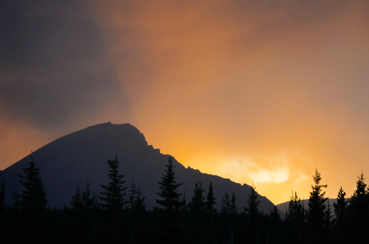
This is one of those trips that I’d relegated to the “maybe I’ll climb it one day” list ever since I first saw its beautiful north-south ridge from nearby Mount Erris and Tornado Mountain. Funnel Peak just seemed too remote and the chances of a successful ascent too uncertain considering how jagged and “cliffy” the summit ridge looks. Finally today the day came where I was ready to tackle a long and potentially strenuous route of uncertain outcome… I really wanted to visit the beautiful High Rock Range in the Dutch Creek area again, so I decided to combine Funnel with an easy objective (Grassy Ridge) for a nice two-day camping trip. The drive from Calgary is long and travel along Dutch Creek Road so slow and bumpy that it’s really only worth coming here if you spend several days in the area.
Of course part of the appeal for Funnel Peak, as is the case with many of my endeavors, is that I had no beta whatsoever on this mountain. Even the name is merely an unofficial one, popping up on Google Maps and my hiking apps. So I planned my route using photos I had taken from surrounding peaks plus satellite images, which really is a big part of the fun of the entire trip itself. I had no idea if my proposed route would lead me to the summit, and I’m so glad it all worked out beautifully.
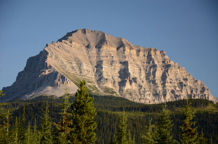
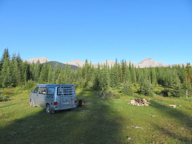
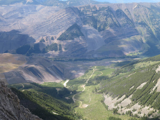
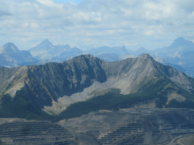
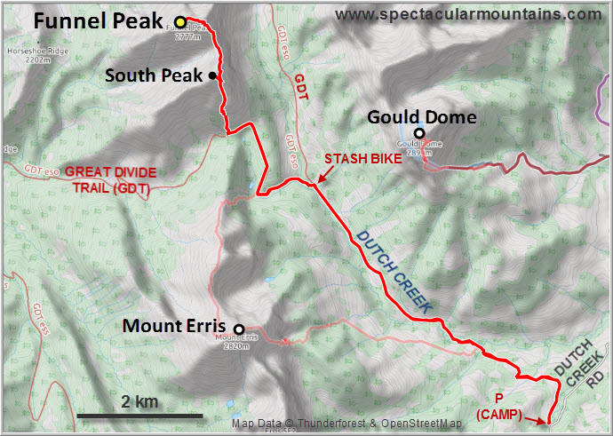
Theoretically, Funnel Peak should be relatively easy to access from B.C. highway 43 to the west, but the vast and ugly Line Creek coal mine stands in the way there. Fastest access from Calgary is via highway 22, the Maycroft Road, a short distance north along highway 40 (Kananaskis Trail), and then west on the Dutch Creek Road for about 18.4 km on gravel. About the first half of the latter is maintained, the rest is very slow-going with plenty of potholes and large puddles that seem to retain water forever. Unless you have a slightly higher clearance vehicle you may run into trouble here; with my VW California it was just ok. There’s a flat grassy area at the 18.4 km mark where a side road heads north into the valley between Gould Dome and Mount Erris, a perfect place to camp complete with fire circle. With the exception of a single truck driving by on the Dutch Creek Rd, I had this wonderful place all to myself as most campers don’t make it this far out.
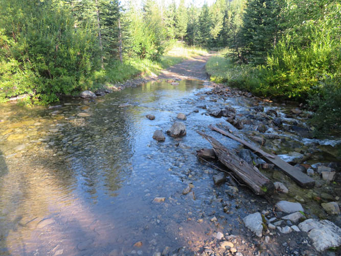
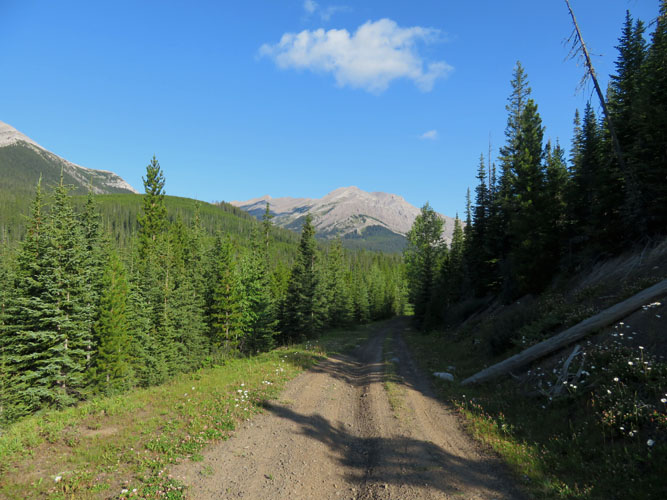
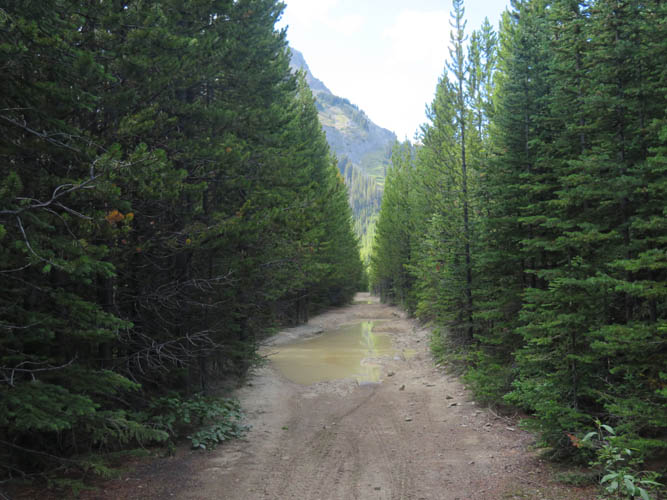
After hiking up Grassy Ridge the day before, I awoke to a surprisingly chilly morning and, feeling sluggish and cold, didn’t really want to get going on what I knew was going to be a long day. The bike ride along the valley road – a rough ATV track really – wasn’t as fast and smooth as I had hoped for. After all, I had walked along here in 2016 before for my Mount Erris trip and remembered several creek crossings that had to be waded. This time, after some rain in the past few days, it was quite a wet and muddy affair along some sections of the track, with lots of big puddles and at least five crossings where I couldn’t quite ride all the way through and got my feet wet.
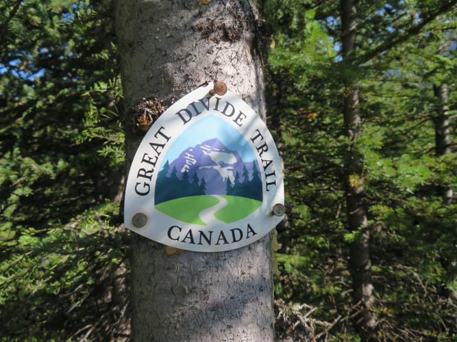
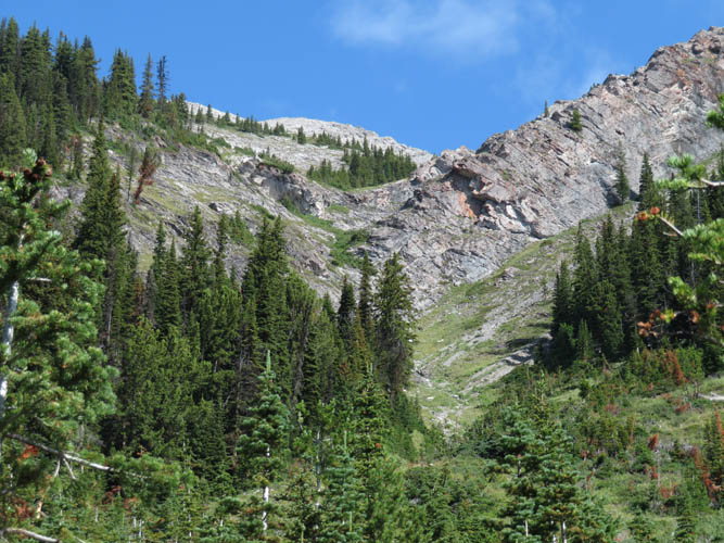
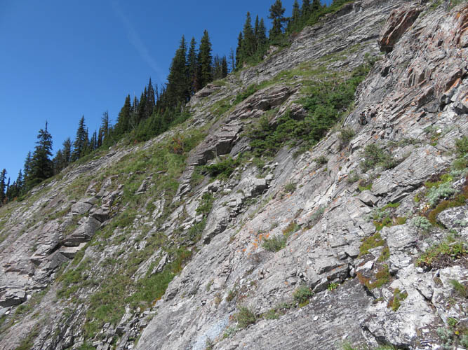
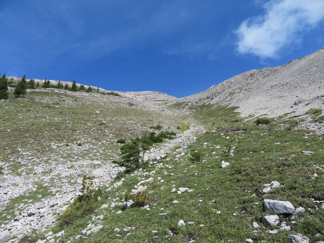
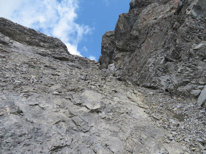
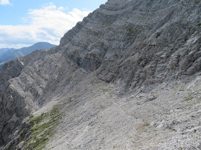
At the intersection with the Great Divide Trail (GDT) after 7.5 km of riding I stashed my bike and changed out my wet sneakers for my comfy hiking boots. After the bumpy and wet ride on my junky bike I was glad to be hoofing it again! I followed the GDT to almost near North Fork Pass, then turned right up a small, grassy valley with a stony drainage in the middle – my ascent route towards the south peak of Funnel. Even though I felt like I had a slow day once again, I thoroughly enjoyed slogging up this picturesque green valley – my own little paradise for the day. There’s no bushwhacking (except the first 3 metres!) and the only hurdles are two cliffbands that require a few moderate to difficult moves when tackled head-on, but can be bypassed on climber’s left.
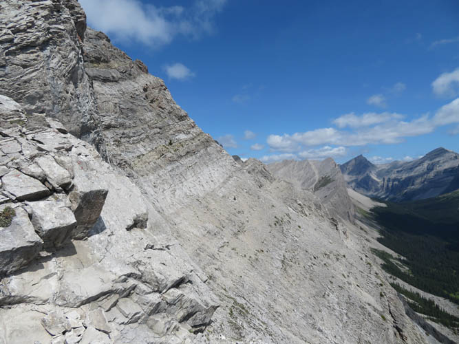
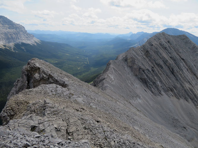
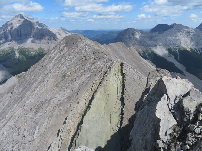
Above the cliffbands the grassy slopes lead almost all the way to a distinctive break in the southeast ridge of Funnel South Peak. This is what I had marked as a possible point to access the east face, thereby avoiding having to navigate all kinds of cliffs and drop-offs along the north ridge of Funnel South. The access point was a winner: a clear goat track led the way along a ledge across the east face, emerging near the saddle between Funnel South and Funnel main peak. Goats know the mountains best, and this was no different – a brilliant and fun way to bypass nasty roadblocks on the ridge above me. It reminded me a little of the access route to South Ghost Peak from Jura Creek.
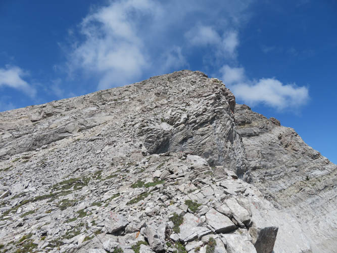
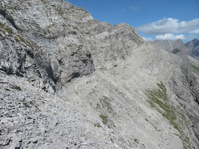
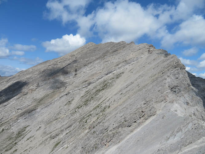
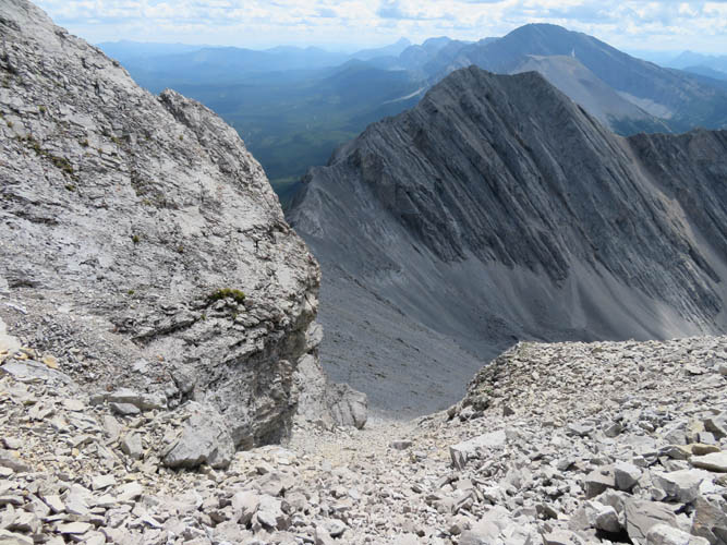
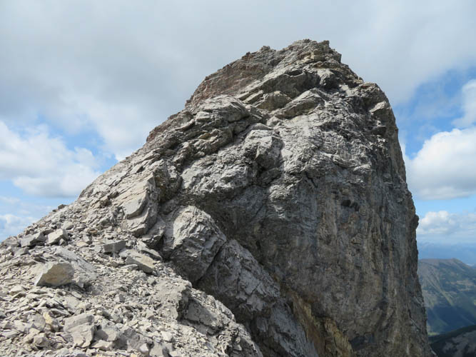
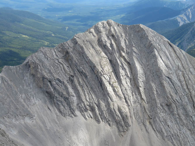
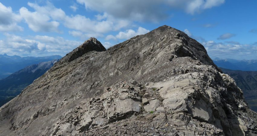
Arriving at the saddle, my heart slumped when I saw what lay ahead of me: Funnel Peak’s complicated south ridge features numerous steps and several major cliffbands dipping down into the small valley to the west. I was very unsure at this point if I could make it, but of course why not give it a try now that I was already here. To my luck, all obstacles could be resolved by mere scrambling. The first major cliff is bypassed by way of a rubbly scree chute on climber’s left, the remainder simply by carefully climbing the crest of the ridge. Difficulty-wise it’s mostly moderate terrain with difficult scrambling on the many cruxes, plus lots of routefinding along the way. Overall very enjoyable, especially of course when it all works out and you get to reach the summit!
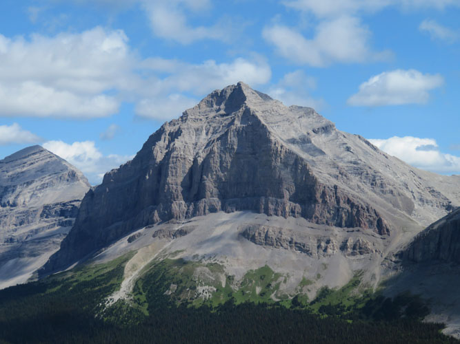
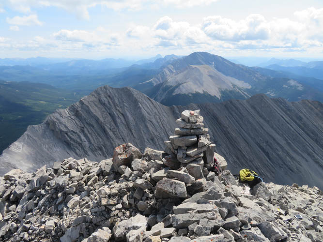
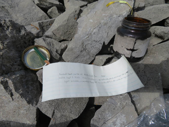
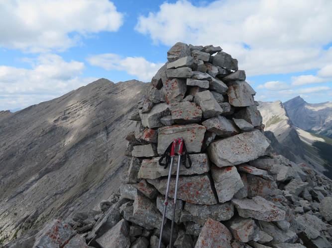
The reward for the effort came in the form of splendid summit views in a rarely visited area: Mount Erris to the south, Gould Dome and Tornado Mountain to the east, Mount Salter and Mount Lyne to the west. Much to my surprise there was a small glass jar with a piece of paper hidden in the summit cairn. Local climber Allan Schierman had placed it on Sep 3rd, 2006, with no other entries since.
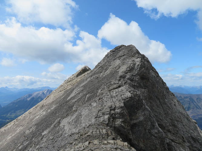
On my way back down the main ridge I had to take my time to negotiate the various cruxes safely, but really enjoyed the scrambling. Once I had traversed the ledges on the east face, I paid a quick visit to the south peak, which is only about a 20 minute scramble from where the ledges intersect with the SE ridge. There is a pretty fat cairn sitting at the top here – obviously a lot more people make it up to the south peak owing to its proximity to the GDT below.
After visiting Funnel South, I headed back exactly the same way I had come up in the morning. The bike ride was quicker this time because it’s mostly downhill and I knew exactly how to ride or wade through the various shallow creeks that cross the road. A thoroughly satisfying and fun outing!
|
Elevation: |
2778 m (my GPS) |
|
Elevation gain: |
1660 m |
|
Time: |
10.5 h |
|
Distance: |
28.0 km (incl. 15 km by bike) |
|
Difficulty level: |
Difficult (Kane), T5 (SAC) |
|
Reference: |
None |
|
Personal rating: |
4 (out of 5) |
NOTE: This GPX track is for personal use only. Commercial use/re-use or publication of this track on printed or digital media including but not limited to platforms, apps and websites such as AllTrails, Gaia, and OSM, requires written permission.
DISCLAIMER: Use at your own risk for general guidance only! Do not follow this GPX track blindly but use your own judgement in assessing terrain and choosing the safest route. Please read the full disclaimer here.