Waterton, AB, Canada
31 July 2021
With Raff
Gorgeous long-distance ridge walk high above Crypt Lake
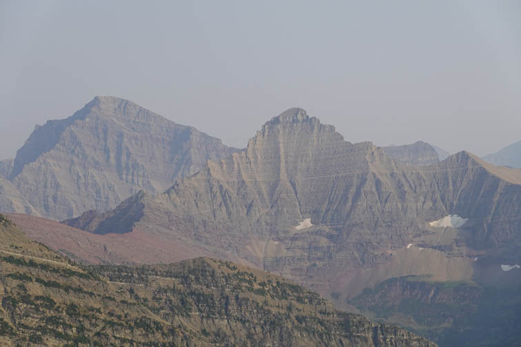
My first trip with Raff, the crazy Pole, and an absolutely fantastic one. When Raff suggested Crypt Peak via Vimy Ridge I was interested right away. Crypt Peak is the highest mountain above Crypt Lake and its summit sits right on the US-Canada border!
We braced ourselves for a long and exhausting day but somehow it turned out to be easier than expected. We had great conditions with very warm weather (34 deg down in the valley!), just a light breeze (very rare in notoriously windy Waterton), and obviously no snow or ice lingering anywhere along the route. It was a bit smoky but the views were still pretty good.
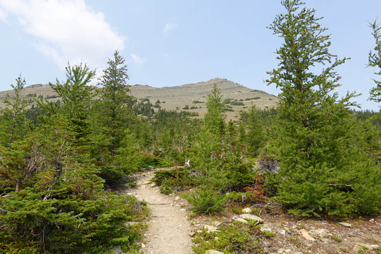
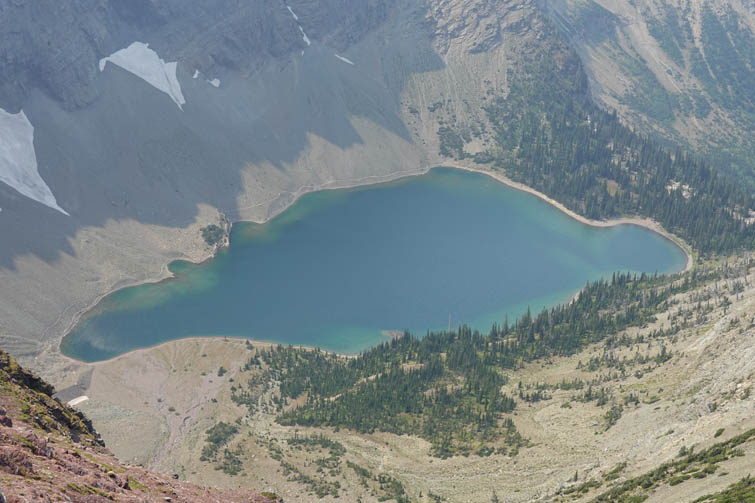
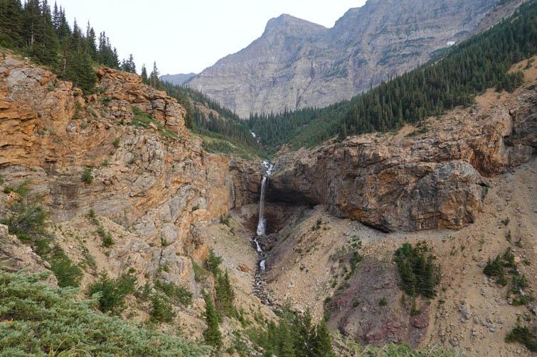
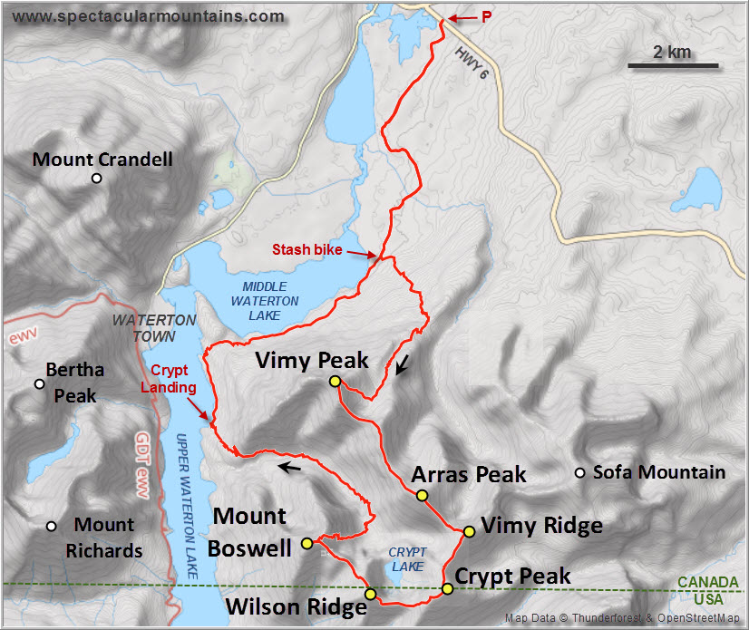
For reasonably fit parties wanting to do Crypt Peak by itself, it should be no problem to take the earliest boat from Waterton to Crypt Landing (8:30 AM), hike up the established trail to the lake, ascend the SE side of the bowl and the north ridge to the summit, and return back to the landing before the last boat back (5:30 PM). The same applies to Mount Boswell of course, as outlined in the excellent More Scrambles book by Andrew Nugara.
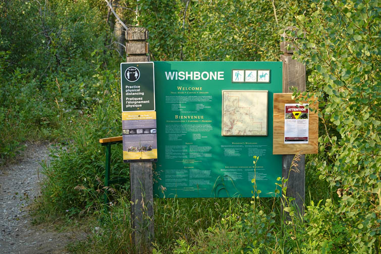
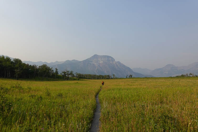
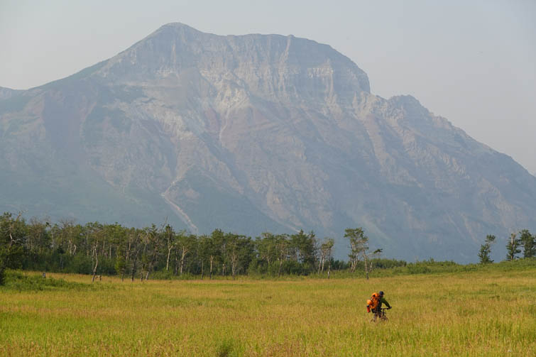
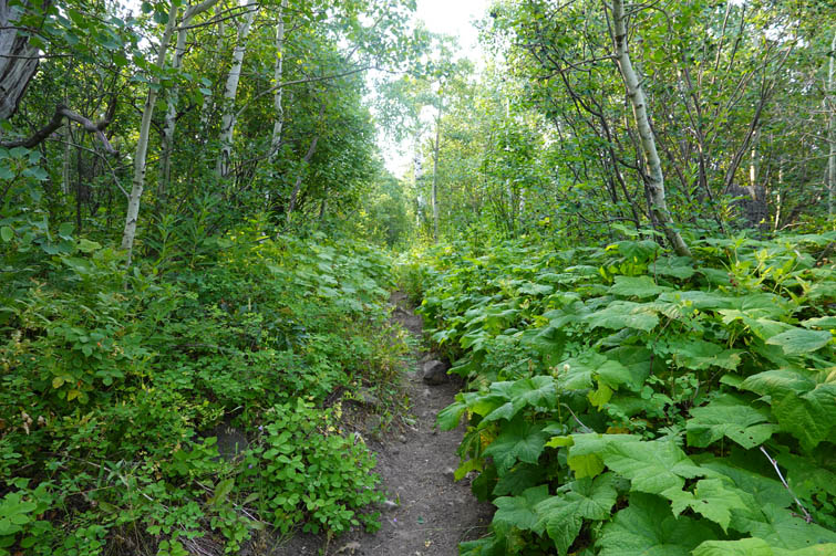
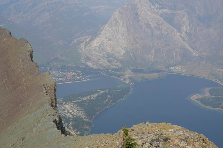
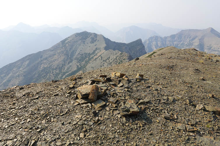
Raff and I decided to forgo the boat ride and approach via the Wishbone Trail from highway 6 (Chief Mountain Highway). We biked the first 7 km to a signed junction where the Vimy Peak trail starts, stashed the bikes in the trees and continued on foot. A few km later the trail splits, the right branch heading up to Vimy Peak and the left going up Vimy Ridge. Raff had done the peak already so he went left while I quickly hiked up to Vimy Peak and then caught up with him along the ridge. The views of Middle and Lower Waterton Lakes from Vimy Peak are absolutely worth the effort of coming up here alone and I can see why this is such a popular outing. Numerous entries in the register booklet and a well-worn trail are evidence of just how many people make the trek up this scenic viewpoint.
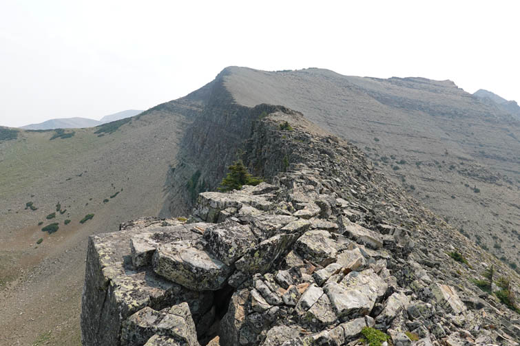
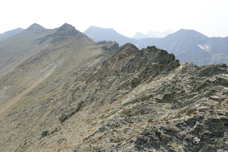
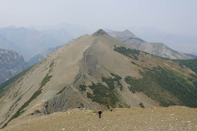
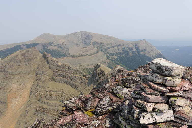
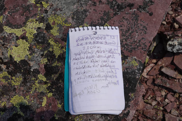
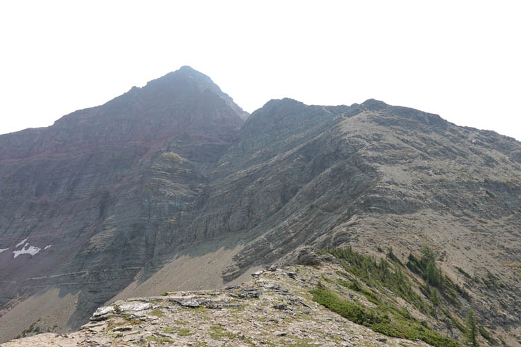
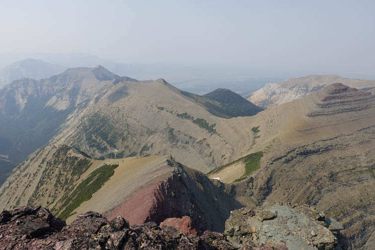
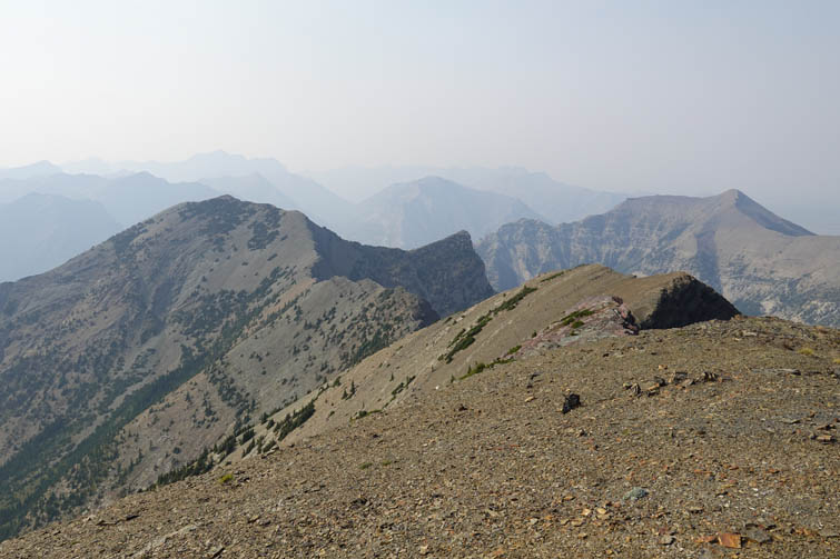
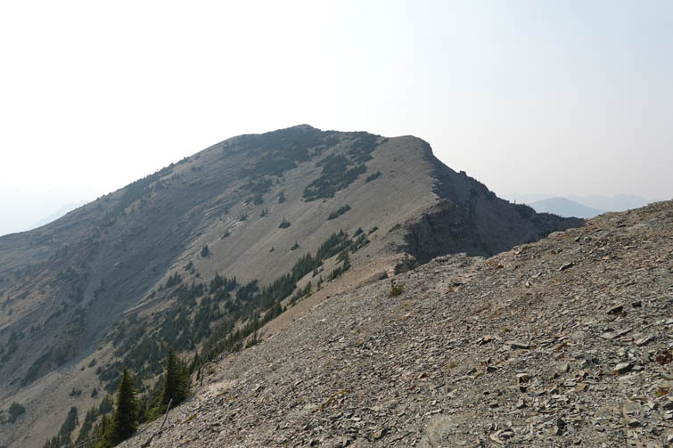
The walk along the long ridge extending SE from Vimy Peak was thoroughly enjoyable. Only one section surprised me a little: there is a stretch of intensely folded rock, an anticline as can be seen from afar, that required slow and careful scrambling either right on the jagged ridge crest or just below it on the left (east) side. Everything else was easy hiking to both the first and the second highpoint. The first peak is called “Arras Peak” in the big yellow register stashed away in the summit cairn, while the second and higher summit is labelled “Vimy Ridge” in the register we found up there. I think Arras is just an unofficial name that was coined by someone who came up here, and a very fitting one of course since Arras is a town in France that saw several battles nearby during the First World War. The Canadian National Vimy Memorial was built near Arras in 1936. “Vimy Ridge” on the other hand is an official name found on Canadian government maps, so it makes sense to have a register with that name on the highest point.
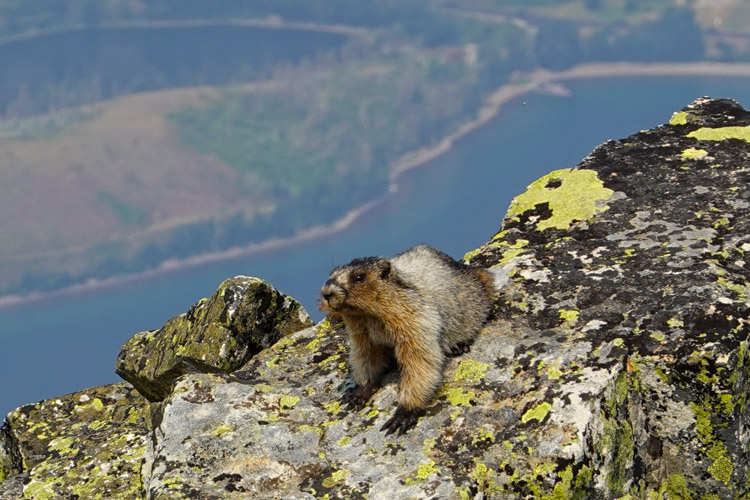
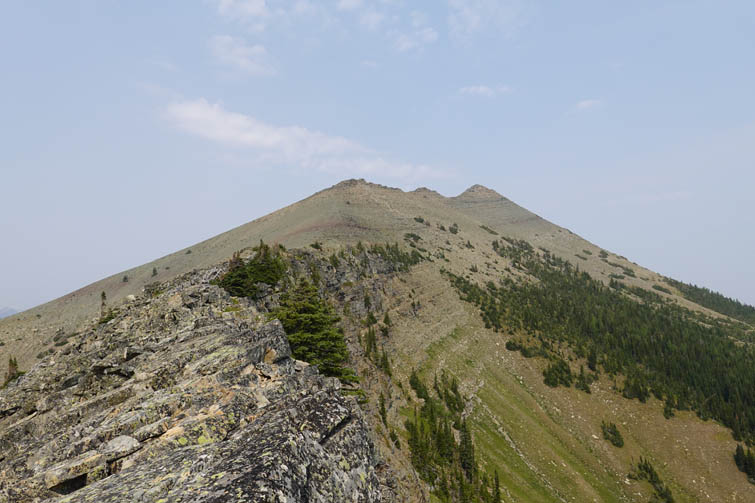
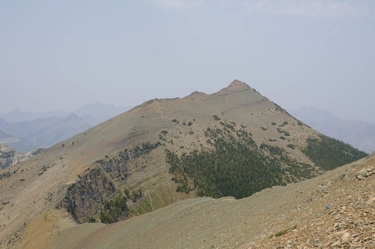
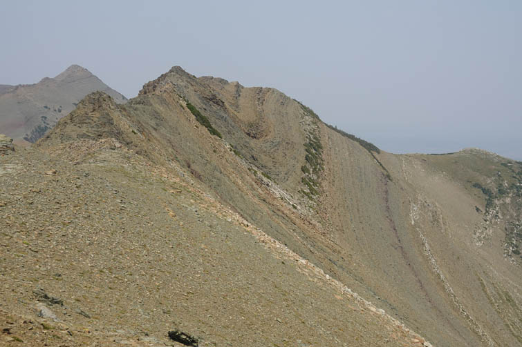
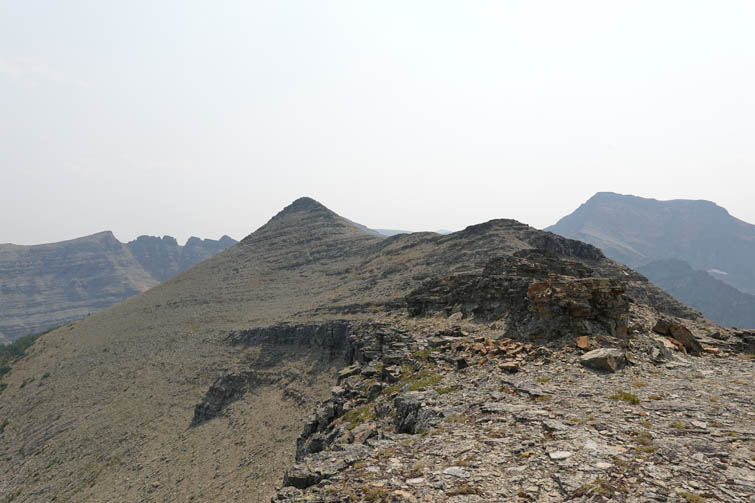
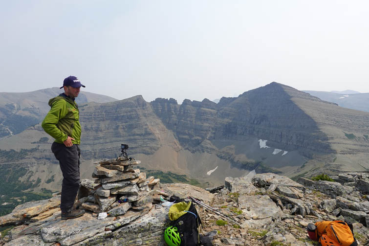
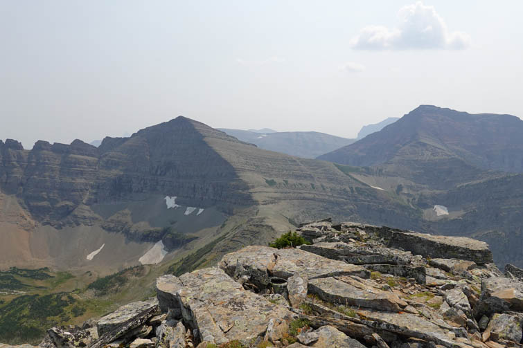
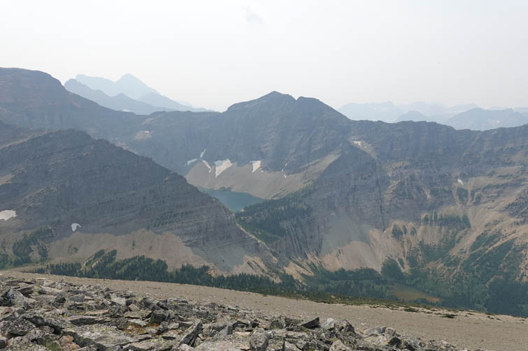
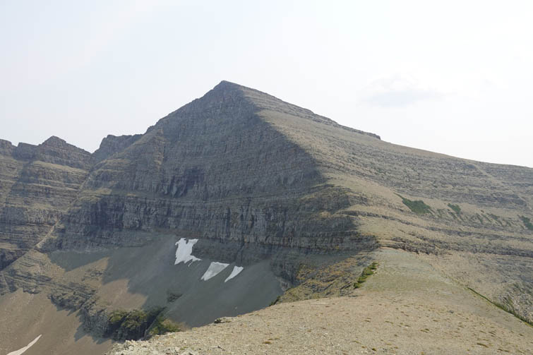
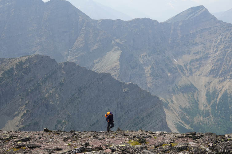
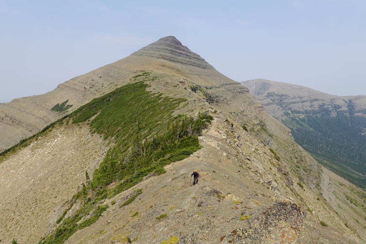
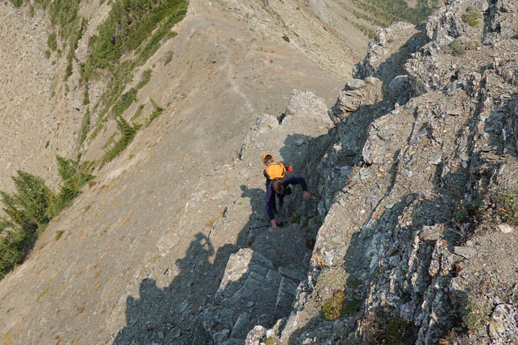
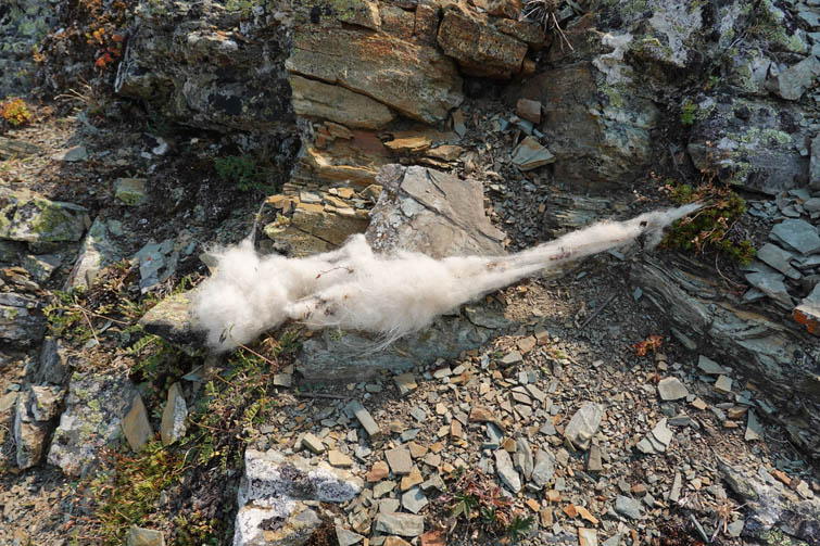
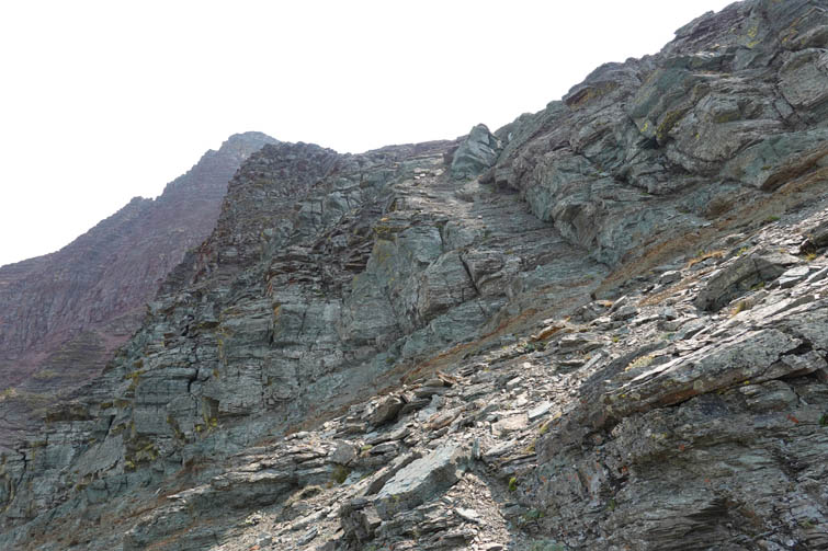
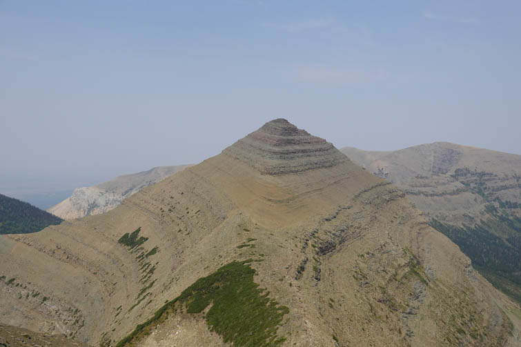
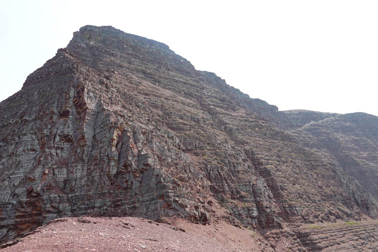
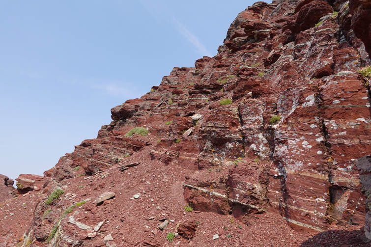
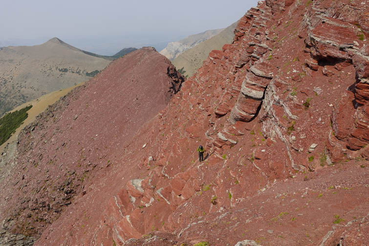
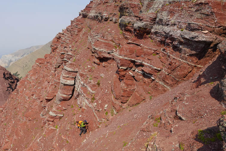
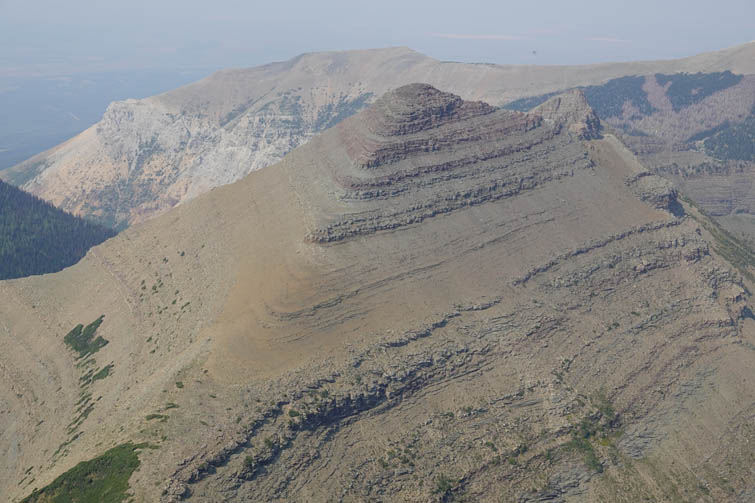
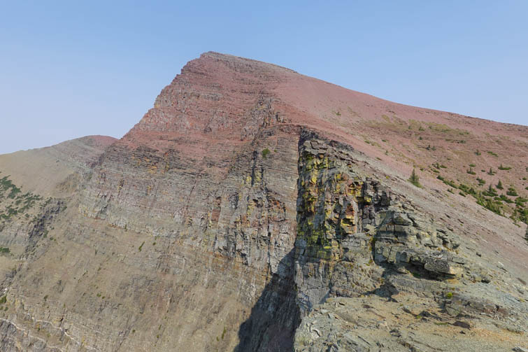
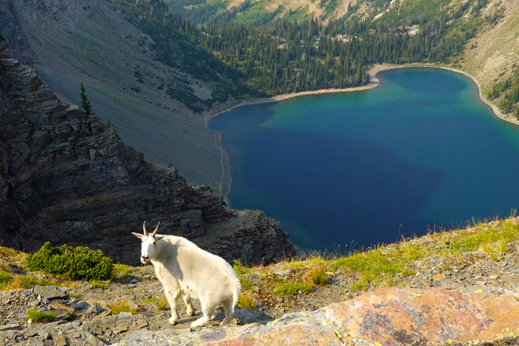
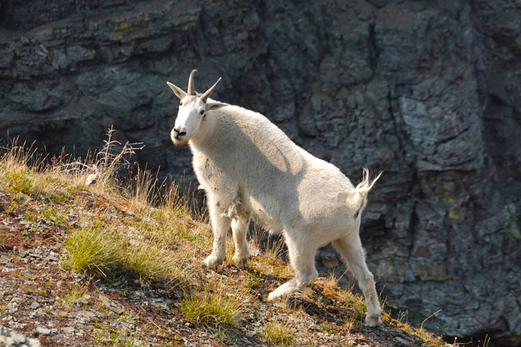
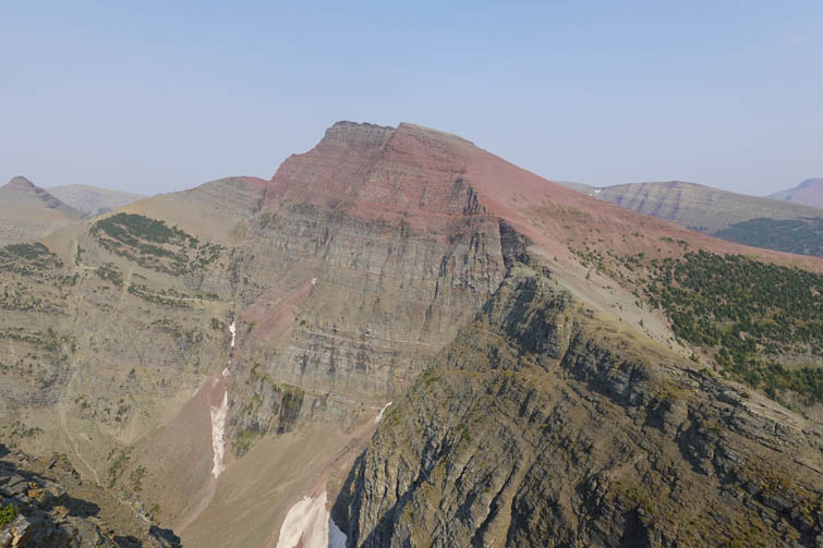
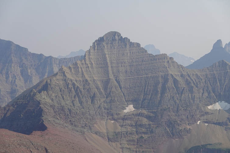
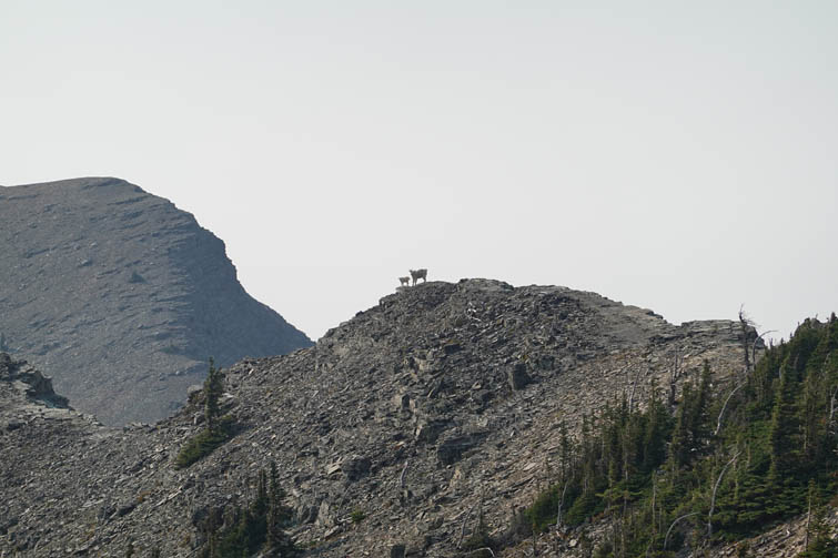
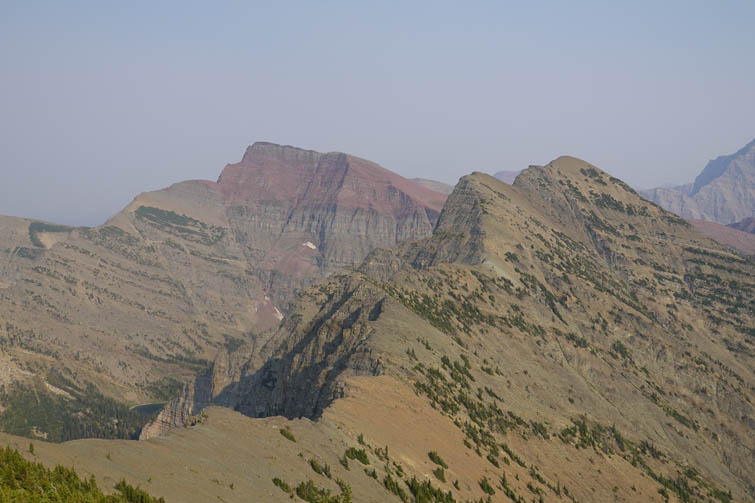
Vimy Ridge highpoint is unique in that it looks a bit like an Egyptian step pyramid, especially when viewed from the south. There is definitely something elegantly beautiful about this little peak. After dropping down to a saddle south of Vimy Ridge we proceeded to tackle what we expected to be the trickiest part of the day – the north ridge of Crypt Peak. It turned out to be a pleasant surprise, a super enjoyable scramble on a moderately steep succession of ledges and minor cliffs composed of beautiful bright red argillite. It’s on the moderate to difficult scrambling scale on the far left (east) side, while it gets progressively easier the further right you go. Goats frequent these slopes a lot and all one has to do is follow animal tracks to find the easiest way around obstacles.
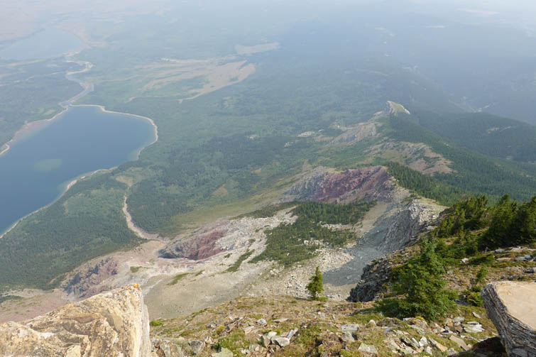
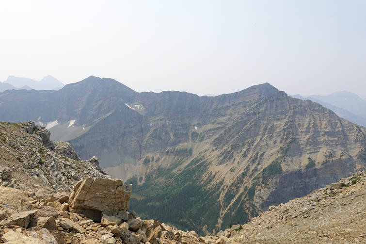
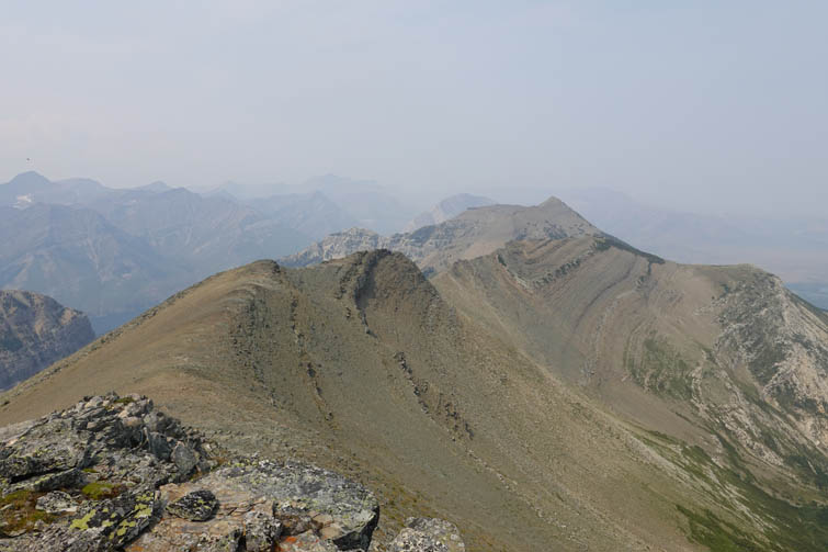
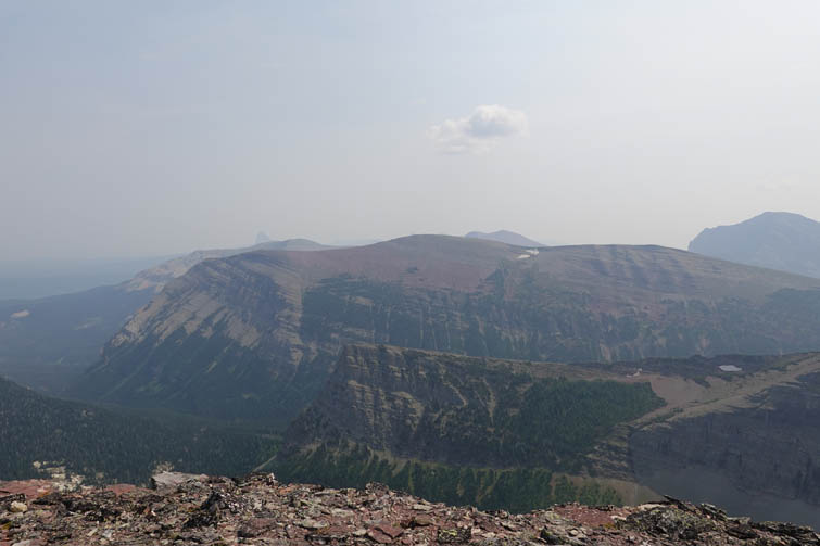
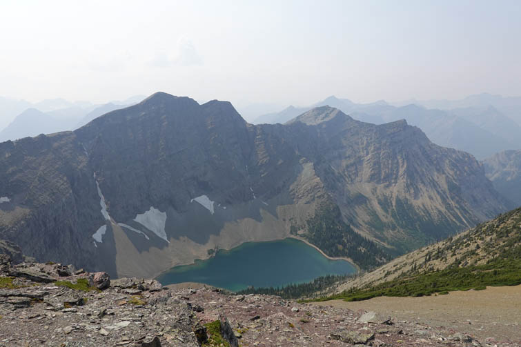
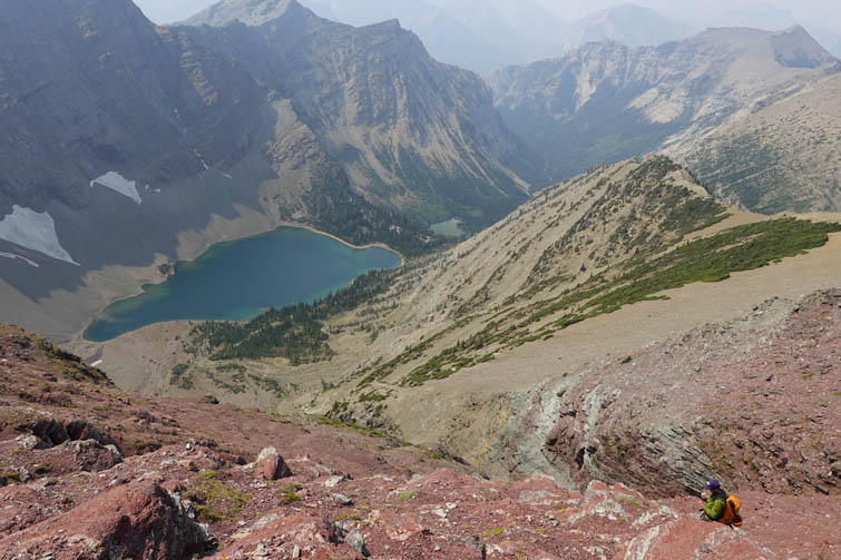
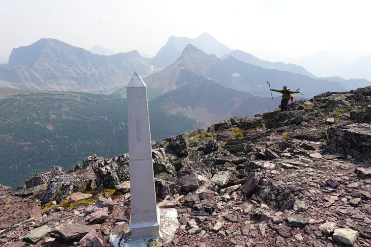
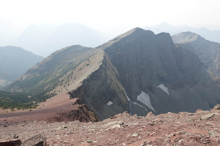
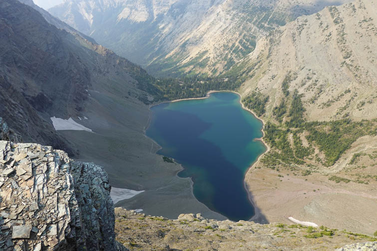
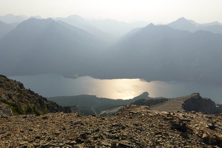
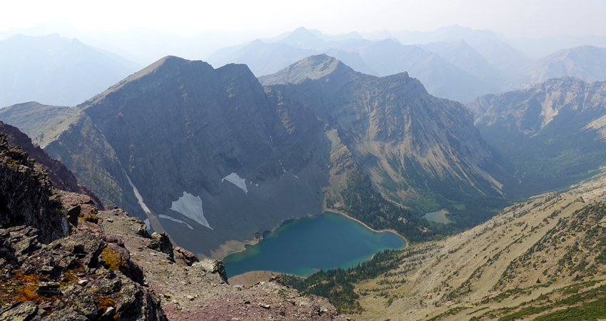
There is a metal pylon marker right next to the summit of Crypt Peak, which Raff and I concurred belongs to Canada, not the US, but only by a mere metre or so! While Raff was enjoying an extended afternoon break, I continued on along the ridge to the next highpoint, which appears to be called Wilson Ridge (as per peakery.com – not the most reliable source but there’s no other information on this peak I could find). The descent off the west side of Crypt was a delightful plunge on soft red scree, followed by an easy trudge up to Wilson Ridge summit where I found a diminutive cairn.
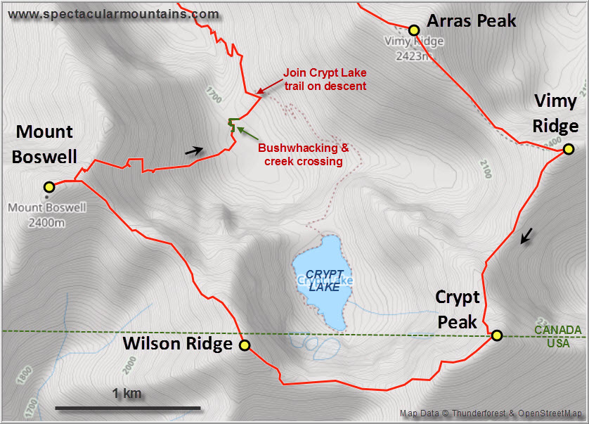
My main concern about continuing along this ridge was the section between Wilson Ridge and Mount Boswell. From across the valley it looked like there was a prominent v-shaped notch that might pose a problem. Thankfully, it was easily bypassed by dropping down a few metres with only moderate scrambling required. The remainder of the ridge to Mount Boswell was without issues and I actually really enjoyed this extension of my already very long ridge walk.
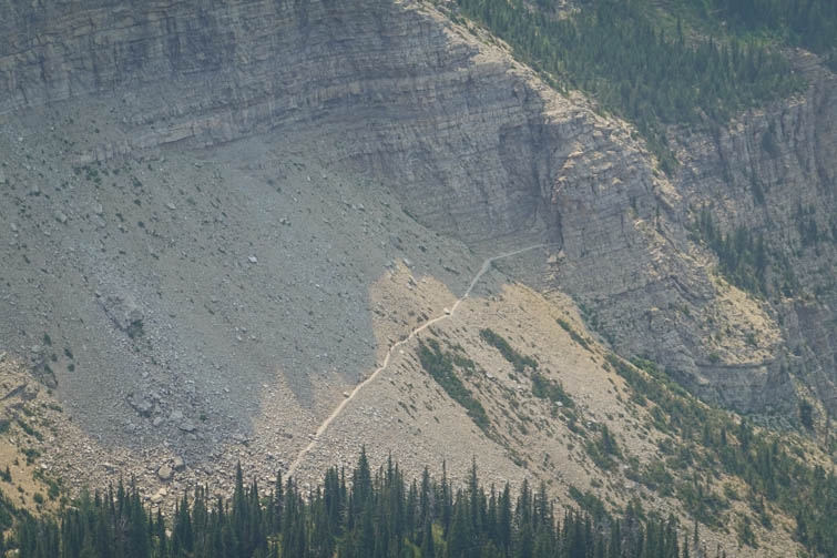
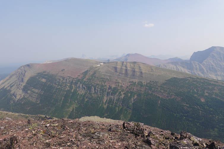
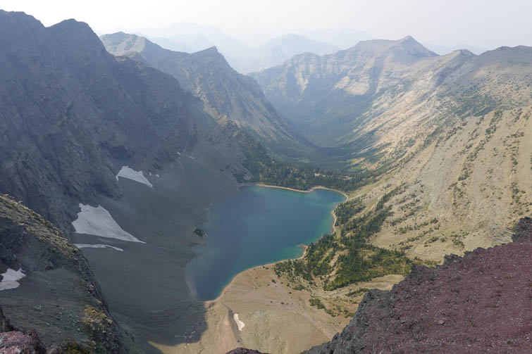
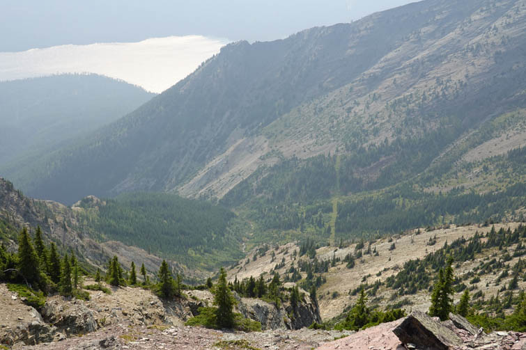
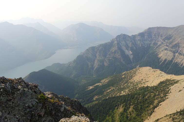
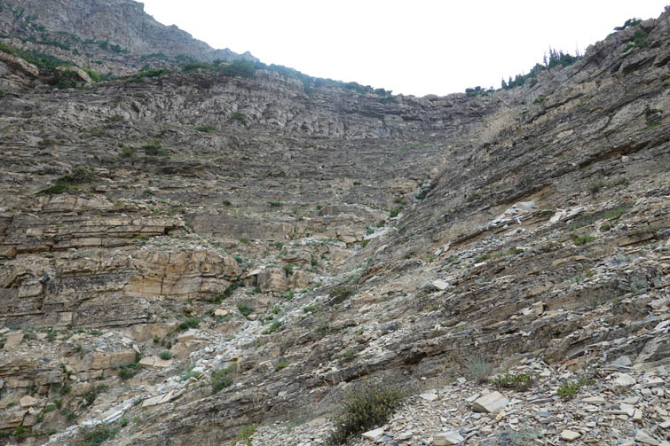
Interestingly, the summit of Mount Boswell is lower in elevation than Wilson Ridge and I’d argue that the views are actually better from Wilson, which overlooks Crypt Lake while you can’t see the lake from Mount Boswell. The descent off Boswell took me much longer than expected. The descent route described by Nugara goes down a prominent drainage that comes off the east side of the mountain. There are lots of tedious rubble-strewn downsloping slabs here that required my full concentration and needless to say I was getting a bit tired by now after more than 10 hours on the go. It was also not easy to find the optimal route down when you haven’t come up these slopes, so at times I had to backtrack a little to either go left or right of the central gully, which isn’t the best place to descend being filled with tons of unstable large boulders.
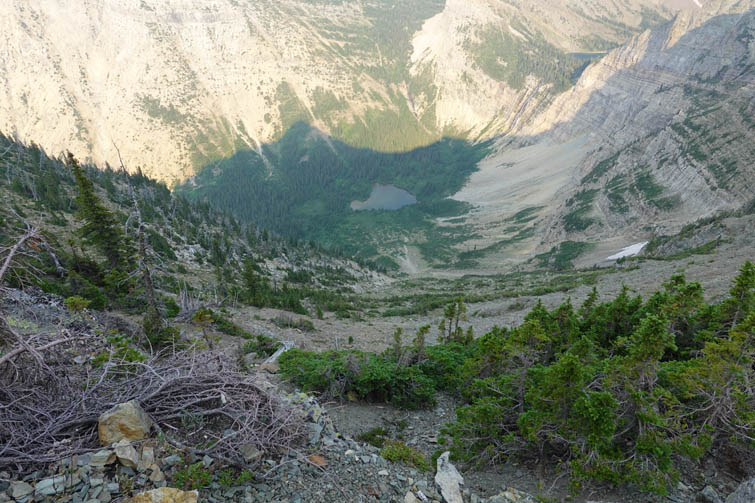
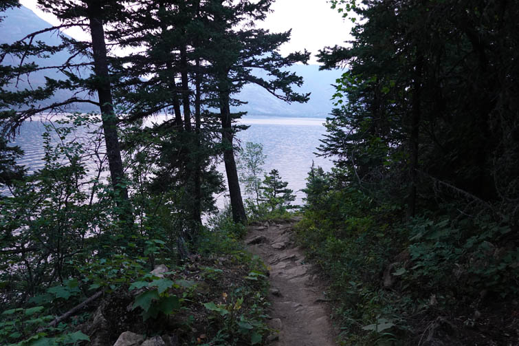
Once down the drainage I reached the small lake in the valley plus some nasty alders to bushwhack through. I muddled my way along the side of the creek that drains the lake to try to find a crossing, but eventually gave up, took off my boots and forded it. On the other side a short hike through the forest eventually landed me on the Crypt Lake Trail – what a relief to be back on a beaten path!
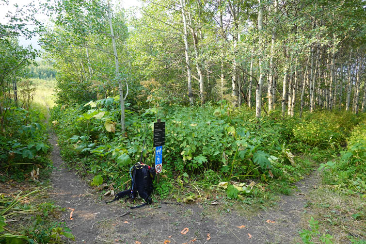
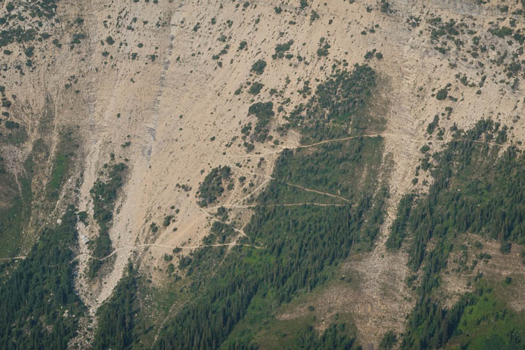
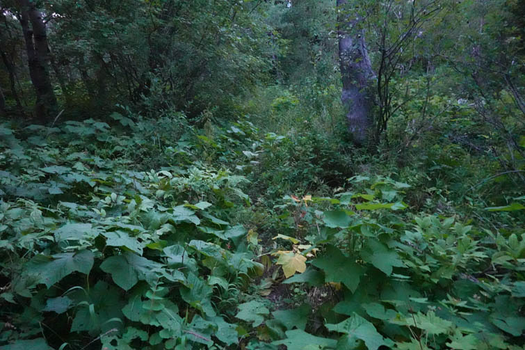
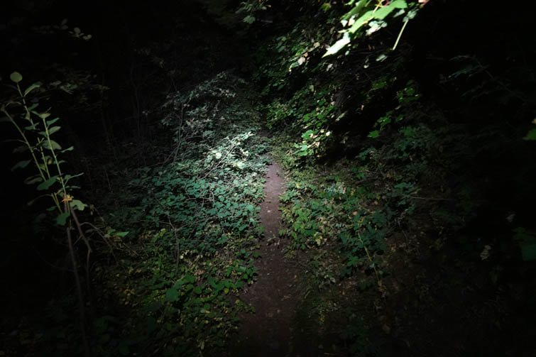
After cruising down the trail to Crypt Landing (it was now about 9 PM and the last boat had long left), the next couple of hours were pretty miserable again. The “trail” that connects Crypt Landing with the Vimy Peak Trail is completely overgrown in places and appears rarely used. The vegetation was so thick in some parts that I had trouble finding the trail, and now that it was getting dark it was even more difficult. But I had no choice – Raff was somewhere ahead of me and had the same troubles to contend with, so I switched on my headlamp, put my head down and just tramped on. I eventually caught up with him at the bikes and we rode back the last 7 km together to arrive at the parking lot at midnight. What a day!
This is an absolutely amazing circuit that I would highly recommend to anyone with plenty of energy and in the right conditions. Good route-finding skills are needed on Crypt Peak’s north ridge, but other than that it’s mostly hiking with some moderate scrambling on Wilson and Boswell. We did this as a clockwise loop, but a counter-clockwise direction might be a better idea: that way you’d get the overgrown trail to Crypt Landing out of the way first, and ascending Boswell’s east face is far superior to descending it. Then all that awaits is a beautiful ridge walk and descent on the excellent Vimy Peak Trail back to the bikes. Moreover, there is the option of bailing to the Crypt Lake Trail from the saddle between Crypt Peak and Vimy Ridge highpoint. Another important pointer is that there is no water source once you’re up on the ridge, so bring plenty of liquids (we had 5 litres each and refilled on the way down). Last but not least note that the section from Crypt Peak to Wilson Ridge is actually in the United States so technically you’re making an international border crossing into a different country here, albeit only for about an hour and a half and over a distance of some 2 km. In practical terms I don’t think this is a problem if you’re not leaving the ridge and just “hiking through” (similar to the descent off the south side of Mount Richards), but I haven’t verified this with the authorities so if you want to be on the safe side please check with U.S. Customs and Border Protection before following my route.
|
Elevation: |
Vimy Peak: 2368 m |
|
|
Arras Peak: 2408 m |
|
|
Vimy Ridge: 2491 m |
|
|
Crypt Peak: 2610 m |
|
|
Wilson Ridge: 2505 m |
|
|
Mount Boswell: 2439 m |
|
Elevation gain: |
2650 m |
|
Time: |
15.5 h |
|
Distance: |
43.8 km (of which 14 km by bike) |
|
Difficulty level: |
Easy to moderate (Kane), T4 (SAC) |
|
Comments: |
Crosses briefly into US. |
|
Reference: |
Nugara for Vimy Peak/Ridge and Mount Boswell. Own route-finding for remainder of route. |
|
Personal rating: |
5 (out of 5) |
NOTE: This GPX track is for personal use only. Commercial use/re-use or publication of this track on printed or digital media including but not limited to platforms, apps and websites such as AllTrails, Gaia, and OSM, requires written permission.
DISCLAIMER: Use at your own risk for general guidance only! Do not follow this GPX track blindly but use your own judgement in assessing terrain and choosing the safest route. Please read the full disclaimer here.