Kananaskis South, AB, Canada
15 November 2019
With Kevin
Unusual Rockies landscape on an extremely windy day
Another great trip with Kevin. Thankfully, this one turned out to be a little shorter than our 11.5 h outing to Sheep Meadow Mountain a few weeks ago – just over 4.5 h this time.
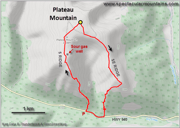
Kevin is used to doing lots of serious rock climbing and mountaineering trips (see his Opal 35 project and other trips on his blog), but today was completely different. Shoulder season is simply not a good time to venture into the more difficult stuff so you just have to content yourself with safer and tamer objectives. We didn’t really know what ridge to hike when we drove south along highway 940, but when we saw Plateau Mountain’s wind-swept southern flanks it was an easy decision. Note that there are lots of logging trucks on this road requiring extreme caution when driving here in the winter.
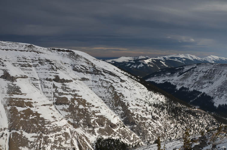
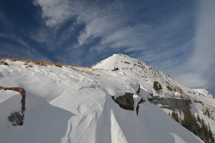
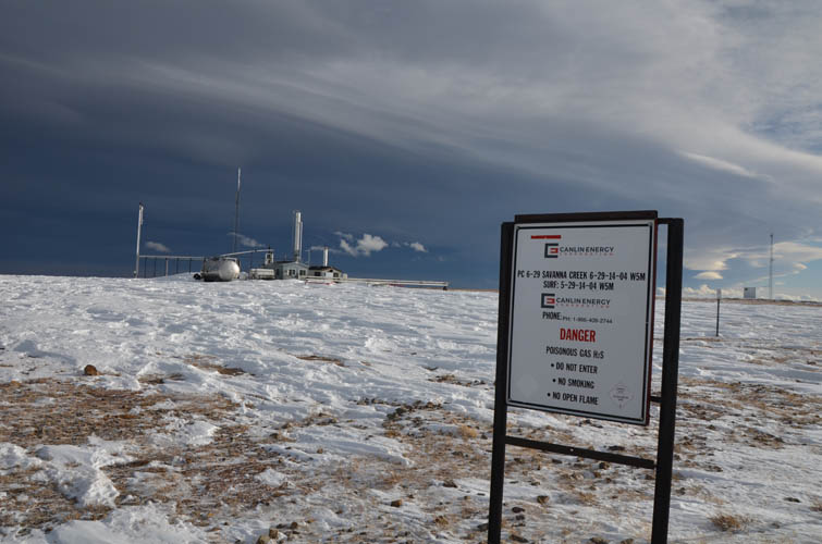
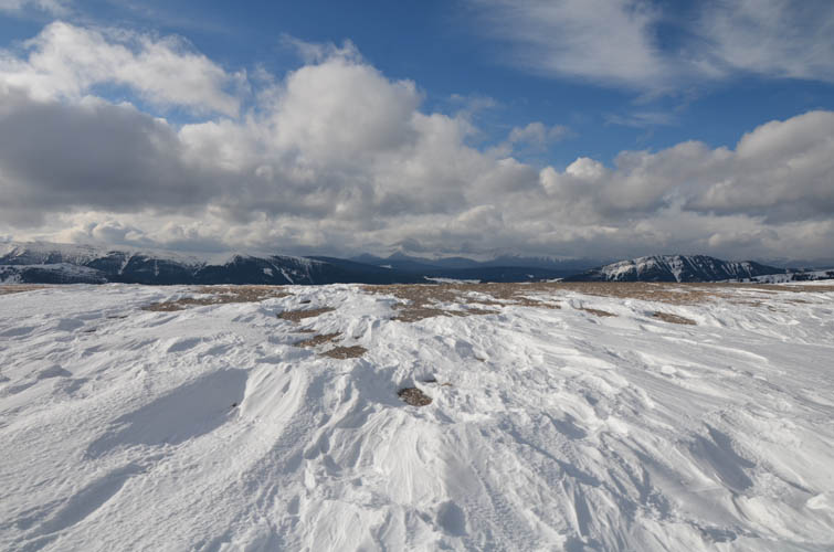
As the name implies, Plateau Mountain is one big flat plateau with fairly gentle slopes around it and several elongated ribs stretching out. A maintenance road goes up the west side to several active well sites located right at the top. These are sour gas wells (H2S) and unauthorized access is prohibited to the sites. However, there are no fences around them so it’s hard to know where you can and cannot walk especially when you don’t come up from the road. Because of the relatively easy terrain, the mountain can be approached from pretty much any side.
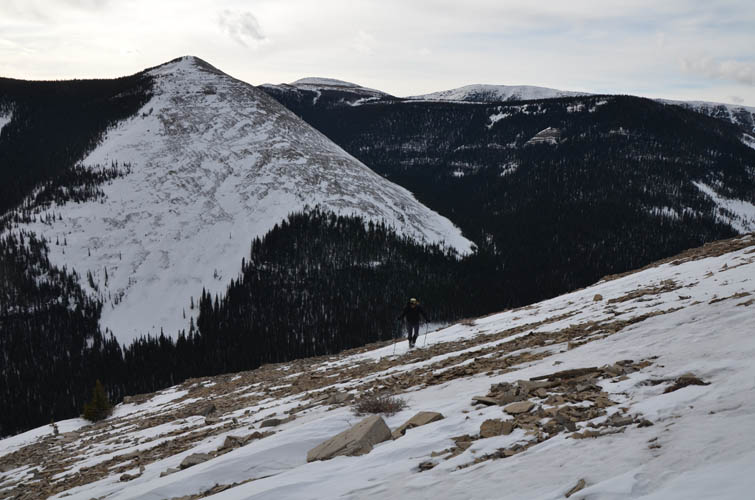
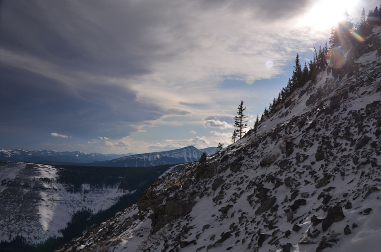
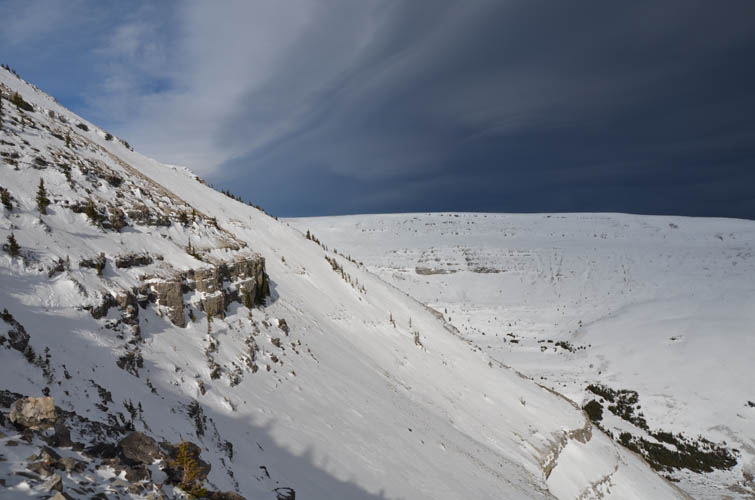
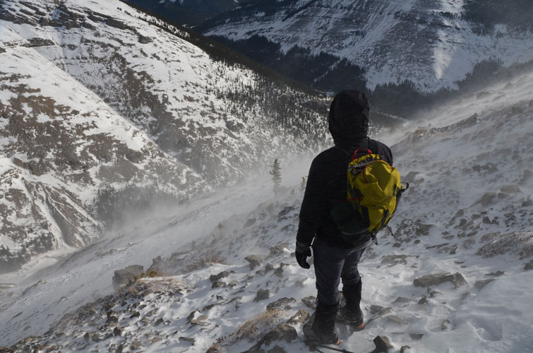
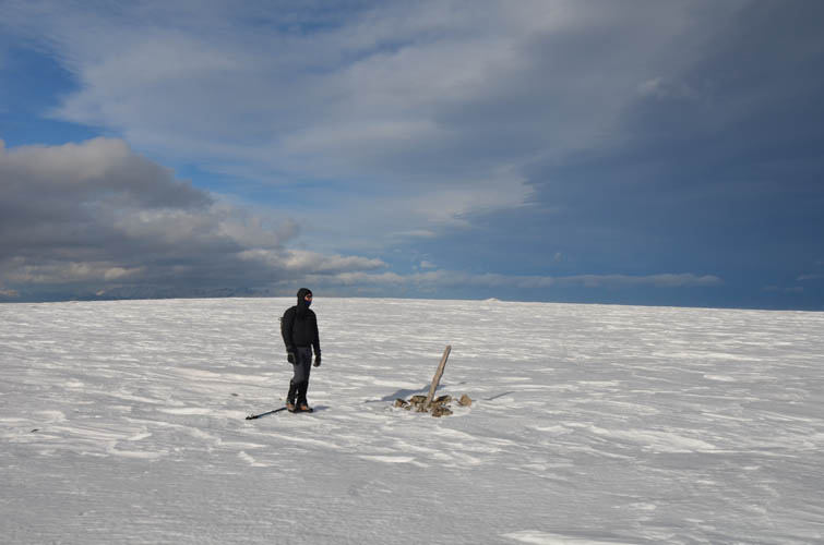
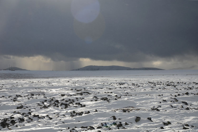
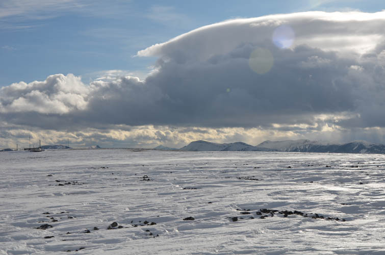
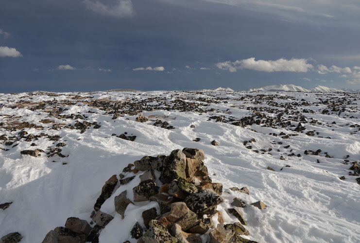
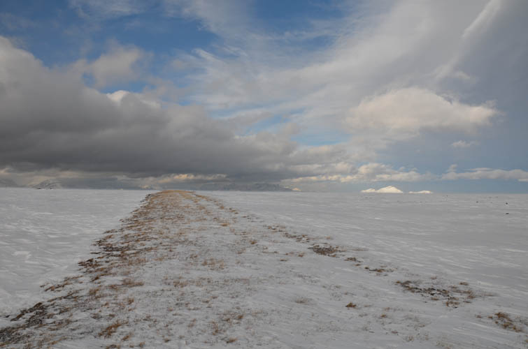
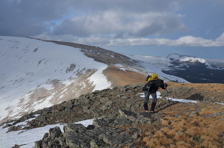
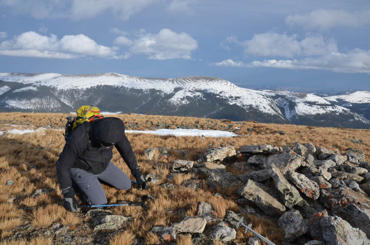
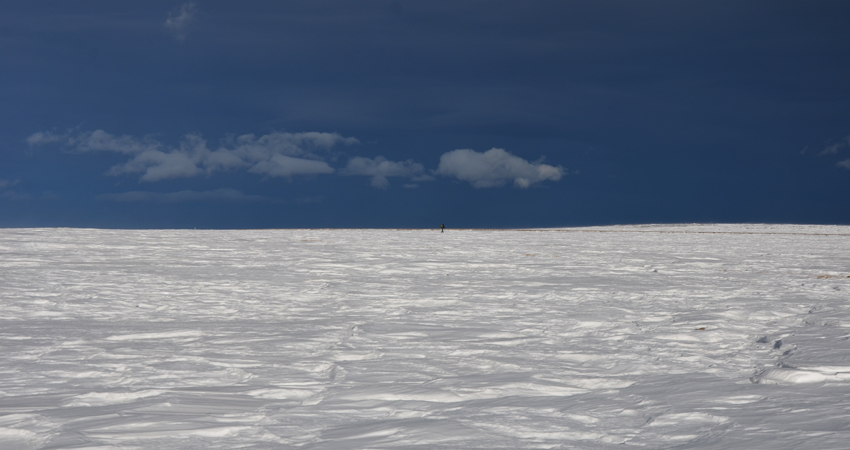
Our loop took us from highway 940 up the south ridge, the first half through light forest and then along the open ridge top where the wind really picked up. We avoided one minor cliff band half-way up on climber’s right. Up on the plateau the landscape was unlike any I’ve seen in the Rockies. Wind-sculpted snow ruffles covered the entire expanse and formed a wonderful contrast to a dark curtain of blue-grey clouds to the west. Gusts of Chinook winds pushed the clouds towards the sun, resulting in a beautiful display of light and shadows in the sky.
The area up here is so flat, it’s really hard to say where the true summit is. We found at least three potential summit cairns, the northernmost one being the highest at 2502 m according to my GPS. It reminded me a bit of the Tablelands in Newfoundland where the terrain is equally flat, though dotted with puddles and marshland. One major difference is that lots of people have been up Plateau of course, while nobody seems to seek out the true summit of the Tablelands.
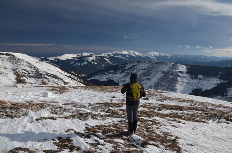
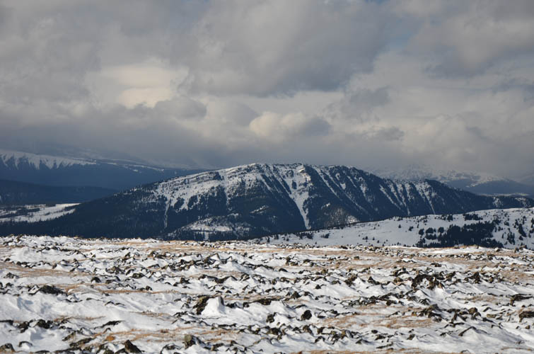
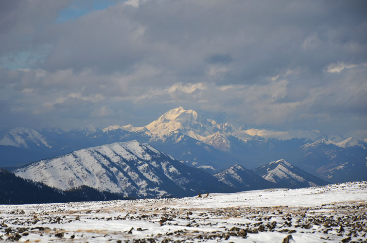
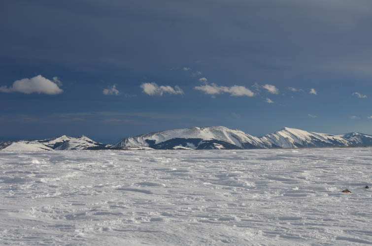
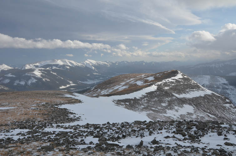
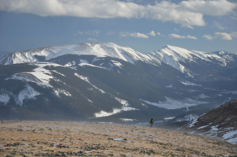
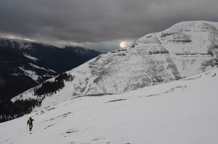
After tagging our assumed high point, we curved back around to the SE ridge, enjoying nice views of Hailstone Butte, Windy Peak, Mount Livingstone and Coffin Mountain to the west and southwest. The wind really picked up here and got so strong at times we couldn’t move anymore; it even lifted my poles off the ground. I don’t think I’ve ever experienced winds as crazy as this!
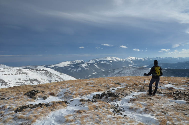
The descent down the SE ridge back to the highway was quick and pleasant, the snow just hard enough to allow for easy plunge-stepping. A few minor rock bands had to be circumvented near the bottom, then we followed a narrow cutline to the road and walked back to our car. A great little winter trip, no snowshoes needed!
Note: The winter gate at Cataract Creek campground (9 km south of Highwood Junction on highway 940) is closed Dec 1st to Apr 30th.
|
Elevation: |
2502 m (my GPS) |
|
Elevation gain: |
680 m |
|
Time: |
4.5 h |
|
Distance: |
8.2 km |
|
Difficulty level: |
Moderate (Kane), T4 (SAC) in winter conditions, Easy in the summer |
|
Comments: |
Can be extremely windy on top! |
|
Reference: |
Own route finding |
|
Personal rating: |
3 (out of 5) |
NOTE: This GPX track is for personal use only. Commercial use/re-use or publication of this track on printed or digital media including but not limited to platforms, apps and websites such as AllTrails, Gaia, and OSM, requires written permission.
DISCLAIMER: Use at your own risk for general guidance only! Do not follow this GPX track blindly but use your own judgement in assessing terrain and choosing the safest route. Please read the full disclaimer here.