Davos, Switzerland
13 July 2018
Solo
A rarely-visited but decent scramble close to Davos
The unpronouncible Chüpfenflue is an easy to reach peak that is often overlooked in favour of the much more popular Schiahorn next door. While the Schiahorn has a beaten path to the summit, there are only smatterings of a trail to the top of the Chüpfenflue.
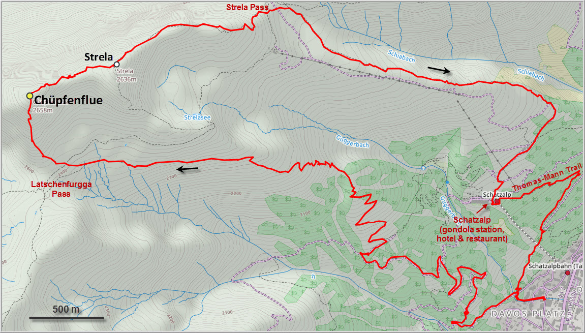
Wen and I started on another beautiful day hike directly from our apartment in Davos. There are lots of different trails one can take to reach the mountain, including the popular Thomas-Mann-Trail via the Schatzalp or the hiking trail via the Latschenfurgga pass, the option we took today. Near the pass Wen decided to take it easy today and go up the Schiahorn instead, while I went on to tackle the Chüpfenflue.
The normal route up is the south ridge, where faint red dots show the best way up, usually just to the left of the ridge crest. There are also some very obvious yellow-red paint markers right on the spine of the ridge, but these demarcate some sort of wildlife boundary as I found out later. The terrain is steepish and features a lot of loose rubble, but following the faint trail isn’t overly difficult.
Before long I stood on the cairned summit complete with register. This is evidently not a well-visited peak, there are perhaps a handful of entries per year on average, which is not much for Switzerland.
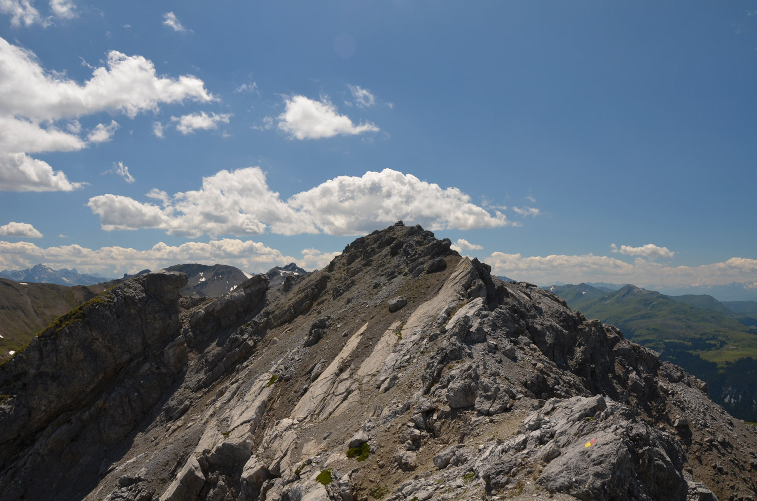
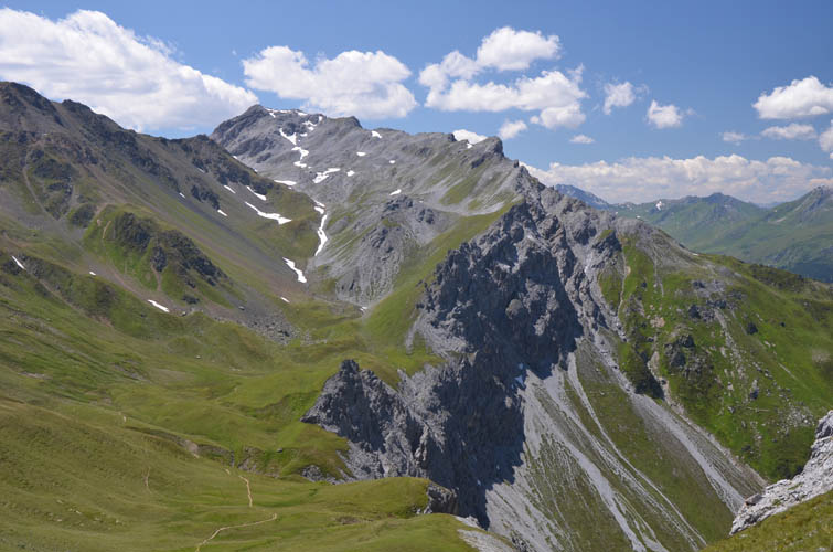
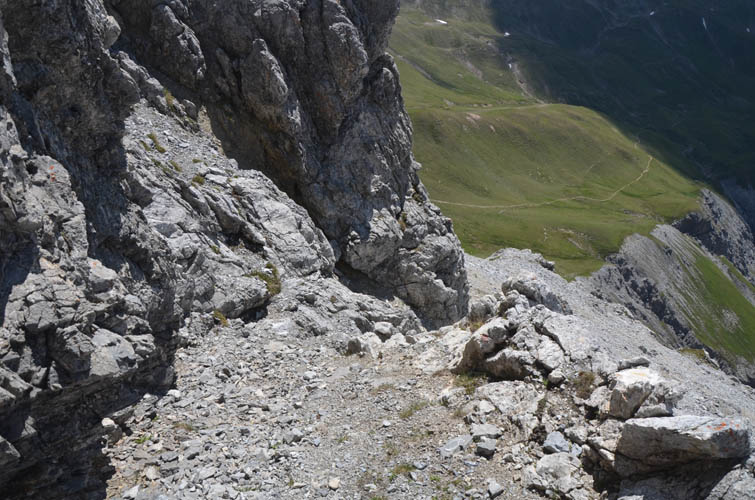
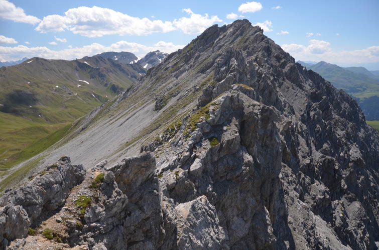
Glancing over to the east, things looked a lot more daunting: a craggy ridge with a vertical drop-off on the north and steeply dipping slabs on the south. This ridge that connects the Chüpfenflue summit with a neighboring high point called “Strela” indeed turned out to be a lot more challenging. There were no red dots to guide me and no trail. The best line was basically directly on the jagged, exposed ridge crest, with frequent bypasses to the south wherever there was a big overhang or gendarme standing in the way. In places these bypasses involved very unpleasant sidesloping on steep, rubbly slabs that are pretty nasty to downclimb. Traversing the ridge in the opposite direction would’ve been a much, much better idea!
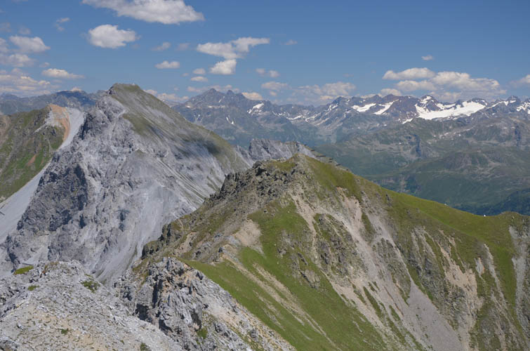
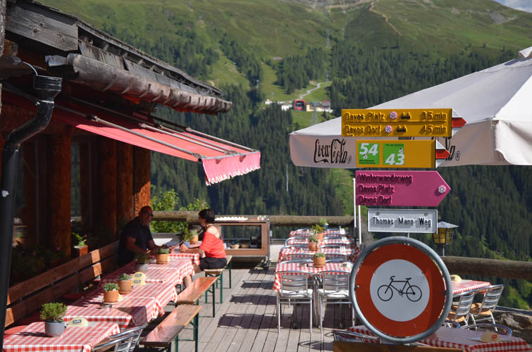
Half-way between the two summits, faint goat tracks make it a bit easier and once on top of Strela, it’s an easy hike down to the Strela Pass on a fair trail again. Many people seem to come up from the pass to enjoy some better views. There is a restaurant with an awesome patio overlooking the Davos Valley at the pass, a popular stop for hikers and mountain bikers in the area.
From the pass I took the direct route back down to Davos via the Schatzalp. Overall this ridge walk was a good challenge, but the loose rock and rubbly slabs made it difficult to enjoy at times. Definitely bring a helmet and either go up and down the south ridge, or for a full ridge traverse go from east to west instead of what I did.
| Elevation: | 2658 m (official), 2651 m (my GPS) |
| Elevation gain: | 1160 m |
| Time: | 8.0 h |
| Distance: | 14.1 km |
| Difficulty level: | Ascent route: Moderate (Kane), T3/T4 (SAC) |
| Ridge traverse: Difficult (Kane), T5 (SAC) | |
| Reference: | Local maps |
| Personal rating: | 3 (out of 5) |
DISCLAIMER: Use at your own risk for general guidance only! Do not follow this GPX track blindly but use your own judgement in assessing terrain and choosing the safest route.
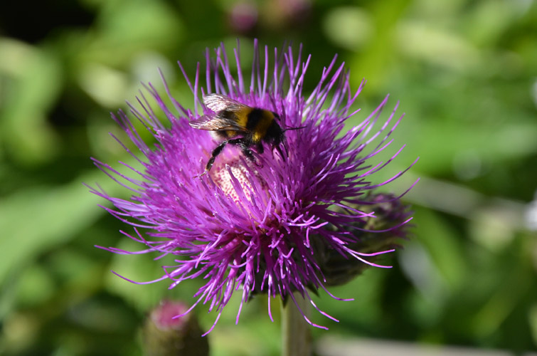
We passed by these beautiful flowers on the way out of Davos town.
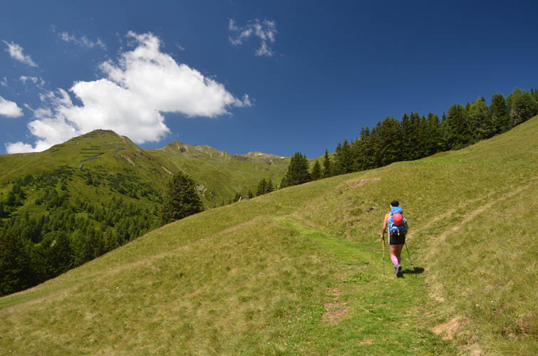
A perfect summer day!
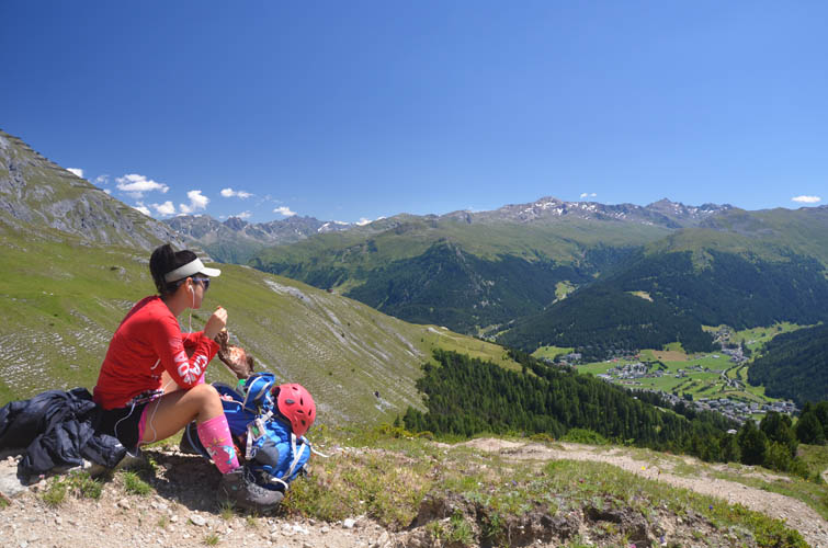
Great views all around on the way up make us stop frequently to soak in the landscape.
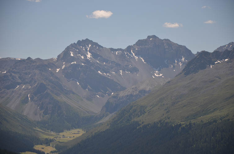
At the end of the Sertig Valley to the south, these two craggy peaks stand out: Plattenflue (L) and Hoch Ducan (R).
View of the Chüpfenflue from the south.

The start of the south ridge. The red-yellow marker denotes a wildlife boundary, not a route or trail as I mistakenly assumed at first.
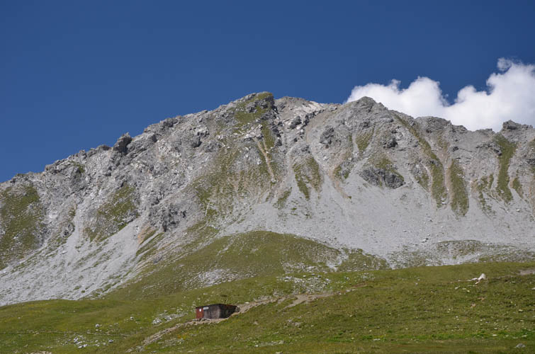
Over to the southwest lies the Mederger Flue (2706 m), which looks like an interesting objective.
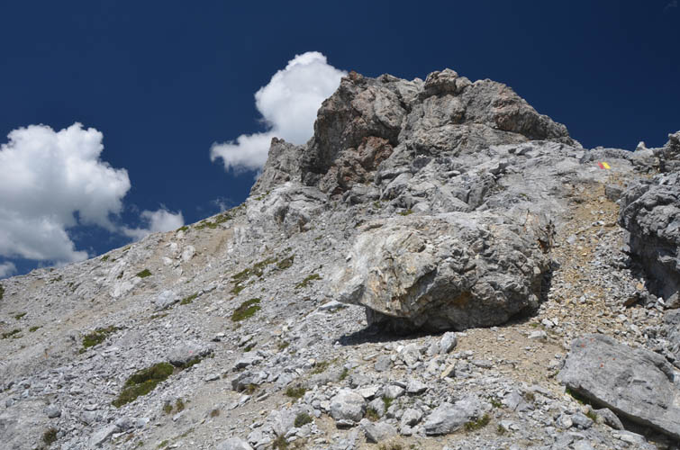
Easy to moderate scrambling up the south ridge of the Chüpfenflue.
Lots of loose rubble here!

The slopes on the west side are steep and fairly exposed.
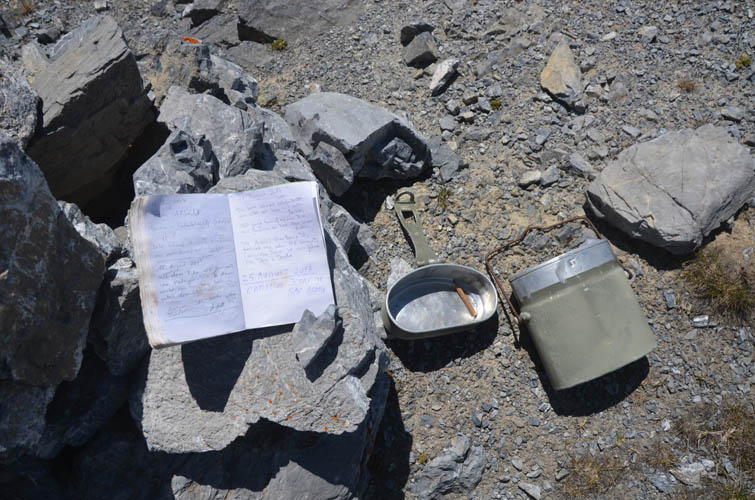
The Chüpfenflue summit register is kept in an old army bottle holder.
Views from the summit: looking east towards Strela (centre) and Schiahorn (left).
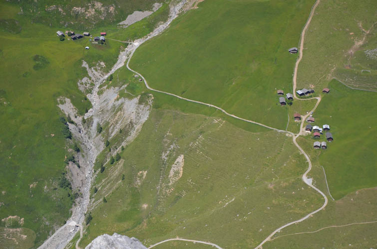
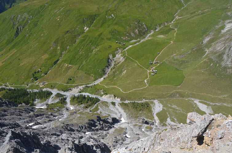
Tiny clusters of farmer’s houses and barns in the valley below on the north side.
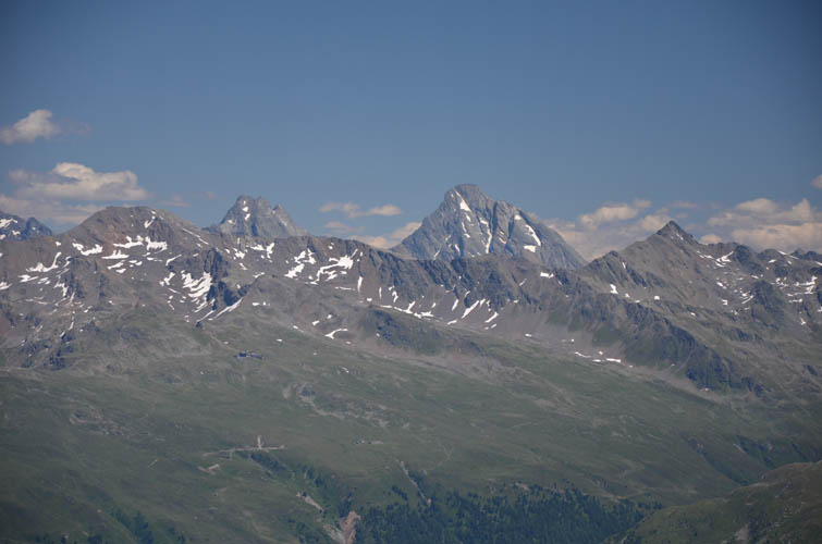
The biggest mountain on the eastern horizon is Piz Linard (3410 m). Pischahorn (L) and Isentällispitz (R) can be seen on the ridge in the foreground.
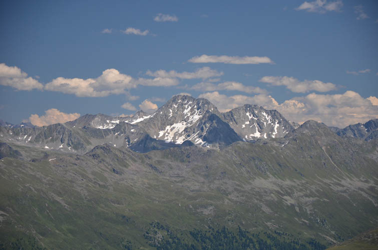
The Flüela Wisshorn, one of my favourite scrambles in the area.
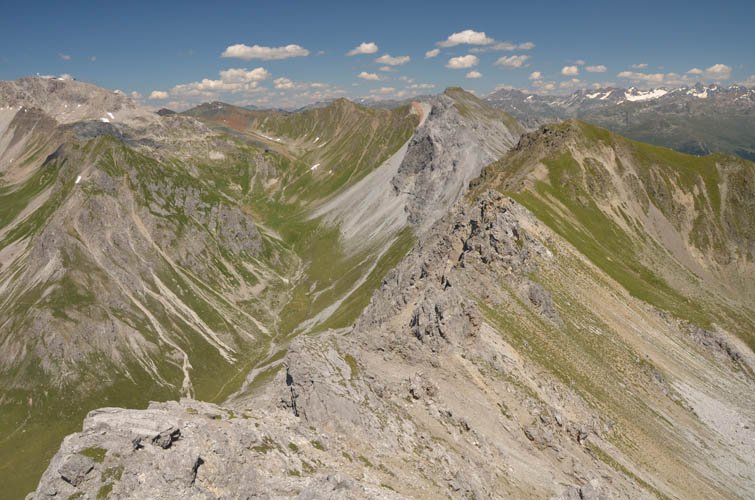
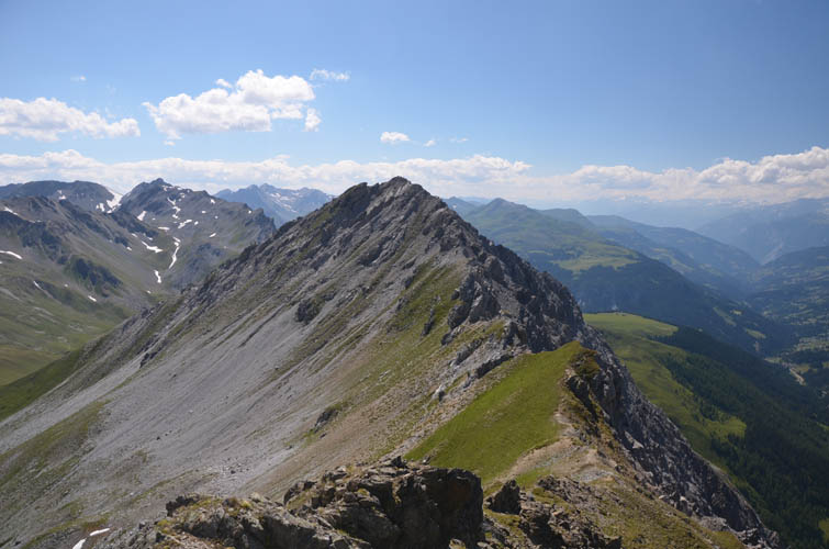
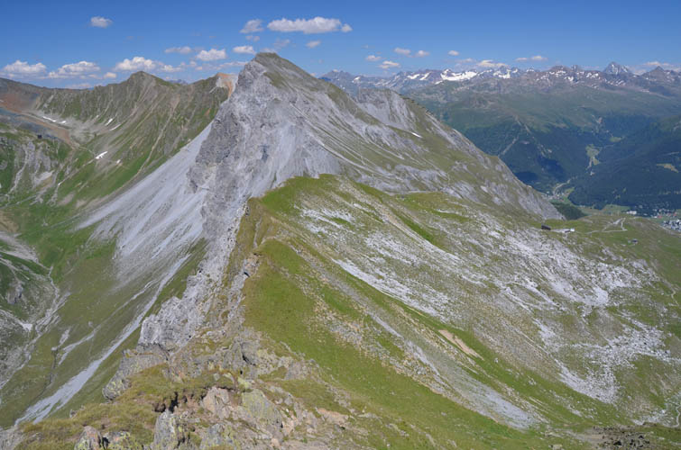
From the summit, I continue along the east ridge towards the next high point called “Strela”.
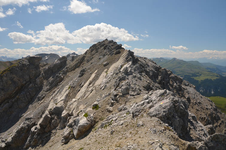
Looking back at the summit: steep, slabby terrain with plenty of loose rock.
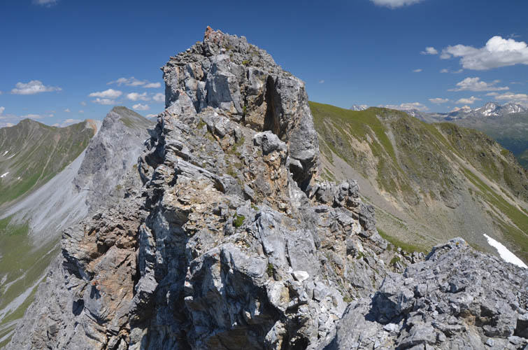
The ridge crest presents many exposed crags and gendarmes that are best avoided on the south side.
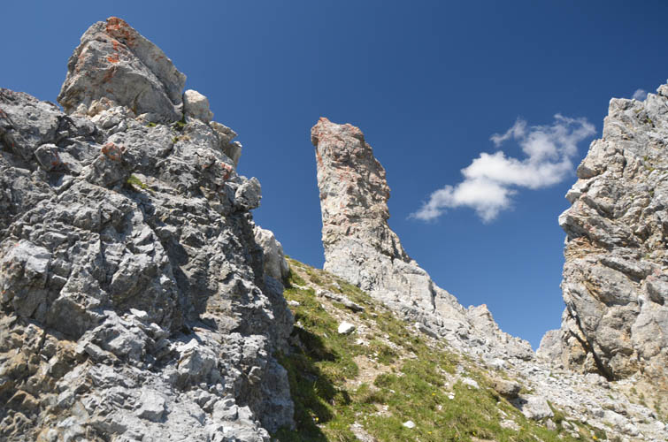
Some neat rock fingers along the ridge.
The dip of the strata is about 40-45 degrees south, which can make for uncomfortable sidesloping when loose pebbles are involved.
Another look back along the ridge. The south side (right) is a sheer drop for hundreds of metres.
600 m straight down!
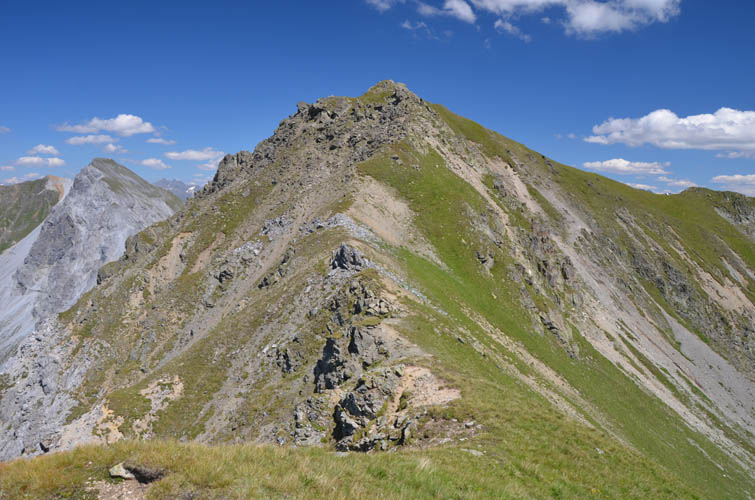
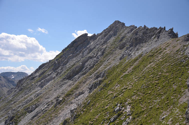
The last bit is an easy hike up to Strela.
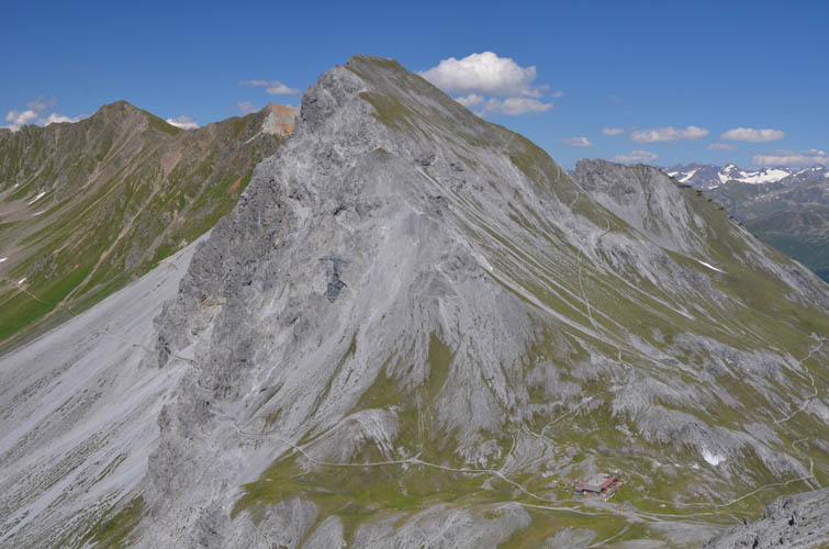
Looking back at the Chüpfenflue from Strela.
Ahead to the east is the Schiahorn, a popular day hike.
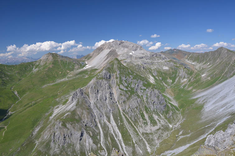
Further to the north lies the Weissfluh, where a gondola carries tourists right to the top.
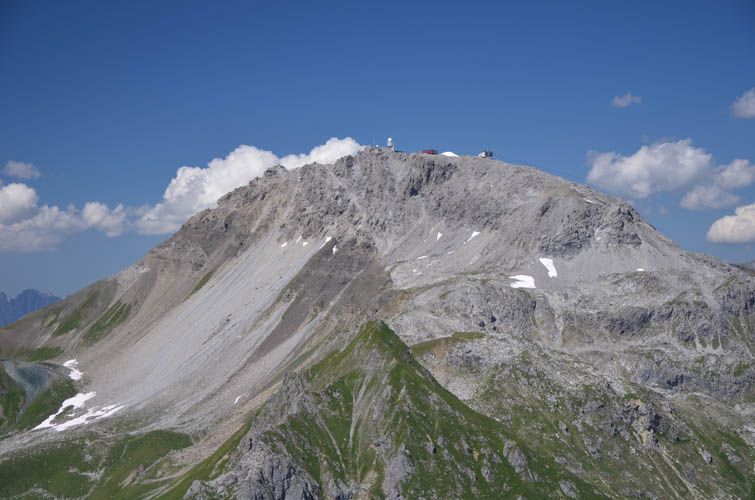
Close-up of the Weissfluh summit complete with gondola station and restaurant.
Another look at the Schiahorn: it’s an easy hike with a good trail all the way to the top.
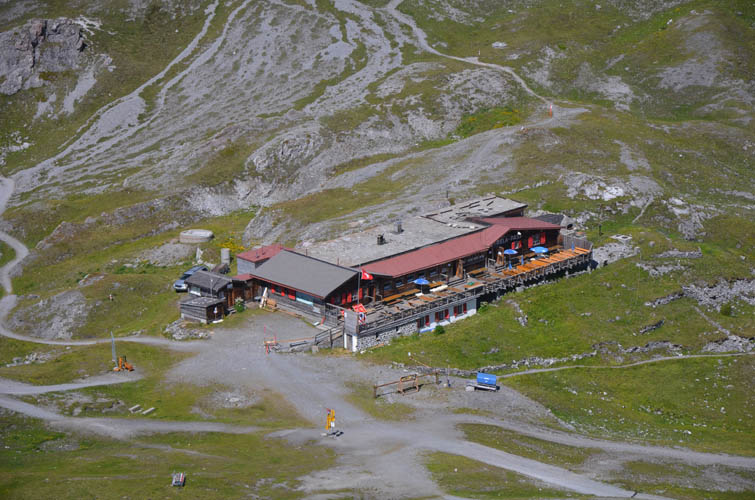
At the saddle between the Schiahorn and Strela (called the Strela Pass) is a nice restaurant whose patio offers brilliant views of the Davos Valley below.
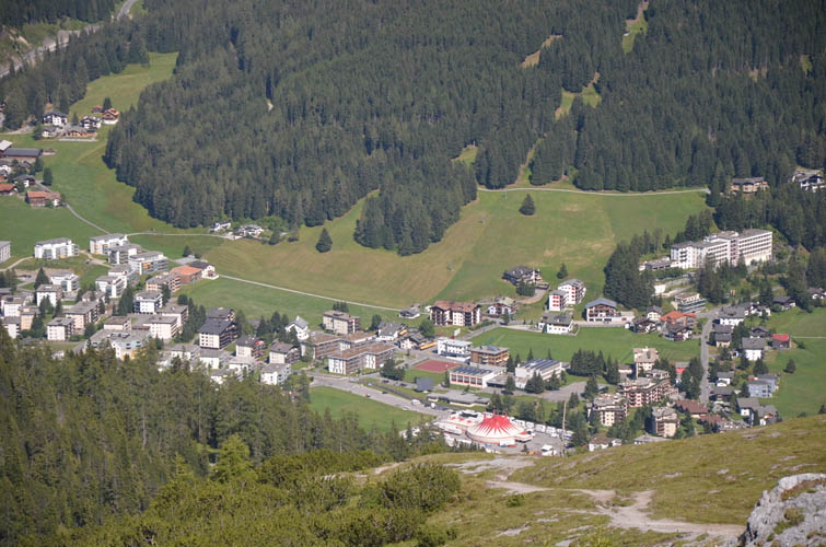
On the hike back down the town of Davos comes back into sight.
Quick stop at the Schatzalp where another sunny patio invites hikers to take a break. The trail descending from here into the town of Davos is called the Thomas-Mann Trail, after the acclaimed German writer Thomas Mann. One of his most famous books, Der Zauberberg (“The Magic Mountain”), was based on observations and experiences he made during a stay at the Schatzalp in 1912.