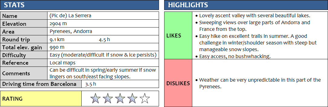
Pyrenees, Andorra
15 June 2018
Solo
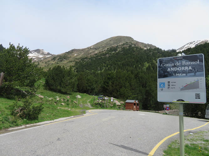
Along with Casamanya, La Serrera is probably one of the most popular peaks to climb in all of Andorra. Access is easy via the Ransol valley in the north of the country, near the town of Canillo. There is a tiny parking lot at the end of the paved road at 1960 m elevation, so you’re pretty much in the Alpine already at this altitude and the approach is relatively short.
My legs were feeling a bit heavy after an 11 hour trip the day before on our big Coma Pedrosa loop, but the weather was nice again today on our last day in Andorra while most of the previous days had been fairly mediocre with plenty of rain. The choice between a day of shopping in the hustle and bustle of Andorra’s tax-free outlet stores and a quiet day out on some mountain ridge was dead easy! Moreover, this is a fairly short outing so with an early start I was likely to get back to our vacation apartment by lunch anyway.
There were no other cars in the small lot at the trailhead when I pulled up at 7 am and I didn’t see any other hikers when I set out along the very good trail (in fact, I didn’t see another soul all day!). I soon discovered why: After about 15 minutes of hiking, the valley narrowed and a good part of the trail was completely covered by a steeply inclined, hardened snow patch, with a raging creek directly below and no easy way to detour around it. Kick-stepping into the snow was possible but risky. In the event of a slip, I would’ve ended up taking a wild ride down the gushing waters of the creek. There had been so much rain lately in Andorra, plus all the recent snow melt, that all the rivers and streams were overflowing, making many creek crossings tricky or impossible.
After some careful searching around, I managed to squeeze by the lower part of the snow slope, with a big jump over water at the end. Once back on the dry trail, I soon hit another bigger snow field, and then another one. Both were wider and slightly shallower, where the kick-stepping technique worked out just fine. However, I have to say that having an ice axe would’ve certainly given me a lot more confidence crossing these snow fields!
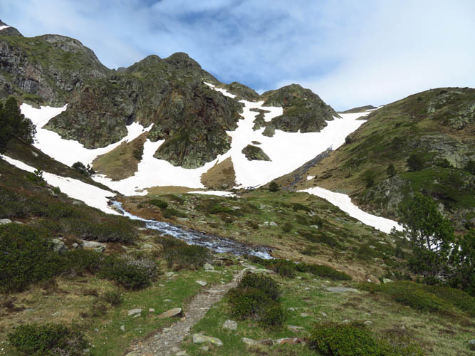
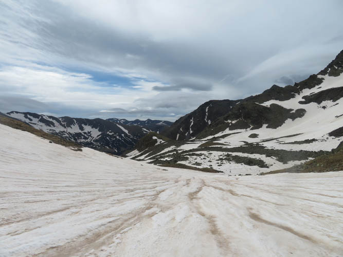
Higher up, the trail crosses the creek again, now more of a series of shallow trickles over a wide boggy area that can be rock-hopped. It was eerily quiet up here in this high valley, with craggy mountain ridges all around me. The trail switchbacks higher into a broad cirque with several small ponds, some of them still covered in ice. And this is supposed to be mid-June! I couldn’t believe how much snow there was still around on the surrounding slopes.
The trail loops around the biggest of the lakes and rises steeply towards the main ridge between La Serrera and a neighboring peak called Pic de la Cabaneta. I had to cross two more large, steep snow fields covering the path. Because I was higher in elevation now and it was still relatively early, the snow hadn’t softened sufficiently yet to allow me to kick into it with my boots properly. Using the edges of my boots (thankfully I still had very good tread), I barely managed to get some grip on the icy snow to slowly slide-slope uphill. I only did this without an ice axe because I knew that a fall would’ve been inconsequential – the run-off was long and gentle and there were no obstacles or traps below me. Also, at this time of the year there was absolutely no chance of avalanches anymore in this area. It’s quite obvious, however, that these slopes would be avalanche-prone in the winter.
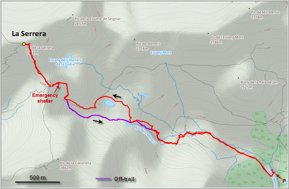
Just before the summit ridge there is a small emergency shelter made of rocks and tucked into the mountain side. I looked inside but didn’t see much except for a metal bed, a few old rusty food cans, and a pile of snow in the middle. There are supposed to be some iron ore mines in the area up here that were in operation in the early 1900s, so perhaps this was one of the huts belonging to the mine workers.
From the hut the trail continues to the main ridge which, in summer, easily leads to the summit with only some minor scrambling. Today, however, there was still a large patch of snow covering the south side of the summit mass, which required careful kick-stepping to get up as it was quite steep. Again, an ice axe or even crampons would’ve been useful, but I was ok without.
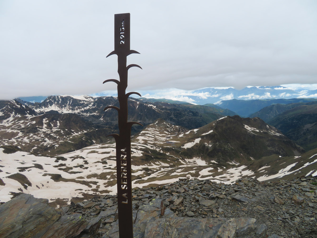
Clouds had moved in from the north by the time I got to the summit, which marks the border between France and Andorra. Just like on Casamanya, there is an iron pole with “La Serrera” written in stencils, plus a heavy iron box with a few pieces of paper acting as a register. A lot of the major mountains of Andorra can be seen from this vantage point, including Coma Pedrosa (2944 m), Pic de l’Estanyó (2915 m), Casamanya (2757 m), and Pic de la Cabaneta (2862 m). Over to the north, the ridge continues to a remote peak in France called Pic du Sal (2743 m). It was striking to see that almost all mountains around me had snow on them – so much white in the middle of June and all below 3000 m.
Although it was only about 1000 m elevation gain, I was feeling pretty tired and decided not to explore the ridge towards Pic de la Coume de Seignac and Pic de Meners. The clouds were thickening and it was getting chilly, so I preferred to just head back. In late summer, the long ridge walk towards these and a series of other peaks along the French-Andorran border would probably make for a terrific high-level traverse with what looks like plenty of good scrambling along the way.
My descent was significantly sped up by the many large snow patches that had slowed me down on the way up. Now the snow was a little softer, so it was easy and fun to just plunge-step or bum-slide down the slopes directly into the high valley by the lakes. It was also a nice shortcut that avoided many of the trail’s bends and turns. I was back at the car after about 4.5 hours, and back home in our vacation apartment in Ransol ten minutes later, just in time for lunch!
La Serrera is a great short hike that offers a lot for relatively little effort. In the middle of summer the excellent trail probably quite busy with people as this is a well-known outing. If you get the timing right then late spring or early summer can be a wonderful time to climb this peak without the crowds but with the benefit of a quick and fun descent on snow.
DISCLAIMER: Use at your own risk for general guidance only! Do not follow this GPX track blindly but use your own judgement in assessing terrain and choosing the safest route.
At the end of the road high up in the Ransol Valley. There’s a tiny parking lot on the right for maybe 3 or 4 vehicles.
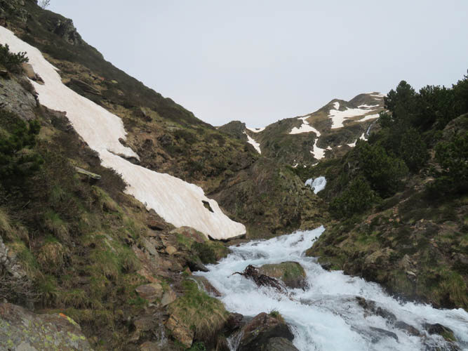
The creek is flowing high, making passage along the trail difficult where snow hasn’t fully melted yet. This is the first obstacle where I managed to squeeze by below.
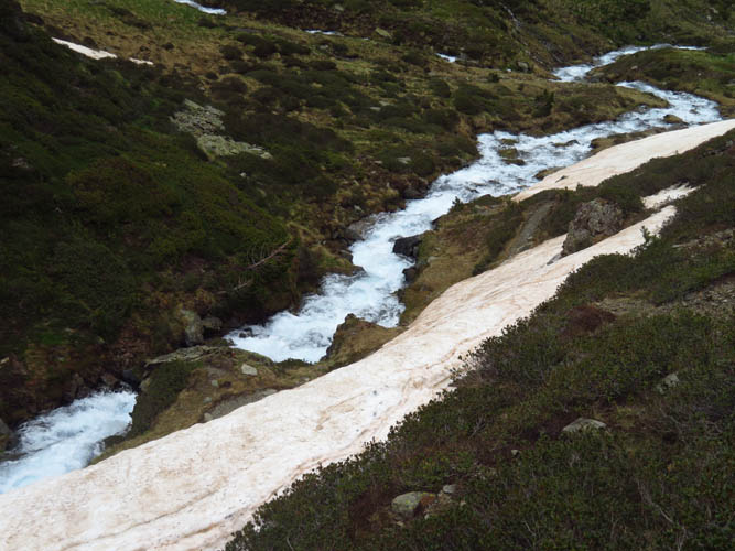
Bypassing another steep snow patch through shrubs above.
Very pleasant hiking through a lovely area.

Wild daffodil (Narcissus pseudonarcissus)
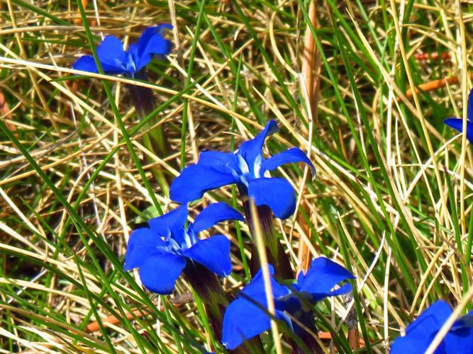
Spring gentian (Gentiana verna)
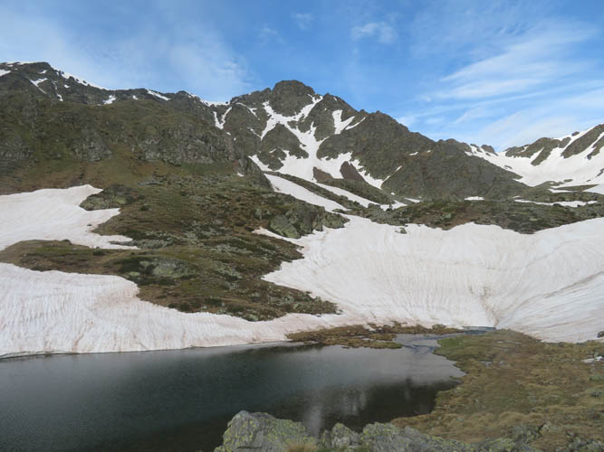
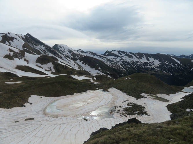
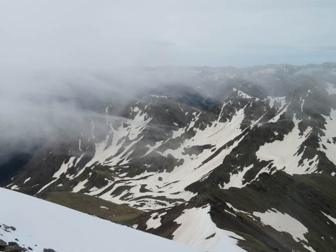
The trail passes by several small lakes in the upper part.
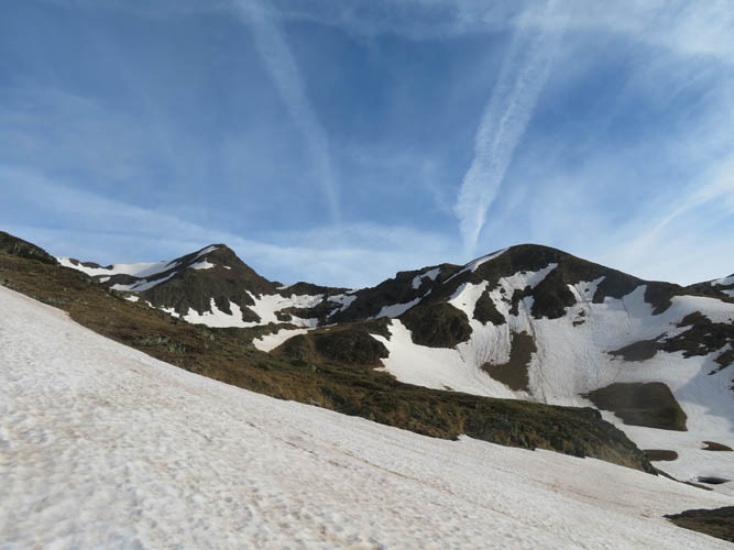
Pic de la Coume de Seignac (L) and Pic de Meners (R).

Here, the trail disappears under a large tongue of snow. It was just soft enough to give me enough grip so I could traverse diagonally up from right to left.
Looking east at the frontier ridge that forms the border between Andorra and France.
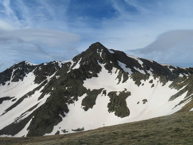
Pic de la Cabaneta
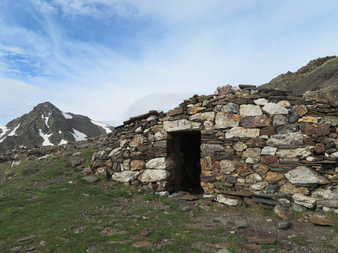
The old emergency shelter
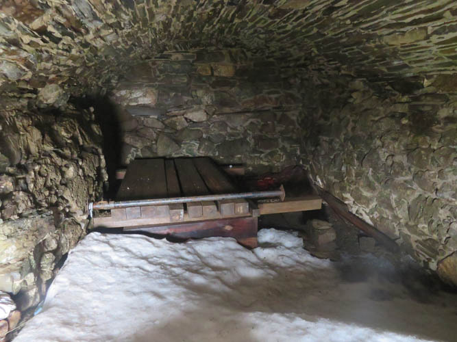
Heaps of snow inside!
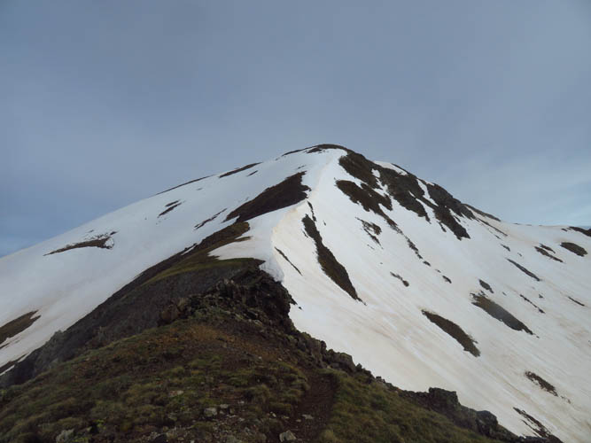
On the final ridge towards the summit of La Serrera.

Pic de l’Estanyó to the SW
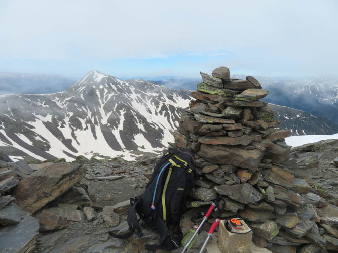
La Serrera summit cairn.
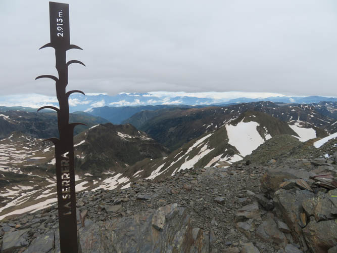
Official height is 2913 m. My GPS recorded a maximum elevation of 2904 m, but weather/pressure conditions were somewhat unstable today.
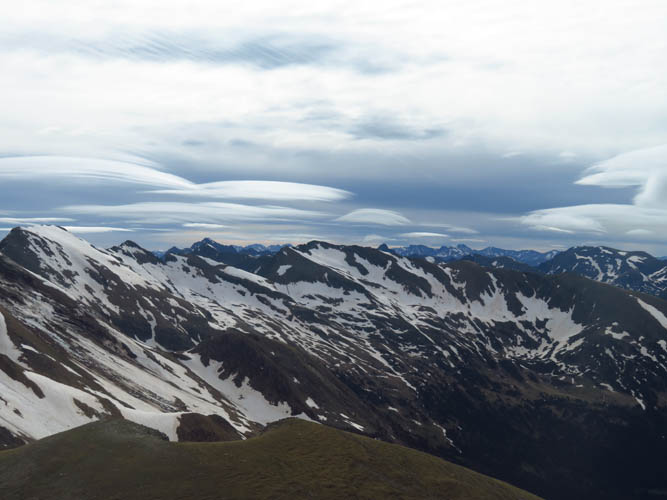
Interesting cloud formations to the east.
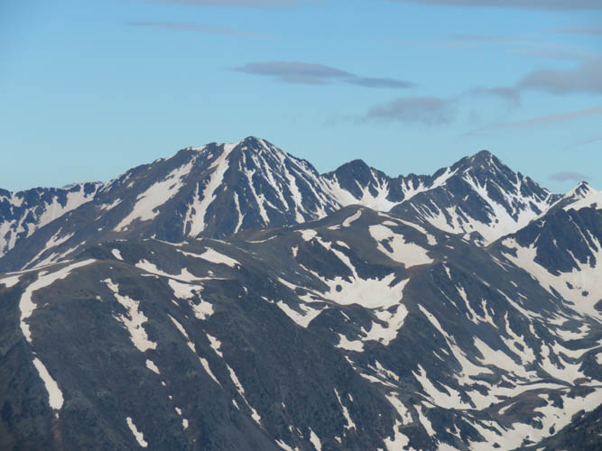
To the west lies Coma Pedrosa, Andorra’s highest mountain (2943 m).
It’s getting windier and the clouds are moving around fast now.
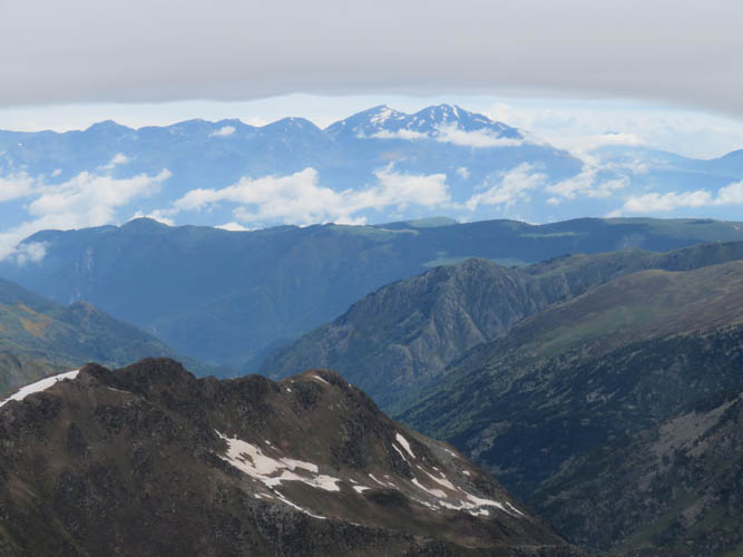
Layers of cloud, ridges and peaks – a glance into the French Pyrenees.
Taking advantage of those snow slopes for a quick descent!