Orjen, Montenegro
17 August 2018
With Wen
One of the best places to see the bizarre world of karst
The Orjen Mountains are a low-lying mountain range along the northern coast of Montenegro overlooking the city of Herceg Novi. We were driving down the coast from Dubrovnik, Croatia, to Montenegro to do some diving but found the beaches to be hopelessly overcrowded, the weather hot and stuffy, and the dive companies to be poorly organized. The mountains right behind the city offered the perfect escape from the heat and all the hustle and bustle of the coastline.
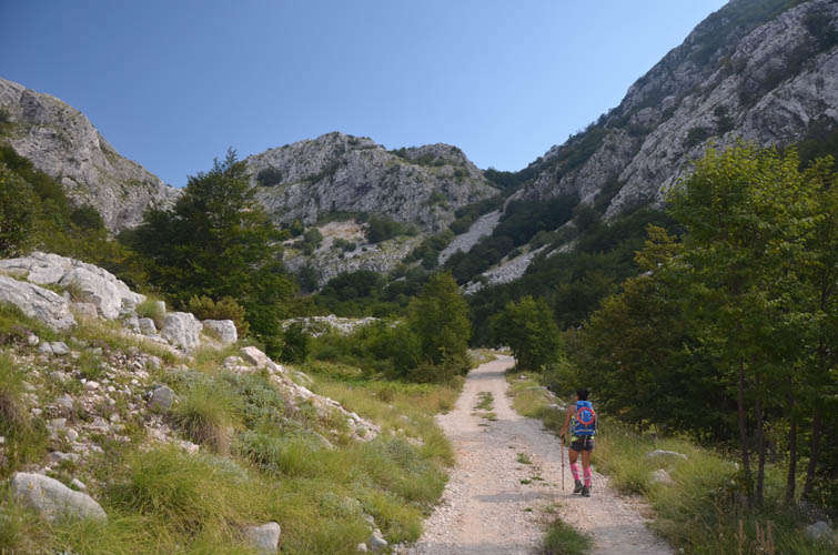
We didn’t even know this but there is a mountain hut maintained by the Herceg Novi mountaineering club nestled right in the middle of the Orjen Mountains at 1136 m elevation. Locals told us about it as we drove the small road uphill from Herceg Novi towards the village of Kameno, where a large plaque has been set up showing all the trails in the area. A few kilometres past Kameno at a place called “Borići” is the trailhead where we parked our van behind some old buildings (an old dilapidated motel). This is also where we met Andy, a super friendly British traveller and fellow VW van enthusiast. We later met up with Andy again to do a bunch of hikes together in Montenegro and Albania.
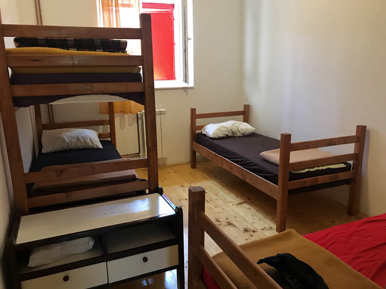
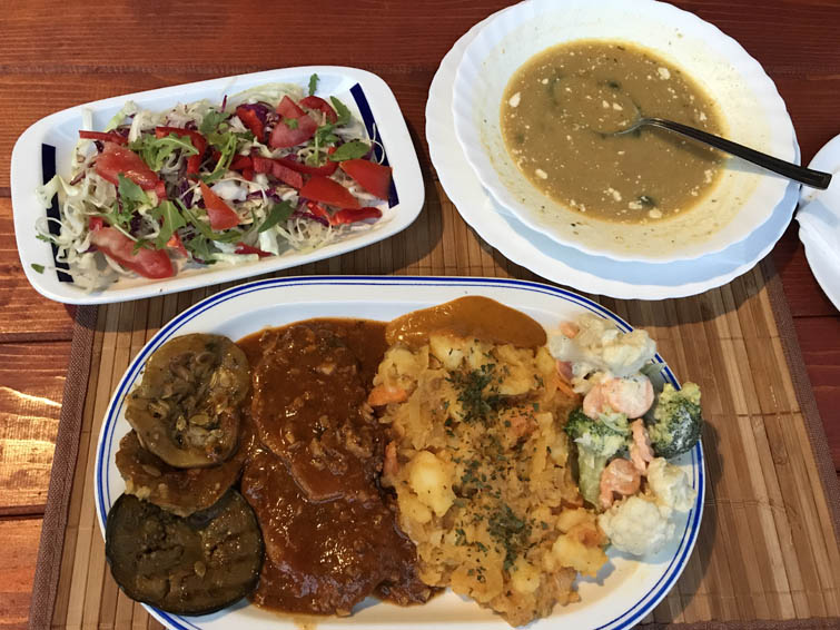
After a good night’s rest in our quiet little campsite, we hiked up the gravel road for about 3 km and 360 elevation metres to reach the Za Vratlom Hut where all trails of the area start. The hut is a beautiful sight when you approach it from the south, with its bright red shutters and solid natural stone walls. It was renovated six years ago with European Union funds and fully holds up to any modern hut you would find in Switzerland or Austria, for example. There are 52 beds, some of which are in private rooms, and home-cooked food, fresh cake, and local beer are served. Vladimir, the care taker, is super friendly and an amazing cook. His traditional Montenegrin dishes were absolutely delicious!
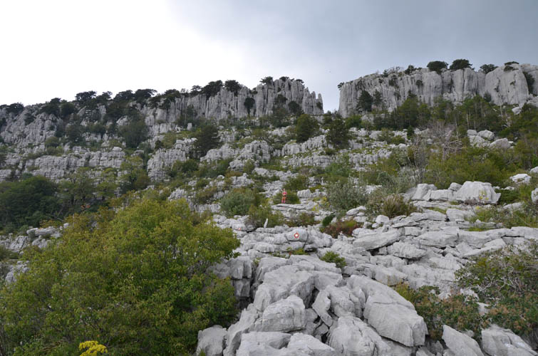
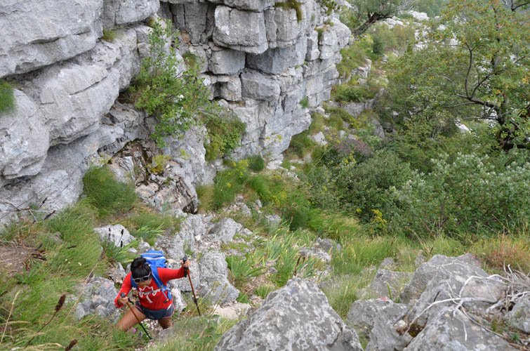
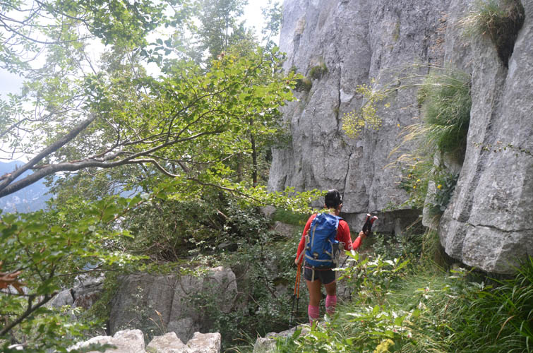
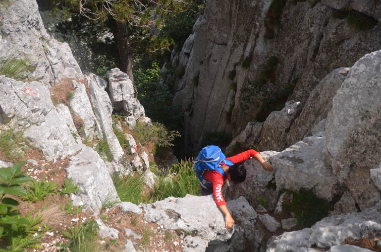
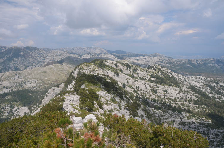
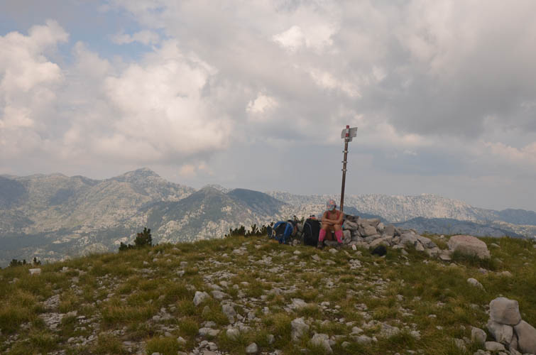
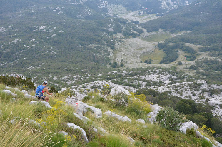
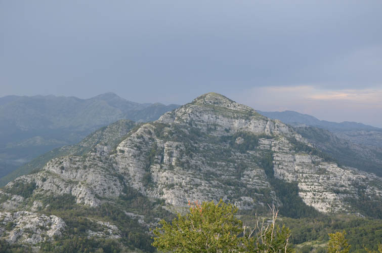
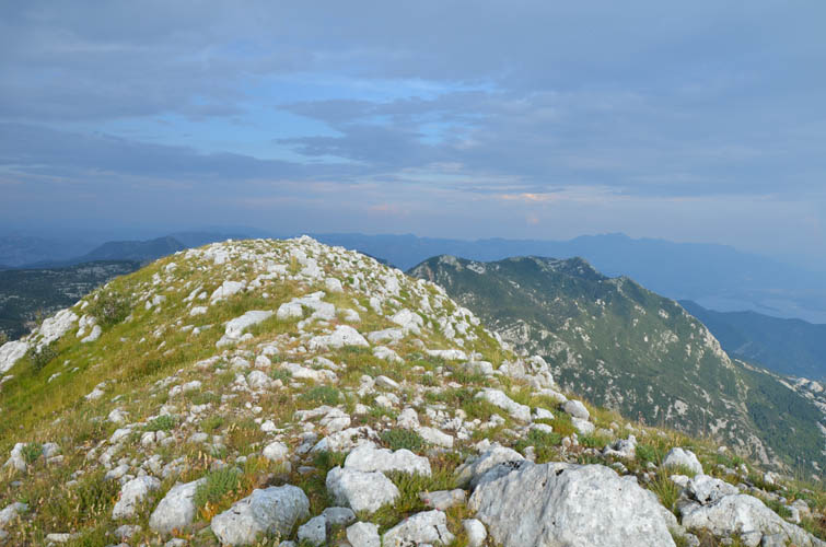
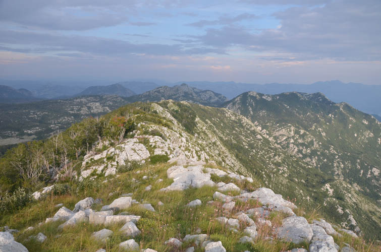
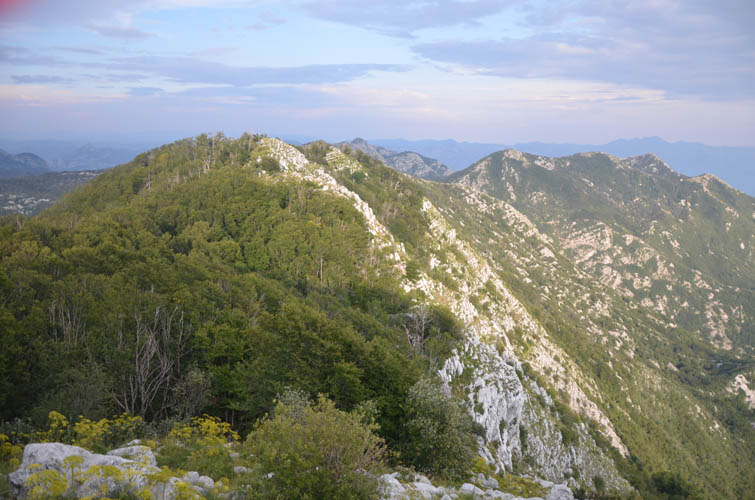
For our first day of hiking we picked Subra – the highest peak and most popular objective in the Orjen Mountains. The main route heads northwest from the hut and goes up a gentle, step-like ridge. Another way of obtaining the summit is to branch off to the north after about 800 m from the hut and follow a secondary trail that loops around the northeastern slopes of Subra, which is the ascent route we took. This is definitely the less popular option and we found the trail to be a bit overgrown in places. It’s also more adventurous and challenging since it involves some routefinding and a few moderate to difficult scrambles over ledges and up a steep gully to gain the ridge top. Occasional thunder roars in the distance and a few short rain showers made our ascent interesting to say the least – Wen didn’t like it, but on a fine day this is a demanding and fun alternative to the main route. We were both happy to stand on Subra’s summit after a more difficult ascent than we had expected.
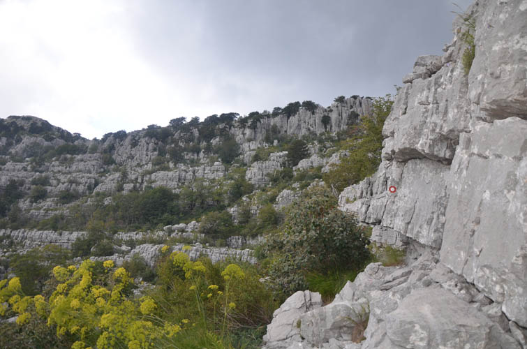
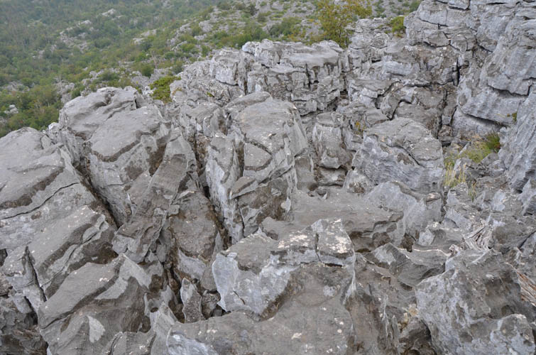
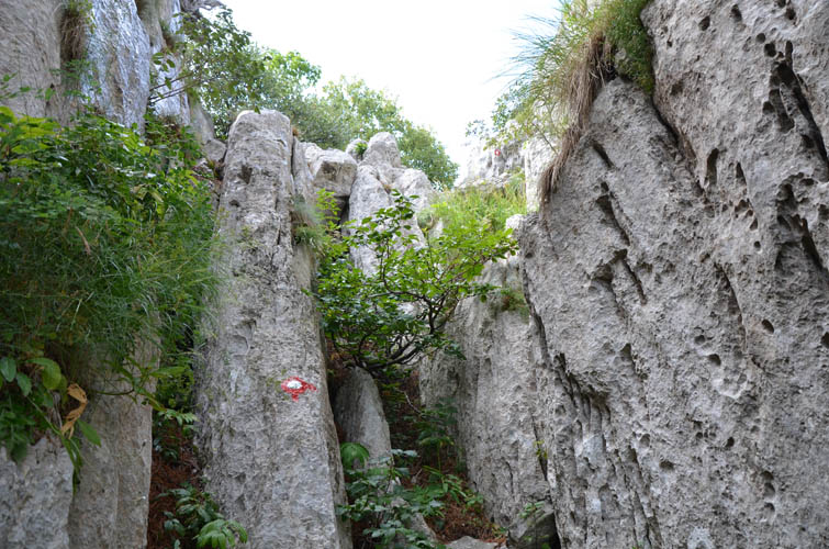
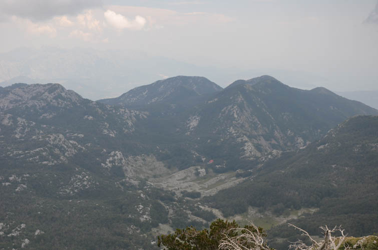
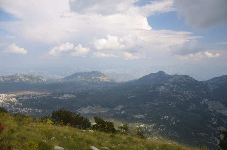
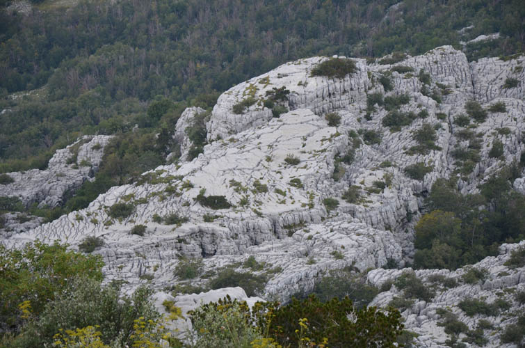
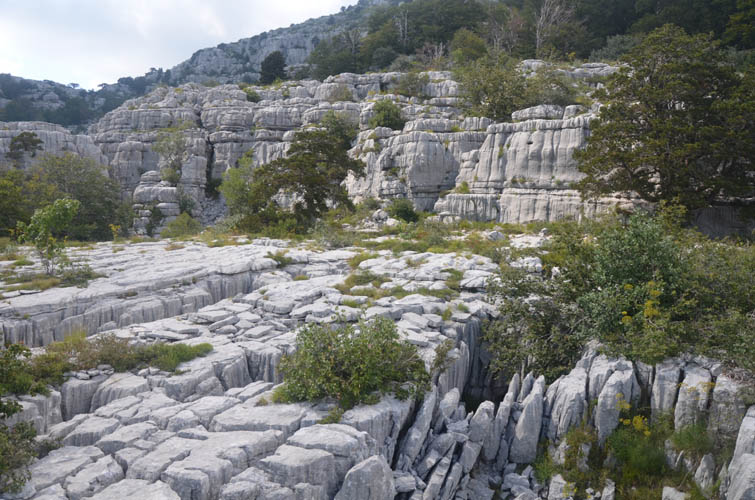
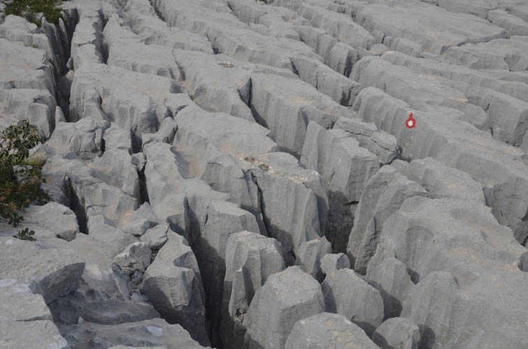
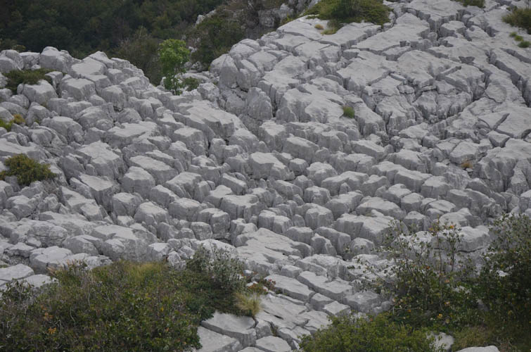
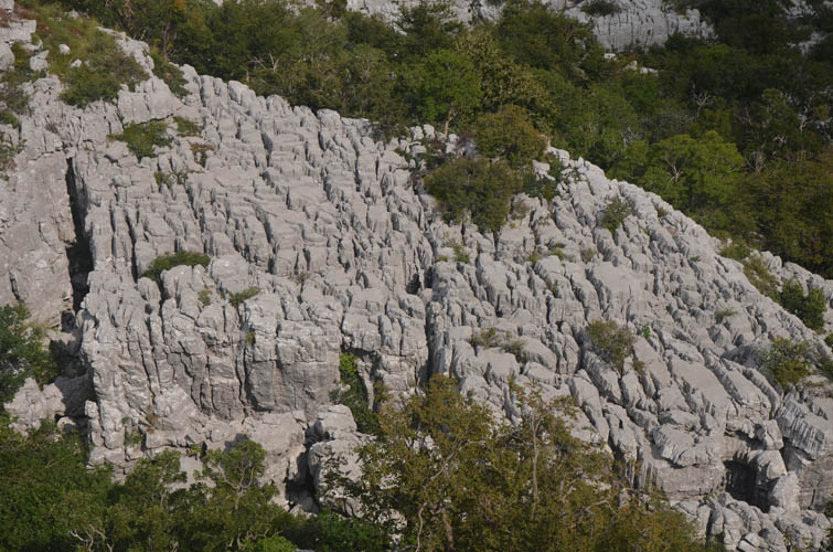
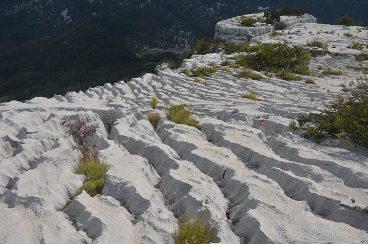
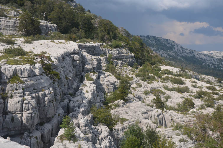
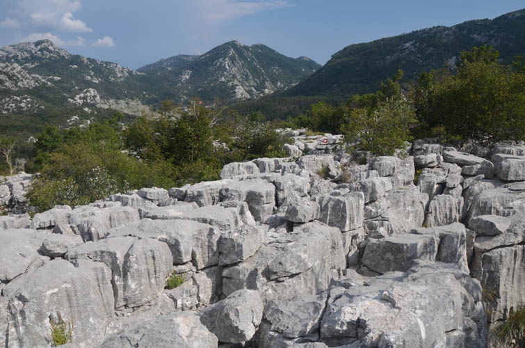
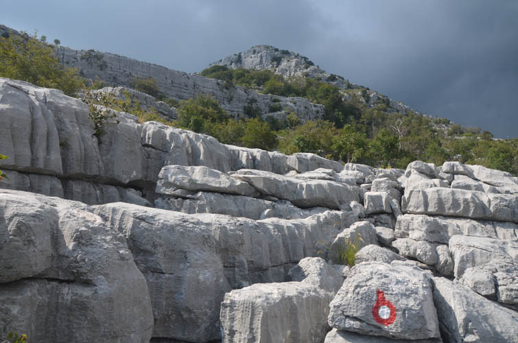
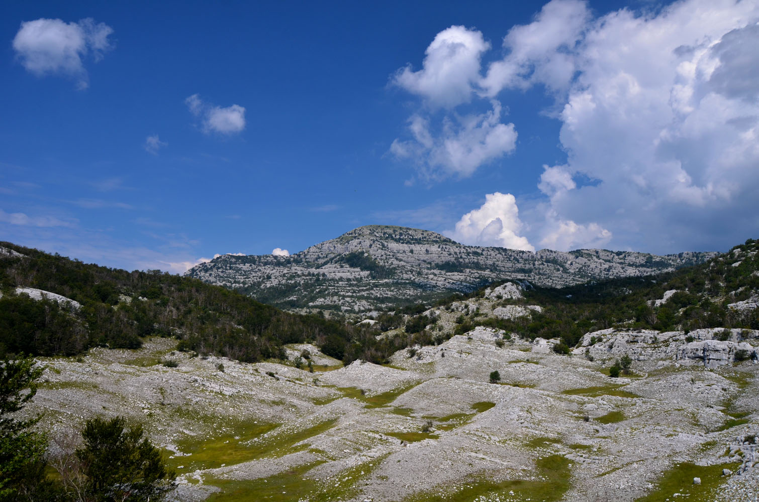
Karst is a prominent geological feature in the Orjen mountains and nowhere can you see it better than on the Subra hike. This is hands-down the best karst hike I’ve ever done. The term “karst” basically refers to fresh water dissolution features within and around limestone rocks. The products of such erosional processes include fractures, fissures, sinkholes, solution pockets, caves and caverns, amongst others. The latter can all be witnessed in the mountains here: the rocks are completely busted up, resulting in some bizarre fracture patterns and carved out channels and holes everywhere you step.
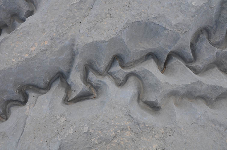
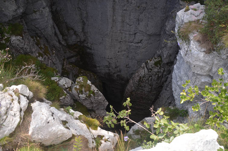
One such amazing feature is the Nikolina Cave, a deep dark hole about 10 m wide and 188 m deep! We stopped by on our way down along the main route to take a look at the abyss – throwing a rock down there takes more than 10 seconds until it hits the bottom. Another short detour well worth the effort is the Vilino gumno plateau. It takes about 10 minutes to get to from the main trail (just after the cave on the way up, branching left) and features some really cool wiggly water channels carved into the limestone slabs, along with a dense fracture network. You definitely don’t want to lose your hiking poles here, or you’ll never see them again!
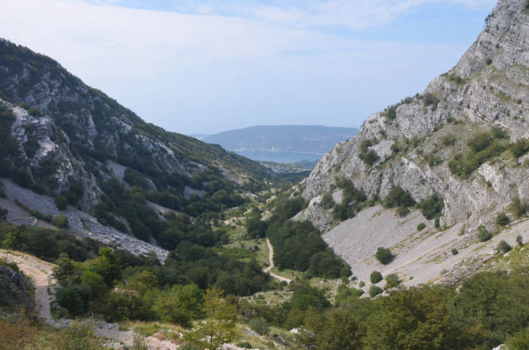
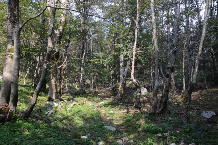
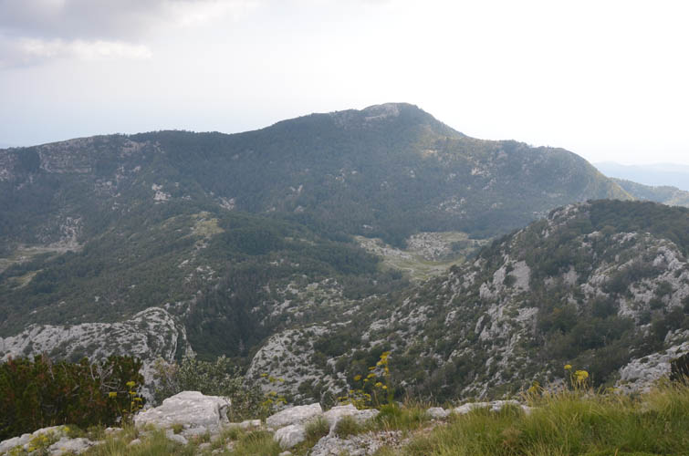
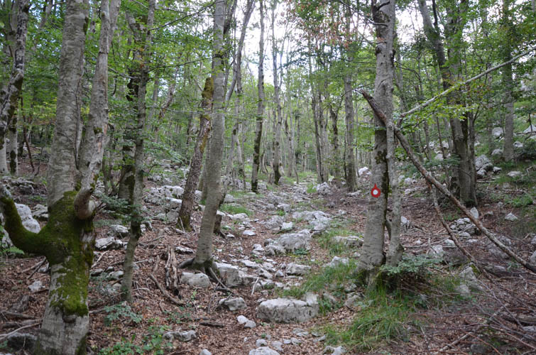
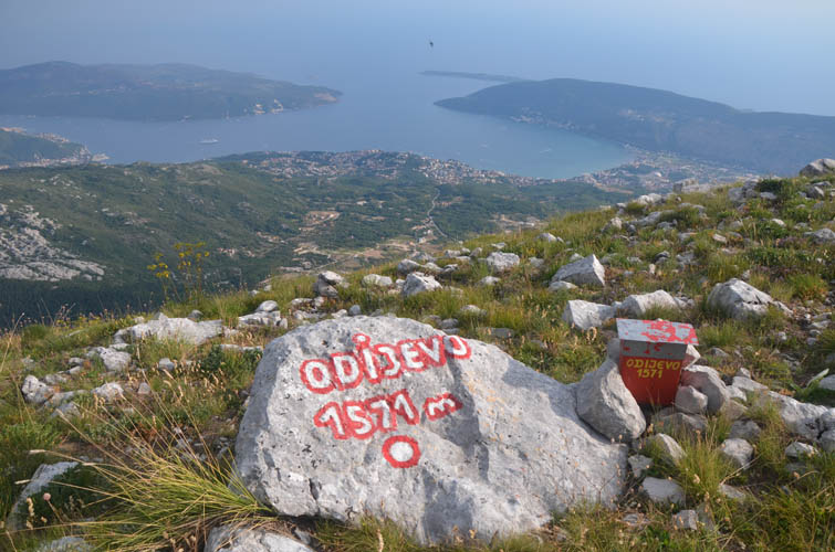
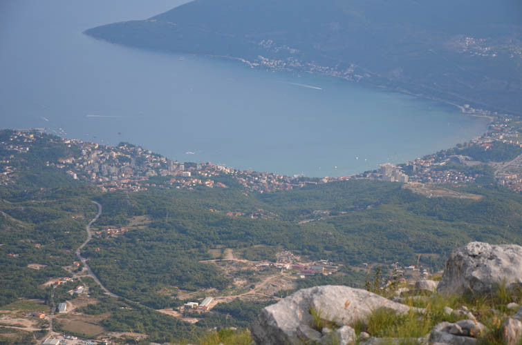
About two thirds of the way down the mountain we came to an intersection where another trail heads west towards a peak called Odijevo. Wen decided to return to the hut while I still didn’t have enough yet and continued to Odijevo. The trail up this little peak is markedly different from Subra: it’s almost all the way in the woods and not as well-marked. Still, it was a lovely forest hike and soon I was standing on Odijevo’s 1571 m summit overlooking the Adriatic Sea and the coastal town of Herceg Novi below.
My navigation app showed a trail along the ridge from Odijevo towards the east that connects up with the main gravel road leading to the hut. Perfect, I thought – I love loop routes and this would probably make for a fine ridge walk. How wrong I was!
The “trail” did in fact not exist. The “ridgewalk” was part bushwhack, part rock hopping, and part clumsy stumbling over an uneven mixture of rocks and grass. Very unpleasant terrain and very slow and strenuous hiking. Because I had to focus so much on where I put my feet, I couldn’t even enjoy the views of the coastline below me. There were also several annoying ups and downs along this ridge that cost me a lot of energy and time. A few sections of nasty thorn bushes topped off the experience :).
Vladimir later told me that my map probably showed an old trail that used to exist a long time ago but isn’t used anymore at all. No wonder! I definitely wouldn’t recommend this “ridgewalk” to anyone. Better to go up and down Odijevo the same way.
Near the end of my ridge slog I reached a small cairn on a small bump called Kamenski Kabao. It’s not really a separate peak but there’s a trail running up from the gravel road below. Relieved to be back on a path, I made quick work of the descent and reached the hut just before dusk.
Practical information:
- One night at the Za Vratlom hut costs around 10-12 Euros per person. A full 3-course dinner is about 14 Euros, breakfast about 5 Euros. Spontaneous drop-ins are usually possible, or you can call or email to book ahead (they’re also on AirBnB). The hut is open year-round, but there may be the odd day when the care taker is away in town for business. Website: www.pksubra.me
- Hiking maps detailing some of the most popular hikes can be bought at the hut for 2 Euros. However, almost all trails are exceptionally well-marked (trail signs and plenty of paint markers) and can be done without a map.
- Most popular day hikes from the hut are Subra and Grab.

| Elevation: | Subra: 1679 m (official), 1674 m (my GPS) |
| Odijevo: 1571 m (official), 1559 m (my GPS) | |
| Elevation gain: | 1540 m |
| Time: | 10.5 h |
| Distance: | 16.3 km |
| Difficulty level: | Subra: Moderate (Kane), T4 (SAC) |
| Odijevo: Easy (Kane), T3 (SAC) | |
| Reference: | Local maps |
| Personal rating: | 4 (out of 5) |
DISCLAIMER: Use at your own risk for general guidance only! Do not follow this GPX track blindly but use your own judgement in assessing terrain and choosing the safest route.