Svaneti, Georgia (Caucasus)
6 October 2018
With Wen
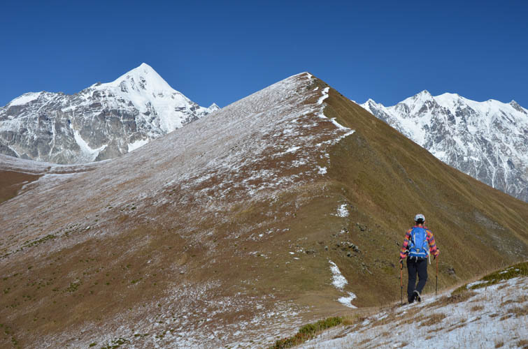
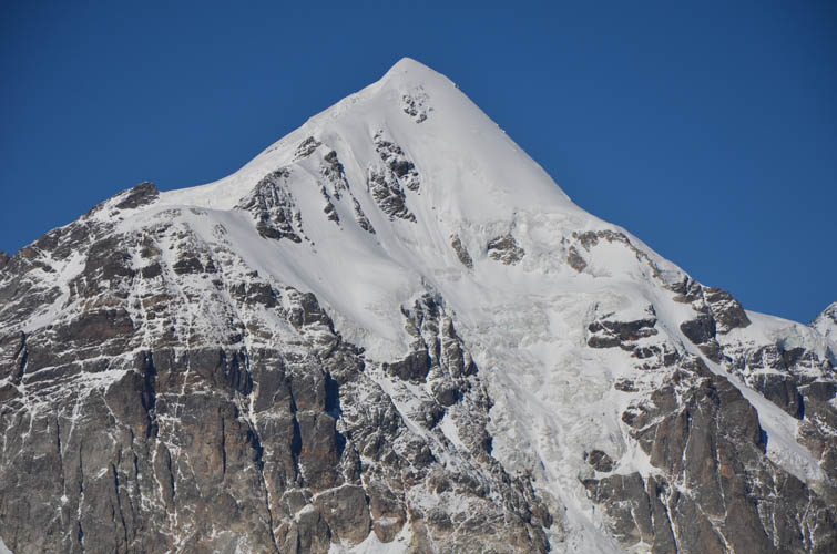
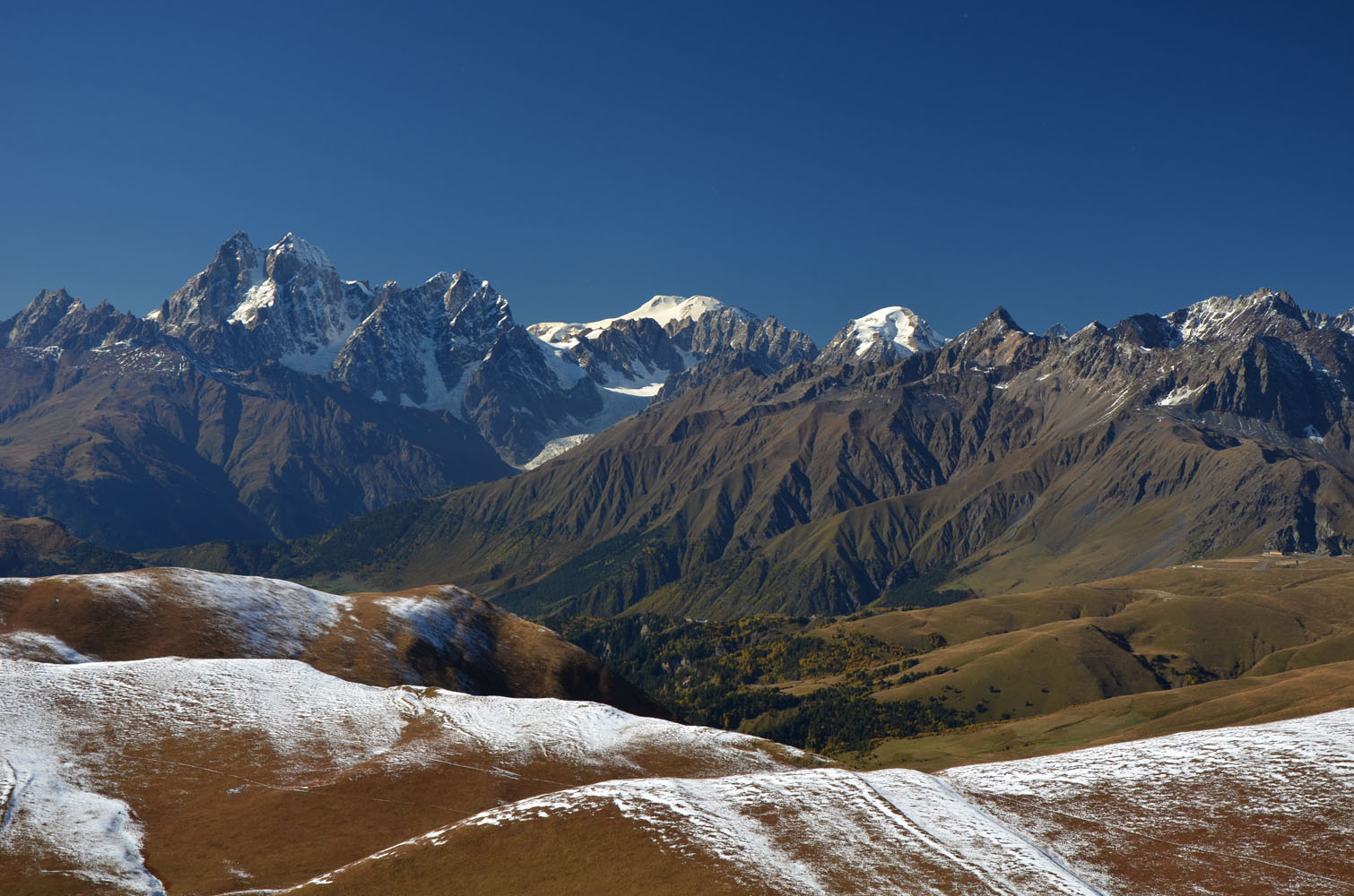
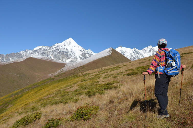
Fantastic views of mighty Tetnuldi
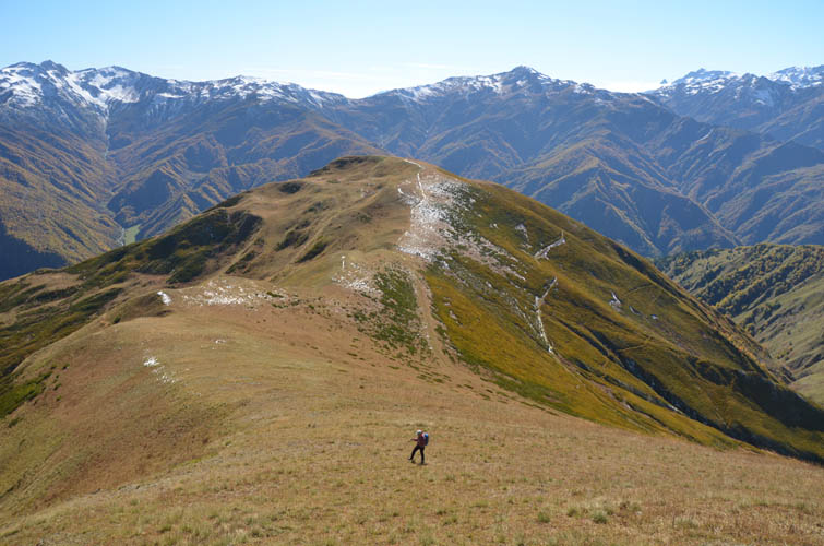
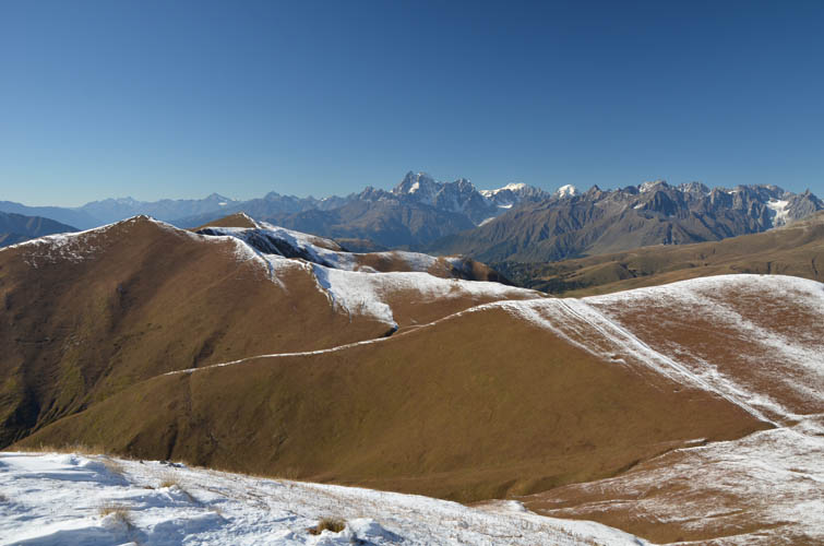
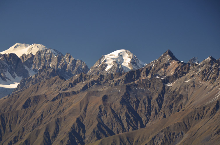
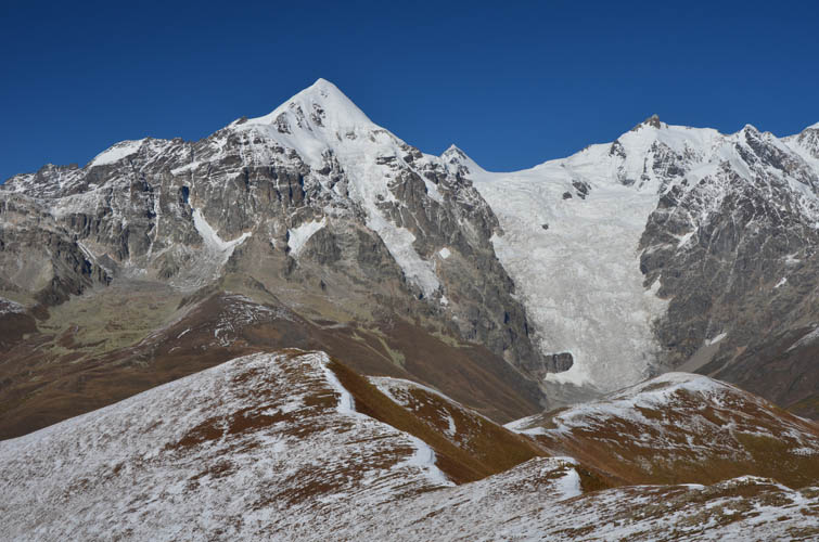
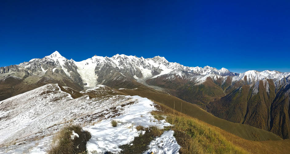
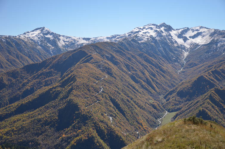
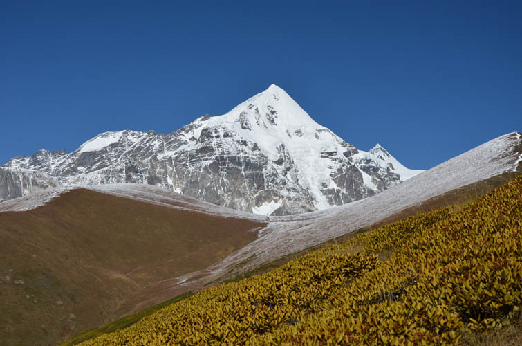
Chkhunderi is the highest point of a series of long grassy ridges that afford splendid views of mighty Tenuldi, a massive snow pyramid that dominates the landscape of Upper Svaneti and a famous mountaineering objective in the Caucasus Mountains. An old, forgotten trail goes up the south ridge from the village of Lalkhori, far off the crowds that ply the nearby “tourist trail” between Mestia and Ushguli.
This is a formidable hike on a sunny day and we were lucky to have cloudless blue skies all day. It’s also a relatively short outing, although the drive up from Mestia takes some time (in part due to the many muddy sections on the unfinished road).
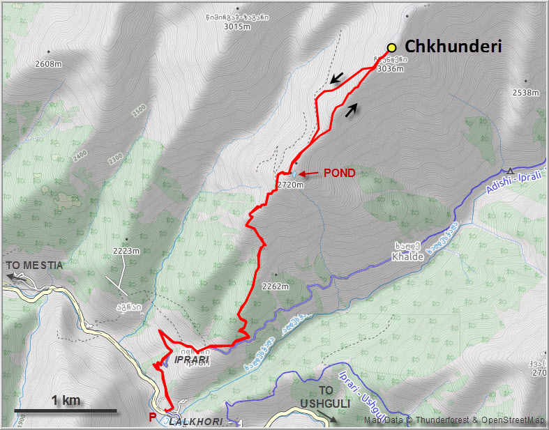
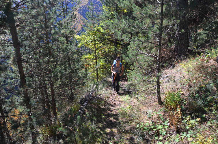
The old trail starts just beyond the last houses of Iprari on the northeastern side and runs through forest for the first hour before the grassy ridge opens up. It’s a bit overgrown, with some deadfall here and there, but overall a pretty decent trail. Once you’re on it, it’s hard to lose – it heads straight up and you gain elevation quickly.
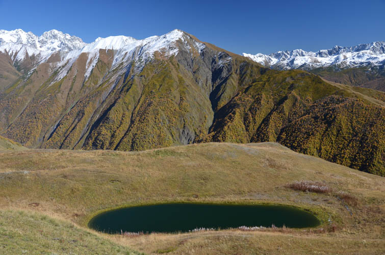
Near the first high point along the south ridge there is a small, lonely pond with dark green water. A far more attractive place compared to the crowded Koruldi Lakes in my opinion – peaceful and untouched, with a backdrop of stunning mountains.
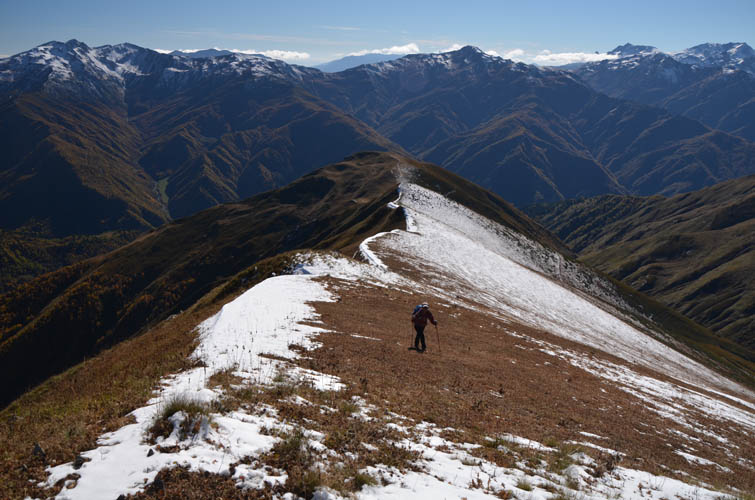
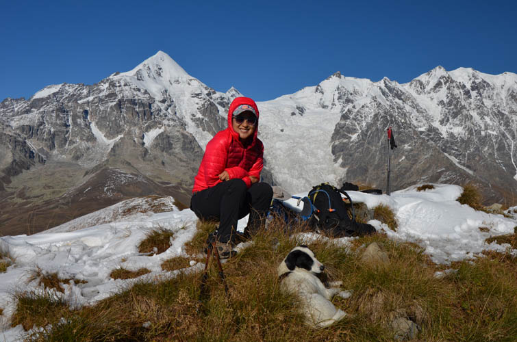
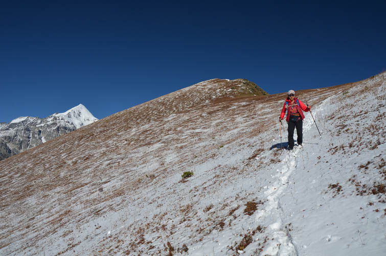
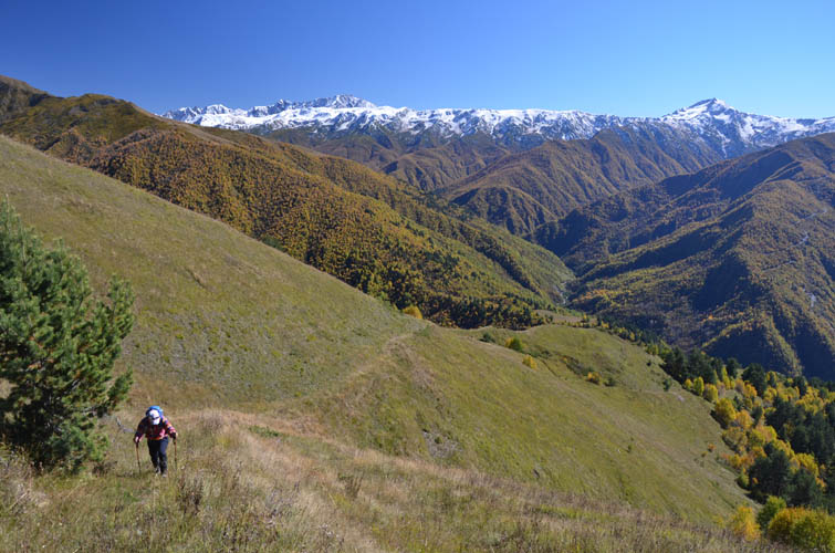
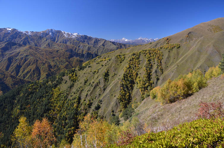
The ridgewalk between here and the summit of Chkhunderi Peak is the best part of the day. The terrain is pretty gentle and you can stare at Tetnuldi and its surrounding glaciers as much as you want while plodding to the top. Our hike was made even more entertaining by a cute little dog that followed us all the way from the village to the top! “Wobby”, as we nicknamed her, appeared to have boundless energy running up and down the hill multiple times, which really made us look like snails.
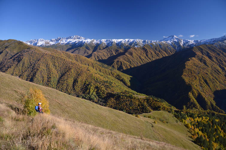
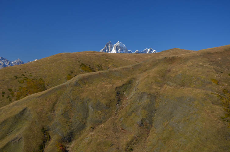
The whole trip took us just over 6 hours, but at brisk pace it can be done in 5 hours or less. There’s also the option of extending the ridgewalk to Chkhunderi Pass to the northeast, then heading down the established hiking trail into the valley east of the peak and back to Lalkhori. Several summits west of Chkhunderi Peak can also be easily reached via gentle grass ridges that connect them.
| Elevation: | 3036 m (official), 3031 m (my GPS) |
| Elevation gain: | 1350 m |
| Time: | 6 h |
| Distance: | 12.7 km |
| Difficulty level: | Easy hike (Kane), T3 (SAC) |
| Reference: | No route information was available to us prior to trip |
| Personal rating: | 5 (out of 5) |
DISCLAIMER: Use at your own risk for general guidance only! Do not follow this GPX track blindly but use your own judgement in assessing terrain and choosing the safest route.

Shkederi (3133 m), the peak on the other side of the valley, would probably make for a pleasant hike as well.