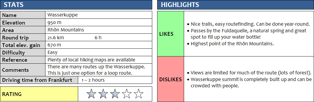
Rhön Mountains, Germany
2 March 2018
Solo
The last few weeks had seen a cold spell over much of Germany, with unusually low temperatures in Bavaria thanks to a high-pressure system bringing in chilly air from the Arctic (-7C is considered very cold here!). Taking advantage of the clear skies and sunny weather that comes with this high, it was time to go for a nice winter hike in our local Rhön Mountains again.
Bischofsheim an der Rhön is a small town of about 5000 people situated in the far northwestern corner of Bavaria. It’s also fairly close to the Wasserkuppe in neighboring Hesse, the highest point of that state and the highest “mountain” in the Rhön at 950 m above sea-level. Close, but not too close so I could still have a good day of exercise to go up and down this locally famous landmark. The peak is a very popular place to visit in summer and is well known for its glider scene (there’s a small airstrip, glider school and museum here), but people come here in winter as well for skiing, snowkiting, tobogganing, and of course hiking. You can drive all the way up on an excellent tar road, so access by car is easy but there are a ton of great hiking trails in the area for those wishing to stretch their legs a bit.
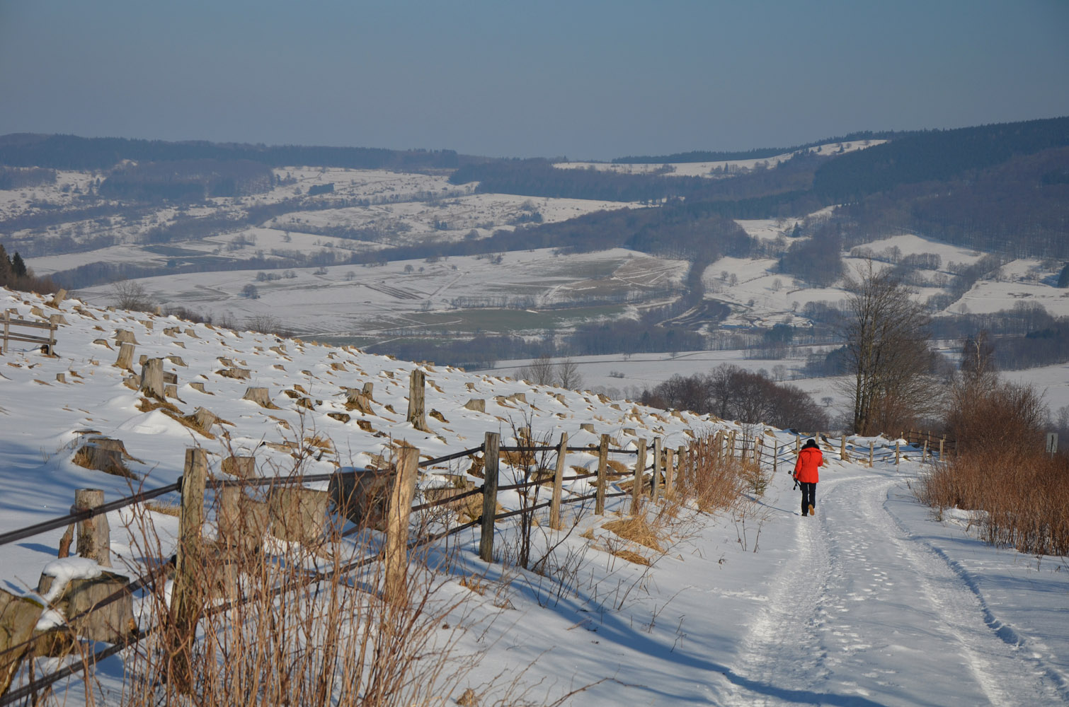
Using Bischofsheim as a starting point, my parents set off on the shorter hike to the nearby Holzberghof, a small but popular countryside inn with excellent Franconian food located in the forested hills north of town, while I headed off in a northwesterly direction pretty much in a straight line towards the Wasserkuppe. There are so many trails to choose from, it’s incredible! The snow on the route I chose was packed, thankfully, but also iced up in places and I was glad I had my steel-tipped poles with me (microspikes would’ve been even better).
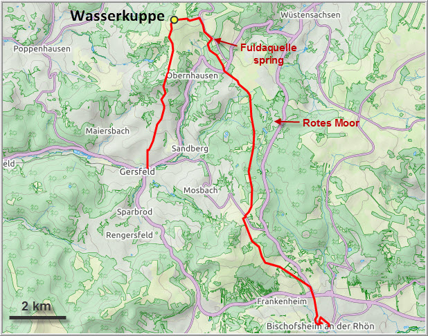
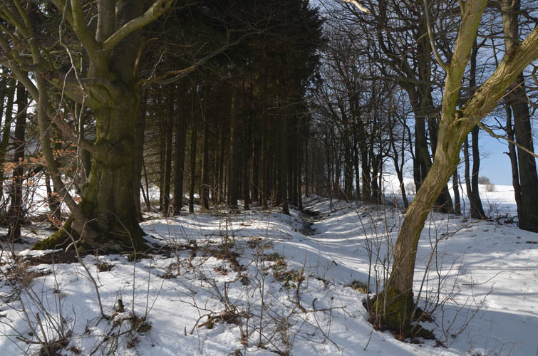
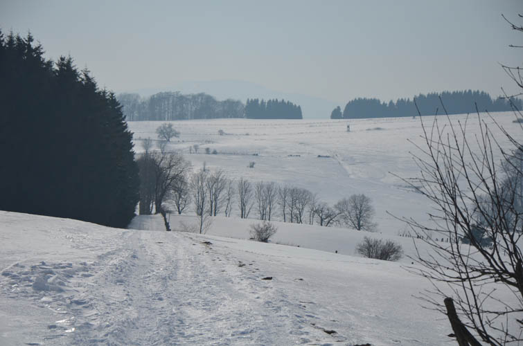
My route took me through the open fields of the Gibitzenhöhe to the Schwedenwall, an ancient demarcation barrier that was used by the Swedes to defend their position during the Thirty Years’ War (1618-1648). Not much is left of this wall today, but it’s interesting to note that the modern-day border between the states of Bavaria and Hesse is loosely based on this ancient barrier. Once in Hesse, I entered a long and rather boring stretch of forest that took me to the “Rotes Moor”, a natural conservation area famous for its marshlands and peat bogs. Right now in winter, much of the area is covered in snow, so there really wasn’t much to see. But in summer this is a special place that certainly deserves a visit when you can walk across bogs and marshes on wooden walkways and observe the unique flora that has developed here.
There were perhaps a handful of other hikers out today at the Rotes Moor, but I was once again the only person on the trail once I had passed the area. Even the groomed cross-country ski tracks were deserted. The low temperatures and cold wind probably kept most people at home today.
After a few more kilometres along the main trail, just before the summit, I reached the “Fuldaquelle”, a natural spring where mineral water gushes out of a small hole in a basalt wall located right by the main road up the mountain. It’s the source of the river Fulda and the highest spring in the state of Hesse. There are some 30 streams and rivers originating from the Wasserkuppe, which in German means “water dome” after all. I was surprised to see several people filling up dozens of jugs and canisters. A friendly lady encouraged me to try it: “The best water you can find! My kids don’t drink tap water anymore, just this. It even cleans the lime off my pots and pans.” Intrigued, I filled up my own bottle and I have to say it was indeed very tasty and refreshing.
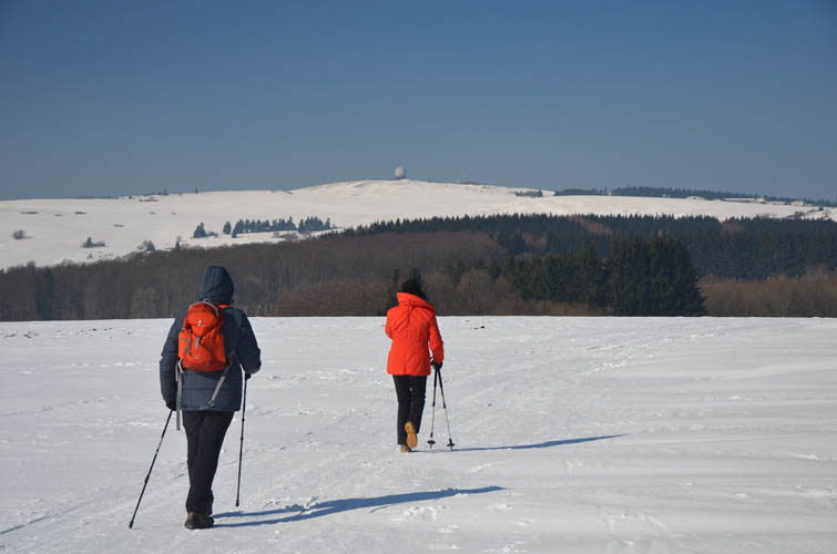
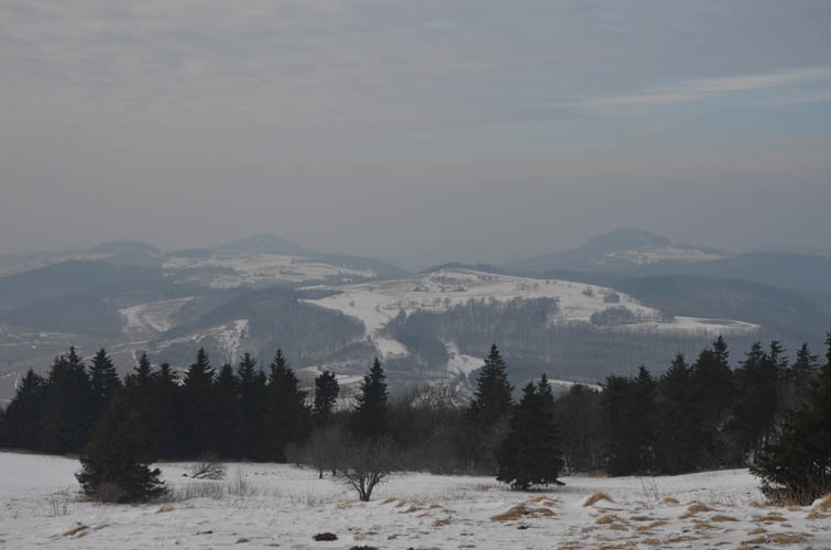
A few hundred metres past the spring I reached the completely built-up summit mass of the Wasserkuppe. There’s a restaurant, café, tourist information, shop, weather station, even a mountain rescue centre up here. And of course the small airstrip where glider pilots take off in the summer. A round radar dome sits at the high point, formerly part of a restricted military complex, but today in the hands of a local gliders club. Next to the dome is a lookout point with picnic tables offering nice views over the surrounding hills. Like on the nearby Kreuzberg, the views are not exactly spectacular, but with their own unique appeal nevertheless. The Rhön is a land of gently rolling hills and mellow valleys that, upon closer inspection, also reveals a wild, untamed side, with wind-battered trees, natural grasslands and unkempt forests.
After wolfing down my tasty salami sandwich at the summit, I followed the hiking trail towards the small town of Gersfeld going directly south. Once again I was the only person on the trail, but I didn’t mind the solitude. More time to let my thoughts wander together with my legs… across open fields, through a short stretch of forest, then downhill again through open land on a mixture of paths into the valley. My parents were already waiting for me at the Café Gersfeld, along with a delicious slice of coffee cake and a cup of tea. The perfect ending to a nice short day hike!
DISCLAIMER: Use at your own risk for general guidance only! Do not follow this GPX track blindly but use your own judgement in assessing terrain and choosing the safest route.
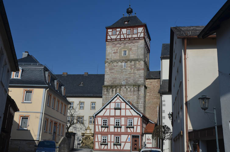
Historic town centre of Bischofsheim an der Rhön with its St. Georg church dating back to 1607.
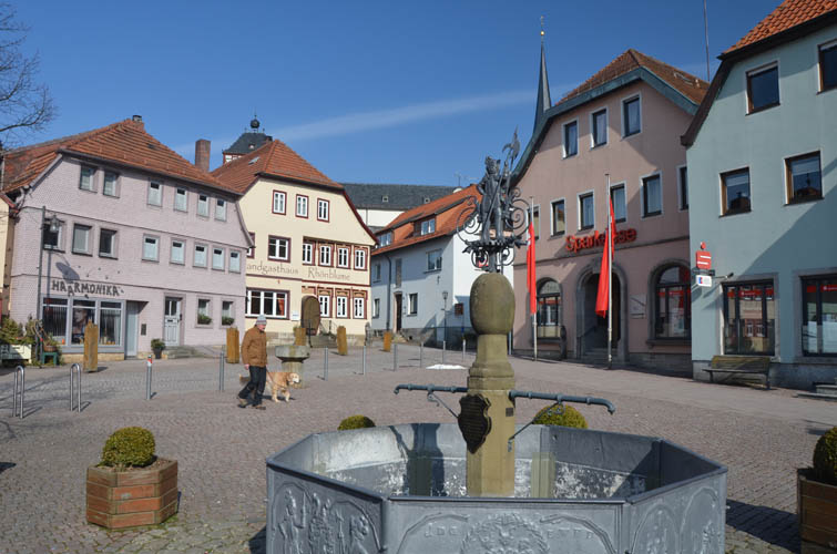
Bischofsheim market square.
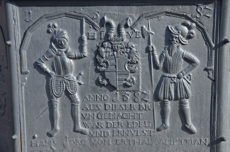
The iron-cast well was made in 1582.
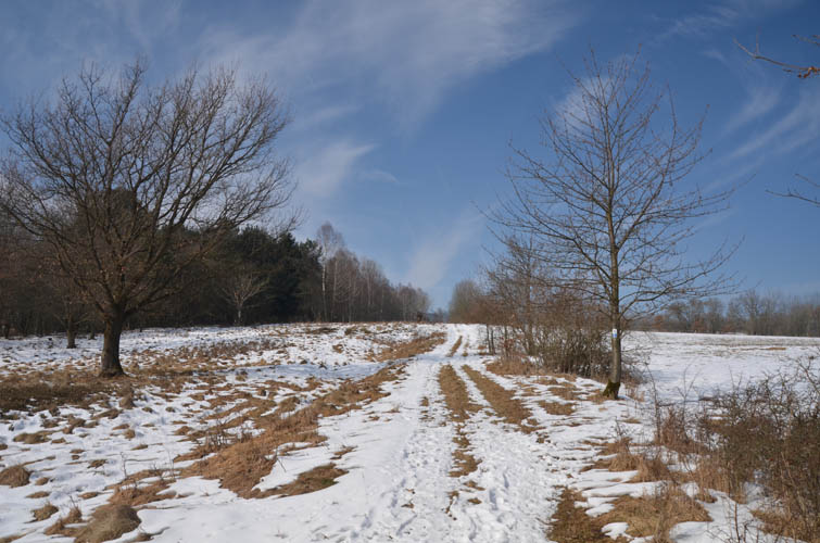
Hiking trail on the open slopes of the Gibitzenhöhe.
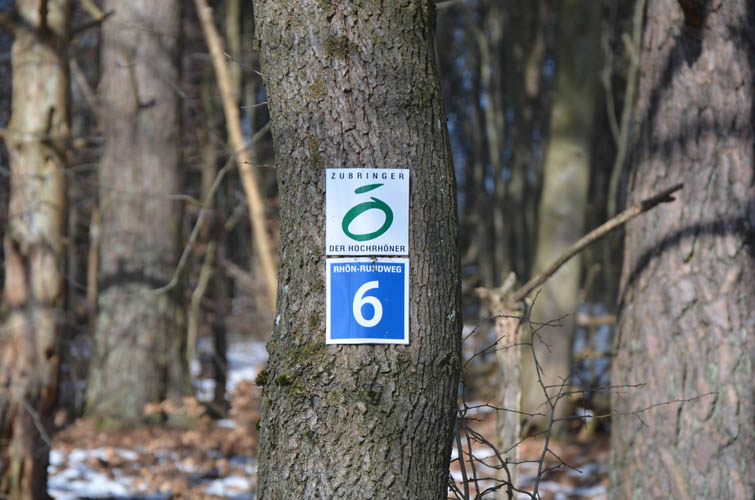
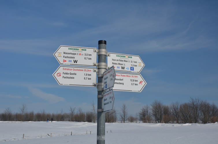
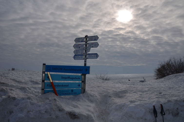
It’s hard to get lost – there are lots of signs and markers telling you which hiking trail you’re on.
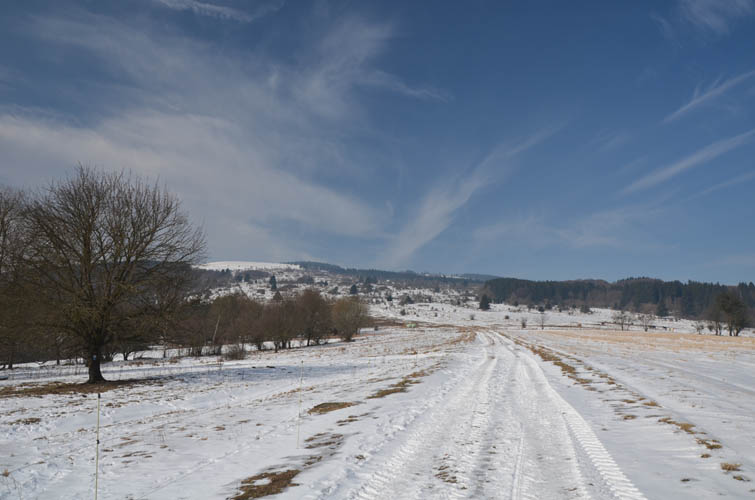
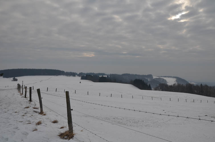
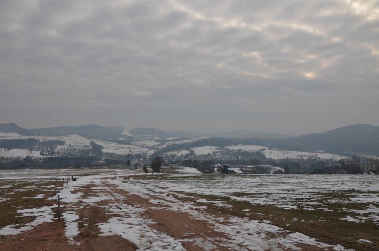
Typical view in the Rhön.
The Schwedenwall, an ancient defense line fortified by the Swedes during the Thirty Years’ War (1618-1648).
Empty landscape – I have it mostly to myself today.
First view of the Wasserkuppe with its distinctive radar dome from near the Rotes Moor (photo taken a week earlier).
Plenty of hiking options here!
The area is also popular for its cross-country ski tracks.
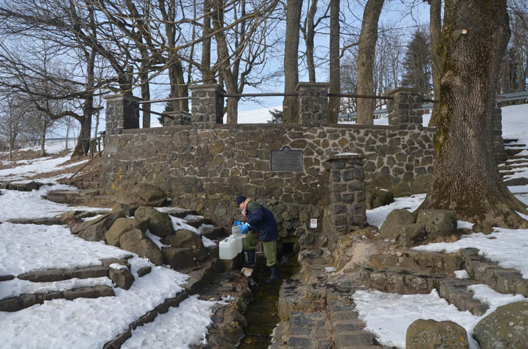
Fuldaquelle spring. Refreshing mineral water straight out of the mountain, free of charge!
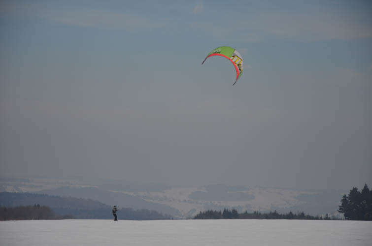
A snowkite on the Wasserkuppe.
There’s lots of snow here this year.
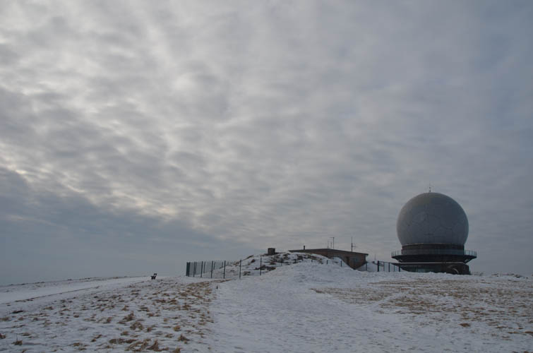
Wasserkuppe summit.
Summit views to the west.
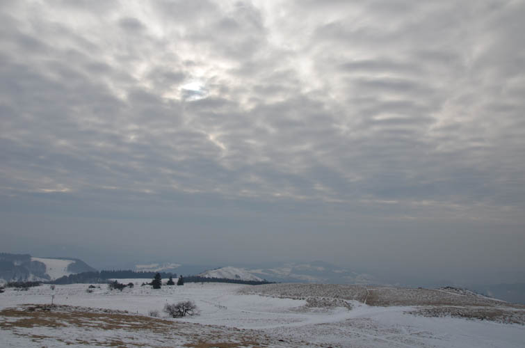
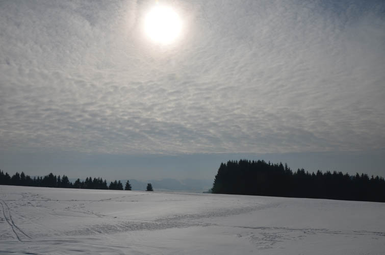
Not much of a view here today.
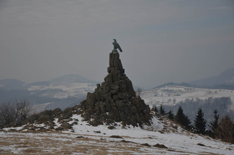
The Fliegerdenkmal, a commemorative monument in honour of the fighter pilots who lost their lives during the First World War (1914-1918). Erected in 1923.
The long trail south towards Gersfeld.
Almost there. Gersfeld is at the bottom of the valley, about 6 km from the top of the Wasserkuppe.