Kananaskis North, AB, Canada
21 May 2017
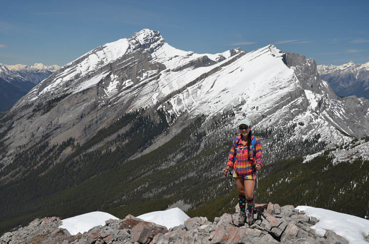
With Wen
Little effort for breathtaking views
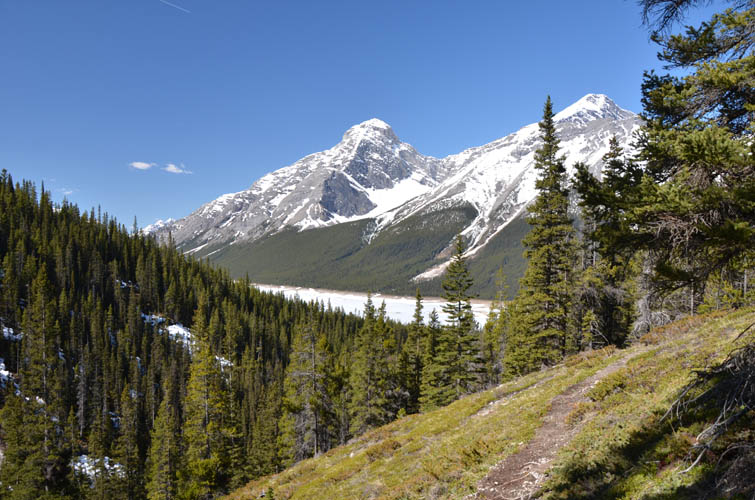
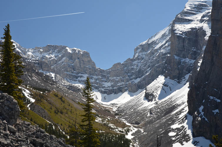
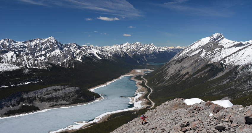
Dwarfed by impressive Mount Sparrowhawk and Mount Lougheed to the east, this little peak offers extraordinary views of Spray Lake and a range of craggy K-Country mountains behind it. Little Lougheed is one of my all-time favourite short hikes with a huge reward-to-effort ratio. It’s also a great shoulder-season or winter objective as most of the route is on west and southwest facing aspects. The preferential exposure to wind and sun often reduces the snow pack on these slopes, but avalanches can of course still occur if conditions are unfavourable.
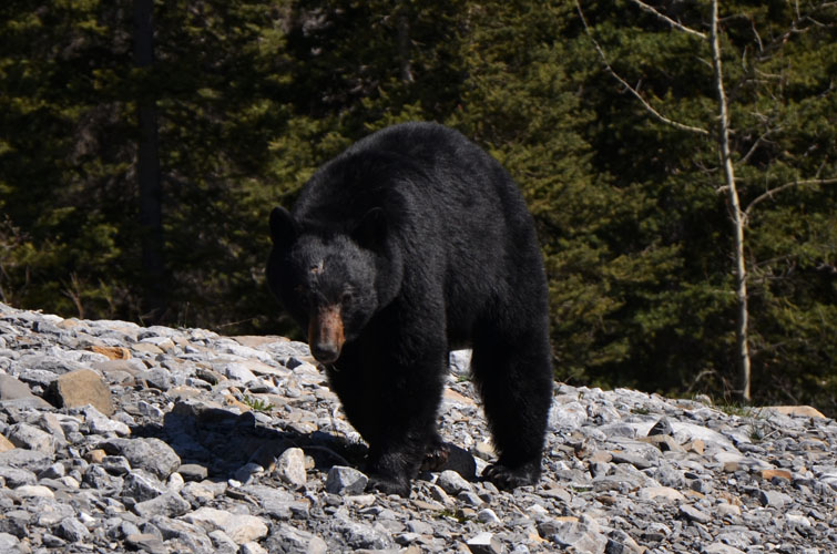
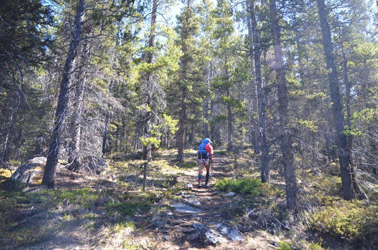
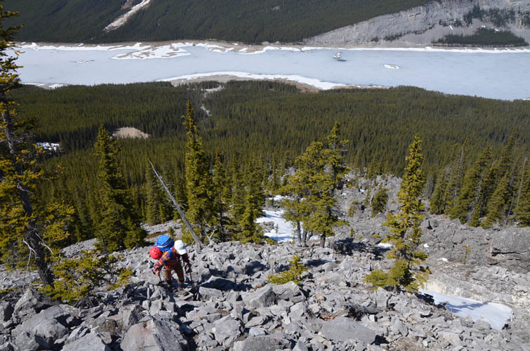
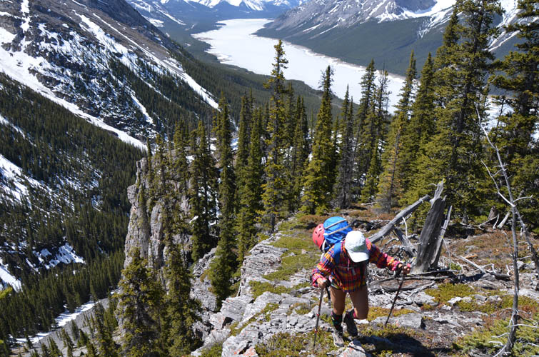
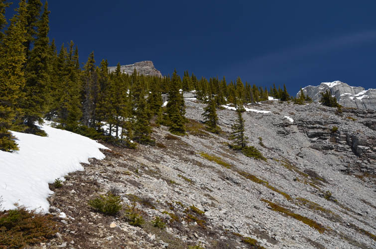
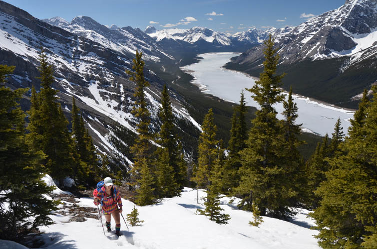
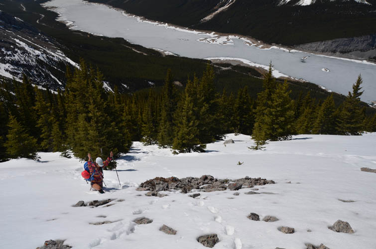
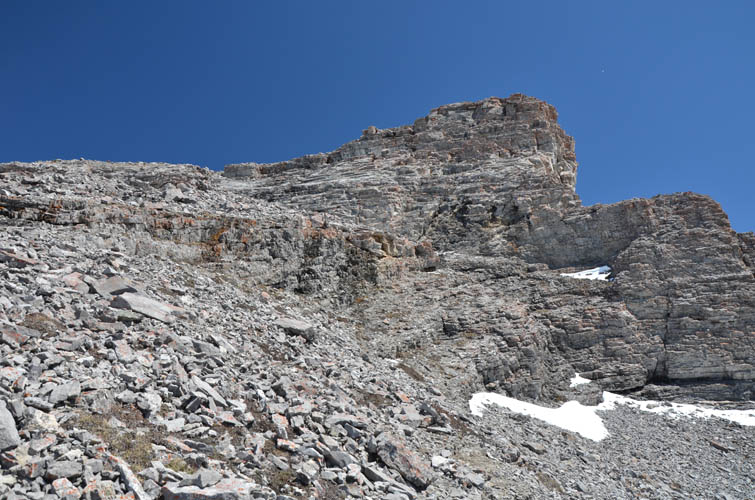
The route starts on Spencer Creek Trail along the east side of the Smith-Dorrien highway. We initially went way too far into the Spencer Creek valley, in part because the trail was so nice, before realizing our mistake and backtracking a few hundred metres. As a result we had to scramble up forest and a talus field before rejoining the normal ascent route to Little Lougheed, which in many places is pretty much trail-less. You simply head up along the crest of the SW ridge, which eventually merges into a wide scree slope above treeline. The scrambling just below the summit was minimal but still requires care because of the loose rock.
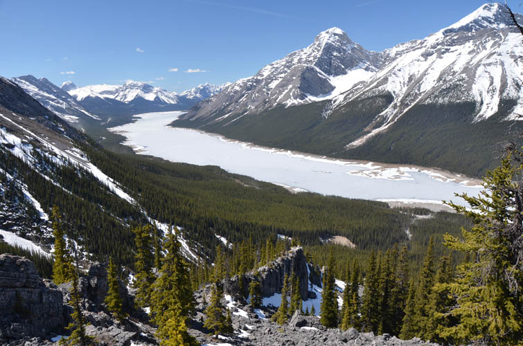
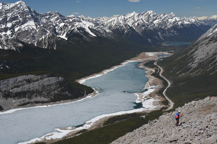
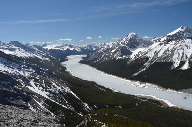
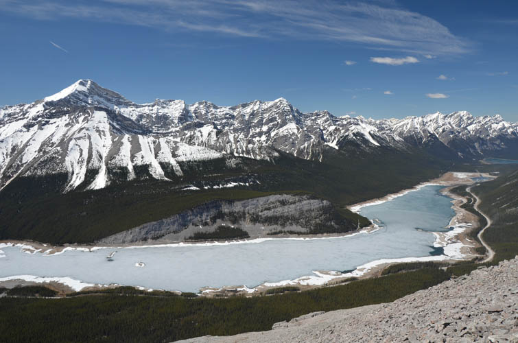
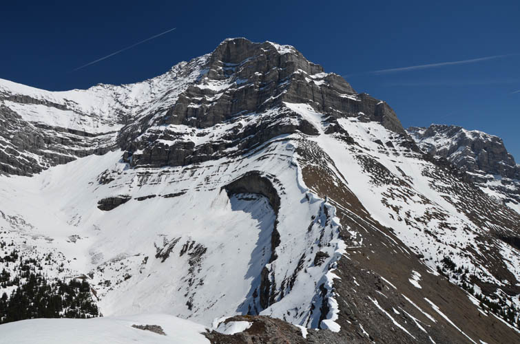
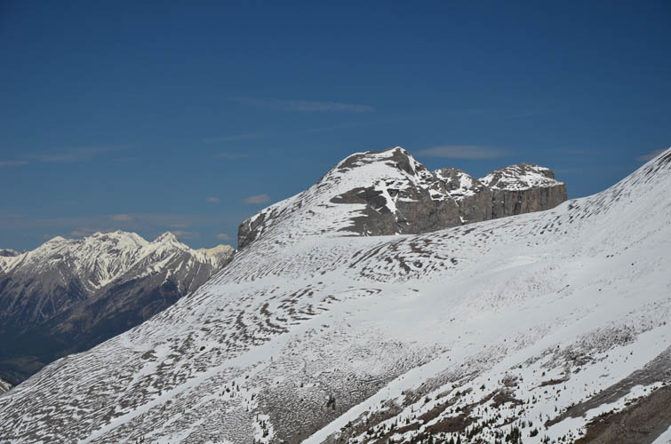
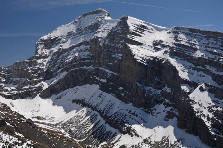
We joined about 10 other people at the top for an absolutely breathtaking summit panorama. The views were just incredible all around and it certainly helped to have clear blue skies on this gorgeous sunny day. Very few mountains – although this is only a minor satellite peak really – offer this much value for so little effort. Directly to the east is the dramatic west face of Mount Lougheed proper, flanked to the south by Mount Sparrowhawk and to the north by Lougheed I. To the west, boomerang-shaped Spray Lake forms a magnificent contrast to the many handsome peaks behind it, including Mount Nestor and Old Goat Mountain at centre stage. What a fantastic place to while away on a sunny day!
Patches of soft snow just above treeline made for some fun sliding on the way down. We stuck to the correct route on descent, although at one point we briefly got confused in the forest where the “trail” seemed to just disappear. No doubt with the increasing popularity of this peak more and more people will be tramping up its slopes and a trail will eventually form, as has happened on so many other mountains in the Rockies in the last few decades. This is certainly one I would do again!
|
Elevation: |
2485 m (my GPS) |
|
Elevation gain: |
890 m |
|
Time: |
5.5 h |
|
Distance: |
7.0 km |
|
Difficulty level: |
Easy (Kane), T3 (SAC) |
|
Reference: |
Bob Spirko |
|
Personal rating: |
4 (out of 5) |
NOTE: This GPX track is for personal use only. Commercial use/re-use or publication of this track on printed or digital media including but not limited to platforms, apps and websites such as AllTrails, Gaia, and OSM, requires written permission.
DISCLAIMER: Use at your own risk for general guidance only! Do not follow this GPX track blindly but use your own judgement in assessing terrain and choosing the safest route. Please read the full disclaimer here.