Yoho National Park, AB/BC, Canada
31 July 2022
With Alan Keller
Fun difficult scramble and short trip with excellent views
Divide Peak is a small officially named summit in Yoho National Park straddling the provincial boundary between Alberta and BC. I think I might’ve never noticed it if it wasn’t for its inclusion in the third edition of Alan Kane’s “Scrambling in the Canadian Rockies” book. And I might’ve never climbed it if it wasn’t for an invite by my buddy Alan Keller. Not only does he have a similar name to Alan Kane, the grandmaster and pioneer of scrambling, he is also equally inspirational. My friend has managed to do something most of us mountain lovers only dream of – successfully climbing the Seven Summits, including Denali (N America), Vinson (Antarctica), Carstensz Pyramid (Australia-Oceania), and of course Everest.
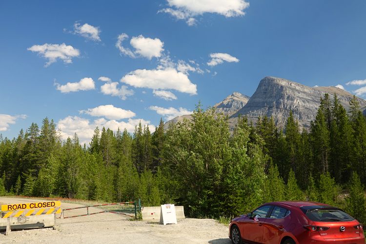
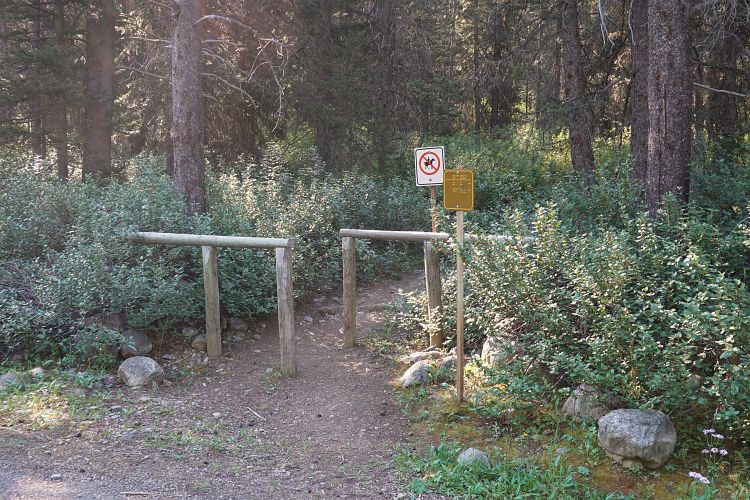
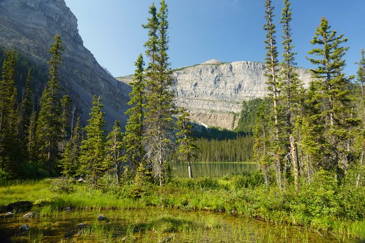
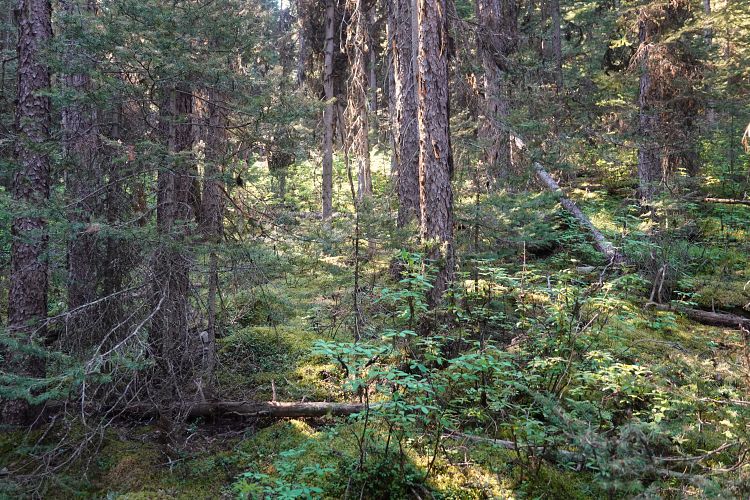
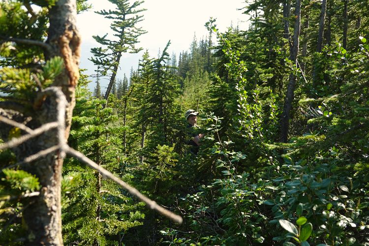
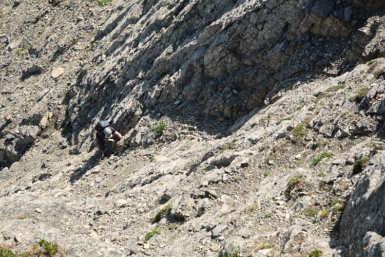
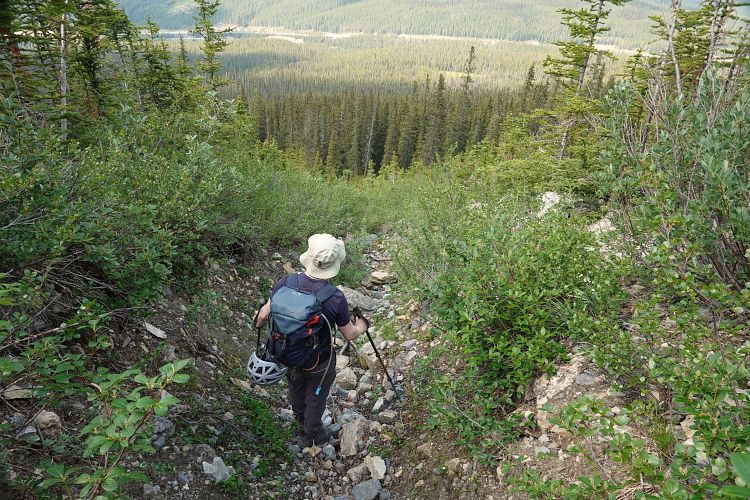
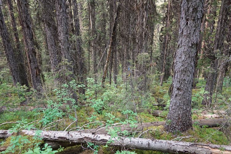
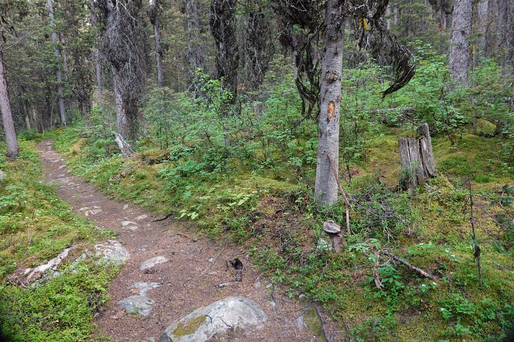
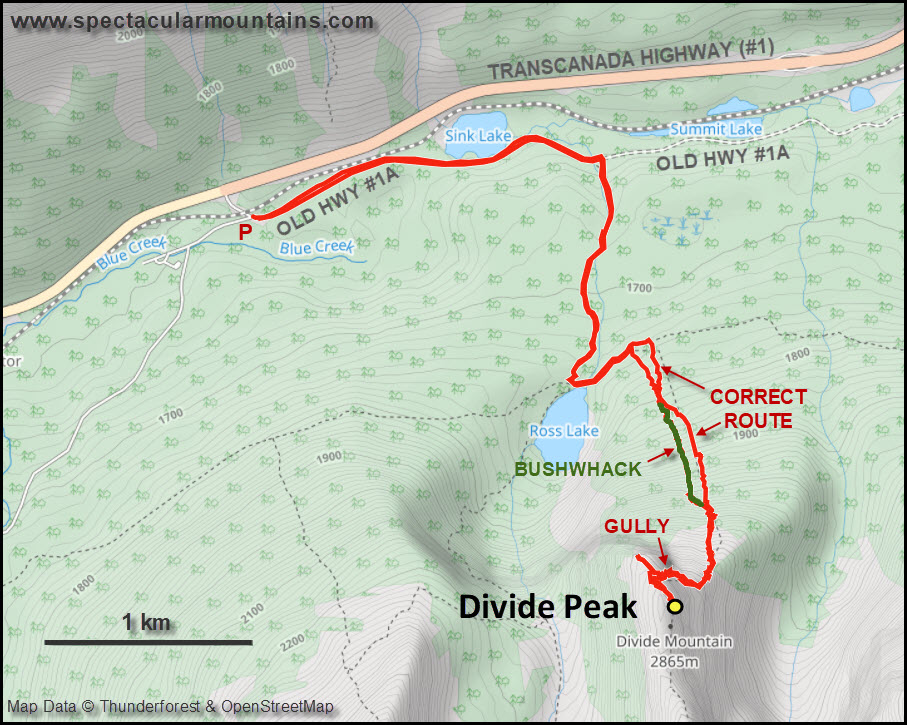
Today’s objective, though not quite as impressive, was a thoroughly enjoyable climb. Well, almost “thoroughly”. We did make one mistake which cost us a lot of unnecessary energy and time. The initial approach along the road (old highway 1A), the trail to and beyond Ross Lake, and the initial easy bushwhack all went smoothly. However, we did not find the correct drainage right away that Kane describes in his book, and we made the mistake of not looking for it long enough. Instead, we basically bushwhacked our way up parallel to the drainage, probably only about 20-30 m west of it. What a nightmare! Dense pine trees with a tangled network of stubborn underbrush on an unrelentingly steep slope made our lives miserable. To make matters worse, Alan also stepped into a wasp’s nest and got stung, fortunately without serious reaction. Higher up we finally found the drainage just where it was about to end… oh well. Lesson learnt, we certainly made no such mistake on the way down!
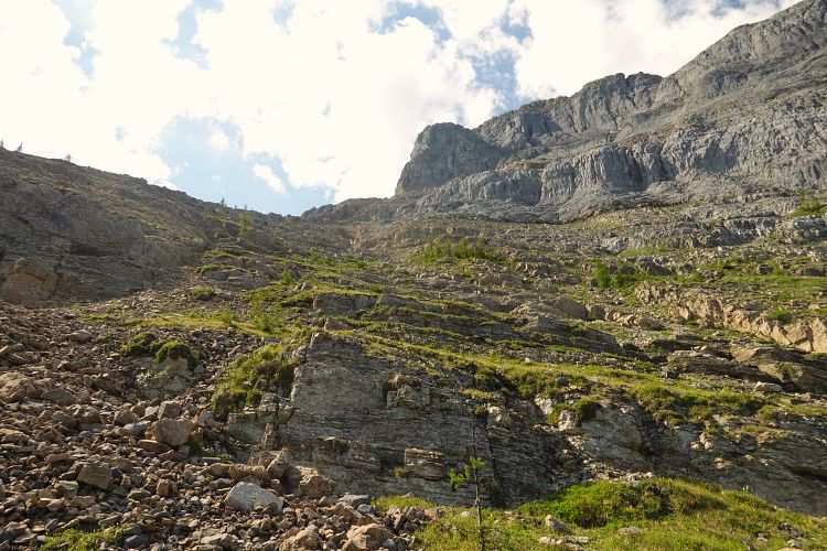
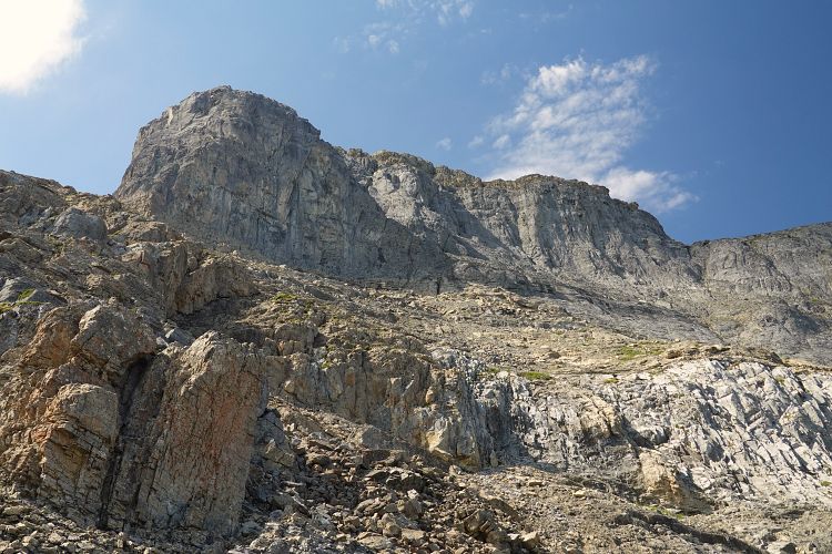
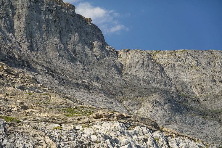
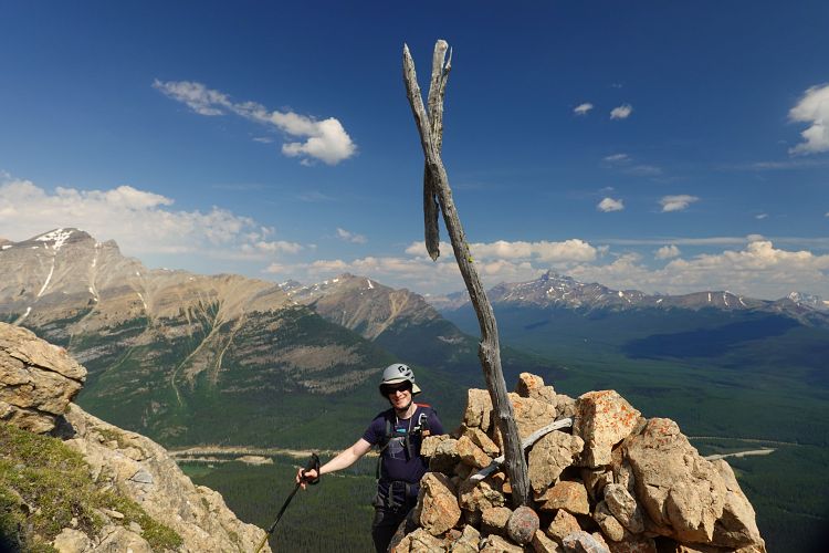
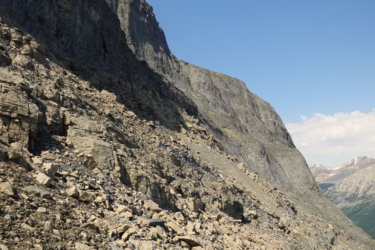
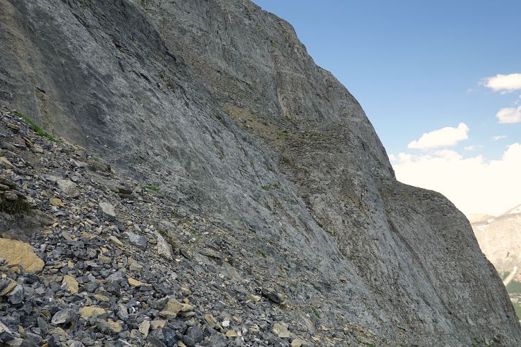
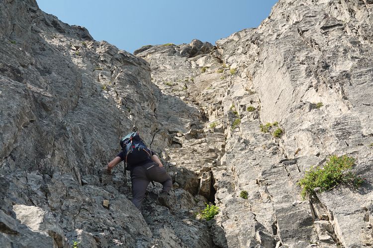
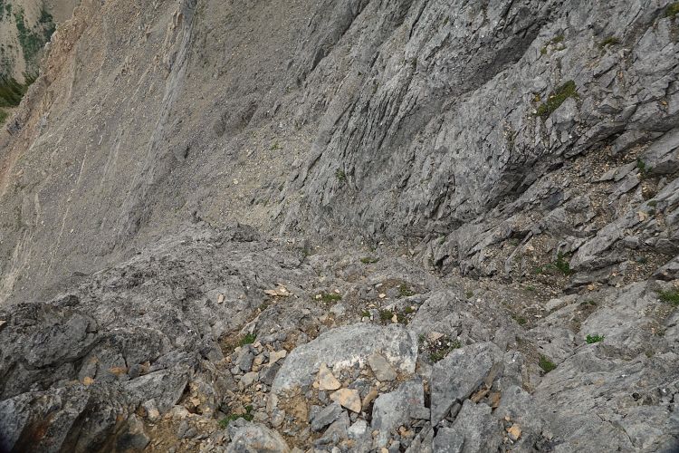
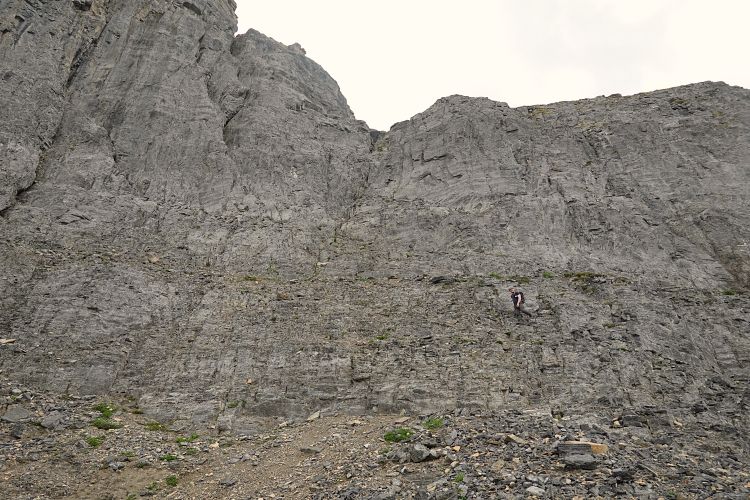
Above the drainage it’s steep hiking to the northeast buttress marked by a large cairn with an old wooden cross. The traverse across scree and boulders to the start of the crux gully in the middle of the peak’s north face was surprisingly quick. The bottom of the gully was marked with a small cairn and pink flagging. People obviously do scramble Divide Peak from time to time, but other than a few cairns and flags there was no evidence of regular visitors and we were a bit surprised by the absence of boot prints.
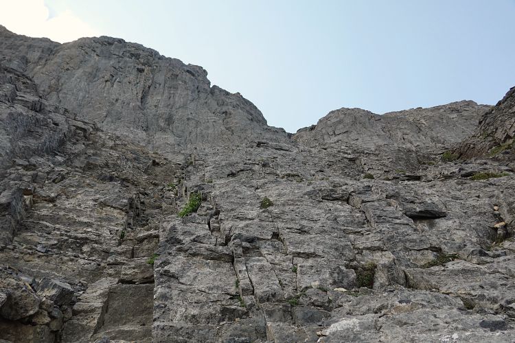
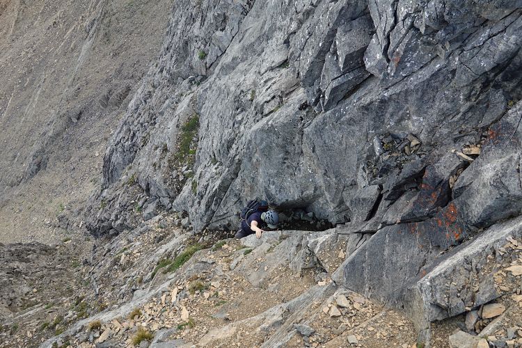
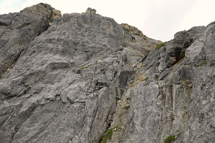
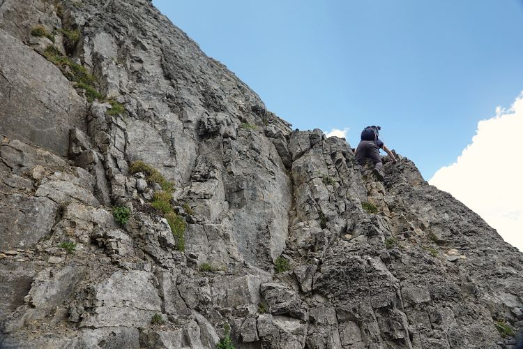
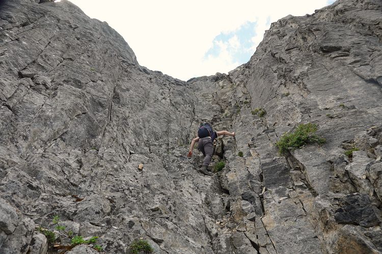
Both of us really enjoyed going up the gully. While the bottom half is more in the moderate realm, the upper section can certainly be considered difficult scrambling and this very much holds true when downclimbing it! There are lots of small ledges and holds, not all of them reliable, but generally plentiful enough to allow for slow, careful, and safe progress. At the very top of the gully we went straight up in some sort of chimney feature (perhaps the one mentioned in Kane’s book), which was near vertical but with solid holds. There is a small cairn on top just where you emerge from the chimney.
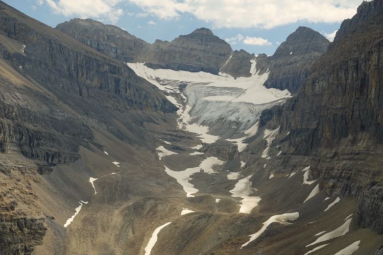
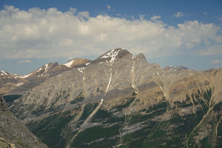
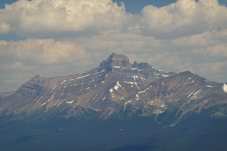
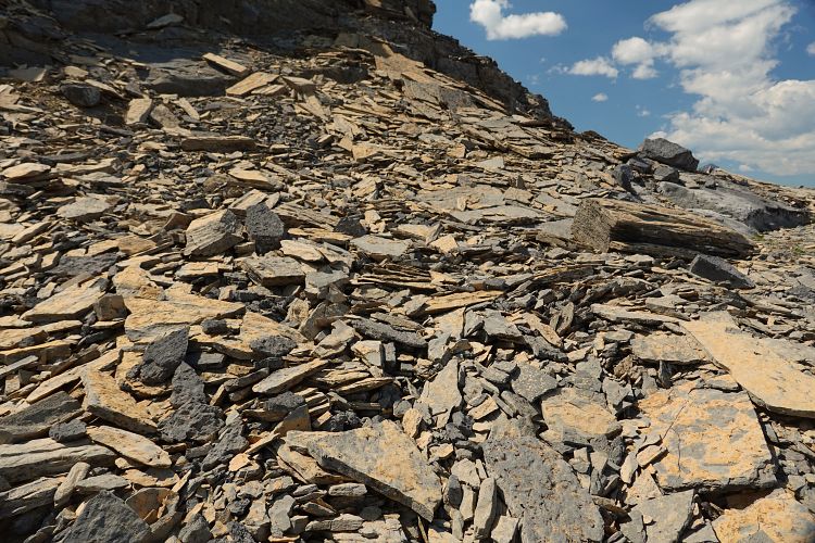
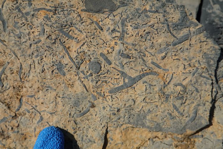
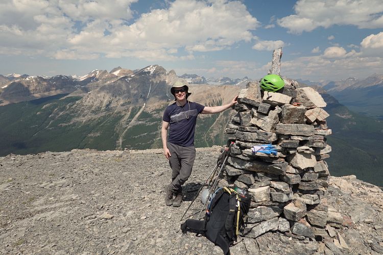
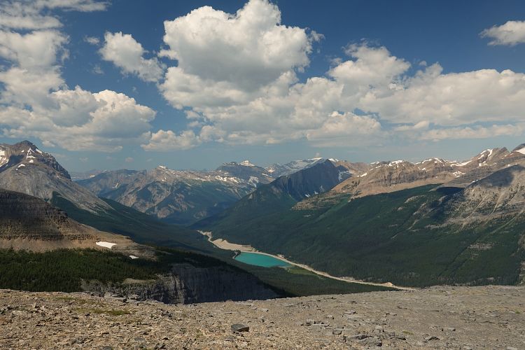
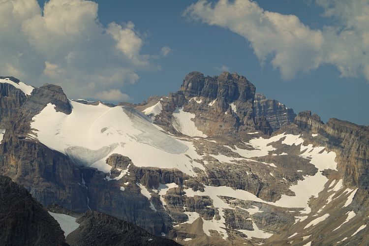
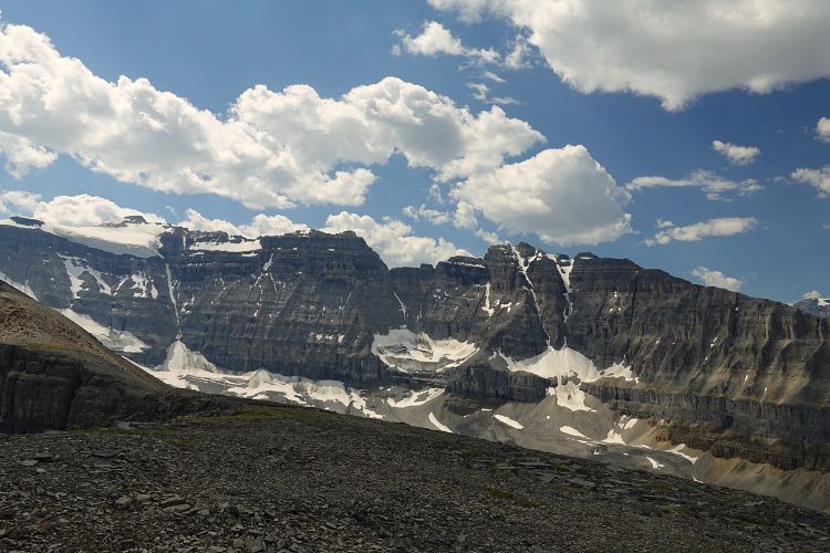
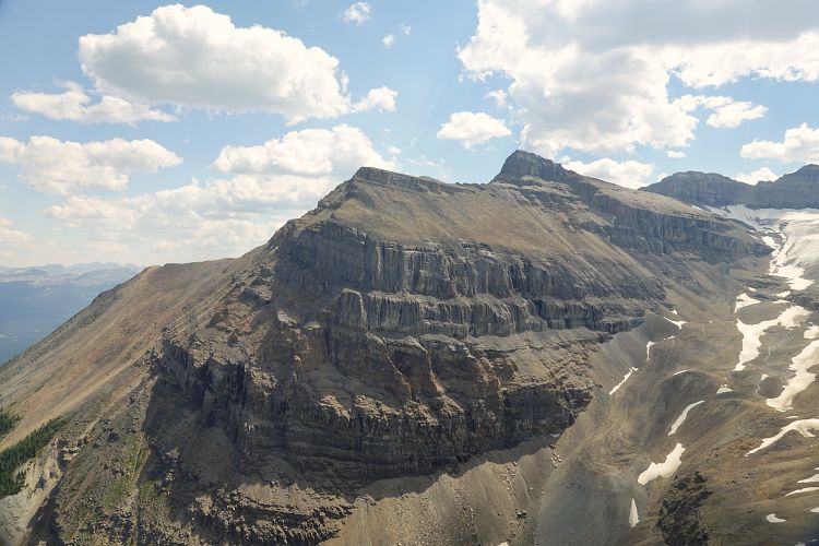
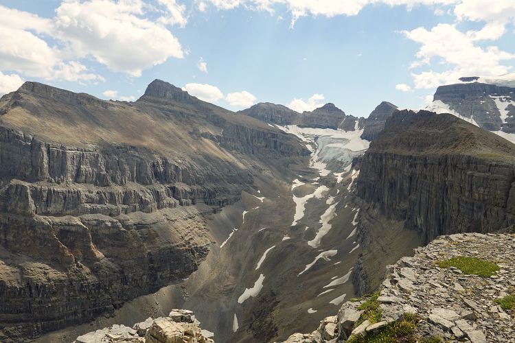
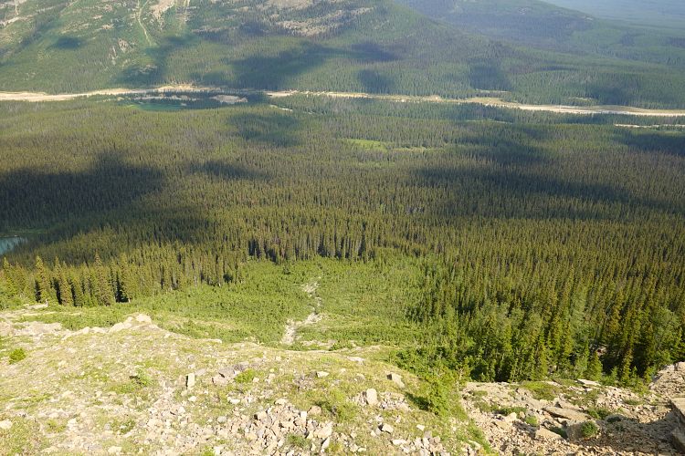
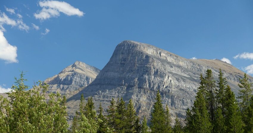
Beautiful slabs of yellow-brown shale with an abundance of worm-like trace fossils can be admired on the flat terrain above the crux. From here we easily walked up to the massive summit cairn in about 10 minutes. Despite a relatively low elevation of just over 2500 m, Divide Peak offers impressive views of several glaciers hanging off loftier peaks nearby. Mount Niblock and Whyte are right across a large scree-filled basin, with glacier-fringed Popes Peak and Narao Peak next door. We also got a good look at Mount Bosworth to the north; you can see the entire ascent route from here very clearly.
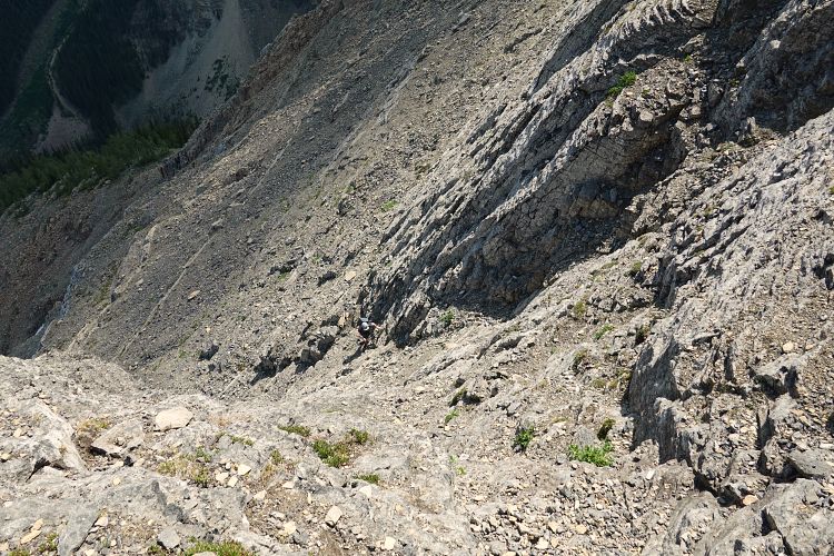
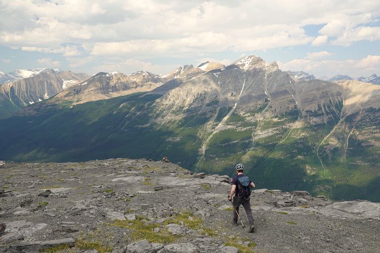
Summit breaks are so much more enjoyable when you don’t have to worry about the weather, freezing winds, or annoying bugs, and we were fortunate to have none of these today. After an extended stay we headed back down to the crux gully. In an effort to avoid going back down the uppermost vertical chimney, we found an easier section on skier’s left about 10 m away (spot now marked by a cairn). There are rubble-strewn ledges here that we used to climb down and sideways back into the centre of the gully. It was still quite exposed and not easy, requiring us to check each hold and sometimes clear ledges of debris. The remainder of the gully was full-on difficult downclimbing, most of it facing the rock, the lower part sideways or facing outward. There is a serious risk of rock fall when messing about here, so helmets are a must and you certainly don’t want other parties above or below you.
I had brought approach shoes for the crux, which I think helped a lot and made me feel more confident on the smaller holds. Once out of the gully, I changed back into my big hiking boots and we quickly made our way back down, making absolutely sure we would follow the drainage all the way to its end this time. It was so much easier and faster than the forest next door! Where the drainage peters out we even found a variety of blue, yellow and pink flagging guiding us back to the trail to Ross Lake.
A very enjoyable and quick difficult scramble, just make sure you find that drainage!
NOTE: This GPX track is for personal use only. Commercial use/re-use or publication of this track on printed or digital media including but not limited to platforms, apps and websites such as AllTrails, Gaia, and OSM, requires written permission.
DISCLAIMER: Use at your own risk for general guidance only! Do not follow this GPX track blindly but use your own judgement in assessing terrain and choosing the safest route. Please read the full disclaimer here.