Abha, Saudi Arabia
2 April 2019
Solo
Awesome on-trail hike to Saudi Arabia’s second highest summit
Until recently Jabal Sawda (variant spelling: Sodah, Sooda, Souda) was considered Saudi Arabia’s tallest mountain. This honour now goes to Jabal Ferwa, which only half a year ago was confirmed to be a few metres higher. The Gilbertson brothers, two Americans who try to climb every high point on Earth, established the new elevations using high-resolution satellite data in August 2018. My own GPS measurements on both Sawda and Ferwa also confirmed this.
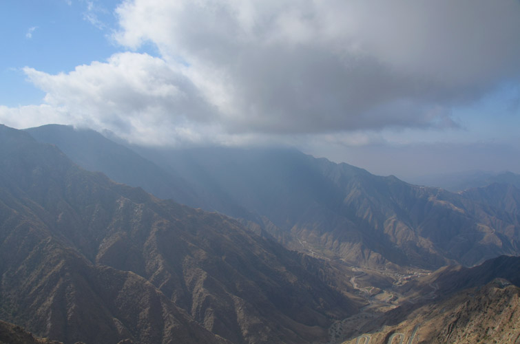
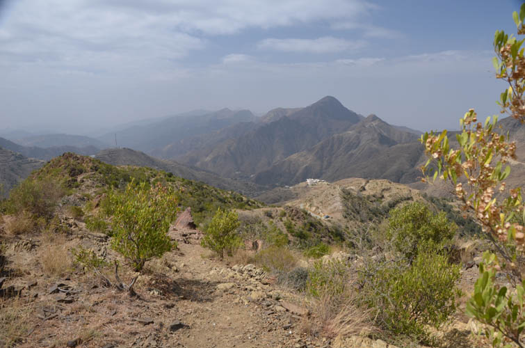
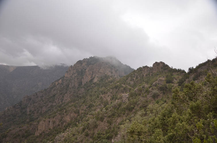
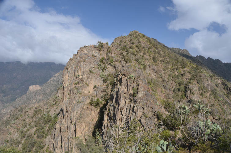
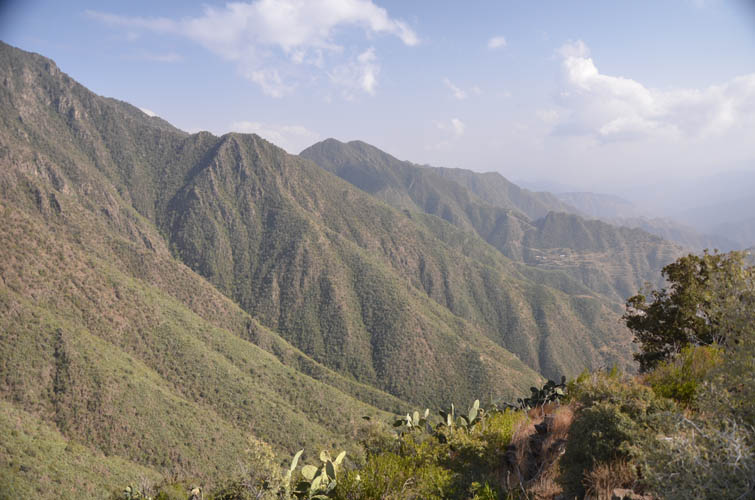
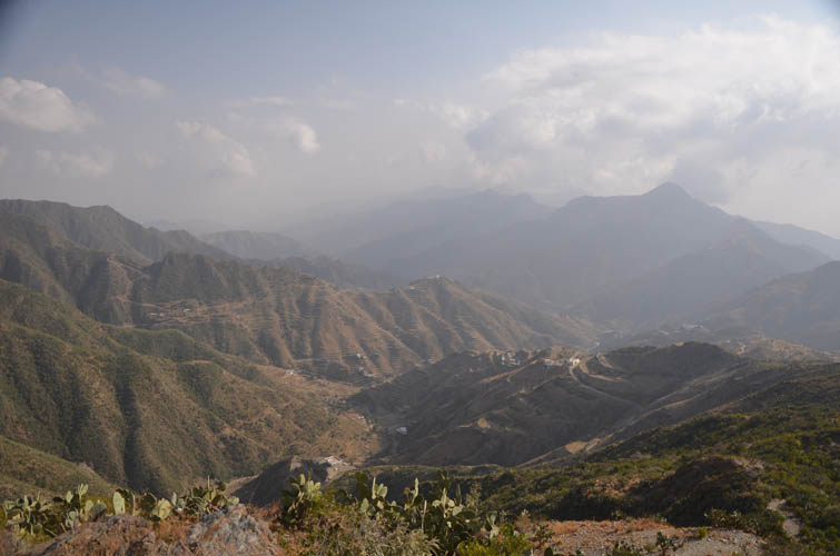
Jabal Sawda is a broad mountain sitting at the edge of a spectacular escarpment that separates the high continental plateau with the city of Abha from the coastal plain to the southwest that stretches all the way to the Red Sea. Moist air coming from the sea tends to rise up along this escarpment, often shrouding the top in a veil of dense clouds. On a sunny day the views from the mountain are absolutely magnificent and I was lucky to have mostly fair weather during my hike, although at the summit I was surrounded by thick fog.
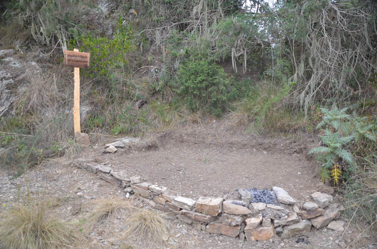
The trip didn’t get off to a good start. The night before, after having climbed Ferwa, Natfa and Mushrif, I had driven my little rental car to the town of Sawda in order to find a place to camp near the mountain. I arrived late at night, and without having a clue of where to look, I decided to drive up the mountain to the end of a road where some kind of visitor park was located. The gates to the park were shut with not a soul to be seen. Fortunately, I found a fairly extensive but completely deserted picnic area in a forest nearby. I parked my car and set up my tent. What an eerie atmosphere… It was pitch black, cold, and clouds were moving in and out fast through the trees. Dogs were barking nearby and I could even hear some baboons nearby.
At around midnight, just as I was about to fall asleep in my tent, a heard a car slowly pulling up. It stopped right in front of me, shining its bright headlights into my tent. I quickly put on my pants and got out, hiking pole in hand just in case and somewhat apprehensive of who could be coming by here so late at night… Thank god it was only a security guard who wanted to know what I was doing here. After a few friendly-sounding words (he didn’t speak English), he was off and I crawled back into bed. Half an hour later the same thing happened again – this time, two cars showed up. Man, I’m not going to get any sleep tonight! Once again I got dressed and stepped out of my tent, this time to find two police officers asking me the same questions again. Thankfully, one of them spoke good English and after a quick inspection of my car and tent, they wished me a good night and good luck on my hike tomorrow. A western tourist sleeping in a tent by his rental car in this remote corner of the kingdom is obviously not a sight they’re used to, and quite understandably so. I think they were as amused as they were confused by me, and I was pleased to see that once again the officers conducted themselves in a most professional and polite manner – very different from what I’ve experienced in many other countries.
After such a short and turbulent night, I woke up pretty dopey and didn’t really feel like going for a full-day hike the next morning. Dogs were roaming around me while I was sitting on a rock having pita bread and Nutella for breakfast, and even a troop of baboons rushed through the trees nearby, to the frantic barking of the dogs around me. Eventually it got too cold and uncomfortable up here and I decided to pack up and start driving to the trailhead, about half an hour in the valley below.
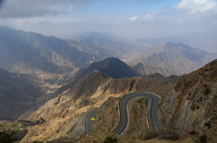
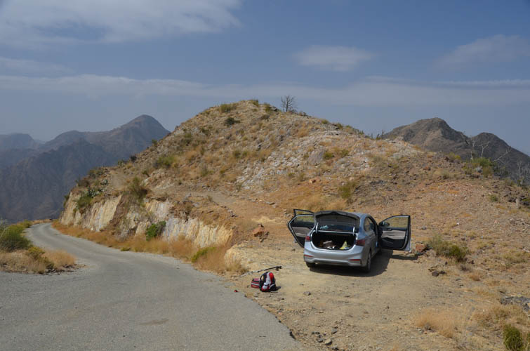
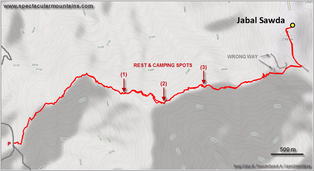
The drive from my camping site to the trailhead was nothing short of breathtaking and worth the trip in itself! I first drove on highway 214 along the edge of the escarpment, stopping at several lookout spots with fantastic views of the ridges and valleys below me. Picnic areas have been built along the side of the road overlooking the steep slopes, also a favourite hangout of hundreds of baboons who come to feed off the garbage left behind by visitors. An excellent road (highway 2442) then descends into the valley in a series of switchbacks and down to the town of Al Jarf. About half way down I turned left (south) up a narrow asphalt road and drove to a cluster of mountain villages, regaining about 600 m of elevation in the process. Although I could’ve started all the way at the bottom in the valley (there’s also a trail here), I figured 1300 m of elevation gain was going to be enough for today considering my late start and how tired I felt from last night.
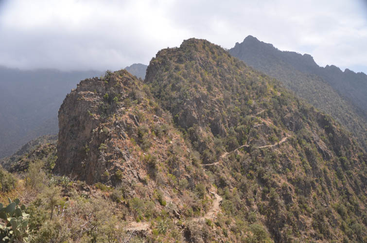
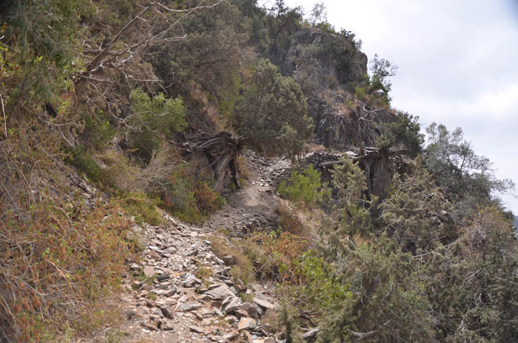
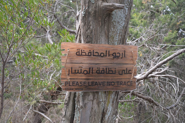
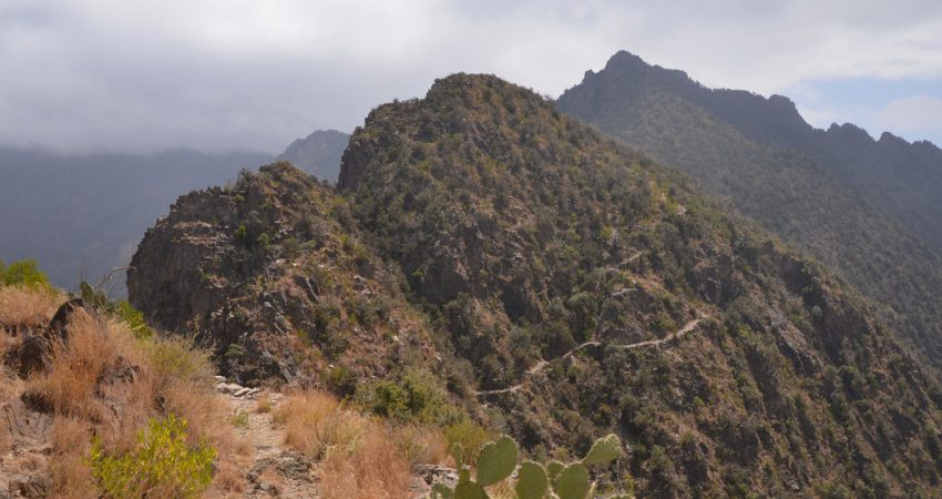
Jabal Sawda is one of the rare mountains in Saudi Arabia that actually has a hiking trail running from the valley down the escarpment on its western side all the way to the summit. The trail is centuries old and used to be frequented by traders linking up the coastal plains with the high plateau above before modern roads were built. Even today there are still some villagers that use the path to get to work: I ran into one fellow on my way down who does the trip every day from his village in the valley – more than 1000 m of elevation up and down! The Saudi Hiking Club has put up some trail markers in a few places and there are indeed occasional hiking groups that use the trail as well, although I didn’t see any today.
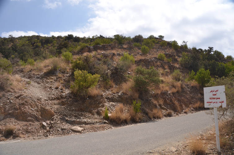
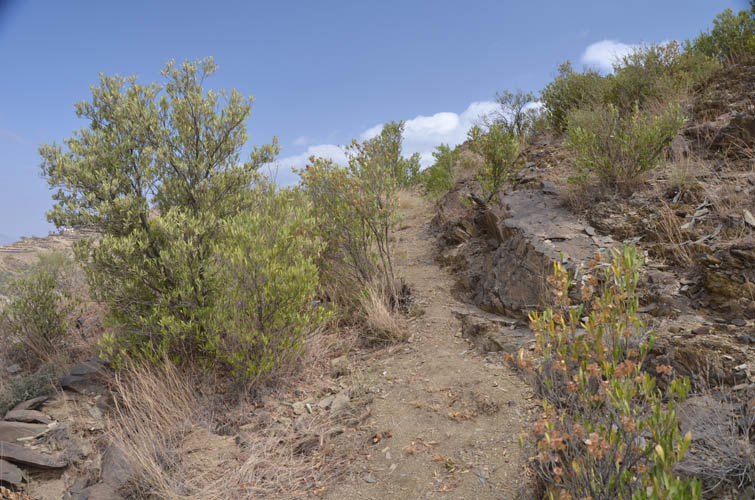
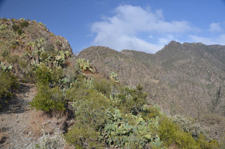
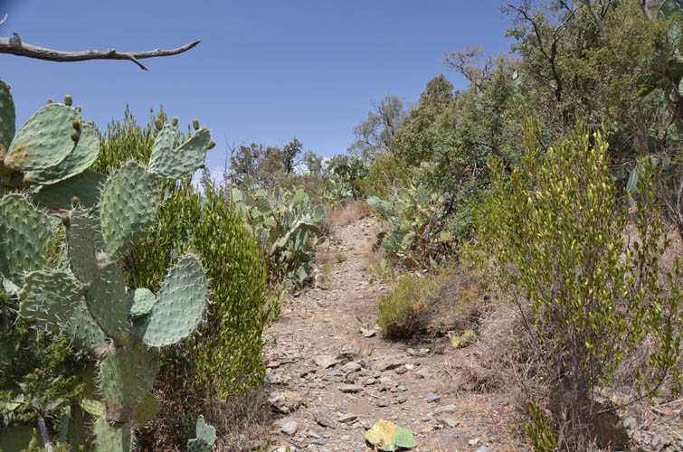
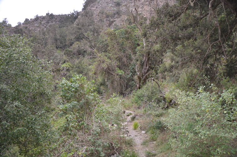
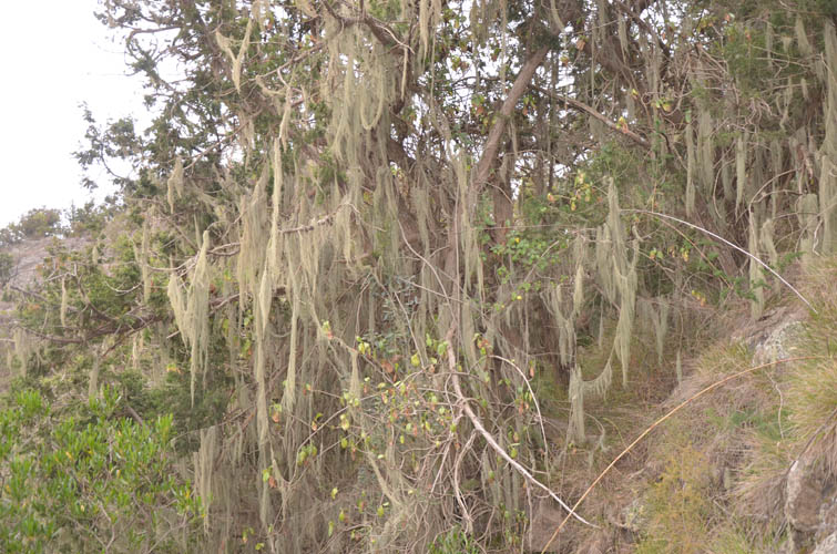
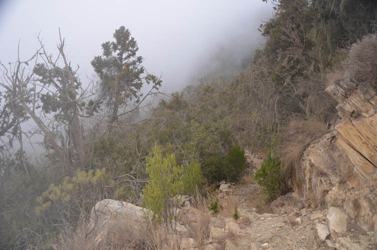
I found the trailhead with the help of a friendly villager; it’s otherwise unmarked and easy to miss so a GPX location is a good idea. Rising steeply on a broad ridge, the trail is initially delineated by rocks on the sides to make sure one doesn’t stray off into the bush. Higher up another trail joins and the path gets more well-defined as does the ridge itself. Sections of the route have been fortified with branches and stones to limit exposure. Overall the trail is in great condition, weaving its way from one side to the other of the increasingly sharp ridge, with plenty of small ups and downs along the way. It was really quite amazing to experience the change in climate and landscape as I gradually went higher, from arid and hot to sub-tropical and humid. While I was hiking through barren shrubs on dry soil at the beginning, the vegetation became increasingly lush and green as I went up, with wafts of clouds moving through the trees that in parts almost felt like a jungle. It also got a lot cooler as I came closer to the summit.
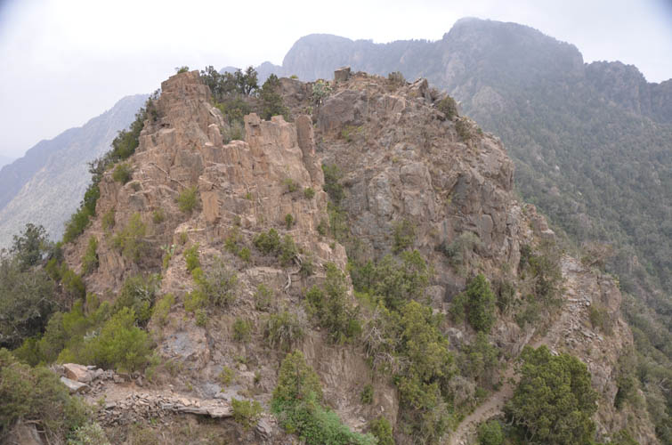
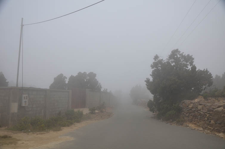
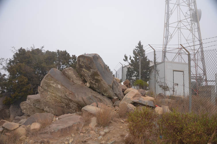
Sadly, the summit mass of Sawda is a far cry from the feeling of remoteness and scenic beauty one can experience on the trail up. The park near which I had camped the night before occupies part of it (complete with cable car, hotel and restaurants), with other parts taken up by residential houses, fields and a telecommunications station at the very top. Reaching the top of Jabal Sawda was thus a highly anticlimactic experience as my trail abruptly ended at a small asphalt road. I soon got lost in a network of small roads which didn’t show up on my map, and dense fog made it impossible to see where I was headed. The houses and streets were strangely empty; I suspect this is more of a temporary resort town for rich Saudis escaping from the stifling summer heat elsewhere. After some erring around I eventually found the summit itself, a fenced area with a radio tower in the middle. There were two fences and thankfully the outer fence was open and the highest point, a large elongated boulder, was right behind it.
It was cold, humid and extremely foggy when I approached the summit, and sparks were coming off the fence when I opened it, there was literally electricity in the air! I scrambled up the boulder and had to put on my jacket, hat and gloves to be able to enjoy my lunch somewhat. At least it wasn’t windy! Unsurprisingly, I had absolutely zero views with all the clouds around me. No point to linger then, I thought, and after finishing up my food and taking some GPS readings, there was nothing left to do but to head back down the same way.
About a quarter of the way down the trail the clouds disappeared and I was able to take off my layers and enjoy some sun and good views again. Shortly after, just as I was trudging down in auto mode all lost in my own world, a person suddenly showed up behind me. Of athletic build and much younger than me, he was moving down the trail at lightning speed, carrying nothing but a small bottle of water in his hand. He said he was working up on the mountain and returning to his village somewhere near the trailhead, and he does this every day. Talk about getting some exercise on your daily commute… incredible!
When I got back to my car I felt immensely happy to have experienced this beautiful and entirely different landscape not normally associated with a place like Saudi Arabia. Despite the ugly summit and lack of views at the top, it had been a fabulous hike on an excellent trail and I was glad I had overcome my morning sluggishness and completed this trip.
|
Elevation: |
2996 m (my GPS), 2998.7 m (Gilbertson, 2018) |
|
Elevation gain: |
1290 m |
|
Time: |
6.5 h |
|
Distance: |
15.4 km |
|
Difficulty level: |
Easy (Kane), T2 (SAC) |
|
Reference: |
No info was available to me prior to trip |
|
Personal rating: |
4 (out of 5) |
NOTE: This GPX track is for personal use only. Commercial use/re-use or publication of this track on printed or digital media including but not limited to platforms, apps and websites such as AllTrails, Gaia, and OSM, requires written permission.
DISCLAIMER: Use at your own risk for general guidance only! Do not follow this GPX track blindly but use your own judgement in assessing terrain and choosing the safest route. Please read the full disclaimer here.