Najran, Saudi Arabia
29 March 2019
Solo
Empty mountains and incredible hospitality
This was another huge adventure. Just like the day before when I found myself hiking up Raoum near Najran, Jabal Anthari was another good example of how the journey surrounding the climb can be at least as exciting as the climb itself.
After spending several days in the city of Najran in the far south of Saudi Arabia, I decided to head northwest and explore the Sarawat Mountains. This area was completely unknown to me, so I was very excited to see how far I was going to get in my endeavours to explore these mountains and do some hiking here. I had marked the approximate location of potential climbs and objectives on my hiking app, which only shows a very general map without any trails or side roads, and most peak names were missing. Because of this lack of detail, I knew I would have to consult the locals to find out more.
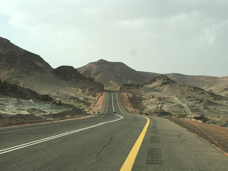
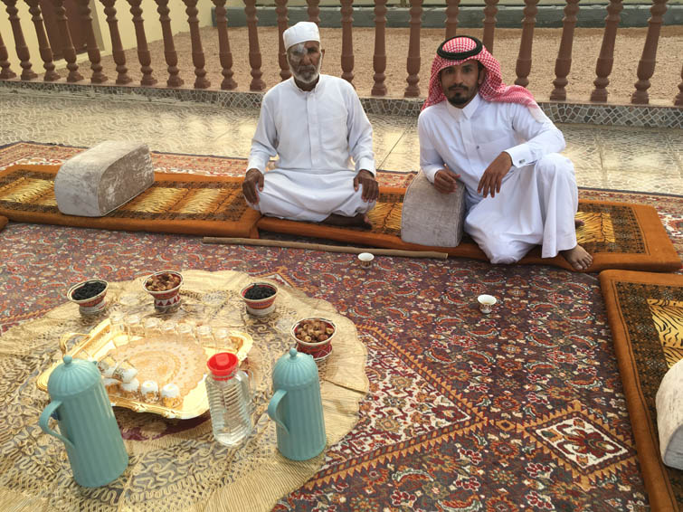
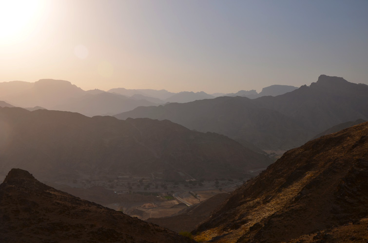
The drive from Najran is absolutely beautiful with vistas of rugged mountains all around. The roads are excellent as in most parts of the kingdom and there wasn’t a lot of traffic, plus no tourists at all – just the way I like it J. As I was coming closer to my first objective in the late afternoon – its name still unknown to me then – a car passed me, stopped a few hundred metres ahead on the road, and a guy got out and flagged me down. “Where are you from? What are you doing here? Would you like to come with me to my house and have dinner?” asked the young Saudi in excellent English. His name was Mohamed, a very friendly and affable pharmacist from Najran who was on his way to his home town of Habuna where he wanted to visit his parents. Habuna was only about half an hour north of the mountain I wanted to climb and I really didn’t want to miss this great opportunity to experience a traditional Saudi dinner out here, so I happily accepted the invitation.
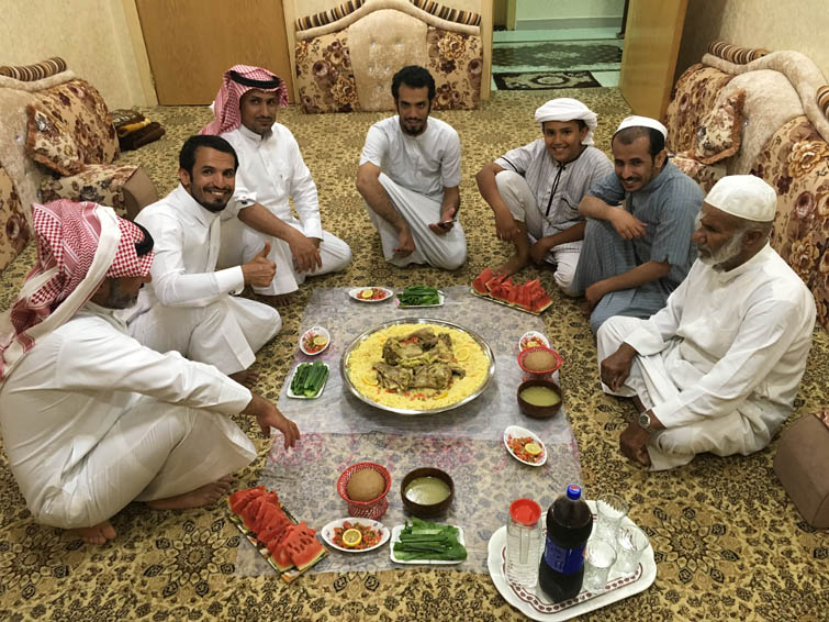
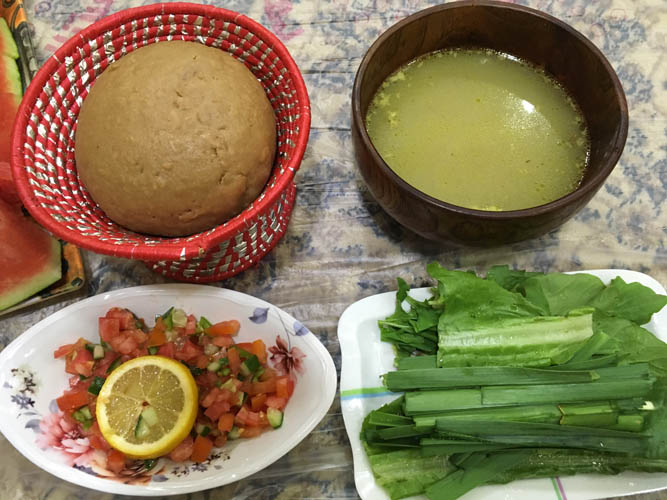
By the time we got to Habuna it was already 6:30 PM and dark outside. His father, brother and nephews were relaxing on the big patio in front of their beautiful house (his father owns two exact same houses, built side by side for each one of his wives), drinking tea and nibbling on fresh dates, raisins and almonds. We sat together on a big carpet with comfortable pillows and chatted, sipping on small cups of green cardamom-infused coffee. Neighbors and friends showed up, join us for a bit to say hi and meet the stranger, and left again as is the custom in this part of the world. This is of course a male-dominated society and I never got to see any women. Even when dinner was ready, it was served in a special room inside the house before we entered and I never had an opportunity to thank the ladies who prepared everything for their wonderful cooking. A young goat had been slaughtered just for me and it certainly was a feast! Piles of meat and bones, the goat’s head, plus organs and intestines were all arranged on a huge platter of rice on the floor. This was served with salad, a kind of soft doughy bread, meat broth, and Pepsi for drinks. Everyone huddled around the big tray and dug in, using their right hand to skillfully scoop up the rice and tear off the meat. I was anything but skillful at eating with one hand, so my hosts would frequently throw a good-sized piece of meat towards my corner on the tray to help feed me. Fresh melon slices were served for desert, followed by another round of tea and dates.
I felt overwhelmed and honoured by the spontaneous hospitality offered to me by Mohamed and his family and thanked them for the honour of being able to join them when we left around 11 PM. Mohamed still had to drive back to Najran that night, so I decided to find a quiet pull-out near the road in the mountains to put up my tent and camp for the night.
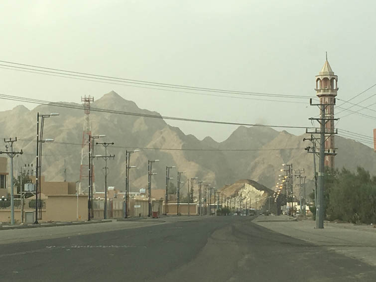
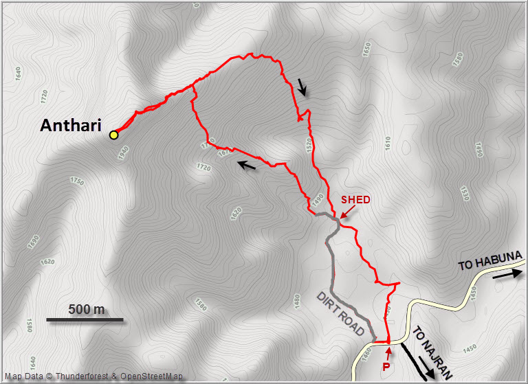
The next morning I woke up a little tired from all the excitement last night but ready to take on the daunting-looking mountain I had marked on my map. Mohamed had never been up there but told me its name: Jabal Anthari, otherwise also known as Al Anthari or Jabal Antar. I parked my car at the intersection of the Najran road and Habuna road, about 2 km north of Wadi Halal. While I was getting geared up almost every car that passed by stopped and someone would ask me if I needed help or what I was doing here (mostly in Arabic, so the conversation was usually short).
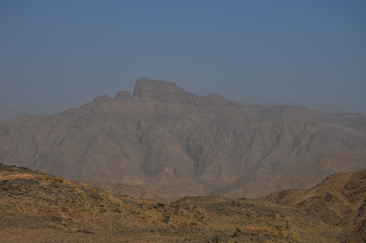
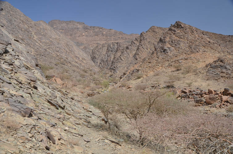
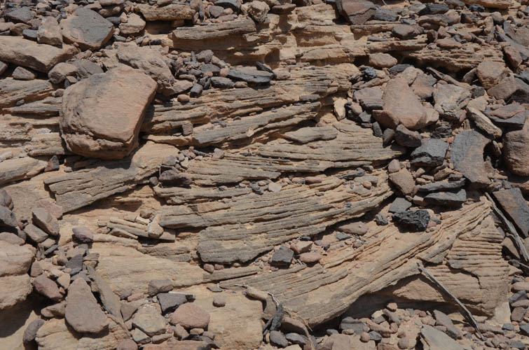
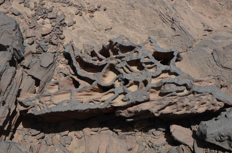
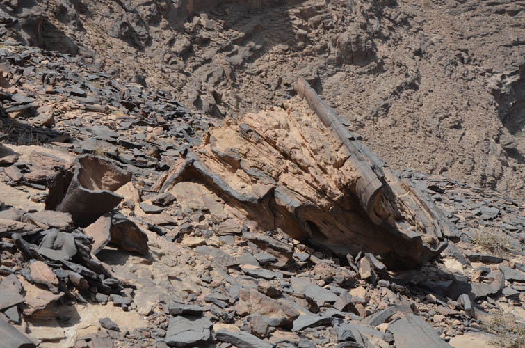
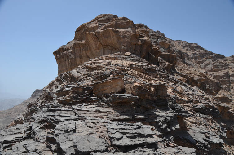
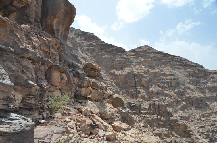
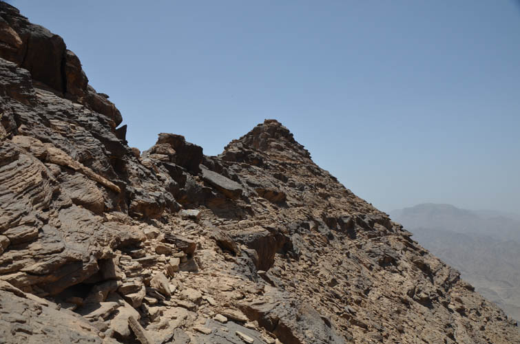
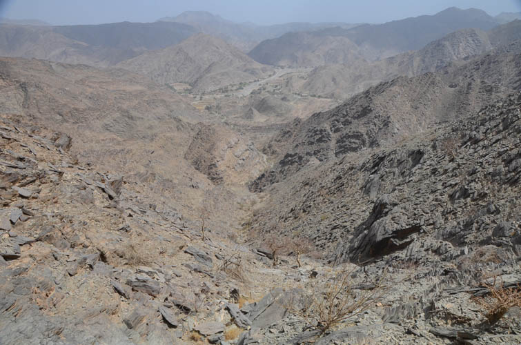
From the road below I could clearly see a summit cairn at the top, but the east wall I was facing looked steep and intimidating while the south side was a vertical drop off flanked by slender pinnacles and notches. The north ridge appeared to offer the easiest way up with its relatively gentle slope, but the terrain between the trailhead and the ridge was messy with lots of minor ridges and valleys. The geology in this area comprises mostly gneisses and schists, which makes the rocks look craggy and crumbly. These metamorphic rocks are topped by layers of sandstone in the upper parts, which tend to be more compact and solid rocks that often form steep cliffs and flat plateaus.
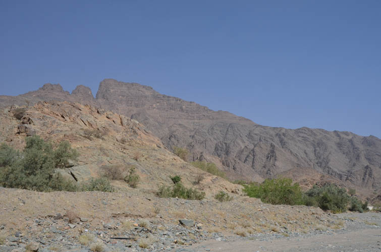
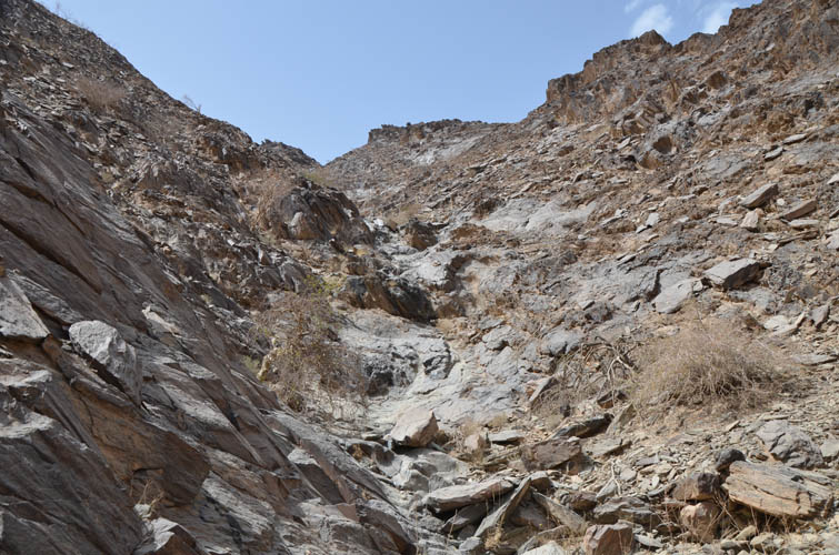
I didn’t pick the best approach as it turns out there is a dirt track that starts as an asphalt road by an old mud building just a few metres from where I had parked. This dirt road certainly saved me some hassle on the way back. The road ends near a shed and beyond this point there are no more trails – it’s off-trail hiking and scrambling all the way to the summit. I picked a small, craggy ridge that looked like it would connect up directly with the main NE ridge. It was a fun scramble along its crest (nothing more than moderate difficulty), but there were lots of ups and downs and my progress was quite slow.
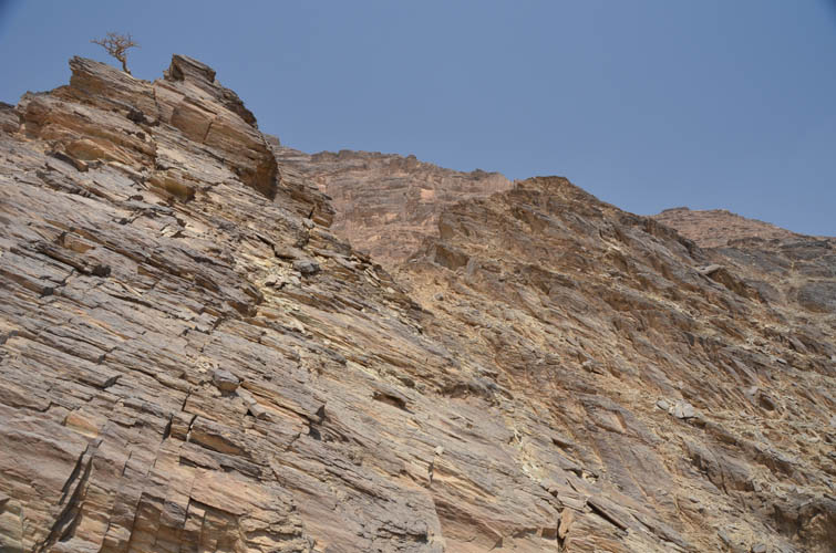
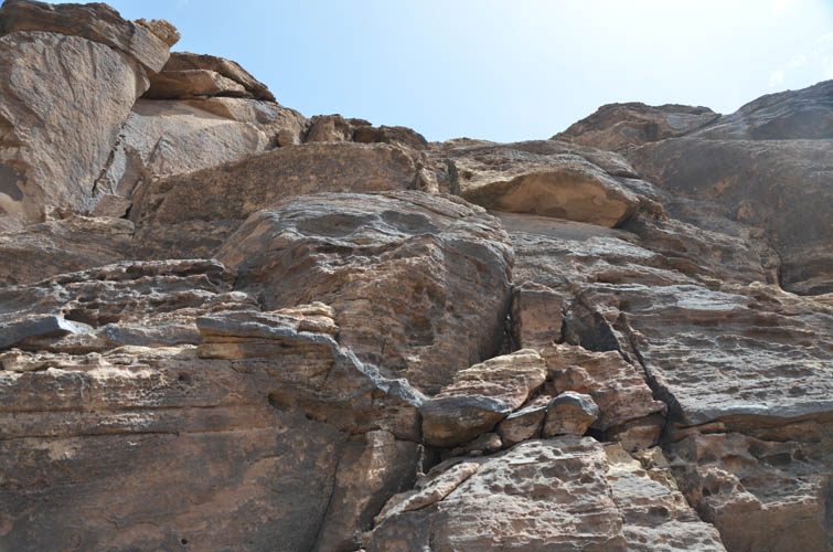
Once I hit the NE ridge, the rock changed from crumbly shale and schist to firm sandstone, which was more enjoyable to move along. There are some really good examples of cross-bedding in some of the sandstone cliffs, evidence that these sediments used to be part of an ancient sand desert. Moving up quickly on the narrow NE ridge I soon encountered the crux of the trip: a vertical cliff forced me to climber’s right where I had to scramble up several steep ledges on very solid rock but with small holds and moderate exposure. It wasn’t overly hard, but challenging enough to qualify as a difficult scramble, especially on the way down.
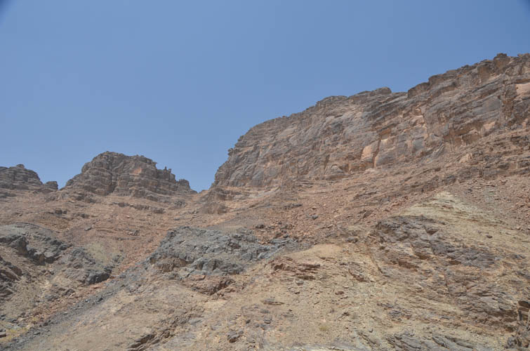
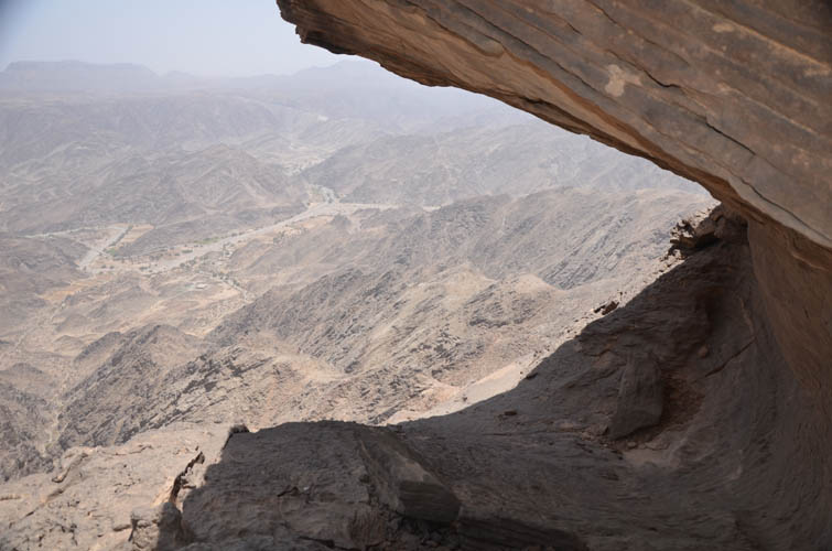
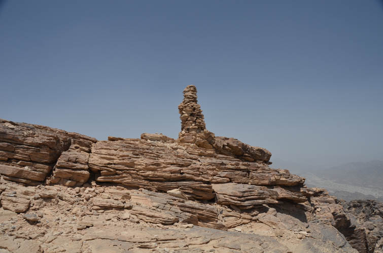
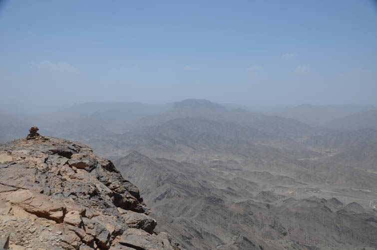
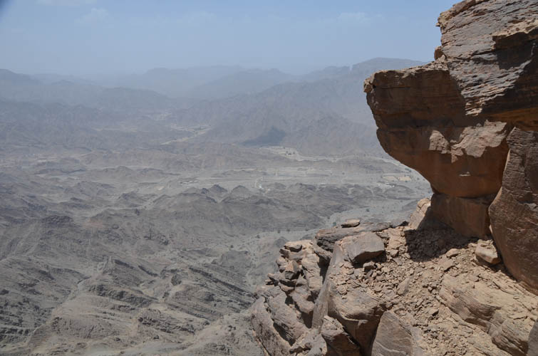
Past the crux the ridge broadened before a massive vertical wall guarding the summit complex made me detour to the right again. The easiest route then went up a few hundred metres on the west slopes directly to the small summit plateau. As expected, there was no register. The only evidence of human activity on the whole mountain was really just the man-sized cairn at the summit. This was a quiet and peaceful spot with magnificent vistas of craggy mountain peaks in all directions. A beautiful area untouched by tourism and a paradise for mountain lovers like me.
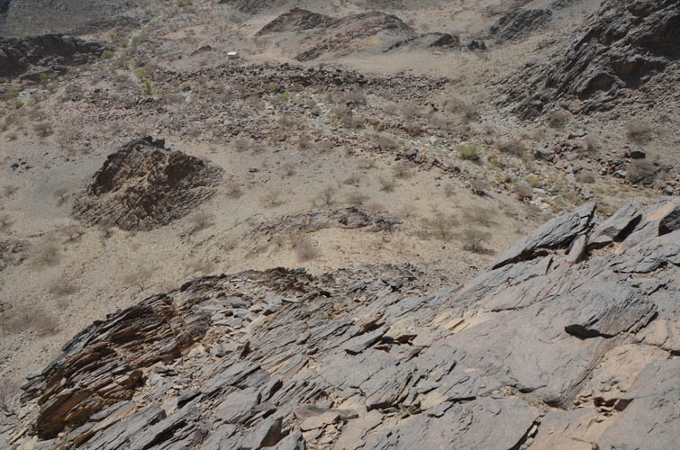
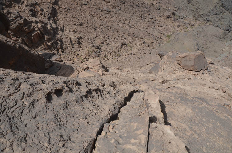
I returned the same way, carefully downclimbing the crux, then continuing down the NE ridge to an obvious drainage on the right (south). This drainage avoided the ups and downs I had encountered on my ascent ridge, but on the flipside it was pretty steep and rubbly and had several water-worn cliffs blocking the way. Fortunately, it was always possible to scramble around these cliffs either on the right or (mostly) the left. At the bottom of the drainage the small valley I was in led me back to the end of the dirt track by the shed, which I easily followed back to the main road.
I really enjoyed this outing. Jabal Anthari was a relatively short but very rewarding off-trail hike with some fun hands-on scrambling and good potential for route variations.
|
Elevation: |
2107 m (my GPS) |
|
Elevation gain: |
790 m |
|
Time: |
6 h |
|
Distance: |
8 km |
|
Difficulty level: |
Difficult (Kane), T5 (SAC) |
|
Reference: |
No info was available to me prior to trip |
|
Personal rating: |
4 (out of 5) |
NOTE: This GPX track is for personal use only. Commercial use/re-use or publication of this track on printed or digital media including but not limited to platforms, apps and websites such as AllTrails, Gaia, and OSM, requires written permission.
DISCLAIMER: Use at your own risk for general guidance only! Do not follow this GPX track blindly but use your own judgement in assessing terrain and choosing the safest route. Please read the full disclaimer here.