Graubünden, Switzerland
25 August 2017
Solo
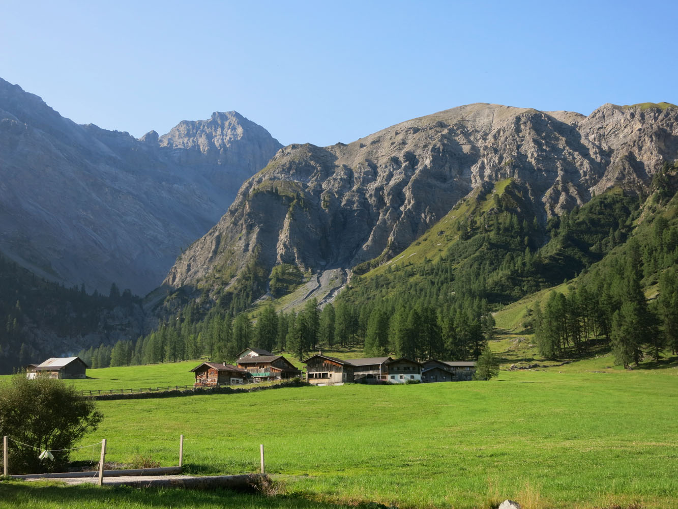
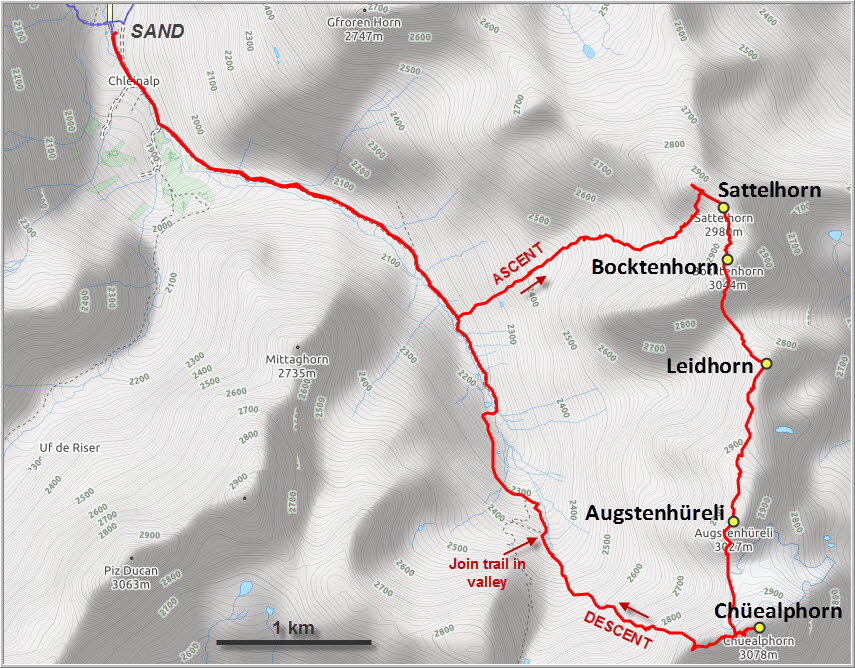
Beautiful first hike on my Swiss vacation this year. Started out with my parents from the tiny hamlet of Sand in the Sertig Valley on the broad and comfortable track up the Chüealp Valley. As they continued on the trail further up the valley, I left the path and trudged up the steep grassy hillside on the left to gain the broad valley between the eastern ridges of the Sattelhorn and Bocktenhorn. This valley even has its own name – it’s called Plattentälli! No trails were evident here, but travel was easy on grass and talus fields.
A scree chute coming off the Sattelhorn offered an easy way up to the main ridge and a short hike took me to the summit cairn of this minor peak. At 2969 m, the Sattelhorn isn’t ascended very often, as evidenced by the lack of a summit register (all prominent or popular peaks in Switzerland have a proper register in the form of a book inside a military flask or metal container of some sort).
From the Sattelhorn it’s a half hour hike and scramble to the summit of the Bocktenhorn, which lies along the long ridge immediately to the south. There was some fun, hands-on scrambling on the north side of the Bocktenhorn, mostly easy to moderate, including one short difficult step with a bit of exposure. The register on this 3036 m summit is a beautiful diary-style book, but only a dozen or so entries were found since its inception in 2014 (i.e. three entries/year avg.) despite the easy access up this mountain.
Descending the Bocktenhorn on its south face involves a fun but short scree run, one of the only ones I’ve had during my entire time here in these couple of weeks. At the bottom of the scree I veered right (west) above some minor cliffs to link up with the south ridge, which easily led to a rocky col and up a minor peak officially called the Leidhorn (2929 m). A tall, skinny cairn marks the high point, but there’s no register. Most people who come up here probably visit as part of a ridge traverse as I did.
The stretch between the Leidhorn and the Augstenhüreli is the longest between all peaks of this ridge. It’s quite rocky at the beginning, requiring some detours around pinnacles and small rock fins, but the route is easy to negotiate. Half way south, the ridge widens into a flat plateau with small Alpine tarns, bits of remnant glacier ice, and a small glacial stream. It is here that I stumbled upon an elongated, shiny object hidden in between the drab chunks of rock: not knowing what to expect, I pulled it out from the rubble… I was holding a large, rusty bullet in my hands! It was about 30 cm long, closed on all sides, the tip still on, and quite heavy… perhaps still a live shell? I slowly and gingerly placed it back on the ground. You just never know, people have found unexploded ordnance in the mountains before! And I found tons more of this stuff as I continued along the barren landscape. I counted at least 30 pieces, so there must be hundreds of bullets lying around here. An easy scramble led me over large boulders to the summit of Augstenhüreli (3020 m), again with a nice cairn but no register. (Several days later I reported my find to the local authorities in Davos, who assured me that these were blanks that had probably been fired by the Swiss military during their bi-annual drills in the area. Although you should never touch any kind of ammunition, these particular ones were harmless.)
Looking south to the Chüealphorn, the views were quite impressive: there’s a small dirty glacier called “Chüealpgletscher” that clings to the north face of the mountain and stretches quite far down. I knew that there was an easy route up this mountain’s east ridge, but that would’ve required a significant elevation loss to circumvent the glacier. Instead, I scrambled down the south ridge of the Augstenhüreli and went straight up along the connecting ridge to a small col just west of the summit tower of the Chüealphorn. The route up the west ridge is quite the challenge! I didn’t expect there to be so much vertical scrambling, a climber’s scramble for sure. I first veered around the south side (a little too far as I discovered on my return; the “normal” route is much closer to the ridge crest) and then weaved my way up a series of vertical steps and narrow cliff bands to a flat part on the summit ridge. Many routes are possible and on descent I took a more direct route down the spine of the west ridge, with minor detours to the left (south) whenever the drops were too airy. Surprisingly, there was only one miserable looking cairn along the whole stretch, so this certainly isn’t a popular route to take. The remainder of the summit ridge was still no walk in the park: a short but exposed bypass around two slender rock fingers, then another difficult vertical 4-5 m step, and finally I reached the broad summit shoulder complete with a massive cairn sitting at 3073 m. Judging by the solid register, lots of people simply hike up the Chüealphorn from the Dischma Valley to the east, and a few do the traverse from the Augstenhüreli, usually by going around the glacier and up the east ridge.
After getting the difficult downclimb off the west ridge behind me, I continued – with much relief – along the jagged ridge westward with the aim of making it down to the Sertig Pass, from where a good trail leads back down the valley. About a third of the way along, I came over a bump and saw the last part of this ridge: nasty-looking, craggy, sharp and with another considerable elevation gain! The official SAC guidebook only mentions “the ridge can be tackled head on or the most difficult sections bypassed on the sides”, but to me it didn’t look scrambler-friendly at all! I had been hiking for more than 8 hours and still had at least 2 hours to get back to the car, so it was an easy decision: head straight back down the valley via scree and grassy slopes and hook up with the trail then. There were some scree skiing sections higher up, but the rest was pretty tedious and I was glad when I reached the excellent trail which took me back to the restaurant at the village of Sand in no time.
Overall a long and highly enjoyable high-level ridge walk with multiple levels of difficulty on highly variable terrain. This part of the Graubünden area doesn’t see that many visitors and I had the mountains all to myself today.

DISCLAIMER: Use at your own risk for general guidance only! Do not follow this GPX track blindly but use your own judgement in assessing terrain and choosing the safest route.
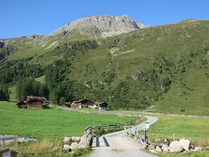
What a picturesque start in the small village of Sand!
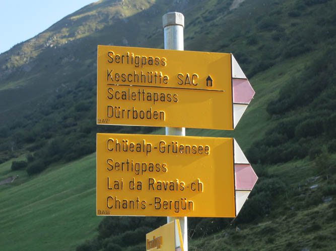
Lots of options for hiking here.
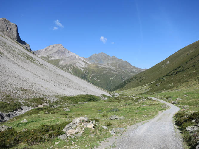
A wide track leads up the lovely Sertig Valley, turning into a hiking path higher up.

Off-trail up the grassy slopes towards the Sattelhorn. Lots of blueberry bushes here!
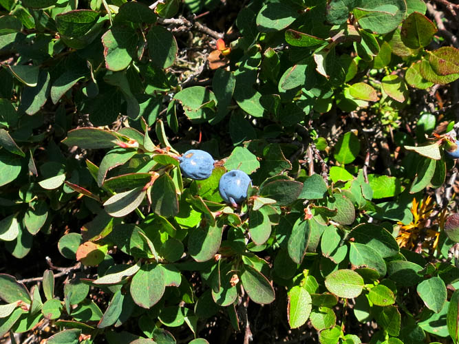
Wild blueberries.
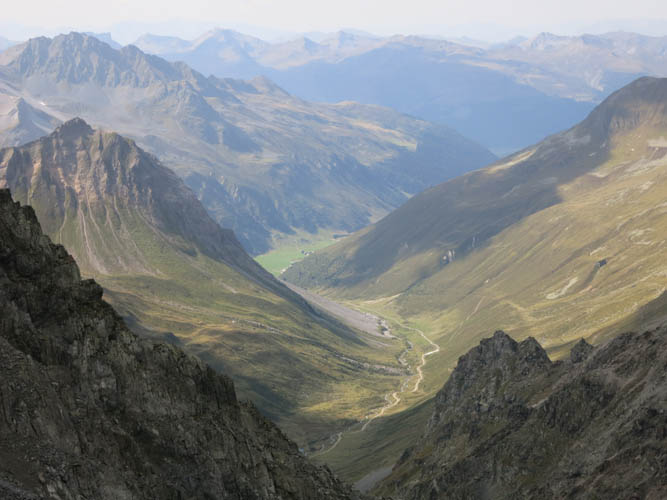
View of the upper part of the Sertig Valley from half-way up the grassy slope. The valley trail leads up and over the Sertig Pass (centre).
Across the valley from L to R: Plattenflue, Mittaghorn, Älplihorn and Leidbachhorn.
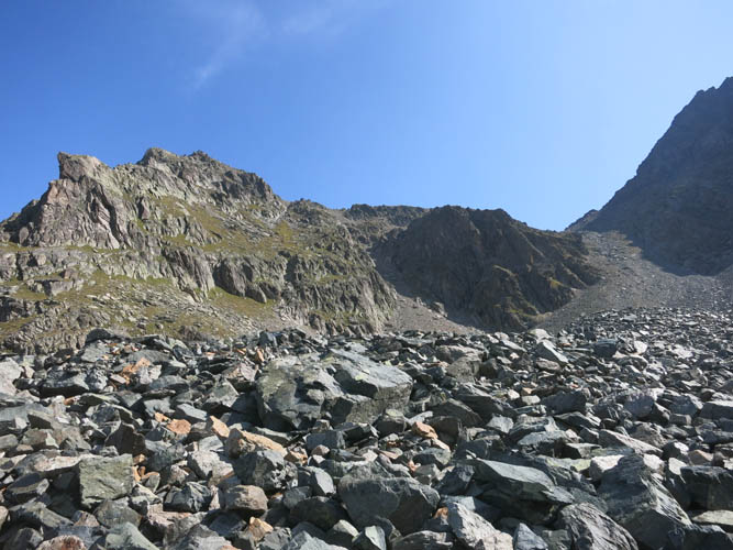
Across a boulder field towards the ridge. I used the access gully in the centre to gain the ridge very close to the Sattelhorn summit.

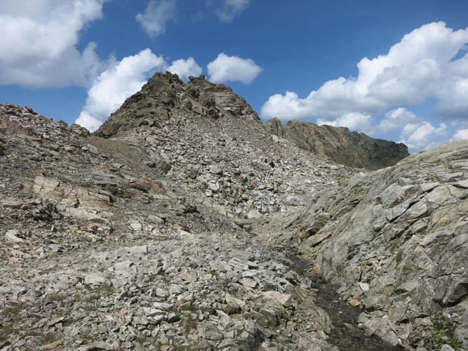
View along the ridge towards the Bocktenhorn (R).
The small patch of green grass at the bottom of the Sertig Valley is where I started out earlier in the morning. Behind and in the shadow are the Älplihorn (L) and Leidbachhorn (R).
On the other side of the ridge to the east lies the Dischma Valley. The prominent peak on the left is the famous Schwarzhorn (official elevation 3145 m).
South of the Schwarzhorn is the distinctive Piz Radönt.
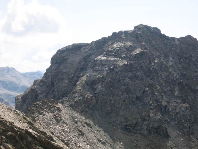
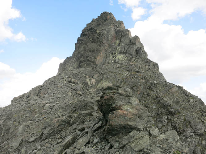
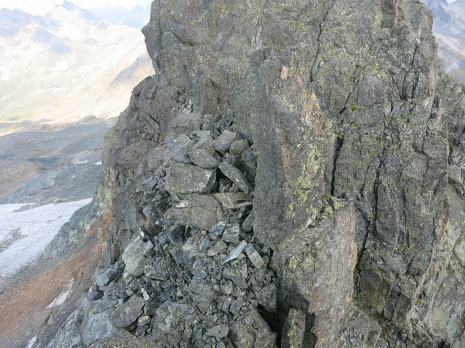
I continue along the ridge towards the Bocktenhorn with moderate scrambling and one difficult step ahead.
Some exposure on the difficult step.
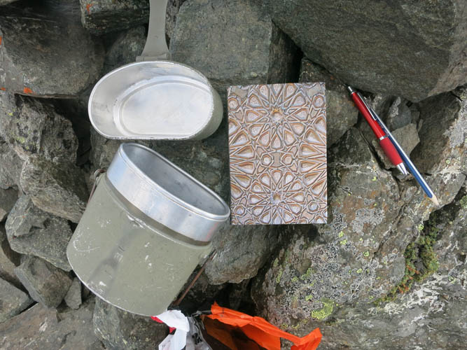
Bocktenhorn summit register.
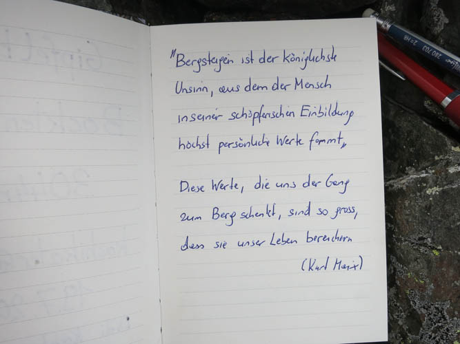
Somebody quoted Karl Marx: “Climbing mountains is the craziest nonsense from which people with all their creative imagination can derive highly personal values. These values that are given to us by the climb up the mountain are big enough to enrich our lives.”
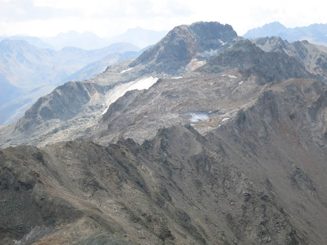
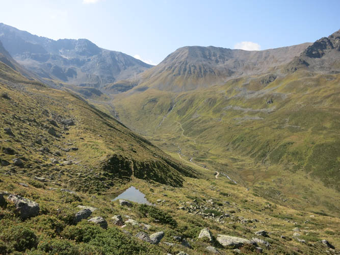
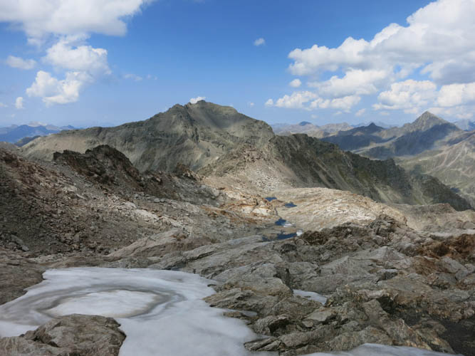
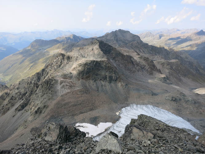
The continuation of the ridge towards the Leidhorn (far left), Augstenhüreli, and Chüealphorn (centre).
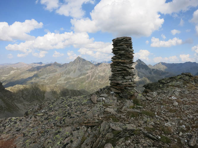
Leidhorn summit cairn.
Looking back at the southern aspect of the Bocktenhorn.
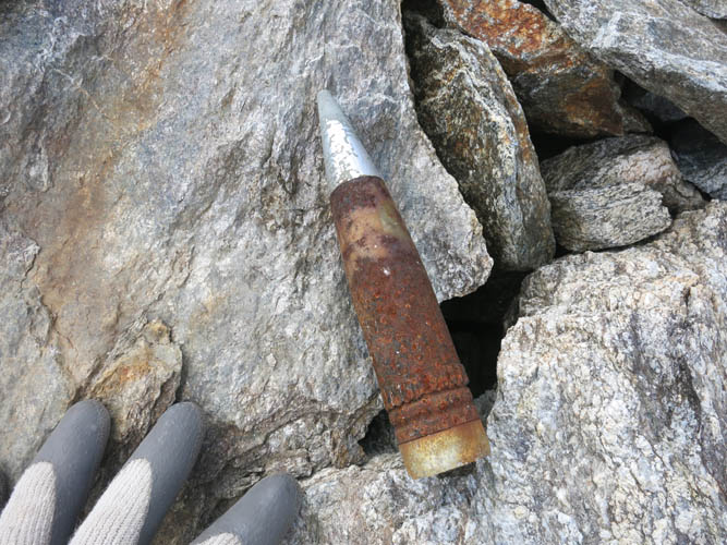
Shortly after the Leidhorn, I stumble upon this old military shell.
On towards the Augstenhüreli.
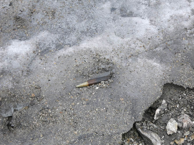
Numerous shells are strewn around the rock and remnant glacier here.
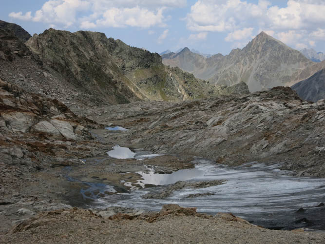
Melt water from the last bits of glacial ice and snow is collecting in small puddles and tarns.
The undulating ridge is a strangely beautiful place here. Bocktenhorn in the background.
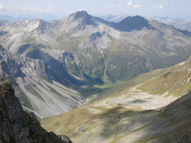
Looking east are the Flüela Wisshorn (centre) and the lofty Piz Linard (left, 3410 m).
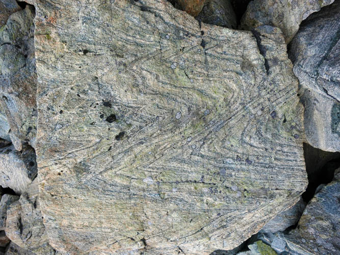
Metamorphic rocks make up much of the peaks here, like this gneiss for example.
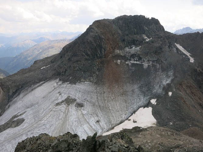
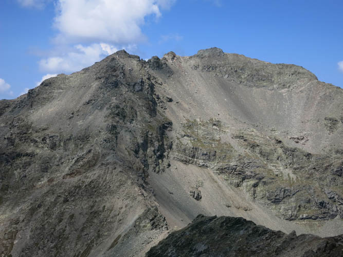
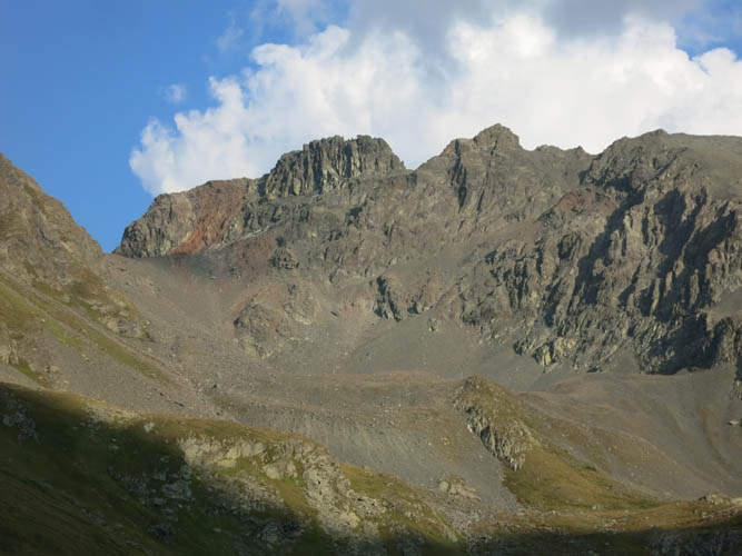
On to the last peak of the day, the Chüealphorn with its north-facing glacier below. My route led me along the right side of the glacier up to the col, then along the crest of the west ridge (right) past the “fingers” seen here in the gap at the top of the ridge.
Starting up the west ridge of the Chüealphorn.
Gorgeous views down the other side to the south.
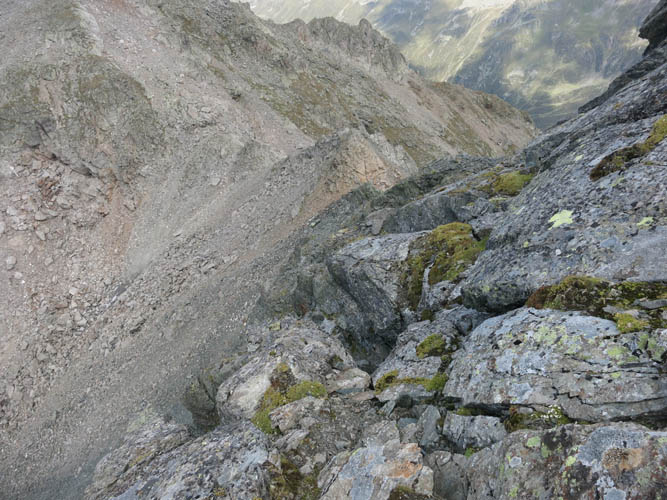
The west ridge is very steep and exposed.
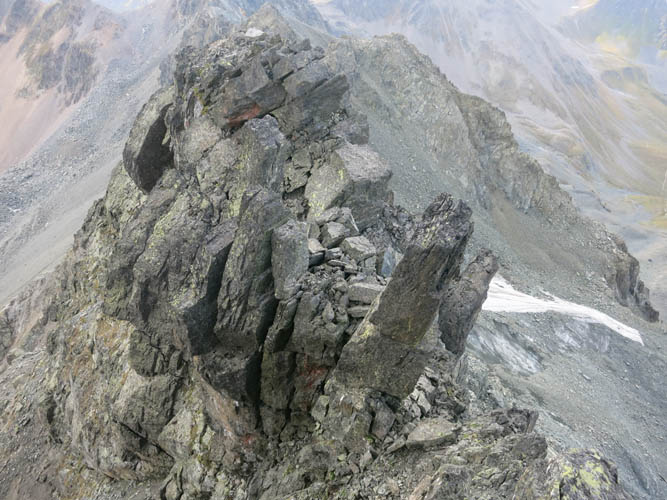
View of the “fingers” along the ridge.

Chüealphorn summit register. Most people come up here from the east side.
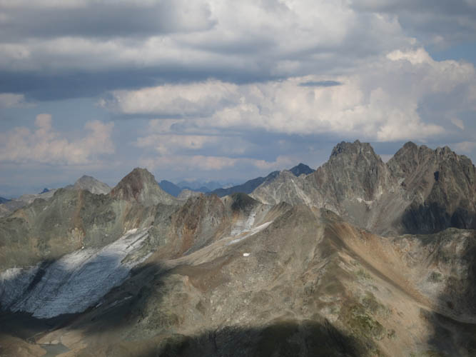
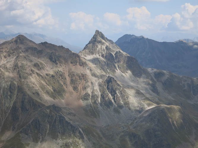
Piz Vadret (3229 m) to the east has a distinctive v-shaped notch in its summit ridge.
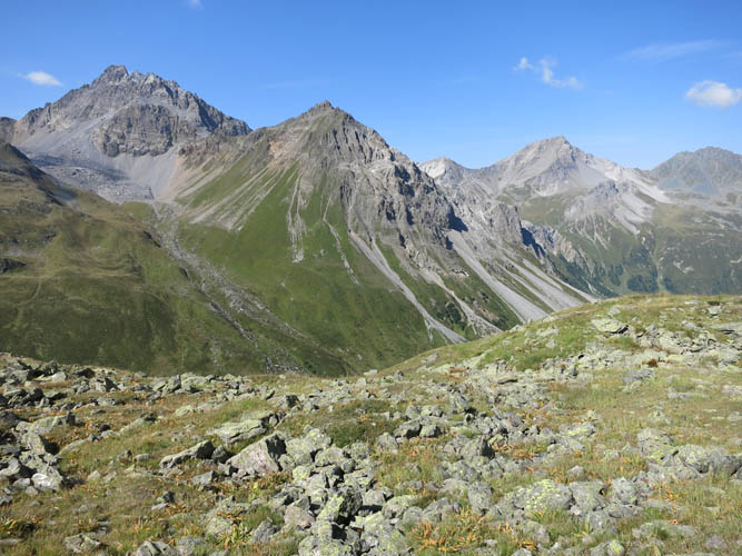
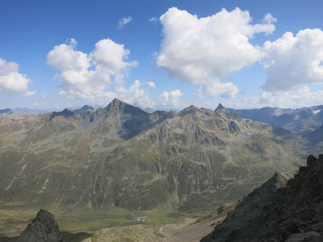
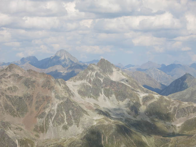
View to the north of my ridge traverse with the Bocktenhorn standing out as the highest peak from here.
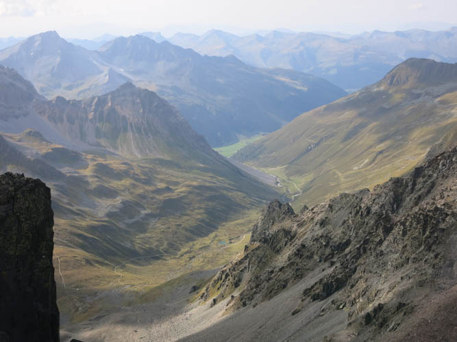
The Sertig Valley is far below me now.
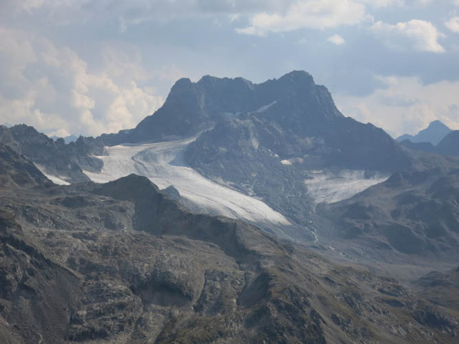
Piz Kesch (3418 m).
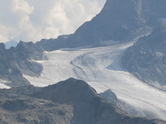
Close-up of Vadret da Porchabella – the glacier on the north side of Piz Kesch.
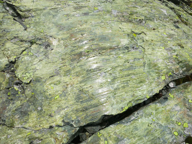
Slickensides on a green phyllite: indications of tectonic movement.
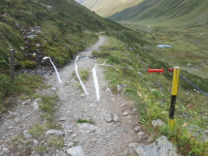
Back in the valley on the good trail again! Meadows belonging to different owners are often separated by electric fences that can easily be opened where they cross the trail.
Looking back up the ridge. The summit of the Chüealphorn is just left of centre.