 Davos, Switzerland
8 September 2014
Solo
On and off the beaten track: my first scramble in Switzerland
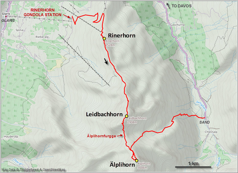
While visiting Davos for the first time in September 2014 with my uncle Karl and my parents, I took the opportunity to explore the area a little and find out if scrambling up mountain summits is possible here. My dad made an excellent suggestion to hike up to the Rinerhorn together, from where I continued south along the ridge to the Leidbachhorn and eventually the Älplihorn. In the meantime, my parents and my uncle followed the very gently sloping trail from the Rinerhorn down to the small hamlet of Sand, which sits at the end of the valley road. Luckily, I found a way to descend to the valley from the col between the Leidbachhorn and Älplihorn. This was a wonderful outing with lots of hands-on scrambling, beautiful views of three valleys, and the added bonus of ascending three peaks in one day. With a good level of fitness it can be done in 8 hours or less.
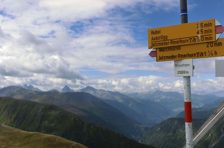
Rinerhorn
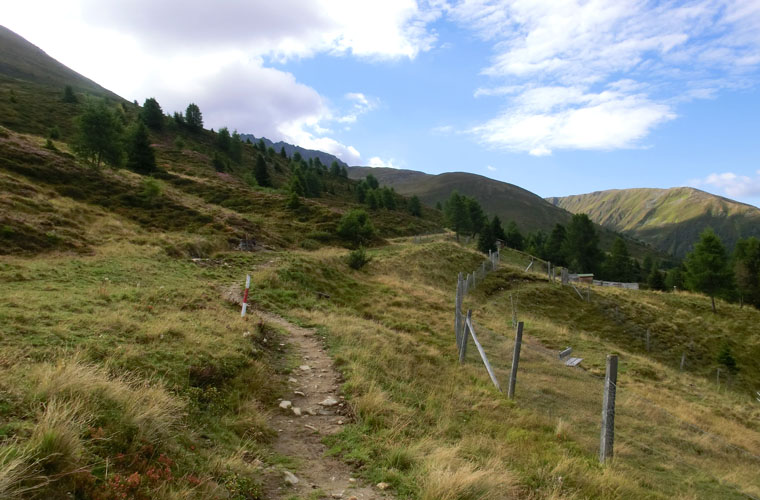
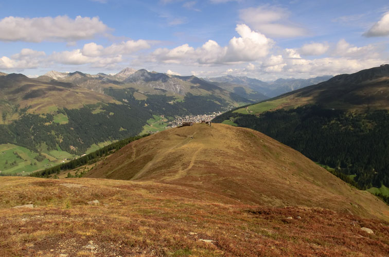
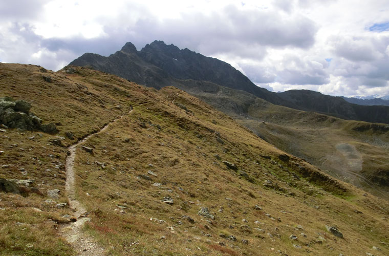
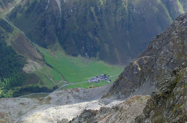
Ascending the Rinerhorn is no big feat, especially if you take the gondola up from the village of Glaris, saving you 600 m of elevation gain. At the gondola station there is a pretty decent restaurant with patio, where we had a hearty Swiss breakfast of croissants, buns, ham, salami and cheese (it was expensive though – 70 Swiss Francs for four!). The hike from here up to the “Hubel” was pleasant and easy and it took my mom and me a mere 45 minutes at leisurely pace to reach this point, which is basically just a small bump along the ridge. My dad and uncle meanwhile opted for even less effort by walking almost at the same elevation over to a point below called “Äbirüg”, where my mom would eventually join them. From the Hubel, I continued up the ridge on a very good path, all fully signed, to the Rinerhorn in another 20 minutes or so. An elderly Scottish couple were the only other people up here, and we gladly took photos for each other.
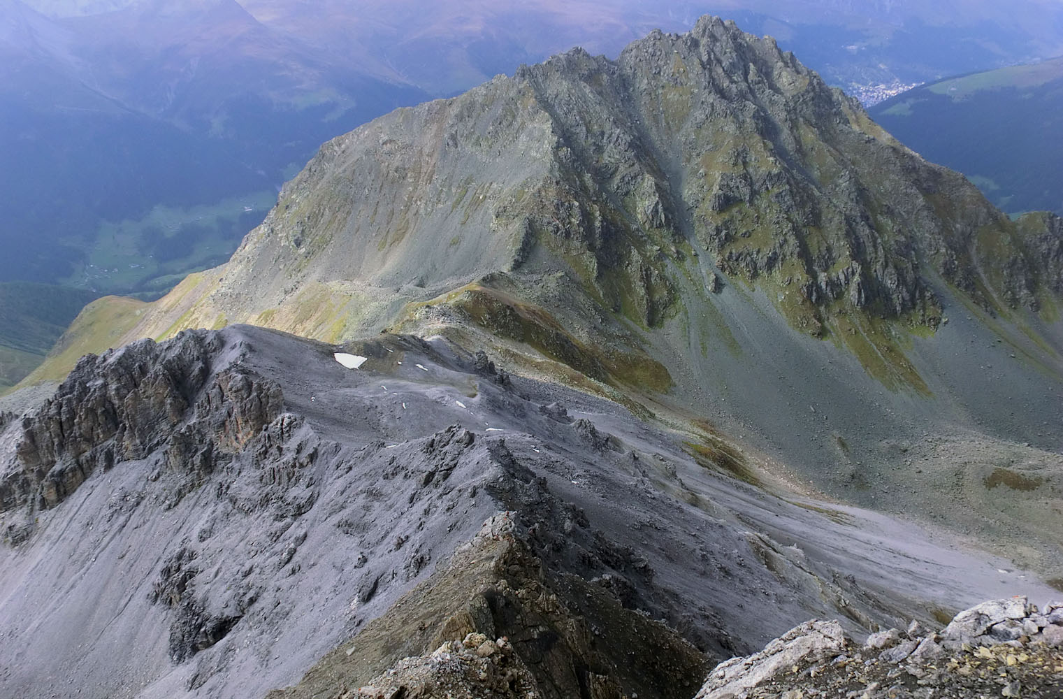
The Rinerhorn is along a popular hiking route, one of many in the area, all with good, well maintained trails and heavy steel signs pointing in every single direction where a trail could possibly lead. This kind of well-developed network of trails and the numerous signs really surprised me; I’ve done most of my hiking in the Canadian Rockies where trail signs and markers aren’t common. What surprised me even more, however, was that as soon as I left the beaten Rinerhorn trail in order to follow the ridge up to the Leidbachhorn – now a scramble – the trail disappeared completely and there wasn’t even a faint track left. I think this says a lot about the popularity of scrambling here; there would have been a trail at least part way up in a similar setting in the Rockies, especially so close to an urban centre.
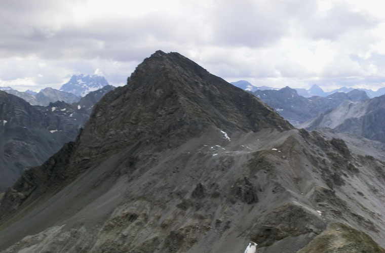
Leidbachhorn
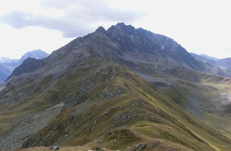
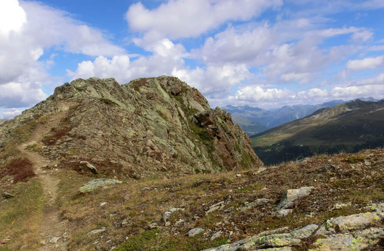
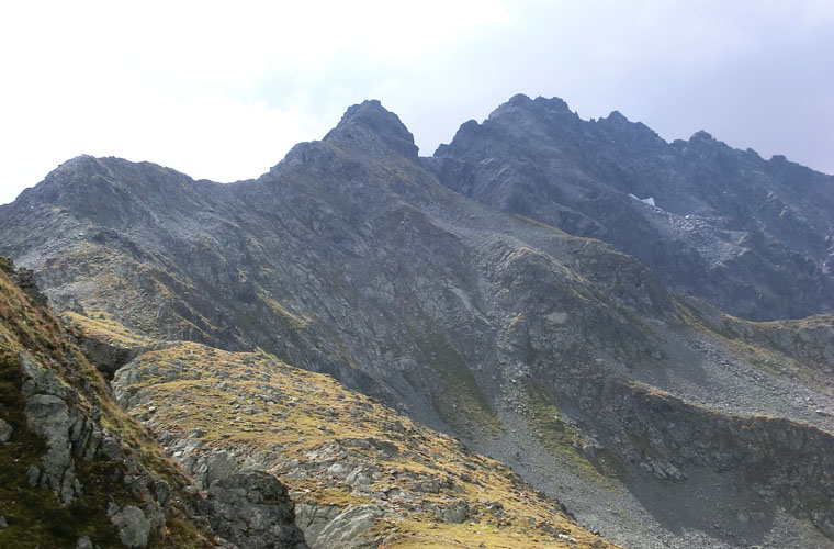
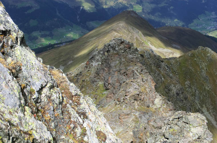
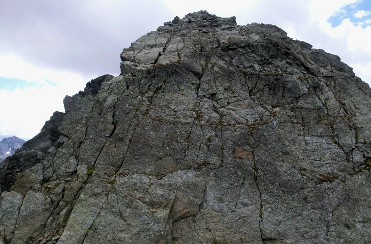
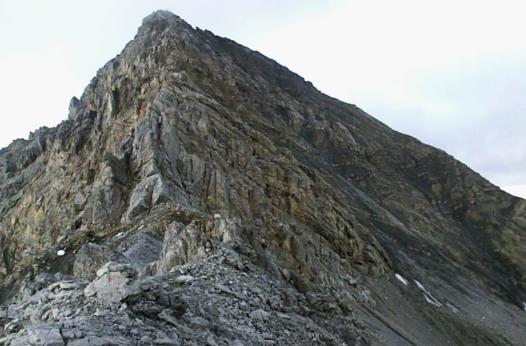
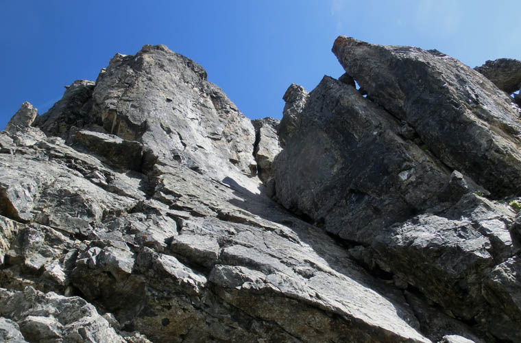
The ridge continuing south from the Rinerhorn was easy to follow at first. After losing some 50-100 m of elevation, I left the good path and veered left to gain the top of the ridge, which now presented a mix of hiking and some easy to moderate scrambling. There were quite a lot of ups and downs and some of the steeper pinnacles required careful downclimbing, but nothing too difficult. The rock here is blocky granite, metamorphic schist and gneiss, all of which can be quite slippery especially when wet. Thankfully, I had sunny and warm conditions throughout until I reached the summit. As I got closer to the summit mass, the terrain got steeper and more serious, and I donned my helmet and put away the poles to overcome several sections of steep blocky cliffs. A steep, smooth rock slab with cracks running through it looked daunting at first, but it was a fun climb that offered good holds and solid footing. I think most of these upper moderate to possibly difficult sections can be avoided by going around to the right, but I found it more enjoyable to tackle them head-on. After perhaps an hour and a half I reached the summit of the Leidbachhorn, where to my surprise another person was having his lunch.
Andreas from Davos had come up the east side from the village of Sertig, ascending the ridge between the Schwarzhorn and the Leidbachhorn. What an interesting and curious character: at 70 years old, he claimed to hold the record of having ascended 310 summits over 3000 m in the Kanton of Graubünden, all without rope or helmet. Quite an impressive feat, I think! He recommended a whole number of other good scrambles to me from his personal experience and it was a real joy chatting with someone equally passionate about the mountains. What I found striking was his comment that he is usually the only person on a summit like this – my presence must’ve surprised him as well.
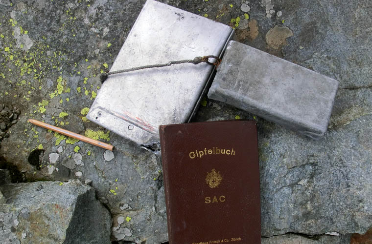
Unfortunately, he had left his poles behind at a craggy cliff 100 m below where he’d run into trouble on his way up. After finishing up our lunch and signing the very solidly built wooden register with aluminum sleeve, we slowly descended together down to the Älplihornfurgga, i.e. the col between the Leidbachhorn and the Älplihorn. A light rain shower slowed our progress in moderate scrambling terrain, but it was nice to have Andreas’s company and we kept chatting away while we descended. At the col we parted and I gave him my poles to make his descent to the valley easier. He promised to leave them in the only restaurant in Sand, which was also my final destination.
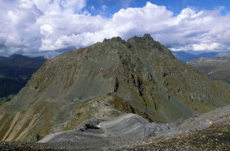
Älplihorn
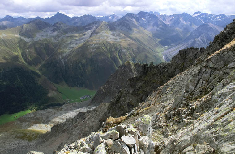
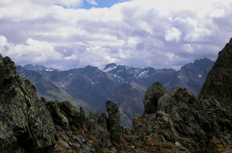
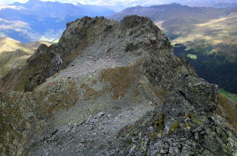
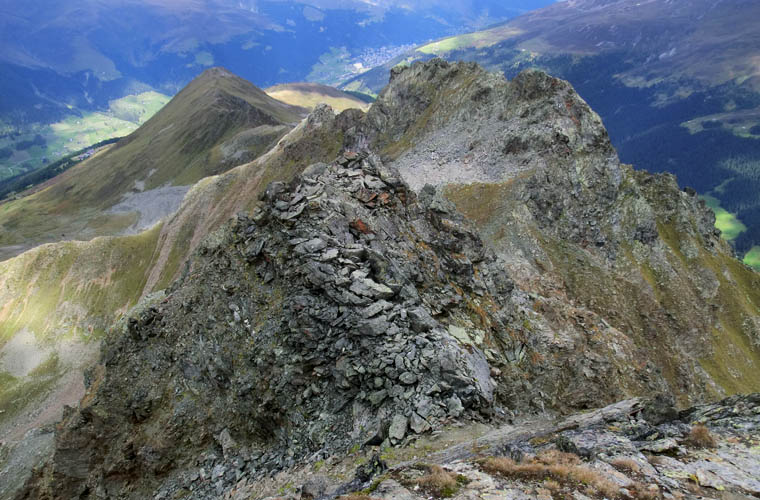
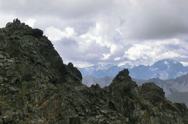
The most challenging section of the whole traverse for me was ascending the Älplihorn right along the ridge toward the south. In hindsight, a lot of the difficult climbing sections could’ve been avoided by traversing toward climber’s right, where the slope eases and you can scramble up a mixture of rock steps and muddy scree. It took me quite some time to find the best route up the crest of the ridge and several times I climbed up a steep rock face only to backtrack again because it got too serious or an overhang would block my route. I found myself clinging on to tiny holds and narrow ledges along vertical walls a few times. The rock was also very loose and crumbly in places, so full concentration was necessary. At one point I stepped on a wide rock ledge and as I pushed myself up the whole ledge gave way and collapsed under the scary sound of more and more distant rumbling. Of course it didn’t help that the rock and mixed up mud were wet and soggy from the rain earlier. I took my time and eventually made my way up to the 3006 m high summit that sports a gracefully slender cairn and of course another robust register. Judging by the entries, only about a dozen people ascend this peak each year. Nobody had been up here in about a week.
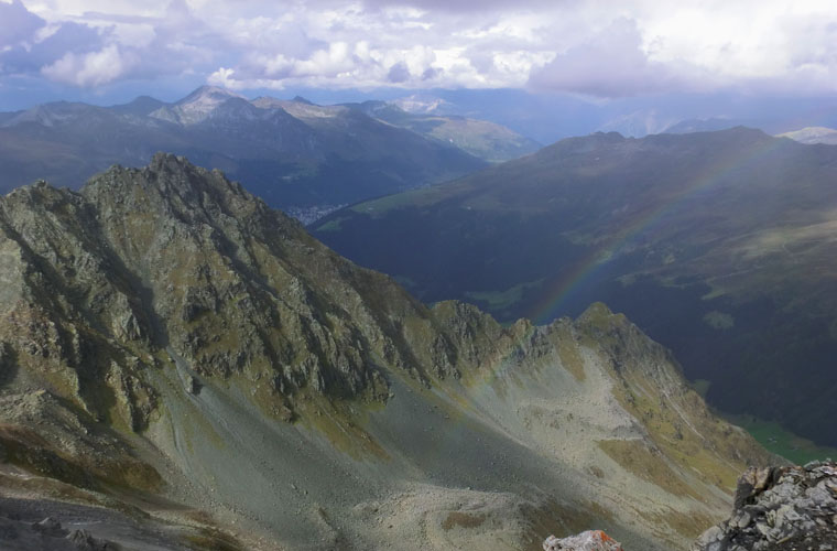
The sky was now darkening and black clouds could be seen to the north, with rain curtains in the distance forming a beautiful rainbow in the valley below me. Not wanting to get stuck in a storm, I hurried down, deciding to veer more towards skier’s left where the terrain was easier with more scree to slide down, instead of going back down the difficult ridge crest. I made it down to the col quickly and descended from here eastward via easy scree and grassy meadows to the tiny village of Sand. Bits of trail here and there helped, but in the lower part I lost the trail again and had to bushwhack down a steep, shrubby slope to get to the valley bottom. Here I joined the gentle trail that my parents and uncle had taken, just a hundred meters from the collection of farm houses that make up Sand. With perfect timing I promptly picked up my poles that Andreas had left in the restaurant as promised and jumped on the Davos bus that had just arrived at this cul-de-sac station (the asphalt road in the Sertig Valley ends here). The half-hour bus ride back to Davos centre was as scenic as it was relaxing after a full day of very enjoyable hiking and scrambling.
|
Elevation: |
Rinerhorn: 2528 m (official), 2518 m (my GPS) |
|
|
Leidbachhorn: 2908 m (official), 2907 m (my GPS) |
|
|
Älplihorn: 3006 m (official), 2997 m (my GPS) |
|
Elevation gain: |
1360 m |
|
Time: |
8 h |
|
Distance: |
10.7 km |
|
Difficulty level: |
Rinerhorn: Easy (Kane), T1 (SAC) |
|
|
Leidbachhorn: Along north ridge, moderate/difficult depending on route; T5. Descent to Älplihornfurgga is moderate; T4. |
|
|
Älplihorn: Difficult scramble if ascending along ridge crest from Älplihornfurgga col; T6. Moderate if scrambling up broad gully on climber’s right (west) of ridge; T5. For descent, the gully is recommended. Both routes have loose, crumbly rock requiring careful testing of holds and routefinding skills. |
|
Reference: |
Local maps & own routefinding |
|
Personal rating: |
4 (out of 5) for the entire traverse |
NOTE: This GPX track is for personal use only. Commercial use/re-use or publication of this track on printed or digital media including but not limited to platforms, apps and websites such as AllTrails, Gaia, and OSM, requires written permission.
DISCLAIMER: Use at your own risk for general guidance only! Do not follow this GPX track blindly but use your own judgement in assessing terrain and choosing the safest route. Please read the full disclaimer here.