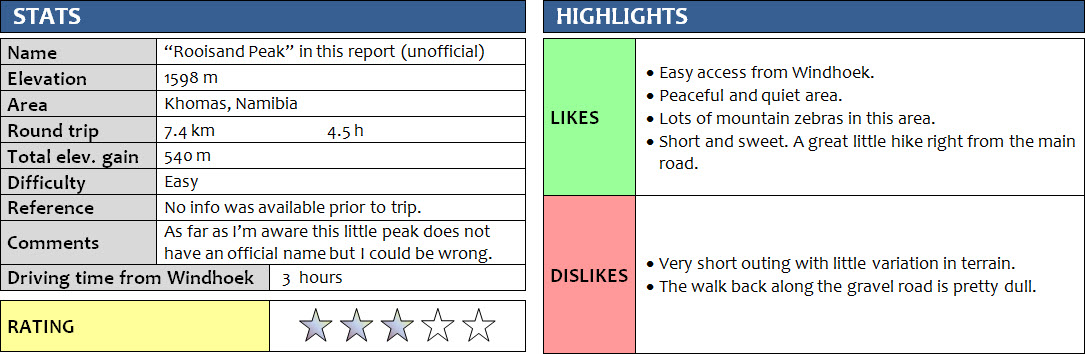
Khomas, Namibia
26 January 2018
With Wen
This little peak is right by the main gravel highway west of Gamsberg Pass and makes for the perfect half-day hike. It’s unnamed on maps and I’m not aware of any informal names (of course I could be wrong), so for reference purposes I’ll call it Rooisand Peak after the nearby ranch/campsite with the same name. Rooisand is Afrikaans for “red sand” – there’s a large patch of sand dunes in the valley here that stands out with its distinctive red colour. The area is also known for its gemstones and minerals, particularly the different types of amethyst (a type of quartz) that can be found here.
A day after our long and strenuous Hakos Mountain hike, I wasn’t expecting to do much today and was very surprised to hear Wen say “Why don’t we go up this little peak here today?” I didn’t hesitate long – of course I was up for another hike! I take every opportunity to get some fresh air, good exercise, and beautiful views from a mountain top. We had only managed to drive about 30 km from Hakos last night and camped under a large tree right by the gravel road (the C26). Waking up in our rooftop tent with a front-row view of a craggy ridge bathed in soft orange light during sunrise was an absolutely magical experience. It was so quiet and the air still crisp in the early morning, and we had enjoyed a thoroughly sound sleep with not a single car going by all night.
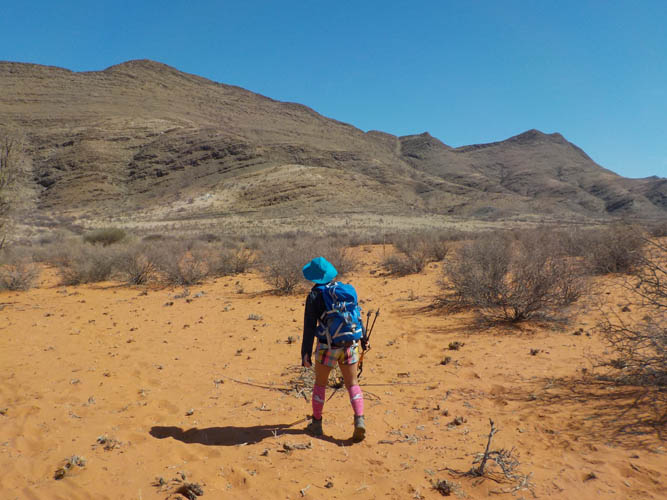
After a delicious breakfast of scrambled eggs and Nutella sandwiches, we packed up our tent, table and chairs and headed off towards an easy looking slope that took us straight up the ridge we’d been eying. It was only a few hundred metres away and the angle of the slope wasn’t as steep as it looked from a distance. There were also quite a few game trails that happened to be exactly where we needed them. Most of these are the work of mountain zebras. As in the Hakos Mountains, Hartmann’s mountain zebras are common here – in fact, we saw a whole bunch of them, including a dazzle (yes, a group of zebras is called a dazzle!) galloping across the slope right below us. They’re social animals that tend to hang out together, roaming the hills and valleys in search for grass to feed on.
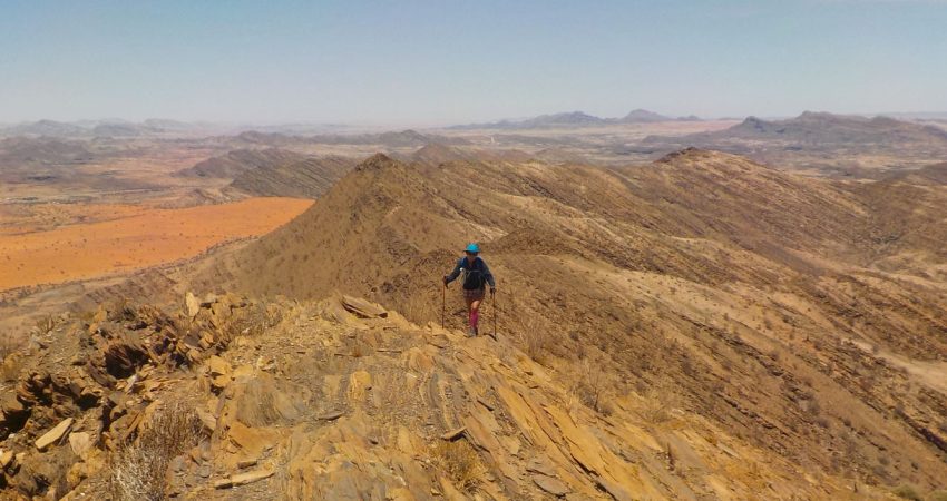
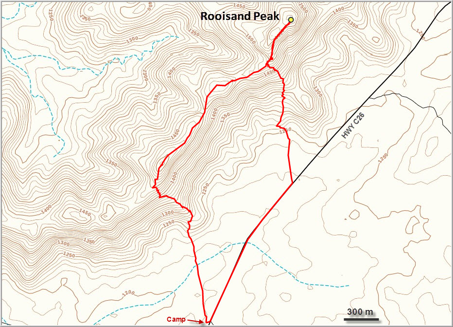
Once we got to the ridge top we looked north and saw the highest point in the distance, perhaps 2 km away. There was no trail up here but it was a fun and enjoyable hike, with a few sections requiring some easy scrambling. The terrain is sparsely vegetated and most of the hike is on a fissile, platy kind of rock called schist. Sounds crumbly but it’s actually pretty solid stuff! A few ups and downs along the ridge followed before we got to the true summit. No cairn, nothing man-made at all, was to be found at the top, so we entertained ourselves during our lunchbreak building a small, slender summit cairn.
What I really like about this area, and most of Namibia really, is the fact that it’s so quiet and peaceful. There are no people, no cars, no noises, nothing bothering you. Unless you go to some of the few tourist “hot spots”, of course, where everybody seems to congregate. But here in the rocky peaks and ridges around the Gamsberg Pass, it’s paradise for anyone wanting to get away from it all. Like yesterday at Hakos, we had the place entirely to ourselves, and even the gravel road below us saw only a handful of cars in the span of 5 hours.
We could’ve spent an hour soaking in the views of the endless brown-grey craggy hills around us, contrasted by the deep red of the Rooisand dunes, but the sun was getting so intense by now, we were literally chased off our butts because the rock was getting too hot to touch. Instead of backtracking along the ridge, we took a pleasant descent route down an easy slope directly back to the gravel road.
A great outing – short and sweet!
Notes on logistics:
- Located about half-way between Windhoek and Walvis Bay on the C26 “highway”.
- Campsite and rooms available at Rooisand Desert Lodge, which is only a few km away: rooisand.com
DISCLAIMER: Use at your own risk for general guidance only! Do not follow this GPX track blindly but use your own judgement in assessing terrain and choosing the safest route.
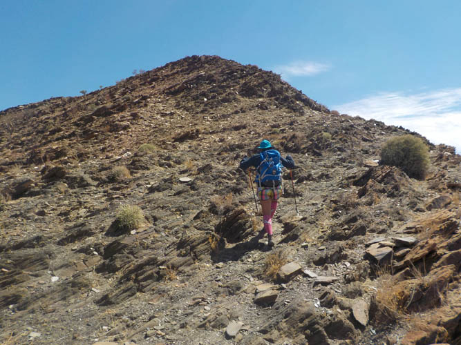
Approaching the ridge. The summit is on the far right.
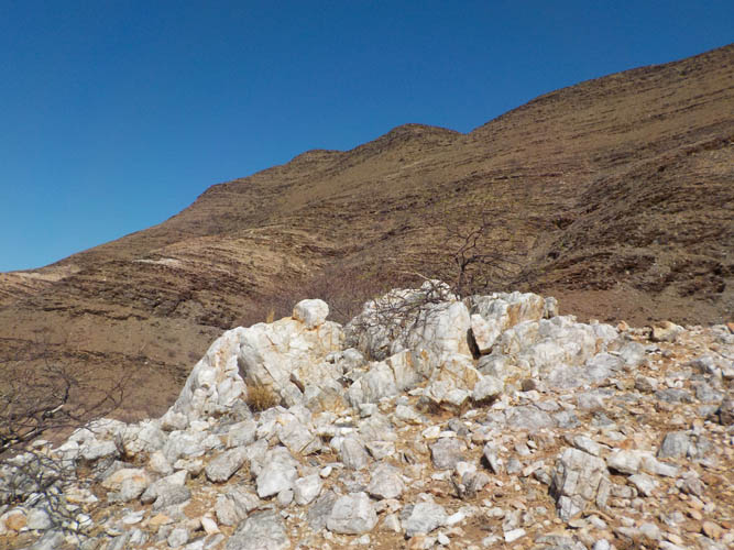
A bright white quartz outcrop.
It’s barren and dry here – and super hot!
Along the ridge.
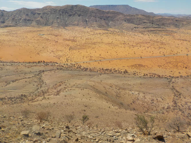
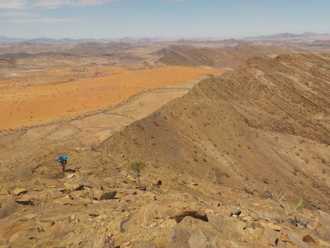
View from the ridge to the south: the C26 road cuts through the Rooisand dunes, with the flat-topped Gamsberg Mountain in the far back.
A slight breeze makes the heat more bearable up on the ridge.
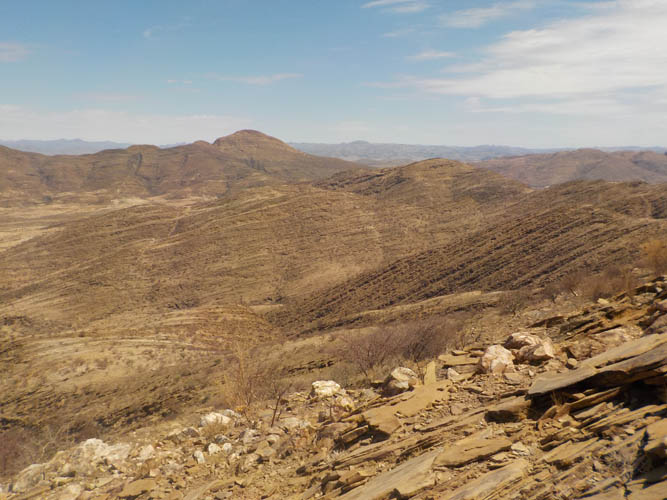
Looking north from the ridge: sparsely vegetated brown hills as far as the eye can see.
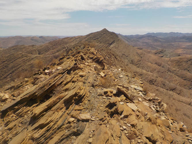
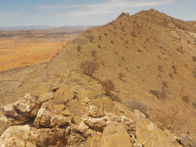
The summit is in the far back.
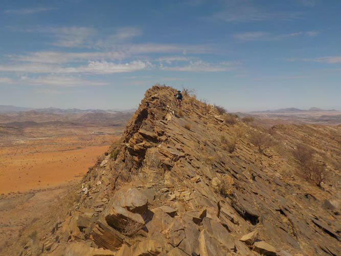
It’s fun to follow the crest of the ridge on the dipping plates of rock.
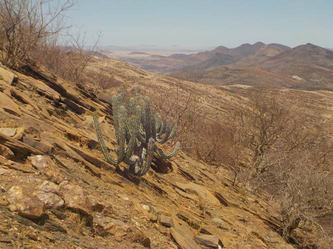
A few single trees, shrubs and cacti are the only plants on these dry slopes.

Cactus close-up.
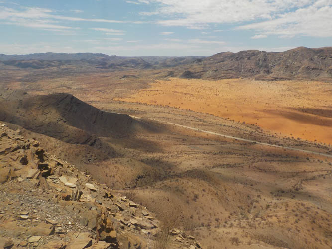
The orange Rooisand dune field ends abruptly on the eastern side (the left side of the sand area in this photo).
Looking back along the ridge.
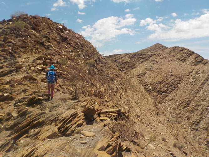
A few more bumps along the ridge to the summit!
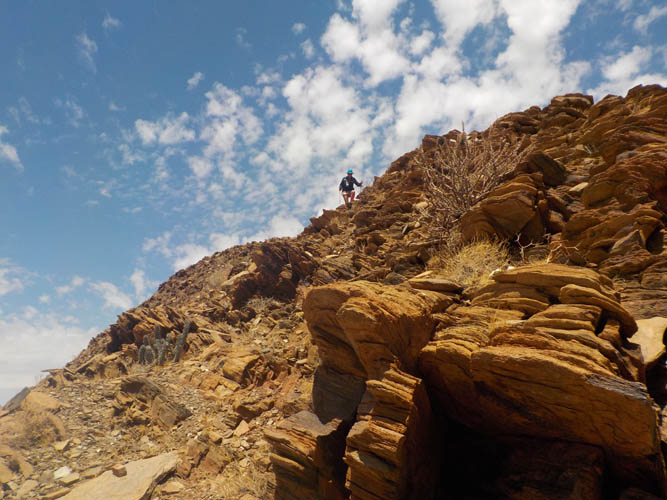
One of the few steepish sections where we did some easy hands-on scrambling. The rock is pretty solid.
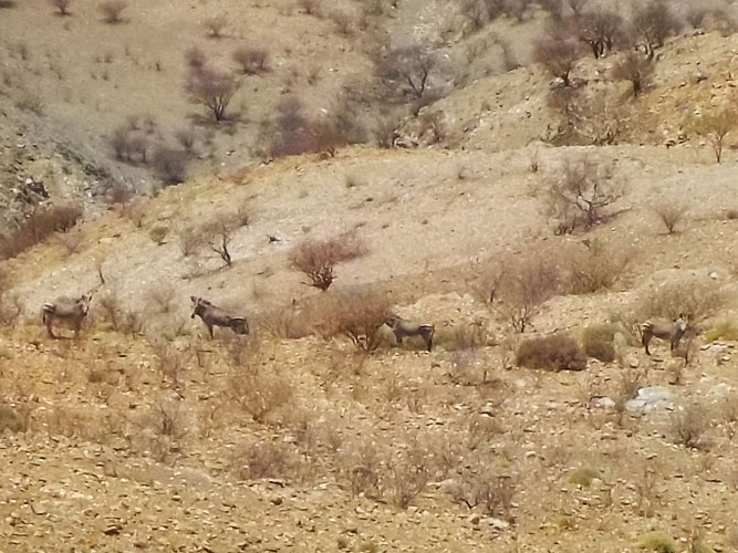
Standing on the ridge near the summit, we discovered this group of mountain zebras on the slopes below us. They do a great job at blending into the brown-grey terrain!

Wen takes in the views.
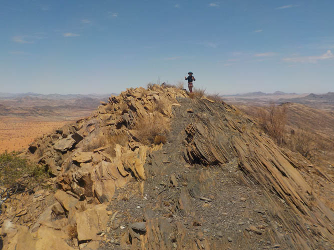
At the summit!
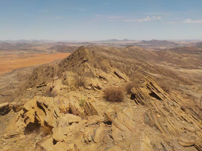
Summit view of the ridge to the south where we came from.
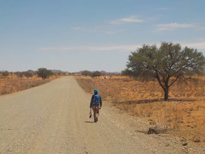
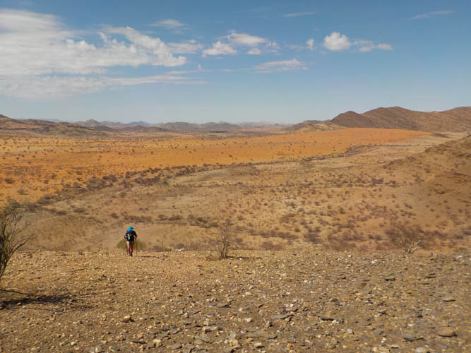
Trudging back along the gravel road to our car.